Canada stretches nearly 8,000 kilometers from coast to coast. It’s honestly one of the best countries anywhere for a road trip.
Every province brings something different. One day you’re winding through British Columbia’s mountain highways, and the next, you’re hugging Newfoundland’s wild coastline. Every stop really does tell its own story.
Driving across Canada isn’t just about racking up kilometers on the Trans-Canada Highway. On the way, you’ll hit prairie skies that seem to go on forever, mountain passes that make you stop just to stare, and small towns where locals wave you in for a chat.
The roads here don’t just link cities—they connect entire ways of life. Sometimes, it feels like you’re hopping between different countries.
Geography shapes the culture at every turn. Whether you’re sketching out a cross-country adventure or just poking around a single region, knowing what makes each province tick will make your Canadian road trip unforgettable.

Overview of the Great Canadian Road Trip
Canadian road trips are a wild ride across vast landscapes and cultures, stretching more than 7,000 kilometers from the Pacific to the Atlantic. Planning is everything here—Canada’s distances and weather can surprise even seasoned travelers.
What Makes Canadian Road Trips Unique
Canada’s sheer size makes road trips here totally different from anywhere else. Sometimes, I’ll drive for hours across Saskatchewan’s endless plains and barely spot another car.
The highways link ten provinces and three territories, each with its own look and feel. You could cross more ground from BC to Newfoundland than you would traveling across many entire countries.
Weather shifts fast. I’ve seen snow in the Rockies and t-shirt weather on the prairies—all in the same week.
Between cities, wilderness stretches on for hundreds of kilometers. Cell phone service? It drops out in the wild spots, making things feel truly remote.
Culture changes with the scenery. In Quebec, French fills the air. Nova Scotia welcomes you with Maritime warmth, and up north, Indigenous traditions shine through.
Planning Your Cross-Canada Journey
The classic route? Start in Victoria, BC, and finish in St. John’s, Newfoundland—about 7,000 kilometers all told. Most folks take 2-4 weeks, depending on how much they want to linger.
Book your stays early, especially if you’re traveling in summer. Places like Banff and Quebec City sell out fast between June and September.
I’d suggest aiming for 400-600 kilometers a day behind the wheel. Any more, and you’ll be wiped out before you even see the sights.
Budget carefully for gas and food. Fuel prices jump between provinces, and in the remote stretches, everything costs more.
Check border rules if your route dips into the US. Some paths need a passport, even if you’re sticking close to Canada.
Essential Packing and Preparation Tips
Pack layers. Even in July, I toss a fleece in the trunk—mountain air bites, and the north rarely gets hot.
Bring a paper map and a GPS. Cell service drops out, so download offline maps before heading into the wild.
Don’t forget emergency basics: water, snacks, blankets, and a first aid kit. If you break down out there, it could be hours before help rolls up.
Carry cash, and let your bank know you’re traveling. Some tiny towns only take bills, and the card readers can be fussy.
Give your car a check-up before you go. Top up fluids, check your tires, and bring spare parts if you’re driving an older vehicle, especially up north.

Iconic Routes and Scenic Highways Across Canada
Canada’s highways connect all 10 provinces, winding through jaw-dropping scenery. The 7,821-kilometer Trans-Canada Highway is legendary, but routes like the Icefields Parkway have their own magic.
Every road seems to lead to a new national park, a mountain range, or a wild coastline.
Trans-Canada Highway Highlights
The Trans-Canada Highway runs from Victoria, BC, to St. John’s, Newfoundland. It’s the world’s longest national highway system.
If you’re starting in Ontario, don’t miss the Terry Fox Memorial Lookout near Thunder Bay. The view over Lake Superior is unreal.
Key Ontario stops:
- Kakabeka Falls: the “Niagara of the North,” standing 40 meters tall
- Wawa Goose: a quirky, 8.5-meter-tall roadside landmark
- White River: birthplace of the original Winnie the Pooh
In Manitoba, Whiteshell Provincial Park is your first taste of prairie beauty. The highway then slices through Saskatchewan’s golden fields before hitting Alberta.
British Columbia’s stretch is pure drama—mountain passes, roaring rivers, and landscapes carved by glaciers.
Must-See National Parks and Natural Wonders
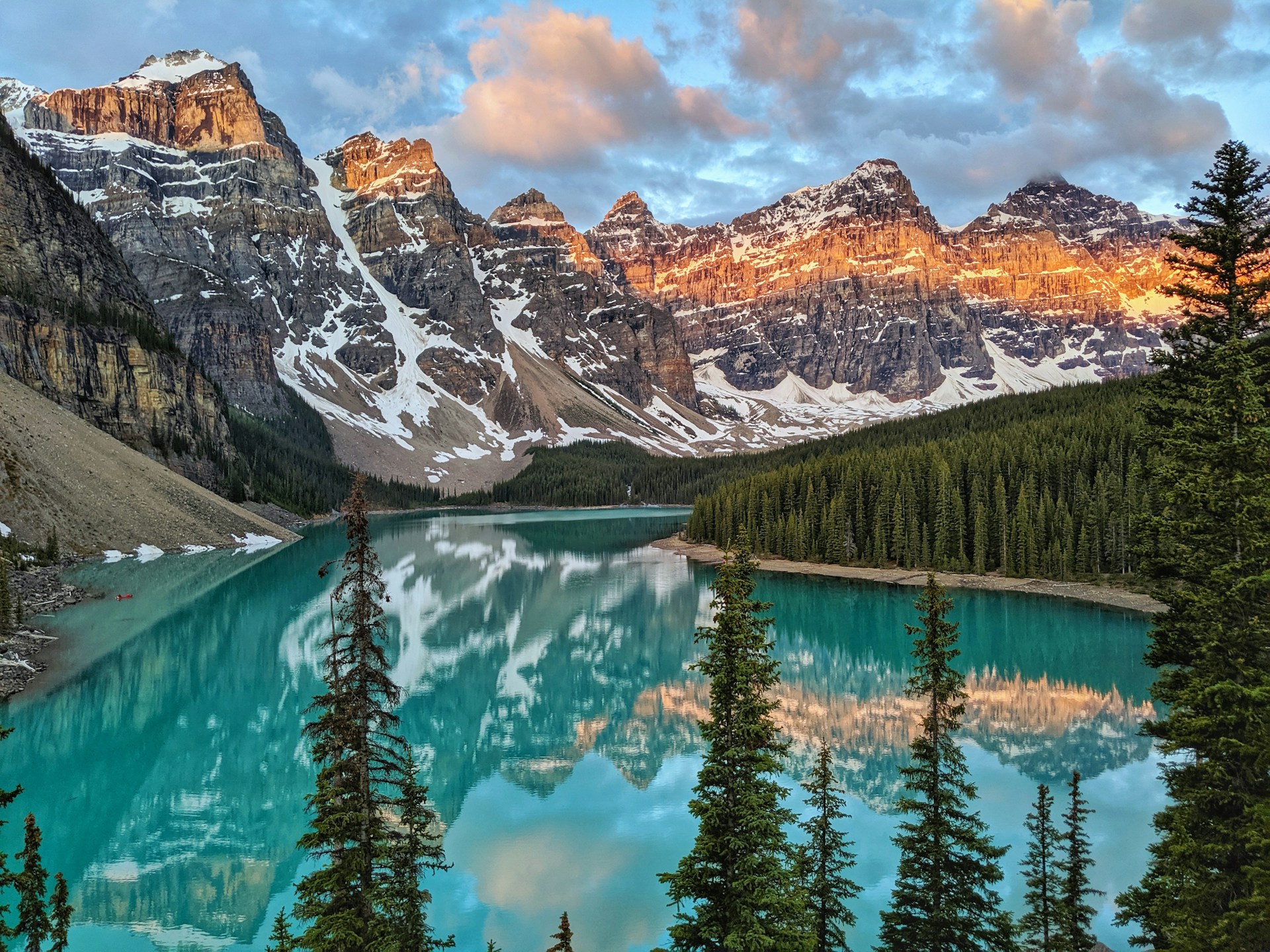
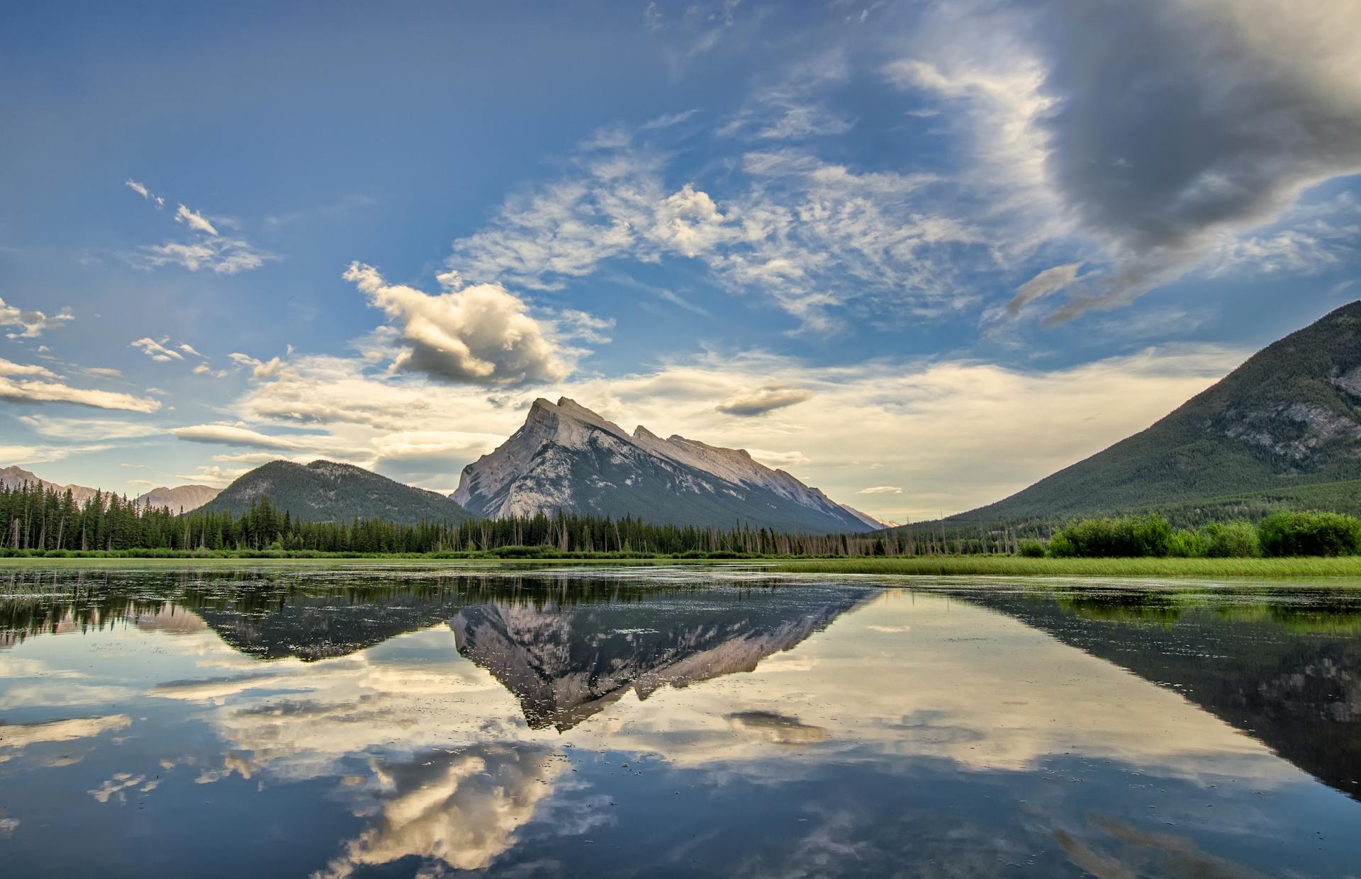
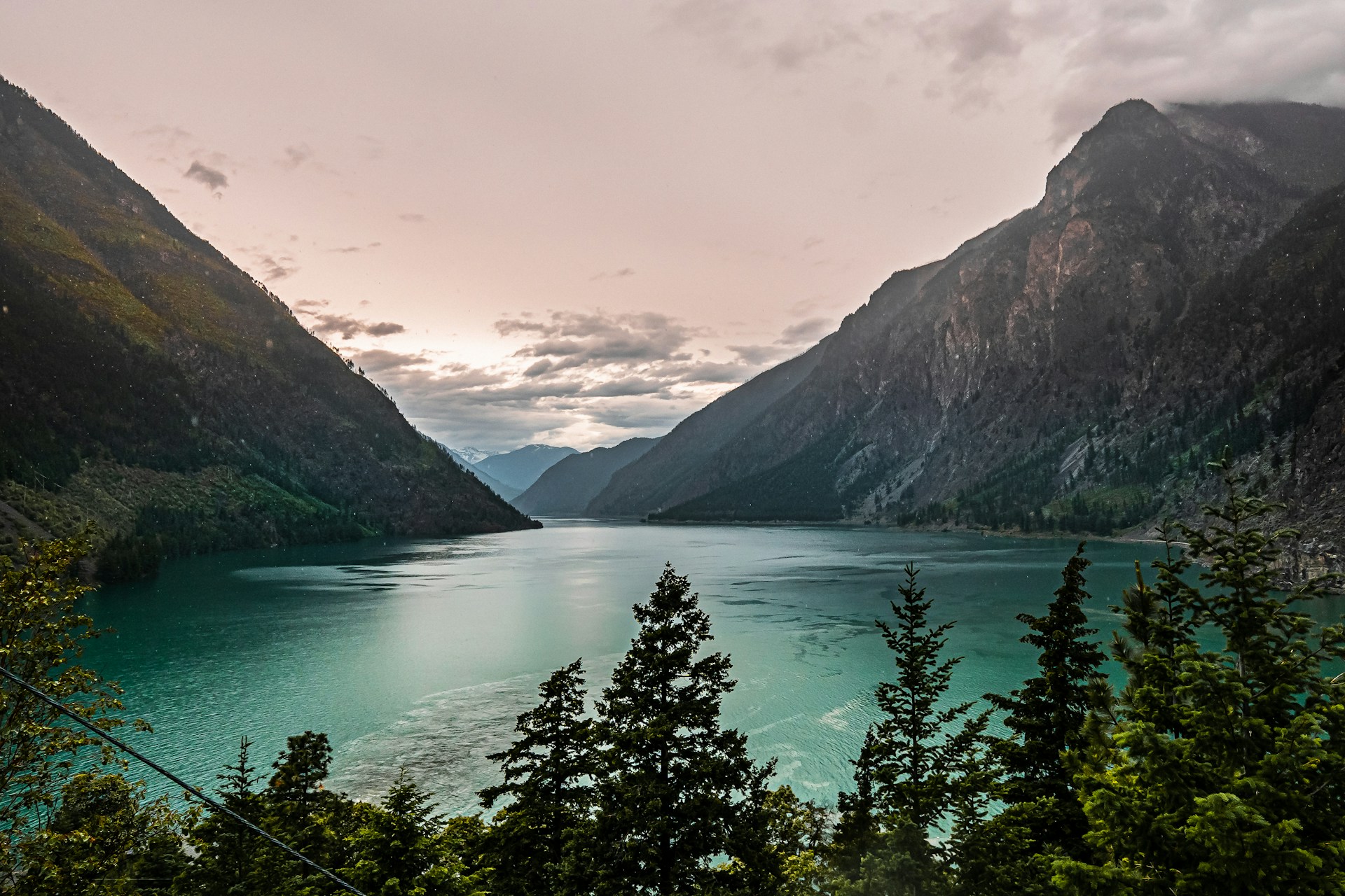
Banff National Park is iconic—think rugged peaks and turquoise lakes. Lake Louise, tucked high in the Rockies, looks like a postcard come to life.
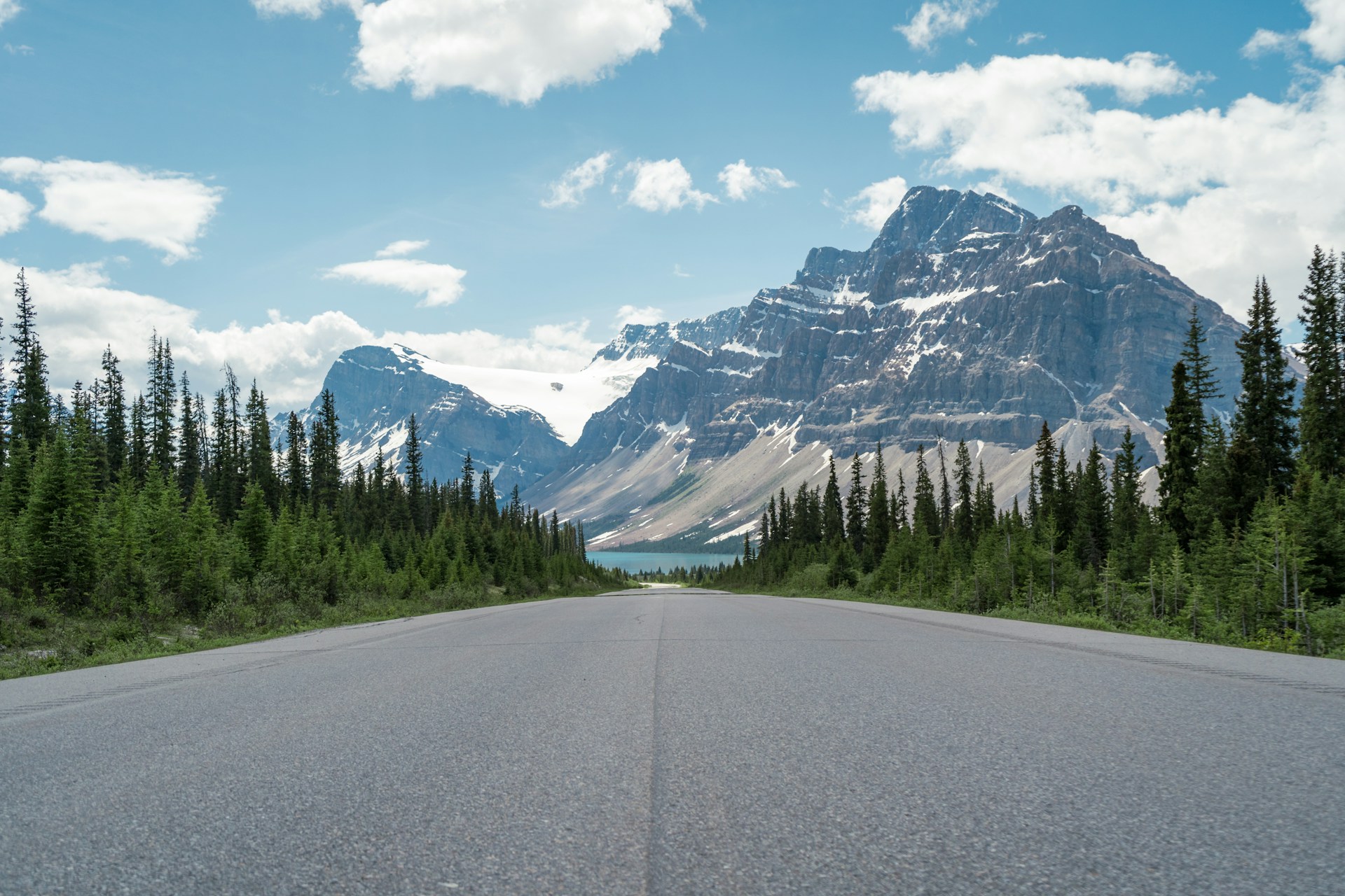
The Icefields Parkway links Banff and Jasper National Park. This 232-kilometer drive is honestly one of the most scenic anywhere. I always tell friends not to skip it.
Don’t miss:
- Athabasca Glacier: You can walk right onto the ice via the parkway.
- Lake Superior’s north shore: Cliffs and beaches straight out of a dream.
- Chippewa Falls: Official halfway point of the Trans-Canada Highway.
Prince Edward Island National Park is famous for its red sand beaches and dunes. Newfoundland’s Gros Morne National Park, meanwhile, offers fjords and ancient mountains.
On BC’s coastal routes, rainforests thrive thanks to over three meters of rain a year. Everything’s green and alive.
Best Times to Hit the Road
Summer—June through August—delivers the best weather nationwide. Most mountain passes stay open, and the days stretch long.
I’m partial to late spring or early fall. May and September mean good weather and fewer crowds.
Regional tips:
- Atlantic provinces: June to October is perfect.
- Prairies: May to September is comfortable.
- Mountains: July to early September for clear passes.
- North: June to August only—otherwise, roads can be impassable.
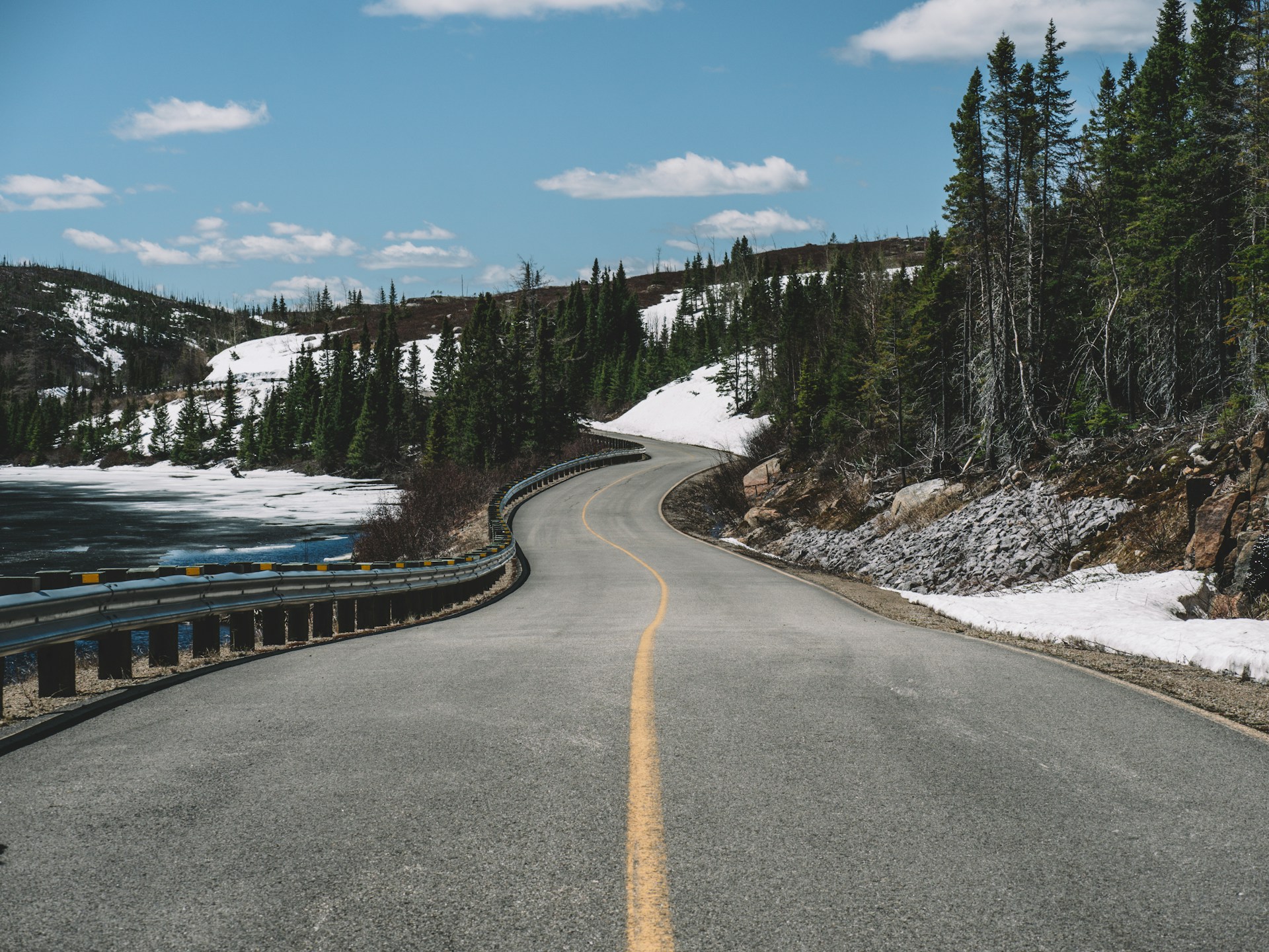
Winter? Only go if you’re prepared. Snow tires are a must in BC from October to March, and Alberta and Saskatchewan can throw wild weather at you.
Spring is unpredictable. I usually skip April—frost heaves and flooding make the roads rough.

Exploring Western Canada: Mountains and Coastlines
Western Canada is all about big mountains, sparkling lakes, and wild coastlines. From Banff’s peaks to the Sea-to-Sky Highway near Vancouver, every road feels like an adventure.
Discovering the Rockies and Banff National Park
Banff National Park really is the jewel of the Rockies. I like to start in Banff town—grab a coffee, then ride the gondola up Sulphur Mountain for sweeping views.
Lake Louise stuns with its turquoise water and snowy peaks. Sitting at 5,600 feet, it always feels a bit magical.
Best stops?
- Johnston Canyon: Waterfall hikes that aren’t too tough.
- Bow Falls: Easy trails and a great picnic spot.
- Banff Park Museum: See local wildlife up close.
- Upper Hot Springs: Soak and relax after a long drive.
Wildlife is everywhere—elk, bighorn sheep, even black bears sometimes wander by.
Banff’s downtown is lively, with good food and shops. After a day outside, it’s nice to stroll the pedestrian streets.
The Icefields Parkway Experience
The Icefields Parkway runs 144 miles from Banff to Jasper. It’s one of those drives you’ll never forget.
Peyto Lake is a must-stop. Its blue color is unreal, thanks to glacial rock flour.
You can actually ride an Ice Explorer onto the Athabasca Glacier—walking on ancient ice is a thrill.
Key stops:
- Bow Lake: Mirror-like mountain reflections.
- Sunwapta Falls: Thundering water and short hikes.
- Athabasca Falls: Deep canyons and photo ops.
Jasper National Park covers a massive area. Jasper town makes a great base for trips to Maligne Lake and Maligne Canyon.
Drive slow—wildlife often pops up right by the road. Bighorn sheep and moose aren’t shy.
Vancouver to Whistler: The Sea-to-Sky Adventure
The Sea-to-Sky Highway links Vancouver and Whistler, winding 75 miles through coastal mountains. Ocean meets peaks the whole way.
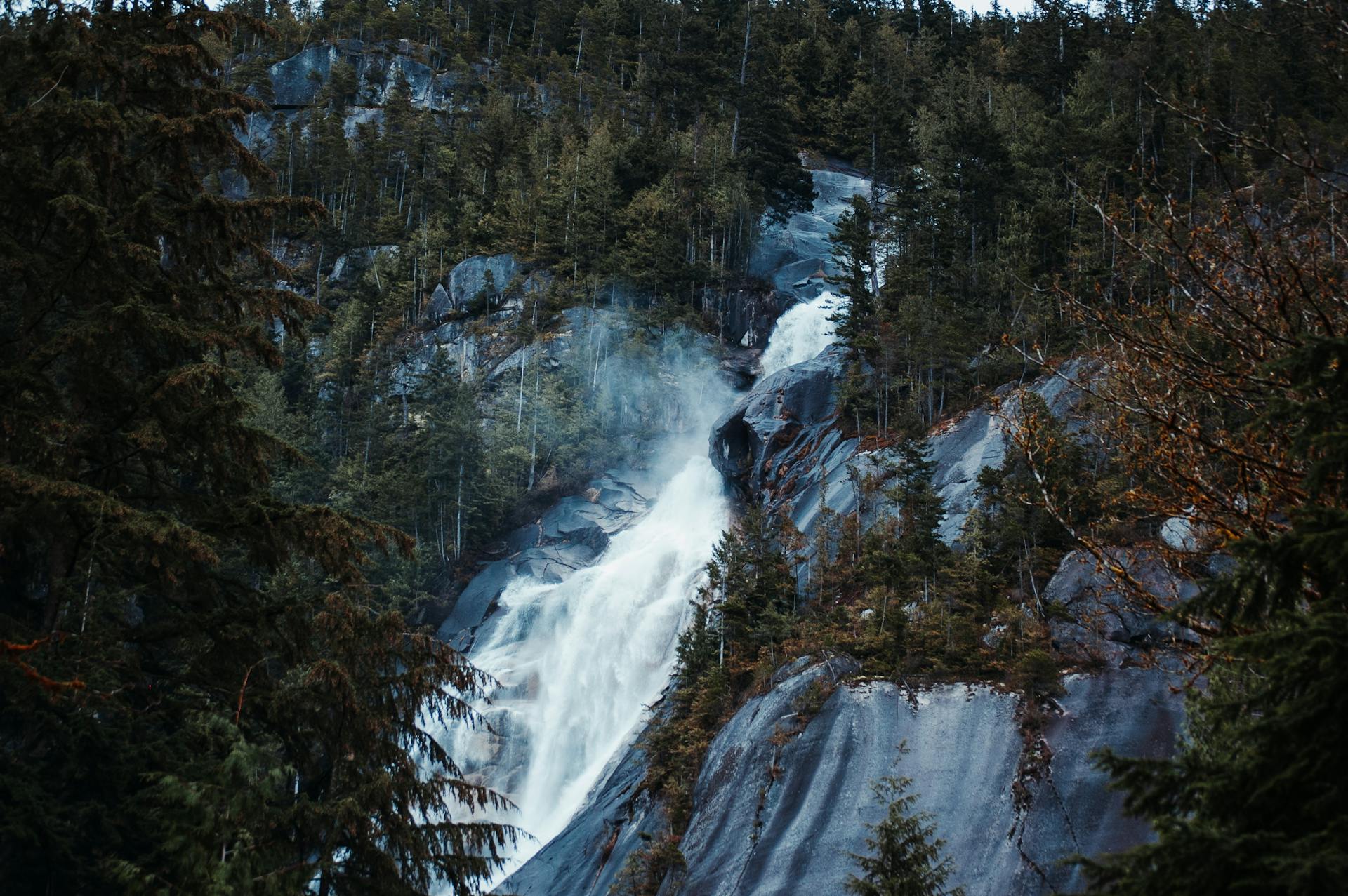
Shannon Falls is an easy stop—1,100 feet of cascading water, especially powerful in spring.
Whistler is famous from the 2010 Olympics, but it’s just as fun in summer. The Peak to Peak Gondola is the world’s longest unsupported cable car—views for days.
Route highlights:
- Horseshoe Bay: Watch ferries come and go.
- Britannia Beach: Explore mining history.
- Squamish: A hub for climbing and hiking.
- Alice Lake: Swimming and short trails.
The drive only takes 90 minutes, but I always stretch it out to half a day—too many good viewpoints to rush.
Whistler village is walkable and packed with shops and restaurants. Whether you ski or hike, it’s a year-round destination.
Urban Stops: Edmonton’s Vibrant Culture
Edmonton is Alberta’s culture capital, home to over a million people. It’s a fun city break between mountain adventures.
West Edmonton Mall is a beast—there’s an amusement park, water park, and even an ice rink inside.
The North Saskatchewan River valley cuts through the city with 100 miles of parkland. I love biking the trails or just relaxing by the water.
Cultural must-sees:
- Royal Alberta Museum: Dive into provincial history.
- Art Gallery of Alberta: Modern art in a striking building.
- Fort Edmonton Park: Step back in time.
- Whyte Avenue: Nightlife and great eats.
Old Strathcona buzzes in summer, with heritage buildings and live music everywhere.
Edmonton sits three hours east of Jasper National Park. It’s a smart overnight stop if you’re driving between the Rockies and other western spots.

Eastern Canada’s Storybook Drives
Eastern Canada serves up some of the country’s dreamiest coastal routes. Cape Breton’s cliffs, Maritime lighthouses, and Acadian culture make every drive feel like a storybook adventure.
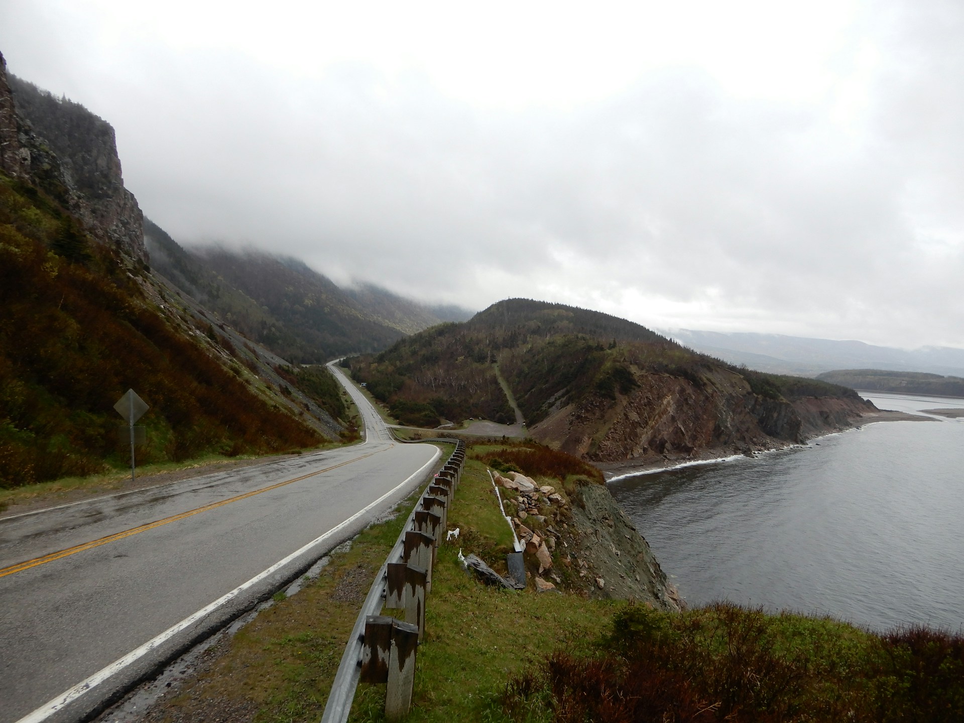
Cabot Trail: The Journey Around Cape Breton Island
The Cabot Trail loops 298 kilometers around Cape Breton Island’s northern tip. Honestly, it’s one of the prettiest drives I’ve ever done.
The road hugs the edge of Cape Breton Highlands National Park. Expect rugged cliffs, deep forests, and fishing villages that look like postcards.
Top stops:
- Baddeck: The Alexander Graham Bell Museum is fascinating.
- Ingonish Beach: Great for families and a quick swim.
- Pleasant Bay: Try a whale watching tour.
- Cheticamp: Dive into Acadian culture and live music.
The loop takes 5-7 hours if you rush, but I’d plan 3-4 days to really soak it in.
Wildlife is everywhere—moose, eagles, even whales offshore.
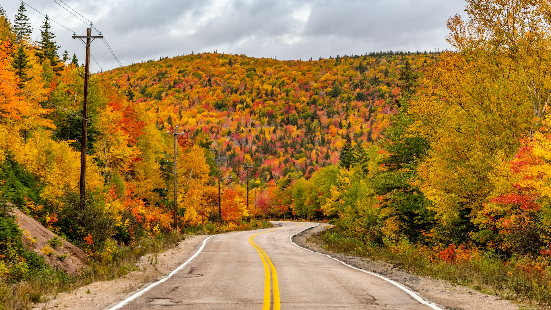
Travel tip: Grab a Parks Canada pass since you’ll drive through the national park. Fall colors here in September and October? Unreal.
Charming Maritime Routes
The Fundy Coastal Drive in New Brunswick runs 460 kilometers, showing off the world’s highest tides.
Hopewell Rocks is the star—you can stroll the ocean floor at low tide, then kayak between the rocks when the water rises.
Prince Edward Island has two scenic coastal drives. The Points East route covers 253 kilometers of beaches and rolling farmland.
PEI highlights:
- Cavendish Beach: Red cliffs and soft sand.
- Greenwich Dunes: Check out the floating boardwalk.
- Basin Head Beach: The sand actually “sings” underfoot.
Nova Scotia’s Lighthouse Route stretches 385 kilometers along the South Shore. Peggy’s Cove Lighthouse is the classic stop, and it’s worth the hype.
Each of these drives takes anywhere from 2 to 4 days, depending on how often you stop—or how long you linger at the beach.
Cultural Gems in the Maritimes
The Acadian Coastal Drive stretches for about 750 kilometers through New Brunswick. You’ll find this route bursting with stories, flavors, and the heartbeat of French Acadian culture.
Cheticamp? That place is alive with traditional Acadian music and food. Tucked along the Cabot Trail, it feels like a cultural crossroads you stumble into and never want to leave.
St. Andrews by-the-Sea? I wandered cobblestone streets lined with historic buildings, all facing the salty waterfront. Whale watching tours launch from here, and the gardens—honestly, I could’ve spent hours just wandering those paths.
Cultural experiences:
- Dance and sing along at Acadian festivals
- Climb up historic lighthouses and hear the locals’ tales
- Dig into fresh seafood right in fishing villages
- Explore Indigenous Mi’kmaq heritage sites
Drive through Quebec’s Gaspé Peninsula and you’ll add another 885 kilometers of French-Canadian flavor. The scenery swings between wild coastline and villages that feel straight out of Europe.
These drives don’t just show you the Maritimes—they pull you right into the story. Each province feels like it’s whispering its own history through every coastal stop and cultural site.

Regional Road Trip Tips and Experiences
Every province throws something different at you. Sometimes it’s a mountain pass that makes your palms sweat, other times it’s a lonely prairie highway stretching out forever. The local food? Always a surprise. Attractions? Never quite what you expect.
If you get a handle on these differences, you’ll plan better stops. Trust me, you’ll dodge a lot of rookie mistakes.
Navigating Different Provinces and Terrains
British Columbia really puts your mountain driving to the test. Those winding roads aren’t for the faint of heart. I always check the weather before crossing a pass—snow tires are non-negotiable from October to March.
The Prairie provinces? Endless, straight highways and not a lot of pit stops. I learned the hard way to fill up the gas tank every chance I got. Saskatchewan and Manitoba usually have rest stops every 50-100 kilometers, but sometimes it feels longer.
Ontario can be a patience game, especially near Toronto or Ottawa. Traffic jams are just part of the deal, and summer construction zones slow things down even more.
Quebec brings you French road signs—so “sortie” means exit, and “arrêt” means stop. Montreal’s highway interchanges can get confusing fast, so I keep my eyes peeled.
Atlantic Canada winds you along coastal roads and tosses in ferry crossings for good measure. I always book ferry reservations ahead, especially if I’m heading to Newfoundland. Some roads here are narrow, with barely-there shoulders.
Weather? It changes on a whim. Prairie storms roll in out of nowhere. Fog in the Maritimes can make you feel like you’re driving through a dream. And in the mountains, the weather shifts with every curve and climb.
Unique Foods, Culture, and Local Attractions
Every province has its own food that really tells you something about the place. In Quebec, you’ve got to try poutine—crispy fries, gooey cheese curds, and gravy that somehow tastes better in the cold. Ontario locals swear by butter tarts, those sweet, sticky treats you find in almost every bakery. If you visit in winter, don’t skip out on a slice of tourtière; it’s hearty and perfect for the season.
Alberta’s steakhouses serve up some of the best beef I’ve ever tasted. Seriously, if you’re a meat lover, this is your paradise.
Out east, the Maritimes take seafood to another level. Nova Scotia’s lobster rolls are legendary—fresh, buttery, and just messy enough. On Prince Edward Island, potatoes are more than a side dish; they’re a source of pride. Newfoundland gets adventurous, serving up cod tongues and hosting screech-ins. Not for everyone, but hey, it’s an experience you’ll remember.
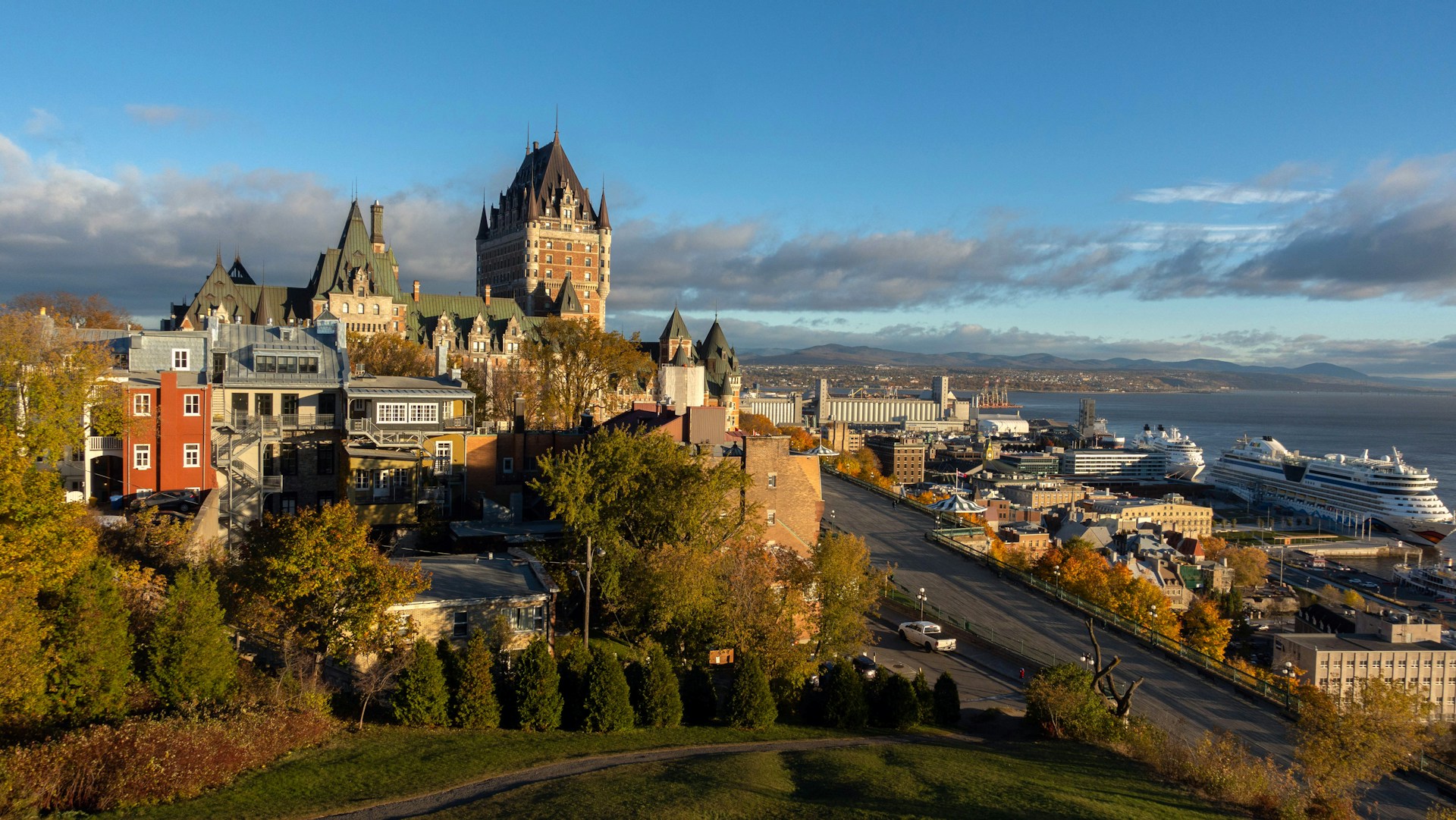
Culture shifts as you travel. Quebec City’s old stone walls practically whisper stories from the French colonial days. In the Prairies, those tall grain elevators stand as reminders of a deep farming tradition. Across the country, Indigenous cultural centers invite you in to learn about First Nations history—these places make you pause and think.
Festivals? They happen all year. The Calgary Stampede in July feels like a wild, dusty party you never want to leave. February brings Quebec’s Winter Carnival, where even the cold can’t stop the fun. If you’re around the Maritimes in summer, you’ll find folk festivals full of Celtic music and laughter.
Outdoor adventures are everywhere. British Columbia calls out to hikers and skiers; the mountains are unreal. Saskatchewan’s lakes are perfect for fishing—peaceful, wide-open, and honestly, a bit underrated. Ontario shines with its cottage country escapes and, of course, the roar of Niagara Falls.