Big Sur’s 90-mile stretch along California’s Highway 1 is honestly one of the most jaw-dropping drives in the country. Sheer cliffs just tumble right into the endless Pacific, and the views? Unreal. I’ve driven this route more times than I can count, and I’ve learned the real magic comes from knowing exactly where to pull over—those stops can make the difference between a good trip and an unforgettable one.
If you want an epic Big Sur road trip, you’ve got to mix iconic landmarks, pristine state parks, and a few secret corners to truly soak in the region’s wild beauty. From the legendary Bixby Creek Bridge to those tucked-away purple sand beaches, every stop has its own vibe and story.
After years of exploring, I’ve narrowed it down to ten must-see spots that really capture Big Sur’s spirit. Whether you’re squeezing it into a single day or taking a whole weekend, this itinerary lays out planning tips, scenic overlooks, charming towns, and killer hiking trails. You won’t leave wondering if you missed something big.
Planning the Ultimate Big Sur Road Trip
A memorable Big Sur road trip takes a bit of strategy. Timing matters, and a little prep goes a long way, especially on this winding, dramatic stretch of Highway 1.
Best Time to Visit the California Coastline
Late spring is the sweet spot for Big Sur. April and May bring those rolling green hills and wildflowers that practically beg you to pull over for a photo.
The weather usually stays pretty mild, but in summer, that famous marine fog can roll in and hide the ocean until later in the day.
Spring Perks:
- Wildflowers peak in April
- Sun’s usually out
- Everything’s lush and green
- Crowds are manageable
Summer Tradeoffs:
- More daylight for exploring
- Bigger crowds, especially on weekends
- Foggy mornings
- Warmer afternoons
Fall’s great too—clear skies, fewer people. Winter? Dramatic storms, but the road sometimes closes because of slides or flooding.
I always check Highway 1 closure reports before heading out. Trust me, nothing kills the mood faster than running into a roadblock after hours of driving.
How to Get to Big Sur From Major Airports
San Francisco International Airport (SFO) is the main jumping-off point if you’re coming from the north. It’s about a two-hour drive to Carmel, and that’s where most folks kick off their Big Sur adventure.
Most travelers fly into SFO, then drive south on Highway 101 before cutting over to Highway 68 toward Carmel. It’s pretty straightforward.
Quick Airport Distances:
- SFO to Carmel: 2 hours (120 miles)
- LAX to San Simeon: 4 hours (230 miles)
- Monterey Airport: 30 minutes to Carmel
Arriving in Carmel the night before your drive is a smart move. You’ll avoid Bay Area traffic and get a jump start in the morning.
Flying into LA makes more sense if you’re starting from the southern end, near San Simeon. Monterey Airport is the closest, but flights can be limited.
Essential Packing Tips for Comfort and Safety
Water and snacks are non-negotiable—places to eat are few and far between. I always throw a cooler in the car with drinks and enough food for the day.
Cell service? Spotty at best. Download offline maps and print directions before you go.
Don’t forget:
- Navigation: Offline maps, printouts
- Safety: First aid kit, basic emergency gear
- Clothes: Layers—weather changes fast
- Food: Water, snacks, picnic stuff
The weather can flip from sunny to chilly in minutes. I never regret bringing a jacket, even in July.
If you’re into photography, pack extra batteries, memory cards, and a lens cloth. You’ll want to capture everything.
Good walking shoes are a must. Many stops require a short hike or scramble down to the beach.
Must-See Iconic Landmarks Along Hwy 1
Big Sur’s Highway 1 is famous for three must-see landmarks. Bixby Creek Bridge is a photographer’s dream, McWay Falls spills right onto the sand, and Pfeiffer Beach stuns with its purple sand.
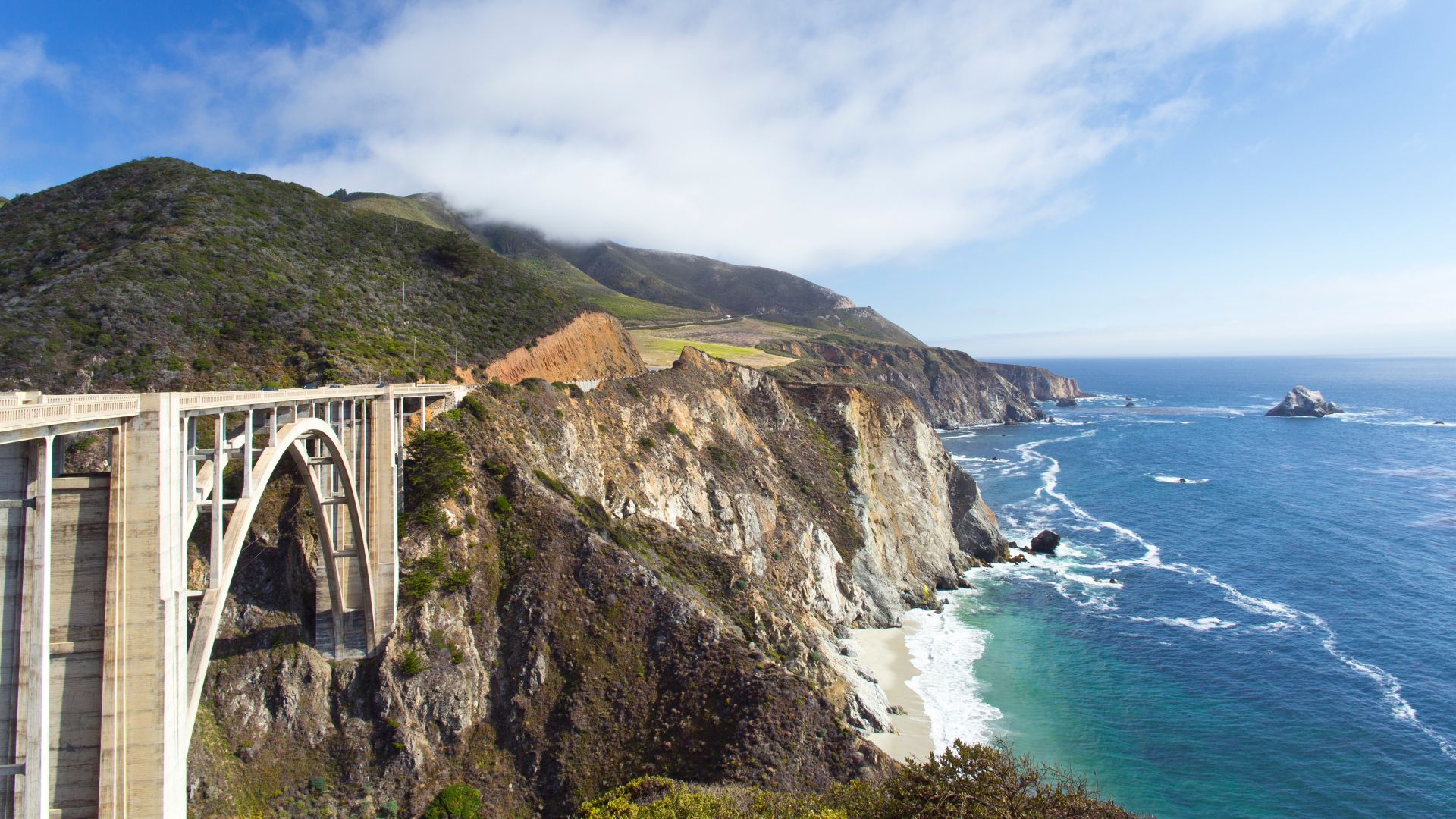
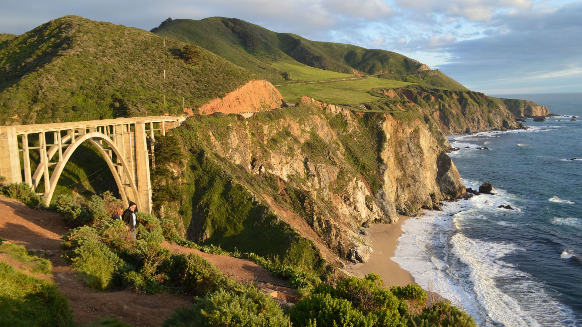
Bixby Creek Bridge Photo Opportunities
Bixby Creek Bridge is probably Big Sur’s most recognizable sight. This concrete arch stretches 714 feet across a deep canyon, standing 280 feet above the creek below.
I always pull over at the north side lookout for the classic shot. It frames the bridge and ocean just right.
Best times for photos:
- Golden hour: About 30 minutes before sunset
- Blue hour: Shortly after sunset
- Early morning: Soft light, fewer people
You’ve probably seen the bridge in movies and commercials. It’s got that iconic California look.
If you want a different angle, walk carefully along the shoulder. Cars zip by, so stay alert and wear something bright.

Exploring the Majestic McWay Falls
McWay Falls drops 80 feet onto the sand below, creating a scene that feels almost unreal. The waterfall flows all year, but it’s really roaring after winter rains.
I reach the falls from Julia Pfeiffer Burns State Park. It’s a super short walk—just 0.6 miles—to an overlook with a perfect view.
A landslide in the ‘80s actually changed the landscape, so now the waterfall lands on a little beach instead of falling directly into the ocean. Makes it even more unique.
When to visit:
- Winter/Spring: Waterfall’s strongest
- Summer: Still pretty, just less water
- Anytime: Gorgeous ocean backdrop
The overlook can get packed. Early morning or late afternoon usually means fewer people and better photos.
Witnessing Purple Sand at Pfeiffer Beach
Pfeiffer Beach is famous for its purple sand, thanks to manganese garnet washing down from the hills. The color pops most when the sand’s wet.
Getting here takes a little attention—look for the unmarked Sycamore Canyon Road about a mile south of Big Sur Station. The road’s narrow and twisty, but it leads straight to the beach.
Why the sand’s purple:
- Manganese garnet particles
- Mixed with quartz and feldspar
- Ocean waves grinding it all together
The beach has cool rock arches and formations too. At low tide, you can actually walk through the keyhole rock.
I always bring layers—fog can roll in fast. If you catch a clear sunset here, it’s magic.
Parking is limited, especially on weekends. Aim for an early or weekday visit to avoid the crowds.
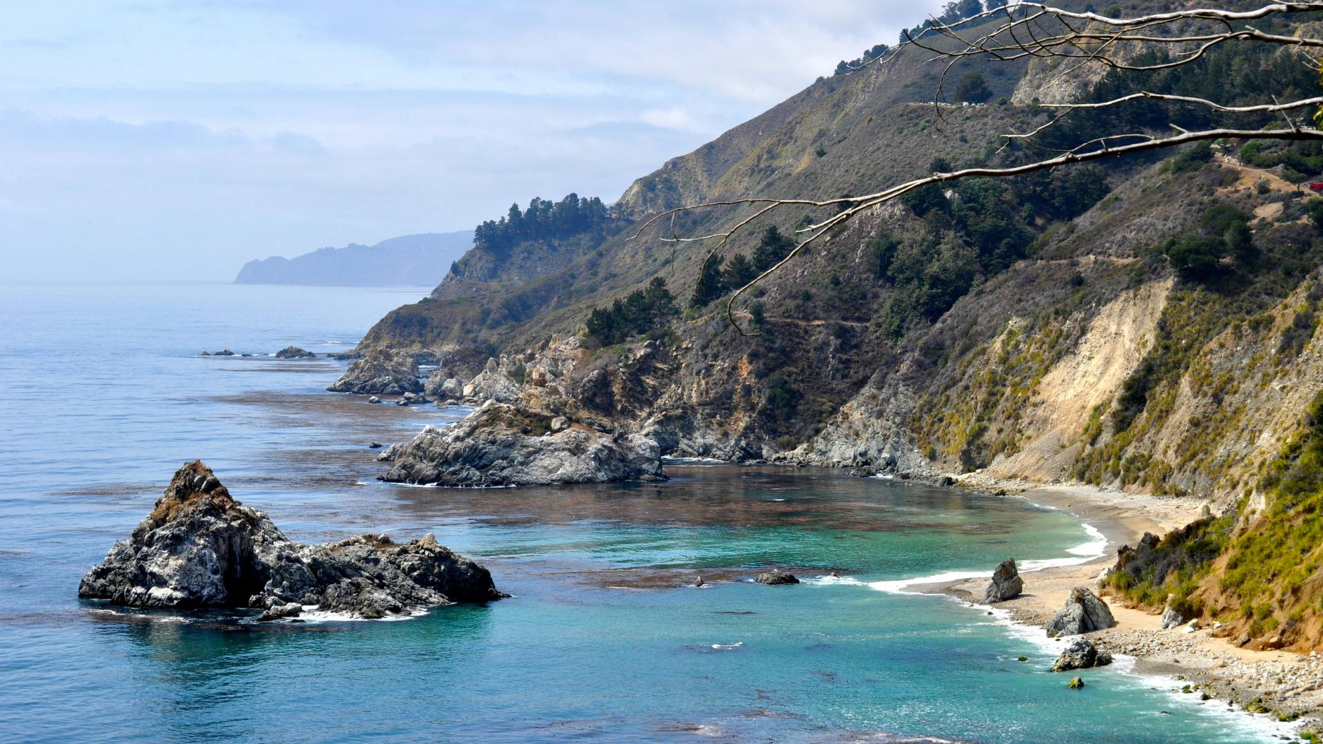
Scenic State Parks and Natural Wonders
Big Sur’s state parks show off the wildest parts of the coast. Rugged cliffs, hidden beaches, and hiking trails let you experience the Pacific up close.
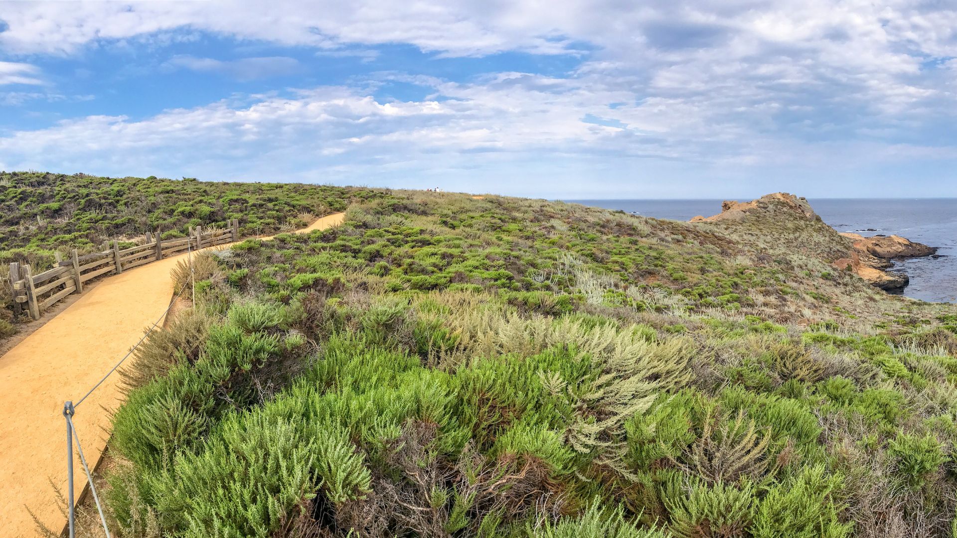
Discovering Point Lobos State Natural Reserve
Point Lobos is hands-down one of my favorite coastal stops. Wildlife is everywhere, all year long.
I like to start with the Cypress Grove Trail. It’s an easy loop through wind-bent cypress trees with amazing ocean views.
The Sea Lion Point Trail is perfect for spotting seals and sea lions lounging on the rocks below.
Best times for wildlife:
- Morning: Animals are active, light is soft
- Late afternoon: Great for photos
The tide pools at Weston Beach are full of sea anemones and hermit crabs at low tide. Check tide times before you go.
Point Lobos charges $10 per car. Parking fills up fast on weekends—arrive early if you can.
Hiking at Garrapata State Park
Garrapata State Park gives you two totally different experiences on either side of the highway. The beach side is all sand and surf.
On the inland side, the Soberanes Canyon Trail is my top pick. It’s a moderate hike through redwoods, with peeks of the Santa Lucia Mountains.
Trail details:
- Distance: 2.5 miles roundtrip
- Elevation gain: 400 feet
- Difficulty: Moderate
For a longer adventure, the Rocky Ridge Trail connects with Soberanes Canyon for a 4-mile loop and big coastal views.
Bring extra layers—the temperature can swing wildly between the canyon and the beach. The park is free, but don’t expect many facilities.
Coastal Beauty at Andrew Molera State Park
Andrew Molera State Park protects Big Sur’s biggest beach and has miles of trails. The park sits where the Big Sur River meets the ocean.
The Beach Trail is a mellow one-mile walk to a wide, sandy stretch.
Heads up: You’ll have to wade the river to reach the beach. Sometimes it’s ankle-deep, sometimes more—check before you go.
The Headlands Trail climbs above the coast for awesome views. It’s a moderate 2.5-mile loop.
There’s also a walk-in campground just 150 yards from the parking lot. Sites cost $25 per night—nothing fancy, but you’re sleeping under the stars in Big Sur.
Day use fee: $10 per car.
Unique Beaches, Valleys, and Forests
Big Sur’s natural wonders go way beyond the usual overlooks. Sand Dollar Beach is the longest stretch of sand here, Calla Lily Valley bursts with wildflowers in spring, and Pfeiffer Big Sur State Park wraps you in ancient redwoods beside a clear river.
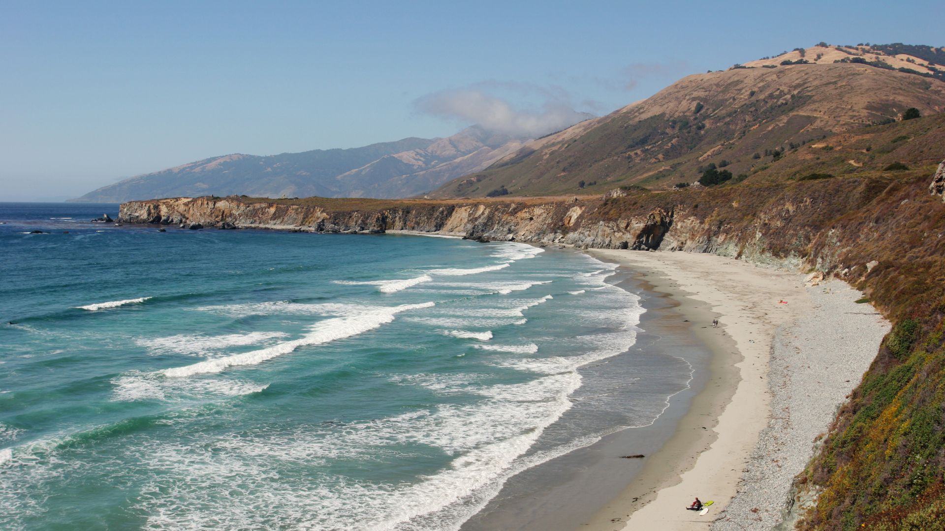
Strolling Sand Dollar Beach
Sand Dollar Beach runs for over a mile, making it the longest beach in Big Sur. It’s my go-to for a long, peaceful walk.
You’ll find it 11 miles south of Lucia, tucked below the highway. There’s a short trail down from the parking area.
Why it’s special:
- Wide, sandy shoreline for beachcombing
- Consistent surf (though swimming can be rough)
- Usually less crowded than other spots
- Killer sunsets
The waves can be strong, so stick to the sand if you’re not a confident swimmer. Fog often creeps in, so layers are your friend.
Parking fills up on weekends, but there are restrooms and picnic tables if you want to stop for lunch.
Venturing to Calla Lily Valley
Calla Lily Valley bursts into bloom from late February through May, covering the ground in white flowers. It’s a bit of a hidden gem, and the hike in is totally worth it.
Start at Garrapata State Park, about four miles south of Carmel. The roundtrip hike takes about 2-3 hours.
Tips for your visit:
- Peak bloom: March and April
- Early mornings have the best light
- Wear sturdy shoes—it can get rocky
- Pack water and snacks
The lilies cluster along a creek at the bottom of the valley. After a rainy winter, the display is especially stunning.
Trails get muddy during bloom season, so stick to the paths and help protect the flowers.
Redwoods and Rivers at Pfeiffer Big Sur State Park
Pfeiffer Big Sur State Park brings together ancient redwoods and the clear Big Sur River. It’s the best place to really feel the forest side of Big Sur.
You can wade or swim in the river—water levels change with the seasons, but there’s always a spot to cool off.
What to check out:
- Nature Trail: 0.7-mile loop through redwoods
- River access: Several spots for swimming or picnicking
- Pfeiffer Falls Trail: 1.5-mile hike to a seasonal waterfall
- Campground: 152 sites for overnight stays
Some of the redwoods here are over 500 years old and tower above you. Pretty humbling.
Summer’s best for swimming. Natural pools form along the river, perfect after a hike.
The park charges a day-use fee. Facilities include restrooms, picnic tables, and a small camp store.
Charming Towns & Cultural Highlights
Big Sur’s nearby towns add a whole other layer to the trip. Think fairytale cottages, world-class aquariums, and a creative spirit that runs deep along the coast. These stops are worth weaving into your coastal adventure.
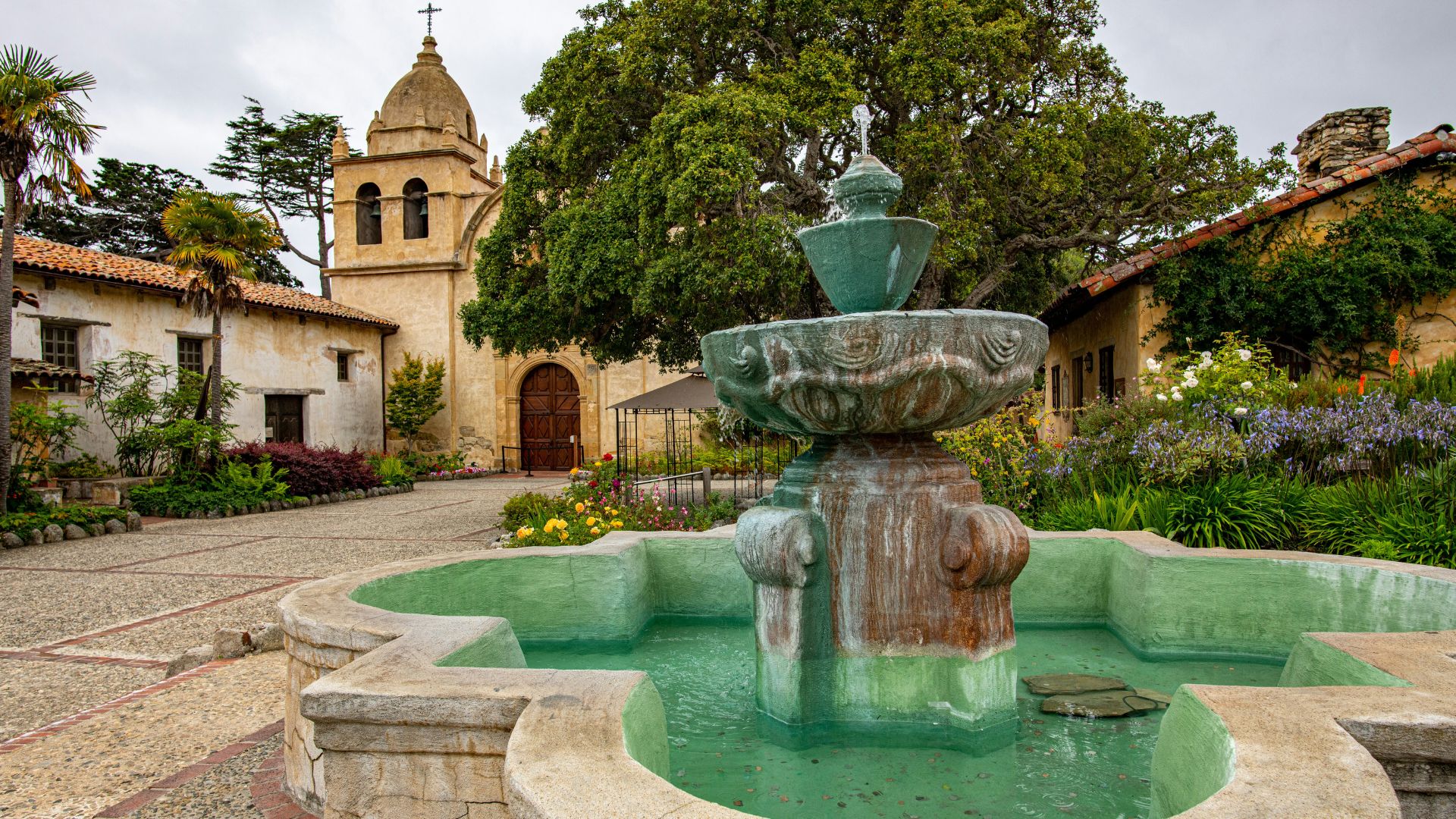
Carmel-By-The-Sea: Art and Architecture
Carmel-by-the-Sea feels like something out of a storybook. These fairy-tale cottages have curved rooflines, quirky stone chimneys, and whimsical details scattered along every street.
Honestly, I can’t walk down Ocean Avenue without stopping to peek into the art galleries. Local artists and photographers fill the spaces with creative energy, and the town has drawn in creative souls for ages.
Carmel Mission Basilica has stood here since 1771. You’ll find peaceful gardens and museum exhibits that dive into California’s early history.
The stone buildings look especially dramatic against the backdrop of the coast. I love how the architecture feels both historic and part of the landscape.
You can stroll down to the town’s white-sand beach for bird watching. Tide pools reveal themselves at low tide, or you can just sit back and take in those rugged shoreline views.
Key highlights:
- Carmel skips street addresses and numbers
- You’ll find dog-friendly beaches and shops
- Clint Eastwood actually served as mayor in the ‘80s
- Downtown’s so compact, you can walk across it in under half an hour
Monterey’s Coastal Attractions
Monterey Bay Aquarium really steals the show here. People from all over come to see the massive kelp forest exhibit and the adorable sea otters.
Cannery Row keeps the town’s sardine canning history alive. Old factories have become restaurants, shops, and hotels, and the waterfront walkway gives you those classic bay views.
The path connects right to the aquarium, so it’s easy to wander between sights.
Fisherman’s Wharf is always buzzing. Sea lions sprawl out on the docks, and fishing boats haul in the day’s catch.
If you’re hungry, try the clam chowder from one of the waterfront spots. It’s kind of a must.
The Monterey Bay Coastal Recreation Trail follows the shoreline for miles. I like walking or biking here—there’s always the ocean in view, and it links up all the main attractions.
17-Mile Drive starts in Monterey, winding through Pebble Beach’s famous golf courses and mansions before dropping you off in Carmel.
Rugged Southern Gateway: San Simeon and Ragged Point
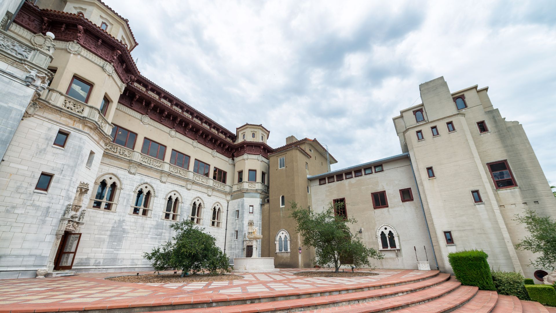
San Simeon marks Big Sur’s southern entrance. Elephant seals crowd the beaches year-round, and Hearst Castle looms above the hills.
Hearst Castle perches high above town. William Randolph Hearst’s mansion has 165 rooms, indoor and outdoor pools, and an art collection that’s honestly jaw-dropping.
You’ll need to book a tour in advance, though—it gets busy.
Ragged Point gives you one of the most dramatic views along Big Sur. There’s a clifftop restaurant and inn, and the short trail down to the waterfall puts you right up close to the coastline.
The Piedras Blancas Lighthouse has guided ships since 1875. It’s a sturdy old beacon that’s seen plenty of fog and storms.
Best viewing times for elephant seals:
- December-March: Breeding season, tons of activity
- April-May: Adult males molt here
- Year-round: You’ll always spot a few seals
Tips for a Smooth and Memorable Drive
Driving Big Sur’s winding coastline definitely keeps you on your toes. Weather and landslides can change road conditions fast, and the wildlife is everywhere.
The landscape’s beautiful, but the roads can be a challenge.
Dealing With Road Conditions and Safety
Before I hit the road, I check current conditions. The California Department of Transportation posts the latest updates on Highway 1 closures and construction.
Weather changes quickly here. Morning fog sometimes rolls in so thick, you can barely see a few feet ahead.
I keep my headlights on and take it slow until things clear up.
Landslides are common, especially after storms. I’ve run into road crews clearing rocks more than once.
I always stash water and snacks in the car, just in case traffic stops for a while.
Highway 1 twists and turns, with steep drop-offs and sharp curves. I give myself plenty of space from the car ahead and use turnouts to let speedier drivers pass.
Cell service? It’s spotty at best. I always download offline maps before setting out.
Gas stations are few and far between—and pricey. I make sure to fill up in Monterey or Carmel before heading out. Trust me, you don’t want to run out of gas on these remote roads.
Wildlife and Nature Encounters
Wildlife crossings can catch you by surprise. I’ve spotted deer, wild turkeys, and even the occasional mountain lion along the way.
Elk herds sometimes graze right by the road, especially early or late in the day. I slow down and keep my camera handy for those moments.
Sea otters and seals pop up at many lookouts. Binoculars make a big difference if you want a closer look without bothering the animals.
Condors and hawks often soar overhead, riding the coastal winds. I use pullouts and designated parking spots to watch or snap photos safely.
Never feed the wildlife. It’s dangerous for them and future travelers. I always stash my food securely in the car, just to be safe.
Navigating the Santa Lucia Mountains
The Santa Lucia Mountains throw out some real driving challenges—steep grades, narrow lanes, and a feeling that the road might just drop out from under you. Whenever I’m heading downhill, I’ll shift into a lower gear to keep my brakes from getting too hot.
Fog rolls in quickly from the ocean. Sometimes, it creeps up so fast that visibility drops to nothing in just a few minutes. When that happens, I’d rather pull over and wait it out than try my luck driving blind.
Mountain weather? It’s a whole different story from the coast. I always bring extra layers because, honestly, the temperature can swing by 20 degrees between the beach and the higher ridges.
GPS signals bounce off canyon walls and, let’s be real, they’re not always reliable out here. I like to check my route ahead of time, jot down a few key landmarks, and keep a paper map close—just in case.
Cell service drops off as soon as the mountains block the towers. Those dead zones can stretch on for miles. Before I disappear into the backcountry, I make sure someone knows my plan and when I’ll be back.