America’s national parks are on another level. One minute you’re standing under granite cliffs that make you feel tiny, the next you’re watching geysers blast steam into the sky. These parks protect landscapes so wild and beautiful, it’s no wonder millions of people travel from all over just to see them.
Let’s talk about nine parks that really show off what America does best—natural wonder. We’re talking the world’s deepest canyon, the largest living trees, and everything in between. Some parks wow you with ancient stone arches, others with waterfalls that thunder down thousand-foot cliffs.
I’ve spent years exploring these places, and honestly, they never disappoint. From Utah’s rainbow-colored rocks to Wyoming’s bubbling hot springs, these parks prove America’s wild places can stand toe-to-toe with anywhere else on Earth.

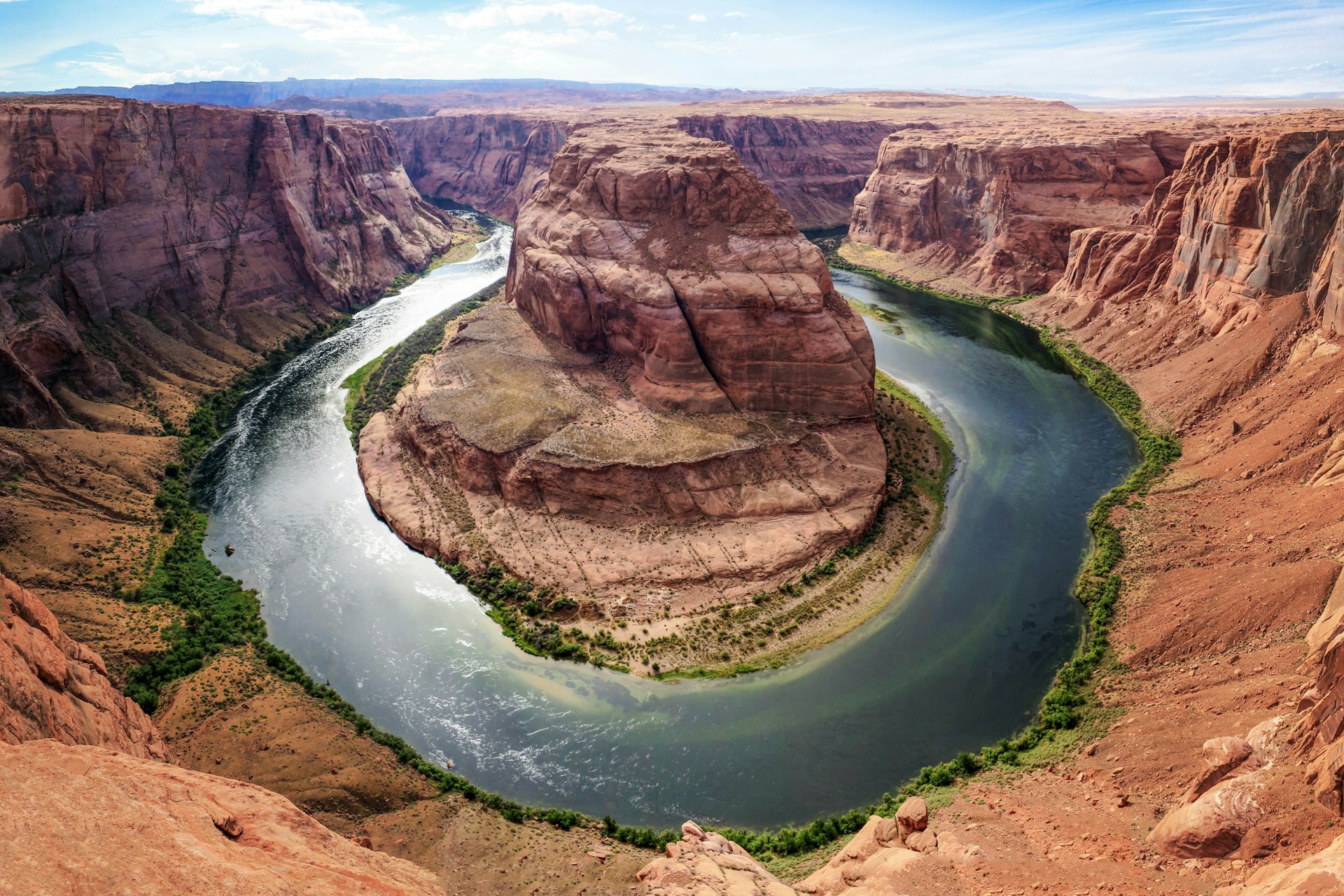
The Marvels of Grand Canyon National Park
Grand Canyon National Park just blows your mind with its size. This canyon runs 277 miles long and shows off nearly two billion years of Earth’s history in its colorful layers.
I love how you can hike right along the rim or, if you’re feeling gutsy, dive into the backcountry on winding trails. Every viewpoint gives you a new angle on the Colorado River’s handiwork.
Geological History and Striking Landscapes
The Grand Canyon acts like a time machine. You can literally see rock layers that tell stories of ancient seas, deserts, and mountains from 1.8 billion years ago.
The Colorado River didn’t just appear—it carved this monster gorge over millions of years. Some spots drop down more than a mile, and the canyon stretches up to 18 miles wide.
Each layer really does have its own story. The bright red Redwall Limestone? That’s from tropical seas. The dark Vishnu Schist at the bottom—some of the oldest rock in North America.
Sunlight plays tricks on the canyon all day. In the morning, the eastern walls glow. By sunset, shadows stretch and the colors shift again.
Key Rock Formations:
- Kaibab Limestone – The creamy top layer at the rim
- Coconino Sandstone – White cliffs made from ancient dunes
- Hermit Shale – Red slopes from old floodplains
- Vishnu Schist – Dark rock at the very bottom
World-Class Hiking Adventures
If you’re into hiking, Grand Canyon delivers for every skill level. I always tell beginners to start with the rim trails before heading into the depths.
The Rim Trail covers 13 miles along the South Rim. It’s mostly flat and paved, so it’s great for families and people just starting out.
Want a challenge? The Bright Angel Trail drops 4,380 feet to the Colorado River. It’s 9.5 miles one way, but there are rest stops and water in the summer.
The South Kaibab Trail is steeper and has no water at all. It’s about 7 miles to the river, so you’ll need to plan ahead and bring plenty to drink.
Essential Hiking Tips:
- Start early—afternoon heat can be brutal
- Bring more water than you think you’ll need
- Wear solid hiking boots with good grip
- Always check the weather before you go
The North Rim feels cooler and less crowded, but it closes from December through mid-May because of snow.

Best Vantage Points and Unique Formations
Most folks stick to the South Rim for easy access and big views. Mather Point near the visitor center is a classic spot for first-timers.
At Desert View, you’ll find a 70-foot stone watchtower from 1932. The Colorado River snakes through the canyon below.
Hopi Point is my pick for sunsets. The view west is wide open and the colors at dusk are unreal.
The North Rim sits 1,000 feet higher than the South. Bright Angel Point gives you a totally different angle, looking back across the canyon.
Unique geological features:
- Temple formations – Buttes named after world religions
- The Narrows – Where the canyon squeezes tight
- Phantom Ranch – The only place to stay below the rim
- Colorado River rapids – Built by debris from side canyons
Cape Royal on the North Rim opens up views of the eastern canyon. The Angels Window arch frames distant rock formations perfectly.

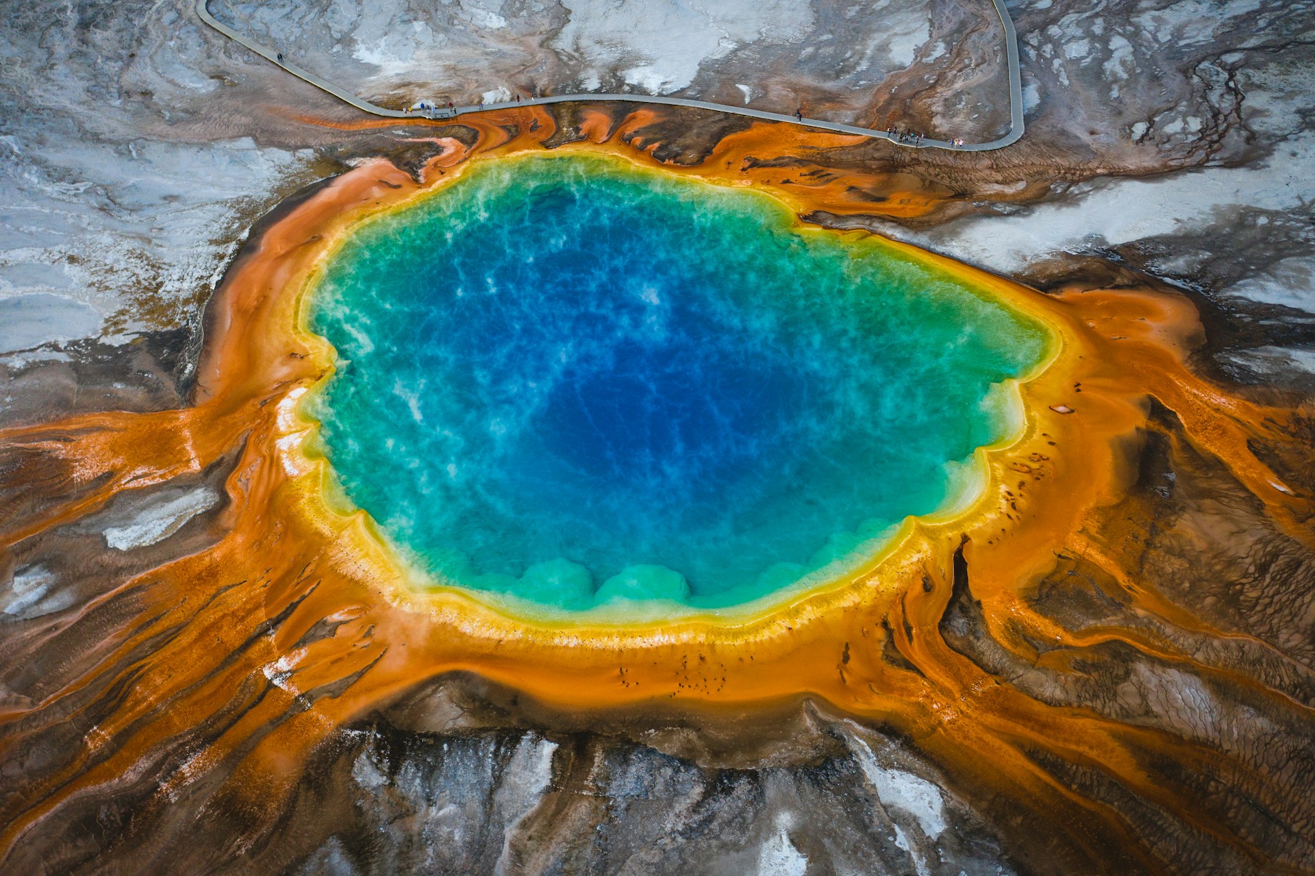
Yellowstone National Park: America’s Geothermal Gem
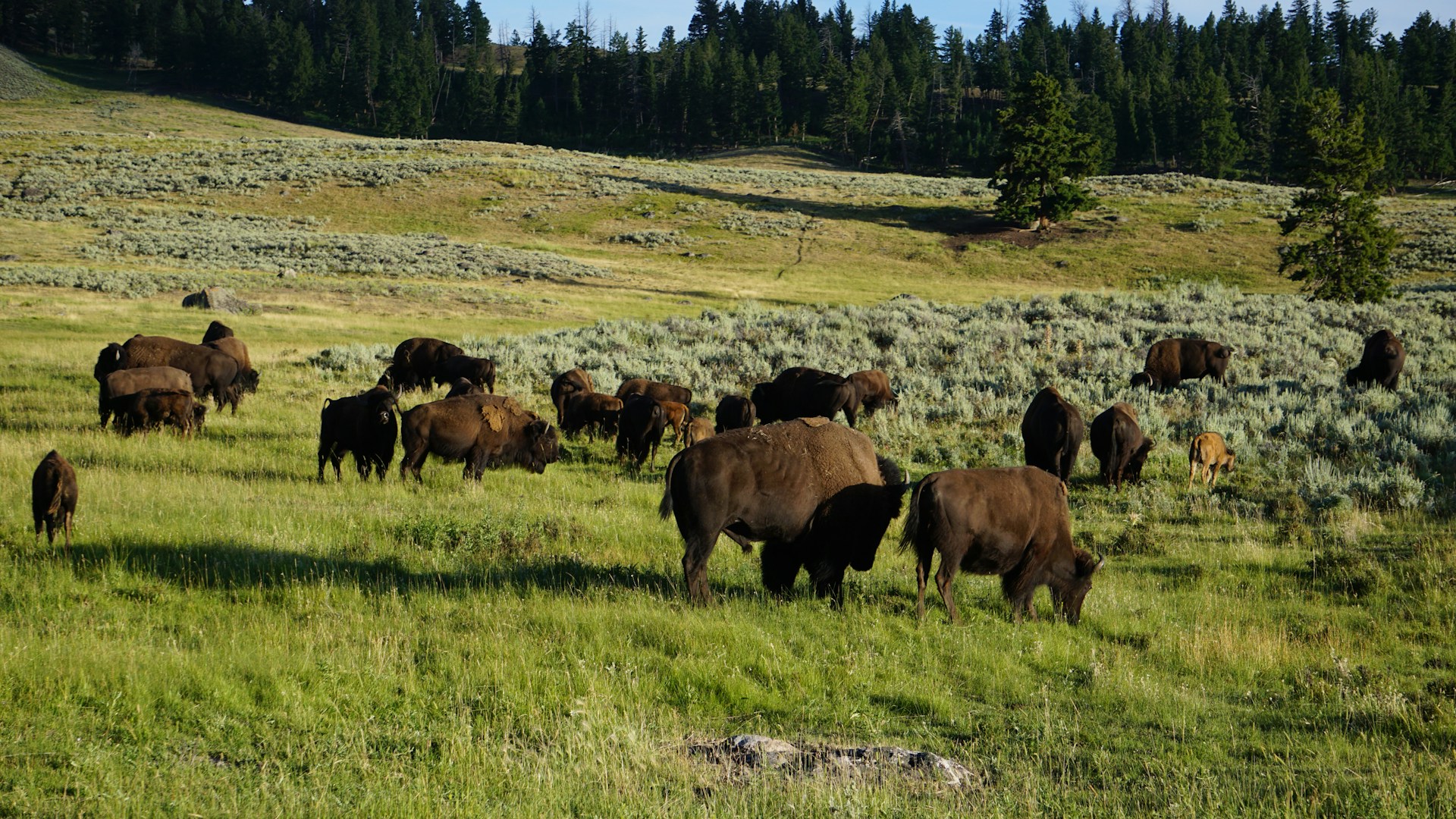
Yellowstone—what a place. It’s the world’s first national park, and you can feel that history everywhere. Over 10,000 geothermal features bubble and steam here, and the wildlife? Grizzlies, wolves, bison—sometimes it feels like you’ve stepped into another world.
Iconic Geysers and Hot Springs
Old Faithful gets all the attention, and for good reason. It erupts about every 90 minutes, shooting water up to 180 feet high. I always try to catch at least one eruption when I visit.
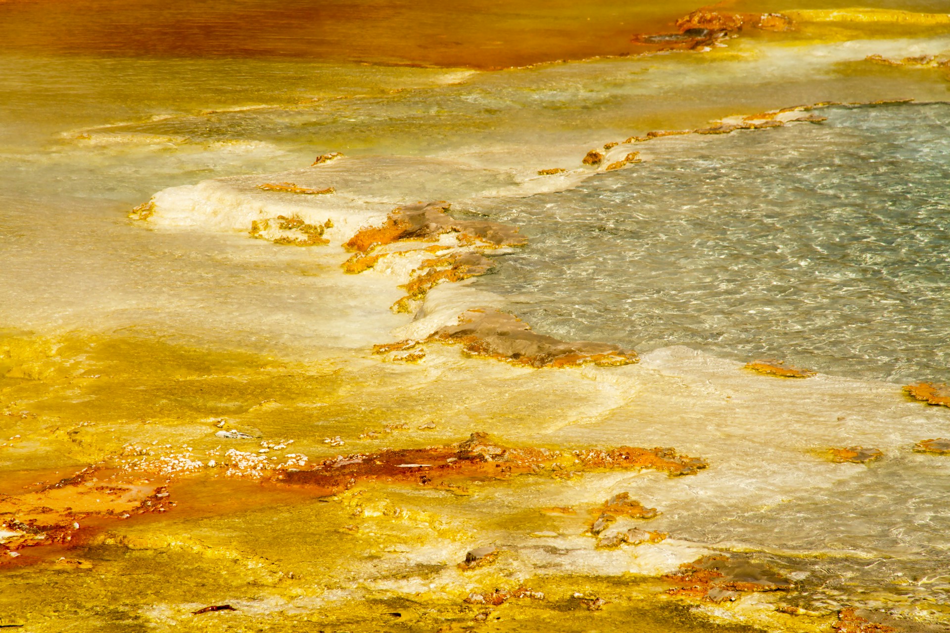
Yellowstone actually has more than half of all the world’s hydrothermal features. I wander boardwalks past steaming hot springs, burbling mudpots, and geysers that surprise you when you least expect it.
Grand Prismatic Spring is ridiculously photogenic. It’s 370 feet across and glows with wild colors—orange, yellow, deep blue—thanks to heat-loving microbes.
All this geothermal action comes from the Yellowstone Caldera, a massive dormant supervolcano under the park. That’s what makes these wonders possible.
If you’re short on time, hit the Upper Geyser Basin for Old Faithful and a bunch of other geysers nearby. The Grand Loop Road makes it easy to reach the big sights.
Wildlife Viewing and Natural Diversity
Wildlife watching here is next-level. In Hayden and Lamar valleys, I’ve spotted grizzly bears—there are about 150 in the park.
Wolves made a comeback in 1995, and now you can sometimes catch a glimpse of a pack in the park’s northern reaches.
It’s not just predators, either:
- Bison herds roam in the thousands
- Elk numbers top 10,000
- Mountain goats and bighorn sheep hang out in the high country
- Over 285 bird species call this place home
Lamar Valley is my go-to for wildlife. Early mornings or evenings—those are the magic hours.
Elevation here ranges from 5,282 to 11,358 feet, creating all kinds of habitats. That’s why you see so many different animals and plants.
Unforgettable Landscapes
Yellowstone’s landscapes feel almost prehistoric. Volcanic eruptions, glaciers, and erosion shaped 3,468 square miles that now span Wyoming, Montana, and Idaho.
Yellowstone Lake sits way up at 7,732 feet. It’s one of the largest high-altitude lakes in North America, covering 136 square miles and dropping to 400 feet deep.
The Grand Canyon of Yellowstone stretches 20 miles and drops 1,200 feet. Artist Point is the place for jaw-dropping views.
Mountains ring the park. The Absaroka Range rises to the east, while the Gallatin Range marks the northwest.
I usually drive the Grand Loop Road to see the geysers, canyons, lakes, and wildlife—all in one epic road trip.
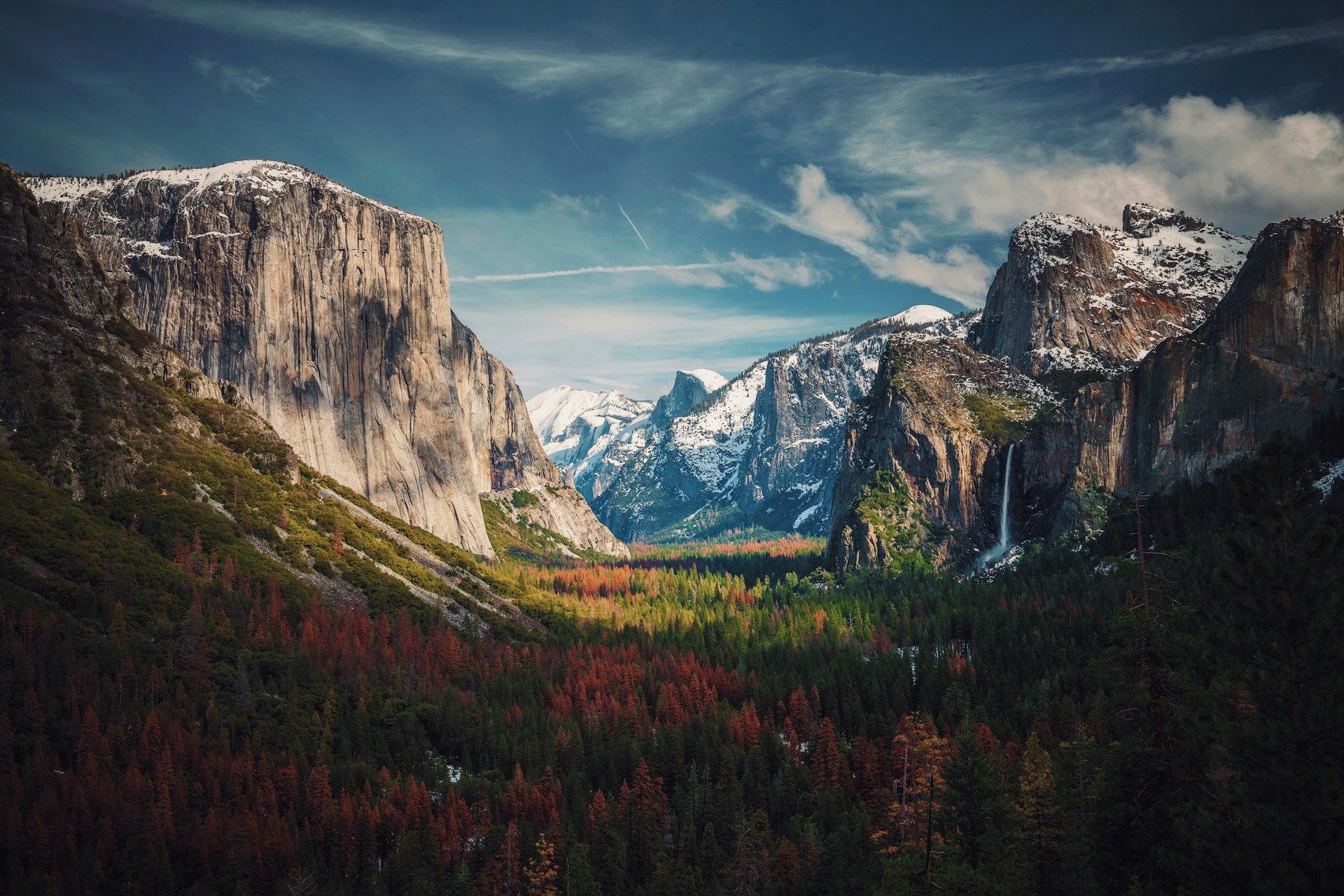
Yosemite National Park: Granite Cliffs and Waterfalls
Yosemite has this way of making you feel both tiny and inspired. Granite giants like El Capitan and Half Dome tower above, while waterfalls thunder down in the spring. It’s a paradise for climbers, hikers, and anyone who loves a good view.
Famous Landmarks: El Capitan and Half Dome
El Capitan is legendary in climbing circles. This sheer granite wall rises 3,000 feet straight up from the valley floor. Even if you don’t climb, just standing below it is awe-inspiring.
These cliffs formed when magma cooled slowly underground, millions of years ago. You can spot different granite types—darker Diorite, lighter El Capitan Granite—if you look closely.
Half Dome is Yosemite’s other icon, standing 4,737 feet above sea level. Glaciers shaved off its face, giving it that unique, sliced look.
Climbers come from all over to test themselves here. El Capitan is for the pros, but the Half Dome hike is doable for non-climbers—just be ready for a tough trek and some cable-assisted climbing at the top.
Both sit within the massive Sierra Nevada Batholith, a 300-mile-long granite formation created during wild volcanic times 120 to 85 million years ago.

Towering Waterfalls and Scenic Vistas
Yosemite Falls drops a staggering 2,425 feet in three stages. The upper fall alone plunges 1,430 feet—no wonder it’s the tallest waterfall in North America.
Spring is when the waterfalls really put on a show. Melting snow swells the rivers, and you can feel the mist from Yosemite Falls half a mile away.
Bridalveil Fall drops 620 feet and never dries up, thanks to underground springs. The wind sometimes blows the water sideways, which is where it gets its poetic name.
Glacial carving set the stage for these waterfalls, funneling water into narrow chutes that make each drop more dramatic.
Vernal Fall and Nevada Fall are a dynamic duo on the Merced River. They drop 317 and 594 feet, and on sunny days, rainbows dance in the mist.

Adventure and Wildlife in Yosemite
Yosemite bursts with life—over 400 animal species, in fact. Black bears are the celebrities here; about 300-500 roam the park.
Meadows in Yosemite Valley are perfect for spotting mule deer at dawn or dusk. They migrate up and down the mountains, following the seasons.
Mountain lions, bobcats, and coyotes keep to the wilder areas. And if you’re a birder, you’ll love the 165+ bird species, including peregrine falcons nesting on the cliffs.
Rock climbing is the park’s signature adventure. There are routes for everyone, from newbies to world-class climbers who spend days on the wall.
Hiking options range from mellow valley strolls to grueling backcountry epics. The Half Dome trail is a beast—16 miles round-trip and 4,800 feet up, with a permit required.
Wildlife is most active in spring and fall. My favorite spots for animal watching? Yosemite Valley meadows, Tuolumne Meadows, and anywhere near water.
Zion National Park: Sandstone Majesty
Zion National Park is all about drama—red sandstone cliffs that soar over 2,000 feet above the canyon floor, carved by the relentless Virgin River. The trail system here is an adventure in itself, leading to iconic spots like Angels Landing and revealing hidden slot canyons.
Canyon Trails and Angels Landing
Angels Landing is legendary for a reason. The hike is 5.4 miles round-trip and climbs 1,488 feet, but it’s the last half-mile that’ll get your heart pounding.
You grip chains, inch along a narrow ridge, and peer down 1,000-foot drops on both sides. Some spots are just two feet wide—definitely not for anyone afraid of heights.
I always start early to beat the crowds and the heat. The park now requires timed permits for Angels Landing, which honestly makes the experience better and safer.
Other classic hikes? The Narrows lets you wade right through the Virgin River, hemmed in by towering canyon walls. The Emerald Pools Trail is a gentler option, with waterfalls and quiet pools.
Observation Point Trail offers views from 1,000 feet above Angels Landing. Parts of it are closed due to rockfalls, but when open, it’s unbeatable.

Virgin River and Unique Geology
The Virgin River is Zion’s master sculptor. Over 13 million years, it’s carved the canyon through Navajo Sandstone, which started as Jurassic sand dunes.
Even now, the river keeps shaping the landscape, hauling thousands of tons of sediment downstream each year. Spring snowmelt and summer storms can turn the river from gentle to wild in a flash.
That Navajo Sandstone is what gives Zion its signature cream, pink, and red cliffs. Iron oxide in the rock paints the canyon in ever-changing hues.
Zion sits where the Colorado Plateau, Great Basin, and Mojave Desert meet. That crossroads creates a surprising mix of ecosystems in a compact space.
Slot canyons like the Subway formed as water sliced narrow channels through softer rock layers. These hidden corridors show just how powerful water can be over time.

Dramatic Scenery and Outdoor Adventure
Zion’s got outdoor adventure on tap all year—not just for hikers. Rock climbers flock here, drawn to those wild vertical sandstone walls. Moonlight Buttress? It’s legendary, especially if you’re into big wall routes.
Canyoneering? Oh, that’s a rush. You’ll hike, rappel, and sometimes even swim through narrow slot canyons. Pine Creek Canyon and Keyhole Canyon are the ones I’d put at the top of your list.
From March through October, the park runs a shuttle system. It keeps traffic down and helps preserve the landscape. Nine stops make it pretty easy to hop on and reach all the major trailheads and viewpoints.
If you want something mellow, check out the Riverside Walk. It’s a paved, easy stroll—just 2.2 miles round trip—and it leads right to the start of the Narrows hike.
Photo ops are everywhere. The Temple of Sinawava and Court of the Patriarchs dish up those classic Zion views even if you’re not up for a strenuous trek.
Winter here? It’s kind of magical. Snow dusts the higher elevations, making those red rocks pop, and honestly, the peace and quiet when the crowds thin out is tough to beat.

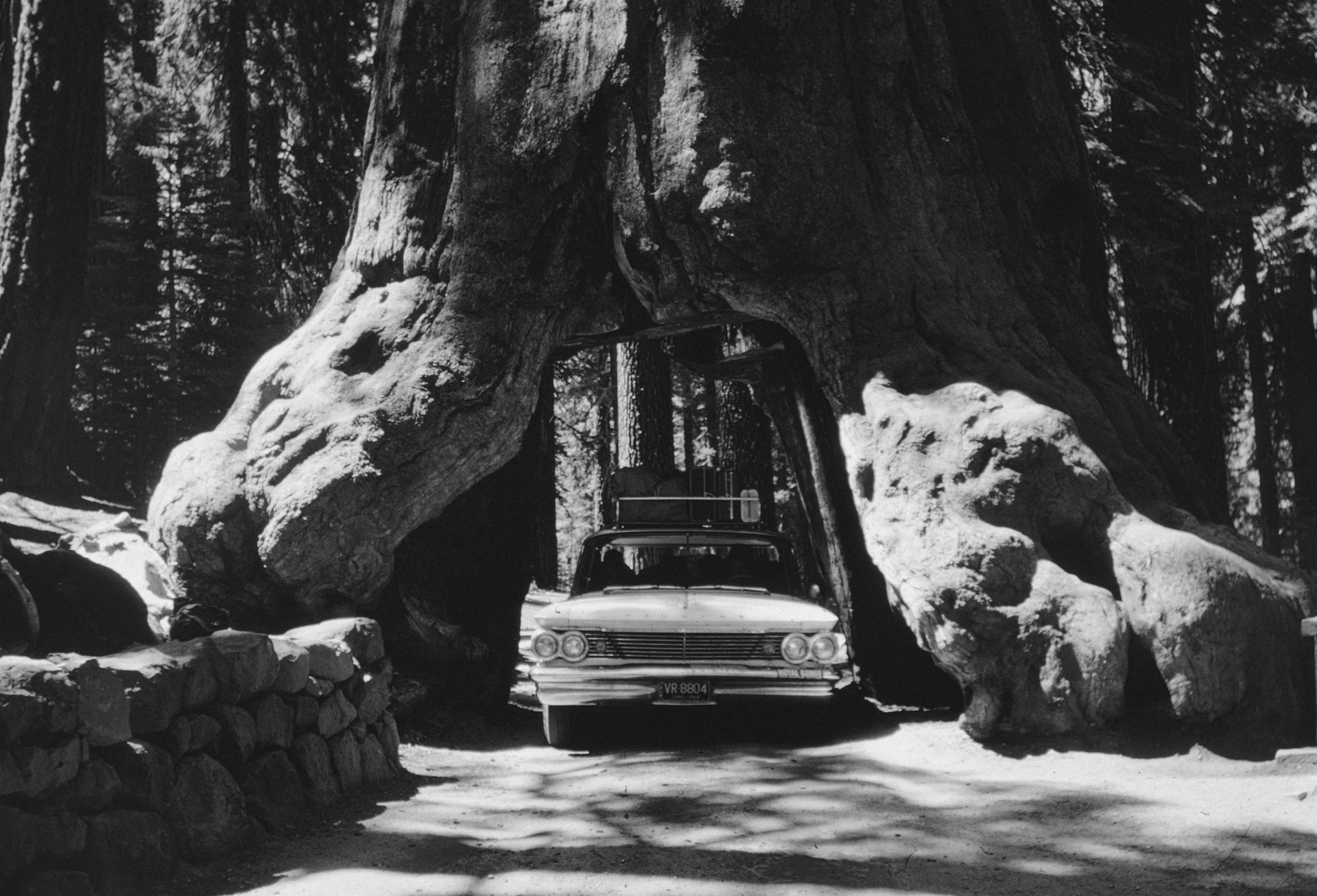
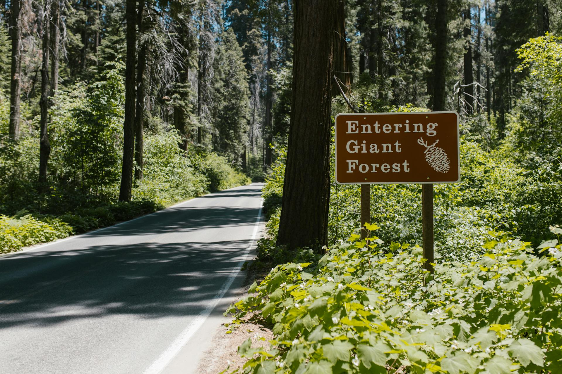
Sequoia National Park’s Towering Giants
Giant sequoias stretch sky-high—over 250 feet—and can live for thousands of years in California’s Sierra Nevada. The park protects these ancient trees and offers miles of trails and all kinds of wildlife across 400,000 acres.
Giant Sequoias and the General Sherman Tree
The General Sherman Tree is just mind-blowing. It’s the largest tree on the planet by volume. Standing in front of it, you can’t help but feel small; it rises 275 feet and the base stretches a whopping 30 feet across.
These giants can live over 3,000 years. You’ll only find giant sequoias in the Sierra Nevada, between 5,000 and 7,000 feet up.
They’re picky about where they grow. Weirdly, fire actually helps them out by opening their cones and clearing out the competition.
Key General Sherman Tree Facts:
- Height: 275 feet
- Base diameter: 30 feet
- Age: Estimated 2,300-2,700 years
- Weight: 2.7 million pounds
If you go, take the paved half-mile trail from the parking lot. It’s an easy walk—about 30 minutes round trip.
Trails Among the Ancient Forest
The Giant Forest covers about 2,000 acres and holds over 8,000 mature sequoias. For families, the Big Trees Trail is a breeze—just a one-mile loop.
The Congress Trail is a bit longer and connects you to groups of sequoias named after government bodies, like the House and Senate. It’s 2.2 miles and a favorite for a reason.
If you’re craving solitude, the High Sierra Camps Trail heads deep into the wilderness. Backcountry routes here wind through groves where it’s just you and the trees.
Popular Sequoia Trails:
- Big Trees Trail: 1 mile, easy, paved
- Congress Trail: 2.2 miles, moderate
- Moro Rock: 0.5 miles, steep climb with stairs
- Tokopah Falls: 3.4 miles, moderate
There’s something for everyone, from gentle strolls to tougher climbs. Most groves connect by well-kept paths, perfect for a day hike.
Biodiversity in Sequoia Landscapes
Black bears wander through these forests, always on the hunt for snacks. I’ve spotted them near trails and campgrounds, especially during the summer.
Mule deer graze in open meadows between the trees. Mountain lions, bobcats, and coyotes also call these woods home, though you’ll need luck to see them.
The park protects everything from low foothills to high alpine zones. Over 1,200 plant species thrive here, including some rare wildflowers and ferns.
Wildlife I’ve Spotted:
- Black bears (most common large mammal)
- Mule deer in the meadows
- Steller’s jays and woodpeckers
- Marmots sunning on the rocks
As you climb higher, the landscape changes. Chaparral covers the lower slopes, while alpine plants take over above 10,000 feet.
Rivers run through the groves, bringing life to everything around. You might see rainbow trout darting in the streams or water ouzels hopping along the banks.

Arches and Monument Valley: Stone Wonders of the Southwest
The Colorado Plateau is packed with natural marvels. Utah alone has over 2,000 natural stone arches, and Arizona’s Monument Valley shows off those iconic sandstone buttes that just scream “American West.”
Arches National Park’s Natural Stone Arches
Arches National Park has more natural arches than anywhere else—over 2,000, all tucked into 76,000 acres near Moab. It’s wild how many you’ll spot just from the road.
Wind, water, and time have sculpted these formations for millions of years. Ancient seas laid down the rock, and then shifting earth pushed everything upward.
How the Arches Formed:
- Salt deposits built up pressure underground
- Surface rock cracked along weak spots
- Erosion widened those cracks into windows
- Eventually, windows grew into full arches
The red sandstone practically glows against the blue sky. I love how the arches look totally different depending on the time of day.
Some arches are tiny, while others, like Landscape Arch, stretch over 300 feet. Each one feels like a snapshot from deep time.
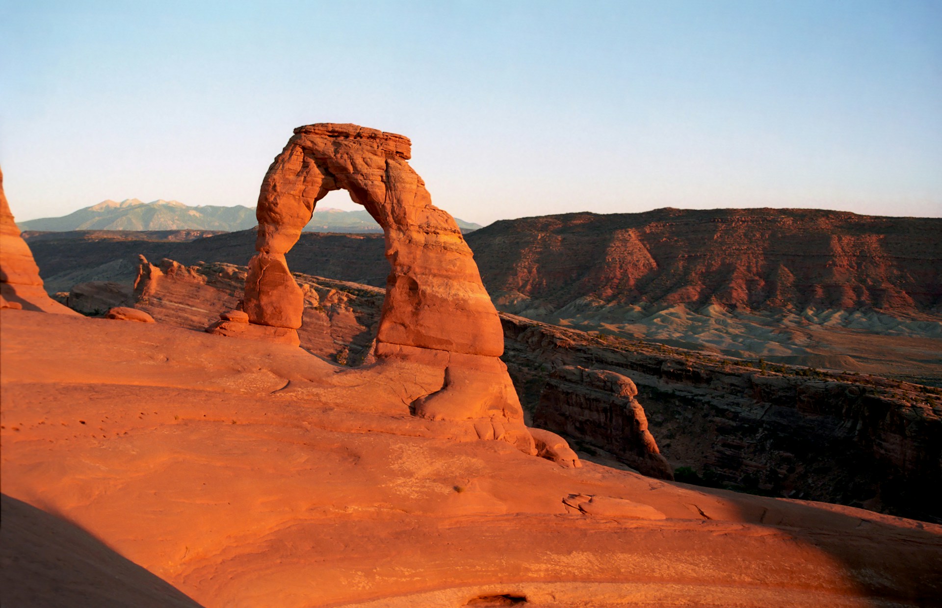
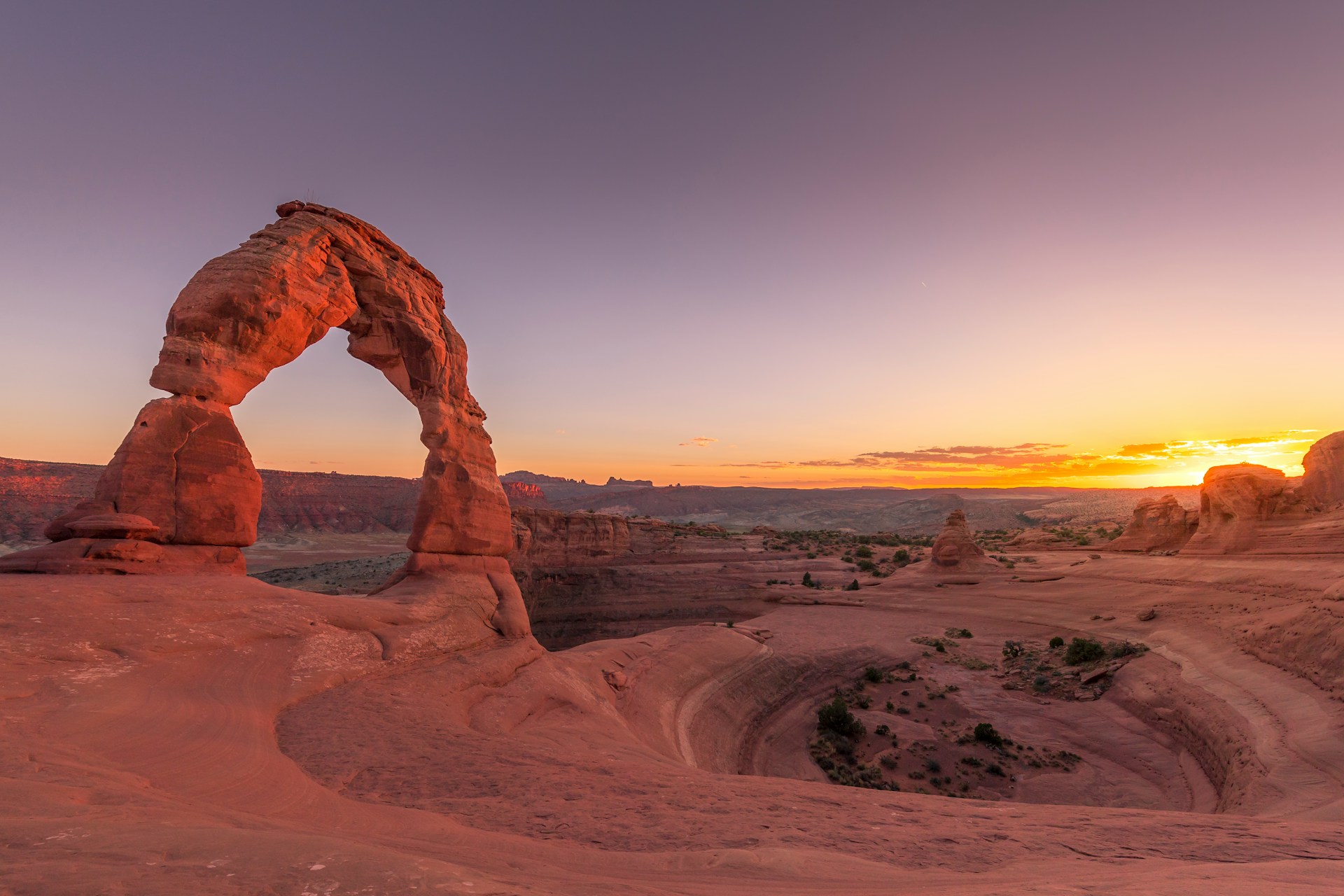
Delicate Arch and Photographic Hotspots
Delicate Arch has to be the most famous arch in Utah. You’ll see it on license plates, postcards, and just about every travel blog.
Getting there takes a bit of effort—a 3-mile round-trip hike—but the view is worth every step. If you can, go during golden hour for jaw-dropping light.
Best Photo Spots:
- Courthouse Towers – Super easy to reach from the road
- Windows Section – Tons of arches close together
- Fiery Furnace – Twisting slot canyons (you’ll need a guide)
- Landscape Arch – The longest natural arch in North America
Landscape Arch spans a whopping 306 feet, though rock falls remind you these wonders are always changing.
The colors are unreal. Early mornings and late afternoons are my favorite for capturing those deep reds and blues—nature’s perfect backdrop.
Monument Valley’s Sandstone Buttes and Western Vistas
Monument Valley sits right on the Arizona-Utah border, deep in Navajo Nation territory. You can’t miss the way those sandstone buttes shoot up from the desert floor like ancient skyscrapers.
Some of these formations tower over 1,000 feet. Merrick Butte and East Mitten Butte? They’re basically the movie stars of the place—if you’ve seen a Western, you’ve probably seen their silhouettes.
Hollywood really put Monument Valley on the map. John Ford loved filming his classics here, and honestly, it’s easy to see why these red rocks became icons of the American West.
The area’s geology feels a lot like what you’ll find at Arches National Park. Ages ago, ancient seas left behind layers of sandstone, which wind and water eventually sculpted into these wild shapes.
Notable Formations:
- The Mittens – Twin buttes that look uncannily like hands waving from the horizon.
- Merrick Butte – A flat-topped mesa that’s impossible to ignore.
- Totem Pole – This one’s a slender spire, almost like nature’s own monument.
When I first visited, I noticed Monument Valley feels much more spread out than Arches. Instead of a cluster, these giants stand alone, scattered across a huge, open plain.
You can drive the 17-mile Valley Drive to get up close to the formations. If you want to dig a little deeper, Navajo guides share stories and insights that really bring the landscape’s cultural history to life.