Most people think of Arizona when they hear “Grand Canyon,” but honestly, Mexico hides something even wilder. Tucked away in the rugged mountains of northwestern Mexico, Copper Canyon sprawls out as a jaw-dropping network of six canyons—way bigger and, dare I say, even more dramatic than its U.S. cousin.
Copper Canyon covers four times the area of the Grand Canyon and dives down over a mile deep in spots. It’s massive, wild, and somehow still flies under the radar for many travelers.
But there’s more to it than just sheer size. The story here winds through ancient geology, centuries-old indigenous culture, and some of the most pulse-pounding adventures anywhere. I want to pull back the curtain on the forces that shaped these canyons, introduce you to the Tarahumara people who’ve thrived here for generations, and give you a taste of the wild experiences waiting for anyone brave enough to visit.
You can ride the legendary El Chepe train through dizzying mountain tunnels or soar over the canyon on zip lines that seem to go on forever. Copper Canyon is Mexico’s best-kept secret, and honestly, it should be at the top of every adventurer’s bucket list.
Unveiling Copper Canyon: Mexico’s Hidden Natural Masterpiece
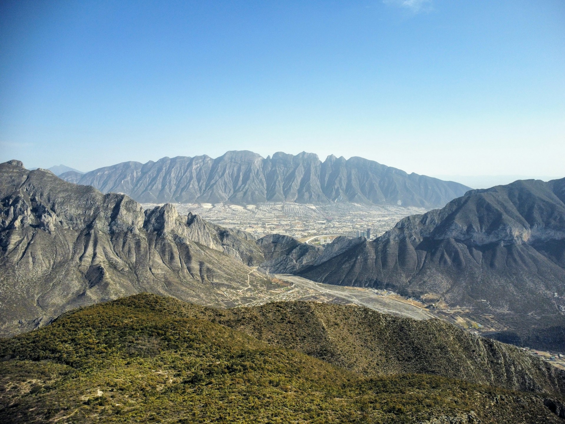
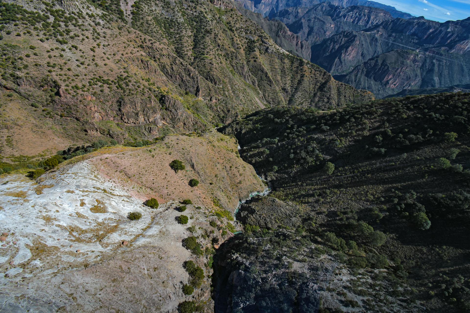
Copper Canyon stretches across 25,000 square miles of Chihuahua’s Sierra Madre Occidental. Imagine a canyon system four times bigger than Arizona’s Grand Canyon. It’s a tangled web of six canyons, with dramatic viewpoints like Divisadero and depths that drop over a mile.
How Copper Canyon Compares to the Grand Canyon
If you line up the stats, Copper Canyon blows the Grand Canyon out of the water. Barrancas del Cobre covers four times the area and sinks deeper in several places.
Some sections plunge lower than the Grand Canyon’s deepest points. The numbers are wild.
Key Differences:
- Size: 25,000 square miles vs. Grand Canyon’s 1,900
- Depth: Over 1 mile (1.6 km) in spots
- Elevation: Canyon rim at 8,200 feet above sea level
The coppery rock gives these canyons their name, and the color pops even more against that impossibly blue sky. Honestly, I think those contrasts are even more intense than the Grand Canyon’s reds.
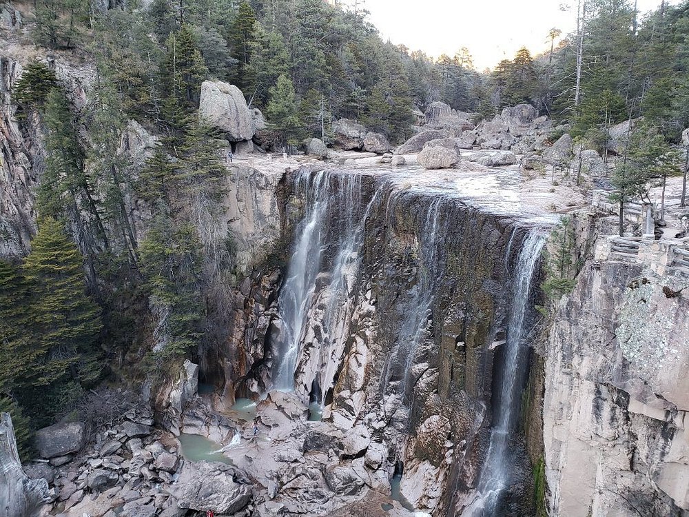
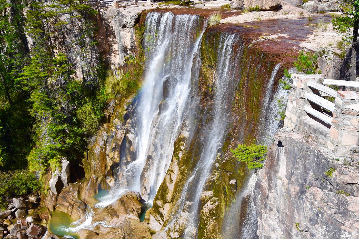
Six major rivers carved out this whole system over millions of years. The Urique River slices through the deepest sections.
Barrancas del Cobre and the Sierra Madre Occidental
You’ll find Barrancas del Cobre tucked in Mexico’s Sierra Madre Occidental range, way up in Chihuahua. This mountain system runs along Mexico’s western spine.
The canyon network connects six main canyons, each with its own vibe and depth.
The Six Main Canyons:
- Urique Canyon (deepest)
- Sinforosa Canyon
- Batopilas Canyon
- Candameña Canyon
- Chinipas Canyon
- Oteros Canyon
Tectonic plates shoved everything upward millions of years ago, laying the groundwork. Rivers then carved out the wild shapes you see today.
The elevation swings are wild—temps can shift by 30 degrees from rim to floor. Pine and oak forests cloak the upper reaches, while tropical plants thrive way down at the bottom.
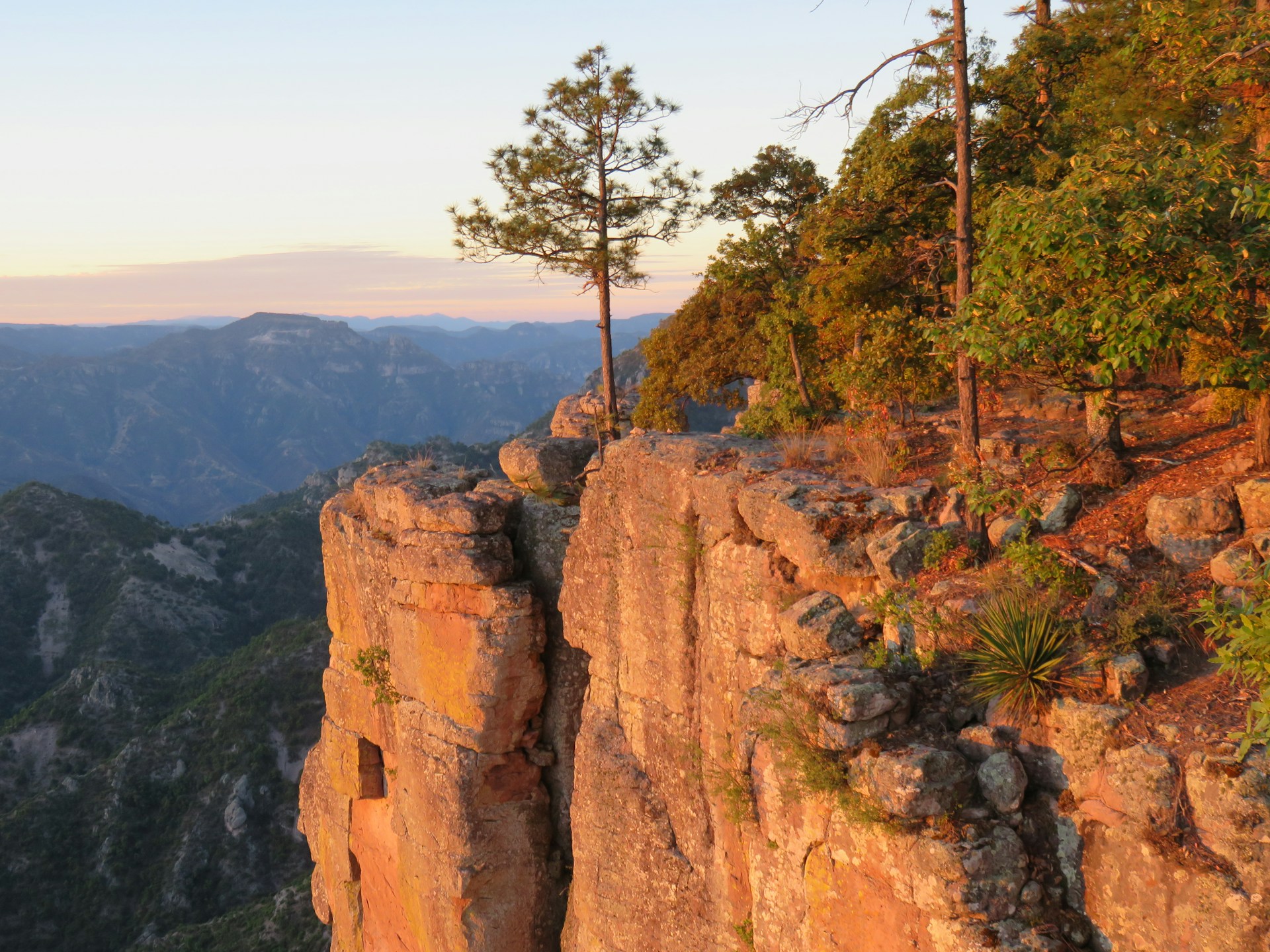
Major Viewing Points: Divisadero and Beyond
Divisadero sits front and center for canyon views. The train stops here for a quick 15 minutes, just enough time to snap a few photos and soak it in.
I always head for the wooden viewing platforms—can’t beat those panoramic shots. The views stretch out forever across the canyon maze.
Top Viewing Locations:
- Divisadero: Main train stop, easy access
- Areponápuchi: Quieter, with great hiking
- Cerro del Gallego: Highest viewpoint around
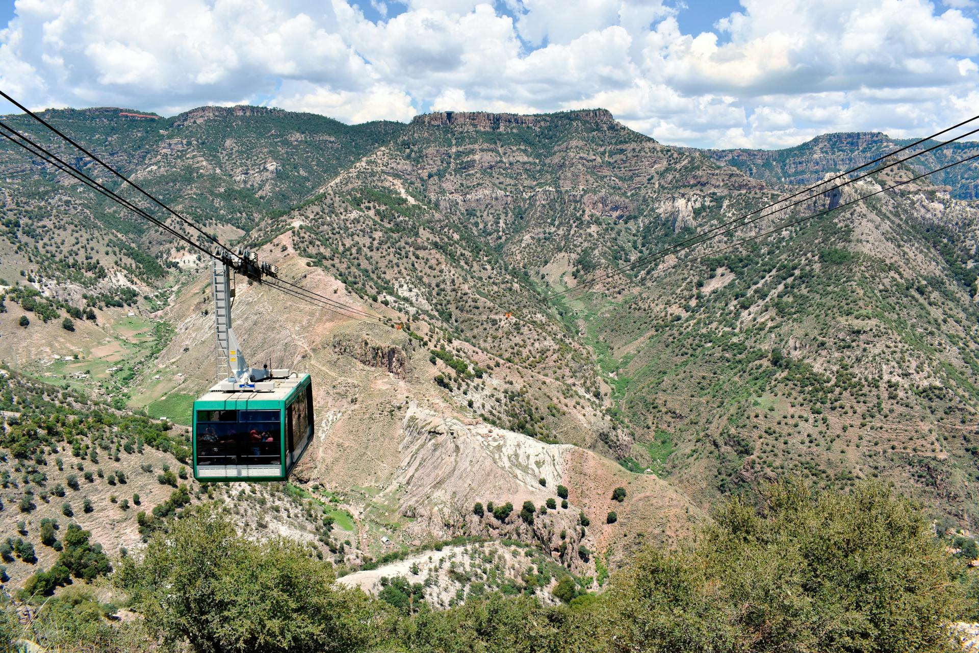
Adventure Park at Divisadero has zip lines that cross the canyon. The longest one? Over 2,500 meters. It’s not for the faint of heart.
Creel is the main jumping-off point for exploring the area. Most hotels and tour guides operate from this little mountain town.
The rim trail links up several viewpoints with marked paths. I always recommend hitting the trails early—morning light and clear skies beat the afternoon clouds.
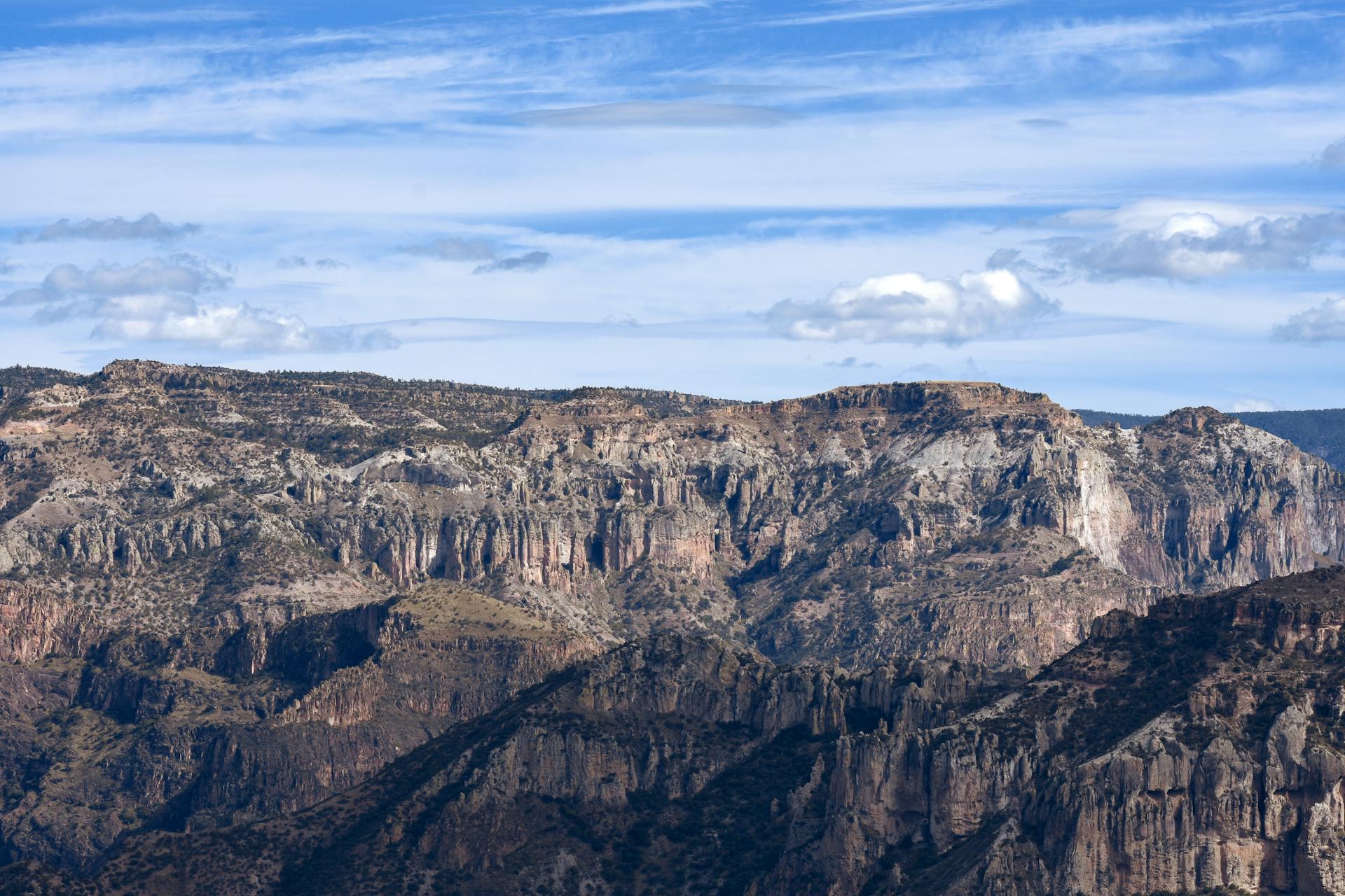
The Geological Wonders Behind Copper Canyon
The Sierra Madre Occidental mountains hide stories that go back over 100 million years. Volcanic eruptions, relentless rivers, and evolving ecosystems all played their part. The result? A canyon system four times bigger than the Grand Canyon, packed with unique wildlife and landscapes.
Formation and Origins
The saga starts with massive volcanic eruptions, some dating back 135 million years. Geologists have pinpointed two major volcanic periods, with a long, quiet gap in between.
First came the older volcanic rocks—violent eruptions spewed out andesitic material, creating layers packed with minerals. Even now, miners still chase those deposits.
After an 11-million-year nap, the volcanoes roared back. This second round left behind the world’s largest ignimbrite cover, stretching more than 250 kilometers wide and 1,200 kilometers long.
Key Rock Types:
- Ignimbrites: Light, bubbly volcanic rock
- Tuff: Hardened volcanic ash
- Andesitic lava: Dense, crystal-rich stone
- Rhyolitic materials: Silica-heavy volcanic deposits
These layers built up slowly, sometimes piling over 1,000 meters thick. Eventually, they formed a high plateau at 7,500 feet.
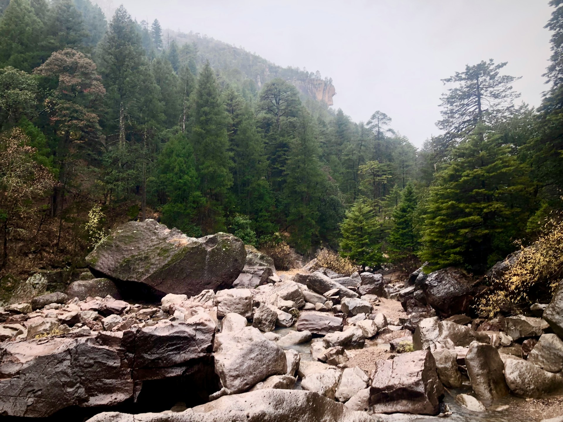
Erosion and Landscape Development
Rivers did the heavy lifting when it came to carving the canyons. They started meandering across gentle land before tectonic forces pushed everything skyward.
As the land rose, the rivers just kept cutting downward. Over time, they sculpted those deep, narrow canyons we see today.
The Urique River and its sidekicks did most of the work. Some canyons slice down 1,400 meters, creating towering cliffs and tight gorges.
Distinctive Landforms:
- Flat-topped mesas
- Buttes rising from the canyon floor
- Stone spires and towers
- Winding river bends
- Multi-level waterfalls
Harder rock layers shield the softer stuff below, so you get weird mushroom shapes and giant boulders perched in odd places.
Distinctive Ecosystems
The crazy elevation changes mean you move through different climates in just a few miles. Temps can swing by 20 degrees Celsius from rim to floor.
Up top, pine-oak forests soak up cool, moist air. Winters bring snow, and summers get their fair share of rain.
Mid-slopes support oak woods and grasslands. The terrain creates little microclimates—some valleys are lush, others dry and exposed.
Down in the canyon bottoms, things turn subtropical. Desert plants, tropical trees, and permanent streams crowd together.
All these layers pack in serious biodiversity. Each elevation hosts its own community of plants and animals.
Flora and Fauna Diversity
Over 200 bird species call Copper Canyon home, including the endangered thick-billed parrot and military macaw. Their colors pop against the canyon walls—hard to miss!
You might spot black bears, mountain lions, or white-tailed deer if you’re lucky. The rough terrain keeps them out of sight most days.
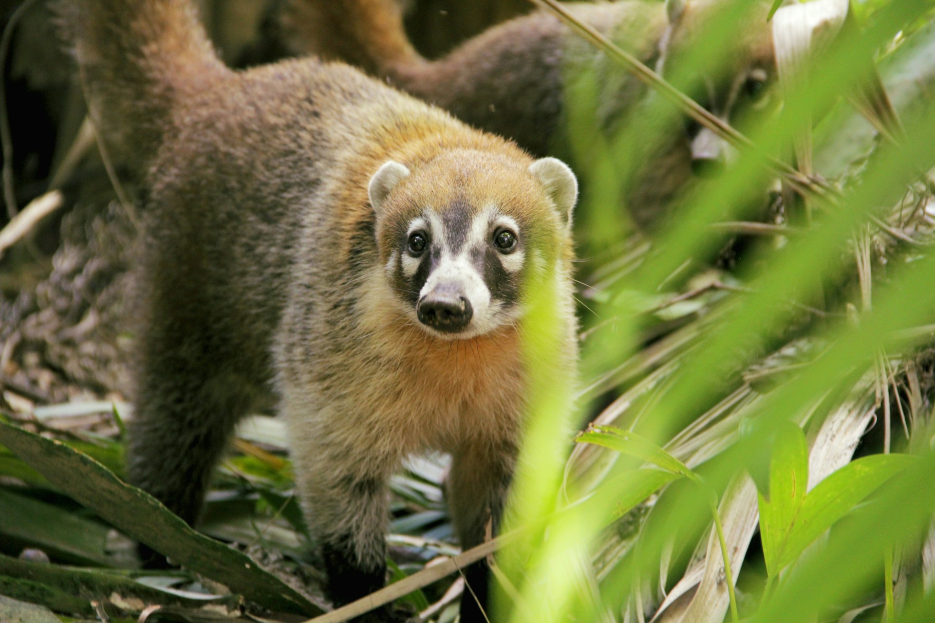
Notable Wildlife:
- Mexican spotted owl: Rare and elusive
- Coati: Social and playful
- Tarahumara frog: Found nowhere else
- Pine-oak jay: Sticks to the upper slopes
Plant life changes with the altitude. Ponderosa pines rule the high ground, while agaves and cacti thrive in the heat below.
Some species evolved in isolated canyon pockets—totally unique to this spot. Conservation matters here, big time.
The Tarahumara people have lived in balance with these ecosystems for centuries. Their knowledge helps scientists piece together how everything fits and survives.
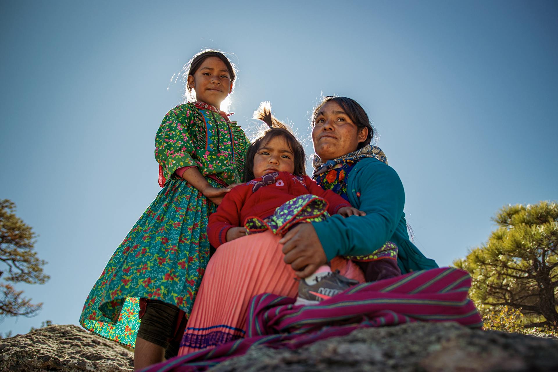
Cultural Legacy: The Tarahumara (Rarámuri) and Indigenous Heritage
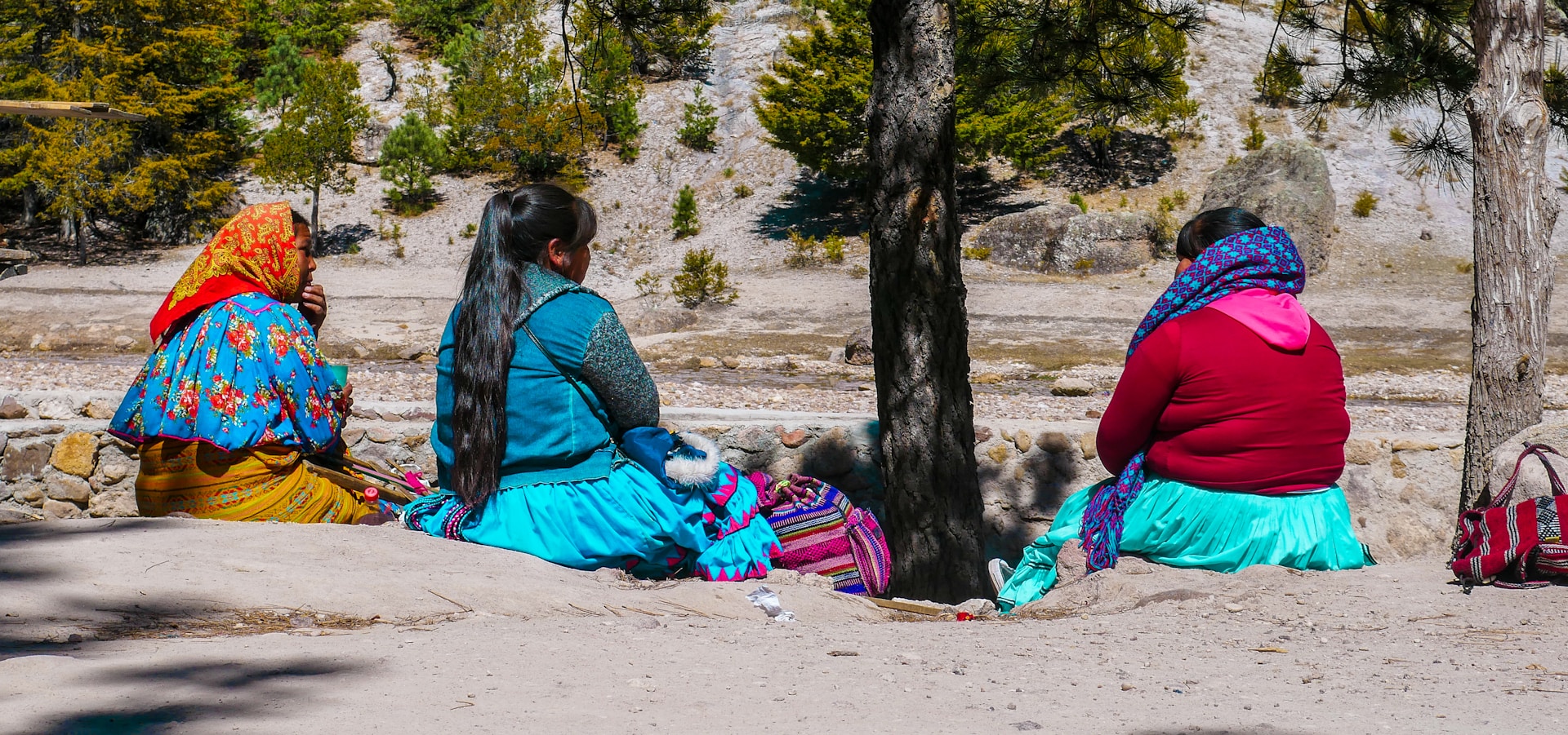
The Rarámuri, or Tarahumara, have called Copper Canyon home for more than a thousand years. Their legendary running skills and sustainable way of life show just how deeply they’ve connected with this wild landscape.
Their crafts, spiritual ceremonies, and environmental know-how still thrive, even after centuries of outside pressure.
Tarahumara Culture and Traditions
The Rarámuri, which means “those who run fast,” keep their spiritual traditions alive in the mountains. Their beliefs blend ancient customs with Catholic elements brought by Spanish colonizers.
One of their most important ceremonies is the yúmari—a ritual dance for good harvests and health. These celebrations can last days and bring the whole community together.
They live in scattered settlements, growing corn, beans, and squash using age-old methods. Community comes first; people share resources and make big decisions together.
Traditional homes, called ranchitos, are simple stone or adobe buildings that blend into the canyon. Families often spread out across several small houses.
Long-Distance Running Legends
For the Rarámuri, running is more than sport—it’s prayer, transport, and a way to bond. Their races, called rarajipari, sometimes stretch for more than 100 miles. Men kick wooden balls, women roll hoops, and everyone keeps moving for hours or even days.
These aren’t typical races. They’re about community and honoring tradition, not competition.
The Rarámuri run in thin-soled huaraches made from recycled tires. Their style is all about steady, efficient movement.
Ultramarathoners from around the world try to learn from the Rarámuri. The secret? Running as meditation, not just as a test of speed.
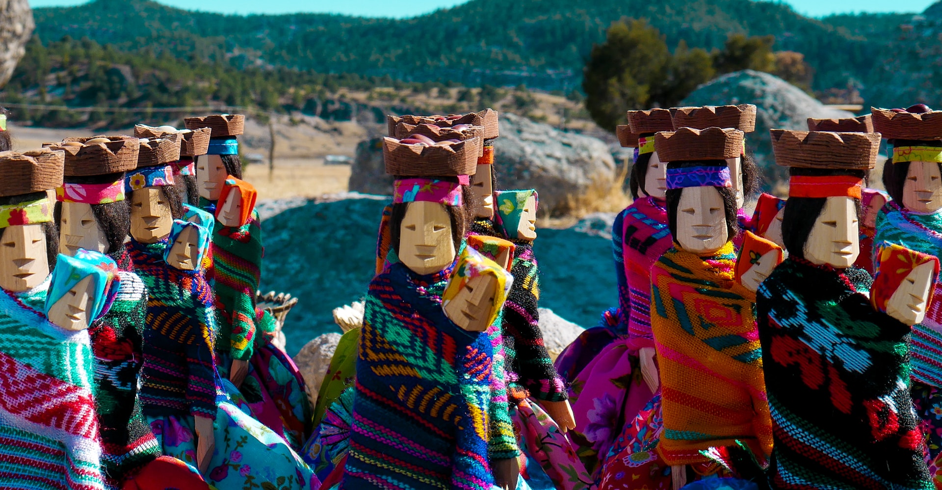
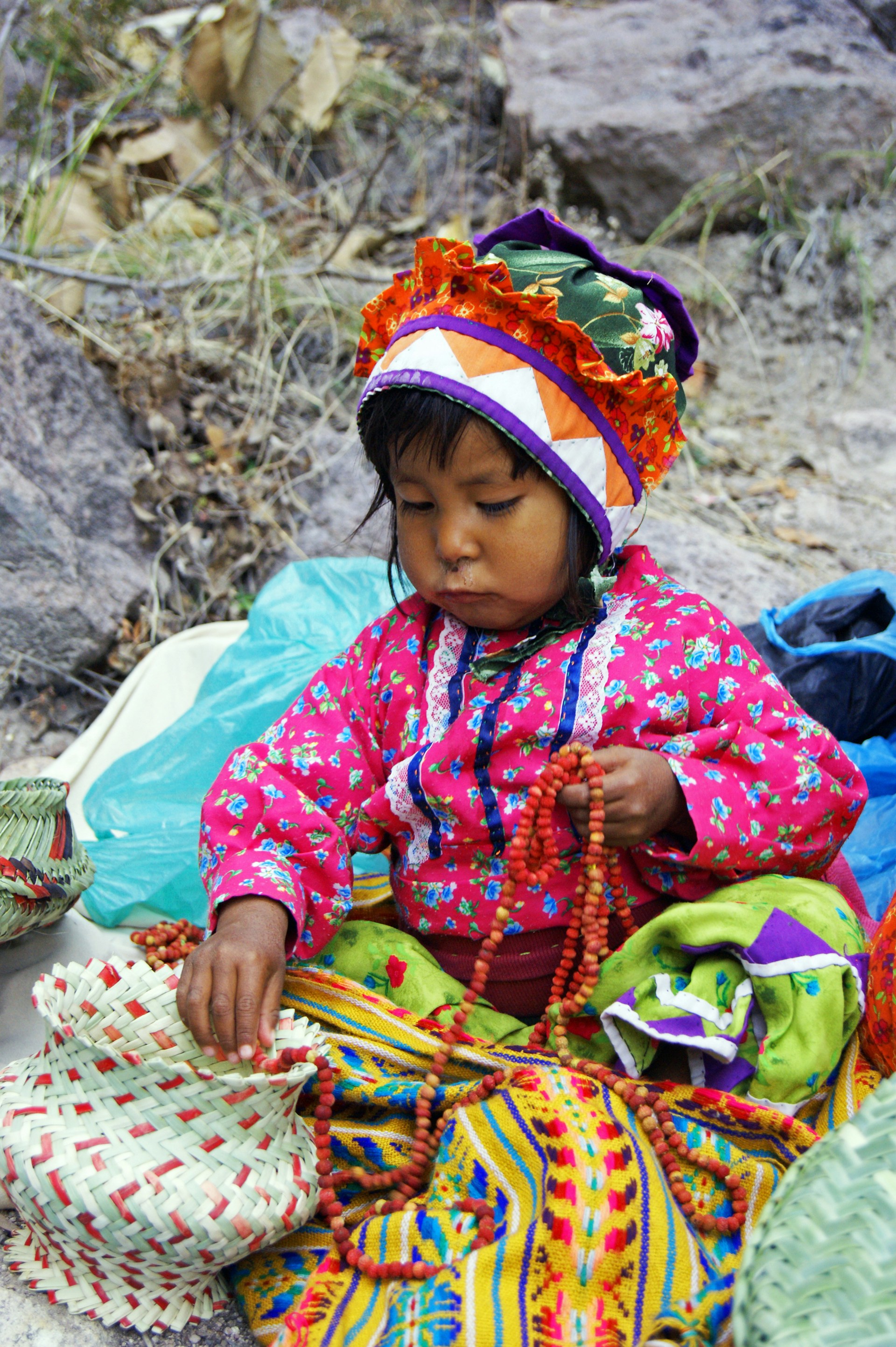
Handicrafts and Textiles
Rarámuri women weave intricate baskets from pine needles and native grasses. These korima baskets are both useful and beautiful.
Their textiles burst with bright colors and geometric patterns. Women use simple backstrap looms, a technique that hasn’t changed much in centuries.
Pottery is another key skill—clay pots for cooking and water storage are shaped by hand and fired outdoors.
Men carve wooden tools, musical instruments, and ceremonial items. Their violins, inspired by Spanish designs, are central to religious gatherings.
Selling crafts to visitors provides income and keeps traditions alive. Master artisans pass down their skills to the next generation.

Indigenous Conservation Wisdom
The Rarámuri farm in ways that protect the land. They rotate crops and let fields rest, keeping the soil healthy without chemicals.
Their deep knowledge of local plants and animals guides everything they do. They gather wild foods carefully, always leaving enough for nature to recover.
Sacred sites stay protected thanks to Rarámuri beliefs. These spots double as wildlife refuges and help keep water sources clean.
Their low-impact lifestyle proves that people can thrive in tough environments without destroying them. Their settlements blend into the landscape and support strong communities.
Mining, logging, and development threaten these traditions, but many Rarámuri stand up to defend their land and its wild diversity.
Adventure Awaits: Exploring Copper Canyon’s Outdoor Activities
Copper Canyon packs in world-class adventures that honestly rival anything in North America. You’ve got hiking trails winding through six massive canyons, zip lines that feel endless, and wild experiences for every skill level.
Hiking and Scenic Trails
There are hiking trails here for everyone. Beginners can stroll the rim near Divisadero and still snag epic views.
If you’re feeling bold, try a multi-day trek down to the canyon floor. The Urique Canyon trail is a beast, but the river views are worth every step.
Popular Trail Options:
- Beginner: Rim walks at Divisadero (1-2 hours)
- Intermediate: Batopilas village hike (4-6 hours)
- Advanced: Canyon floor expeditions (2-3 days)
October through April is the sweet spot for hiking—cooler temps and less rain. Local Tarahumara guides know the safest routes and always have stories to share about their homeland.
Mountain Biking and Rock Climbing
You’ll find mountain biking trails crisscrossing the canyon rim, dropping into wild valleys below. Some routes are smooth dirt roads—others, well, they’re technical single track that’ll keep you on your toes.
Locals love the old mining roads near Batopilas. I think these are perfect if you want moderate challenge and jaw-dropping canyon views all at once.
If you’re into rock climbing, you’re in luck. The canyon walls serve up sport climbs and classic trad routes just waiting for your chalky hands.
Climbing Considerations:
- Bring your own gear—don’t count on rentals here.
- Dry months offer the best grip and safest conditions.
- Local guides know the safest spots to climb.
Honestly, I always check the weather before heading out. The rainy season (June through September) can turn the cliffs downright dangerous.
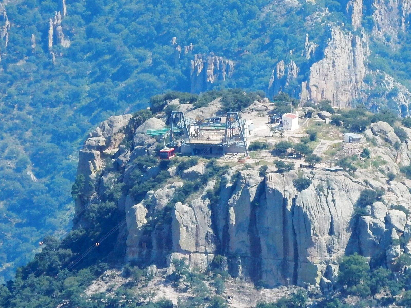
Zip-Lining, Rafting, and Adventure Parks
Copper Canyon Adventure Park isn’t just any park—it’s home to the world’s second-longest zip line. Picture yourself flying 2,530 meters, hitting speeds up to 130 kilometers per hour. It’s a serious rush, and the ride lasts a thrilling 2-3 minutes.
For a different kind of adrenaline, try the via ferrata. This adventure ropes you across hanging bridges and down rappelling sections. There’s even a 48-meter rappel and a little cave exploration thrown in. Takes about two hours but feels like a whole day’s worth of excitement.
Adventure Park Details:
- Zip line cost: 1,000 pesos per person
- Weight limits: 45-120 kg
- Age restrictions: Adults only for the wild stuff
If rafting’s your thing, the Urique and Batopilas rivers have you covered. Class II-IV rapids mean it’s best for intermediate and advanced paddlers looking for a challenge.
Rafting season runs July to October when the rivers swell with rainwater. I’d always recommend booking with a local outfitter—safety first, right?
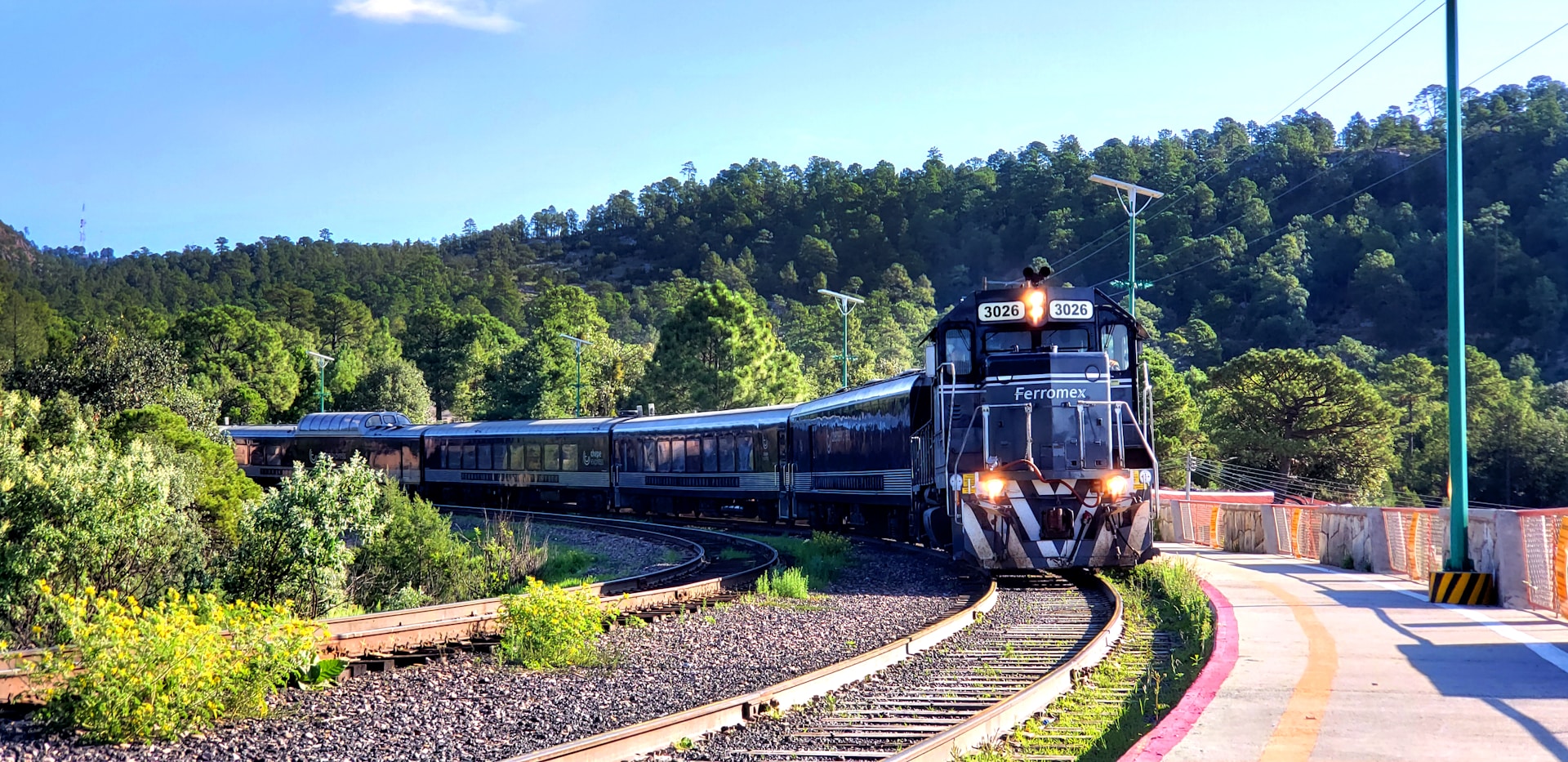
The Legendary El Chepe Train: A Journey Through the Canyons
If you ask me, there’s no better way to see Copper Canyon than by train. The Ferrocarril Chihuahua Pacífico—everyone just calls it El Chepe—takes you right through the heart of this wild place. This train journey stretches 350 miles, connecting Los Mochis on the coast to Creel up in the mountains. Expect about nine hours of ever-changing, jaw-dropping scenery.
Route Highlights: From Los Mochis to Chihuahua
El Chepe starts in Los Mochis, Sinaloa, and climbs into the Sierra Madre Occidental. I remember being amazed as the train covered more than 350 kilometers in just nine hours.
You’ll cross 87 bridges and zip through 36 tunnels—it’s honestly a feat of engineering. Watching the landscape shift from sea level to over 8,000 feet is something I’ll never forget.
Route highlights:
- Towering canyon walls
- Waterfalls that seem to tumble out of nowhere
- High desert stretching for miles
- Pine forests so thick you’ll lose sight of the sky
It took almost a century to build this railway, finally wrapping up in 1961. That’s wild to think about—one of Mexico’s biggest engineering triumphs.
The train twists through canyon systems that, in some spots, are deeper and wider than the Grand Canyon. I’d put this ride at the top of any North American train journey list.
Train Experience and Notable Stops
El Chepe makes five main stops on the way to Chihuahua state. Each station opens up a new slice of canyon life and culture.
Main stops:
- El Fuerte, Sinaloa – A colonial town with character and old-world charm
- Bahuichivo, Chihuahua – Your gateway to Urique Canyon
- Divisadero, Chihuahua – The spot for those unbeatable canyon views
- Creel, Chihuahua – The final stop, and it’s got that Magical Town vibe
First-class service means comfy seats and huge windows. If you can, grab a seat on the right side—those are the views you’ll want.
You can hop off at any station and catch a later train, which I love because it lets you explore at your own pace. Divisadero is the showstopper for epic overlooks and photos.
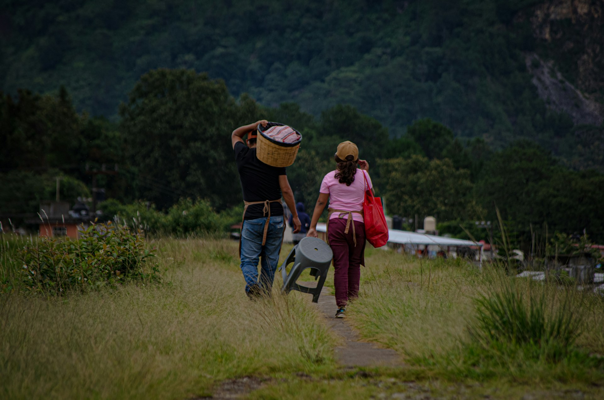
This ride takes you through the homeland of the Rarámuri people. At several stops, you’ll find local vendors selling handmade crafts—perfect for a meaningful souvenir.
Safeguarding the Canyon: Conservation and Sustainable Tourism
Copper Canyon’s beauty comes with a catch: balancing tourism with environmental protection. The region needs thoughtful tourism that actually helps local communities while keeping wildlife and wild places safe.
Conservation Initiatives and Wildlife Protection
The Sierra Madre Occidental isn’t just stunning—it’s a haven for hundreds of species. I’ve noticed that conservation groups focus on protecting creatures like the military macaw, which nests high up in the canyon walls.
Local organizations and government agencies work together to track wildlife. They monitor endangered species and keep nesting sites safe from human interference.
Key Conservation Areas:
- Military macaw breeding cliffs
- Old-growth pine forests
- Vital water sources and riverbanks
- Traditional Tarahumara lands
The region sprawls across 25,000 square miles of rugged terrain. That sheer size makes conservation tough—but it also gives wildlife room to thrive.
I’ve seen that the best conservation efforts blend science with traditional wisdom. The Tarahumara people have safeguarded these lands for generations.
Supporting Local Communities
Tourism works best when locals get a real say in what happens. The Tarahumara communities rely on both their traditional lifestyle and the income from visitors.
Sustainable tourism creates jobs and respects what makes the culture unique. Local guides don’t just show you the sights—they share stories you can’t find in any guidebook.
How to support local communities:
- Buy crafts straight from the artists
- Stay in guesthouses or hotels owned by locals
- Hire local guides for your adventures
- Always respect traditions and sacred spaces
I’ve noticed projects succeed when they actually listen to residents about what they want from tourism. Small-scale, family-run businesses and community co-ops seem to work best—offering steady income without putting too much pressure on local resources.
Responsible Travel Tips
Honestly, traveling responsibly in Copper Canyon isn’t just a good idea—it’s essential if you want to keep this place beautiful for everyone. Small choices really do add up, and I’ve found that even simple actions can help protect the canyon’s wild spaces.
Essential Guidelines:
- Choose certified local guides. They’re usually the ones who know the land best, and they can share stories you won’t find in any guidebook.
- Stick to marked trails. Wandering off might seem tempting, but it’s easy to damage fragile plants or disturb hidden wildlife.
- Always pack out your trash. Even tiny bits of litter can harm the ecosystem here.
- Leave wildlife and nesting spots alone. Watching quietly is way more rewarding than getting too close.
- Respect Tarahumara customs and privacy. If you aren’t sure what’s appropriate, just ask or observe how others behave.
Water here is a big deal. I never leave without plenty of water, and I make sure not to pollute streams or springs—locals and animals rely on them.
Heading into the canyon takes some planning. Weather flips fast, and you can’t count on rescue teams to show up in a hurry if you get into trouble.
When it comes to photography, I always ask before snapping pictures of Tarahumara people. Most prefer not to be photographed, and honestly, respecting that feels right.
If you want a quieter experience, try visiting during off-peak times. Early mornings and late afternoons not only mean fewer crowds, but you’ll also spot more wildlife—plus, the light is just gorgeous.