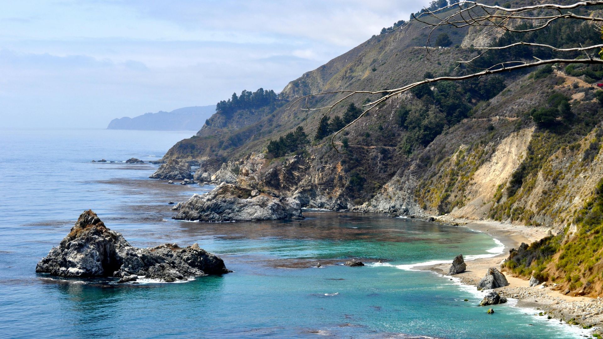
Big Sur’s Highway 1 has to be one of California’s most stunning drives. The road twists for 90 miles between Carmel and San Simeon, hugging wild cliffs that drop straight into the Pacific.
I’ve lost track of how many times I’ve cruised this legendary stretch, and honestly, it never gets old. The raw beauty and those “wow, pull over now!” moments just keep coming.
Planning the perfect Big Sur road trip takes a little know-how. You’ll want to figure out the best routes, when to go, and which must-see stops you just can’t miss.
Every mile has something new—a jaw-dropping bridge, a redwood grove, a hidden beach with purple sand. I’ve stopped so many times just to stare or snap another photo.
No matter if you’ve got a day or a whole week, you’ll find plenty to do. I’ll walk you through my favorite stops, outdoor adventures, and those quirky experiences that make a Big Sur trip so special.
This guide covers everything from planning tips to sample itineraries. You’ll make the most of your time on California’s most dramatic coast—I promise.
Essential Planning for a Big Sur Road Trip
Getting ready for a Big Sur adventure means thinking about your route, the best time to go, and a few safety basics. The Pacific Coast Highway sometimes closes after mudslides, and the weather can be unpredictable, especially in winter.
Cell service? Pretty much gone once you hit the cliffs.
Choosing Your Route and Starting Point
I usually recommend starting from San Francisco or Los Angeles. If you’re up north, Big Sur is just a 2.5-hour drive south along Highway 1. That route gives you a slow reveal—from city chaos to rugged coast.
Flying in? San Francisco International Airport is your best bet for rental cars. Monterey Regional is closer, but you won’t find as many flights.
Heading up from LA? You’re looking at about five hours on the road. I like to stop in Santa Barbara or San Luis Obispo to break up the drive.
Key Route Options:
- North to South: San Francisco → Half Moon Bay → Santa Cruz → Monterey → Big Sur
- South to North: Los Angeles → Santa Barbara → San Luis Obispo → Big Sur
The heart of Big Sur runs about 90 miles between Carmel and San Simeon. The road twists a lot, so plan for slow driving and plenty of stops.
Best Time to Visit and Weather Considerations
If you can swing it, October is the sweet spot for Big Sur. Clear skies, fewer crowds, and that pesky summer fog finally disappears.
May and June? I’d skip those months if you’re after sunshine. The fog can be so thick you’ll barely see the ocean—I’ve learned that the hard way.
Weather by Season:
- Spring (March-May): Wildflowers everywhere, but fog picks up
- Summer (June-August): Foggy mornings, sometimes clearer afternoons
- Fall (September-November): Best weather, blue skies
- Winter (December-February): Rainy, with possible road closures
Even in summer, it gets chilly after sunset. I always throw a jacket in the trunk—trust me, you’ll need it for those golden hour views.
Important Safety Tips and Road Conditions
Highway 1 can close in a flash thanks to mudslides or storm damage. Before you go, check the Caltrans website for updates. I got caught out once after a 2021 slide closed the southern approach—lesson learned.
Cell service drops out for most of Big Sur. Download your maps in advance; I rely on Google Maps’ offline feature.
Essential Safety Prep:
- Check for road closures before you leave
- Download offline maps
- Fill up your tank before entering Big Sur
- Bring emergency supplies and water
- Drive slow, especially on the cliffside curves
The roads get narrow, and some drop-offs are pretty intimidating. I always slow down and pull over at viewpoints if someone’s riding my bumper.
Gas stations are rare, so I keep my tank above half. If you run low, the next station could be hours away.
Must-See Stops and Destinations on Highway 1
The Big Sur stretch of Highway 1 links up some of California’s most memorable towns and landmarks. Each place has its own flavor, from fairy-tale villages to wild beaches.
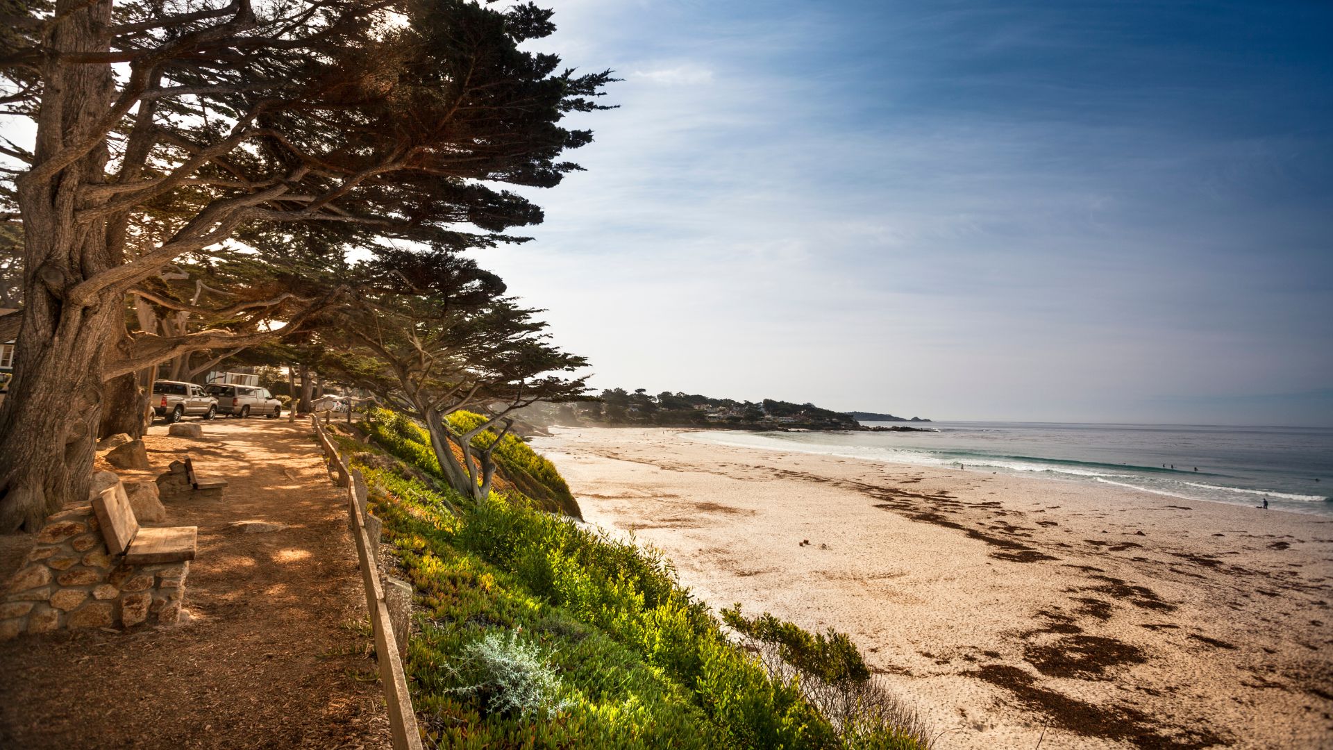
Carmel-by-the-Sea and Carmel Beach
Carmel-by-the-Sea marks the start of Big Sur’s northern end. The town looks like something out of a storybook, with its quirky cottages and twisty little streets.
I love wandering the main drag—window shopping, popping into art galleries, or just admiring the architecture. The whole place feels a bit European, honestly.
Carmel Beach sits below the village, all white sand and wind-bent cypress trees. It’s a great spot for sunset, and dogs run free here, which always makes me smile.
The old mission on the edge of town dates back to 1771. If you need a break from the crowds, its gardens feel peaceful and timeless.
Parking fills up fast, especially in summer. I usually aim for early morning or late afternoon to avoid the rush.
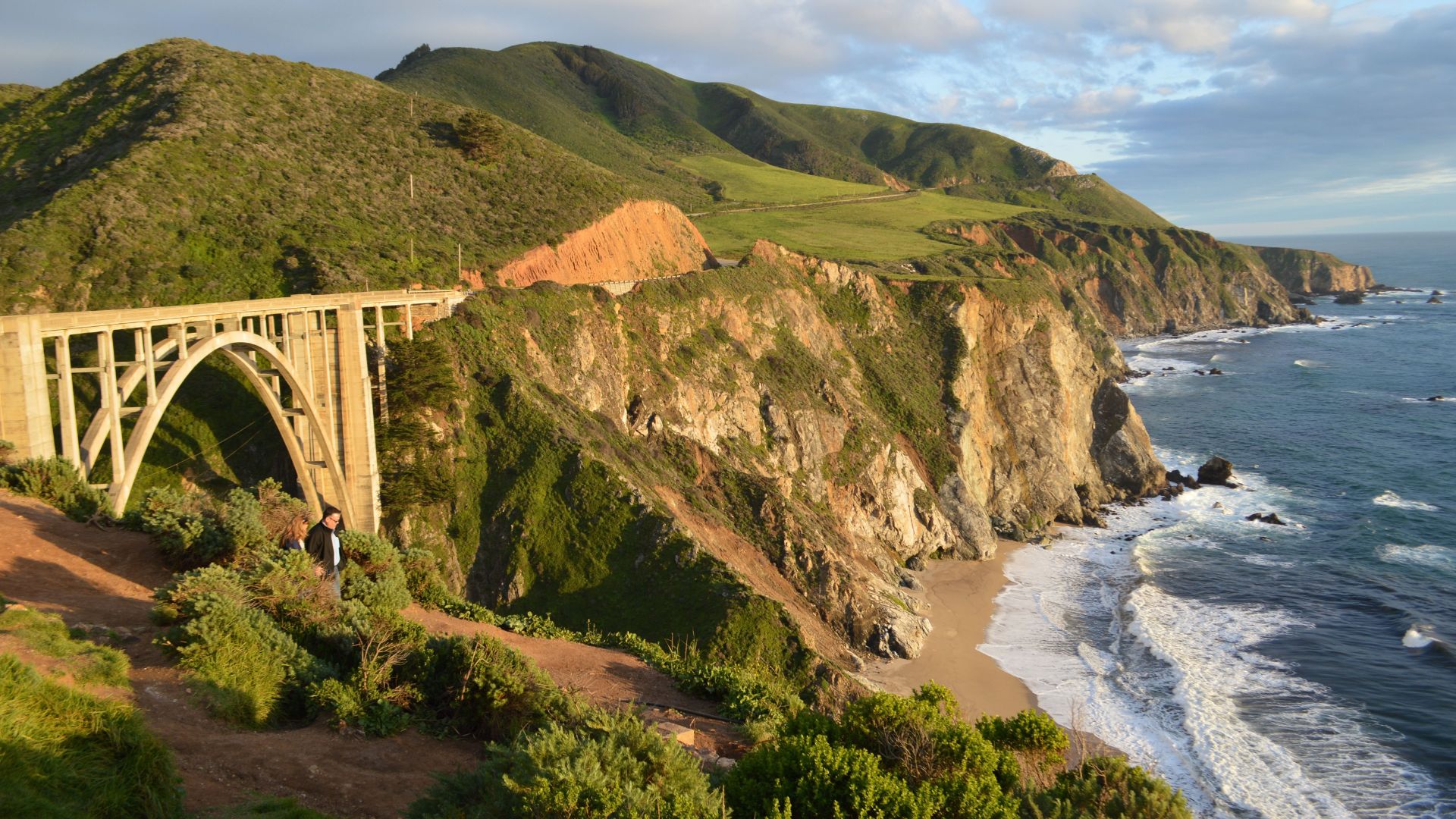
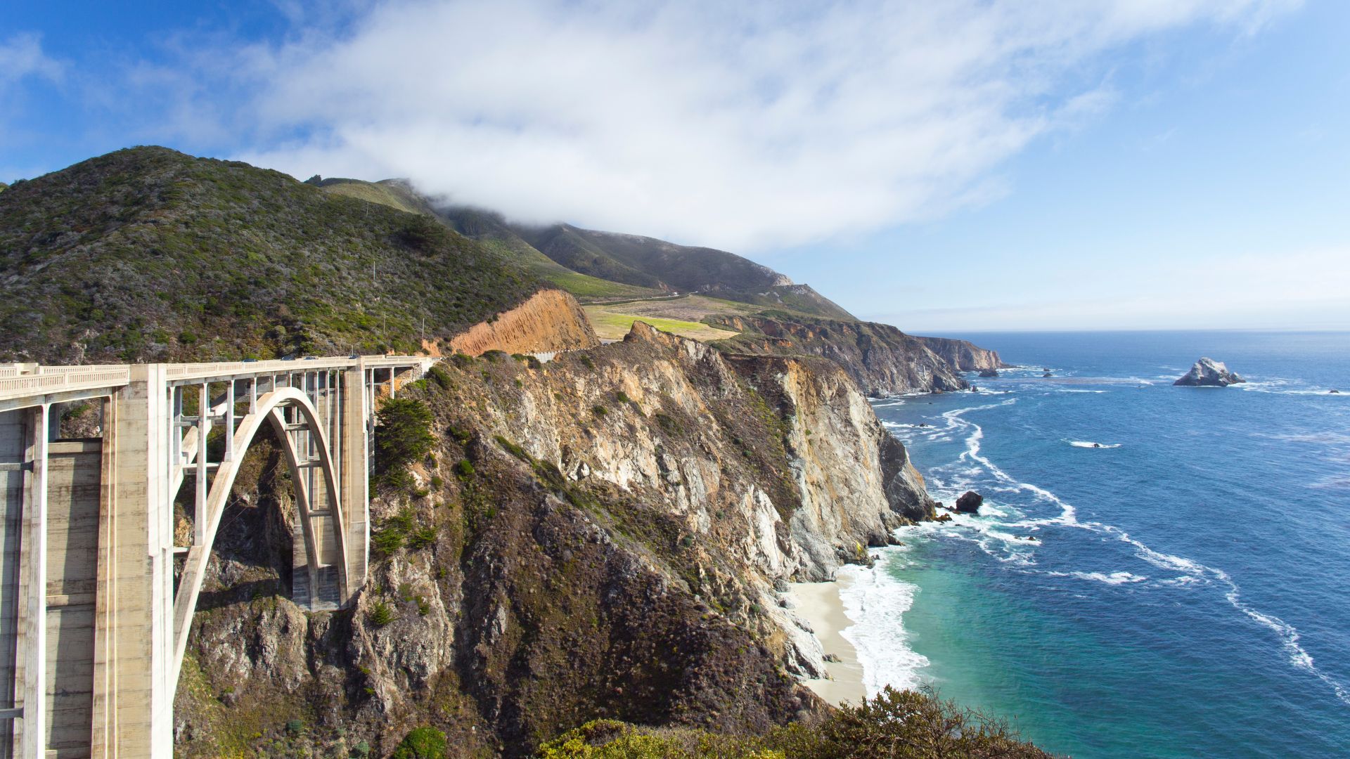
Iconic Bixby Bridge and Viewpoints
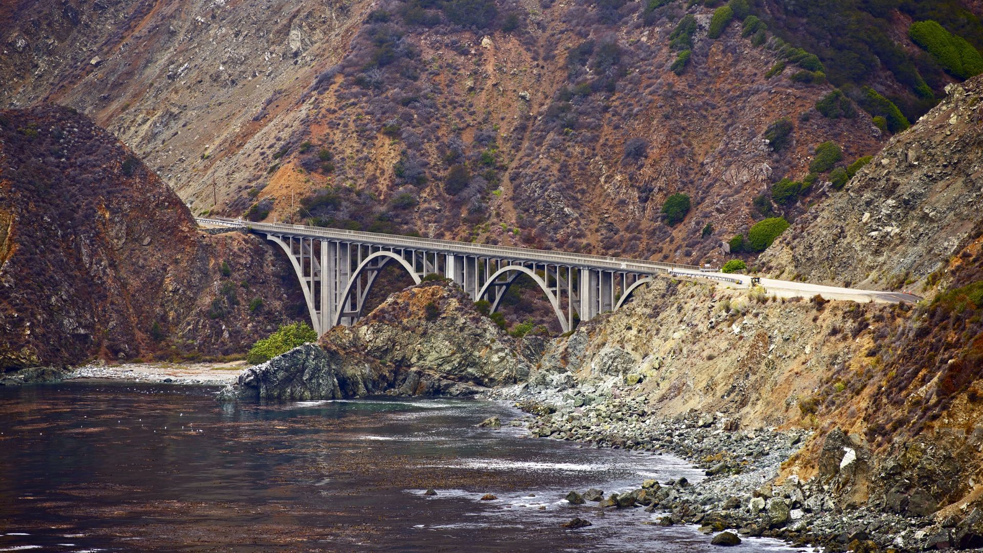
Bixby Creek Bridge is probably the most famous spot on Highway 1. The concrete arch soars 280 feet above a canyon, about 13 miles south of Carmel.
I always stop at the north side pullout for that classic photo—can’t resist it. There’s also a small parking area on the south side and a great view from Rocky Point Restaurant’s deck.
The bridge dates back to 1932, built in just two years. For its time, the design was cutting-edge.
If you want the best photos, go early. Morning light is magic, and later in the day, fog can roll in and make everything look mysterious—or totally block the view.
I’ve walked partway across for different angles. There’s a pedestrian walkway, so you can safely snap photos looking back at the coast.
Charming Monterey
Monterey brings together ocean views, history, and marine life. It’s right at the northern tip of the Big Sur drive.
Monterey Bay Aquarium is world-class. The kelp forest and sea otter feedings are always a hit, no matter how many times I visit.
Cannery Row still shows off its fishing past, but now it’s full of shops, restaurants, and hotels in old sardine canneries.
The 17-Mile Drive winds through Pebble Beach and Pacific Grove. It costs $10, but you’ll see famous golf courses and Seal Point.
Fisherman’s Wharf is the place for fresh seafood and sea lion watching. I’ve sat there with a bowl of clam chowder, just watching the seals play.
Old Monterey State Historic Park has a handful of 19th-century buildings. The Custom House and Pacific House give a glimpse of early California days.
Cambria and San Simeon
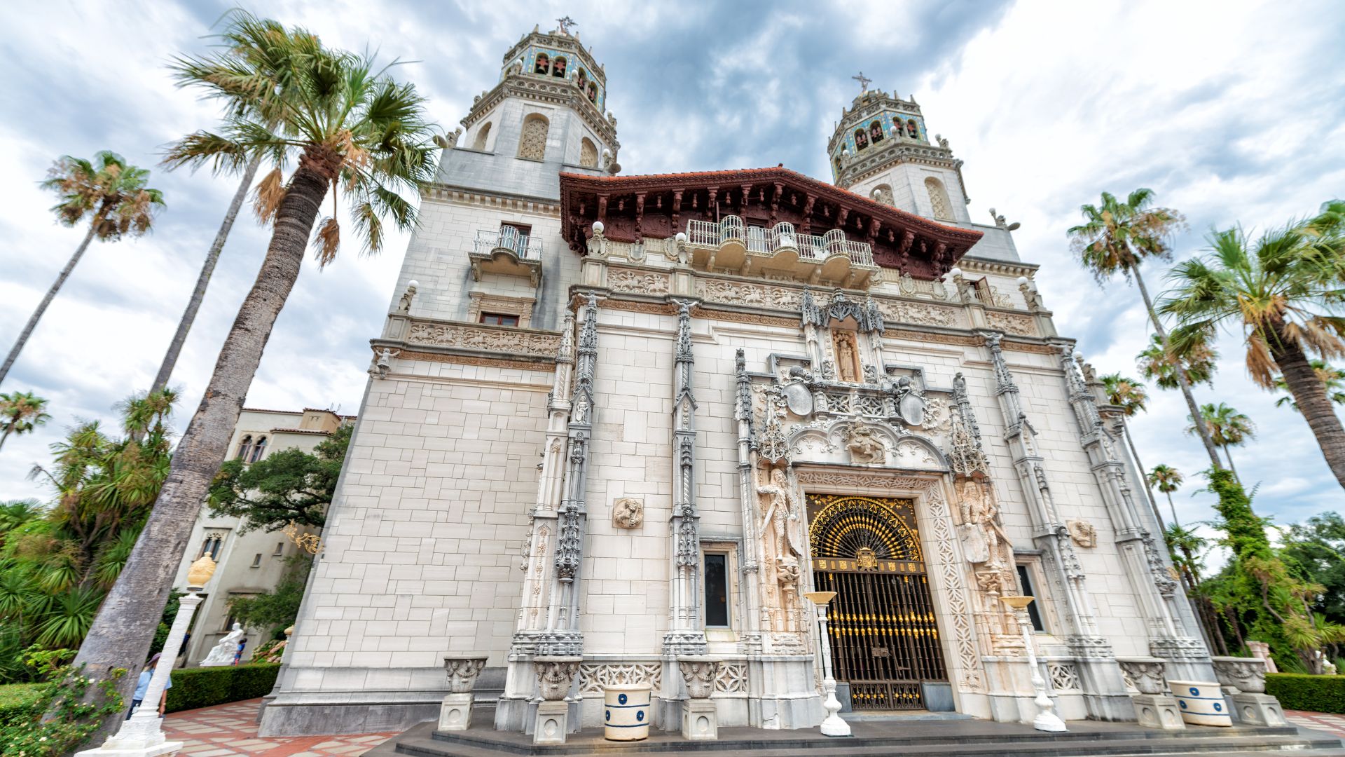
San Simeon marks Big Sur’s southern end. This little town is the jumping-off point for Hearst Castle and elephant seal watching.
Hearst Castle sits high above the ocean, filled with 165 rooms and packed with European art. William Randolph Hearst knew how to collect.
Tours run about 45 minutes, and you’ll want to book ahead. The Grand Rooms Tour is a solid intro if you’re new.
Elephant Seal Rookery is just north of town. Between December and March, thousands of elephant seals haul out to breed and molt.
The boardwalks make it easy to watch without disturbing them. I went in February and saw hundreds of pups sprawled in the sand.
Cambria is a few miles inland, and the vibe is artsy and laid-back. Think galleries, antiques, and cozy B&Bs.
East Village is best for shopping and dining, while West Village gets you closer to the beach.
Unforgettable Natural Wonders and Parks
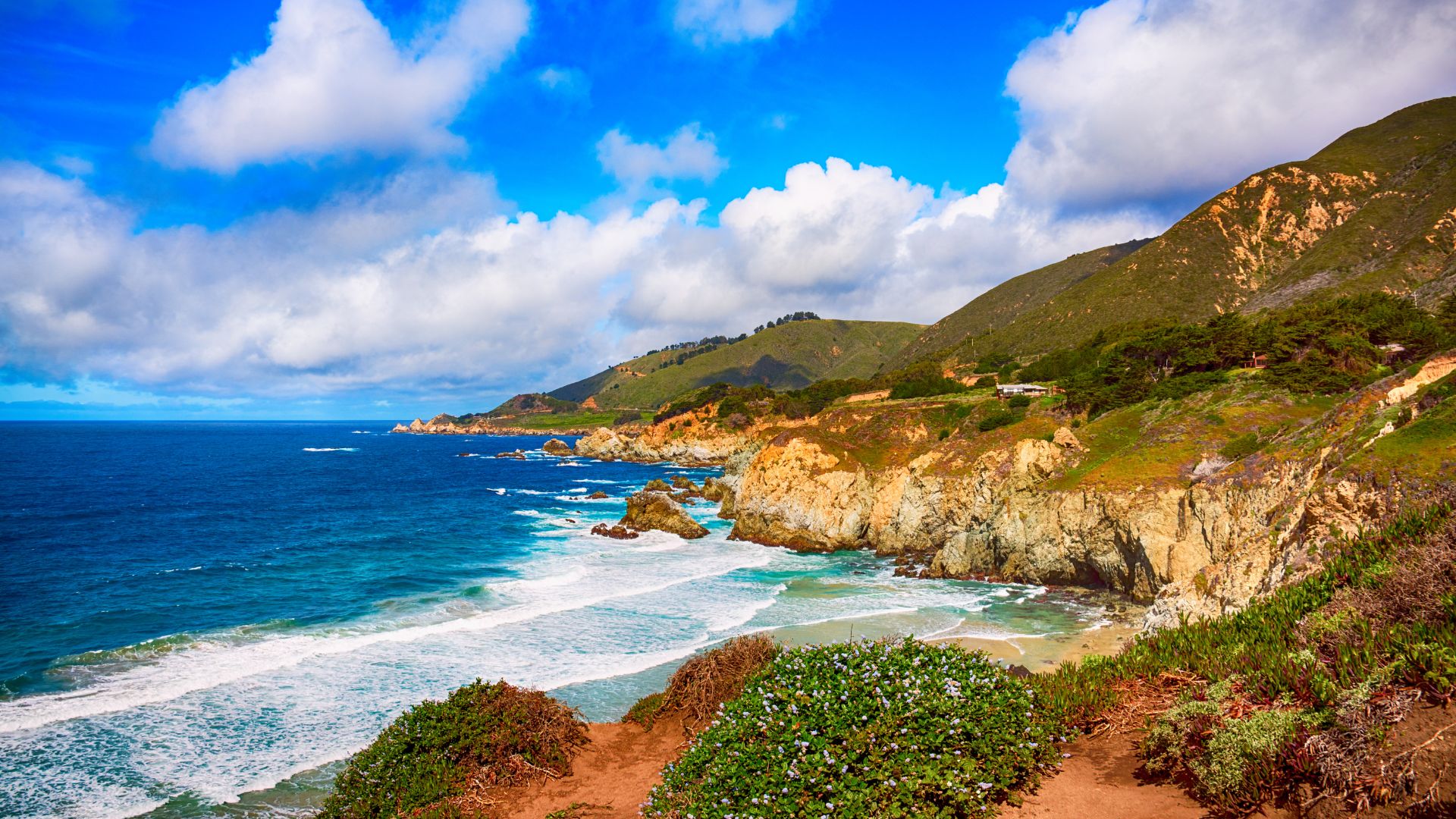
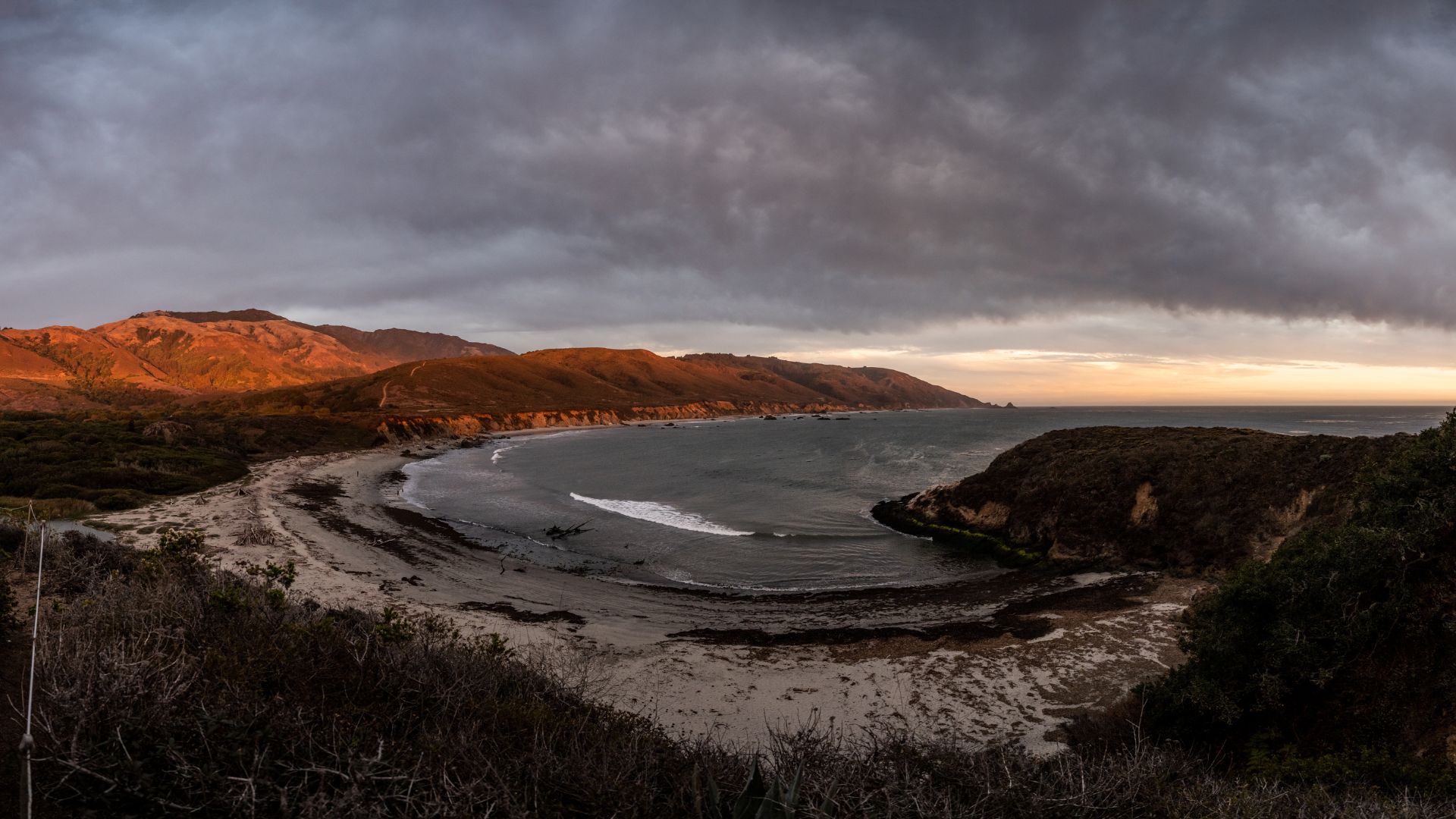
Big Sur’s state parks protect some of California’s most dramatic coastline. You’ll find waterfalls, purple-sand beaches, and wild places where the cliffs drop right into the sea.
Julia Pfeiffer Burns State Park and McWay Falls
McWay Falls is probably the most photographed waterfall in Big Sur. The 80-foot drop lands right on the sand, framed by rocky bluffs.
Getting there is easy—a short, mostly flat trail (about 0.6 miles) leads from the parking lot to the overlook.
The waterfall never dries up, but it’s most powerful in winter. High tide makes for the best photos, with waves crashing all around.
Need to know:
- Cost: $10 per car
- Best time: Late afternoon for great light
- Trail: Easy, quick walk
Swimming isn’t allowed at McWay Beach—the currents are just too dangerous. You can’t actually get down to the sand from land.
Julia Pfeiffer Burns State Park has more backcountry trails if you’re up for a challenge. The hikes head deep into the Santa Lucia Mountains.
Pfeiffer Beach and Keyhole Rock
Pfeiffer Beach is famous for its purple sand and the wild Keyhole Rock formation. The beach stretches for about a mile, with waves pounding the shore.
Finding the entrance can be a little tricky. Turn onto Sycamore Canyon Road—it’s easy to miss the small sign—and wind your way down for two miles.
The purple sand comes from manganese garnet in the cliffs. It’s brightest when the sand is wet, so look for it after a wave.
Why it’s special:
- Purple sand (seriously, it’s real)
- Keyhole Rock arch
- Big, dramatic waves
- Killer sunset shots
Keyhole Rock has a natural arch, and in winter, the sunset lines up perfectly through it. Photographers go nuts for this.
Swimming isn’t safe here—the water’s cold and the currents are rough. It’s better for walking, photos, and tide pooling.
Parking: $10 per car
Garrapata State Park and Calla Lily Valley
Garrapata State Park is one of my favorite free spots for hiking and views. It sits on both sides of Highway 1 near mile markers 17 and 18.
The main coastal trail runs about 1.25 miles, hugging cliffs and offering constant ocean views. Rocks jut out of the sea, and waves crash below.
In spring, wildflowers cover the hillsides. March and April bring a splash of white from blooming calla lilies in the valleys.
Trail highlights:
- Free entry
- Easy to moderate hikes
- Sea cliffs and wildflowers
I rarely see crowds here. The trails feel peaceful, especially compared to busier Big Sur spots.
Most inland trails are closed after the 2016 Soberanes Fire. Stick to the coastal section for now.
Point Lobos State Natural Reserve
Point Lobos is a gem—some of California’s most untouched coast, just south of Carmel. The reserve protects both land and sea, and it feels wild.
Multiple trails wind through the park, leading to hidden coves and rocky viewpoints. You might spot sea lions, harbor seals, or even sea otters.
Popular activities:
- Hike the coastal trails
- Watch for wildlife
- Explore tide pools
- Scuba dive the kelp forests
Whalers Cove has a tiny museum in a restored fishermen’s cabin. You’ll find stories from the 1800s whaling days.
The park limits visitor numbers, so it’s smart to arrive early, especially on weekends.
Entry: $10 per car
Best time: Mornings, when wildlife is active
Divers love Point Lobos for its underwater kelp forests. The marine life here is just incredible.

Outdoor Activities and Things to Do Along the Coast
Big Sur’s rugged coast is basically an outdoor playground. You can hike under redwoods, spot sea life, or just find a quiet cove to watch the waves.
Hiking Scenic Trails and State Parks
Andrew Molera State Park is my go-to for hiking. The Andrew Molera Loop combines the Bluffs, Panorama, and Ridge Trails, showing off epic coastal views.
The path takes you through redwoods and oaks before dropping you at Andrew Molera Beach. The full loop is about 8 miles, but you can shorten it if you want.
Limekiln State Park has the beautiful Limekiln Falls Trail, though sometimes it closes if the road is out. The hike is family-friendly and leads to waterfalls through lush forest.
If you’re up for a challenge, try the Tanbark Trail or Tin House Trail. Both start at the same point—Tanbark heads through thick woods to big overlooks, while Tin House ends at a funky old building with a story.
Partington Cove Trail is a bit different. You’ll walk through a 60-foot tunnel built in the 1880s and end up at a cove with a unique history. The hike takes anywhere from 45 minutes to 2 hours, depending on your pace.
Wildlife Watching and Nature Photography
If you’re into wildlife, the Elephant Seal Vista Point at Piedras Blancas Rookery is hard to beat. Just seven miles north of San Simeon, this free viewing area draws up to 17,000 seals during peak times. It’s kind of wild to see so many in one place.
Best viewing times:
- January: Peak breeding season
- April: Molting season
- October: Juvenile gathering
But it’s not just about the seals. Gray whales cruise along this coastline from December through April. If you time it right, you might spot them spouting offshore—prime whale-watching season, honestly.
Ragged Point is one of my favorite spots for marine life and those epic coastal photos. The views from up high? Unreal, especially at sunset.
State parks along Highway 1 are a haven for bird lovers. If you’re serious about wildlife photography, don’t forget your binoculars or a telephoto lens.
Hidden Coves, Beaches, and Viewpoints
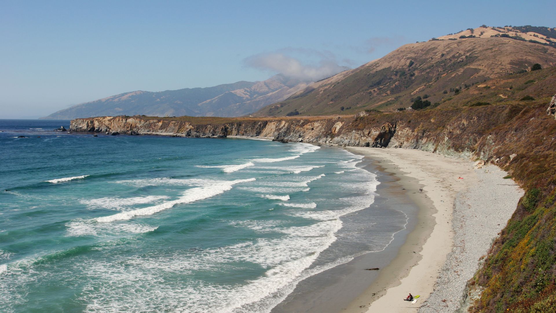
Sand Dollar Beach keeps popping up on “best beaches” lists, and for good reason. It’s long, sandy, and great for tide pooling when the tide’s out.
Then there’s Partington Cove, tucked away and reached through this old tunnel. It feels like a secret spot. The cove has calm waters and quirky rock formations—perfect if you want some cool photos without a crowd.
McWay Falls always draws photographers. I mean, an 80-foot waterfall dropping straight onto the sand? It flows all year, so you never miss the shot.
Pfeiffer Beach is famous for its purple sand and that Keyhole Rock. If you’re chasing the perfect photo, winter sunsets line up just right through the arch.
These viewpoints along the coast all have their own vibe. Sometimes you’re on a high cliff, sometimes you’re tucked into a quiet cove. There’s always something new to see or photograph.
Dining, Lodging, and Unique Experiences
Big Sur’s food scene is a treat. You’ll find everything from fancy cliffside restaurants to laid-back riverside cafes. The lodges? Some are pure luxury, with ocean views that make you want to stay forever. Honestly, the mix of jaw-dropping scenery and top-notch hospitality makes this place special.
Top Places to Eat and Drink
You can’t talk about Big Sur without mentioning Nepenthe. It sits 800 feet above the Pacific, and the view alone is worth the trip. Their Ambrosiaburger is famous, but I always look forward to the fresh seafood and a sunset cocktail on the terrace.
Nepenthe opens daily from 11:30am to 10pm, and you don’t need a reservation. The California wines on the list pair perfectly with the view.
If you want something different, try Big Sur River Inn. You can literally sit with your feet in the river while you eat. Their seafood is fresh, and the burgers are sourced locally. They serve all day from 8am to 9pm.
Breakfast at Deetjen’s Big Sur Inn is a must. This place has history—it’s been around since 1937. The pancakes are fluffy, and sipping coffee under the redwoods just feels right.
For a splurge, Sierra Mar at Post Ranch Inn offers fine dining with sweeping ocean views. Their wine cellar is massive—over 3,200 bottles.
Best Places to Stay with Breathtaking Views
If you want to go all out, Post Ranch Inn is the ultimate Big Sur experience. The treehouse-style rooms perch 1,200 feet above the ocean, with floor-to-ceiling windows and private decks. It’s pricey (around $1,000 a night), but the views and amenities—like infinity pools and a spa—are unforgettable.
Big Sur River Inn is a solid, more affordable pick. Rooms start at $200, many with river views. You’ve got the restaurant right there and easy trail access.
Ventana Big Sur blends luxury with a Japanese-inspired vibe. Their spa and wellness offerings are a big draw. You can swim, relax, and take in the valley views.
For travelers on a budget, Fernwood Resort offers cabins and camping. The tavern serves up surprisingly good food, and live music nights keep things lively.
Unique Roadside Attractions and Experiences
You can’t miss McWay Falls—it’s one of the most iconic scenes in California. The 80-foot waterfall drops straight onto the sand. The overlook trail is quick, about ten minutes.
Bixby Creek Bridge is a classic photo stop. I always pull over on the north side for that postcard-perfect angle. The bridge stretches 714 feet across the canyon, and it’s even more impressive in person.
At Piedras Blancas, you get up close to the massive elephant seals. Some weigh up to 5,000 pounds! The best time to visit is December through March.
Hearst Castle sits at the southern end of Big Sur. The guided tours take you through 165 rooms packed with art and stories.
If you love hiking, Julia Pfeiffer Burns State Park lets you wander among ancient redwoods. These giants are over a thousand years old and soar up to 300 feet.
Sample Big Sur Itineraries for Every Traveler
I’ve put together these itineraries for different types of trips and travelers. Whether you’re squeezing in a day trip or lingering for a few days, you’ll catch the highlights or dig up some hidden gems.
Classic One-Day Big Sur Road Trip
Morning (9:00 AM – 12:00 PM)
Kick things off at Point Lobos State Natural Reserve. Tide pools, rugged coastline—great way to wake up. Then drive down to Bixby Creek Bridge for some photos and a quick stroll.
Afternoon (12:00 PM – 4:00 PM)
Next up: McWay Falls in Julia Pfeiffer Burns State Park. The waterfall’s an easy visit—plan about half an hour.
After that, hit Pfeiffer Beach for its purple sand and wild rock formations. There’s a short hike down from the parking lot, but it’s worth it.
Evening (4:00 PM – 6:00 PM)
Wrap up your day at Nepenthe. Dinner here with an ocean sunset? Pretty unforgettable.
Total Distance: About 60 miles
Drive Time: 3-4 hours without stops
Flexible Multi-Day Road Trip Options
Two-Day Option
On the first day, I usually hit the northern gems—Point Lobos, Garrapata State Park, and that iconic Bixby Creek Bridge. By evening, I like to unwind in Carmel or Big Sur for the night.
The next day, I head straight for the central highlights. McWay Falls always takes my breath away, and Pfeiffer Beach is a must-see. Sand Dollar Beach rounds out the day, perfect for a laid-back stroll.
Three-Day Option
Got an extra day? I’d definitely swing south. Ragged Point feels like the edge of the world, and watching the elephant seals at Vista Point—honestly, it’s unforgettable. I also make time for a hike at Limekiln State Park; it’s worth the effort for those redwoods and waterfalls.
Planning Tips:
- I always book my accommodations early, especially if it’s summer. Places fill up fast.
- Checking road conditions before setting out has saved me more than once.
- Cell service drops out often, so I download maps ahead of time.
- The weather changes quickly along the coast, so I pack layers. Trust me, you’ll thank yourself later.