California’s Highway 49 snakes its way through 300 miles of the Sierra Nevada foothills, linking up old Gold Rush towns that still echo with stories from the 1849 gold fever days. I hopped in my car and hit this legendary route—locals call it the Golden Chain Highway—and, honestly, it’s easy to see why this drive still ranks as one of the most fascinating in California.
This highway doesn’t just connect towns; it lets you time travel. You stroll through preserved mining towns, see original 1850s storefronts, and maybe even try your luck panning for gold. Jamestown’s got that classic charm, while Columbia State Historic Park feels like a living museum. Every stop tells a different tale from California’s wild gold rush years.
My own trip wound through Tuolumne County’s hidden gems, past creeks where hopeful miners once swirled pans, and even into caves so big you could fit the Statue of Liberty inside. There’s more than just history here, though. You’ll find outdoor adventures, cool little restaurants, and views that make you want to pull over every few miles.
Essential Guide to Highway 49 and the Golden Chain Highway
Highway 49 runs about 277 miles through California’s Gold Country, tying together mining towns from Vinton all the way down to Oakhurst. The road snakes through the Sierra foothills, nestled between Lake Tahoe and Yosemite.
Overview of Highway 49 Route
Highway 49 cuts north to south, right through the heart of Gold Country. It starts near the Nevada border in Vinton and winds down to Oakhurst, which is basically the front door to Yosemite.
You’ll pass through historic places like Nevada City, Grass Valley, Auburn, Placerville, and Jamestown. Each town brings its own vibe.
Key Route Features:
- Total distance: 277 miles
- Terrain: Sierra foothills, rolling and rugged
- Road type: Mostly two-lane, sometimes pretty narrow
- Driving conditions: Expect lots of curves and a few hairpin turns
Miners first found gold in the surface deposits along this stretch. Those easy-to-reach gold spots turned this region into a magnet for fortune seekers in 1849.
On my drive, I soaked in mountain views and watched streams tumble by. The road rises and falls through grassy hills dotted with oaks.
Golden Chain Highway: Origins and Naming
People started calling it the Golden Chain Highway because the road links all these old mining towns, almost like beads on a necklace. Each stop has its own gold rush story.
Back in 1849, rough trails connected the camps. Eventually, those trails became the backbone for Highway 49.
Highway Development Timeline:
- 1849: Miners blazed the first trails
- Early 1900s: Roads got upgrades for cars
- 1964: Official Highway 49 designation
- Today: Maintained as a scenic byway
The “Golden Chain” name just fits—gold history, connected communities, and a little marketing magic from the tourism folks.
Locals use both names. You’ll see “Highway 49” on road signs, but brochures and guides love calling it the Golden Chain Highway.
Planning Your Road Trip Adventure
If you’re thinking about tackling Highway 49, plan for slow going. The road twists and turns, and you’ll want to stop often anyway.
Best Travel Times:
- Spring (March-May): Wildflowers everywhere, nice temps
- Fall (September-November): Clear skies, not too hot
- Summer: Hot, but doable if you start early
- Winter: Higher spots can get snow
I’d say give yourself at least 2-3 days for the whole drive. That way you can actually enjoy the towns and not just speed through.
Essential Planning Tips:
- Book your hotel or B&B early, especially on weekends
- Fill up on gas before you start—stations get rare in some stretches
- Pack water and snacks for the quieter sections
- Check for road closures in winter
Cars, motorcycles, and small RVs all work, but if you’re in a big rig, double-check the route for tight spots and steep grades.
Weekend crowds get heavy, especially in the popular towns. I noticed weekdays felt way more relaxed, with parking much easier to find.
Discovering California’s Gold Rush Legacy
The Gold Rush didn’t just change California—it exploded the population and put the state on the map. Today, Highway 49 keeps those stories alive, letting you step right into the past with hands-on experiences and museums that bring the 1840s and 1850s back to life.
The Gold Rush Era: History and Key Events
It all kicked off in 1848 when James Marshall stumbled on gold at Sutter’s Mill in Coloma. That single discovery set off one of history’s biggest migrations.
By 1849, around 300,000 people had flooded into California, all hoping to strike it rich. They’re the “49ers”—named for the peak year.
The rush lasted from 1848 to about 1855. During those years, California’s population shot up from just 14,000 to over 300,000.
Key Gold Rush Facts:
- Peak year: 1849, with 90,000 new arrivals
- Gold extracted: Over $2 billion (in today’s dollars)
- Mining methods: Placer, hydraulic, hard rock
- Major discoveries: Sutter’s Mill, Grass Valley, Nevada City
Boomtowns popped up overnight. Some of the towns along Highway 49 went from tiny outposts to bustling cities in a matter of months.
Landmarks and Museums Along Highway 49
I found some awesome museums along the way, packed with real gold rush artifacts and stories. The California State Mining and Mineral Museum in Mariposa really dives deep into mining tools and techniques.
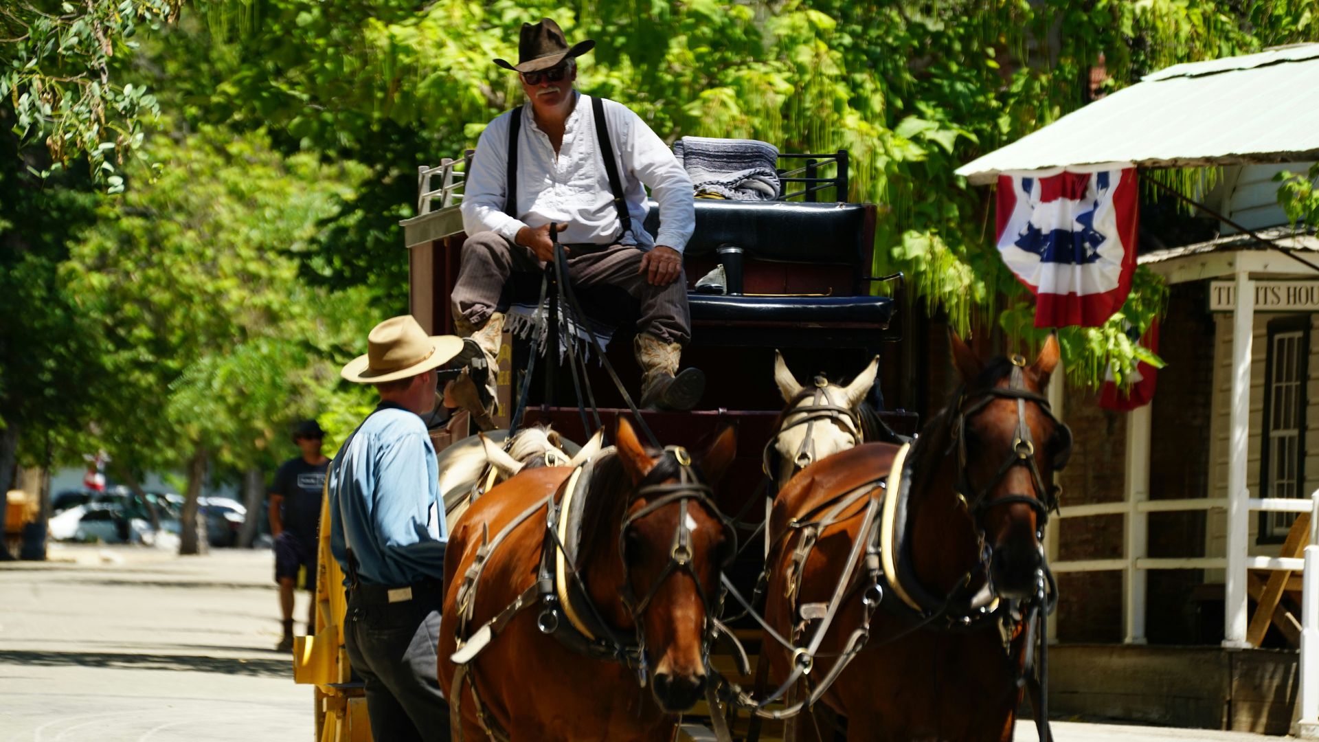
Columbia State Historic Park is something else—it’s like walking into the 1850s. People dress up and show you what daily life was like back then. You’ll find original buildings, from old saloons to general stores.
Jamestown’s Railtown 1897 State Historic Park is heaven for train buffs. Real steam locomotives, some of which starred in movies, still run there.
Notable Historic Sites:
- Hotel Jeffrey (Coulterville): John Muir and Theodore Roosevelt both stayed here
- Sutter’s Mill (Coloma): Where Marshall found the first gold
- Empire Mine (Grass Valley): Oldest and richest mine in California
- Malakoff Diggins: Biggest hydraulic mining site
A lot of these towns still look like they did in the 1850s. Wandering the streets, you really do feel like you’ve stepped into another era.
Gold Panning Experiences for Visitors
Gold panning is still a thing here. Several spots along Highway 49 let you roll up your sleeves and try it for yourself.
Jamestown offers guided gold panning lessons. Local pros show you the ropes, and you’ll probably find a few flakes if you’re patient.
The American River near Coloma is another prime spot. That’s where Marshall first found gold, so there’s some history in those waters.
Popular Gold Panning Locations:
- Jamestown: Guided tours with gear included
- Coloma: Historic site, easy river access
- Placerville: Several commercial panning setups
- Nevada City: South Yuba River access
Renting a pan and basic equipment usually costs $10-20 a day. Most places promise you’ll find at least a little gold to take home.
You need permission for private mining claims, but plenty of public areas allow recreational panning. Always double-check the local rules before you start.
Exploring Tuolumne County’s Historic Towns
Tuolumne County packs in four Gold Rush towns with real character. Jamestown has that famous Railtown 1897 train park, and Sonora is the biggest town around, with a downtown that’s full of energy and hiking trails just minutes away.
Jamestown’s Gold Rush Heritage and Railtown 1897
Gold first turned up in Tuolumne County right here in Jamestown, way back in 1848. It’s a great place to kick off your Gold Rush exploration.
Main Street feels like stepping into the past, with buildings from the 1870s and 1880s now home to cozy inns, restaurants, quirky shops, and even a brewery.
Railtown 1897 State Historic Park is the main draw. The famous steam engine “Sierra No. 3” lives here—it’s a movie star in its own right, having appeared in “Back to the Future III.”
I joined a tour of the old roundhouse and got up close to the locomotives. On weekends from April to October, you can actually ride behind vintage diesel engines.
Other park highlights:
- Movie museum
- Historic depot store
- Water tower from “Petticoat Junction”
- Shady picnic spots
Rocca Park has a cool Walk of Fame with plaques for movies and TV shows filmed nearby. The Jamestown Museum, set in a replica blacksmith shop, is worth a quick visit for more local lore.
Sonora: History, Shopping, and the Dragoon Gulch Trail
Sonora is the biggest town in Tuolumne County and makes a solid base for exploring. The historic downtown buzzes with shops, galleries, good eats, and a couple of museums.
I checked out the Tuolumne County History Museum, which is inside an old jail from 1857. The building alone tells you plenty about the tough old mining days.
The Red Church is a local icon—one of the most photographed spots in the county. Downtown comes alive with 2nd Saturday Art Nights, when artists and musicians take over the streets.
If you want to stretch your legs, the Dragoon Gulch Trail system is right in town. There are more than three miles of trails, ranging from easy to a bit challenging.
The path winds through oaks and manzanita, with some sweet views of downtown Sonora.
Just a short drive away, Indigeny Reserve makes organic hard apple cider. The tasting room is laid-back, with picnic grounds and orchard walks.
Columbia State Historic Park Immersion
Columbia State Historic Park is about as close as you can get to a real Gold Rush town. The park recreates 1850s mining life, not just with buildings but with people and activities.
You can hop on a stagecoach, try gold panning, and sip sarsaparilla in an old-time saloon. The park is free and dog-friendly, which is always a plus.
Park attractions:
- Working blacksmith shop
- Old-fashioned bowling alley
- Historic theater
- Shops and restaurants with period charm
The Wilson-McConnell House doubled as Grace Kelly’s home in “High Noon.” It’s a great photo op, especially with the Wells Fargo Building nearby.
Most people miss the Columbia Schoolhouse, but it’s worth the short walk to see how kids learned back in the day.
Inner Sanctum Cellars has a tasting room right in the park. Their patio is a sweet spot for a glass of wine and some live music.
The Story of Tuolumne Town
Tuolumne sits southeast of Sonora, just off Highway 49. It’s a small town but its mining roots run deep.
The Tuolumne City Memorial Museum tells the story of the people who built the town, from miners to families. The exhibits are personal and give you a real sense of daily life.
Across the street, the 9/11 Global War on Terrorism Memorial offers a quiet spot for reflection. West Side Memorial Park has a little steam locomotive, a nod to the area’s railroad days.
Cover’s Apple Ranch on Cherokee Road is a fun stop for fresh-baked treats and a slice of their famous Mile-High Apple Pie.
The West Side Trail follows the old Hetch Hetchy & Yosemite Valley Railroad. It’s an easy walk, with info signs and wildflowers everywhere in spring.
On summer Wednesday evenings, the park hosts Concerts in the Park and Outdoor Market. Locals come out for music and to shop from small vendors.
Notable Stops and Local Flavors on Highway 49
Highway 49 isn’t just about gold and history—you’ll find some of the best wine tasting in the Sierra Foothills and apple cider tastings in fall. The region is dotted with unique eateries and artisan shops, each with its own local flavor.
Wine Tasting in Sierra Foothills
The Sierra Foothills pump out some of California’s most interesting wines. The area is especially known for Rhone varietals and bold reds that thrive in the mountain sun.
Helwig Winery in Plymouth grabbed my attention with its barn-style tasting room and sweeping views. Their wine cave tour was a cool bonus, and I learned a bit about how they age their wines.
Most wineries here keep it small and personal. The elevation and climate help grapes like Syrah, Grenache, and Mourvèdre stand out.
Top Wine Regions Along Highway 49:
- Amador County – Old-vine Zinfandel is king here
- El Dorado County – Rhone varietals shine
- Calaveras County – Up-and-coming, with lots of variety
Tasting rooms often have outdoor seating, so you can sip with a view. In summer, many wineries host live music and food pairings.
Apple Cider Orchards and Tastings
Higher up along Highway 49, you’ll find apple orchards that really come alive in the fall. That’s prime time for apple cider tastings and fresh-pressed cider.
Many orchards open for tours during harvest. I stumbled upon a few family-run places that have been growing apples for generations. The cool mountain air makes for crisp, flavorful apples—perfect for cider.
Some spots make hard cider with creative flavors, while others stick to classic sweet cider and apple pies.
Peak cider season runs from September through November. A lot of orchards let you pick your own apples, which is a fun way to spend an afternoon.
Unique Regional Dining and Artisan Goods
The Farm Table in Placerville dishes up artisanal house-cured meats alongside farm-fresh produce. You’ll spot their charcuterie board loaded with local ingredients, all under a gorgeous stamped-tin ceiling—honestly, the vibe just adds to the flavor.
In Sutter Creek, Element gets creative with breakfast. I couldn’t resist their soppressata Benedict, and the challah French toast with caramelized bacon? It’s a perfect example of the region’s farm-to-table spirit.
Wandering through local artisan shops, I stumbled on all sorts of handmade treasures. Pottery, small-batch preserves, unique jewelry—each Gold Rush town seemed to have its own twist.
You’ll often find these specialty shops tucked inside historic buildings. The Fountain & Tallman Soda Works in Placerville, built back in 1852, now acts as a museum and gives a glimpse into the area’s industrial past.
Restaurants here really lean into locally sourced ingredients. The Gold Country’s agricultural roots run deep, and you can taste it in menus up and down the corridor.
Unforgettable Sights and Outdoor Experiences
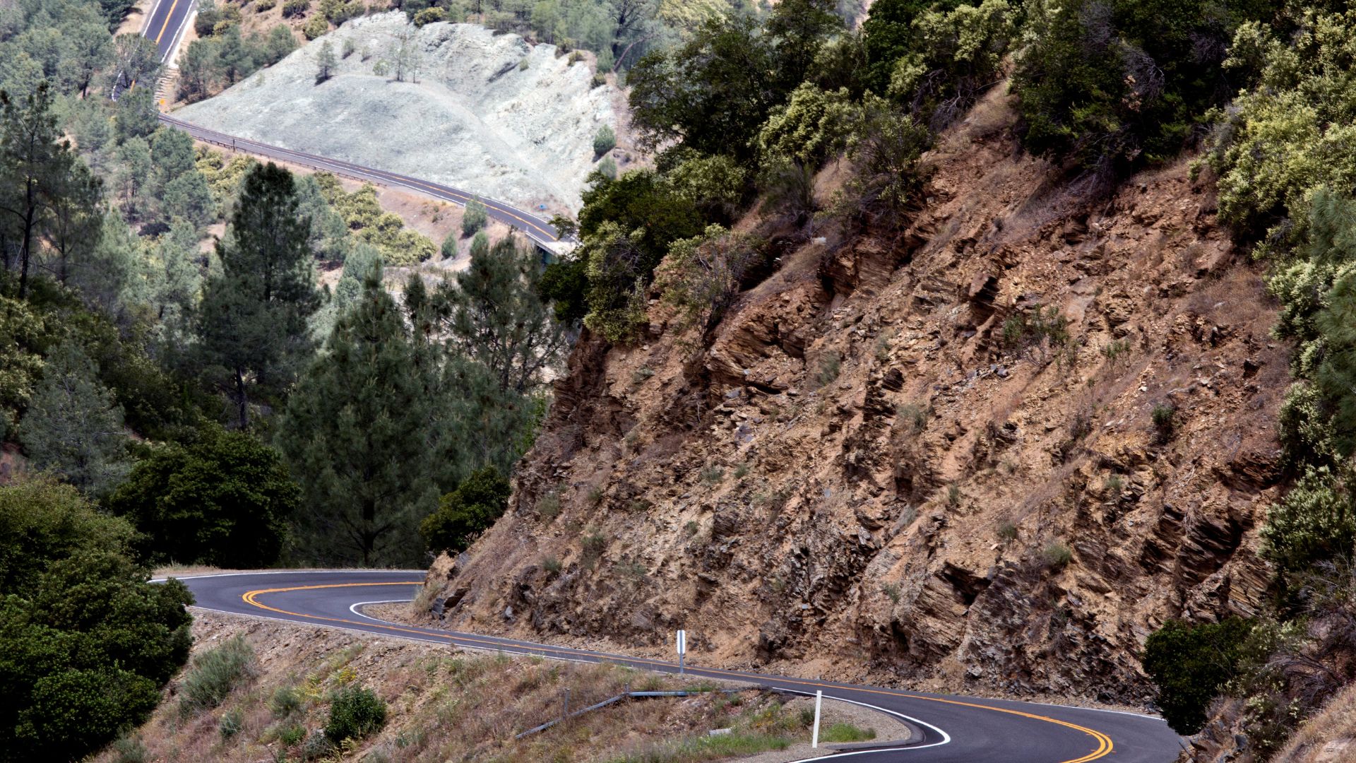
Driving Highway 49, I couldn’t help but stare at the Sierra Nevada foothills. Views roll out in every direction, and outdoor adventures—hiking, biking, you name it—are always close by. It’s surprisingly easy to reach Lake Tahoe for a taste of alpine wilderness, too.
Scenic Drives and Viewpoints
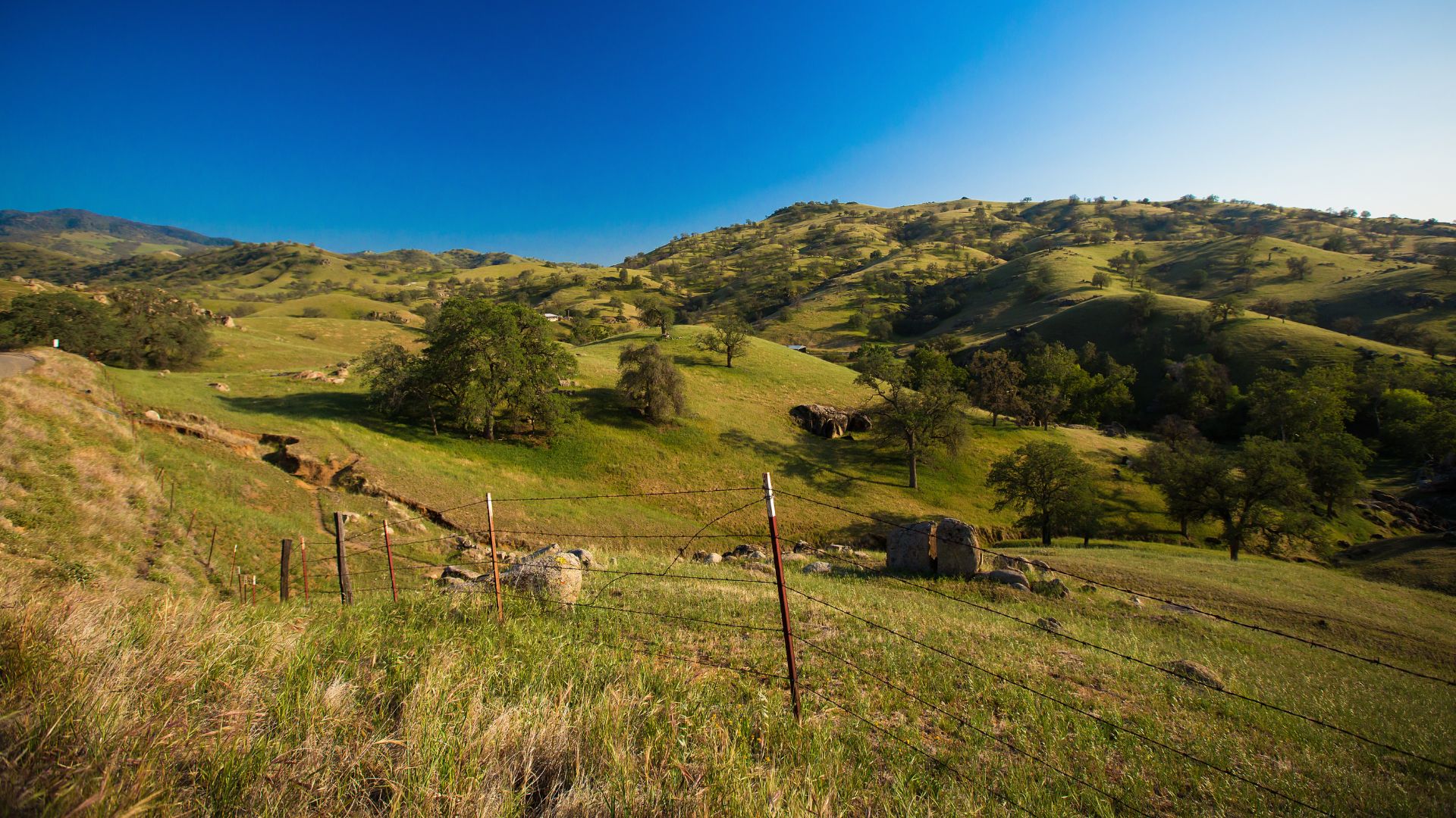
Cruising along Highway 49, the Sierra Nevada foothill scenery just keeps coming. The stretch between Oakhurst and Mariposa really stuck with me.
Miles of rolling hills, all dotted with oaks, unfold before you. Spring brings wildflowers that light up the grasslands, and if you head north, golden valleys give way to forests of pine.
A few viewpoints I loved:
- Coulterville area: Sweeping valley panoramas
- Between Jamestown and Sonora: Classic mountain vistas
- North of Angels Camp: Creeks and dramatic rock formations
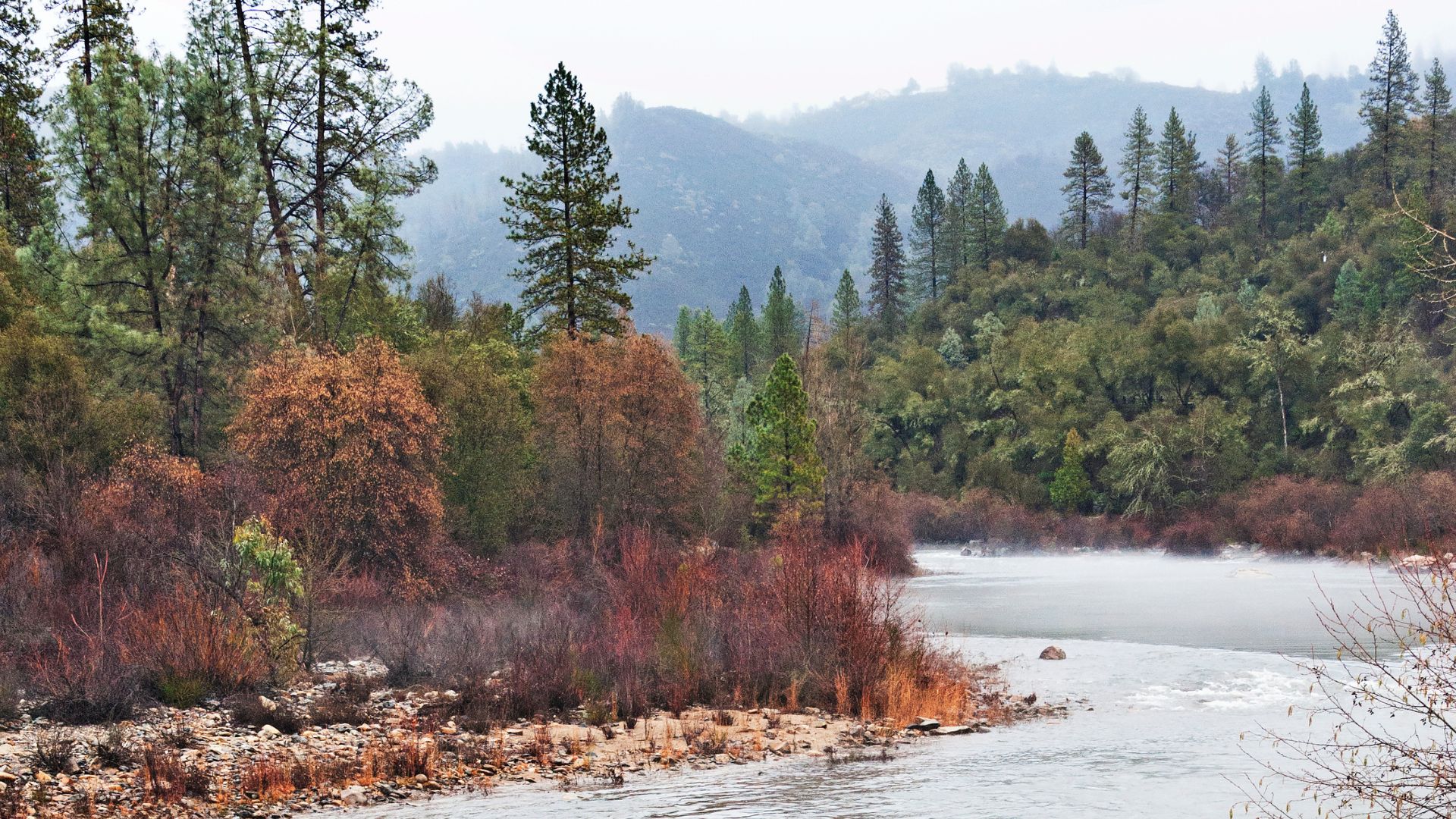
Streams bubble right alongside the highway, adding a calm soundtrack to the drive. I pulled over at several spots just to snap photos or soak it all in.
If you’re into photography, early mornings are magic. The golden hour makes those hills practically glow.
Outdoor Activities: Hiking, Biking, and Nature Trails
Gold Country is a playground for outdoor lovers. I tried out a handful of trails and each one showed off a different side of the landscape.
Some favorite activities:
- Hiking gentle foothill trails near old mining towns
- Biking along quiet, winding country roads
- Wandering oak woodlands on easy nature walks
- Casting a line in mountain streams
State parks along Highway 49 keep their trails in great shape. Columbia State Historic Park, for instance, has easy paths that wind through restored mining sites.
You’ll find everything from mellow valley strolls to steeper mountain hikes. Most trails stay open all year, though summer can get a bit toasty.
Spring is probably my top pick for hiking—cool temps, wildflowers everywhere. In fall, the oak leaves turn and the air feels just right.
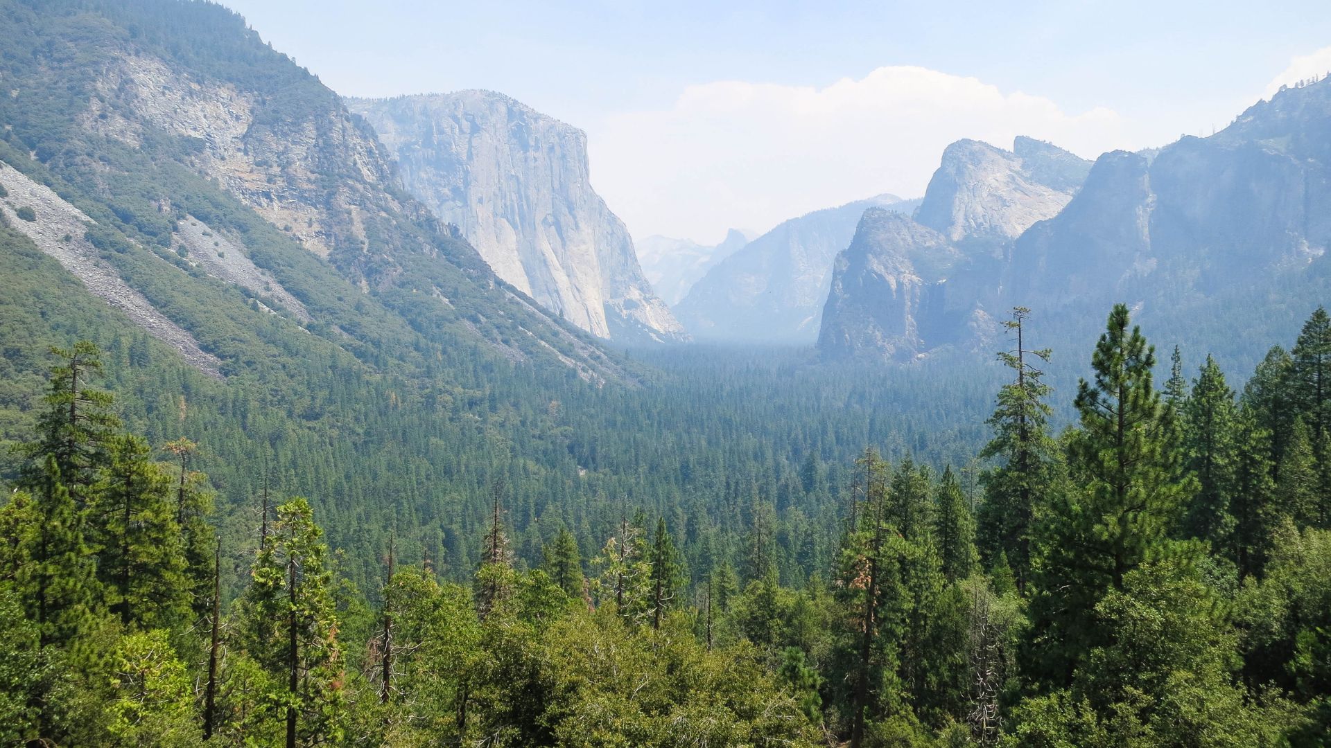
A Getaway to Lake Tahoe
Lake Tahoe sits about two hours east of the northern stretch of Highway 49. If you’re chasing a bit of adventure after exploring Gold Rush country, this alpine lake truly delivers.
You’ll catch glimpses of crystal-clear water reflecting those towering, snow-capped peaks. Hiking trails hug the shoreline, but they also wind up into the mountains if you’re feeling ambitious.
Lake Tahoe activities:
- Take a slow, scenic drive around the 72-mile shoreline—there’s always something new around each bend.
- Hike out to hidden waterfalls or catch a viewpoint you’ll want to linger at.
- Jump in for a swim if you’re brave enough for the chilly, clear mountain water.
- Set up camp in one of the nearby national forests for a night under the stars.
Honestly, I’d plan for at least a full day at Lake Tahoe. There’s just something unforgettable about moving from old mining towns into this wild, alpine landscape.
Driving from Sonora to Lake Tahoe, I watched the scenery shift dramatically. You leave behind the rolling oak foothills and suddenly you’re winding through pine forests at higher elevations.