Most folks heading to Yosemite stick to the famous valley floor. But honestly, Tuolumne Meadows has some of the most jaw-dropping high-altitude hiking in the Sierra Nevada—think granite domes, sparkling alpine lakes, and wildflower meadows all at 8,600 feet.
I stumbled into this subalpine paradise on my first drive along Tioga Road. It didn’t take long before it became my go-to escape from the crowds below.
The difference between Yosemite Valley and Tuolumne Meadows? It’s like night and day.
While the valley buzzes with millions of visitors, the high country stays pretty peaceful. The same dramatic granite, the same wilderness, but way fewer people.
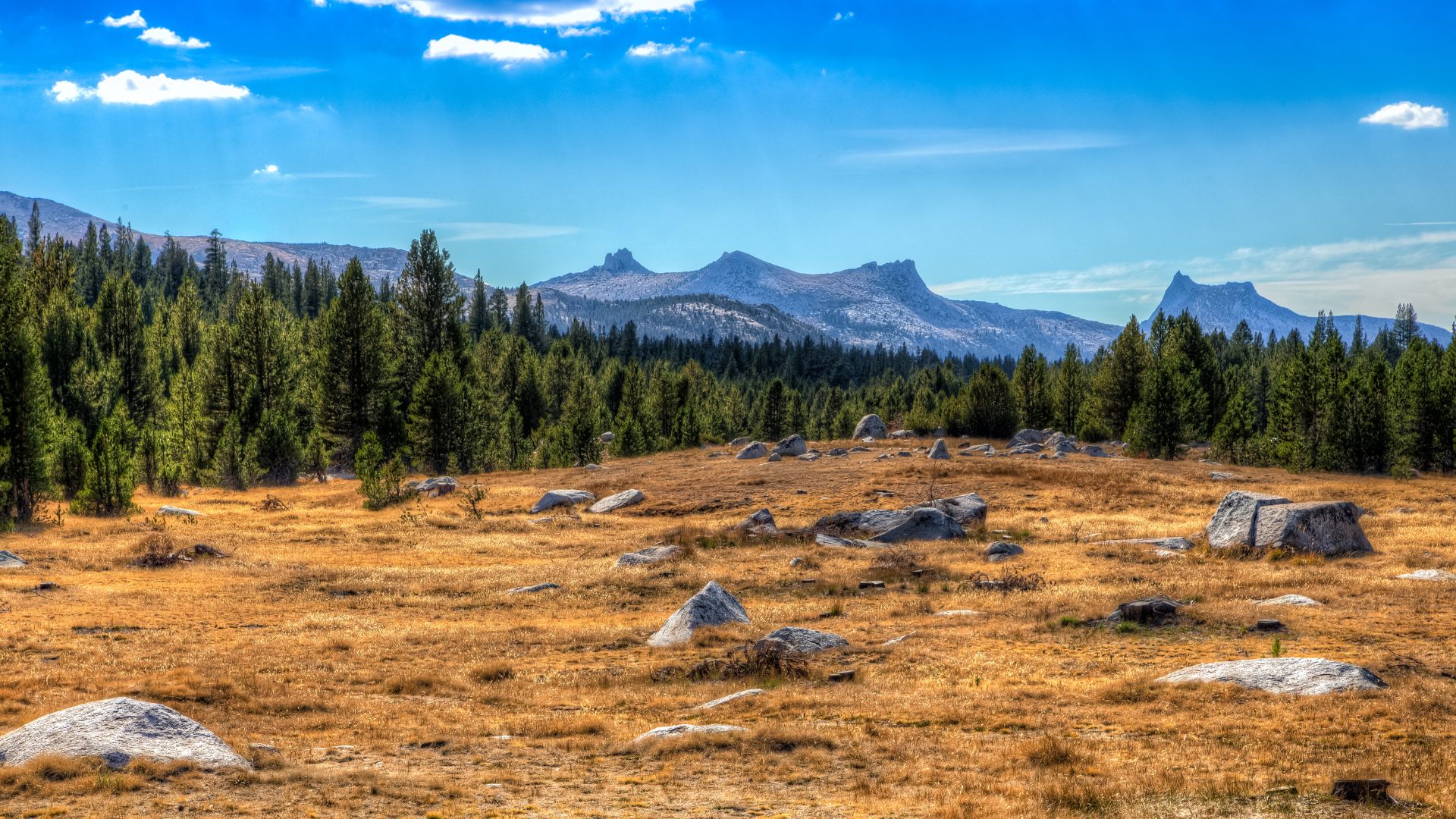
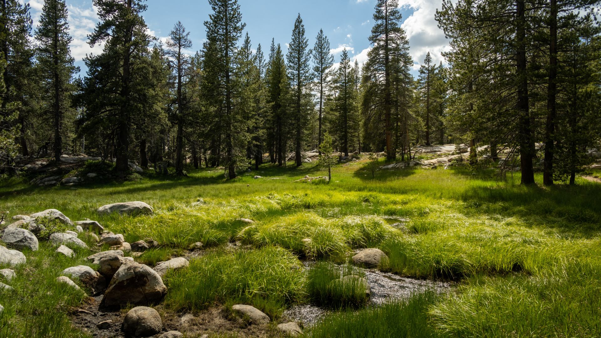
The meadows stretch over two miles along the Tuolumne River. This is the largest subalpine meadow in the Sierra Nevada.
After hiking here a few times, I get why outdoor lovers call Tuolumne Meadows essential. You can wander through wildflowers or scramble up granite domes—there’s something for everyone.
And that alpine calm? It’s what makes Yosemite magic for me.
Tuolumne Meadows at a Glance
Tuolumne Meadows sits at 8,600 feet, smack in the middle of the Sierra Nevada. That elevation means cool temps, short summers, and a landscape that just feels wild.
The animals and plants up here? They’re tough, shaped by the altitude and the seasons.
Elevation, Climate, and Landscape
Tuolumne Meadows sits about 8,600 feet above sea level. Up here, summers are short and winters drag on.
You can only get in from late May through October. The rest of the year, snow covers everything.
Summer days usually land between 40-70°F, but at night it can drop to 20-30°F. I never forget my warm layers, even in July.
The Tuolumne River winds right through the meadow. It’s a glacially carved basin, stretching for two miles.
Open grasslands mix with patches of dense forest. Granite bedrock hides just under a thin layer of soil.

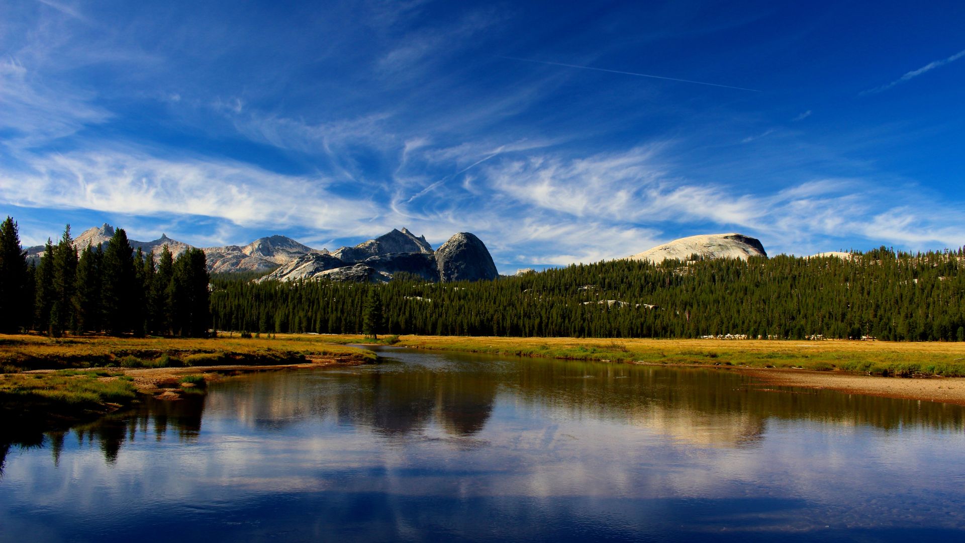
Alpine Scenery and Granite Domes
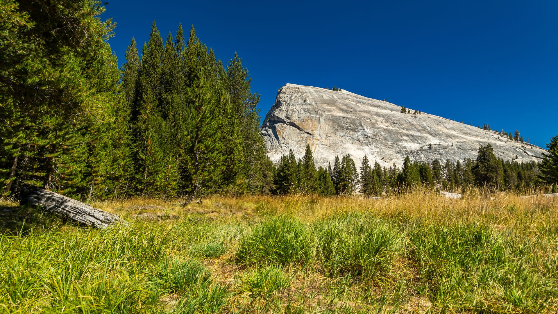
Granite domes surround Tuolumne Meadows, standing guard on all sides. Glaciers shaped these rounded giants thousands of years ago.
Lembert Dome stands tall to the north. I love hiking up for those sweeping basin views.
To the south, Cathedral Peak and Unicorn Peak cut a jagged line across the sky. Their sharp spires feel wild and dramatic.
Millions of years ago, granite formed deep underground. Glaciers later carved and polished the rocks into these shapes.
Alpine lakes sparkle between the granite. Tenaya Lake and Cathedral Lakes mirror the peaks on calm mornings.
Wildflowers and Wildlife Highlights
The growing season is quick and intense. Wildflowers explode from July through August, especially in the wetter meadows.
Common flowers:
- Mountain aster (purple)
- Indian paintbrush (red-orange)
- Lupine (blue-purple)
- Corn lily (white)
Black bears hang around the meadows, especially late summer when berries ripen. I always stash food in the bear boxes.
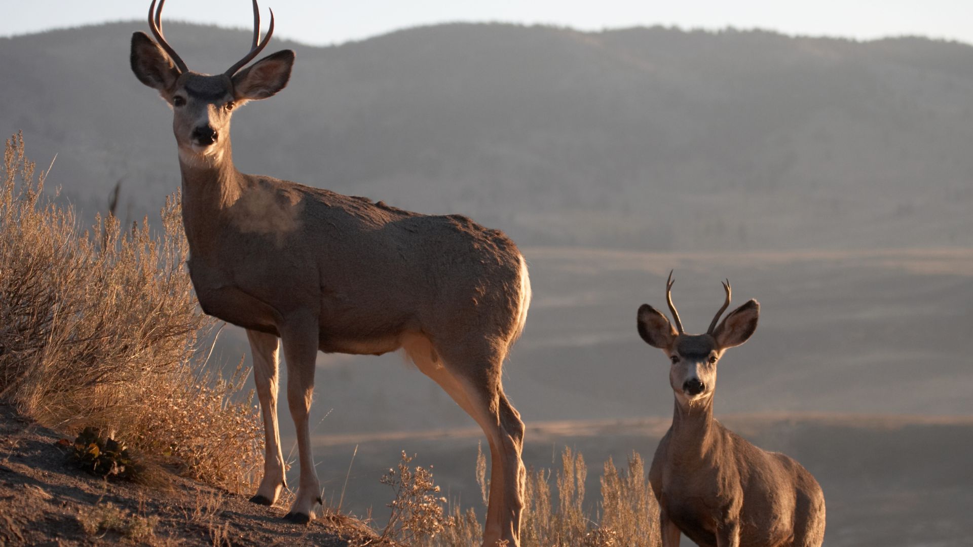
Mule deer graze out in the open during the early and late hours. They barely notice hikers, unlike their shy cousins down below.
Belding’s ground squirrels dig tunnels all over the grasslands. Their sharp alarm calls echo when a predator gets close.
I spot Clark’s nutcrackers and Steller’s jays often. Both birds stash seeds to get through the winter.
Getting There: Access, Directions, and Seasonal Tips
Getting to Tuolumne Meadows takes a bit of planning. Tioga Road closes for much of the year, so timing matters.
Snow controls everything up here—sometimes it lingers late into the season.
Navigating Tioga Road
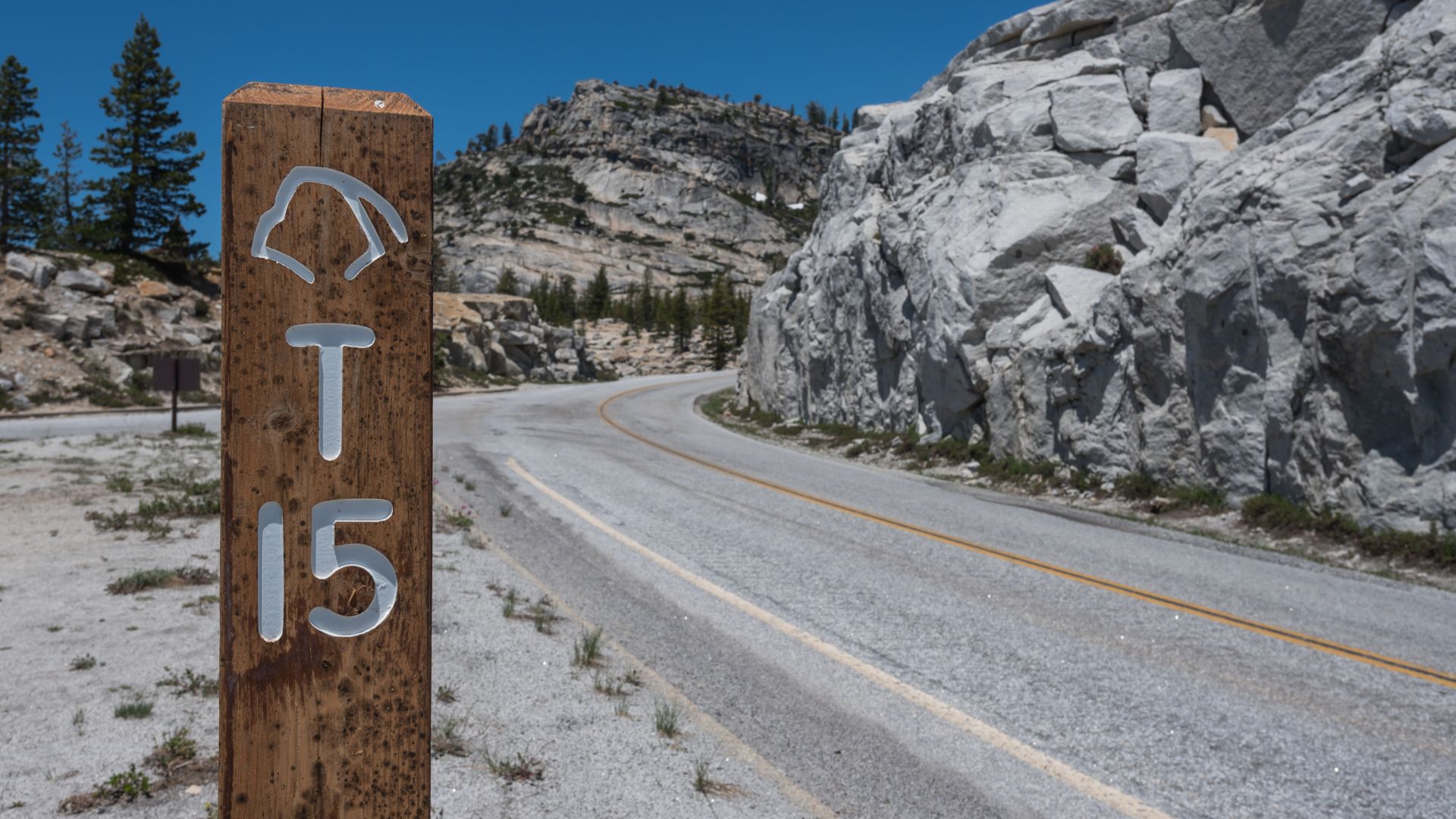
Tioga Road is your only way in by car. It connects Yosemite’s west and east sides, winding through the mountains.
The road usually opens in May or June. By November, snow shuts it down again.
I always check the National Park Service website for road updates before heading out.
From the west, Tioga Road begins at Crane Flat. It’s about a 45-minute drive to Tuolumne Meadows from there.
From the east, you’ll enter at Tioga Pass near Lee Vining—almost 10,000 feet up.
The road climbs fast, with plenty of curves and steep stretches. I take my time and let faster cars pass at the pullouts.
Best Times to Visit and Snow Conditions
July through September is prime time. The weather’s usually good, and most trails are open.
But snow can stick around well into June. I’ve hit icy spots and mud even in early summer.
If you’re coming in late spring, be ready for snow and wet trails. May and June can be tricky.
At 8,600 feet, weather changes fast. Even in July, storms can roll in out of nowhere.
I always bring layers. Temps can swing 30 degrees from day to night.
September is my sweet spot. Fewer crowds, stable weather—just right.
Travel from Yosemite Valley and Beyond
Driving from Yosemite Valley takes 1.5 to 2 hours. That’s 39 miles up Tioga Road, through some beautiful country.
From San Francisco, it’s a solid 4-5 hour drive. Highway 120 leads you east through the park.
Parking fills up fast in peak season. I try to get there by 9 AM for a spot at the trailheads.
The closest gas is at Crane Flat, 39 miles away. I always fill up before heading up.
Coming from the east, Lee Vining is your last stop for food and supplies. I stock up there before entering the park.
Tuolumne Meadows has only limited services, so I bring all my food and water for day hikes.

Unforgettable Hikes in Tuolumne Meadows
Tuolumne Meadows serves up some of the best hikes in the Sierra. Granite domes, alpine lakes, waterfalls—take your pick.
The area’s also a jumping-off point for famous long-distance trails.
Top Day Hikes and Scenic Trails
If you’re new to the area, start with Lembert Dome. The views from the top are unreal.
The Dog Lake trail makes a great half-day outing. It’s 3.8 miles round-trip, with 850 feet of climbing to a quiet alpine lake.
For a longer trek, I always go for Cathedral Lakes. The 7.6-mile hike takes about 6-7 hours and climbs 1,000 feet. The granite spires and lakes are worth every step.
Elizabeth Lake is another favorite. It’s a 6.8-mile hike to a glacier-carved lake below Unicorn Peak, plus a pretty loop around the water.
| Hike | Distance | Time | Elevation Gain |
|---|---|---|---|
| Lembert Dome | 2.8 mi | 2-3 hours | 850 ft |
| Dog Lake | 3.8 mi | 3-4 hours | 850 ft |
| Cathedral Lakes | 7.6 mi | 6-7 hours | 1,000 ft |
| Elizabeth Lake | 6.8 mi | 6-7 hours | 1,000 ft |
High Sierra Backpacking Adventures
The High Sierra Camps Loop links five camps through all kinds of alpine scenery. I’ve hiked sections—meadows, passes, you name it.
Young Lakes is a great intro to backcountry camping. The 13.6-mile round-trip can be done in a day, but I usually turn it into an overnight.
Glen Aulin is a classic backpacking spot. The 11-mile round-trip follows the Tuolumne River past waterfalls and granite steps.
Hardcore backpackers might try the Mono Pass Trail. It’s 8 miles round-trip, with big views of Mono Lake and the eastern Sierra.
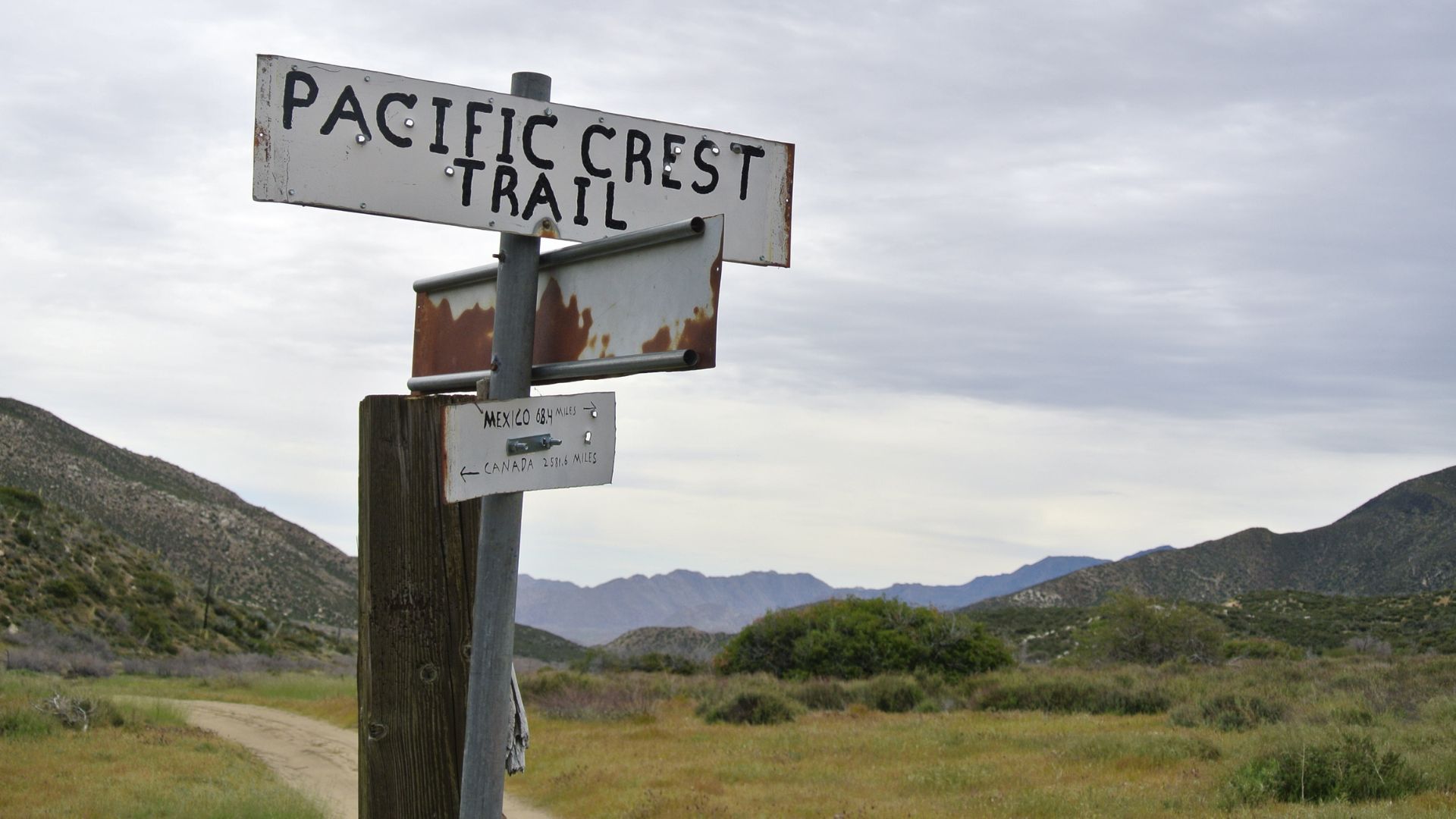
Pacific Crest Trail and John Muir Trail Experience
The Pacific Crest Trail runs right through Tuolumne Meadows. I’ve walked some stretches—flat, easy, and the meadow views are endless.
The John Muir Trail meets local trails near Twin Bridges. I like following it along the Lyell Fork of the Tuolumne River.
Both trails show off the high country in different ways. The PCT gives you wide-open meadows, while the JMT hugs the river and granite.
These trails attract hikers from everywhere. I’d say try a short section first before tackling anything longer.
Granite Peaks, Waterfalls, and River Walks
Pothole Dome is the easiest place to climb granite. The 1-mile round-trip is mellow, with a bit of scrambling for big meadow views.
The Tuolumne River offers plenty of hiking. I love following it downstream toward Glen Aulin, where waterfalls tumble over granite.
Waterwheel Falls is the showstopper during peak flow. The water spirals and spins—nature’s own water wheels.
Soda Springs is a gentle riverside stroll. The 1.4-mile trail stays mostly flat and leads to naturally carbonated springs and old Parsons Lodge.
Hiking along the river keeps things cooler on hot days. The granite slabs make perfect spots for a snack or some photos.
Camping, Lodging, and Staying in the High Country
Staying overnight at 8,600 feet takes some planning and good gear. The campground needs reservations, the lodge has comfy tent cabins, and backpackers get special sites with permits.
Tuolumne Meadows Campground Insights
The campground sits at 8,600 feet, with over 300 sites open from mid-June to late September. I learned the hard way—reservations are a must on recreation.gov now.
Nights get cold, fast. On my September trip, it hit 70°F during the day but dropped to 28°F at night. I brought a sleeping bag rated for 20 degrees and plenty of layers.
You’ll find:
- Standard tent sites with picnic tables and fire rings
- RV sites with hookups
- Group sites
- Horse camping areas
Bear safety is non-negotiable. I got warning emails about active bears before I arrived. Everything scented—food, toothpaste, chapstick—goes in the metal lockers.
There are clean restrooms with flush toilets and drinking water. A general store nearby stocks last-minute basics and propane.
Overnight at Tuolumne Meadows Lodge and Tent Cabins
Tuolumne Meadows Lodge has 69 canvas tent cabins at 8,700 feet. The lodge runs from mid-June to mid-September and feels like a cozy upgrade from regular camping.
The tent cabins give you a roof and walls, so you don’t need to haul all your own gear. Beds and basic furnishings come standard.
The lodge sits right in the middle of the high country—perfect for day hikes.
Book early—the season is short, and spots go fast.
I found the tent cabins strike a nice balance. You get the outdoor vibe, but you’re not shivering in a nylon tent at 2 AM.
Backcountry Camping and Wilderness Permits
Backpackers with wilderness permits can use a special campground area. It costs $6 per person per night—bring cash and the exact amount.
No reservations needed for these sites. You can stay one night before and one night after your trip. (Half Dome permits don’t count.)
Parking isn’t right at the backpacker area. I parked in the overnight lot and walked in. The wilderness center handles all the permit stuff.
You have to camp at least four trail miles from Tuolumne Meadows if you’re on a backpacking trip passing through. That’s the rule.
Visitor Resources and Park Facilities
The Tuolumne Meadows area dishes out some pretty great resources for visitors. You’ll find a staffed visitor center, a wilderness center, and even a few historic sites tucked nearby. These facilities spring to life from late May through September, offering ranger programs and a bunch of educational chances all summer.
Tuolumne Meadows Visitor Center Overview
The Tuolumne Meadows Visitor Center opens its doors from late May to late September. I really appreciated the rangers at the info desk—they always had spot-on trail tips and up-to-date conditions.
Inside, there’s a bookstore loaded with local guidebooks and maps. I liked the interactive exhibits that break down the area’s geology, plant life, and animal species.
Key Services:
- Ranger-staffed information desk
- Educational exhibits on local wildlife and geology
- Bookstore with maps and guidebooks
- Restroom facilities
The Tuolumne Meadows Wilderness Center stays open a bit longer, running from late May through mid-October. It’s the go-to spot for backcountry permits and all things wilderness camping.
Honestly, if you need a bear canister, a detailed map, or just some solid pre-trip advice, swing by the wilderness center. The staff always shares the latest trail conditions and tips for low-impact camping.
Educational and Ranger Programs
Summer brings some fantastic ranger programs that really dig into the high-altitude ecosystem. I’ve joined a few that covered everything from local geology to wildlife identification, and each one left me with something new.
These programs usually run June through early September. You might find yourself stargazing one night, then wandering through wildflowers or hearing about granite domes the next.
Popular Program Topics:
- Alpine wildflower identification
- Granite dome formation
- Wildlife tracking
- Night sky programs
Most sessions are free and totally family-friendly. I’d suggest checking the visitor center for the latest schedule and where to meet up.
During winter, rangers also post weekly updates for cross-country skiers heading into the area.
Nearby Landmarks: Soda Springs, Parsons Lodge, and More
You don’t have to go far from the visitor center to stumble on Soda Springs. This natural carbonated spring bubbles up cold water inside a quirky old log cabin.
It’s just a short trail walk from the Lembert Dome parking area. I couldn’t resist tasting the fizzy water straight from the ground—definitely a unique experience.
Parsons Lodge sits about a mile from the visitor center or Lembert Dome. Inside, you’ll find historical exhibits about John Muir and how the park came to be.
This spot marks the meeting place of John Muir and Robert Underwood Johnson, where they dreamed up Yosemite National Park. The lodge usually opens from late June to early September.
Additional Facilities:
- Tuolumne Meadows Lodge (seasonal accommodations)
- General store and post office
- Tuolumne Meadows Campground
- Shuttle service during peak season

Nature Encounters: Tuolumne Meadows Flora and Fauna
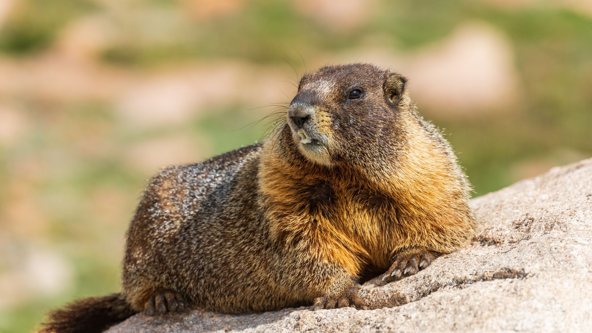
At 8,600 feet, the high-altitude air sets the stage for some pretty awesome wildlife sightings. I’ve watched mule deer graze quietly in open meadows and spotted yellow-bellied marmots stretched out on warm granite rocks. The subalpine ecosystem puts on a show of wildflowers that change with the season.
Spotting Mule Deer and Marmots
During my early morning hikes, mule deer almost always make an appearance. They seem to prefer the open grasslands, especially near the Tuolumne River.
Best viewing times:
- Early morning (6-8 AM)
- Late afternoon (5-7 PM)
- Areas near water sources
These deer are bigger than the ones you’ll see in the valley. They stand out with their huge ears and those black-tipped tails.
On warmer days, yellow-bellied marmots come out to play. I usually find them lounging on granite outcrops and boulders, soaking up the sun.
They’re about the size of a small cat and have this habit of whistling loudly when they sense danger. That sharp call really carries across the meadows.
Marmot hotspots I visit:
- Soda Springs area
- Cathedral Lakes trail
- Granite domes near Tenaya Lake
Ecozones and Alpine Plants
From July through August, the meadows explode with wildflowers. I’ve noticed that different plant communities pop up depending on the elevation and how wet the ground is.
Wet meadow areas support:
- Shooting stars (purple flowers)
- Elephant heads (pink spikes)
- Corn lilies (large green leaves)
Dry meadow zones feature:
- Lupines (purple spikes)
- Indian paintbrush (red-orange)
- Mountain aster (white petals)
Around the edges, forests of lodgepole pine, mountain hemlock, and western white pine create natural borders. These trees really frame the open meadows.
Above 9,000 feet, things change. Alpine zones support tough plants like whitebark pine, alpine buttercup, and cushion plants that hug the ground to survive the wind.
Wildlife Safety and Observation Tips
When I’m out hiking, I keep a respectful distance from wildlife. Mule deer, for example, might look calm, but they can kick if they feel threatened—especially in the fall when they’re a bit more on edge.
My safety rules:
- I stay at least 25 yards from deer.
- Feeding animals? Never a good idea.
- If deer decide to block the trail, I make some noise to let them know I’m there.
- If one starts coming my way, I just back off slowly.
Marmots usually mind their own business, but if they feel trapped, they’ll bite. I don’t try to touch them or sneak in close for a photo—just not worth it.
Binoculars have become my best friend for wildlife viewing. With them, I get to watch animals doing their thing, without messing up their routines.
Best observation practices:
- Move slow and keep quiet.
- I like to wear neutral colors so I blend in a bit.
- No sudden moves—animals pick up on that.
- For photos, I rely on a telephoto lens instead of getting closer.
Packing out every bit of food, even the tiniest crumb, has become second nature. Wild animals really don’t need our leftovers—it’s better for them, and honestly, it’s better for the wild places too.