Standing at the edge of what many call the world’s most jaw-dropping erosion crater, I felt that familiar rush of anticipation. Caldera de Taburiente stretches almost 9 kilometers wide and drops nearly 2,000 meters deep into La Palma’s volcanic core.
This massive geological marvel has lured hikers from all over, and after tackling it myself, I totally get the hype.
The hiking trails inside Caldera de Taburiente deliver one of the wildest and most rewarding adventures in the Canary Islands. You’ll wander through ancient riverbeds, stumble upon colorful waterfalls, and cross terrain that sometimes feels downright Martian. My trek through this national park genuinely pushed my limits but rewarded me with moments and views I’ll keep forever.
What sets this hike apart? It’s not just the epic scenery or the physical test—though both are real. The caldera pulls you into a living, breathing geological museum. Every step reveals something unexpected.
Planning, respecting the environment, and embracing a bit of uncertainty all matter out here.
Caldera de Taburiente: The Heart of La Palma
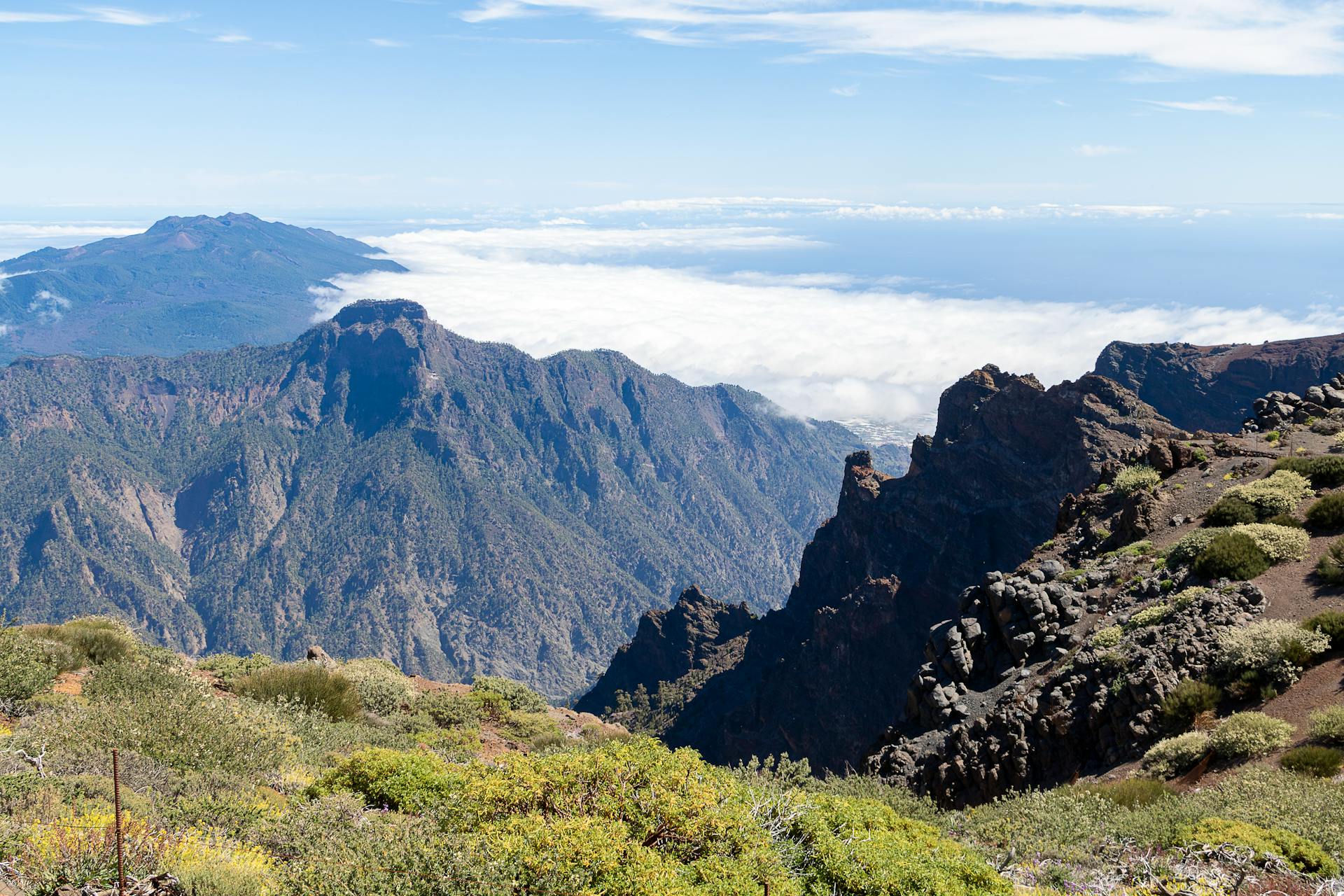
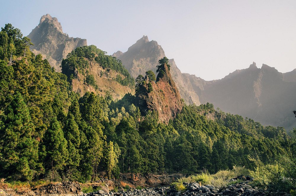
This enormous volcanic crater sits smack in the middle of La Palma. Millions of years of relentless erosion shaped one of the world’s largest erosion craters.
The caldera spans about 8 kilometers across and plunges 1.5 kilometers deep. It’s a world unto itself, tucked inside the Canary Islands.
Geological Origins and Erosion
Caldera de Taburiente didn’t explode into existence. Instead, volcanic activity built it up, and then water and wind slowly carved out this massive depression.
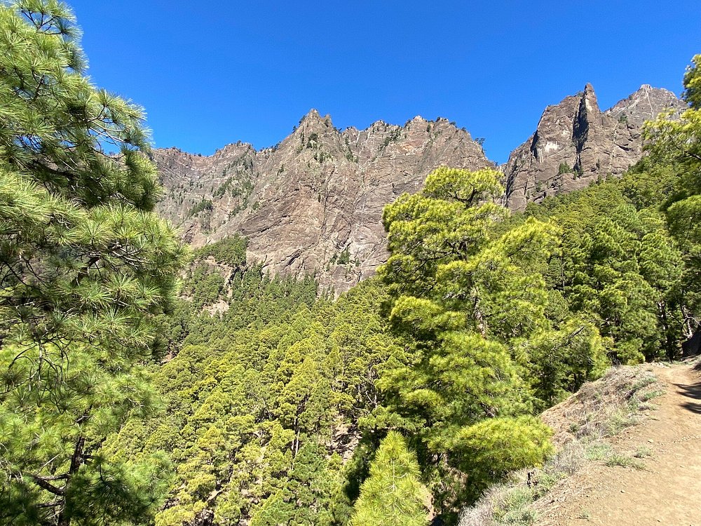
Over millions of years, erosion cut through volcanic rock layers. I could see the evidence everywhere as I hiked—towering cliffs, jagged outcrops, and those dramatic drops.
Key Measurements:
- Diameter: 8-9 kilometers
- Depth: Up to 1.5 kilometers
- Rim Height: Nearly 2,500 meters above sea level
Sheer caldera walls drop for up to 1,000 meters in places. Hiking inside really feels like stepping into another dimension.
Streams and waterfalls keep working on the landscape even now. Water flow constantly etches new lines into the rock.
Significance Within the Canary Islands
La Caldera stands out as a true giant among the Canary Islands’ natural wonders. Spain declared it a national park back in 1954, recognizing its rare beauty and importance.
The caldera shapes La Palma’s weather and water systems. It’s the island’s geological heartbeat.
This giant bowl creates its own microclimate. The steep walls trap clouds and moisture, so temperatures stay cooler than on the outside slopes.
Why it’s special:
- Biggest erosion crater in the Canaries
- One of the only places with year-round running water
- Endemic plants you won’t find anywhere else
Underground streams start here and flow out to nourish the rest of the island.
Unique Features of La Caldera
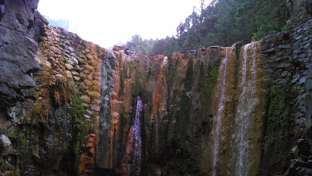
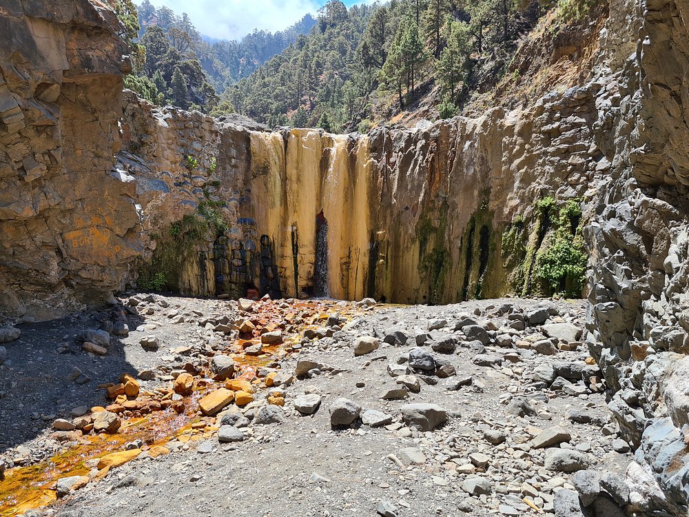
Inside, the caldera hides surprises you just won’t see anywhere else in the archipelago. The Cascada de Colores waterfall, for one, bursts with wild yellows, oranges, and greens from mineral buildup.
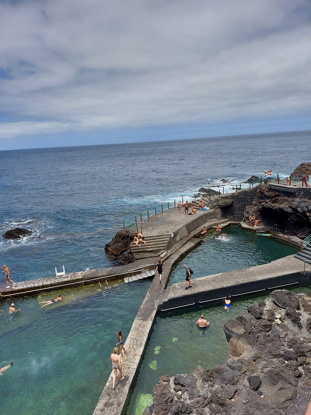
Taburiente Beach sits deep inside the crater, miles from any ocean. It’s a freshwater “beach” with smooth pebbles and impossibly clear water—perfect for a swim if you’re brave enough.
Canary Island pines here reach massive sizes. The protected setting lets these giants thrive, forming thick forests on the caldera floor.
Barranco de Las Angustias slices through the caldera wall—a narrow ravine that acts as the main exit for hikers and water alike.
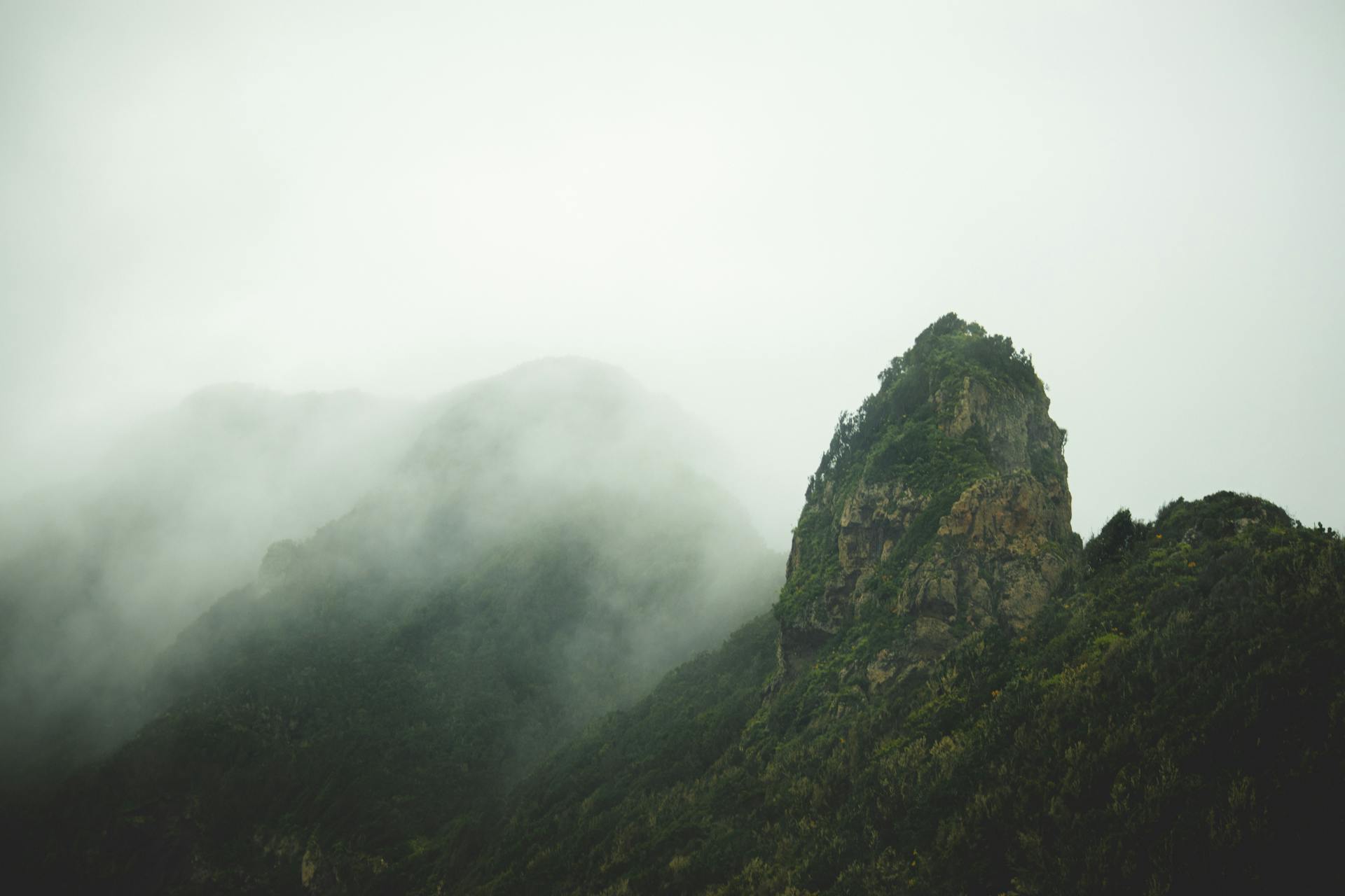
Some of La Palma’s highest peaks ring the caldera:
- Pico de la Cruz: 2,351 meters
- Pico de la Nieve: 2,236 meters
- Punta de los Roques: 2,085 meters
These peaks form a dramatic crown around the crater. The contrast between the rim and the deep interior creates unforgettable views.
Planning Your Caldera Adventure
The Caldera de Taburiente offers hiking options for just about everyone. You can choose from easy day hikes to tough multi-day loops.
Most folks start from Barranco de las Angustias or descend from Los Brecitos viewpoint. Weather conditions can make or break your plans, so always check before you go.
Choosing the Right Hiking Trails
The classic PR LP 13 trail from Los Brecitos is a solid pick for beginners. This 16-kilometer route winds down through pine forests and crosses gentle rivers. It usually takes 6-8 hours.
If you’re after gorgeous views without too much pain, this trail is a winner. The path stays well-marked and gives you sneak peeks into the volcanic heart.
Seasoned hikers can tackle the 30-kilometer loop starting from Barranco de las Angustias. This one’s a beast, with:
- 1,700 meters of climbing
- Technical scrambles and rocky stretches
- Side trips to Hoyo Verde waterfall
- Roque de la Desfondada viewpoint
Plan for 8-10 hours if you want to do the whole thing. Splitting it into two days and camping at Playa de Taburiente works well if you don’t want to rush.
Shorter hikes include out-and-backs to Dos Aguas (about 4 hours round trip) or simple explorations along the riverbed from the main parking lot.
Getting to Barranco de las Angustias and Los Brecitos
You’ll find the Barranco de las Angustias parking lot right off the LP-214 road. Most trails kick off here and the big loop ends at this spot.
The drive from Santa Cruz de La Palma takes about 45 minutes. Parking’s free, but it fills up super fast during busy months.
Los Brecitos viewpoint sits up a twisty mountain road. Most hikers take a taxi up and walk back down to Barranco de las Angustias.
Public buses don’t go to either trailhead. Renting a car gives you way more freedom.
Taxis to Los Brecitos cost around 25-30 euros. I usually book through my hotel or by calling a local cab.
Seasonal Conditions and Weather
Spring and fall are the sweet spots for hiking, with mild temps and clear skies. I hit the trails in November and loved the crisp mornings and sunny afternoons.
Summer brings the heat. Water sources dry up, and the sun gets brutal—so start early if you’re hiking between June and August.
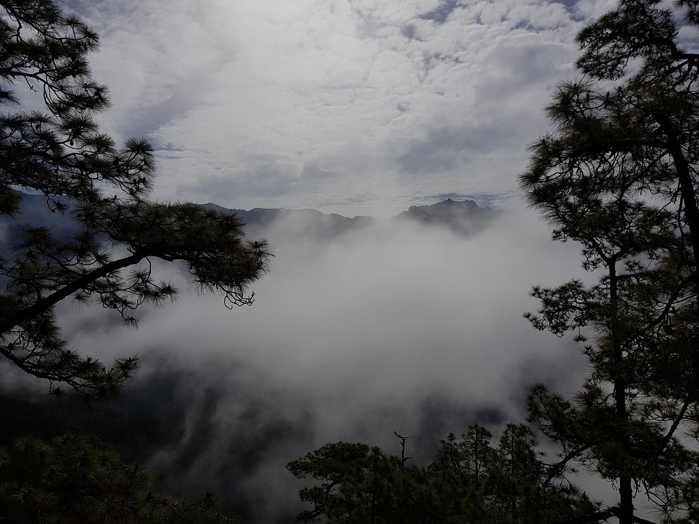
Winter can surprise you with rain or even snow up high. Waterfalls like Hoyo Verde really come alive from December to March.
Always check the latest forecast before heading out. The weather inside the caldera can flip in a heartbeat.
During dry spells, waterfalls might vanish entirely. The ground gets dusty but stays more stable for hiking.
No matter the season, bring layers. It gets chilly as you climb, and the wind can whip across the ridges.
Immersive Trail Highlights and Route Details
Hiking the Caldera de Taburiente trail means moving through wildly different landscapes. You’ll walk under dense pine forests, drop into deep ravines, and rest at peaceful “beach” clearings.
The main highlights? The famous Cascada de Colores waterfall and the laid-back Playa de Taburiente campsite.
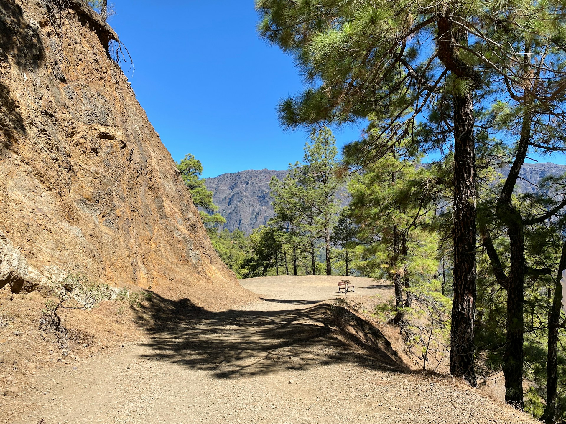
Winding Through Pine Forests and Ravines
The first descent from Mirador de Los Brecitos drops you right into thick pine woods. These towering Canary Island pines throw cool shade and dapple the trail with sunlight.
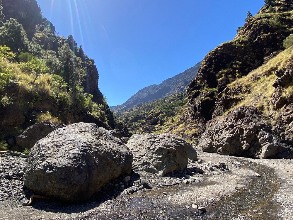
The path twists through several ravines that ancient rivers carved out. I noticed how the ground shifts from soft pine needles to sharp volcanic rock as you go.
Trail highlights:
- Canopy shade everywhere
- Wild rock formations for photos
- Stream crossings that need steady feet
- Trail markers show up often but not always when you want them
The ravines get deeper the further you go. Sometimes you’ll scramble over boulders or pick your way across loose gravel.
Water flows in these channels when it rains. In dry months, you’ll find mostly empty riverbeds with the occasional pool.

Cascada de Colores: The Iconic Waterfall
Cascada de Colores might be the caldera’s most famous spot. The waterfall gets its name from the wild mineral colors streaking the rock—orange, red, yellow, you name it.
You’ll reach the Cascada de Colores waterfall after a short detour off the main trail. I took the 15-minute walk and honestly, it was worth every step for the photos alone.
Water flow changes a lot with the seasons:
- Wet season (November-March): Water rushes down in full force
- Dry season (June-September): Sometimes just a trickle
The best colors pop in midday sunlight. A small pool at the bottom is perfect for cooling your feet, though the water stays icy all year.
Taburiente Beach and Playa de Taburiente
Taburiente Beach sits right in the caldera’s heart, nowhere near the sea. It’s a sandy, flat spot that earned its “beach” name from the light volcanic sand.
At Playa de Taburiente, the ground finally levels out. I always take a long break here—snacks, photos, maybe even a quick nap.
You’ll find:
- Soft volcanic sand for lounging
- Mountains in every direction
- Usually a stream nearby
- Natural shelter from wind thanks to the cliffs
Pine trees cluster around the edges for shade. The center stays open, so you get big, unobstructed views.
The stream runs clear and cold. I always treat the water before drinking, just to be safe.
Campgrounds and Rest Areas
The official campsite near Playa de Taburiente needs a permit from the park office. Facilities are basic: composting toilets and not much else.
Camping rules:
- Maximum stay: 2 nights
- Groups up to 8 people
- No fires allowed
- Pack out everything you bring
I spotted a few unofficial rest spots with flat ground and easy water access. They’re fine for daytime breaks, but overnight camping is only okay at the official site.
The campsite hides among the pines, so you’re shielded from wind. There are water taps with treated drinking water, but I’d still bring a backup filter.
Stone walls outline tent platforms to keep the ground healthy. Each platform fits a couple of tents, depending on size.
Biodiversity Encountered Inside the Crater
Caldera de Taburiente hosts some wild plant communities that shift as you move up or down. Endemic birds also call this volcanic landscape home, making it a haven for nature lovers.
Rare Flora and Vegetation Zones
Plant life changes fast as you descend from the rim to the valley. Thick Canarian pine forests dominate the upper slopes above 1,200 meters.
These pines handle volcanic soil like pros. Their bark shrugs off fires, and their needles pull moisture right out of the fog.
Lower down, laurel forests take over in the damper areas. These ancient woods are leftovers from when southern Europe looked a lot like this, millions of years ago.
Tree heather grows everywhere at middle elevations. Inside the crater, some of these shrubs tower over four meters high.
On the valley floor, the vibe shifts again. Riparian plants crowd the streambanks—willows, rare herbs, and other species you just won’t see anywhere else.
Endemic species I spotted:
- Echium wildpretii (tower of jewels)
- Aeonium succulents clinging to rock faces
- Crambe plants with their odd white flowers
Fauna and Birdwatching Opportunities
The crater’s laurel forests shelter some truly unique birds you won’t find anywhere else. Bolle’s pigeon and the laurel pigeon both call these misty woods home.
I remember stopping in my tracks, listening to their odd, echoing calls filter through the morning fog. These pigeons exist only in the Canary Islands, and sadly, they’re endangered.
You’ll probably spot the Canary Islands chiffchaff darting along the trails. This little yellow-green bird seems almost fearless, hopping near hikers and flitting from branch to branch.
On the rocky slopes, Berthelot’s pipit builds its nest. I watched a few pairs busy with their routines, their brown, streaky feathers blending perfectly with the volcanic stones.
Keep an eye out for the Canarian ravens. These birds are bigger than the usual European raven and sometimes glide above the rim, keeping an eye on hikers—probably hoping for a snack.
Once night falls, Canarian owls take over the pine forests. I rarely caught a glimpse, but their eerie calls echoing through the darkness made camping inside the crater feel like an adventure straight out of a storybook.

Essential Tips for a Safe and Memorable Hike
Getting ready for a hike here isn’t just about excitement—it’s about being smart. The right gear, a little planning, and a lot of respect for the landscape go a long way.
Equipment and Packing Guide
I always bring more water than I think I’ll need. The volcanic ground just soaks up the sun, and it’s shockingly easy to get dehydrated, even when it feels cool.
Walking boots are non-negotiable. I learned this the hard way after trying to hike in regular sneakers, slipping and sliding over loose rock.
Weather can turn on a dime up here. I pack layers for those surprise temperature drops, and I never forget sunscreen—those exposed ridges will catch you off guard.
Here’s what I never leave behind:
- Water: 3-4 liters per person if I’m out all day
- Sturdy hiking boots with ankle support
- Sun hat and sunscreen (SPF 30+)
- Warm layer for chilly spots at elevation
- Rain jacket because the weather is unpredictable
- First aid kit—blisters happen
- Headlamp for early mornings or if I get caught out late
Navigation and Marked Trails
Trails wind through Caldera de Taburiente, and they’re impressively well-marked. I always stick to the official paths—it’s safer, and honestly, it’s the best way to protect these fragile habitats.
I always check the weather before heading out. Wet volcanic rock turns slick fast, and landslides can happen, especially in winter.
The main path down into the caldera is comfortable to follow, with clear signs at every viewpoint. I make a habit of letting someone know my route and when I plan to be back.
In wet weather, landslide-prone spots need extra caution. The ground just doesn’t hold up when it’s soaked—no hike is worth risking it.

Conservation and Responsible Hiking
I always stick to the park’s strict rules to help protect this incredible UNESCO Biosphere Reserve. No fires—seriously, none—are allowed anywhere here.
Camping? You can only set up in the areas the park designates. Before I plan any overnight trip, I double-check with the park rangers about which zones are currently open.
Swimming at La Playa de Taburiente feels amazing after a tough hike, but you can’t use soap in the water. I get it—the mountain streams are so clear, it’d be a crime to mess them up.
I leave every plant, rock, and animal right where I find them. Taking endemic species out of the park isn’t just against the rules—it actually harms this rare ecosystem.
Bringing in outside plants or animals? Not a chance. I make sure to clean my boots before I go in, just in case I’ve picked up seeds or bugs that don’t belong.