When hurricane season hits the American East Coast from June through November, I start daydreaming about a quieter place across the Atlantic. Europe only gets about two ex-hurricanes a year, usually between August and November, so Croatia suddenly seems like the dream escape from America’s wild hurricane season.
While folks in the U.S. nail plywood over windows and rush inland, Croatia basks in Mediterranean sunshine. There’s barely a hint of storm drama here.
Honestly, the difference is huge. Having survived my share of hurricane seasons, I’ve realized Europe’s relationship with tropical storms feels almost alien compared to North America’s. Croatia, hugging the Adriatic Sea, sits comfortably outside the hurricane zones that torment the Caribbean and the U.S. coast.
Ever wonder why Europe dodges most hurricanes? It comes down to ocean temperatures, wind patterns, and geography. I’ll dig into how climate change could shake things up, how forecasting varies on each side of the Atlantic, and why Croatia stands out as such a safe bet during those wild American months.
Why Croatia Stands Out as an Escape During Hurricane Season
Croatia gives American travelers a steady Mediterranean haven just when Atlantic hurricanes threaten their usual beach getaways. The country’s tucked away in southeastern Europe, far from cyclone breeding grounds, but still warm and inviting.
Geographical Advantages of Croatia
Croatia’s home in the Mediterranean basin, thousands of miles from where hurricanes get their start. Tropical cyclones basically skip this place—data puts their frequency at just 2.31% compared to global averages.
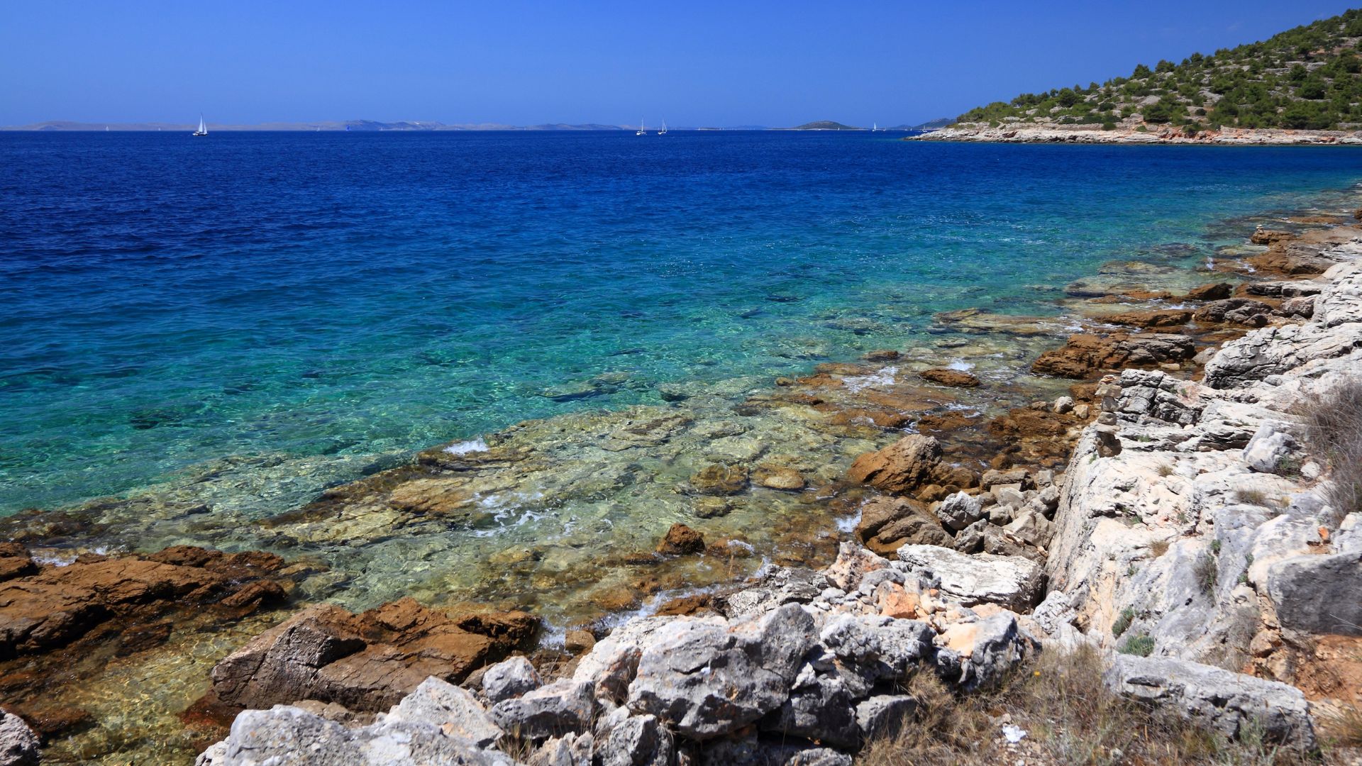
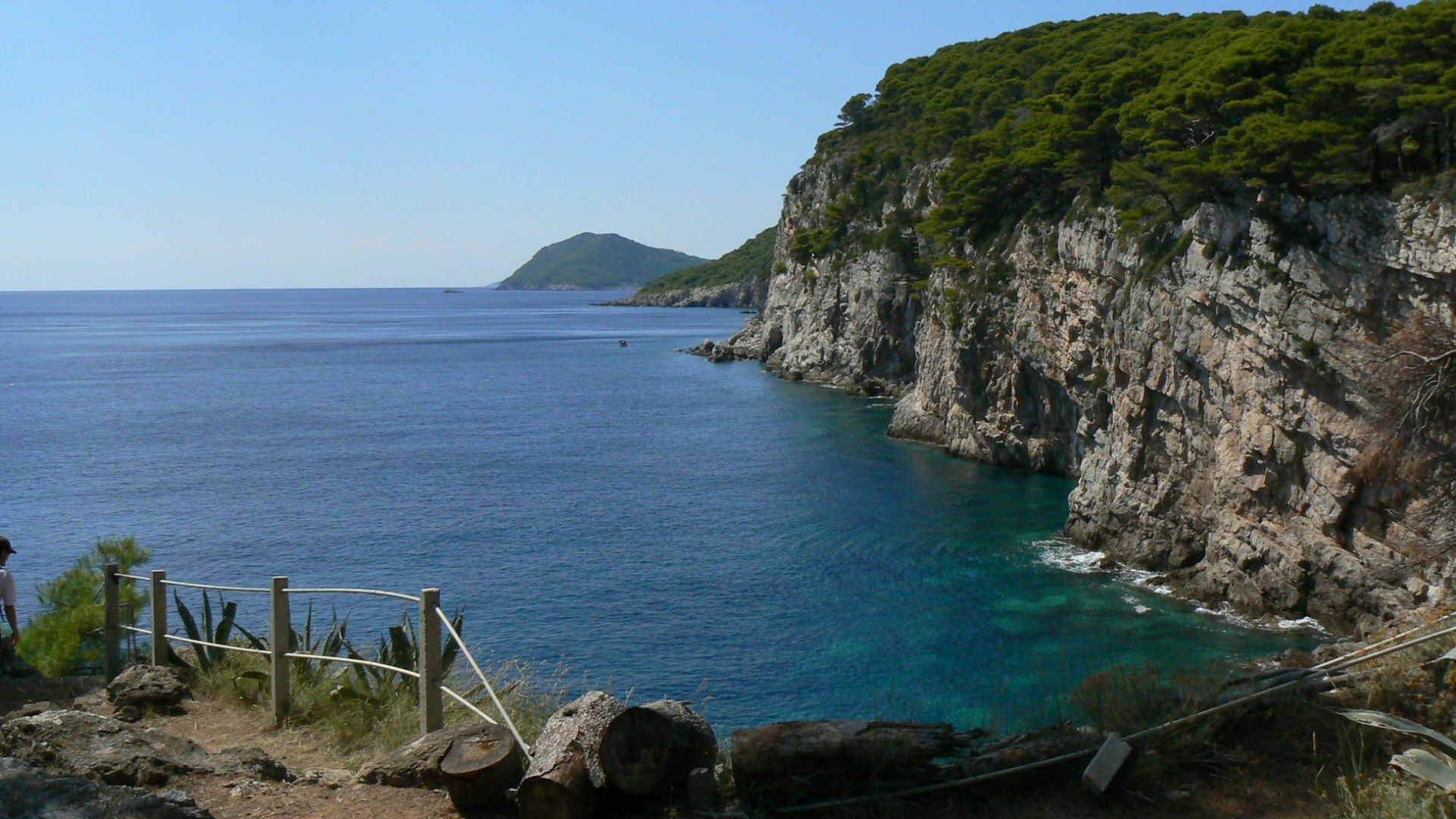
The Adriatic Sea stays calm and warm, but you won’t find the wild weather that powers Atlantic storms. Croatia’s location keeps it safe from the hurricane tracks that batter the Caribbean, Gulf Coast, and Eastern Seaboard.
Why Croatia stays safe:
- Far from tropical storm birthplaces
- Predictable Mediterranean weather
- No hurricane landfall history
- Sheltered Adriatic shoreline
Sure, you’ll get the odd summer thunderstorm. But they’re quick, and nothing like the drawn-out chaos a hurricane brings.
Comparing Croatia and Typical Hurricane-Prone Destinations
During hurricane season in North America, places like Florida, the Bahamas, and Mexico brace for trouble. I’ve seen how these storms can wreck travel plans and put a damper on the fun.
Croatia offers similar perks, minus the weather stress.
| Hurricane-Prone Areas | Croatia Alternative |
|---|---|
| Florida beaches | Dalmatian Coast |
| Caribbean islands | Croatian islands |
| Cancun resorts | Split and Dubrovnik |
| Bahamas cruises | Adriatic sailing |
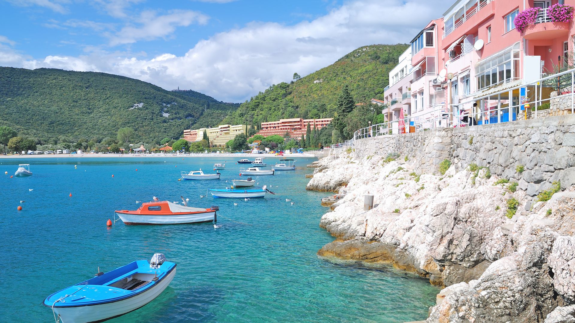
The Croatian coast boasts clear blue water, ancient cities, and mouthwatering Mediterranean food. Summer temps float between 75–85°F, so you’re getting the classic vacation vibe.
When hurricanes peak in the U.S. (August–October), Croatia’s weather is at its best. The timing couldn’t be better for Americans looking to escape hurricane threats.
Appeal for American Travelers
Americans find Croatia mixes European flair with comforts that feel familiar. The country’s poured resources into tourism, so you can expect high standards.
Direct flights from major U.S. cities make travel easier than you’d think. Croatia’s reputation as a premium destination means you’ll find quality hotels and services that won’t disappoint.
Why travel feels easy here:
- No hurricane evacuations
- Steady booking conditions
- Predictable, sunny weather
- Fewer cancellations
Croatia’s tourism peaks during hurricane months, so everything’s open and lively. I’ve noticed travelers love the reliability—when you’re spending big on a trip, you want some certainty.
You’ll find everything from lazy beach days to wandering through old towns and hiking in national parks. The best part? You don’t need to check the weather every hour.
Hurricane Season Overview: Europe vs. North America
Europe barely sees direct hurricanes—just a couple of ex-hurricanes a year, mostly between August and November. North America, on the other hand, faces 14 named storms every season, each with its own personality.
Tropical Cyclones and Post-Tropical Cyclones in Europe
Europe doesn’t get classic hurricanes. Instead, we see the leftovers—remnants that lost steam crossing the Atlantic.
Since 2000, about 30 hurricane remnants have reached European shores, usually in late summer and fall.
The busiest months for hurricane leftovers are:
- August: Early arrivals
- September: Most active
- October: Late season
- November: Rare stragglers
Hurricane Ophelia in 2017 stands out. It slammed Ireland with winds up to 156 km/h, knocking out power for 360,000 people.
Scientists warn that by 2100, Europe might see 13 hurricane-force wind events a year—currently, it’s just two.
The Mediterranean also creates “Medicanes”—mini hurricane-like storms that seem to be popping up more often as the sea warms.

Frequency and Impact of Hurricanes in North America
North America gets hammered by hurricanes. The Atlantic Basin averages 14 named storms each season, which runs from June to November.
Of those, about 7 become hurricanes (winds over 74 mph), and three usually turn into major hurricanes (Category 3+).
| Storm Type | Average Per Season | Wind Speed |
|---|---|---|
| Named Storms | 14 | 39+ mph |
| Hurricanes | 7 | 74+ mph |
| Major Hurricanes | 3 | 111+ mph |
The season peaks between August and October, with September being the busiest.
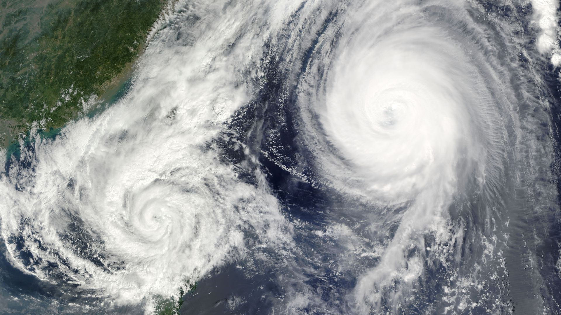
Hurricanes need warm water, low wind shear, and a bit of atmospheric chaos—all things North America offers up every year.
The costs? They’re staggering. Hurricanes cause billions in damages and change lives in a heartbeat.
Storm Path Differences Across Continents
Storm tracks explain why North America takes the brunt. Hurricanes form off Africa, then follow the trade winds west toward the Americas.
Most storms hit North America head-on. By the time any leftovers reach Europe, they’ve traveled thousands of miles and lost their punch.
Warm ocean water keeps storms strong. The Gulf of Mexico and western Atlantic are bathwater-warm during hurricane season, but European seas are much cooler.
Storm path basics:
- North America: Direct hits from warm Atlantic
- Europe: Only gets weakened remnants
- Intensity: Drops fast over cold water
Wind patterns matter too. The jet stream sometimes nudges dying storms toward Europe, but by then, they’re shadows of their former selves.
The Coriolis effect also shapes their paths. Hurricanes curve northward as they travel, which is why they rarely make it across the pond at full strength.
How Hurricanes Affect Europe: Myths and Realities
A lot of people think Europe never sees hurricanes, but that’s not quite true. While direct hits are rare, old tropical storms sometimes limp onto European shores after a long journey.
The Science of Hurricane Recurvature Toward Europe
Most hurricanes form in the tropical Atlantic and head west. Sometimes, though, a storm gets caught by the jet stream and curves back toward Europe.
As these storms hit colder Atlantic waters, they start to unravel. By the time they reach Europe, they’re no longer true hurricanes—meteorologists call them post-tropical cyclones.
What changes along the way:
- The eye disappears
- Warm and cold fronts form
- Winds weaken
- The storm becomes extratropical
On average, about two of these post-tropical cyclones reach Europe each year. Some years, none; others, five or more.
The ones that hang onto their tropical traits tend to pack the biggest winds.
Role of the Tropical Atlantic and Atlantic Temperatures
The number of hurricanes that end up in Europe depends on what happens in the tropical Atlantic. More Atlantic hurricanes mean more chances for storms to curve east.
Warm Atlantic waters fuel busy hurricane seasons. Scientists use climate patterns like El Niño to guess how wild the season might be.
What affects Europe’s risk:
- Total Atlantic hurricane count
- Sea temperatures in the tropics
- Jet stream routes
- Wind shear over the Atlantic
Climate change could mean more storms make it across. Warmer water gives hurricanes more staying power.
Still, the science isn’t settled. Models don’t always agree on what’s coming.

Case Studies of European Hurricane Impacts
Hurricane Ophelia (2017) is the poster child for a storm making it to Europe. It started as a Category 3, then lost steam before hitting Ireland and the UK, but still caused chaos.
Other notable storms:
- Hurricane Katia (2011): Took the classic eastward path
- Ex-Hurricane Ophelia (2017): Widespread damage in Ireland and the UK
- A handful of unnamed storms: Regular, but less dramatic, visits
Only about 1% of European storms are post-tropical cyclones, but they’re responsible for 8% of the region’s dangerous wind events.
These storms usually show up between August and October, right when the Atlantic is most active.
Europe gets a severe storm from a post-tropical cyclone about once every five years, on average.
Forecasting Storms: European and American Predictive Approaches
Meteorologists on both sides of the Atlantic use different tricks to track storms. Europeans focus on long-range accuracy, while Americans want fast updates and detailed regional forecasts.
European Weather Models vs. American Models
The European Centre for Medium-Range Weather Forecasts (ECMWF) has set the bar for hurricane tracking. Their Integrated Forecasting System (IFS) used to outshine American models.
Main differences:
- Europe: Looks at global weather patterns
- U.S.: Zooms in with high-resolution data
That gap’s closing fast. New American FV3-based models now rival the European system in accuracy.
The Global Forecast System (GFS) is America’s main tool, updating four times a day. The European model updates twice daily.
Recent upgrades like the Hurricane Analysis and Forecast System (HAFS) have really improved U.S. forecasting. Now, both sides are pretty evenly matched.
Both models use powerful computers. The real difference is in the math behind the scenes.

Contributions of the University of Reading
The University of Reading is a big player in European weather research. Their meteorology team works closely with ECMWF to make storm forecasting better.
Researchers here study how tropical cyclones form and move, especially as they approach Europe.
They help create better models through data analysis and clever algorithms. Their work tweaks the math that powers forecasts.
Reading also trains up-and-coming meteorologists. Many grads end up at weather services across Europe.
They’re not just about forecasting, either. The team digs into how climate change could affect storms in the future.
Forecasting Tools and Technology Including Apps
Modern storm tracking uses all sorts of data—satellites, ocean buoys, even planes flying into storms.
Popular apps for travelers:
- Windy: Real-time European model data
- Weather Underground: Combines different models
- MyRadar: Radar and satellite images
Pros use more advanced tools, and the full European model data can cost a fortune.
Apps give us the highlights, turning complex data into simple graphics.
Most apps update every 6–12 hours. The pros get fresh data within minutes.
Machine learning is starting to spot patterns humans might miss, adding another layer to forecasting.
With both European and American strengths, today’s forecasters have the best tools ever.
Climate Change and the Future of Hurricane Risks in Europe
Climate change is warming up North Atlantic waters, letting hurricanes keep their power over longer distances. Scientists think Europe could see more intense storms and sudden surges as these patterns shift.
How Climate Change Influences Storm Patterns
Warmer ocean waters have started to shake up how storms behave across the Atlantic. I’ve noticed hurricanes holding onto their energy for much longer as they drift toward Europe.
The North Atlantic keeps heating up, and that’s a big deal. Storms just don’t weaken as quickly anymore. Hurricanes that form near America? They often stay powerful all the way east.
Climate models keep hinting at changes in where storms hit and how intense they get. If you’re in Northwestern Europe, you might want to pay attention—this region faces a rising risk of storm activity in the years ahead.
Ocean temperatures also nudge the jet stream around. Sometimes, these shifts push hurricanes along paths that would’ve seemed odd a few decades ago.

Trends in Rapid Intensification
Let’s talk about rapid intensification—it’s happening more often these days. I’ve seen hurricanes ramp up in strength in just a day.
Take Hurricane Erin in August 2025. It shot up from Category 1 to Category 5 in only 24 hours. That kind of leap creates storms that are tough to predict and even harder to prepare for.
Warm waters are the main culprit here. When hurricanes pass over especially hot patches of ocean, they can turn into “super storms” almost overnight.
Then there’s La Niña. Mix that with warming seas, and you get a recipe for storms that are not only more intense, but also stick around longer.
Scientists expect rapid intensification to become even more common. Honestly, that makes forecasting storm strength—and getting ready for what’s coming—a real challenge.
Potential Changes to Hurricane Season in Europe
So, Europe isn’t really known for hurricane seasons the way America is. Still, with climate change shaking things up, more ex-hurricanes seem to be making their way across the Atlantic—often packing a surprising punch.
I’ve noticed storms are showing up on European shores a lot more often these days. They don’t exactly qualify as full-blown hurricanes, but honestly, they bring way more muscle than your average European storm.
You might see the timing of storm activity shift, too. What used to be a winter thing? Well, now it’s starting to feel like the Atlantic hurricane season is stretching its influence further east.
Here’s what stands out:
- Ex-hurricanes are popping up in Europe more frequently
- Storms are hanging onto stronger winds by the time they arrive
- Dangerous weather seems to stick around longer than before
- Old seasonal patterns? They might not mean much anymore
If you’re anywhere near the coast, you’ll want to pay extra attention. These changing patterns mean storm surges and wind damage could really ramp up in some areas.