So, I stumbled across what might just be California’s most underrated gem, tucked way up in the northeastern corner of the state. Here, bubbling mud pots and steaming vents paint a landscape that honestly gives Yellowstone a run for its money.
Lassen Volcanic National Park serves up an unreal geothermal wonderland. Four types of volcanoes, crystal-clear alpine lakes, and over 150 miles of hiking trails—all without those shoulder-to-shoulder crowds you get at the “big” parks.
My own adventure across this 106,000-acre volcanic playground took me from the summit of Lassen Peak, which stands at a breezy 10,457 feet, all the way down to the colorful hydrothermal areas of Bumpass Hell. I wandered boardwalks above boiling springs and sulfur vents.
Every turn surprised me. One minute, I’d be in dense forest, the next at a tranquil lake, then suddenly staring up at a volcanic peak or walking on painted dunes left behind by ancient eruptions.
If you’re plotting your first trip or just hunting for the best trails, I’m sharing everything I picked up while exploring this wild, underrated destination. From geothermal hotspots and epic hikes to camping tips and where to spot wildlife, here’s what you need to plan your own bubbling, steaming escape in California’s volcanic wonderland.

Geothermal Marvels and Volcanic Wonders
Lassen Volcanic National Park just brims with active geothermal features. Bubbling mud pots, steaming fumaroles, and those bold volcanic peaks are everywhere.
The park’s two main hydrothermal areas really show off the underground action, while different volcanic formations hint at a rowdy, explosive past.
Signature Hydrothermal Features: Bumpass Hell and Sulphur Works
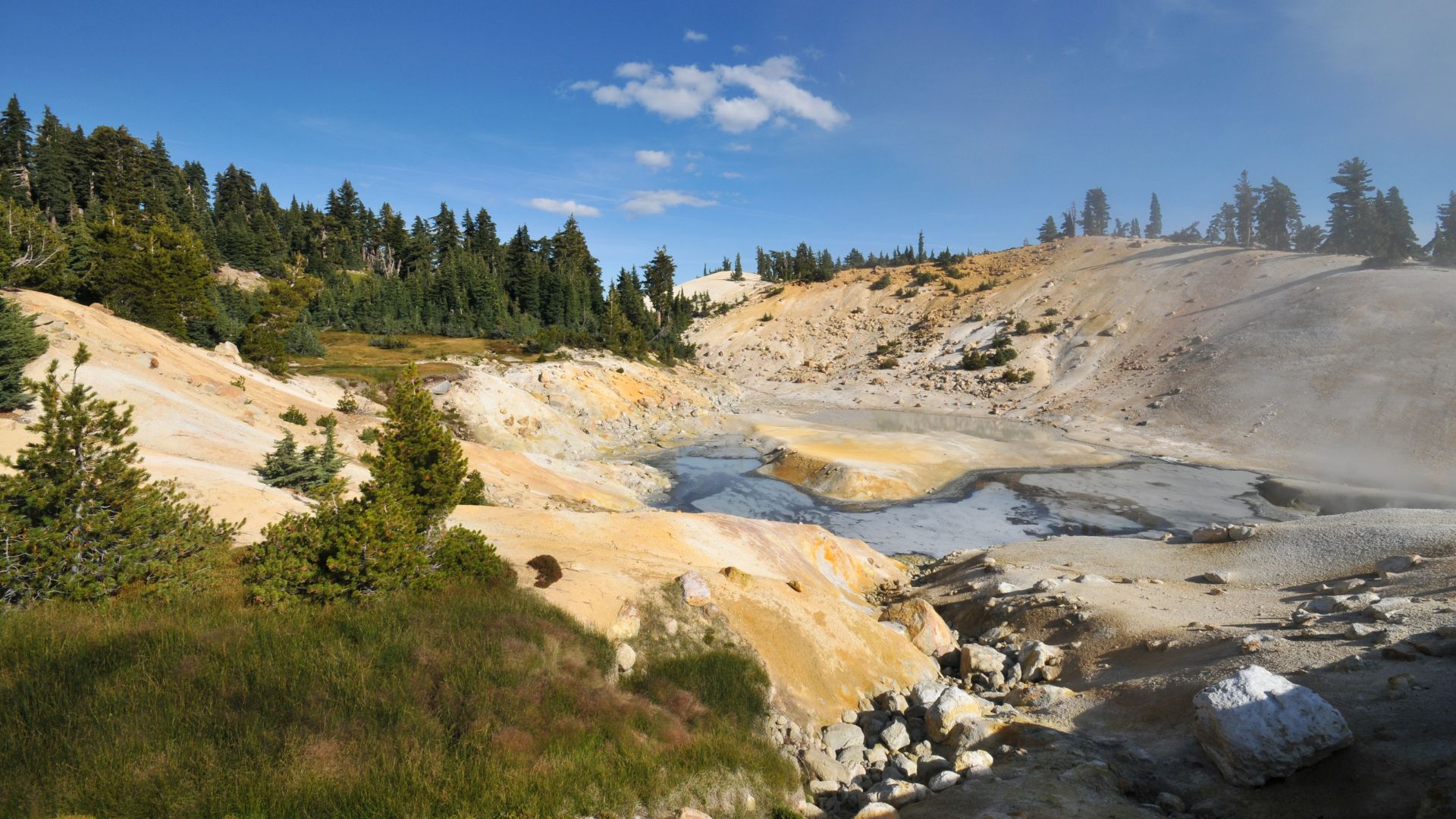
Bumpass Hell is the park’s showstopper—sixteen acres packed with boiling springs, mud pots, and steam vents. You can really feel the energy here.
I followed the boardwalk trail that snakes through this steamy zone. Springs can get up to 196°F—no joke. The sulfur smell? You’ll notice it before you even see the steam.
Sulphur Works sits right off the main park road, so it’s a breeze to reach. This smaller area features:
- Active fumaroles shooting out steam and gases
- Mud pots bubbling away
- Steam vents puffing year-round
- Sulfur deposits painting the rocks yellow
Magma chambers deep below keep both these places lively. Every day, geothermal activity keeps shifting and shaping the land.
Mud Pots, Fumaroles, and Steam Vents
The mud pots here are something else. Acidic water mixes with volcanic rock, and you get these thick, bubbling clay pools that almost look alive.
Fumaroles vent steam and volcanic gases straight from cracks in the ground. Some hit 200°F or more. The constant clouds of steam make the whole place feel a bit surreal.
You’ll spot steam vents not just in the main thermal zones but all over—sometimes right beside a trail or up near a volcanic peak. The underground system here? It’s massive.
Seasons change the show. Winter snow makes the steam even more dramatic, while in summer, you see more of the rocks and minerals.
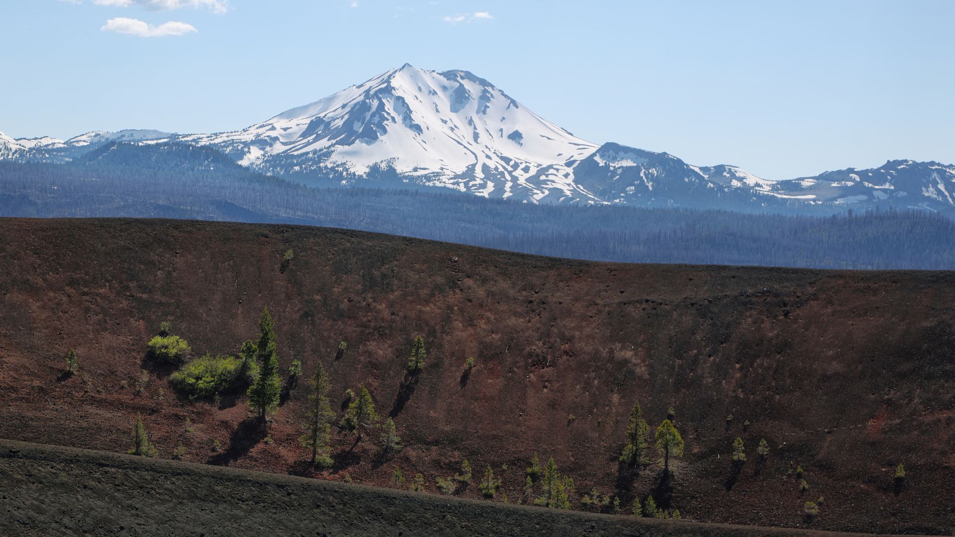
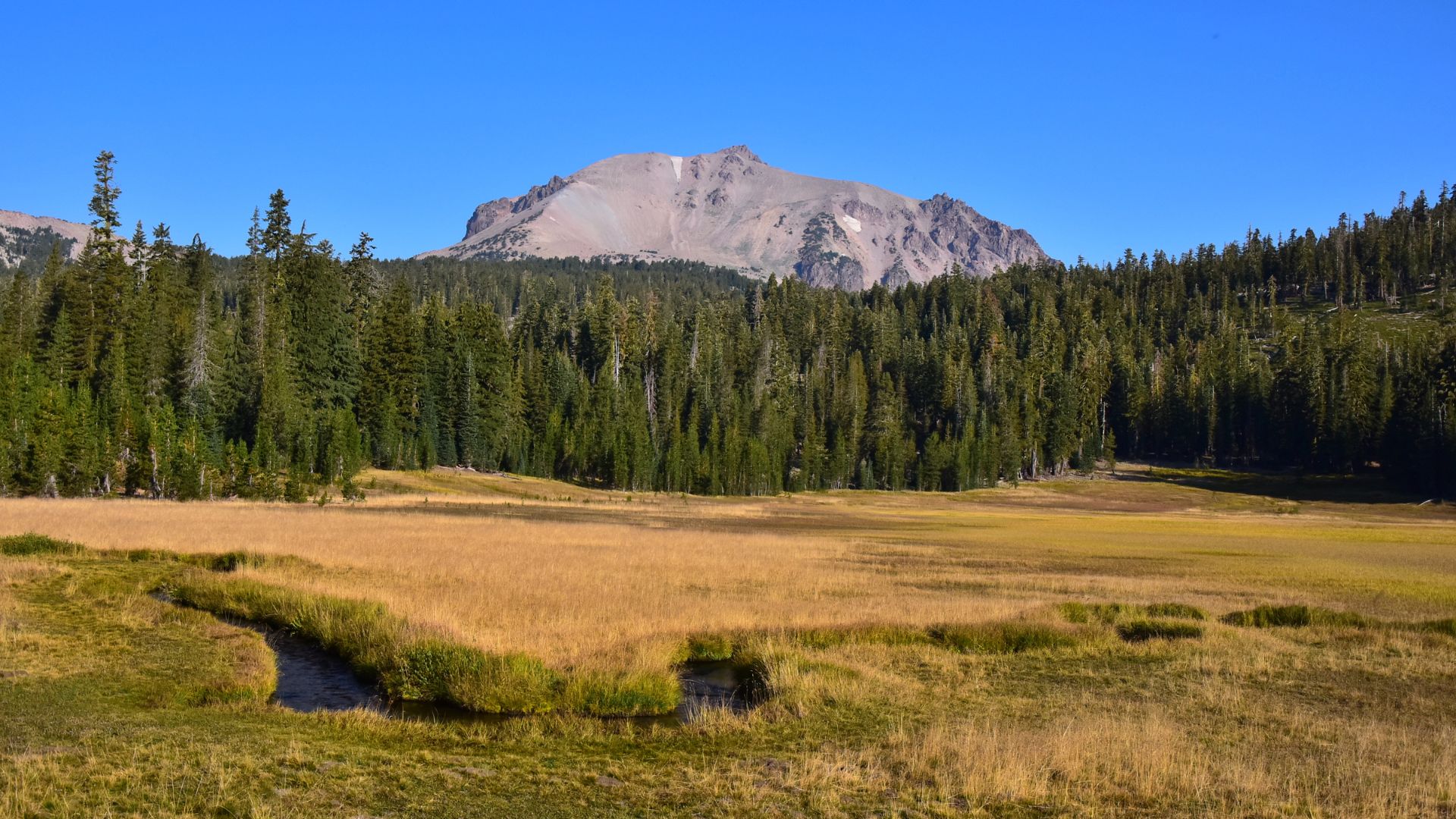
Active Volcanoes and Volcanic Peaks
Lassen Peak steals the spotlight as the world’s biggest plug-dome volcano. It last erupted between 1914 and 1917, so in volcanic terms, that’s pretty recent.
Thick lava pushed up through the crust to build this mountain. Instead of a classic cone, Lassen Peak has a big, rounded dome—thanks to all that slow-moving lava.
Cinder Cone is a totally different story. Explosive eruptions built this 750-foot cone, scattering volcanic debris everywhere. The nearby Painted Dunes? Those wild colors come from volcanic ash.
Mount Harkness and Prospect Peak add even more drama to the skyline. Each peak tells a different story about volcanic growth and erosion over thousands of years.
The whole park sits in the Cascade Range, where volcanic activity is still a thing. Magma chambers underfoot keep fueling the geothermal features I saw all over the place.
Epic Hiking Trails and Volcanic Landscapes
Hiking in Lassen gets you right up close to bubbling geothermal spots, volcanic summits, and waterfalls. Every trail feels a little different—sometimes you’re walking through steam, sometimes across colorful dunes.
Bumpass Hell Trail Experience
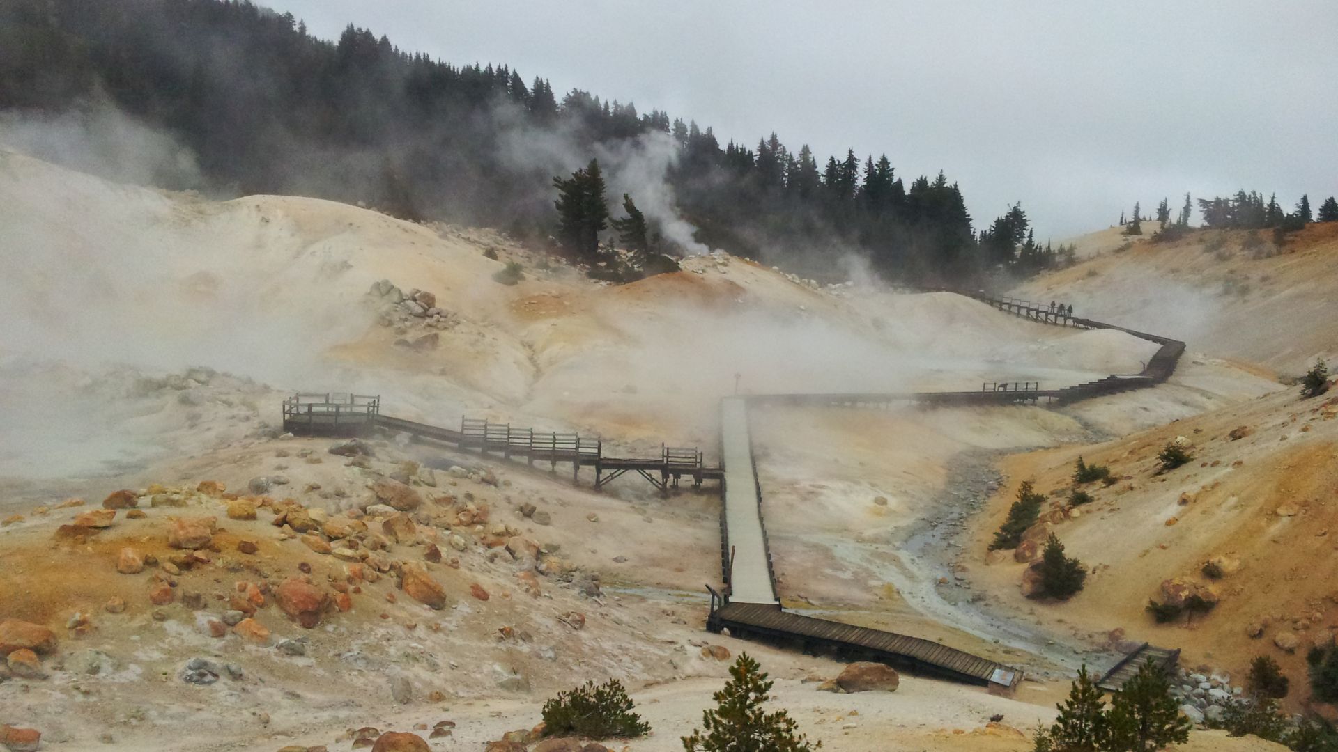
I dove right into Lassen’s volcanic heart with the Bumpass Hell Trail. It’s a 3-mile round trip and leads you straight to the park’s biggest geothermal area.
Boardwalks wind over bubbling mud pots and steaming fumaroles. The colors and smells here? Honestly, it’s like stepping into another world—kind of Yellowstone vibes, but with fewer people.
Key Features:
- Distance: 3 miles round trip
- Elevation gain: 300 feet
- Difficulty: Easy to moderate
The trailhead sits right off the main road. As I got closer, the sulfur smell really ramped up.
Steam curls up from vents all across the valley floor. The boardwalks keep you safe while letting you get close to the action.
Lassen Peak: Summit Trails and Panoramic Views
The Lassen Peak Trail is a real leg-burner, but totally worth it. It’s a 5-mile round trip with a 2,000-foot climb.
I started early to dodge the afternoon thunderstorms that love to roll in during summer. The trail switchbacks through different zones, and you can feel the air thinning as you climb.
Trail Stats:
- Distance: 5 miles round trip
- Elevation gain: 2,000 feet
- Summit elevation: 10,457 feet
From the top, the views blew me away—Mount Shasta to the north, Sierra Nevada to the south.
Snow often hangs on up here until July. I brought extra layers because it gets chilly, even in summer.
Cinder Cone Trail and Painted Dunes
The Cinder Cone Trail takes you right through some of Lassen’s wildest volcanic scenery. It’s a 4-mile round trip that crosses the Painted Dunes and then heads up the steep cinder cone itself.
Walking across loose volcanic sand is a workout—every step forward slips back a little.
The Painted Dunes are streaked with color from oxidized ash and cinders. The final climb up Cinder Cone is tough, but reaching the top feels epic.
What to Expect:
- Distance: 4 miles round trip
- Elevation gain: 850 feet
- Surface: Loose volcanic material
Up top, you get a great view of Snag Lake and the whole volcanic landscape. The crater at the summit is 175 feet deep.
Bring gaiters if you have them—volcanic sand loves to sneak into boots.

Waterfall Treks: Mill Creek Falls and Kings Creek Falls
Mill Creek Falls and Kings Creek Falls are a cool change of pace from all the volcanic stuff. These trails follow mountain streams through shady canyons.
Mill Creek Falls is a 3.4-mile round trip with moderate ups and downs. I followed the creek through thick forest to a 75-foot waterfall.
Kings Creek Falls Trail is 3 miles round trip and a bit steeper. The trail drops into a canyon, ending at a 50-foot waterfall that spills over volcanic rock.
Waterfall Comparison:
| Trail | Distance | Waterfall Height | Difficulty |
|---|---|---|---|
| Mill Creek Falls | 3.4 miles | 75 feet | Moderate |
| Kings Creek Falls | 3 miles | 50 feet | Moderate-Hard |
Both waterfalls put on their best show during spring snowmelt. I found late May through early July had the strongest flow.
The creeks here create little pockets of cool, lush greenery—totally different from the volcanic terrain up above.
Scenic Lakes, Meadows, and Outdoor Activities
Lassen’s twenty alpine lakes are ridiculously clear and perfect for swimming, fishing, or paddling around with a kayak. In summer, wildflower meadows explode with color, and come fall, the whole park glows with autumn leaves.
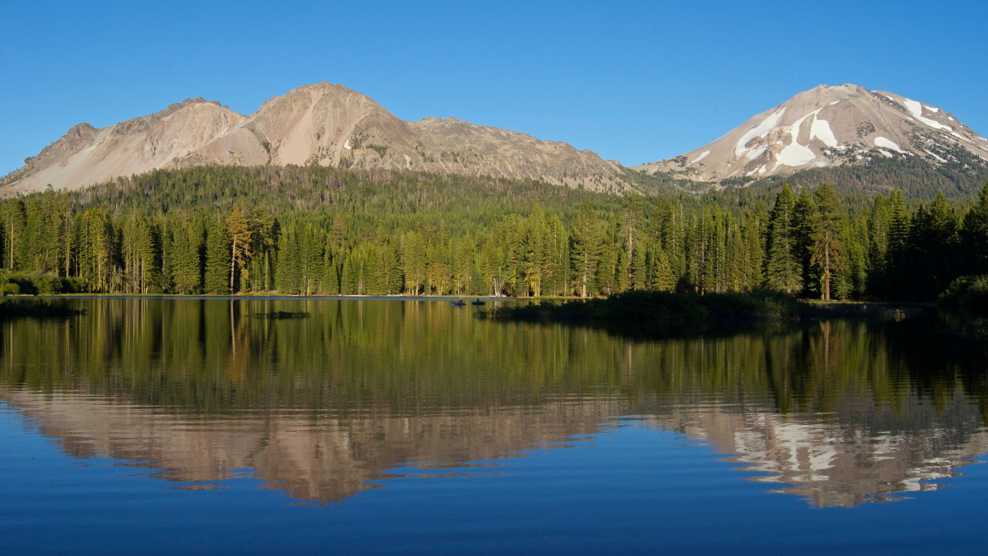
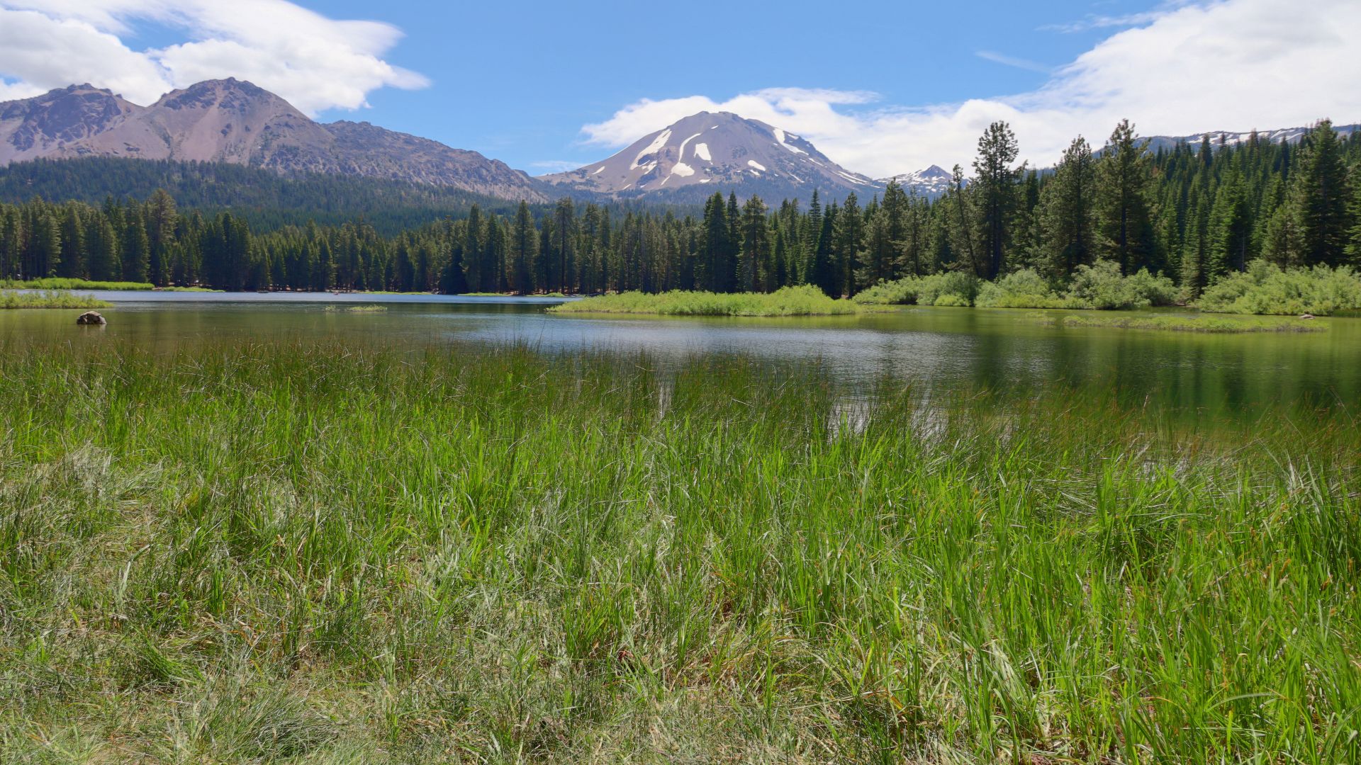
Manzanita Lake Adventures
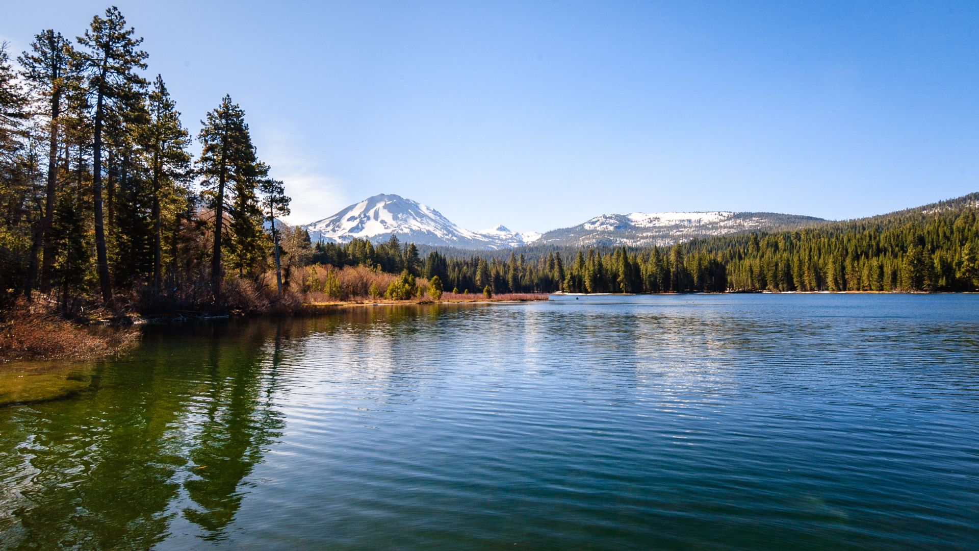
Manzanita Lake sits right by the north entrance and is probably the easiest lake to check out. There’s a 1.5-mile trail circling the shoreline through willows and pines.
The views of Lassen Peak and Chaos Crags reflecting in the water? Unreal, especially at sunset.
Wildlife love this lake. Ducks, geese, muskrats, beavers, and deer all show up.
Activities Available:
- Kayak rentals in summer
- Fishing for rainbow, brown, and brook trout
- Lakeside camping at Manzanita Lake Campground
- Photography and wildlife watching
The trail is flat and great for families. You’ll find picnic tables and fire rings all around the shore.
Alpine Lakes: Lake Helen, Juniper Lake, and Emerald Lake
Lake Helen is the only pure glacial lake in the park, sitting way up at 8,200 feet. It stays iced over most of the year—only in August and September does the deep blue water really shine.
It’s pretty deep, too—110 feet. Fun fact: it’s named after Helen Tanner Brodt, the first woman to summit Lassen Peak back in 1864. Snow sometimes blocks the road here until late summer.
Juniper Lake sits at 6,700 feet and is one of the park’s biggest lakes. The 6.8-mile Juniper Lake Trail winds through thick forest.
The campground at Juniper Lake is quiet and feels remote. Sunsets here are gorgeous. It’s a solid spot for fishing or a chilly swim.
Summit Lake is easy to reach from the road and stays pretty peaceful, even when it’s busy. Wetlands around the lake attract all sorts of migrating birds.
Boating, Kayaking, and Fishing
Most lakes in Lassen welcome non-motorized boats and kayaks. Only Manzanita Lake rents kayaks, and that’s just in summer.
Best Fishing Lakes:
- Manzanita Lake: Rainbow, brown, and brook trout
- Summit Lake: Rainbow trout and bass
- Juniper Lake: Rainbow and brown trout
- Butte Lake: Rainbow trout
If you have your own kayak or canoe, bring it for the more remote lakes. Calm water and mountain reflections make for perfect paddling.
Swimming is popular at Summit and Juniper Lakes in summer, but the water stays cold—just something to keep in mind.
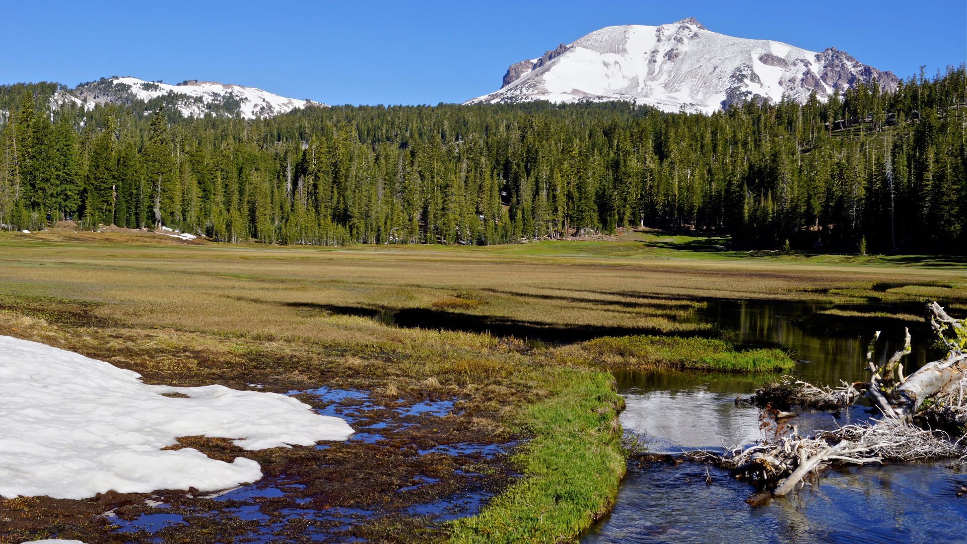
Wildflower Meadows and Fall Foliage
Wildflowers peak from July into August, turning the meadows into a riot of color. Bumpass Hell Trail and the areas near Summit Lake had the best blooms when I visited.
Common Wildflowers:
- Mountain lupine (purple spikes)
- Indian paintbrush (bright red)
- Mule ears (yellow, sunflower-like)
- Penstemon (purple tubes)
Fall colors start showing up in late September. Aspen groves go gold, and the meadows around Manzanita and Juniper Lakes really pop.
Higher elevations get fall colors first, usually early September. Down lower, it’s more like early October before the first snow sweeps in.
Camping, Campgrounds, and Visitor Essentials
Lassen has eight campgrounds with 375 total sites, plus two visitor centers where you can grab maps, permits, and info. Most campgrounds need reservations through Recreation.gov, and bear-proof storage is a must everywhere.
Manzanita Lake Campground and Summit Lake Campground Highlights
Manzanita Lake Campground is my go-to pick for first-timers. It’s right by the northwest entrance and has 179 sites for tents and RVs (up to 35 feet).
Amenities here are solid—dump station ($8), camper store, pay showers, and laundry. Most spots have picnic tables, fire rings, and bear lockers.
It’s a quick walk to the lake for fishing or kayaking, and several trailheads are nearby.
Summit Lake Campground splits into north and south loops. North stays open longer and fits RVs up to 30 feet. South is tent-only.
Both sections sit at 6,700 feet next to Summit Lake. I liked the cooler temps and mountain views. If accessibility matters, site A1 in the north loop is wheelchair-friendly.
Butte Lake and Warner Valley Campgrounds
Butte Lake Campground feels like the most remote spot you can camp in Lassen. You’ll find it tucked away in the park’s northeast corner, and you have to brave a 6-mile stretch of unpaved road to get there.
There are 101 sites here, and they allow RVs up to 35 feet. I noticed it was way less crowded than the other campgrounds, which was a relief. The sites sit right next to Butte Lake, so you can just walk over for a swim or try your luck fishing.
Warner Valley Campground is tiny—only 18 sites, and it’s tent-only. It sits at the very end of Warner Valley Road.
Getting there wasn’t easy; I had to drive 17 miles on a bumpy dirt road. But once you arrive, you’re close to hot springs and several hiking trails.
Despite the rough road, these sites fill up fast.
Camping Tips and Bear-Proof Containers
Every campsite comes with a bear-resistant storage locker. These metal boxes are about 4 feet by 3 feet by 2.5 feet—plenty of room for all your stuff.
I had to stash all my food, toiletries, and anything with a scent inside. The latch system took a second to figure out; you press the sides and lift the handle at the same time.
Don’t ever leave food in your car or tent. That’s just asking for trouble.
Essential items to store:
- All food and drinks
- Toiletries and sunscreen
- Trash and recycling
- Pet food
- Scented items like soap
Most campgrounds offer potable water, but Juniper Lake doesn’t. I always bring extra water when I camp there.
Flush restrooms are available at the main campgrounds, which is a nice bonus.
Visitor Centers: Kohm Yah-mah-nee and Loomis Museum
Kohm Yah-mah-nee Visitor Center is the main hub for info. You’ll find it at the southwest entrance, and it’s open all year. I stopped in for maps, permits, and the latest trail updates.
Inside, you’ll see exhibits about the park’s volcanic history. There’s a gift shop and a café if you need a snack or souvenir.
The parking lot even allows overnight camping for self-contained vehicles (for a fee, of course).
Loomis Museum sits near Manzanita Lake Campground. It focuses on the park’s photography history and volcanic features.
The museum opens seasonally, late May through October.
Both centers provide wilderness permits for backcountry camping. I always recommend popping in before heading out to the more remote areas.
Wildlife Watching, Photography, and Ranger Programs
Lassen is a dream for wildlife spotting. Black bears, deer, and more than 200 bird species call this place home.
The variety of landscapes makes it perfect for photography and stargazing. Ranger-led programs add a lot to the experience and help you understand the park’s ecosystem in a deeper way.
Spotting Black Bears, Deer, and Bird Species
I’ve found early mornings and late afternoons are best for wildlife. Black bears seem to wander out just as the sun comes up, especially around meadows and berry patches.
Prime Wildlife Locations:
- Manzanita Lake: Great for deer and waterfowl
- Juniper Lake: Black bears hang out here often
- Devastated Area: Birds really thrive in this spot
- Kings Creek Meadow: Perfect for deer sightings
Mule deer are everywhere. I usually spot them grazing in open meadows or hanging out along the trails. They’re not as jumpy as deer in other parks, so you can actually watch them for a while.
Bird lovers, you’re in luck. Over 200 species are here, including mountain bluebirds, Clark’s nutcrackers, and all kinds of hawks. Spring and summer bring the most variety.
If you want to get the most out of it, bring binoculars and always keep a safe distance. With black bears, stay at least 100 yards away—seriously.
Photography Hotspots and Stargazing
The volcanic landscape here gives you some wild photography opportunities. The hydrothermal areas are unlike anything I’ve seen elsewhere.
Top Photography Spots:
- Bumpass Hell: Steam vents and bubbling mud
- Emerald Lake: Mirror-like reflections
- Lassen Peak: Sweeping summit views
- Cinder Cone: Stark volcanic scenery
If you want that perfect shot, try early morning. The golden hour makes the steam from the geothermal areas look magical.
Stargazing here is unreal. With barely any light pollution and high elevation, you can see the Milky Way on clear nights.
A tripod helps a ton for both landscape and night sky shots. The variety of terrain means you’ll never run out of new angles.
Ranger-Led Activities and Educational Events
Rangers offer programs all year, and the topics change with the seasons. These free events cater to every age and interest.
Program Schedule:
- Summer: Tons of activities, longer hours
- Winter: Snowshoe walks and indoor talks
- Spring/Fall: Focus on wildlife and geology
I joined a few ranger walks, and they really deepened my understanding of the park’s geology and wildlife. Rangers share stories about volcanic eruptions and how everything connects.
You need to reserve your spot at least three weeks ahead. The popular programs fill up fast, so don’t wait too long.
Reservation Timeline:
- August-October programs: Reserve starting June 1
- January-March programs: Reserve starting November 1
- May-July programs: Reserve starting February 1
Some evening programs include stargazing. Rangers use telescopes and laser pointers to point out constellations and planets—super cool if you’ve never tried it.
Seasonal Adventures and Travel Planning
Lassen Volcanic National Park changes with the seasons. From November through May, snow closes roads but opens up a whole new world of winter activities.
The two main highways give you access to different parts of the park, but what’s open and accessible depends a lot on the time of year.
Best Time to Visit Lassen
For full road access and the best hiking, I’d go between June and October. Summer days usually hit 70-80°F, and fall cools down to around 50-60°F.
Summer (June-August) is warm and all the trails are open, but it’s also the busiest and costs $30 per vehicle to get in.
Fall (September-October) is quieter and cooler—perfect for hiking without sweating buckets.
Winter (November-May) means deep snow and the main road closes. But the entrance fee drops to $10 per vehicle, which is nice if you don’t mind the cold.
Spring can be tricky. Snow lingers, and some trails stay closed longer than you’d expect.
Winter Sports: Snowshoeing and Cross-Country Skiing
When winter hits, Lassen turns into a snow playground. The park gets dumped on, making it ideal for snowshoeing and cross-country skiing.
I usually start at the Southwest Entrance by Kohm Yah-mah-nee Visitor Center, which stays open all year. You can rent gear here, too.
Snowshoeing is easy to pick up, and rangers lead guided walks on weekends during winter.
Cross-country skiing is better if you’re already comfortable on skis. The park grooms some trails, so you can choose your challenge.
For winter trips, I always pack:
- Warm, layered clothing
- Waterproof boots
- Sun protection (yep, you can get burned in the snow)
- Emergency supplies
Accessibility, Picnic Areas, and Safety Tips
Lassen tries to make things accessible for everyone. The Kohm Yah-mah-nee Visitor Center follows ADA standards, with accessible parking and restrooms.
Some trails, like parts of the Devastated Area Interpretive Trail, are also accessible. It’s a good idea to check current conditions before you go.
Picnic areas are scattered around:
- Manzanita Lake (tables and grills—classic setup)
- Summit Lake (killer mountain views)
- Butte Lake (usually quieter)
Safety tips? Always stick to marked trails, especially near the geothermal spots. Bring more water and food than you think you’ll need.
Let someone know where you’re hiking, and always check the weather. Cell service is pretty much nonexistent in most of the park, so plan ahead.
Travel Routes: Highway 36 and Highway 44
You’ll find two main highways that lead into Lassen Volcanic National Park, and honestly, each one has its own quirks and surprises.
Highway 36 comes up from the south and takes you straight to the Southwest Entrance. It’s open all year, which is a lifesaver if you’re visiting in winter or making the trip from Sacramento or San Francisco. I usually end up at this entrance when I’m chasing snow or just want a reliable route to the visitor center. Here’s my go-to spot for winter visits, by the way.
Highway 44 swings around to the north and drops you near Manzanita Lake. This entrance shuts down in the winter, which is a bit of a bummer, but in summer it’s perfect for camping and hiking. If you’re after those classic lakeside mornings, this is your road.
The main park road that links these highways? It closes for a big chunk of the year, usually from November to May, thanks to all the snow. When that happens, only the first few miles from either entrance stay open, so your exploring gets limited.
Still, both routes wind through some of the most dramatic volcanic scenery in northern California. The drives alone are worth it, even if you’re just passing through.