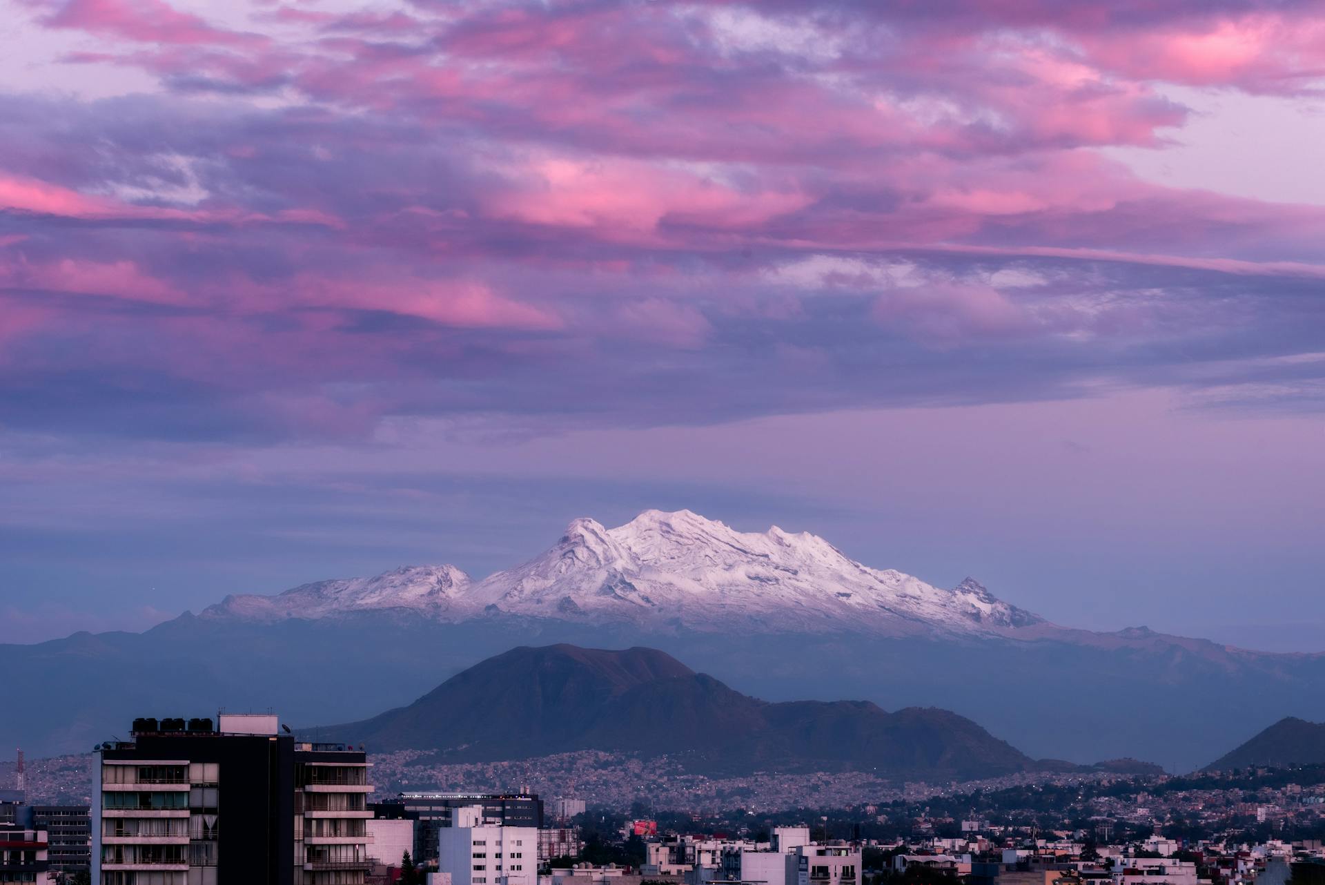
When you think of Mexico, do you picture endless beaches and lush resorts? I used to—until I found out that Mexico’s towering mountain ranges flip that image on its head. Mexico actually offers some of the world’s most accessible high-altitude climbing, with Pico de Orizaba shooting up to 18,491 feet just a few hours from Mexico City.
I’ve wandered among these volcanic giants that rise from the central plateau. They’ve offered me adventures that honestly rival anything you’d find in the Alps or Rockies. The country’s highest peaks aren’t just for climbers—they’re living museums, full of ancient stories and ecosystems that morph with every thousand feet you climb.
As I explored Mexico’s mountain regions, I found vibrant highland cities, indigenous communities that have thrived at altitude for generations, and volcanic landscapes that challenged everything I thought I knew about this country. From the snow-capped volcanoes of the Trans-Mexican Volcanic Belt to the cloud forests of Chiapas, these mountains completely redefine the Mexican experience.

High Altitude Landscapes That Define Mountain Mexico
Mexico’s wild topography throws up landscapes where snow-tipped volcanoes soar above 18,000 feet. Vast plateaus sprawl between rugged ranges.
These high-altitude environments boast volcanic peaks reaching over 5,000 meters. Deep canyons slice through the land, and valleys at altitude nurture ecosystems you won’t find anywhere else.
Notable Mountain Ranges and Peaks
Pico de Orizaba towers as Mexico’s tallest at 18,491 feet. This massive volcano marks the line between Puebla and Veracruz.
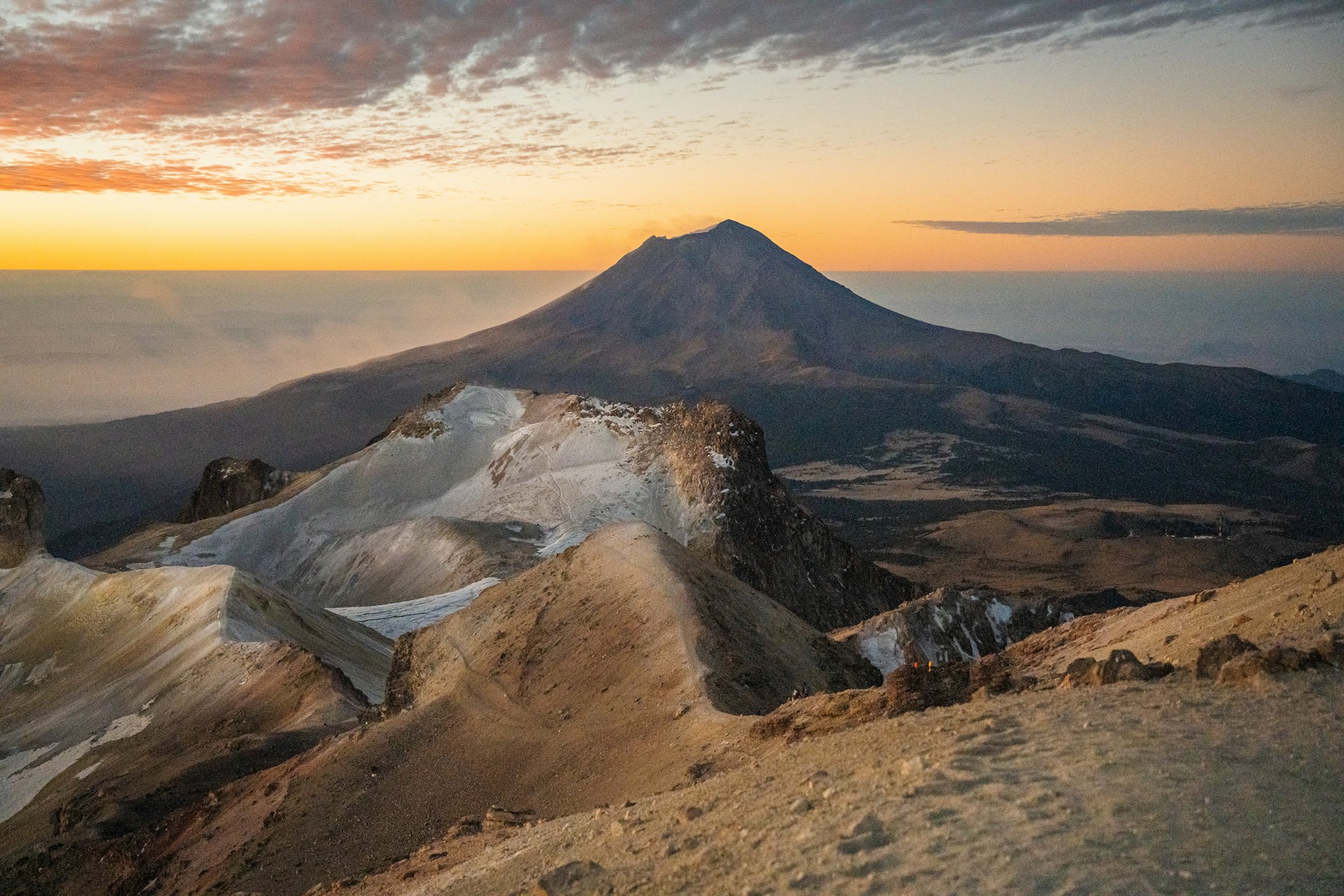
The Trans-Mexican Volcanic Belt hosts most of the country’s highest mountains. Volcán Popocatépetl climbs to 17,759 feet, and Iztaccíhuatl sits just behind at 17,103 feet.
The Sierra Madre Oriental hugs Mexico’s eastern edge. Cerro El Potosí stands out at 12,205 feet in Nuevo León.
Over on the west side, the Sierra Madre Occidental creates wild elevation swings, from sea level up past 10,000 feet.
Nevado de Toluca rises to 15,387 feet in central Mexico, with twin crater lakes that glimmer at the summit.
Three peaks in Mexico break 16,400 feet. Ten mountains climb past 13,123 feet, making the country a real paradise for high-altitude junkies.

Unique Geography: Valleys, Plateaus, and Canyons
The Mexican Plateau stretches across central Mexico, sandwiched between major ranges. It sits between 3,000 and 8,000 feet above sea level.
High valleys nestle between volcanic peaks throughout central Mexico, each one with its own microclimate.
Many valleys perch above 7,000 feet. The Valley of Mexico, where Mexico City sprawls, shows how people have adapted to life in these lofty basins.
The Copper Canyon system in Chihuahua carves out some of North America’s deepest gorges. Some canyons plunge more than 6,000 feet straight down.
Mountain-locked basins trap moisture, creating unique habitats. Pine and fir forests thrive in these cool, elevated spots.
Volcanic Features Shaping the Landscape
Active volcanoes still shape Mexico’s high country. Volcán Popocatépetl often sends ash plumes soaring over 20,000 feet.
The Trans-Mexican Volcanic Belt stretches for 600 miles across central Mexico. Fourteen peaks here break the 10,000-foot mark.
Nevado de Colima and Volcán de Colima make up a volcanic duo in the west, rising above 14,000 and 12,500 feet.
Volcanic action creates wild landforms up high—crater lakes, lava domes, and cinder cones pop up everywhere between the big peaks.
Volcanic soils here support farming, sometimes even above 8,000 feet. These fertile highlands feel worlds away from Mexico’s deserts.
Ancient lava flows built up the plateaus that now link the major volcanoes across central Mexico.

Iconic Volcanoes: Legends, History, and Adventure
Mexico’s volcanoes aren’t just piles of rock—they’re legends, adventure playgrounds, and the backbone of local culture. Popocatépetl and Iztaccíhuatl stand out as the country’s most famous volcanic pair, loaded with myth and challenge.
Popocatepetl and Iztaccihuatl: Myths and Cultural Significance
Their names mean “Smoking Mountain” and “White Woman” in Nahuatl. There’s a classic legend behind them.
Supposedly, a warrior named Popocatépetl fell in love with Princess Iztaccíhuatl. He went off to battle, and someone brought her false news that he’d died. She died of heartbreak before he made it home.
The Legend’s Impact:
- Popocatépetl carried her up the mountains
- He built her a tomb and kept an eternal flame burning
- The gods turned them into volcanoes
- Smoke still rises from Popocatépetl as he mourns
Indigenous groups saw these peaks as sacred. The Nahua and Mexica performed ceremonies here, believing gods lived inside the mountains.
Artists, writers, and musicians still pull inspiration from this story. You’ll spot these volcanoes in paintings and poems everywhere. They’ve come to symbolize eternal love and the bond between land and people.
Mountaineering and Volcano Exploration
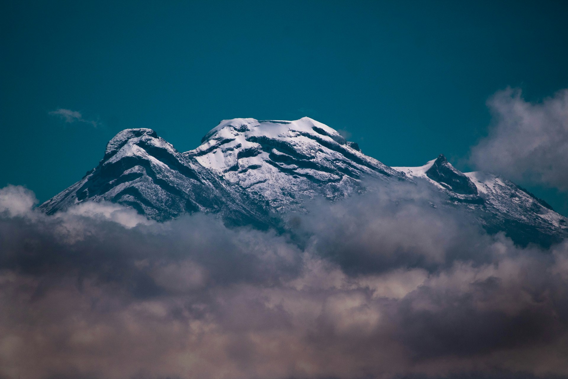
Iztaccíhuatl has become Mexico’s go-to mountaineering training ground. At 17,159 feet, it offers technical climbing without the danger of eruptions.
Most climbers kick off from La Joya base camp at 10,827 feet. The route climbs through pine forests and then opens up into alpine zones. The summit gives jaw-dropping views of Mexico City and the valleys below.
Popular Routes:
- La Arista: A classic path for beginners
- El Pecho: Some technical rock to keep things interesting
- Los Pies: A longer approach with old glacier remnants
Popocatépetl has stayed off-limits since eruptions ramped up in 1994. I’ve watched huge ash clouds billow up to 18,000 feet during some eruptions. Mexican authorities set up a 7-mile exclusion zone to keep people safe.
Professional guides run trips to both peaks during the dry season (November to March). You’ll need 3-5 days to get used to the altitude. Technical gear like crampons, ice axes, and ropes are a must for the upper slopes.
These volcanoes sit just 40 miles from Mexico City. That makes them surprisingly easy to reach for a weekend adventure. Every year, thousands try their luck on Iztaccíhuatl.
Geological Impact on Local Communities
Popocatépetl’s eruptions impact around 25 million people in central Mexico. Ash sometimes drifts all the way to Mexico City. I’ve seen airports shut down and people wearing masks for days.
The volcanic soil here grows some of the best crops around—corn, beans, fruit trees. Local farmers count on these rich fields.
Community Adaptations:
- Early warning systems keep an eye on volcanic activity
- Towns have mapped out evacuation routes
- Volunteers hand out ash masks during eruptions
- Water sources get extra protection from contamination
Villages like Amecameca have leaned into volcano tourism. Local guides offer horseback rides and hikes. Craftspeople use volcanic rock and ash in their art.
The government set up CENAPRED monitoring stations to watch for gas emissions, ground shifts, and earthquakes. Real-time data helps keep people safe.
Schools teach volcano safety right alongside earthquake drills. Kids practice evacuations, and local leaders coordinate with emergency crews during alerts.

Mountain Adventure Experiences in Mexico
Mexico’s mountains offer three main kinds of adventure—each one draws climbers and nature lovers from all over. From technical volcanic ascents that top 18,000 feet, to wildlife-rich ecosystems, these peaks go way beyond the usual beach getaway.
Trekking and Hiking Hotspots
Pico de Orizaba is Mexico’s big trekking challenge at 18,491 feet. I suggest starting in Tlachichuca, where you can acclimatize at Piedra Grande base camp before the tough midnight push up the glacier.
You’ll need crampons and an ice axe for the upper sections. Most trips last 4-6 days.
Iztaccíhuatl, the “Sleeping Woman,” is a little less technical but just as rewarding at 17,126 feet. The “Knees” route from Paso de Cortés takes you through forests, scree, and high meadows.
La Malinche is a great warm-up at 14,636 feet. The trail starts around 10,800 feet and is perfect for intermediate hikers.
Ajusco offers day hikes right outside Mexico City, with trails up to 12,894 feet. There’s something here for every skill level.

Rock Climbing and Technical Ascents
Mexico’s volcanic peaks demand real mountaineering chops. Pico de Orizaba requires Class 3-4 scrambling and ice climbing for the final push.
You’ll want:
- Crampons and ice axes
- A harness and helmet
- Sturdy boots
- Cold weather gear (it can get down to -10°F up there)
Iztaccíhuatl features mixed rock and ice climbing on the upper ridges. Multiple summits connect via technical ridges, adding to the challenge.
First-timers really should hire a guide. Companies like 3Summits handle gear, permits, and all the logistics.
Most technical climbs take at least two days, and you’ll need time to adjust to the altitude.
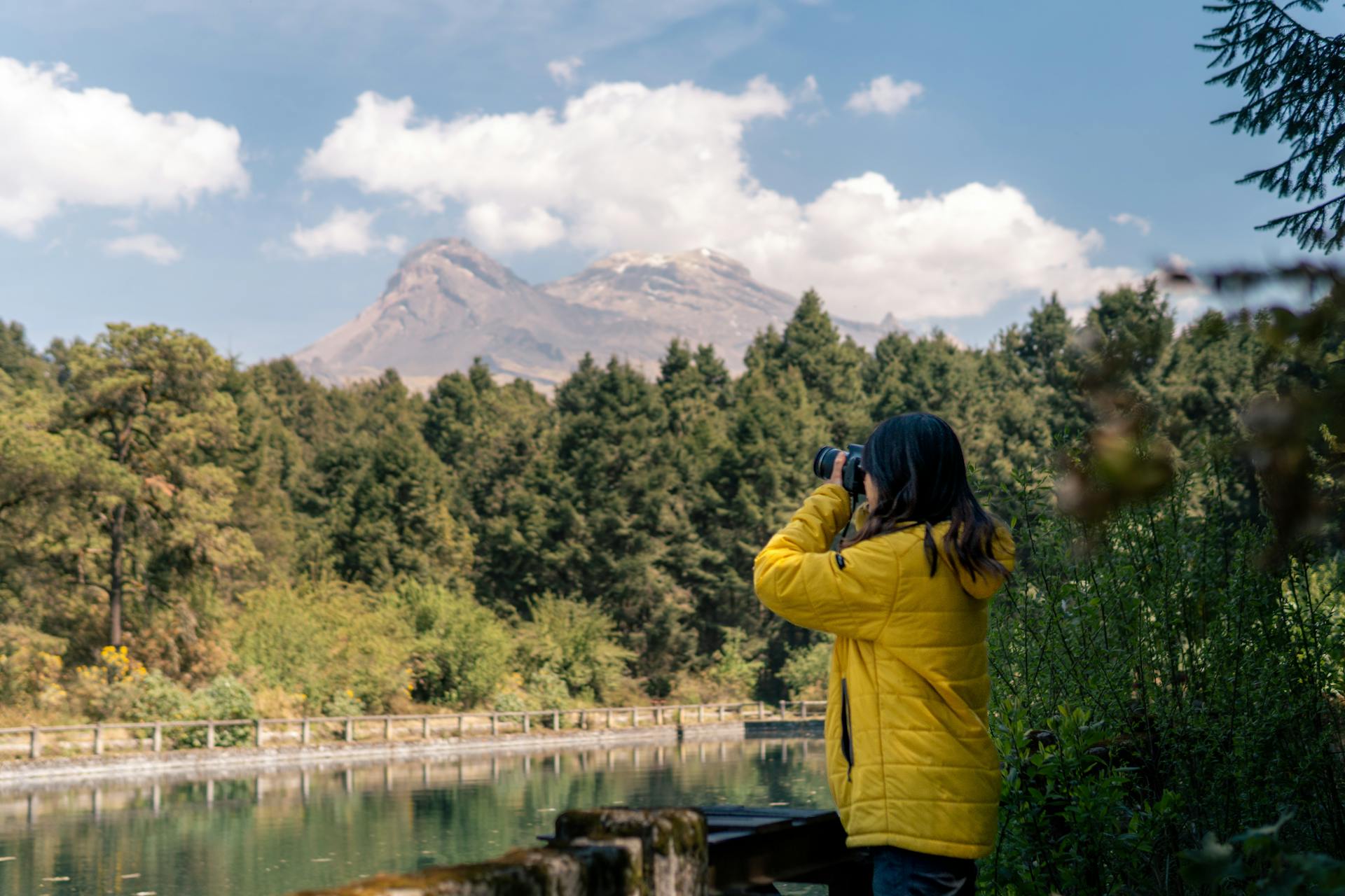
Wildlife and Nature Observation
Mexico’s high-altitude zones are a haven for unique wildlife. The Trans-Mexican Volcanic Belt creates habitats from 8,000 to 18,000 feet.
Pine and fir forests dominate the middle elevations. You might spot white-tailed deer or catch birds darting through the trees. Above the treeline, alpine meadows host tough little plants.
Pico de Orizaba National Park protects endangered species and rare habitats. Early mornings and late afternoons are prime time for wildlife watching.
Near Pico de Orizaba, ancient obsidian mines add a fascinating layer of geology to the landscape.
Wildlife activity changes with the seasons. During the dry months (November-April), animals gather near water, making them easier to spot.

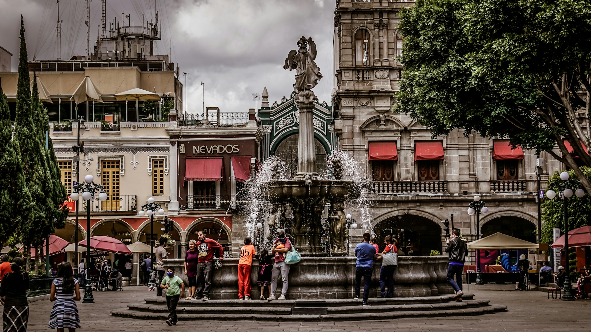
Mountain Cities, Culture, and Zocalos
Mexico’s mountain cities blend urban energy with high-altitude charm. Central plazas—the zocalos—anchor community life, surrounded by a mash-up of indigenous and colonial architecture.
Mexico City’s High Altitude Urban Energy
Mexico City sits way up at 7,350 feet. That thin air gives the city a unique vibe you can feel everywhere—from the way people walk, to the food, to the art.
The altitude keeps the climate mild. Even in summer, it rarely gets too hot. Early mornings feel crisp and fresh, with a coolness you don’t expect from a city this size.
Volcanic peaks ring the city, creating epic backdrops. On clear days, you can spot snow-capped mountains from busy downtown streets.
Visitors sometimes feel the altitude at first. Locals, though, have adapted—strong lungs and hearts are just part of life here.
Altitude shapes the culture, too. The food scene leans toward hearty dishes that warm you up. Street vendors sell hot champurrado and atole to fight off the mountain chill.
The Role of the Zocalo in Mountain Communities
Mountain town zocalos pulse with daily life. These plazas host morning markets and evening celebrations alike.
Zocalos up here often feature covered walkways, or portales, to shield folks from the unpredictable mountain weather. Stone benches and fountains invite people to linger and catch up.
Local governments use the zocalo for big announcements and community events. Political rallies, festivals, and religious processions all center around these spaces.
Key Zocalo Features in Mountain Cities:
- Stone construction for durability
- Covered areas for shelter
- Central fountains or monuments
- Government buildings on the edges
- Market stalls on certain days
Small mountain towns depend on their zocalos for social connection. During festivals and holidays, these spaces come alive in a way that feels uniquely Mexican.

Mountain City Architecture and Traditions
Mountain city architecture always grabs my attention. Locals build with thick walls, steep roofs, and small windows to keep out the cold and snow.
You’ll notice colonial touches blending with indigenous know-how. I’ve seen plenty of homes with local stone and timber—nature’s own insulation. Those red tile roofs? They’re not just pretty; they send rain and snow sliding right off.
Builders in these regions use what the mountains offer. Volcanic rock, pine timber, and clay shape each town’s look. These materials also help keep homes cozy when temperatures swing.
Common Architectural Elements:
- Stone foundations anchor homes against shifting ground.
- Wooden beam ceilings trap warmth inside.
- Courtyards give families a sheltered spot outdoors.
- Thick walls block out the chill.
People adapt their traditions to mountain life. Many homes have large fireplaces or wood-burning stoves—essential for those frosty nights.
When winter arrives, festivals usually move indoors. The celebrations feel more close-knit, almost like everyone’s sharing a secret.
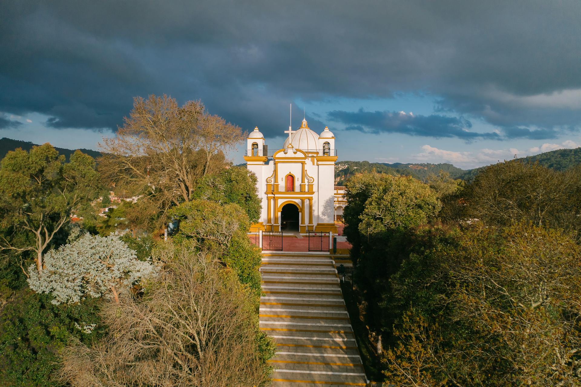
Churches here look a bit like fortresses. Their thick walls and tiny windows stand up to the mountain weather—and maybe a bit to the spirit of the place, too.
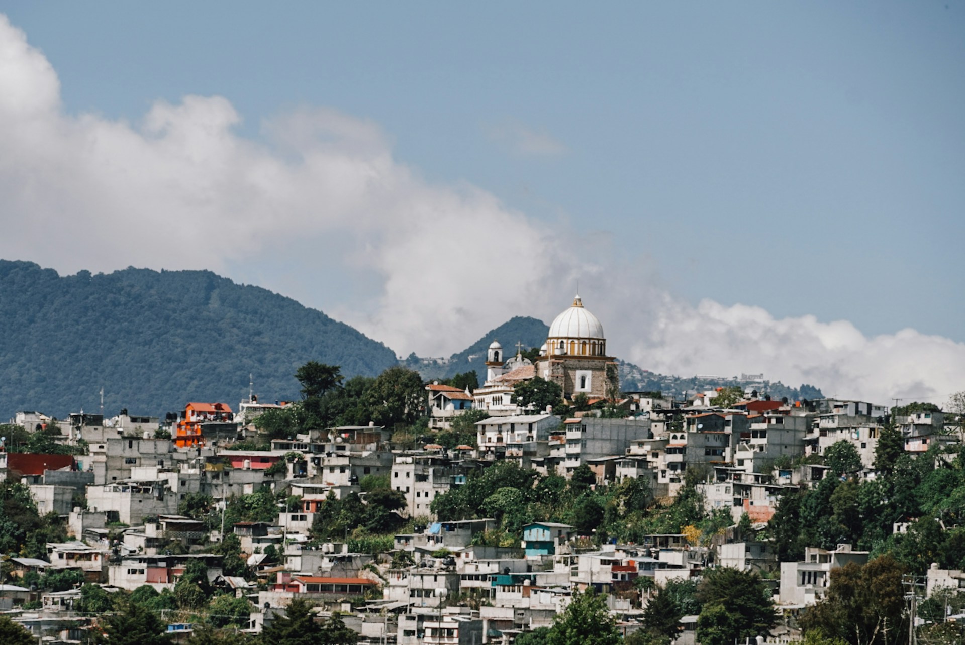
Chiapas and the Southern Highlands
Chiapas sits at Mexico’s southern tip, where mountains soar above 13,000 feet. Ancient Mayan communities still keep their traditions alive up here.
San Cristóbal de las Casas stands at the heart of these highlands. The city feels like a crossroads, with Guatemalan influences blending into the local culture.
The State of Chiapas: A Land of Mountains
The Chiapas Highlands always leave an impression. The mountains here come in three bold, parallel bands running toward the Pacific.
The Sierra Madre de Chiapas forms a dramatic western wall. Peaks shoot up to 9,000 feet, sometimes just 20 miles from the sea. Heavy rains drench these slopes, feeding lush coffee plantations.
On the eastern side, the Northern Mountains of Chiapas rise above 12,000 feet. Volcanic rock tops many of these rugged summits.
Tacaná Volcano claims the region’s highest point at 13,484 feet. This giant straddles the Mexico-Guatemala border—a true natural landmark.
Between the ranges, the central valley cradles the Grijalva River. Down here, farmers grow corn, bananas, and coffee. Wheat thrives at higher altitudes, while cattle graze on the loftiest pastures.
The shifting elevations create wild climate zones. The mountains catch Pacific moisture, making some areas the wettest in Mexico. Some highland spots get over 4,000 mm of rain every year—hard to imagine until you see it.
San Cristóbal de las Casas: Zocalo and Heritage
San Cristóbal de las Casas rests in the Jovel valley, perched at 7,200 feet. I always think of it as the cultural soul of the Chiapas Highlands. It’s also home to the country’s largest indigenous population.
The main zocalo buzzes with life at the city’s core. Colonial buildings with those signature red roofs ring the plaza. The yellow cathedral stands proudly on one side, while nearby streets burst with markets selling colorful textiles and crafts.
Indigenous communities keep their traditions strong here. Seven different Mayan groups live in the mountains around the city. Each one has its own language and signature clothing—walking through the markets feels like stepping into a living patchwork.
Even though you’re in tropical Mexico, the climate here stays cool all year. It’s perfect for highland crops, especially coffee, which thrives on the hillsides.
The city’s blend of Spanish colonial charm and indigenous roots feels truly one-of-a-kind. San Cristóbal opens the door to mountain villages where life moves at its own pace. Traditional weaving and farming aren’t just history—they’re part of daily life, unchanged for generations.
Chiapas’ Border with Guatemala: Cross-Cultural Influences
The border with Guatemala cuts right through the middle of the Chiapas Highlands. Honestly, it’s wild to see how this international line sparks cultural exchanges in both directions—sometimes you can’t even tell which side you’re on.
Tacaná Volcano stands tall, straddling both Mexico and Guatemala. If you climb this peak, you’ll literally step from one country into the other. The mountain isn’t just a border; it’s a landmark you can spot for miles, no matter which side you’re on.
Indigenous Mayan groups have lived here for centuries—way before anyone drew borders on a map. Their families and traditions stretch across both countries, ignoring the lines politicians made.
Trade routes wind through the highlands, connecting communities. Walk through a market on either side and you’ll see the same coffee beans, handwoven textiles, and colorful crafts. Goods and stories move freely from one mountain town to the next.
The Pan-American Highway slices through the central valley, heading toward Guatemala. This is the road that links Mexico City to the rest of Central America. I’ve driven it myself, passing through mountain passes so high, your ears pop and the clouds hang low.
Living or traveling in this border region, you start to notice something. The mountains, not the border, shape people’s lives here. Culture flows with the land—sometimes the only thing separating you from the next country is a river or a ridge.