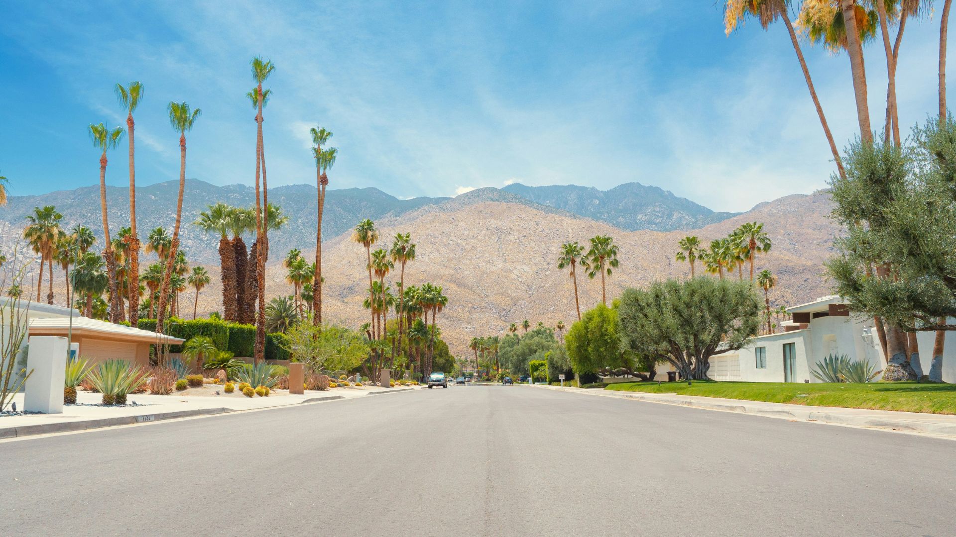
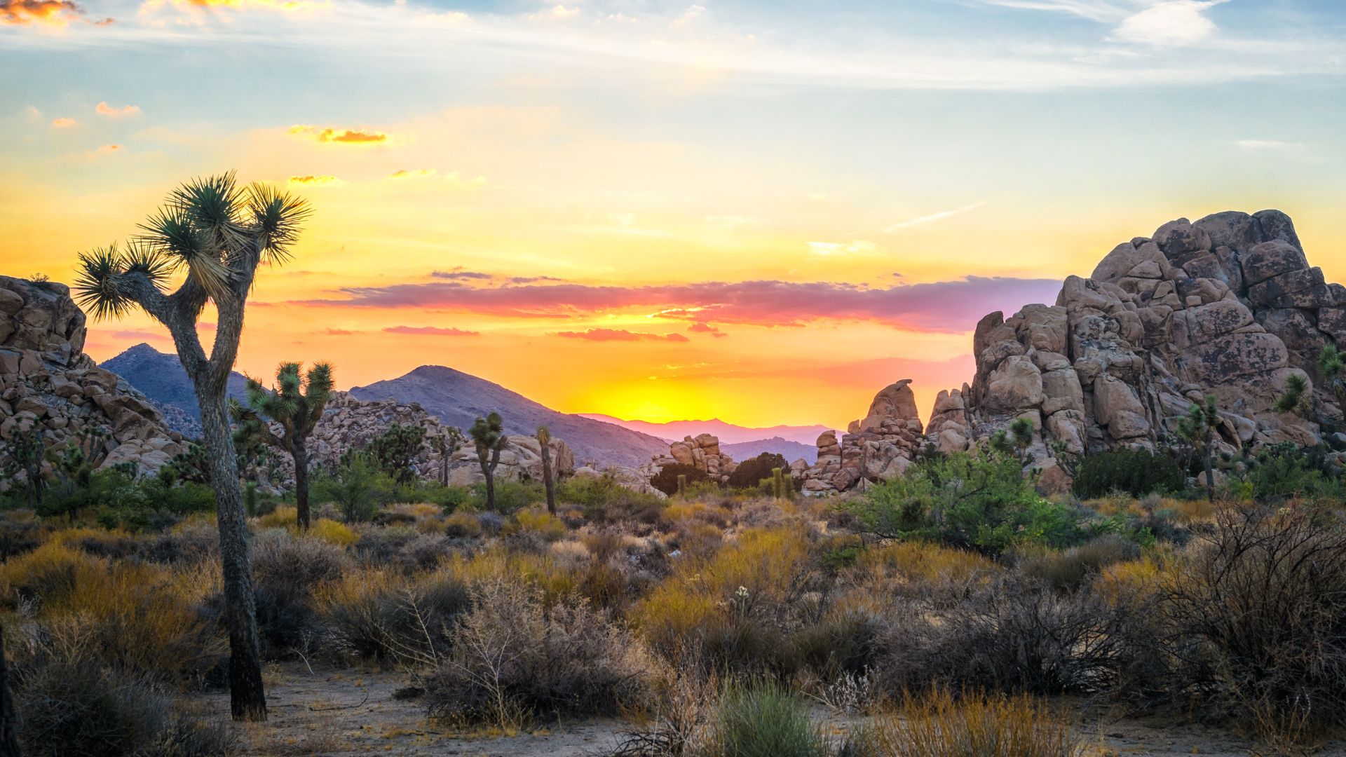
I can’t get enough of hiking near Palm Springs. The area offers everything from lush palm canyons to winding mountain trails. October through April is my favorite time to explore—mild weather, blue skies, and just the right amount of sun.
Let’s dive into my top picks for hikes near Palm Springs that I keep coming back to in the cooler months.
Looking for an easy stroll through palm-filled canyons? Or maybe you want a tougher trek with mountain views? There’s a trail out here for every mood and skill level.
Some of my go-to spots are Indian Canyons, the Andreas Canyon Trail, and the South Lykken Trail. These hikes highlight the desert’s wild beauty and keep me active all season long.
Top Palm Canyons and Iconic Desert Trails
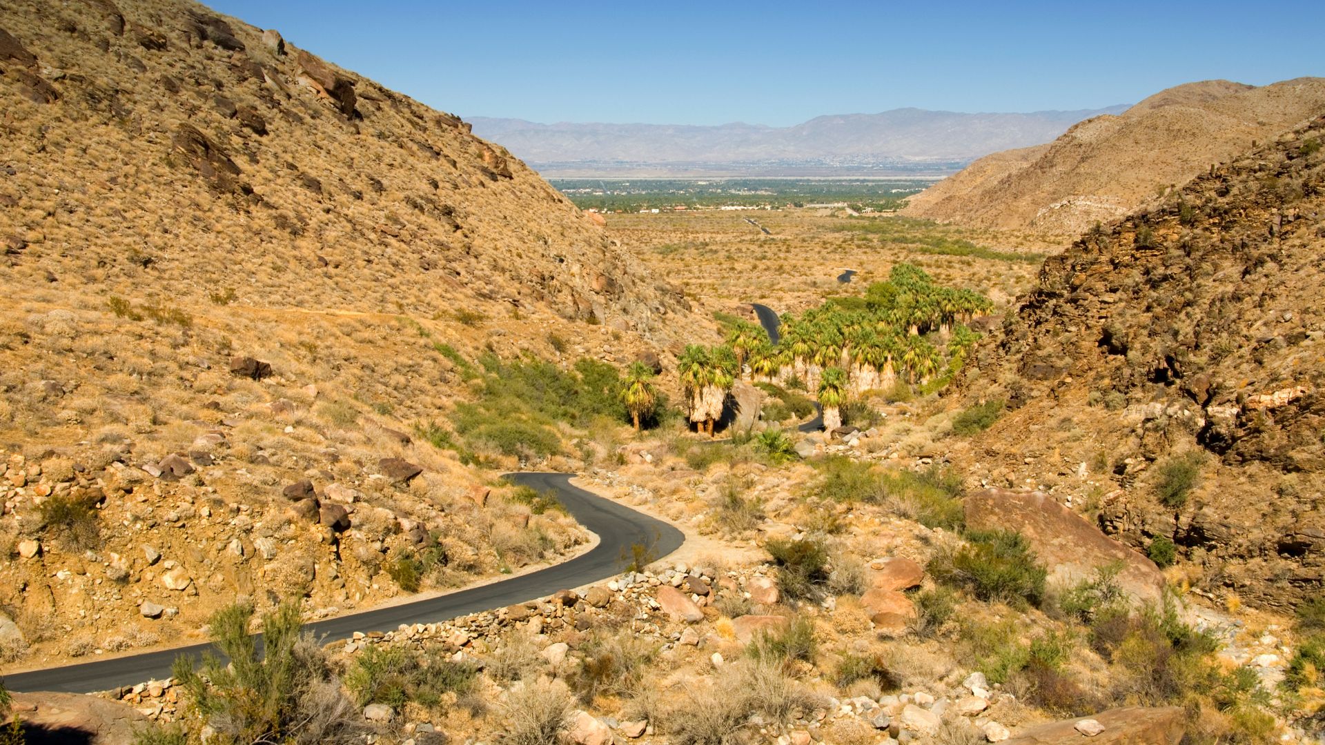
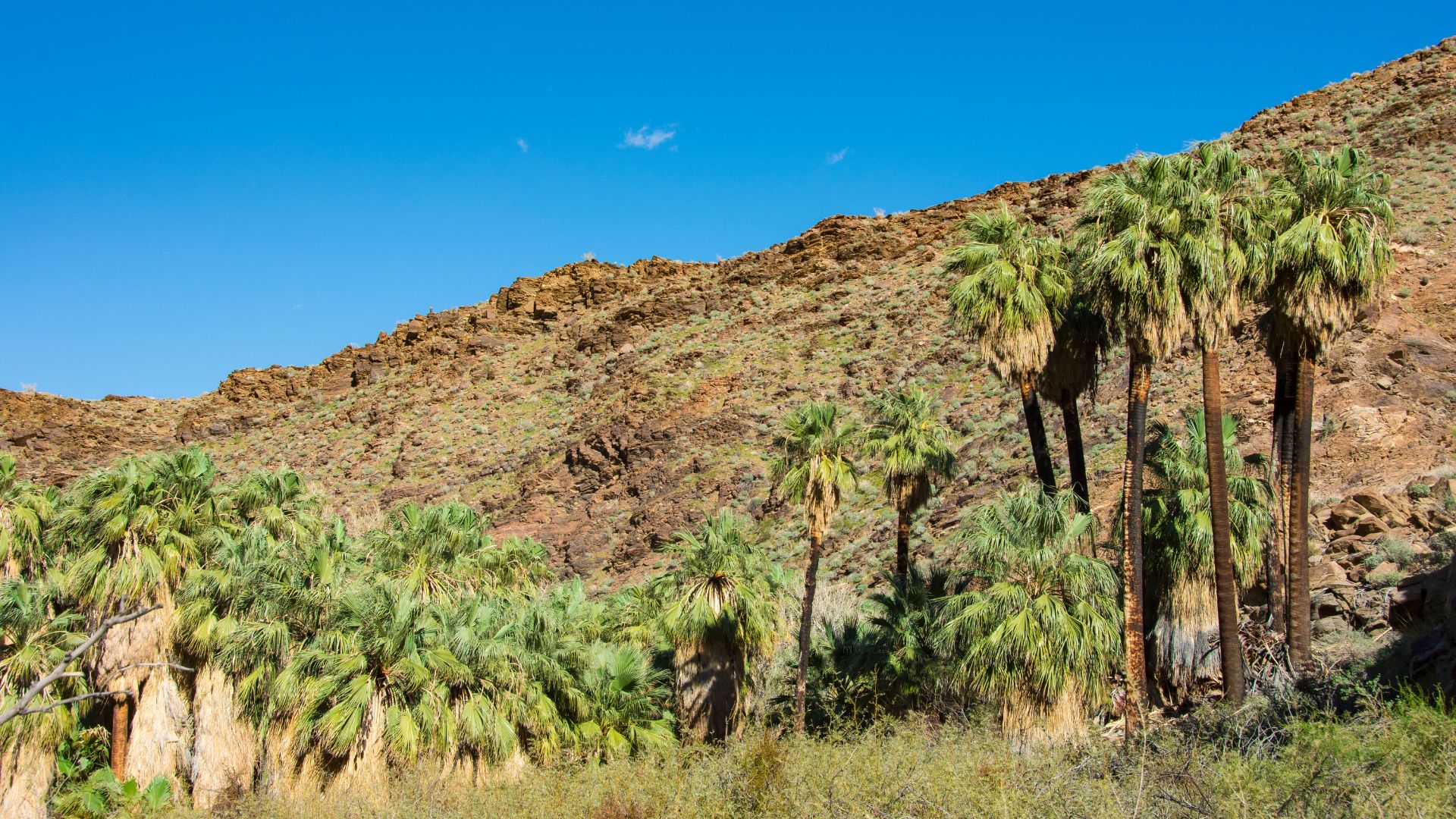
Hiking around Palm Springs means wandering through dramatic canyons, stumbling on cool rock formations, and finding shady palm oases. Many trails cross the Agua Caliente Band of Cahuilla Indians Reservation, so you get a peek at native California fan palms and a landscape you just won’t see anywhere else.
Palm Canyon Trail
Palm Canyon Trail has to be one of my favorites. The trail starts in the Indian Canyons area and drops me right into the heart of Palm Canyon, where giant California fan palms crowd together in lush groves.
It’s around 15 miles round-trip, but honestly, most people (myself included) hike just to the picnic areas or the Stone Pools. Those spots are especially nice when the weather cools down.
The contrast always gets me: bright green palms against the dry, rocky desert backdrop. I pay a day-use fee to enter since the trail crosses reservation land.
At the trailhead, I find water stations and picnic tables—super handy if you’re hiking with family or just want a break. In spring, wildflowers pop up everywhere and add a splash of color.
Tahquitz Canyon and Waterfall Adventures
Tahquitz Canyon is a classic for good reason. The rugged landscape and the waterfall at the end always impress me.
The 2-mile Tahquitz Canyon Loop is a moderate challenge—rocky steps, uneven ground—but the 60-foot waterfall at the end is worth every step. The Agua Caliente Band of Cahuilla Indians holds this canyon sacred, and the visitor center at the trailhead has some fascinating exhibits about local plants and history.
Shade is scarce, but palm trees and big boulders offer a little relief from the sun. If you want to splash around at the falls, wear water shoes. The canyon opens seasonally, so I always double-check before planning a visit.
No pets are allowed, and the area has strict rules to keep it clean and beautiful.
Indian Canyons Network: Andreas, Murray, and More
The Indian Canyons network is a hiker’s playground. Each trail has its own vibe. Andreas Canyon Trail is short—just about a mile—but the scenery is unreal. There’s a stream, tons of palms, and rocks that look straight out of a movie set.
Birdwatchers love it here for the desert wildlife. Murray Canyon Trail is a bit longer and rougher, winding through sandy washes and over boulders before reaching Seven Falls. Those waterfalls only flow after good rain, but the palms along the way always give plenty of shade.
I grab a day pass for entry, and the area offers basics like restrooms and parking. Whether I want a quick walk or something longer, there’s always a trail that fits my mood.
Mountain Adventures: Climbing Above Palm Springs
If you want cooler air and massive mountain views, head for the hills above Palm Springs. These trails climb to the highest points in the area and show off the Coachella Valley from way up high.
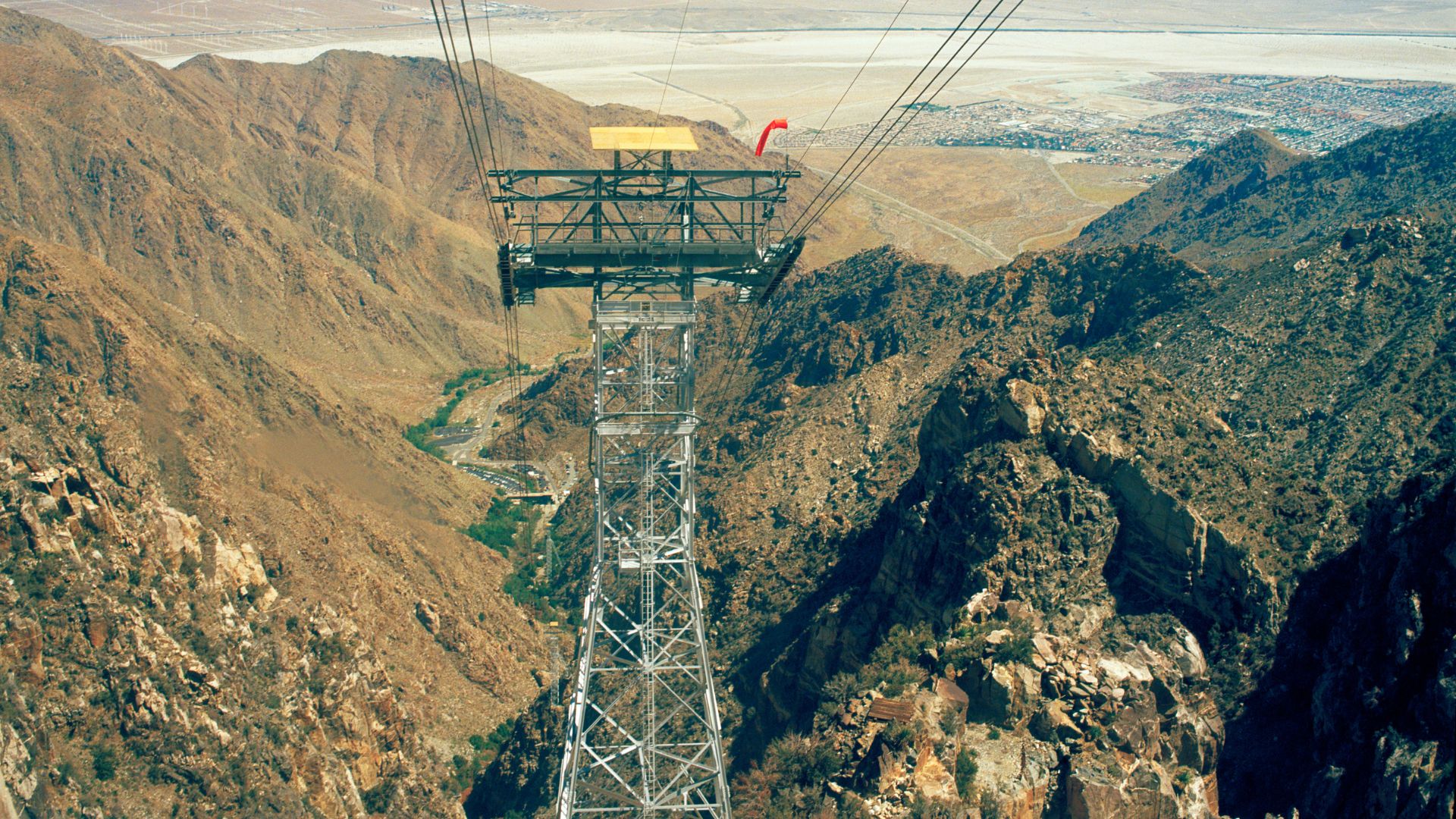
Palm Springs Aerial Tramway to Mount San Jacinto
The Palm Springs Aerial Tramway never gets old for me. I hop on for a fun ride up, and when I step out at Mountain Station, I’m already in the high country.
From there, the hike to Mount San Jacinto Peak begins. The trails here, inside Mount San Jacinto State Park, feel cooler and shadier than anything down in the valley.
It’s about 11 miles round-trip to the peak. The path is clear, and the climb is steady—not too wild, but definitely a workout. I pass through forests of pine and fir, and the views over Palm Springs are unreal.
Standing at the summit (10,834 feet!), I can see for miles across Southern California.
Trail Details—Aerial Tramway to San Jacinto Peak
| Distance | Elevation Gain | Difficulty | Best For |
|---|---|---|---|
| 11 miles RT | 2,600+ feet | Hard | Scenic hikes |
I always bring extra layers. It’s way colder up top than you’d expect.
Skyline Trail and Cactus to Clouds Challenge
If you want a real test, the Skyline Trail—aka Cactus to Clouds—is the one. This trail starts near downtown and climbs over 10,000 feet straight up to Mount San Jacinto.
It’s about 20 miles one way and is only for experienced hikers. The route is steep, mostly exposed, and water is hard to find.
The climb is relentless, but the reward? Jaw-dropping views, ever-changing landscapes, and a huge sense of accomplishment. You finish at the top of San Jacinto Peak, with sweeping views all the way down to Palm Springs.
Heads up: Only attempt this in cool weather. Most people arrange a tram ride down after the climb.
Murray Hill and Panoramic Ridge Walks
When I want a mountain adventure but not an epic slog, I pick Murray Hill. It’s a solid hike but much more manageable than Cactus to Clouds.
Depending on where I start, it’s about 8 miles round-trip. The trail winds through desert hills, past wildflowers and rocky outcrops, and up to one of the highest points near Palm Springs.
Reaching the top, I get a panoramic sweep of Palm Springs, the San Jacinto mountains, and sometimes even the Salton Sea if the day’s clear. There are plenty of ridge walks nearby, each with its own set of killer views over the valley.
If you want something rugged but not crazy, these are hard to beat.
Best Hiking Trails for Cooler Months
Cooler months really bring out the best in Palm Springs hiking. Mild temps, crisp air, and the desert feels more alive.
Some trails climb to big mountain lookouts, while others wind through unique plants, wildlife, and those iconic palm canyons. Each one stands out for its scenery, history, or just how easy it is to get to.
North and South Lykken Trails
The North Lykken Trail starts at the north end of Palm Springs and climbs along the mountains for sweeping views over the city. If I hike the full route, it’s about 4.4 miles out and back.
The South Lykken Trail begins at the south end of town and gives a different angle on the desert and mountains. I like these trails most between October and April, when the sun isn’t too harsh and the air feels fresh.
The rocky paths are well marked, so I never worry about getting turned around. Both trails are full of photo ops, especially in the golden light of morning or late afternoon.

Quick Facts:
| Trail Name | Difficulty | Distance | Best Months |
|---|---|---|---|
| North Lykken Trail | Moderate | 4.4 miles (RT) | Oct–Apr |
| South Lykken Trail | Moderate | 7 miles (RT) | Oct–Apr |
Bring plenty of water and sun protection—shade is almost nonexistent out here. The steady climbs always leave me feeling accomplished, and the views are just plain relaxing.
Araby Trail, Museum Trail, and Urban Routes
The Araby Trail is famous for passing close to the Bob Hope House. It isn’t super steep, but it climbs fast enough to get your heart going.
It’s about 4 miles out and back, and you get a mix of desert scenery and unique hillside homes. The Museum Trail starts right behind the Palm Springs Art Museum. Short and steep (just over 2 miles round-trip), but the city view at the top is worth every step.
Sometimes, I just want an easy walk, so I’ll take the urban routes. These follow city wash trails or meander through neighborhoods—flat, accessible, and ideal for families or anyone not in the mood for a climb.
Tip:
Start early for the Araby or Museum Trail. Parking fills up, and the midday sun can be brutal.
Family-Friendly and Interpretive Hikes
When I’m showing friends or family around—especially folks who don’t hike much—I almost always pick Andreas Canyon Trail. It’s a mellow one-mile walk along a stream, with loads of shade from native palm trees. The greenery makes you forget you’re in the desert at all.
Indian Canyons has more interpretive hikes, like Murray Canyon and Palm Canyon. These usually stay under 6 miles and come with educational signs about native plants and animals.
Murray Canyon sometimes has a waterfall, and Palm Canyon is dotted with info signs. All ages can enjoy these trails, and the peaceful scenery is a bonus.
Ranger stations at the trailheads are a nice touch—they hand out maps and always have tips to share.
Popular Family-Friendly Trails:
- Andreas Canyon Trail (1 mile)
- Murray Canyon Trail (6 miles)
- Palm Canyon Trail (15 miles, with shorter loop options)

Victor Trail and Victor Loop
Victor Trail and Victor Loop don’t get much attention, but I think they’re some of the best hikes around Palm Springs, especially when it’s cool out.
These trails loop through Indian Canyons, linking up with Palm Canyon and weaving between rocky ridges and palm-filled oases. The Victor Trail runs about 2.6 miles one way, and the Victor Loop adds a bit more distance.
Along the way, I wander through open desert, under tall palms, and—if I’m lucky—spot bighorn sheep or some interesting birds. The scenery changes constantly, which keeps things fresh.
Crowds rarely find these trails, even in peak season. I always bring a map, since the trails branch off and connect in a few places. The signs are decent, but a backup never hurts.
The mix of views, wildlife, and peace makes these some of my top picks in the area.
Epic Day Trips and Nearby Destinations
Hiking near Palm Springs isn’t just about the local canyons. Some of the best day trips take you out into new deserts, hidden oases, or rugged mountains.
There’s truly something for every hiker—whether you want a gentle nature walk or a full-on adventure.
Joshua Tree National Park Highlights
Joshua Tree National Park sits just about an hour from Palm Springs. I keep coming back for those wild landscapes—giant boulders, spiky Joshua Trees, and that endless sweep of open desert.
When I’m up for a longer trek, the Boy Scout Trail is my go-to. It stretches about 8 miles one way, weaving through dramatic rock formations and offering a real sense of solitude.
On days when I want a shorter challenge, I hit the Ryan Mountain Trail. It’s only 3 miles round trip, but the climb rewards you with one of the best views in the park.
If you’re after something quieter, check out the Willow Hole Trail. It starts from the Boy Scout Trailhead and winds about 7 miles through Joshua Tree forests, ending at a shady oasis that always feels like a hidden gem.
For families or an easy stroll, the Desert View Trail in the northwest corner is under a mile. Interpretive signs line the way, and the vistas are surprisingly good for such a short walk.
Popular Trails Table
| Trail | Distance | Highlights |
|---|---|---|
| Boy Scout Trail | 8 miles | Solitude, boulders |
| Ryan Mountain | 3 miles | Summit views |
| Willow Hole | 7 miles | Joshua trees, oasis |
| Desert View | 0.7 miles | Interpretive, easy, vistas |
Coachella Valley Preserves and Oasis Hikes
Sometimes, I crave a break from all the rocks. That’s when I head for the Coachella Valley Preserve, famous for its palm oases and rare wildlife.
The Thousand Palms Oasis Preserve has easy loop trails, like the McCallum Trail. This one leads you through thick palms to a clear, spring-fed pond that feels almost magical after miles of desert.
Most trails here are flat, making them perfect for spotting birds or just soaking in the cool shade. Some paths have panels with local info, so you can learn about the area’s geography and endangered species as you walk.
If you’re going on a weekend, try to arrive early—parking fills up fast when it’s busy.

La Quinta and Painted Canyon Adventures
Craving more color in your hike? I make my way to La Quinta for that.
The La Quinta Cove to Lake Cahuilla trail offers a 6-mile round trip with mountain views, desert wildflowers, and the lake as your prize at the end.
But for something truly different, I head out to the Ladder Canyon Trail and Painted Canyon Loop Hike in the East Indio Hills Badlands. You’ll climb ladders, squeeze through slot canyons, and wander among rocks streaked in pinks, yellows, and reds.
These trails are best when it’s cool and after you’ve checked for recent storm damage—flash floods can really change things out here.
Bring plenty of water, because shade is rare, especially on the Painted Canyon Loop. Trust me, you’ll need it.
Palm Desert Bump and Grind, Art Smith, and More
Palm Desert has some solid hikes right near town. My favorite for a quick sweat? The Bump and Grind Trail—a 4-mile loop that locals and visitors both love.
You get wide views over the Coachella Valley and open desert slopes. There’s not much shade, so I always start early to beat the heat.
If I have more time, I tackle the Art Smith Trail. It runs about 16 miles round trip through rugged hills, with plenty of bighorn sheep and spring wildflowers if you’re lucky.
Shorter trails, like the Hopalong Cassidy Trail, wind through the same foothills and give you big valley views without the long mileage.
I never forget extra water and sunscreen. Even in winter, the sun here doesn’t mess around.
Planning Your Hike in the Palm Springs Area
Hiking near Palm Springs means rugged trails, desert heat, and scenery that’s honestly hard to beat. Canyon oases, mountain peaks, and everything in between—there’s a lot to take in.
I always pay close attention to what I pack, how I navigate, and when I hike. Cooler months are usually best, both for comfort and safety.
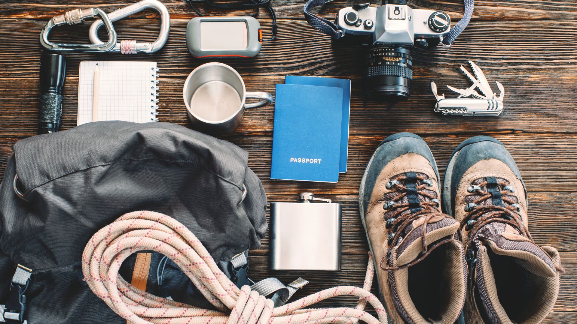
Packing Essentials for Desert Hiking
Every time I hit the trails around Palm Springs, I double-check my gear. Sturdy hiking boots are a must for rocky ground.
A hat, sunglasses, and sunscreen? Non-negotiable. The sun here will get you if you’re not careful.
I always bring more water than I think I’ll need—at least 2 liters, sometimes more. Dehydration sneaks up fast out here.
High-energy snacks like trail mix or granola bars keep me going, especially on longer climbs near the San Andreas Fault or up toward San Jacinto Peak.
I toss a lightweight first-aid kit, whistle, and multi-tool in my bag. A small trash bag helps me stick to Leave No Trace—packing out everything so the trails stay wild.
| Packing Item | Purpose |
|---|---|
| Hiking boots | Foot and ankle support |
| Hat, sunglasses | Sun protection |
| Sunscreen (SPF 30+) | Prevent sunburn |
| Water (2+ liters) | Hydration in arid conditions |
| Snacks (bars, nuts) | Maintain energy |
| First-aid kit | Minor injuries |
| Trail map/phone | Navigation |
| Trash bag | Pack out waste (Leave No Trace) |
Trail Maps and Navigational Tools
I never set off without checking a trail map first. The trail networks around Palm Springs can be confusing, especially when you’re crossing canyons or heading toward San Jacinto Peak.
I use the AllTrails app for updated maps, reviews, and GPS tracking. Cell service drops out in the canyons sometimes, so I download offline maps and keep a paper map as backup.
I watch for landmarks and follow trail signs to stay on track, especially on the quieter routes. Scoping out elevation and distance ahead of time helps me pick a hike that matches my mood and energy.
Trail conditions matter—a lot. Some hikes, like Murray Canyon Trail, have stream crossings or sudden terrain changes. It pays to be prepared.
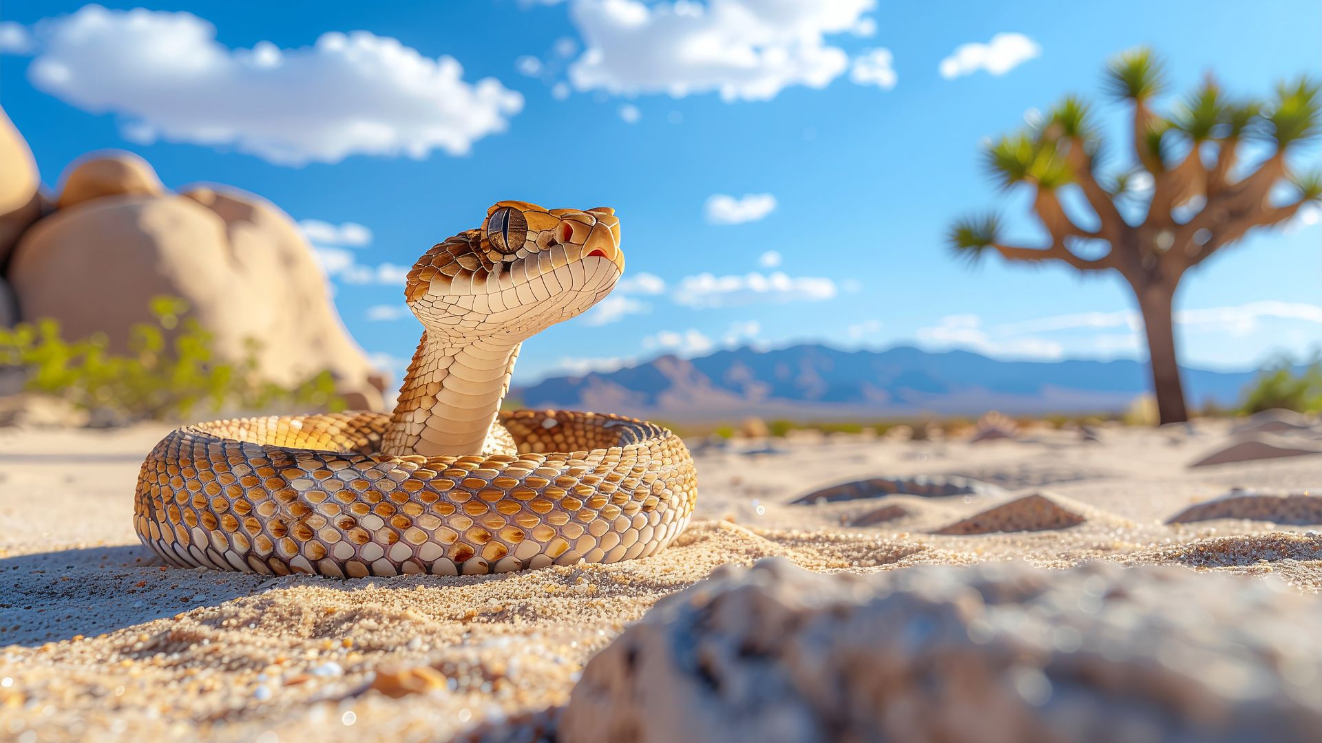
Wildlife and Safety Awareness
I stay alert for wildlife every time I’m out here. Palm Springs is home to rattlesnakes, bighorn sheep, coyotes, and tons of lizards.
I watch where I step and avoid putting my hands anywhere I can’t see, especially when it’s warm and snakes are active.
If I spot bighorn sheep or any big animal, I keep my distance and let them do their thing. For snakes, I listen for their warning and give them room to move off.
A basic first-aid kit comes in handy for minor run-ins with prickly plants or bugs.
I always keep snacks sealed and follow Leave No Trace to avoid attracting animals or disturbing their homes. Sticking to marked trails helps protect sensitive spots and lowers my chances of a surprise encounter.
Hiking Tips for Cooler Months
Honestly, Palm Springs hikes just feel better from October through May. I always hit the trail early, chasing those cool morning hours and hoping to wrap up before the midday sun gets too intense.
Even in winter, the sun here means business. I’ve learned to keep sunscreen handy and reapply it every few hours—burning in January is not on my to-do list.
Layers are a lifesaver, especially if you’re anywhere near the San Andreas Fault or heading up San Jacinto Peak. The weather can flip on you fast up there. I never skip checking the forecast—wind, surprise rain, or even a rare dusting of snow can totally change your plans.
Before I head out, I run through a quick checklist so nothing important gets left behind:
- Full water bottles or a hydration pack
- Energy-packed snacks
- Sun protection (hat, sunscreen, sunglasses)
- A real map and some navigation tools
- An emergency whistle or my phone
Cooler months open up so many more trails—longer routes suddenly seem doable, and I can push for those tougher hikes without worrying as much about the heat. If you ask me, it’s the best time to explore.