California’s Shasta Cascade region and North Coast blew me away with some of the most jaw-dropping natural wonders I’ve ever come across. This stretch of Northern California just keeps unfolding—one minute you’re staring at waterfalls, the next you’re wandering among ancient redwoods.
The Shasta Cascade alone packs in 42 waterfalls, all tangled through mountain ranges, plus secret caves, volcanic peaks, and lakes so clear you can see straight to the bottom. Honestly, I found hidden spots out here that most people probably drive right by without realizing.
My trip took me from the famous waterfall loops around Mount Shasta all the way to the rugged coastline, where massive trees brush up against the Pacific. Each place brought its own vibe—sometimes I walked behind a roaring cascade, other times I ducked into underground caves or watched wildlife do their thing.
Experiencing the Majesty of Waterfalls
Shasta Cascade’s waterfalls really changed my mind about what makes a waterfall special. Some thundered so loud I could feel it in my chest, while others hid in quiet corners, waiting for someone to stumble on them.
Burney Falls: The Crown Jewel
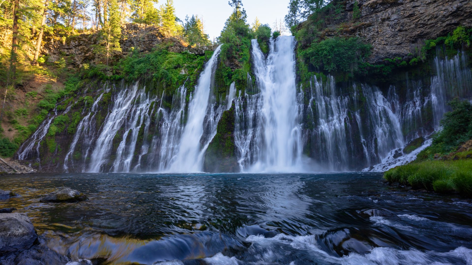
Burney Falls floored me the first time I saw its 129-foot drop. Water spills down in a perfect curtain, fed by underground springs that never seem to run dry—even in the middle of summer.
I loved how the mist would catch the afternoon light and throw rainbows across the rocks. The constant roar echoed all the way to the parking lot, so I heard it before I even caught a glimpse.
Why Burney Falls Stands Out:
- Height: 129 feet of non-stop flow
- Source: Springs keep it going all year
- Trail: Easy 1-mile loop
- Best time: Late afternoon for rainbows
The viewing platform puts you right in the action. I probably spent over an hour just watching the shifting patterns as the sun moved.
Whiskeytown Falls and Mossbrae Falls Adventures
Whiskeytown Falls made me work for it—a 3.4-mile hike through thick forest, but wow, that 220-foot waterfall at the end was worth every sweaty step.
The pool at the base was icy and perfect for a quick dip. I figured out the best shots came from a rocky ledge halfway up; you can see the whole waterfall from there.
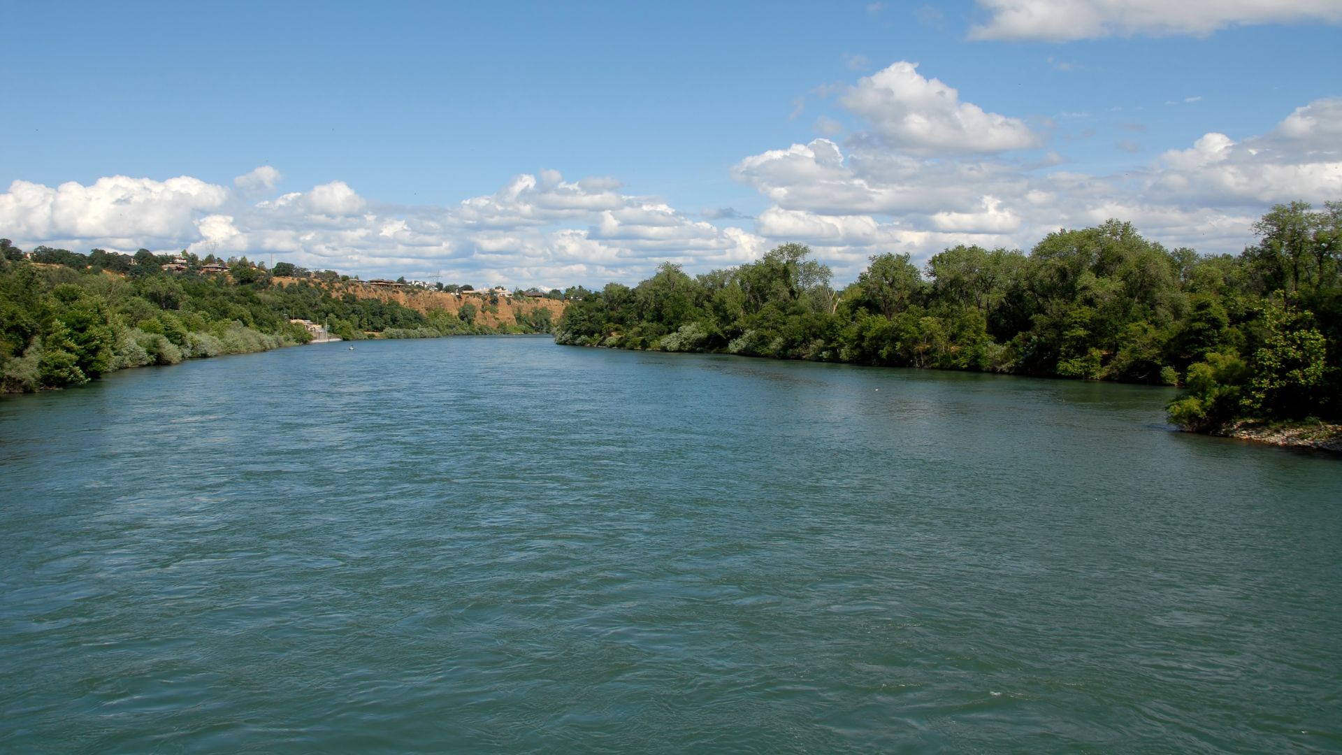
Mossbrae Falls near Redding felt like something out of a fairytale. Water seeps out of mossy rocks right into the Sacramento River, making dozens of tiny streams that all merge together.
You have to walk along the railroad tracks to get the view, which is a bit sketchy with the trains, but it’s the only way. The hillside just leaks water everywhere, and it all tumbles down in a green, sparkling curtain.
Exploring the McCloud River Waterfalls
The McCloud River handed me three waterfalls for the price of one. Lower McCloud Falls was super easy to reach, and the 15-foot cascade is basically made for swimming.
Middle McCloud Falls drops 50 feet into a huge pool, with basalt cliffs all around. The trails connect everything, so you can see all three falls in a single afternoon.
Upper McCloud Falls took a little more effort, but the peace and quiet made it my favorite. A 40-foot drop into a narrow gorge, and the sound just ricochets around you.
Each spot had its own charm—Lower was for swimming, Middle for snapping photos, and Upper for just sitting and soaking it all in.
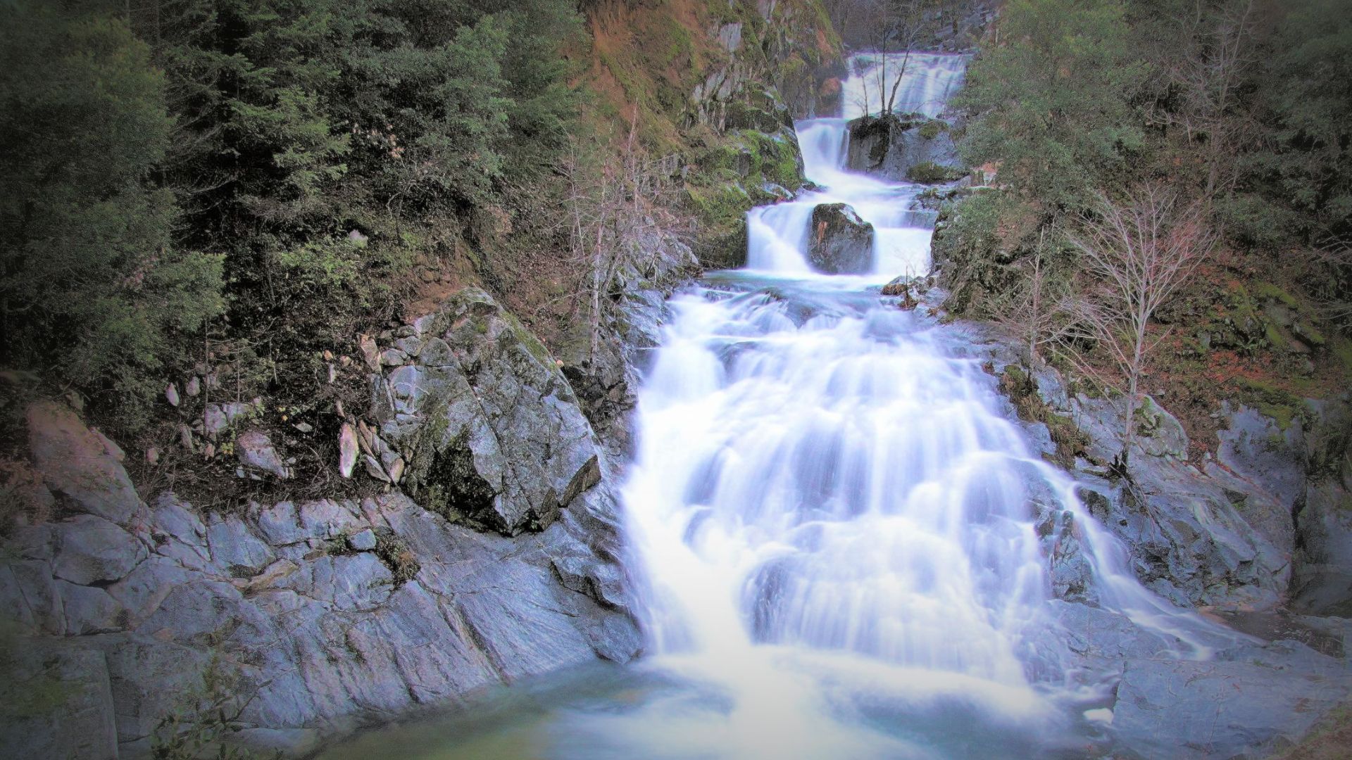
Crystal Creek Falls and Other Hidden Gems
Crystal Creek Falls was my favorite “secret” waterfall. After a quick, steep hike, I found myself at a 35-foot cascade with a crystal-clear pool and not another soul in sight.
The water stays freezing year-round, which honestly felt amazing on a hot day. I had to be careful—good shoes are a must, since the rocks near the water get slippery.
Other Waterfalls Worth a Detour:
- Hedge Creek Falls: You can actually walk behind the 30-foot drop
- Potem Falls: Only flows in winter, but it’s dramatic when it does
- Faery Falls: A delicate 20-footer tucked in a ferny grotto
These smaller falls gave me a sense of connection I didn’t get at the bigger, busier spots. I could just stand there and notice all the little details most people miss.
Extraordinary Underground and Geologic Wonders
Shasta Cascade isn’t just about what’s above ground. This region hides some of California’s wildest caves and volcanic features. Lake Shasta Caverns blew my mind with its limestone formations, and Lassen Volcanic National Park is basically a living geology lesson.
Lake Shasta Caverns: Stalactites and Stalagmites
I stumbled upon these limestone caves up in the northern Sacramento Valley. They perch 800 feet above Shasta Lake, and just getting there felt like an adventure.
How You Get There:
- Hop on a boat across the lake
- Take a bus up the mountain
- It’s always a cool 58°F inside
The main chamber stopped me in my tracks. Stalactites dangled overhead like frozen daggers, some of them stretching over 10 feet—imagine how long that takes to form.
The Cathedral Room was the real showstopper. Giant stalagmites rose up from the floor, and the echoes in there were unreal.
Why This Place Rocks:
- The formations are still growing
- Flowstone drapes the walls
- I even spotted rare cave pearls in the shallow pools
I watched drops of water slowly build up the stone, little by little, over who knows how many centuries.
The Volcanic Marvels of Lassen Volcanic National Park
Lassen Volcanic National Park brought me face-to-face with active volcanoes—yes, plural. It’s the only place I know with all four types of volcano in one spot.
Bumpass Hell quickly became my favorite. The ground hisses with steam, mud pots bubble, and the whole place smells faintly of sulfur.
Boardwalks keep you from roasting your shoes on the 200°F ground. I wandered around, watching the steam curl up and listening to the weird, gurgling sounds.
What Stood Out:
- Mudpots boiling at nearly 200°F
- Fumaroles puffing out volcanic gases
- Mineral-rich hot springs
- Rocks stained yellow and orange from sulfur
Sulphur Works sits right by the main road, so it’s easy to check out. Steam vents everywhere, all day long.
Lake Helen sits high at 8,200 feet, and on a calm morning, it mirrors Lassen Peak perfectly. Sometimes there’s still snow up there in July.
I loved how you can go from a peaceful, icy lake to bubbling, sulfurous vents in just a few minutes. It’s wild.
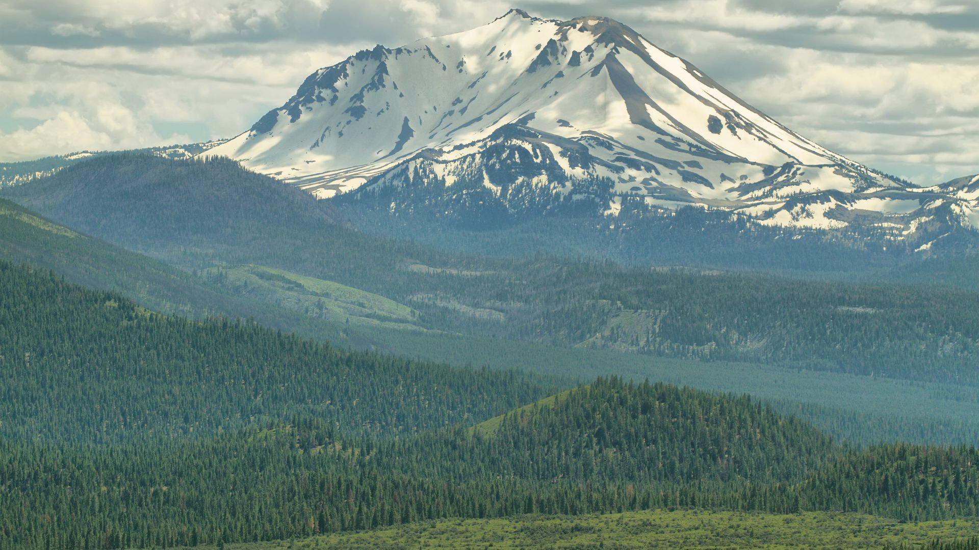
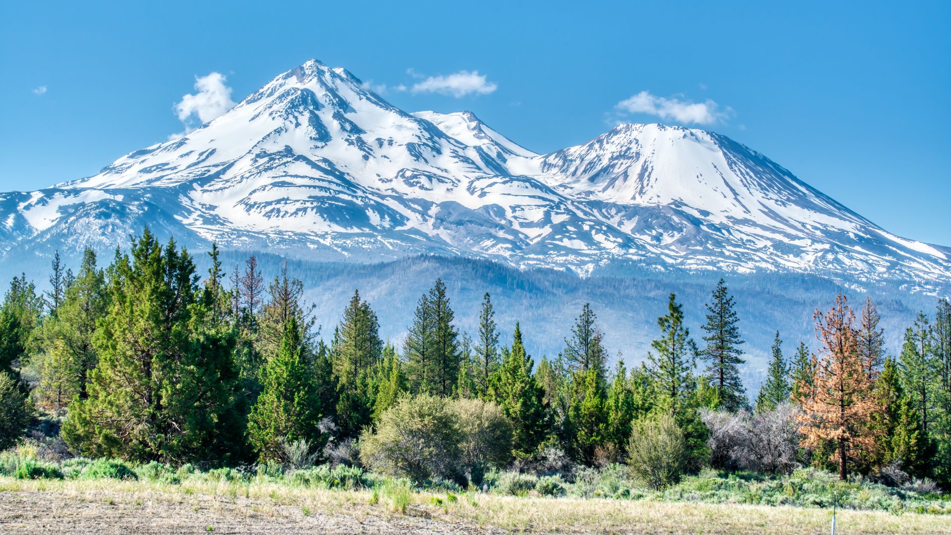
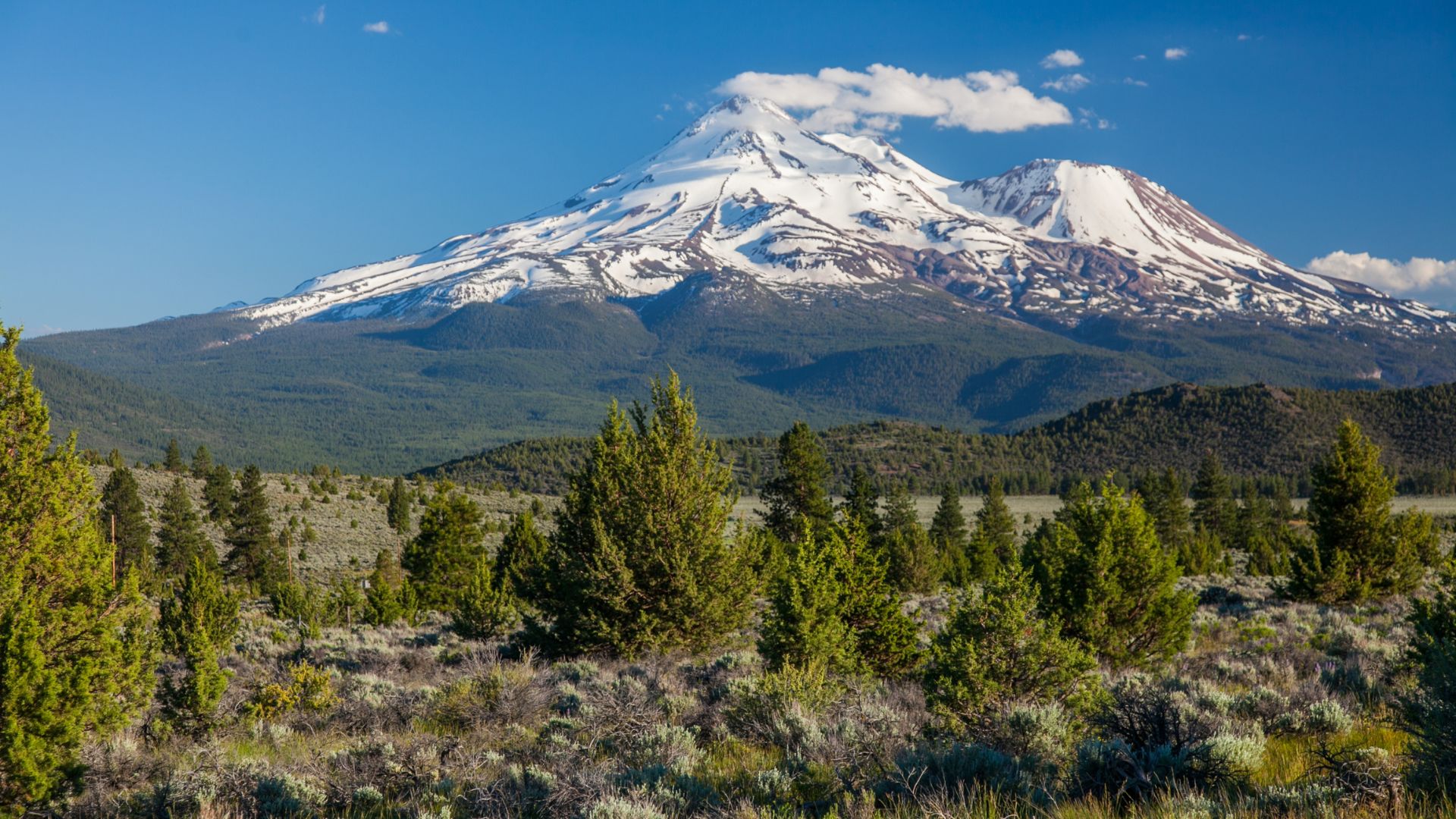
Mount Shasta and Towering Peaks
Mount Shasta towers over everything at 14,179 feet. Then you’ve got the Trinity Alps, all rugged granite and hidden alpine lakes, plus Castle Crags’ ancient spires jutting out of the forest.
Hiking Mount Shasta’s Trails
That first view of Mount Shasta from the Gray Butte Trail? I still remember it. The hike starts at Panther Meadows, winding through old red firs before you hit the rocky climb.
Once I got to the top at 8,129 feet, the whole volcano loomed right in front of me. It’s a view that sticks with you.
Trail Info:
- 3.4 miles round trip
- 1,000 feet elevation gain
- Moderate, but worth it
Heart Lake Trail gave me another epic view. It’s a steep 2.2-mile trek, starting from Castle Lake’s north shore and winding up through the firs.
The climb was a grind, but at the top, I could see Mount Shasta, Black Butte, and Mount Eddy all at once. Not a bad payoff.
The Enchanting Trinity Alps
The Trinity Alps spread out like a gray, rocky ocean. They’re part of the bigger Klamath Range, and honestly, I barely saw another soul out there.
Granite Peak was a highlight for me. The ridges and valleys go on forever, and the silence is almost total.
Why They’re Special:
- Over half a million acres of wilderness
- Granite peaks topping 9,000 feet
- Dozens of alpine lakes
- Ancient, twisted rock everywhere
I loved the solitude—sometimes I felt like I had the whole mountain to myself.
Crystal Lake and Sapphire Lake both sit in granite bowls, left behind by glaciers. They’re the kind of places you want to linger.
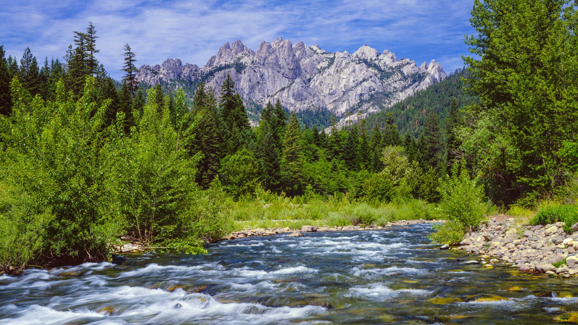
Views from Castle Crags State Park
Castle Crags State Park hit me with its wild granite spires. These peaks are 225 million years old and shoot straight up out of the forest.
I took the Castle Dome Trail for a closer look. It’s a steady 2.7-mile climb through oaks and pines.
Castle Dome Trail:
- 5.4 miles round trip
- 2,000 feet up
- Best view: Castle Dome overlook
Root Creek Trail is an easier walk—3.1 miles along a mountain stream. I lost track of time just listening to the water.
Vista Point lets you see both Castle Crags and Mount Shasta in one sweep. The dark granite against the snow-capped volcano is a sight I won’t forget.
From up here, you can spot the Trinity Alps to the west and the Cascade Range stretching north. It’s a view that makes you want to keep exploring.
Spectacular Lakes and Scenic Landscapes
The Shasta Cascade region has some of California’s clearest alpine lakes, all set against dramatic peaks. These lakes are perfect for escaping the crowds and just soaking up the silence.
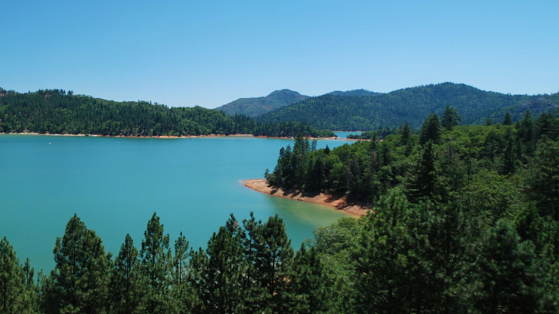
Serenity at Shasta Lake and Manzanita Lake
Shasta Lake became my go-to spot for peaceful mornings. The reservoir sits right under Mount Shasta, and on a still day, the reflections are flawless.
I launched my kayak at dawn from Antlers Marina. The water was so smooth I could see trout darting below. With 30,000 acres to explore, I always found a quiet cove.
Manzanita Lake, tucked inside Lassen Volcanic National Park, felt completely different. The easy 1.6-mile loop around the shore only took me about 45 minutes.
Early morning was the best. Lassen Peak reflected perfectly, and I watched deer and osprey doing their thing. The boardwalk made it easy to snap photos without scaring anything away.
Emerald Lake and the Wild Sierra Nevada
Emerald Lake is exactly what it sounds like—water so green it almost glows. It’s hidden in the Sierra Nevada foothills, and getting there meant a moderate 2-mile hike.
The trail weaves through granite and pine, and when I finally reached the lake, I could see the bottom even 20 feet down. The color comes from minerals in the rocks.
I spent a couple hours here, just taking photos and enjoying the quiet. Only a handful of people showed up the whole time, so it felt like my own private spot.
The best photos came from the north shore, with fallen logs in the foreground. At sunset, the whole place turned gold, but the lake kept its emerald shine.
Unique North Coast Destinations and Wildlife Encounters
California’s North Coast serves up some of the most memorable wildlife experiences and natural landmarks I’ve seen. Whether it’s the futuristic Sundial Bridge in Redding or a run-in with Tule elk, this region shows off just how diverse California’s wild side can be.
Exploring Redding: Sundial Bridge and Turtle Bay
Redding really surprised me—it’s such a great launchpad for exploring the North Coast’s wild beauty. The Sundial Bridge instantly grabbed my attention, stretching elegantly over the Sacramento River.
I wandered across its glass deck, marveling at how it links downtown Redding to Turtle Bay Exploration Park. Turns out, this 700-foot span isn’t just a bridge; it’s also the world’s largest working sundial. How cool is that?
Key Features:
- Glass deck lets you peer straight down into the Sacramento River
- Cable-stayed design just begs for a photo or two
- Pedestrian and bike access only—no cars to dodge, thankfully
At Turtle Bay Exploration Park, I found myself drawn into hands-on exhibits about local wildlife and the ecosystems that make this region tick. Hours slipped by as I explored, especially when I learned how vital the Sacramento River is for so many species.
The park’s outdoor trails tempted me outside, where I caught glimpses of all sorts of birds flitting through the trees. At the right time of year, steelhead trout make their way up these waters—a reminder that nature’s always moving.
Wildlife Watching: Tule Elk, Mule Deer, and More
If you’re into wildlife, the North Coast will blow your mind. My wildlife encounters here totally exceeded what I’d hoped for. Tule elk, in particular, stand out as a real California comeback story.
I watched herds of these incredible animals grazing in protected meadows—some of the bulls looked massive, especially during mating season when they can weigh up to 700 pounds.
Common Wildlife Sightings:
- Tule elk—Best chance to spot them is early morning or late afternoon
- Mule deer—You’ll see them all over the forests
- Teal ducks—Hang around wetlands year-round
- Various waterfowl—Pass through with the seasons
Mule deer often popped up along hiking trails, their big ears and bouncy stride making them easy to recognize as they darted through the woods.
I found the wetlands especially lively, with all sorts of birds showing up. Marsh areas became my go-to for spotting different teal species—every visit felt like a new surprise.
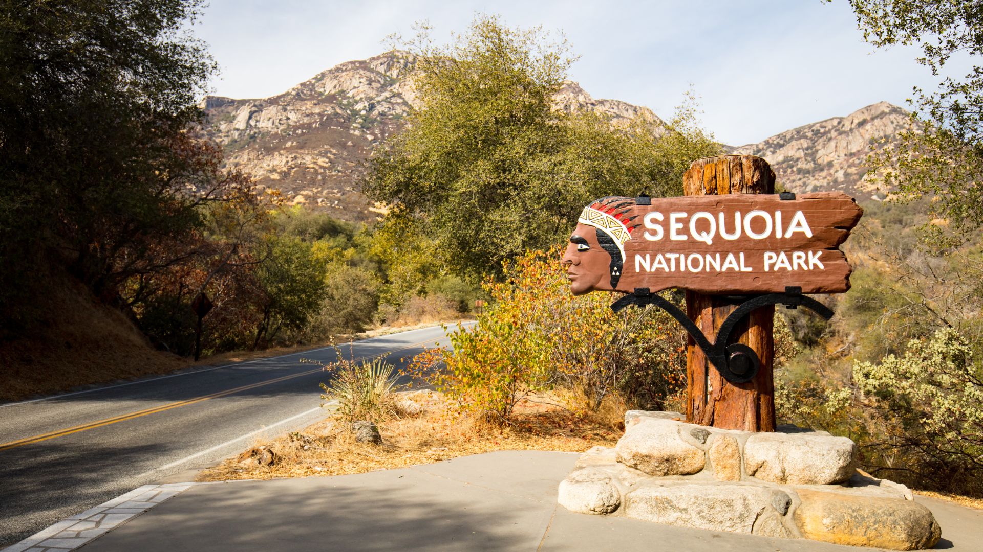
Journey to Sonoma and Sequoia National Park
I set out from Sonoma’s wine country and eventually found myself among the giant sequoias farther inland. Sonoma County, with its blend of vineyards and wild coastline, surprised me with unexpected wildlife sightings before I even thought about heading for the mountains.
Within just a day’s drive, I moved through wildly different ecosystems. Along the coast near Sonoma, I spotted seals and seabirds, while the inland hills started to hint at the presence of mountain creatures.
Travel Route Highlights:
- Sonoma County – Stretches of coastal wildlife and endless rows of grapevines
- Mountain transition zones – Noticeable shifts in habitats, sometimes within a few miles
- Sequoia National Park – Towering trees and glimpses of high-altitude wildlife
When I reached Sequoia National Park, mountain wildlife became the stars of the show. I caught sight of deer—different from the ones I’d seen at lower elevations—clearly built for the rugged terrain.
Honestly, the sharp contrast between the coast and the mountains left a big impression on me. Each area, with its own elevation, seemed to host a completely different cast of animals.
Those giant sequoias? They create a world all their own. As I wandered through the ancient groves, I noticed animals behaving differently, almost as if the trees shaped the entire rhythm of life around them.