Point Reyes National Seashore juts out like a wild finger into the Pacific Ocean, carving one of California’s most striking coastal landscapes just an hour north of San Francisco.
This 71,000-acre peninsula blends rugged cliffs, untouched beaches, and rolling hills where old dairy ranches still exist alongside elephant seal colonies and herds of tule elk roaming free.
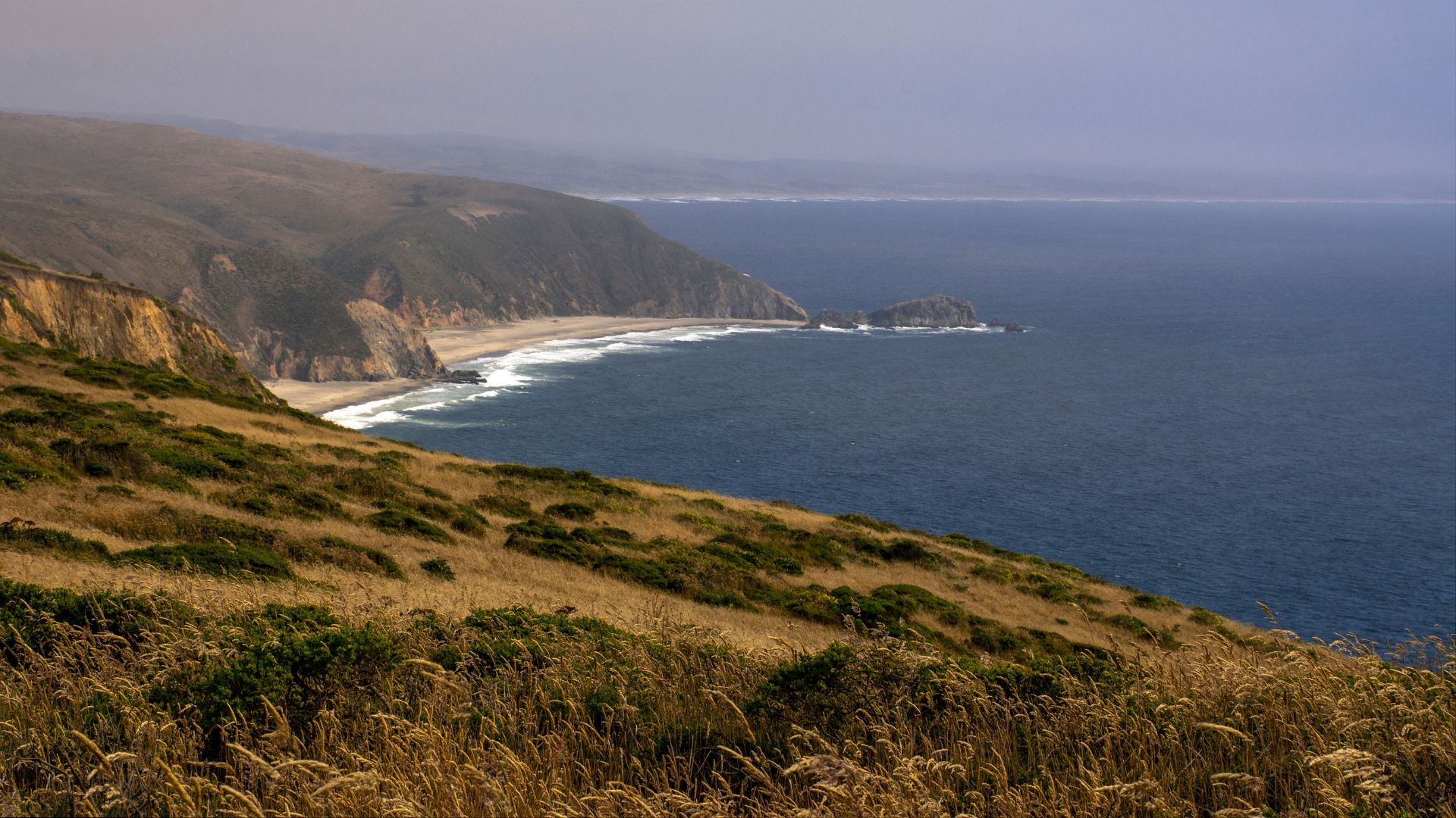
My time at Point Reyes showed me exactly why adventurers from all over flock here. The iconic lighthouse clings to dramatic cliffs, and Alamere Falls spills straight onto the sand—a rare sight.
With 80 miles of shoreline and 150 miles of hiking trails, this place becomes a paradise for anyone who loves wildlife, wild places, and the sound of crashing waves.
During my visit, I realized Point Reyes offers experiences you just can’t find elsewhere on the West Coast. There’s something about the easy wildlife encounters, the rich history, and those one-of-a-kind features like waterfalls on the beach that makes the whole day feel like a true escape—even though San Francisco is so close.
Windswept Landscapes and Essential Orientation
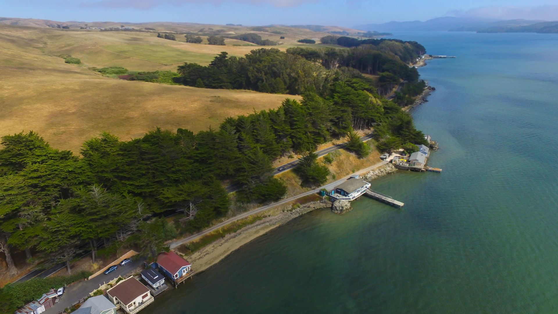
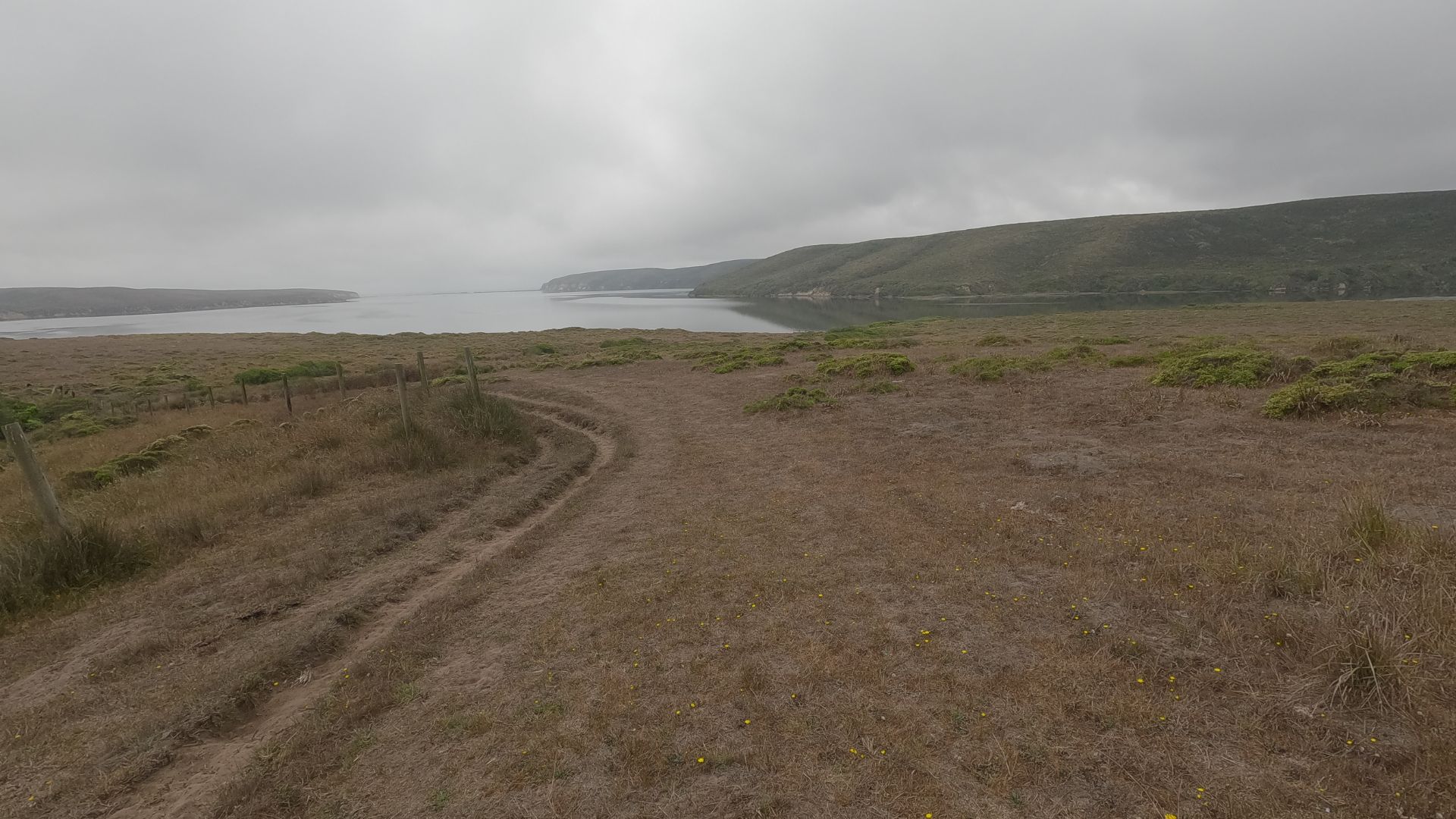
Point Reyes National Seashore sits on a bold peninsula in Marin County, California, roughly an hour north of San Francisco.
The ocean brings cool, foggy weather most of the year, but fall and late spring usually offer the best days to visit.
Where Is Point Reyes National Seashore?
Point Reyes National Seashore covers over 70,000 acres of protected coastline in Marin County.
The park sits on a triangular peninsula that juts into the Pacific, about 30 miles northwest of San Francisco.
Point Reyes Station is the main gateway town, a small, welcoming spot that acts as the jumping-off point for the park.
From here, roads branch out to the lighthouse, beaches, and trailheads.
Key spots in the park:
- Tomales Point (northern tip)
- Point Reyes Lighthouse (western edge)
- Limantour Beach (central coast)
- Drakes Beach (southern coast)
The National Park Service runs the seashore, but unlike many parks, Point Reyes still allows some ranching, blending history and conservation in a way that feels uniquely Californian.
Climate and Best Times to Visit
Point Reyes has a Mediterranean coastal climate—cool, wet winters and mild, dry summers.
Fog rolls in year-round, especially during summer.
When to go:
- September-November: Warmest, clearest days
- April-May: Wildflowers and fewer crowds
- December-March: Whale watching (but expect rain)
Summer fog can linger all day. I noticed mornings often started gray but cleared by afternoon.
Winter storms sometimes sweep in, sending waves crashing against the cliffs.
Temperatures usually hover between 50-65°F. The wind never really lets up along the coast, so I always toss a jacket in my bag, even if the sun’s out.
How to Get There
From San Francisco, I took Highway 101 north for about 15 miles to San Rafael.
Then I exited onto Sir Francis Drake Boulevard and followed it west for about 20 miles to Point Reyes Station.
Driving times:
- From San Francisco: about 1 hour via Sir Francis Drake Boulevard
- From San Rafael: 45 minutes
- From Highway 101: Take Lucas Valley Road or Sir Francis Drake Boulevard west
Public transit isn’t really practical here. Golden Gate Transit offers weekend bus service to Point Reyes Station, but honestly, you’ll want a car to explore freely.
Parking fills up fast at popular spots like the lighthouse or main beaches, especially on weekends. If you want a spot, arrive early.
My Journey to the Historic Point Reyes Lighthouse
The Point Reyes Lighthouse perches 265 feet above the Pacific, waiting at the end of a short but steep 0.45-mile walk and 313 steps down.
Built in 1870, this historic lighthouse guided ships for 105 years before the National Park Service stepped in to preserve it in 1975.
Visiting the Lighthouse and Surrounding Cliffs
I drove the winding Sir Francis Drake Boulevard for about 45 minutes from Bear Valley Visitor Center.
The road snakes through rolling hills and coastal scrub before reaching the small lighthouse parking lot.
With only 38 spaces, the lot fills up quickly. I showed up early and snagged a spot—by afternoon, folks circle for ages or park along the road. RVs and trailers have to park roadside.
From the lot, I walked 0.45 miles uphill on a paved path. With every step, the coastline grew more dramatic.
Wind often whips across the point at 40 mph or more, so I bundled up in layers. Trust me, you’ll want them.
Facilities here:
- Lighthouse Visitor Center with exhibits
- Ocean Exploration Center
- Restrooms at the lot and near the visitor center
- Water bottle filling station
The cliffs drop straight to the ocean. I stayed on marked trails since all off-trail areas west of the parking lot are closed for safety and to protect the landscape.
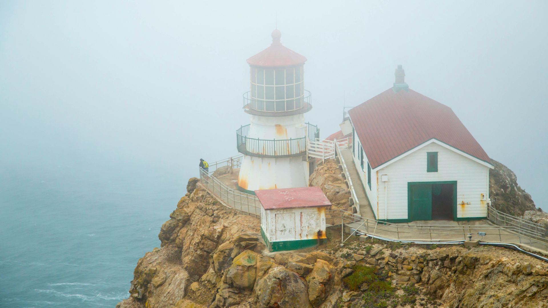
Lighthouse History and Maritime Heritage
People first lit the Point Reyes Lighthouse in 1870 to warn ships about the dangerous headlands.
The Point Reyes Headlands stretch 10 miles into the Pacific, creating a notorious navigation hazard for ships heading to and from San Francisco Bay.
The lighthouse protected mariners for 105 years. In 1975, the U.S. Coast Guard installed an automated light and handed the old lighthouse over to the National Park Service.
A major restoration project wrapped up in November 2019, helping preserve this piece of maritime history. The visitor center now displays the Fresnel lens from the San Francisco Lightship.
The lighthouse stands 265 feet above sea level. Its location made it crucial for maritime safety on this wild stretch of coast.
Navigating the Stairs and Access Tips
Descending the 313 steps to the lighthouse takes some effort. I took it slow going down and especially coming back up.
Staff close the stairs when winds top 40 mph for safety.
What to bring:
- Plenty of gas in your car (nearest station is 20 miles away)
- Layers for wind and chilly temps
- Water and snacks
- Good walking shoes
I always check the weather before heading out. Fog, rain, and strong winds are common, and cell service is spotty at best around the lighthouse.
The lighthouse itself isn’t wheelchair accessible, but the visitor center and observation deck are.
Visitors with disabled parking placards can get through a gate to park closer.
I set aside at least two hours for the whole lighthouse visit. Between the drive, the walk, and time spent soaking in the views and exhibits, it’s easy to spend a big chunk of the day here.

Immersed in Tule Elk Herds and Wildlife
Point Reyes has three main areas where tule elk wander freely, and Tomales Point Trail is the best bet for spotting them.
The 2,900-acre Tule Elk Reserve protects over 300 elk. Coyotes and owls also roam these hills, making every hike a bit of a wildlife safari.
Best Places to Spot Tule Elk
I found three main spots to see tule elk at Point Reyes.
The Tomales Point area holds the largest herd in a fenced reserve—about 315 elk as of 2023.
The Limantour area is home to a free-ranging herd of around 199 elk.
The Drakes Beach area now hosts 188 elk, a group that crossed Drakes Estero on their own after being reintroduced in 1998.
Tomales Point offers the most reliable sightings since the elk stay inside the reserve.
The free-ranging herds at Limantour and Drakes Beach move around more, so it takes some patience (and luck) to spot them.
If you’ve got time, check out more than one area. Elk numbers and locations change with the seasons and food availability.
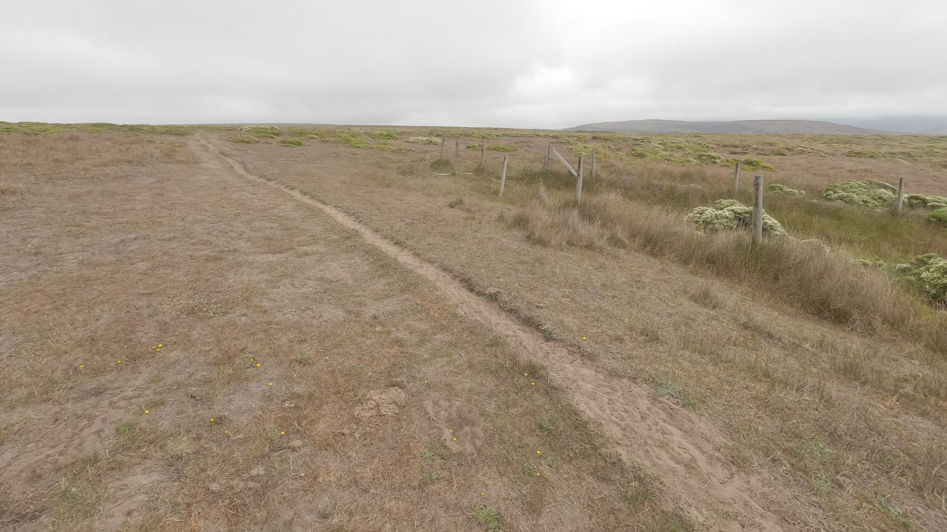
Tomales Point Trail Adventure
The Tomales Point Trail might just be the best wildlife hike in the Bay Area.
This 9.4-mile round-trip trek winds through the old Pierce Point Ranch area, now protected wilderness.
I spotted several elk herds along the way. The open grasslands make them easy to see, even from a distance.
During fall rut, the bulls show off some seriously impressive antlers.
Handy gear:
- Binoculars
- Telephoto lens if you’re into photography
- Water and snacks
- Layers for shifting weather
No permits are needed, and the trail stays open year-round.
Early mornings and late afternoons are best for photos and animal activity.
I noticed elk rested in shaded spots during the midday heat.
Wildlife Viewing Beyond Elk
Point Reyes is a haven for wildlife, not just elk.
On my Tomales Point hike, I watched a coyote hunting in the grass.
Other critters to look for:
- Burrowing owls nesting underground
- Red-tailed hawks and other raptors
- Bobcats (rare but possible)
- Gray foxes
- Black-tailed deer
The open landscape makes it easier to spot predators than in the woods.
I watched a coyote creep through the grass while elk grazed nearby.
Bird life is everywhere—raptors perch on fence posts and utility poles along the trail.
Down along the coast, seals and sea lions haul out on the beaches.
Each season brings its own wildlife drama. There’s always something new to see.
Chasing Waterfalls: Alamere Falls and the Coastal Wonders
Alamere Falls is one of only 25 tidefalls in the world—a 40-foot waterfall that tumbles directly onto the beach.
Getting there means a 13-mile round-trip hike, but the ever-changing views and wild landscape make it worth every step.
Hiking to Alamere Falls
I found three main ways to reach Alamere Falls, but the Palomarin Trail is by far the most popular.
The trailhead sits at the end of Mesa Road, about 35 minutes from Bear Valley Visitor Center.
The Palomarin lot holds only 75 cars and fills up fast on weekends. I learned to arrive before 8 a.m. to avoid getting turned away.
From Palomarin, the Coast Trail runs 6.5 miles to the falls.
The path weaves through Douglas fir forests and past several small lakes before reaching the bluffs.
Other routes:
- Bear Valley Trailhead: 7.3 miles one way, bigger lot (210 spaces)
- Five Brooks Trailhead: 7.1 miles one way, 50 spaces
The Coast Trail gives you sweeping ocean views for most of the hike.
I walked along clifftops hundreds of feet above the shore, with the Pacific stretching out forever.
Beach Waterfall Experience and Safety
Alamere Falls plunges 40 feet from the cliff straight onto Wildcat Beach. It’s wild—fresh water meeting ocean in a single dramatic drop.
The falls flow all year, but they’re biggest in winter and spring.
I skipped the sketchy unofficial “Alamere Falls Trail” that some websites mention. The National Park Service warns against it—crumbling cliffs and frequent rescues are a real risk.
Safety tips:
- Stay away from cliff edges (erosion is no joke)
- Stick to official trails to reach the beach
- Watch for loose rocks if people are above you
- Bring plenty of water (no sources at the trailheads)
Cell service is basically nonexistent, so I kept my phone off to save battery for emergencies.
The beach below gives you great views of the waterfall from all angles.
I didn’t swim—the water’s cold year-round—but it’s tempting on a hot day.
Nearby Trails and Nature Highlights
The Coast Trail connects to a 16.5-mile network stretching from Palomarin up to Limantour Road.
I explored a few side trails that branch off toward lakes and viewpoints.
Favorite stops along the Coast Trail:
- Bass Lake: A perfect spot to rest your feet
- Pelican Lake: Great for bird watching
- Wildcat Beach: A long sandy stretch north of the falls
Wildlife is everywhere. I spotted harbor seals, seabirds, and sometimes even whales offshore during migration.
Limantour Beach, further north, is easier to reach if you want coastal views without the long hike. The cliffs and habitats are just as stunning.
The trails pass through coastal scrub, grasslands, and in spring, wildflowers blanket the hills in color.
Beaches, Trails, and Iconic Sights
Point Reyes boasts over 30 beaches and 150 miles of trails, each with something special.
The most photogenic spots? Windswept beaches, a magical tree tunnel, and old shipwrecks that beg for a photo—these are the places that stick with you long after you leave.
Exploring Limantour and Drakes Beaches
Limantour Beach stretches for miles, covered in soft sand and lapped by calm waters. I love coming here for tide pooling when the tide’s out.
Parking sits right next to the sand, which means I never have to haul my stuff too far. The wide shoreline gives everyone room to spread out, and families seem to gravitate here since the waves stay gentle compared to other Point Reyes beaches.
Drakes Beach is tucked into a cove, with white cliffs looming behind. You’ll find a visitor center here, complete with restrooms and some surprisingly interesting marine life exhibits.
I noticed the water stays calmer at Drakes than at the more exposed beaches. It feels a bit more peaceful, honestly.
Limantour faces the open ocean, so the waves run bigger and wilder. Meanwhile, Drakes Beach feels sheltered and relaxed.
It takes about 20 minutes to drive to either beach from the main visitor center. The roads wind through the park, so I always plan a little extra time.
Must-See Photo Spots: Cypress Tree Tunnel and Shipwreck
The Cypress Tree Tunnel arches over the road, creating a natural, almost magical frame. In the morning, the light filters through in a way that’s just perfect for photos.
It doesn’t take long to visit—just pull over (safely!) and wander into the tunnel for that iconic shot. The trees have grown together over decades, and you can feel their history.
Not far from Inverness, there’s an old grounded boat resting in the marsh. The Point Reyes shipwreck makes for dramatic photos, especially if you catch a sunset.
The weathered wood stands out against the green marsh grass. I always bring a zoom lens for this spot since the boat sits in protected wetlands, and you can’t really get close on foot.
Both spots are easy to reach by car. The cypress tunnel sits right off the main road, and you can spot the shipwreck from several places along the Inverness shoreline.

The Coastal Hiking Experience
Chimney Rock Trail offers stunning coastal views in just 1.75 miles. I hiked it for elephant seal watching and to snap some lighthouse photos.
The path stays mostly flat, with a few gentle hills—nothing too tough. Chimney Rock itself gives you panoramic ocean views, and in winter, elephant seals gather on the beaches below.
Spring throws wildflower blooms all along the trail. The path connects to other coastal trails, so if you want a longer hike, you’ve got options.
I always notice the views get better as you walk out toward the point. The wind can really whip up here, so I usually pack an extra layer just in case.
Most coastal trails at Point Reyes follow clifftops above the ocean. The trails are well-marked, but after rain, they turn muddy fast.
Sturdy hiking shoes make a big difference out here. Trail conditions shift with the seasons, so I recommend checking with rangers before heading out, especially if storms have rolled through.
Wildlife Encounters and Natural Highlights
Point Reyes just delivers when it comes to wildlife. You might spot massive elephant seals hauled out on beaches, or stumble into a patchwork of wildflowers across the meadows.
The park’s mix of ecosystems supports everything from rare tule elk to thousands of migratory birds and marine mammals. It feels wild in the best way.
Elephant Seals and Overlooks
The first time I saw the elephant seals at the overlook near Chimney Rock, I couldn’t believe their size. These marine giants gather here from December through March for breeding season, and it’s something you have to see.
The adult males tip the scales at up to 5,000 pounds. Their long, drooping noses give them that unmistakable look.
Best viewing times:
- December: Males arrive first to claim territory
- January-February: Females give birth to pups
- March: Peak activity with up to 100 animals
You can hear the males’ trumpeting calls from over a mile away—no kidding. The overlook gives you a safe spot to watch all the action without disturbing them.
On weekends during peak season, trained docents set up with binoculars and spotting scopes. They’re happy to help you spot seals and answer questions.
Seasonal Wildflowers and Birdwatching
Spring transforms Point Reyes into a wildflower wonderland. My favorite displays pop up at Abbotts Lagoon, Chimney Rock, and along the Tomales Point Trail.
Prime wildflower locations:
- Abbotts Lagoon: Easy 1.5-mile trail with tons of blooms
- Chimney Rock: Coastal bluffs dotted with native plants
- Tomales Point Trail: Grassland flowers in March-May
Almost half of North America’s bird species pass through the park. I’ve spotted hawks, osprey, and even golden eagles at Abbotts Lagoon during fall migration.
Five Brooks Pond is a great spot for winter birding. Green-backed herons, grebes, and hooded mergansers rest here when it’s cold.
The lighthouse area can surprise you with unusual songbirds, especially on foggy fall days. Turkey vultures and ravens seem to stick around all year.
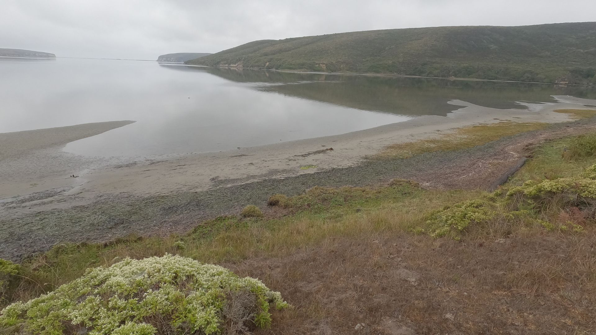
Drakes Estero and Tidal Wonders
Drakes Estero boasts California’s largest harbor seal breeding colony. About one in five of the state’s mainland harbor seals live right here—kind of wild when you think about it.
You’ll find a one-mile trail winding through what used to be a Christmas tree farm. Sometimes, I’d catch an owl just sitting quietly in the old pines, watching everything.
What to expect:
- When the tide’s out, mudflats appear and crabs scuttle everywhere, along with all sorts of little invertebrates.
- Egrets and herons wade around, hunting in the shallows.
- If you visit during fall migration, you’ll get some of the best birding—seriously, bring binoculars.
The footbridge is a favorite spot for snapping photos. I’ve spent afternoons just watching harbor seals sprawl out on rocks, while shorebirds poke around for snacks in the mud.
Tomales Bay links up with Drakes Estero, and that connection makes the whole area a buffet for marine life.