When you stand beneath the towering giants of Sequoia and Kings Canyon National Parks, your sense of nature’s scale just flips. These two connected parks show off some of the most jaw-dropping features on Earth—from the world’s largest trees by volume to the deepest canyon in the country. On my trip through this wild landscape, I finally understood why people call it the “Land of Giants.”
The parks deliver a wild range of experiences, whether you’re wandering among ancient sequoias that have stood for more than 2,000 years or hiking through high-altitude wilderness with endless mountain views. Every grove feels like it’s got its own story, and the Sierra Nevada peaks create a dramatic backdrop that seems to shift with every trail and lookout.
If you’re here for the famous General Sherman Tree, the rugged backcountry, or just peaceful wildflower meadows, there’s honestly something unforgettable around every bend. As I explored, I moved through ecosystems where massive trees suddenly open up to alpine lakes, deep canyons, and wildlife that kept me guessing what might show up next.
Discovering the Giants: Sequoias and Iconic Trees
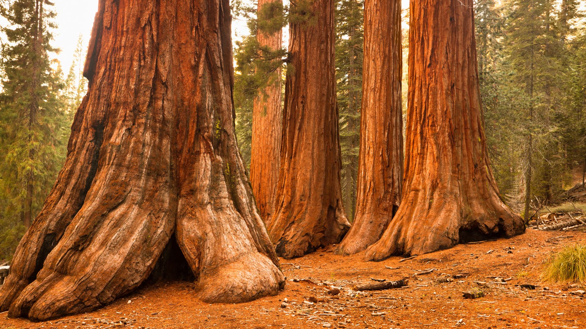
The giant sequoias in Sequoia National Park are some of the planet’s most massive living things. Trees like General Sherman break records for trunk volume. These ancient giants thrive in certain Sierra Nevada groves, and fire is actually key to their survival.
Giant Sequoia Trees of the Sierra Nevada
Giant sequoias, or Sequoiadendron giganteum, only grow naturally in California’s Sierra Nevada. I found them clustered in groves between 5,000 and 8,000 feet.
They’re picky about where they live. They need:
- Deep winter snowpack for moisture
- Mild year-round temps
- Well-drained soil
- Regular fire cycles for new growth
Some sequoias live over 3,000 years. They aren’t the tallest trees—that’s the coast redwood—but by trunk volume, they’re the biggest.
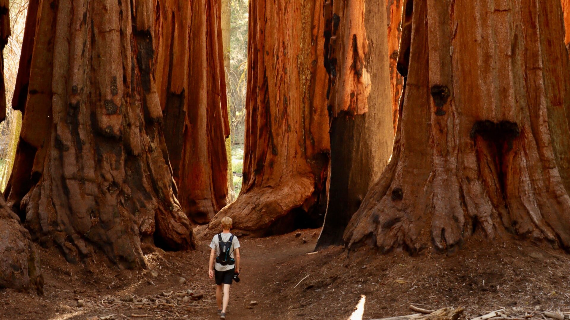
Grant Grove and Giant Forest show off the most famous specimens. Walk here and you’ll see hundreds of mature sequoias packed together.
These trees just keep growing. Even the ancient ones add about a foot in diameter each year.
General Sherman, General Grant, and Notable Trees
General Sherman Tree holds the record for largest tree by trunk volume. You’ll find it in Giant Forest, and every year it adds the weight of a 60-foot tree.
I followed the paved Congress Trail to reach General Sherman. The two-mile loop starts right at the tree and winds deep into the Giant Forest Grove.
General Grant Tree stands in Grant Grove as the runner-up in size. Congress even named it the “Nation’s Christmas Tree.”
Other giants worth seeing:
- President Tree (third largest)
- Lincoln Tree (fourth largest)
- Sentinel Tree (right near the Giant Forest Museum)
The Big Trees Trail is a gentle 1.2-mile loop, perfect for a stroll to see several massive specimens. I’d suggest starting at the Giant Forest Museum to get your bearings and a bit of background before heading out.
Fire, Ecology, and Sequoia Longevity
Fire isn’t just a threat here—it’s essential. Sequoias have thick, fire-resistant bark, so most blazes don’t faze them.
In fact, they need fire to reproduce. The heat pops their cones open and clears the forest floor so new seedlings can grow.
But lately, fires have gotten more intense. The 2021 KNP Complex Fire wiped out an estimated 2,380 giant sequoias.
Climate change and drought have made things worse. Dead trees pile up as fuel, and the living ones don’t hold as much moisture.
During big fires, park staff wrap the most famous trees in protective foil. I remember seeing General Sherman all bundled up during the 2021 fires.
Even with these challenges, sequoias bounce back in ways that amaze me. That thick bark and high canopy really help them survive fires that would destroy other trees.
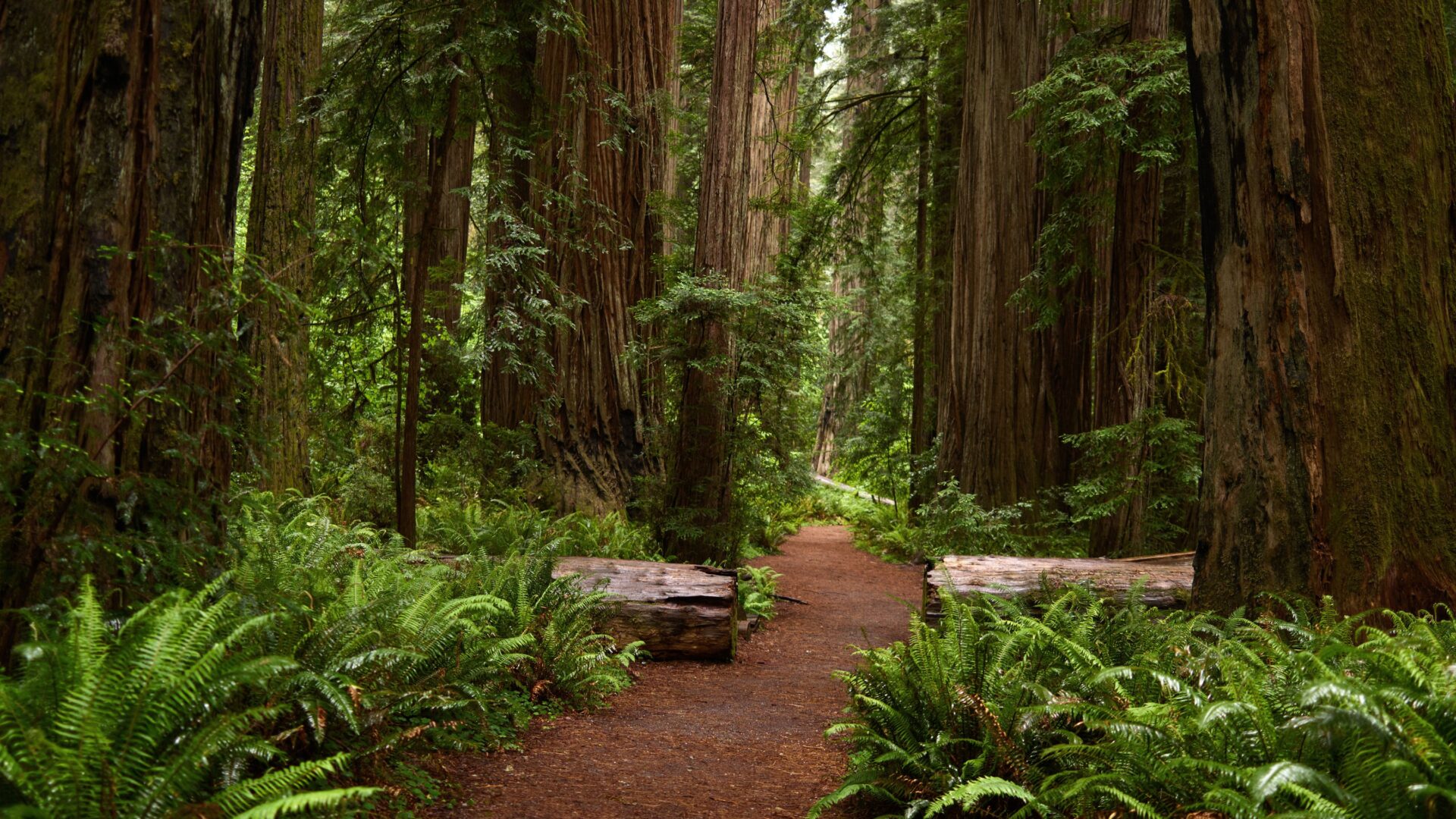
Exploring Towering Forests and Scenic Groves
Most of the giant sequoias cluster in a handful of groves, each with its own vibe and trails. I found some spots with easy paved paths, while others made me work for the views with tougher hikes.
Giant Forest and Congress Trail
Giant Forest is the epicenter for sequoia lovers. Nowhere else on Earth has a higher concentration of these giants.
The Congress Trail quickly became my go-to. This 3-mile paved loop links up with famous trees, including General Sherman.
I started at the Giant Forest Museum to get a crash course on sequoia ecology. The museum sits right where you need it, with several trailheads nearby.
If you want something shorter, the Big Trees Trail is a 1.3-mile paved loop. It’s perfect for families or anyone just wanting a quick wander among the giants.
The Tunnel Log is a quirky highlight. Someone cut a tunnel through a fallen sequoia, so you can literally drive your car through a tree.

Grant Grove and General Grant Tree
Grant Grove, over in Kings Canyon National Park, is home to some seriously impressive trees. The General Grant Tree is the star here.
This beast stands 267 feet tall and more than 40 feet across. Congress named it the “Nation’s Christmas Tree,” which I think is kind of charming.
The General Grant Grove Trail is an easy 0.6-mile paved loop. On this walk, I checked out the Grant Tree and a few others, like the California Tree.
There’s also the Centennial Stump—a massive reminder of the trees lost before the park got protection.
Crescent Meadow and Trails
Crescent Meadow got dubbed the “Gem of the Sierra” by John Muir. It’s a peaceful spot, ringed by sequoias and granite.
The Crescent Meadow Loop is a gentle 1.6-mile trail. I loved catching glimpses of the forest and mountains as I circled the meadow.
From here, you can launch into longer wilderness hikes. The High Sierra Camps and backcountry trails start in this area, perfect for anyone craving a multi-day adventure.
When I visited in early summer, wildflowers were everywhere. The mix of massive trees and delicate blooms was something I’ll never forget.
Redwood Mountain Grove and Other Hidden Gems
Redwood Mountain Grove is the world’s largest sequoia grove by total volume. I barely saw anyone else here—it’s way less crowded than the main spots.
You’ll need to hike a bit farther to reach it, but the payoff is solitude among giants. I took the 2.5-mile loop right through the grove’s heart.
There’s also Muir Grove and Dorst Creek Grove. These are smaller, quieter, and great if you want to dodge the crowds.
Getting to these out-of-the-way groves takes a little more planning and a willingness to hike. Trails are often unpaved and can get tricky if the weather turns.
The High Sierra Wilderness: Peaks, Meadows, and Deep Canyons
The High Sierra region is all about granite peaks soaring over 14,000 feet, and alpine meadows bursting with wildflowers in the short summer. Kings Canyon slices almost 8,000 feet deep through solid granite, making for some of California’s wildest scenery.
High Sierra Landscapes and Alpine Meadows
The High Sierra rises like a granite fortress above the lower hills. I was surrounded by jagged peaks that seemed to go on forever.
Elevation Changes:
- Foothills: 2,000-4,000 feet
- Mid-elevation: 4,000-8,000 feet
- High Sierra: 8,000-14,000+ feet
Above 8,000 feet, alpine meadows pop up in summer. These little patches of green and wildflowers appear where the snow finally melts. I wandered through fields of Indian paintbrush, lupine, and mountain asters.
The growing season is short—just 3-4 months. Most of the year, snow buries these meadows. When it melts, water rushes down the granite, forming temporary streams.
Granite domes and razor-sharp ridges dominate the view. These rocks formed deep underground, then glaciers carved them into their current shapes.
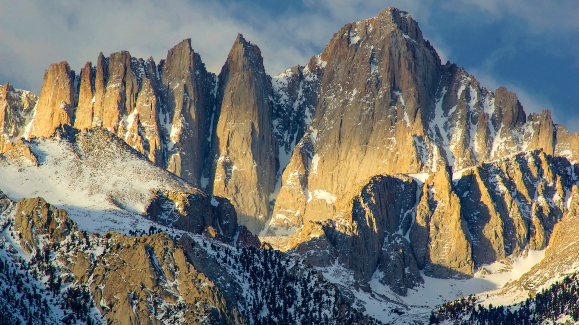
Great Western Divide and Mount Whitney
The Great Western Divide splits the Kern and Kings River drainages. This ridge runs north-south through the Sierra.
Mount Whitney towers at 14,505 feet—the tallest summit in the lower 48. It sits on the Sierra’s eastern edge.
From several viewpoints, I spotted Mount Whitney’s flat summit and steep granite faces. Climbers and hikers try for the top year-round.
The Divide has loads of peaks over 12,000 feet. These mountains separate different watersheds, and weather can change fast from one side to the other.
Snow lingers longer on north-facing slopes. I noticed this on nearly every peak I passed.
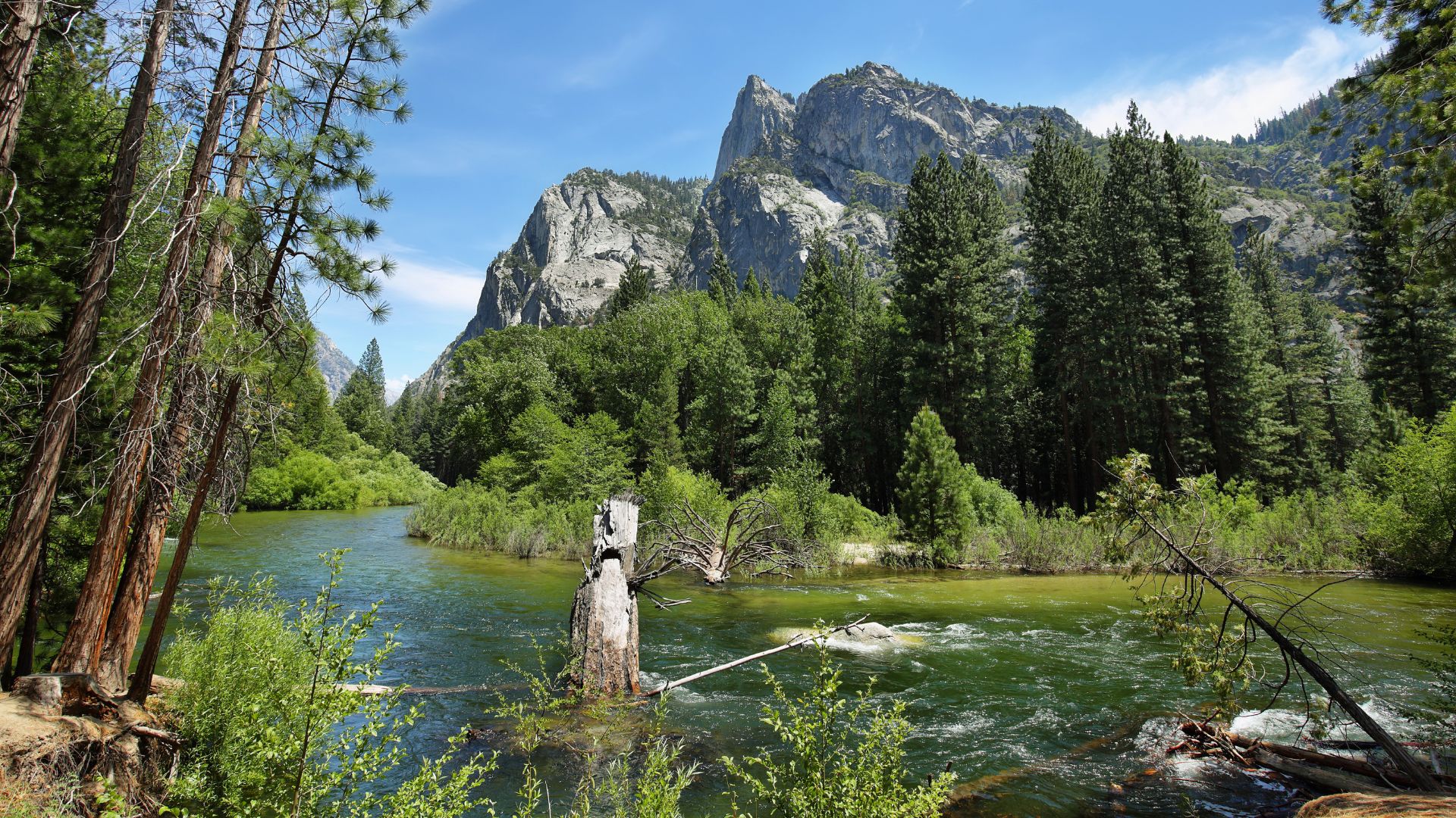
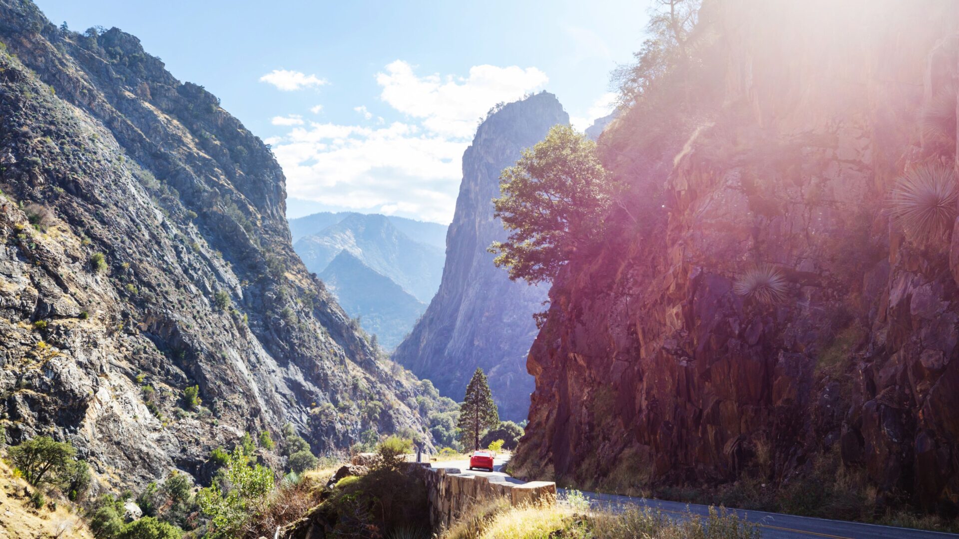
Kings Canyon: Deepest Canyons in California
Kings Canyon drops a staggering 8,000 feet from rim to river. The South Fork Kings River carved this gorge over millions of years. Only the Grand Canyon is deeper.
Sheer granite walls rise almost vertically. At some viewpoints, I could barely spot the river far below.
Canyon Features:
- Depth: Up to 8,000 feet
- Width: 1-3 miles at the rim
- River: South Fork Kings River
- Rock type: Granite and metamorphic
Water flow changes a lot with the seasons. In spring, snowmelt turns waterfalls into roaring torrents. By late summer, many of them vanish.
The canyon has its own microclimate. It can be 20-30 degrees warmer at the bottom than at the top. I definitely felt the temperature swing on my way down.
Unforgettable Sights and Signature Landmarks
Sequoia and Kings Canyon are packed with natural wonders. From granite domes to secret caves and thundering waterfalls, every landmark feels like a window into the Earth’s wild past.
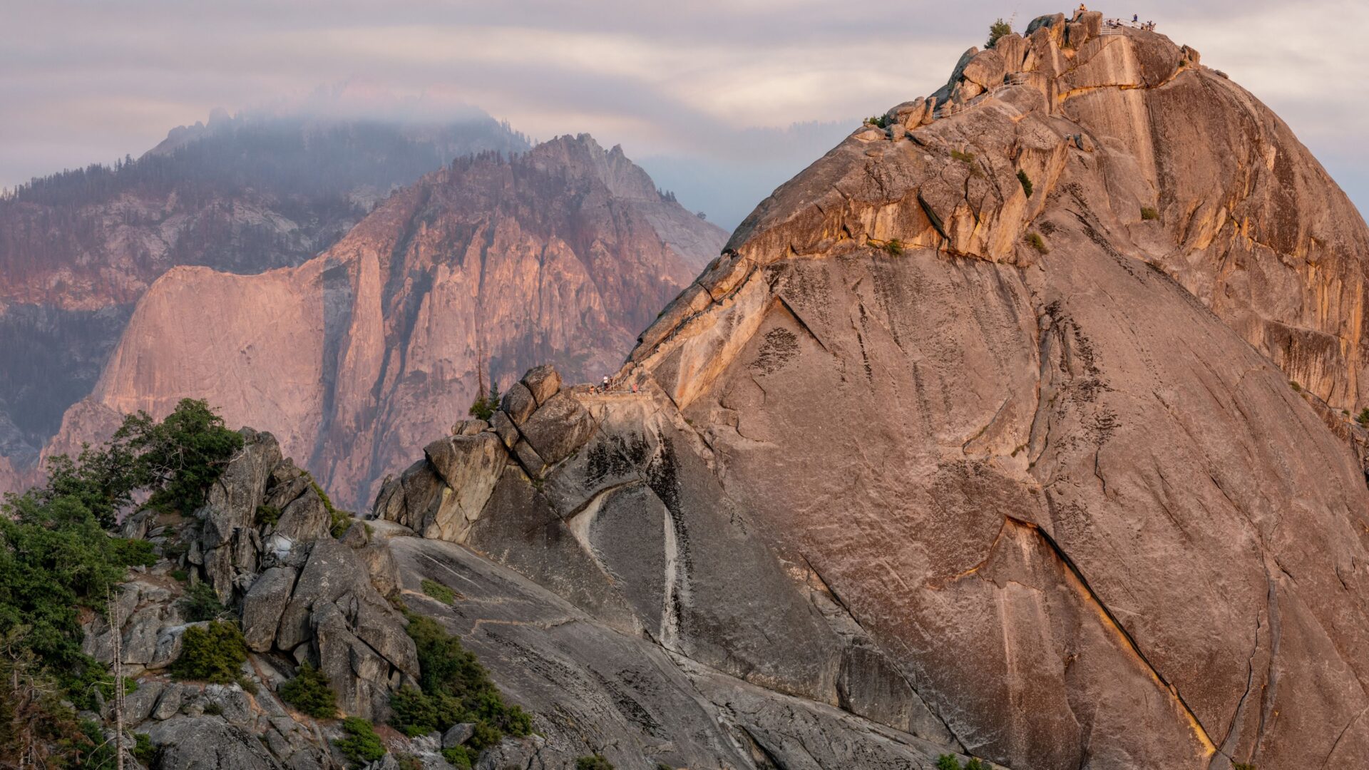
Moro Rock and Tunnel Rock
Moro Rock is one of the most iconic granite domes in the parks. It rises to 6,725 feet in the Giant Forest area.
The climb is no joke—400 steep stone steps wind up the rock. I found the hike tough but totally doable if you’re reasonably fit.
Key Features:
- 400 steps to the summit
- Sweeping views of the Great Western Divide
- Mornings or late afternoons are best for the climb
- Open seasonally, depending on weather
From the top, I could see across the San Joaquin Valley to the west and the High Sierra to the east. On a clear day, the views go for more than 100 miles.
Tunnel Rock sits near the Giant Forest Museum. It’s a chunk of granite with a natural tunnel carved out—proof of what water and weather can do over ages.
Crystal Cave and Marble Cavern
Crystal Cave is the only underground tour in the parks. This marble cave formed as water slowly dissolved limestone over millions of years.
It’s always chilly inside—about 48 degrees Fahrenheit. Even in summer, I needed a jacket.
Tour Info:
- Guided tours only
- About 45-50 minutes long
- You have to book ahead
- Closed in winter
Inside, I saw wild formations—stalactites, stalagmites, and flowstone curtains. The marble walls shine and reflect light in a way that’s almost otherworldly.
Marble Cavern links to Crystal Cave through a series of underground passages. This section isn’t open to the public, but it’s part of the huge cave system hidden below the park.
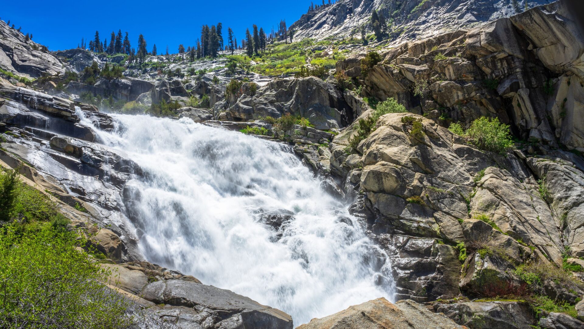
Tokopah Falls and Water Features
Tokopah Falls tumbles 1,200 feet down a sheer granite cliff in the Lodgepole area. In spring, especially from May to July, the waterfall really puts on a show thanks to the snowmelt.
The trail to the falls hugs the Marble Fork of the Kaweah River for about 1.7 miles. I found this hike pretty easy—there’s hardly any elevation to worry about.
Trail Details:
- 3.4 miles round trip
- Minimal elevation gain
- Well-maintained path
- Accessible for most fitness levels
Granite walls soar up on both sides, turning the area into a natural amphitheater. Water slips over the smooth rocks, breaking into smaller cascades as it drops.
When the water’s roaring at its peak, the mist drifts out and cools you down—something I definitely appreciated on warmer days. That granite bounces the sound around, too, so the falls sound even bigger and wilder than they actually are.
Wildlife Encounters and Natural Wonders
These parks are home to a surprising variety of animals, from hulking black bears to tiny, chubby marmots in the alpine meadows. Watching them, I started to notice how things like fire, altitude, and shifting habitats shape their daily lives.
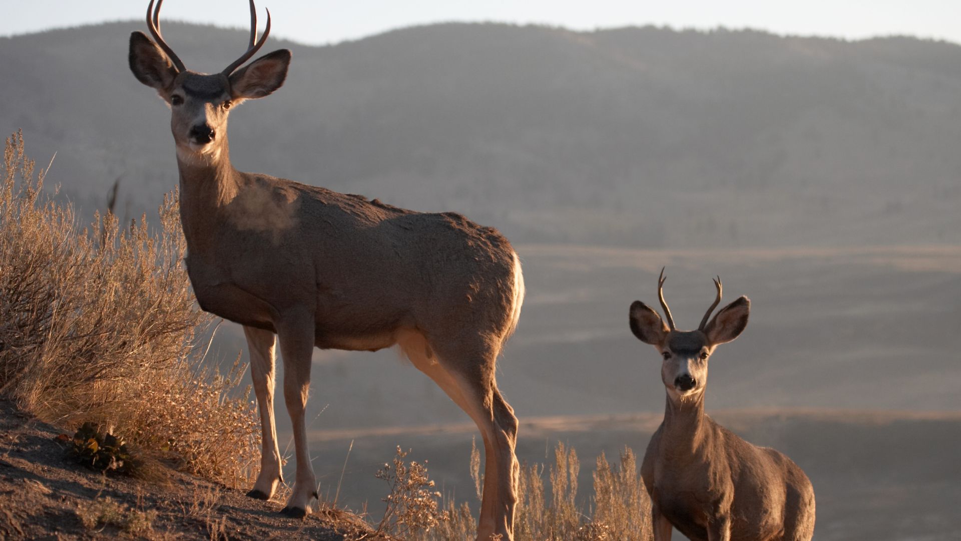
Mule Deer, Black Bears, and Mountain Lions
Mule deer wander all over—through foothills, up to the subalpine zones. I usually spotted them at dawn or dusk, especially near meadows or creeks. Their oversized ears twitch at every sound, always on alert for predators.
Black bears show up often, especially around campgrounds and picnic spots. I learned they can weigh up to 400 pounds and climb trees like it’s nothing. That’s why everyone needs to be careful with food storage.
Mountain lions live here, too, but good luck spotting one. They hunt deer and smaller animals, but I never caught a glimpse myself. Rangers told me these cats often use the same trails hikers do, just at different times.
The KNP Complex Fire in 2021 really changed things for these animals. Some places burned to the ground, while others stayed untouched, so now there’s this wild patchwork of habitats.
Birds of Prey: Peregrine Falcons
Peregrine falcons perch and nest on the high granite cliffs all over the parks. I watched one dive at what must’ve been over 200 miles per hour, chasing after other birds. Their calls echoed off the stone walls, sharp and wild.
Back in the 1970s, DDT nearly wiped these falcons out, but conservation efforts brought them back. Now, they thrive on these cliffs.
I found the best spots to watch them along the Kings River canyon. They hunt smaller birds flitting through the forest below, and their eyesight is so good they can spot prey more than a mile away.
Marmots, Bobcats, and Diverse Fauna
Yellow-bellied marmots hang out in the high country above 8,000 feet. I’d hear their piercing whistles warning the others whenever danger got close. Winters are rough up there—they hibernate for seven months straight.
Bobcats hunt throughout the parks, usually sticking to rocky spots with thick brush. I only ever saw their tracks near water, never the animals themselves. They go after rabbits, squirrels, and the occasional bird.
The parks also support over 200 bird species. I spotted Steller’s jays, mountain chickadees, and white-headed woodpeckers. Each bird seems to have its favorite elevation, depending on what it eats.
Ecosystem and Park Conservation
Giant sequoias create their own little worlds. Some of these trees have stood for over 3,000 years, and their massive trunks shelter all sorts of creatures. Flying squirrels and bats often move into the tree hollows.
Fire actually helps keep these ecosystems healthy. The parks now use prescribed burns to clear out dangerous undergrowth, which helps avoid disasters like the KNP Complex Fire.
Climate change is starting to threaten high-elevation animals like marmots and pikas. They need cool temperatures, and as things warm up, their habitat shrinks. Park scientists keep a close eye on these changes.
People have a big impact, too. Visitors need to follow strict rules about food storage and keep their distance from wildlife to protect everyone—four-legged or two.

Planning Your Journey: Getting There and Visitor Essentials
These parks aren’t the kind you just breeze into—they connect via the Generals Highway, and getting around takes some planning. Where you stay and when you go can totally change the vibe of your trip in the Sierra Nevada.
Access Points and Generals Highway
If you’re aiming for the southern part of Sequoia, I’d suggest the Ash Mountain Entrance. It’s right off Highway 198, just past the town of Three Rivers.
The Generals Highway ties both parks together. This 46-mile stretch winds from Ash Mountain all the way to Kings Canyon’s Cedar Grove. It’s scenic, but be ready for some curves.
Heads up if you’re driving a big rig: Anything over 22 feet long has to use the Big Stump Entrance on Highway 180. The road from Three Rivers is way too tight for large RVs or trailers.
Main routes in:
- Highway 198 from Visalia through Three Rivers to Ash Mountain
- Highway 180 from Fresno to the Big Stump Entrance
- Mineral King Road (seasonal access) for the adventurous backcountry crowd
These mountain roads can take longer than you think, with all the twists and elevation changes. There’s no gas inside the parks, so fill up before you go in.
Lodging, Camping, and Gateway Towns
Wuksachi Lodge is the top pick for comfort inside Sequoia National Park. It’s open year-round, with a restaurant and modern perks at 7,200 feet.
Three Rivers is the main stop before you enter the parks from the south. You’ll find hotels, restaurants, and places to grab last-minute supplies.
Camping’s popular here, with 14 campgrounds across both parks. Most are first-come, first-served, so showing up early—especially in summer—really helps.
Popular campgrounds:
- Lodgepole (reservations required)
- Dorst Creek (reservations required)
- Potwisha (near Ash Mountain)
- Azalea and Sunset in Cedar Grove
If you want more options, Visalia is about 45 minutes from Ash Mountain and has all the usual chain hotels and restaurants.
Mineral King does have a small campground, but the road in is a winding, 25-mile mountain adventure. I’d only recommend it if you’re comfortable with mountain driving.
Visitor Centers, Entrances, and Shuttles
The Lodgepole Visitor Center is the main hub for Sequoia. You’ll find it in the Giant Forest area, with exhibits about the sequoias and park history.
The Foothills Visitor Center near Ash Mountain covers the lower elevations. Staff there can clue you in on current road conditions and weather.
Cedar Grove Visitor Center opens seasonally in Kings Canyon and focuses on the canyon’s geology and the Kaweah River.
Unlike some national parks, there’s no shuttle system here. You’ll need your own set of wheels to get around and reach the trailheads.
Entrance fees apply for both parks, but one pass covers both. If you’re planning to come back, an annual pass is a solid deal.
Seasonal Tips and Park Safety
Summer (June-September) usually means gorgeous weather, but wow, it gets crowded. Every road and facility opens up, so you can explore without much restriction.
Winter access gets tricky when snow covers the Generals Highway. Most folks stick to the lower elevations near Ash Mountain since those areas stay open.
Spring draws fewer visitors, which I love, but you might run into lingering snow here and there. Always check the latest conditions, especially if you’re heading up to higher spots.
Key safety considerations:
- From November through April, always bring tire chains—just in case.
- Weather can turn on a dime, so keep an eye on the forecast.
- Pack layers. Trust me, temperatures swing wildly as you change elevation.
- Bears roam the parks, so store your food with care.
During spring, the Kaweah River really surges with snowmelt. I’d recommend steering clear of fast water and those slick rocks along the edge.
Cell service? Pretty unreliable in most of the park. Download offline maps ahead of time and let someone know your plans before you venture into the wild.