If you’re dreaming about exploring Yosemite’s high country, you’ve probably realized that everything depends on one thing: when Tioga Pass actually opens. This winding mountain road links the eastern Sierra with Yosemite’s wildest corners, but snow buries it for months at a time.
Most years, Tioga Pass opens somewhere between late May and early June, then closes again in November when winter storms roll in. The exact dates? They’re a moving target—snowfall and spring weather call the shots. Road crews usually start plowing around April 15, but sometimes it takes a month or two to dig it all out.
I’ve pulled together this guide so you can plan your high country adventure without second-guessing. I’ll share the best ways in, favorite stops, and some tips to keep you safe while you’re out in this jaw-dropping part of Yosemite. The pass leads to lakes, domes, and meadows most visitors never get to see.
When Does Tioga Pass Open and Close Each Year?
Tioga Pass doesn’t stay open year-round. It usually opens late May or early June and shuts down in November. The actual dates are anyone’s guess until the snowpack melts and the plows get through.
Typical Opening and Closing Dates
Looking at the records from 1933 to 2022, Tioga Pass has averaged an opening date of May 28 and a closing date of November 3.
But honestly, it can swing wildly. I’ve seen the pass open as early as April or as late as July when the snow just keeps coming.
Here’s the recent pattern:
- Most years: Late May to early June
- Big snow years: Mid-June or even July
- Light snow years: Sometimes mid-May
Usually, Tioga Road stays open for about 5-6 months. In 2023, Yosemite got hammered with snow—over 240% of average—so the opening didn’t happen until late June.
Highway 120 through Tioga Pass is the only direct way across the Sierra Nevada up here. When it’s closed, you’ll have to loop around the mountains on other highways.
Why and How the Dates Vary
Plowing usually starts mid-April, but the timeline is totally at the mercy of the weather. Crews sometimes have to dig through snowdrifts up to 40 feet deep.
A late spring storm in April or May can set everything back by weeks. Even a dusting of new snow can stop the plows for days.
What really affects the opening?
- How much snow fell over winter
- If spring is warm or cold
- April and May storms
- Whether all the equipment and crew are ready
Yosemite National Park doesn’t give out exact opening dates, even late in spring. If you’re planning a trip, check road updates often.
Usually, the pass closes with the first real snow in November.
Snowpack, Weather, and Road Conditions
April 1 snowpack numbers are the best clue for when Tioga Pass might open. If the water content is high, expect a late opening.
How the snowpack changes things:
- 100% or less: Usually late May
- 150-200%: Early to mid-June
- Over 200%: Late June or even July
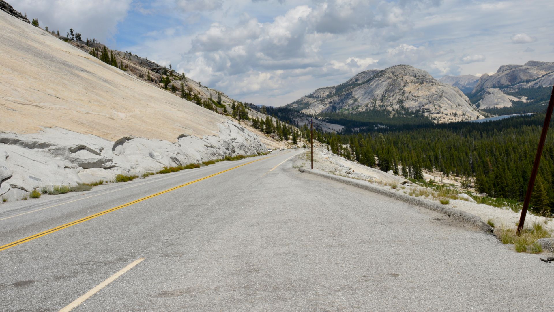
Tioga Road climbs way up—Tioga Pass itself sits at 9,943 feet. That’s high enough for snow to stick around way longer than you’d think.
Warm springs help the snow melt and speed up plowing. Cold, late springs drag things out.
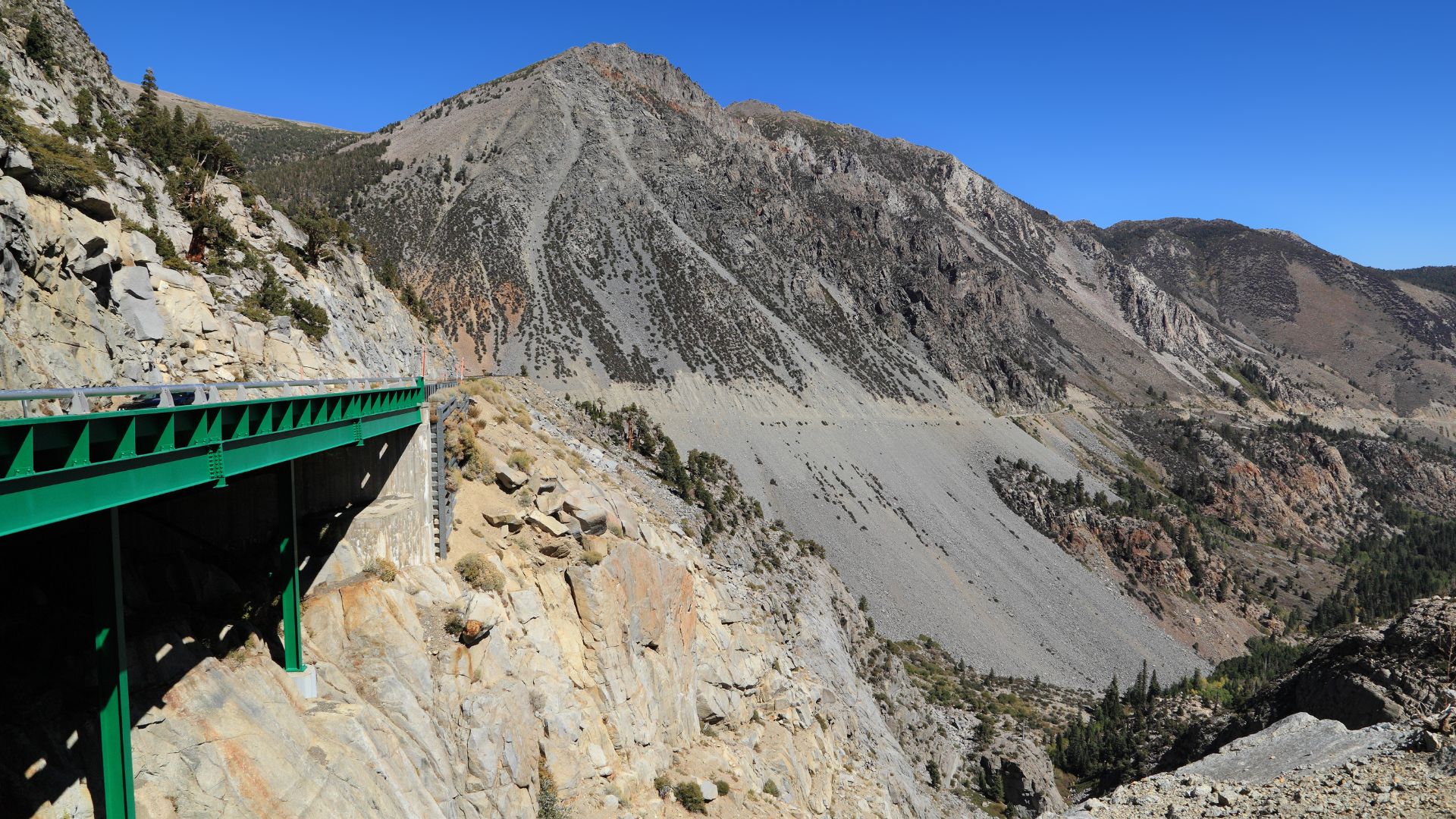
It’s not just snow, either. Rockslides, road washouts, or pavement damage from freeze-thaw cycles can keep the road closed even after the snow’s gone.
Accessing Tioga Pass: Routes and Entrance Information
Tioga Pass links the eastern Sierra with Yosemite’s high country along Highway 120, topping out at 9,943 feet. It’s the only way into Yosemite from the east, and you’ll need to plan your route carefully since the road isn’t open all year.
Directions and Main Access Points
You’ve got two main ways to reach Tioga Pass. Coming from the east, head up Highway 395 to Lee Vining, then turn onto Highway 120 west straight to the entrance.
If you’re coming from the west, drive through Yosemite Valley or another park entrance. Get on Big Oak Flat Road, then continue to Crane Flat where it meets Tioga Road (Highway 120 East).
Eastern Approach:
- Highway 395 → Lee Vining → Highway 120 West
- Best if you’re coming from Las Vegas, Death Valley, or Reno
- You’ll get some great Mono Lake views
Western Approach:
- Enter Yosemite any way → Big Oak Flat Road → Crane Flat → Tioga Road
- Works well if you’re already inside the park
- Also connects with Highway 41 from Fresno
Tioga Pass Entrance and Park Reservations
The entrance station at Tioga Pass sits right at 9,943 feet and only opens from late May through October. If you’re coming from the east, you’ll need to pay your park fee here.
You can get park passes and brochures at the entrance. The entrance fee covers you for seven days.
What you’ll need:
- A valid park pass or payment
- A vehicle up for mountain driving
- A quick check on road conditions before you go
Parking fills up fast at the popular stops along Tioga Road, especially in summer. I always try to get there early for a better shot at a spot.
Alternate Routes When Tioga Pass is Closed
If Tioga Pass is closed for the season, you’ll need a different plan. The closure usually runs November to May, so winter visitors have to use other routes.
Main alternatives:
- Highway 41 (Wawona): Southern entrance from Fresno
- Highway 140 (El Portal): Western entrance through Merced
- Highway 120 West (Big Oak Flat): Northwestern entrance
If you’re coming from the east, like Lee Vining, you’ll have to drive south on Highway 395, then over to Highway 41 through Fresno. It adds a lot of time, but it’s the only way in during winter.
Big Oak Flat entrance will get you to Crane Flat, but beyond that, Tioga Road stays closed until the plows finish up in spring.
What to See and Do Along Tioga Pass
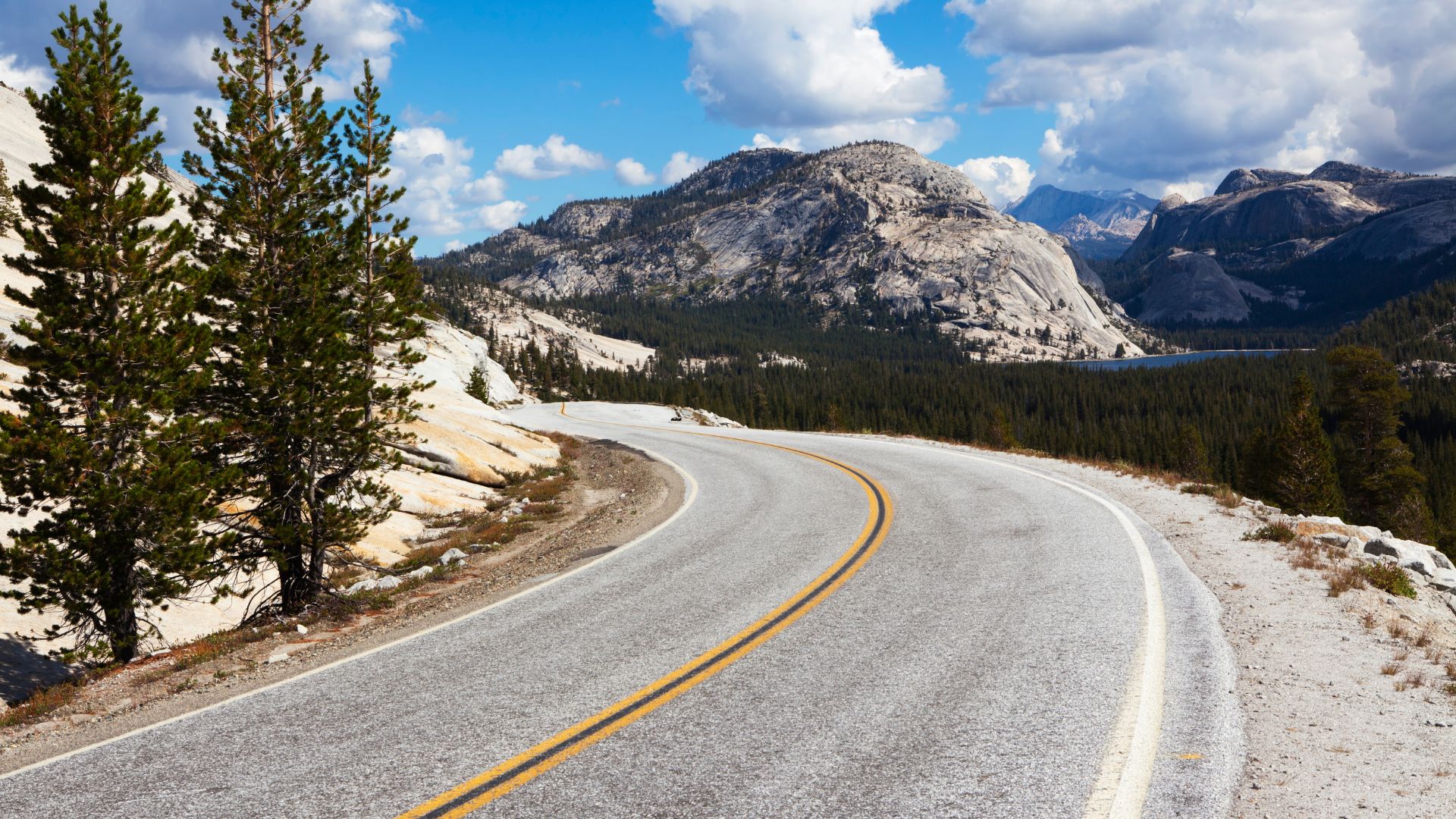
Tioga Pass is packed with alpine scenery—meadows, lakes, granite everywhere. The 47-mile drive links up hikes, overlooks, and water spots you just can’t find anywhere else in Yosemite.
Top Destinations and Scenic Stops
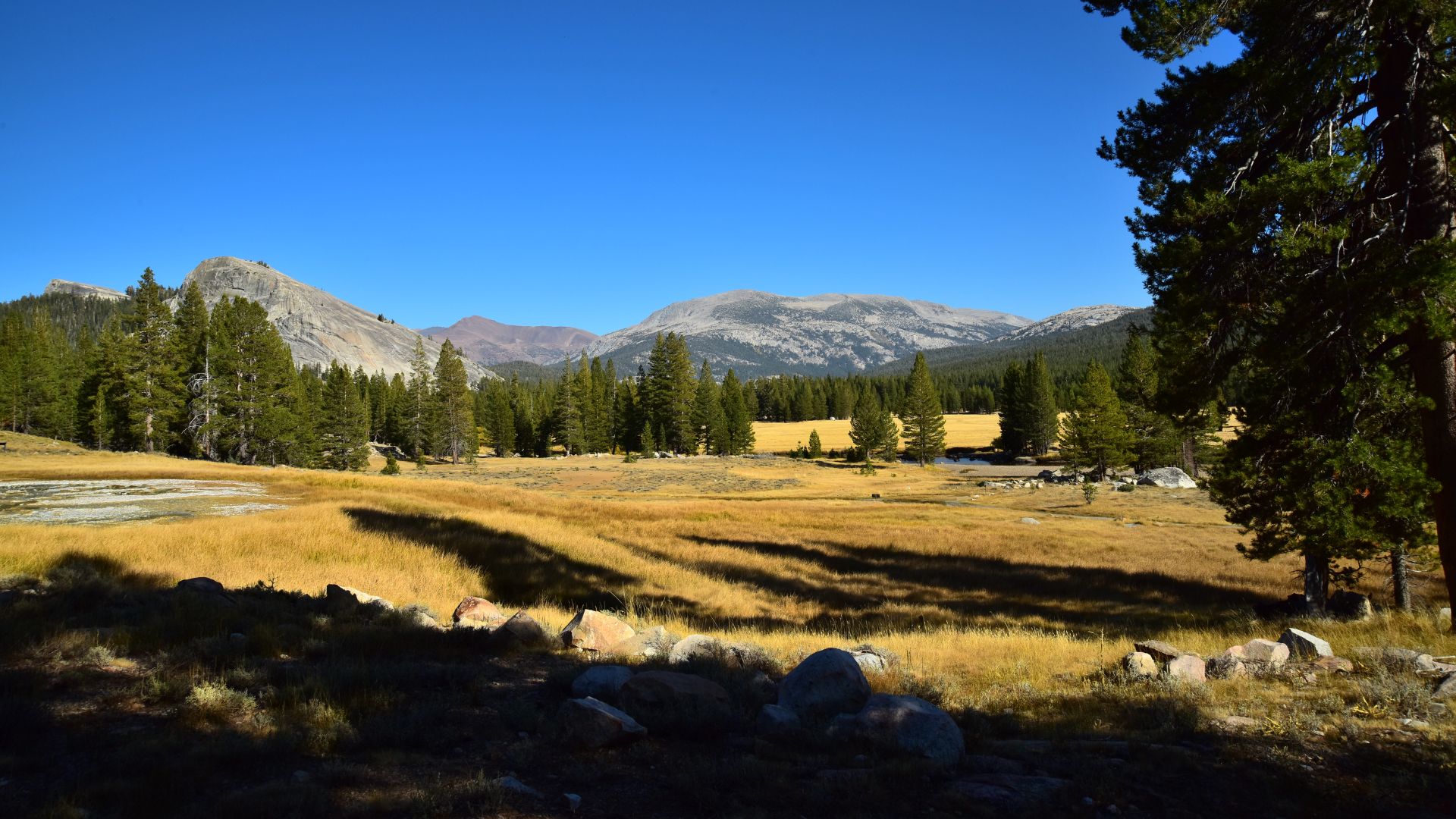
Tuolumne Meadows is the big one. This huge subalpine meadow goes on for miles, with the Tuolumne River winding through and granite domes all around.
If you stop at the visitor center, you can grab maps and trail info. The meadows have easy walks and serve as the jumping-off point for longer adventures.
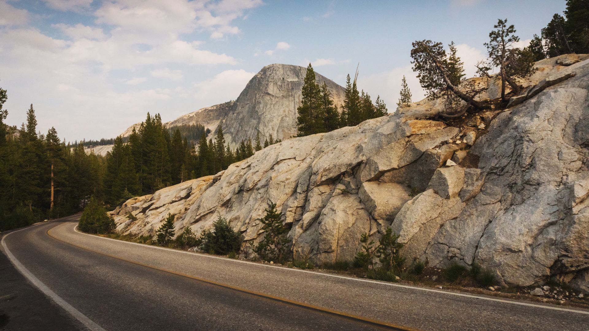
Olmsted Point gives you a totally different view of Half Dome. From here, you’re looking at the back, not the classic valley side.
It’s just a short walk from the parking lot to the granite slabs—super easy for photos and a quick stop.
White Wolf is quieter. You’ll find camping, a small lodge, and fewer crowds. It’s a nice place to slow down, grab a bite, or hit a trail away from the busy spots.
Recommended Hiking Trails
Lembert Dome is a short, steep hike with huge payoffs. You can get to the top in about 30-45 minutes, and the view over Tuolumne Meadows is unreal.
The granite is grippy, so most people can manage it. Bring water, and if you want to avoid the crowds, go early.
May Lake Trail takes you to a peaceful alpine lake under Mount Hoffman. It’s a moderate hike—about 2.4 miles round trip—and the scenery is top-notch.
The trail climbs about 500 feet, and the lake is perfect for photos or just relaxing.
Cathedral Lakes Trail starts in Tuolumne Meadows and leads to two beautiful alpine lakes. It’s about 7 miles round trip and shows off classic Sierra views—granite spires, crystal-clear water.
Lake Visits and Water Activities
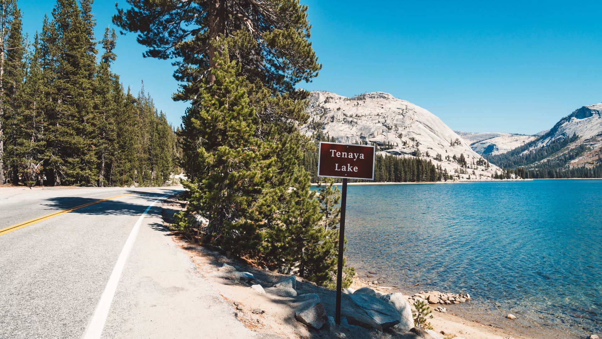
Tenaya Lake is the spot for swimming, paddleboarding, or kayaking. The water’s cold but super clear, and there are two picnic areas with awesome views.
Even in summer, the lake stays chilly, but if you’re up for it, a swim is pretty refreshing.
Siesta Lake is smaller and a bit warmer. You’ll find it about 13 miles east of Crane Flat. It’s less crowded, so it’s a good place for a quiet picnic or a short swim.
Since it’s small, the water warms up faster. I like stopping here for a break when I’m driving through.
Unique Geological Features
Soda Springs bubbles up naturally carbonated water—it’s protected inside an old log cabin near Parsons Lodge. It’s just a short walk from Lembert Dome parking.
The water tastes a bit odd, but it’s a fun stop and definitely something you won’t find everywhere.
Granite domes are everywhere along Tioga Pass. These huge rock formations, shaped by glaciers, give the high country its unique look.
Lembert Dome, Tenaya Peak, and lots of unnamed domes are perfect for climbing or just as landmarks. They catch the light beautifully, especially at sunset.
Planning Your Yosemite High Country Adventure
Visiting the high country is a bit different than a trip to Yosemite Valley. There aren’t many places to stay or eat, and the few that exist fill up fast. Book early and always bring extra food.
Lodging and Camping Options
Tuolumne Meadows Lodge is the main place to stay up high. It’s all canvas tent cabins—no electricity, no private bathrooms.
The lodge usually opens mid-June and closes by mid-September. They release reservations exactly 366 days ahead, and they go fast.
Tuolumne Meadows Campground has 304 sites. You can reserve half of them ahead of time; the rest are first-come, first-served.
If you want to backpack overnight, you’ll need a wilderness permit.
A lot of folks stay in Mammoth Lakes or Lee Vining on the east side. Both towns have plenty of hotels and restaurants, and they’re about a 30-45 minute drive from the pass.
Dining and Food Availability
Tuolumne Meadows Grill serves up basics—burgers, sandwiches, that sort of thing. It’s only open when the lodge is open.
The Tuolumne Meadows Store has snacks, groceries, and some camping gear, but don’t expect a huge selection.
I always pack extra food and a cooler. Once you leave the valley, there’s not much to eat until you reach Lee Vining or Mammoth Lakes.
Seasonal Travel Tips
June through August usually brings the best weather, but it also means crowds. Daytime temps are mild, but it gets cold at night—sometimes below freezing.
September and October are quieter, with cooler temps and a hint of fall color late in September.
Pack layers. The weather can flip from warm to chilly fast, and summer thunderstorms are pretty common.
Fill up your gas tank before you head in. The nearest gas stations are outside the park.
Always check road conditions before you go. At this elevation, things can change quickly.
Wildlife and Safety in the High Country
The high country is wild, and that’s part of the appeal. You’ll probably see bears, marmots, and other critters—just remember to keep your food secure and stay aware of your surroundings. The mountains can be harsh, so a little caution goes a long way.
Common Wildlife Sightings
Black bears show up as the biggest wildlife concern I run into in Yosemite’s high country.
They roam around campsites and popular spots like Tuolumne Meadows, always searching for food.
I stash my food in bear boxes or hang it up, no exceptions. Bears smell food from miles away—honestly, it’s incredible and a little intimidating.
If you leave stuff out, they’ll rip into your car or tent without a second thought.
Yellow-bellied marmots hang out near rocks and meadows, and trust me, they’re bold for their size.
They’ve chewed through backpack straps and even tent fabric just to get to a snack or a bit of salt.
I keep my gear out of reach whenever I spot them. It only takes a few minutes for a marmot to ruin something expensive.
Pikas make their homes above treeline in the rocks.
They’re tiny and harmless, but seeing one means you’ve wandered into pretty sensitive alpine territory.
Mountain lions also live up here, though I’ve never actually bumped into one.
If it ever happens, I know to look big and back away slowly—no sudden moves.
Driving and Trail Safety
Road conditions up here can flip from fine to sketchy in no time.
Before I hit the road, I always check the latest updates and pack some emergency gear.
Even in summer, ice can show up on the roads, especially in the early morning.
Some stretches have these steep drop-offs and, honestly, no guardrails at all.
I take it slow and let faster cars pass when I can. Cell service? Pretty much nonexistent in most spots.
Trail safety is all about being ready for anything.
Weather above treeline can turn on you fast. I always bring layers, rain gear, and extra snacks.
Afternoon thunderstorms? Super common in summer, so I start my hikes early and turn back if it looks dicey.
Sometimes snow lingers on the trails in July or August.
I carry a map and compass because trail markers might be buried, and getting lost up here isn’t on my bucket list.
Environmental Protection and Etiquette
Leave No Trace principles really matter up in the alpine. I always pack out my trash—no exceptions. Sticking to the trails just feels right, and it keeps the landscape healthy for everyone.
High elevations have such a short growing season. If hikers trample the plants, it could take decades for those little green patches to bounce back.
When I camp, I pick only the spots marked for it. If there’s a fire ring already there, I use that, though sometimes campfires aren’t allowed at all when it’s dry.
Protecting water sources is non-negotiable for me. I make sure my tent’s at least 100 feet away from lakes and streams.
For dishes, I stick to biodegradable soap, but I never wash anything right by the water. Even the “safe” stuff can mess with aquatic life.
Wildlife up here deserve to eat what nature intended. No matter how cute the chipmunks look, I don’t feed them—or any animals, honestly.