Big Sur just might be the most breathtaking coastal drive in the world. But let’s be honest—if you pick the wrong time, your dream trip can quickly spiral into a mess of traffic, blinding fog, and road closures.
I’ve cruised this legendary stretch of Highway 1 more times than I can count. Timing really does make all the difference.
So, when’s the sweet spot for Big Sur? Late fall through early spring—think September to March. You’ll dodge the worst crowds, catch clearer skies, and usually deal with fewer road headaches.
Summers, though? They’re brutal. Heavy traffic, thick fog that sometimes barely lifts all day, and crowds everywhere. Winter storms can get nasty too—landslides and closures happen, and I’ve seen travelers stuck for hours.
If you want your Big Sur adventure to actually feel like an adventure (and not a slog), you’ve gotta plan around the weather, tourist seasons, and possible hazards. Over the years, I’ve picked up a few tricks for finding those crystal-clear viewpoints and staying safe on these wild curves.
Ready to make the most of your trip? Let’s get into it.
Best and Safest Times to Drive Big Sur
When you drive Big Sur matters—a lot. September through November gives you the best shot at clear skies and fewer crowds.
The marine layer loves to roll in along the Pacific Coast Highway, but you can outsmart it if you know when to go.
Ideal Months for Weather and Scenery
September through November is my go-to window. The marine layer usually lifts early and stays away longer than in summer.
Temperatures hang out between 55-70°F—pretty much perfect. You’ll actually see the iconic Bixby Creek Bridge and McWay Falls instead of just a wall of fog.
Late spring (April-May) can be lovely too. The redwoods are lush from winter rains. Still, you might run into road closures from landslides—so double-check before you go.
Summer? Honestly, it’s tough. June through August brings relentless fog, sometimes until well after lunch. Traffic crawls, especially on those narrow, winding stretches.
Winter (December-March) is the bargain season for hotels, but it’s risky. Rain triggers landslides, and the days are short. If you go, keep your plans flexible.
Seasonal Fog Patterns and Marine Layer
The marine layer has its own schedule. In summer, fog usually rolls in by late afternoon—think 4-6 PM—and sometimes doesn’t budge until mid-morning the next day.
Spring and fall are your best bet for blue skies. Fog tends to clear by 9 AM and doesn’t return until after 6 PM, giving you a decent window.
Some spots get hit harder than others. Bixby Bridge often escapes the worst of it, but Julia Pfeiffer Burns State Park can be socked in. If you climb higher on Highway 1, you might rise above it all.
I’ve watched folks trek out to Keyhole Arch at Pfeiffer Beach, only to find nothing but gray. It’s a gamble during heavy fog.
Winter fog is unpredictable—sometimes it’s light, sometimes it’s thick. Rain and low clouds can be just as tricky as summer fog.
Time of Day Tips for Avoiding Fog
Start your drive between 8 and 10 AM most of the year. That’s when the marine layer usually lifts, and you’ll have daylight on your side.
Driving Big Sur after sunset? I wouldn’t recommend it. The curves are sharp, and fog often creeps back in by evening. Aim to finish by 5 PM.
Mid-morning to early afternoon is your golden window. The sun burns off the last of the fog, and you’re not fighting the afternoon marine layer.
If you’re traveling in summer, leave even earlier—7 AM is smart. Fog takes its time clearing, and you’ll want every good hour you can get.
I always check the marine layer forecast before heading out. Some weather apps even show hourly fog predictions—super helpful.
How to Avoid Crowds and Traffic
Big Sur’s no secret, so if you want a peaceful drive, timing is everything. I mix off-peak visits with a little strategy around the big attractions.
Least Busy Periods and Off-Peak Days
Tuesday through Thursday are your friends. I’ve noticed the difference—midweek drives usually mean half the crowds.
Winter (December to February) is the quietest, though rain can close roads. If you catch a clear day, you’ll have those epic views almost to yourself.
Early mornings are magic. If you hit the road by 7 AM, you’ll stay ahead of the day-trippers from the cities.
Steer clear of these times:
- Memorial Day through Labor Day
- Spring break (March-April)
- Holiday weekends
- Summer Fridays (traffic starts early!)
Strategic Stops at Major Attractions
Bixby Bridge becomes a zoo from 10 AM to 4 PM. I swing by before 9 AM or after 5 PM for easy parking and crowd-free photos.
McWay Falls fills up fast. That tiny parking lot at Julia Pfeiffer Burns State Park? It’s packed by mid-morning on weekends.
Pfeiffer Beach takes a little planning. The access road is narrow and jams up when it’s full. I go early or stick to weekdays.
Garrapata Beach has more room, but even it gets busy. I like the pullouts along the coast—sometimes you’ll get the place to yourself.
I always have backup spots in mind. If one’s crowded, I just move on down the list.
Planning Around Popular Events
Carmel-by-the-Sea throws some big festivals that snarl traffic. The Carmel Bach Festival (July) and Pebble Beach events especially clog up the northbound lanes.
San Simeon gets busy during Hearst Castle’s summer rush (June-August). That can affect the southern Big Sur entrance.
Elephant Seal Vista Point near San Simeon is a madhouse during pupping (December-March) and molting (April-May).
I always check event calendars:
- Carmel Chamber of Commerce
- San Luis Obispo County events
- State park sites
Funny enough, fog season (June-August) sometimes keeps crowds away. Many visitors bail when they hit the thick stuff, so you might luck out with emptier viewpoints.
Best Times to Visit Iconic Spots
Golden hour—sunrise or sunset—gives you the best light and the smallest crowds. Most tourists stick to midday.
Bixby Bridge: Sunrise (6-7 AM) or late afternoon (5-6 PM) is prime time.
McWay Falls: Early morning (7-9 AM) or late afternoon (4-6 PM) works well.
Pfeiffer Beach: Sunset is magical, and the purple sand glows with fewer people around.
Weekday mornings are great for the Santa Lucia Mountains overlooks. On weekends, parking disappears fast.
I time my stops for the best light and quietest moments. It’s the only way to really soak in the coast.
Navigating Road Closures, Hazards, and Safety
Highway 1 through Big Sur is gorgeous but unpredictable. Landslides, construction, and weather can shut things down without warning.
I always check road conditions from a couple of sources and stash emergency supplies in the car before I set out.
Update Sources for Road Conditions
I rely on Caltrans QuickMap for real-time closure and construction updates. It’s the most accurate source I’ve found.
The 511 system is handy too. I just call 511 from my phone for highway and closure info.
California State Parks websites post alerts about park access. I check individual parks—especially near Rocky Creek Bridge—for the latest.
Social media groups for Big Sur travelers can be goldmines for real-time updates. I follow a few for reports on fog, accidents, and sudden closures.
I always double-check info. Conditions can change fast out here.
Preparing for Landslides and Construction
Landslide season is November through March, when rains hit hard. If a big storm’s coming, I’ll usually postpone my drive.
Construction can close Highway 1 for months at a time. I always look up work zones before I book anything.
I fill up the gas tank before entering Big Sur. Gas stations are few and far between, and detours can eat up fuel.
There aren’t really any backup routes for most of Highway 1. I plan extra time and stay ready to turn back if things get dicey.
I slow down through construction zones and watch for loose gravel or lane shifts.
Emergency Supplies and Safety Essentials
I keep water and snacks in the car, no matter how short the drive. You never know when you’ll get stuck.
My emergency kit has:
- Flashlight and batteries
- Blankets or warm clothes
- First aid kit
- Phone charger or power bank
- Some cash, just in case
I always check my spare tire and keep a full tank of gas. Cell service gets spotty pretty quickly.
Emergency flares or reflectors are a must. If you have to pull over, you’ll want to be seen.
I let someone know my plans and when I’ll be back. It’s a simple step, but it matters if you end up stranded.
Must-See Stops and Scenic Viewpoints
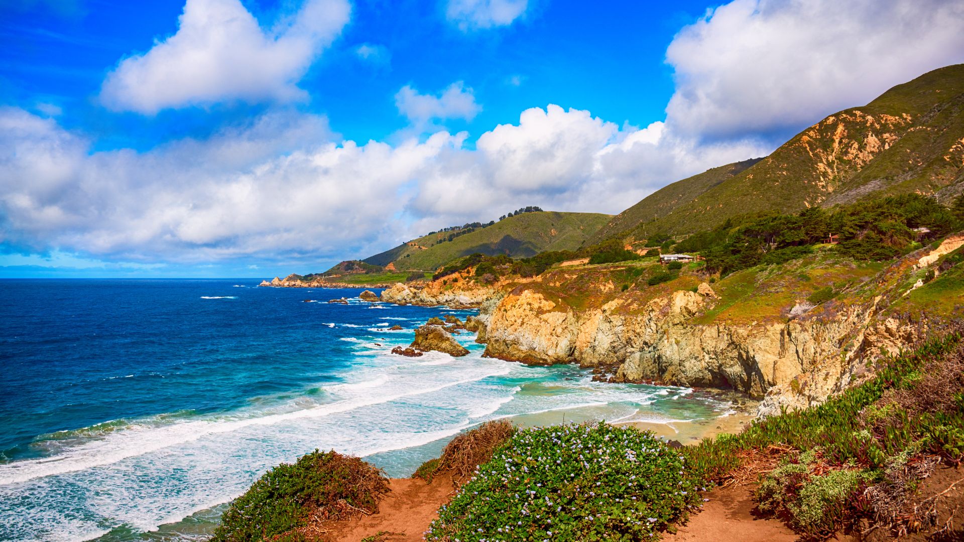
Big Sur’s coastline is wild, dramatic, and packed with jaw-dropping views. From famous bridges to secret beaches, there’s something here for everyone.
The state parks are fantastic for hiking, and the viewpoints? Just wow.
Iconic Bridges and Coastline Vistas
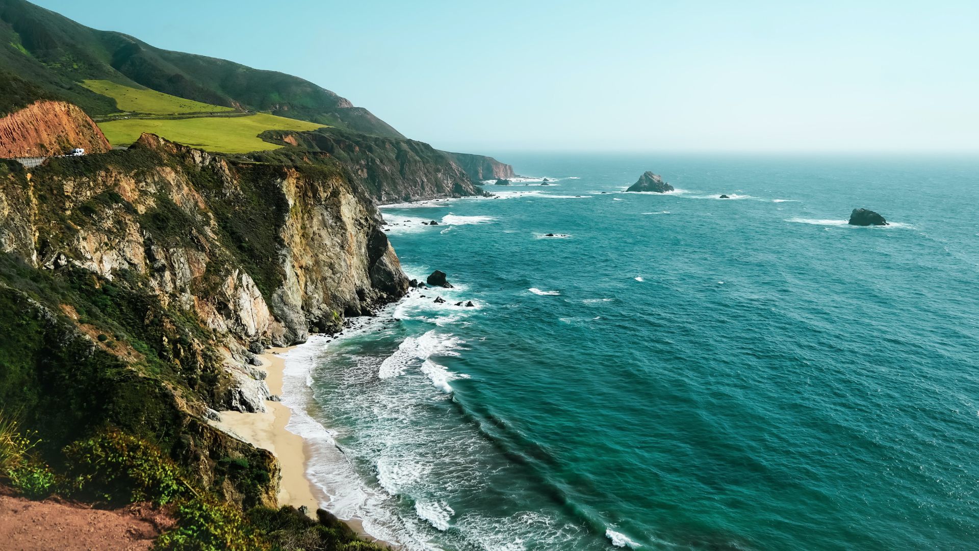
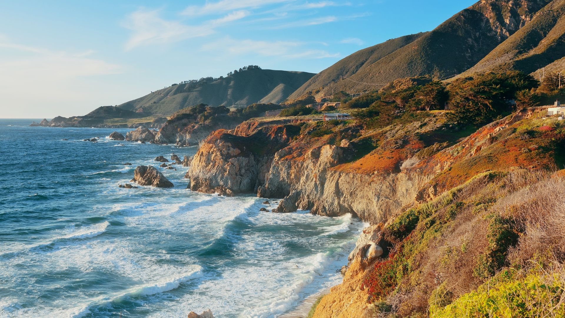
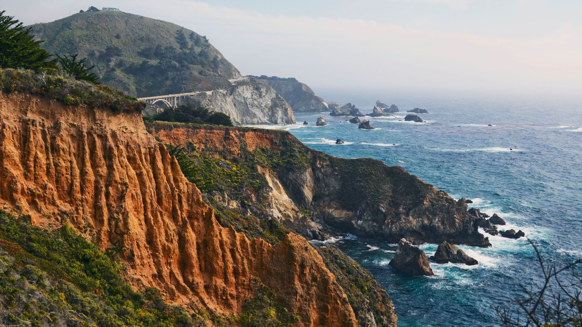
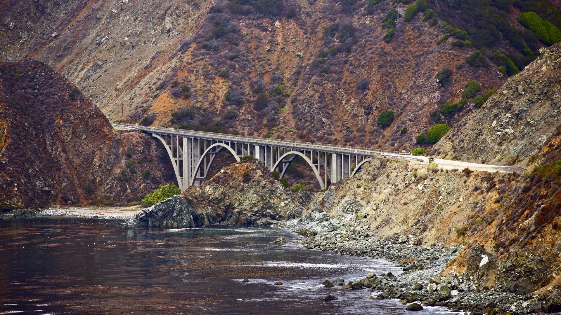
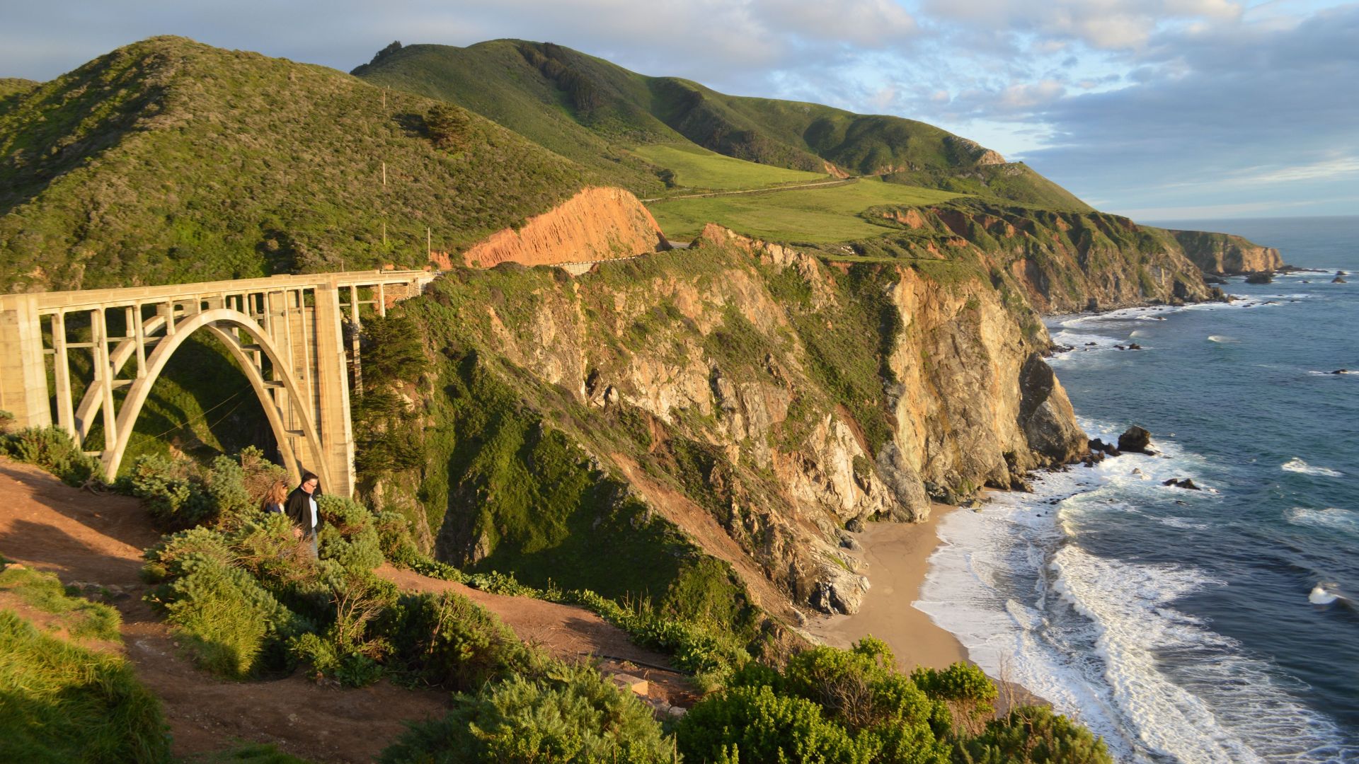
Bixby Creek Bridge is probably Big Sur’s most famous spot. This concrete arch stretches 714 feet across the canyon, and the views are unreal.
I like the turnout on the north side for the best shots. Golden hour makes the bridge practically glow.
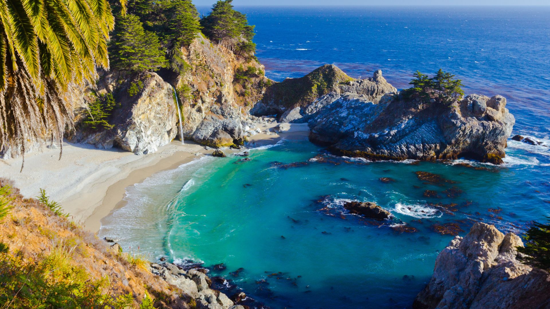
McWay Falls at Julia Pfeiffer Burns State Park is a must-see. An 80-foot waterfall drops right onto the sand—a real California postcard.
The overlook trail is short, maybe 10 minutes from the lot. The waterfall runs all year, but it’s most impressive in winter and spring.
Keyhole Arch at Pfeiffer Beach is another classic. The rock formation frames the sunset perfectly certain times of year.
That purple sand? It’s real and makes the place feel almost otherworldly. Getting there means a tight, twisty drive—skip it if you’re in an RV.
Top Hiking Trails and Beaches
Point Lobos State Natural Reserve is my top pick for coastal hiking. The Sea Lion Point Trail is easy and great for spotting wildlife.
The Bird Island Trail gives you big ocean views and wildflowers in season. Both trails are flat—perfect if you’re not looking for a workout.
Garrapata State Park has the Garrapata Bluff Trail, which hugs the cliffs for endless ocean views. No big climbs, just epic scenery.
The Bluffs Trail links up with several beach paths. Springtime brings wildflowers all along the way.
Sand Dollar Beach is the longest sandy stretch in Big Sur. You’ll need to walk downhill from the parking lot, but it’s worth it.
Andrew Molera State Park offers a mix of easy beach walks and tougher inland trails. The river mouth is a magnet for wildlife.
So, whether you’re chasing waterfalls, hiking through redwoods, or just soaking up the views, Big Sur never disappoints. Just pick your moment, plan for the unexpected, and let the coast work its magic.
Notable Parks and Natural Highlights
Pfeiffer Big Sur State Park stands out as the go-to spot for soaking up those classic redwood vibes. You’ll find plenty of camping options, winding hiking trails, and the Big Sur River just steps away.
The Nature Trail? It’s a super easy way to get your first look at those massive redwoods. If you’re up for more of a workout, the Valley View Trail climbs higher and rewards you with sweeping forest views.
Julia Pfeiffer Burns State Park isn’t just about McWay Falls (though that view is something else). The park stretches inland too, with some surprisingly rugged hiking for folks who want to get off the beaten path.
Limekiln State Park mixes a bit of everything—beach access, groves of redwoods, and those old lime kilns from the 1800s. I’ve camped here, and honestly, waking up surrounded by those trees feels magical.
Take the short trail to Limekiln Falls for a peaceful, shady walk. The old lime kilns are tucked away in the woods and give you a peek into Big Sur’s quirky industrial past.
Most parks charge an entrance fee, usually around $10-15 per car. Before you head out, I’d double-check the latest hours and trail updates—things can change fast out here.

Planning Your Big Sur Itinerary
Planning a Big Sur road trip is a bit of an art. You want to see the big sights, but driving here takes longer than you’d think, especially if the weather turns foggy or the road gets busy.
Figure out how much time you’ve got and pick stops that actually excite you. Don’t try to squeeze in everything—trust me, you’ll want time to just breathe it all in.
Sample One, Two, and Three-Day Routes
One-Day Route (North to South):
- Start in Carmel-by-the-Sea (1 hour)
- Point Lobos State Natural Reserve (1.5 hours)
- Rocky Creek Bridge photo stop (30 minutes)
- Bixby Bridge (30 minutes)
- Point Sur Lighthouse viewpoint (30 minutes)
- McWay Falls at Julia Pfeiffer Burns State Park (1 hour)
You’ll cover about 60 miles, and it usually takes 6-7 hours with stops. If you can, start early—the morning light is gorgeous and you’ll probably beat the afternoon fog.
Two-Day Route:
On Day 1, focus on the stretch from Carmel down to Big Sur Village. Take your time at each stop and add a hike in Pfeiffer Big Sur State Park.
Day 2 heads south to San Simeon. If you’re curious, Hearst Castle is worth a visit (just make sure to book ahead).
Three-Day Route:
With three days, you can dive a bit deeper. Try a tough hike like Buzzard’s Roost Trail or spend a whole day exploring Point Lobos. There’s time for those little inland detours that most people skip.
Recommended Stops for Various Interests
Photography enthusiasts—don’t miss sunrise at Bixby Bridge or the iconic view of McWay Falls. Rocky Creek Bridge is also great for dramatic shots, and it’s usually less crowded.
Hikers will find their happy place on the trails at Point Lobos and Pfeiffer Big Sur State Park. Buzzard’s Roost Trail, in particular, has some knockout coastal views if you’re up for the challenge.
History buffs should swing by Point Sur Lighthouse and Hearst Castle near San Simeon. Both offer guided tours, but you’ll want to book those in advance.
Families might prefer shorter stops and easy-access viewpoints. Point Lobos has gentle trails that work well for kids or anyone who just wants a relaxing stroll.
Luxury travelers can treat themselves to upscale meals and scenic stays in Big Sur Village. There’s no shortage of cozy, beautiful spots to indulge.
Timing Your Itinerary to Optimize Conditions
Morning starts (7-8 AM) really help you dodge the crowds and that classic afternoon fog. I usually aim for my must-see stops before noon—there’s just something about the early hours that feels right.
Weekday visits make a huge difference in traffic. I’ve noticed weekends can get wild, especially around those iconic photo spots everyone wants to see.
Check road conditions before you head out. Highway 1 sometimes closes without much warning, and a detour can easily tack on 2-3 hours. That’s a rough surprise if you’re not prepared.
Weather timing is a big deal in summer. I try to hit inland spots during the peak fog hours (2-6 PM), then swing back to the coast in the morning when it’s usually clear.
Buffer time saves the day. I always add about 30% extra time to whatever Google Maps tells me—because, let’s be honest, there’s always an unexpected view or quirky roadside stop calling your name.