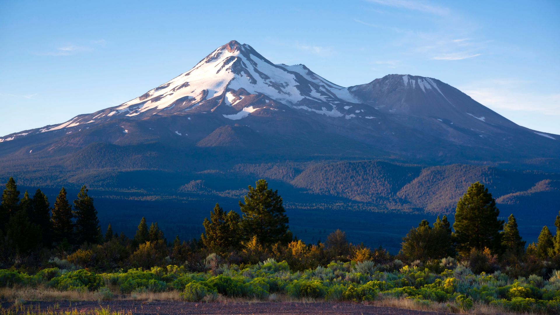
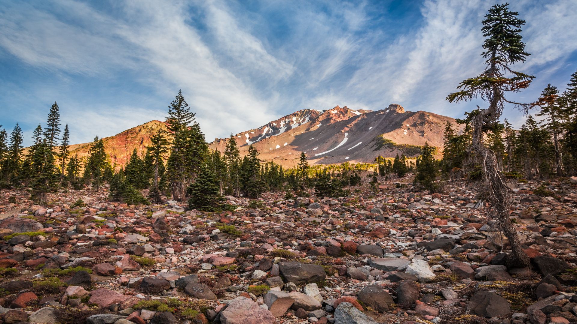
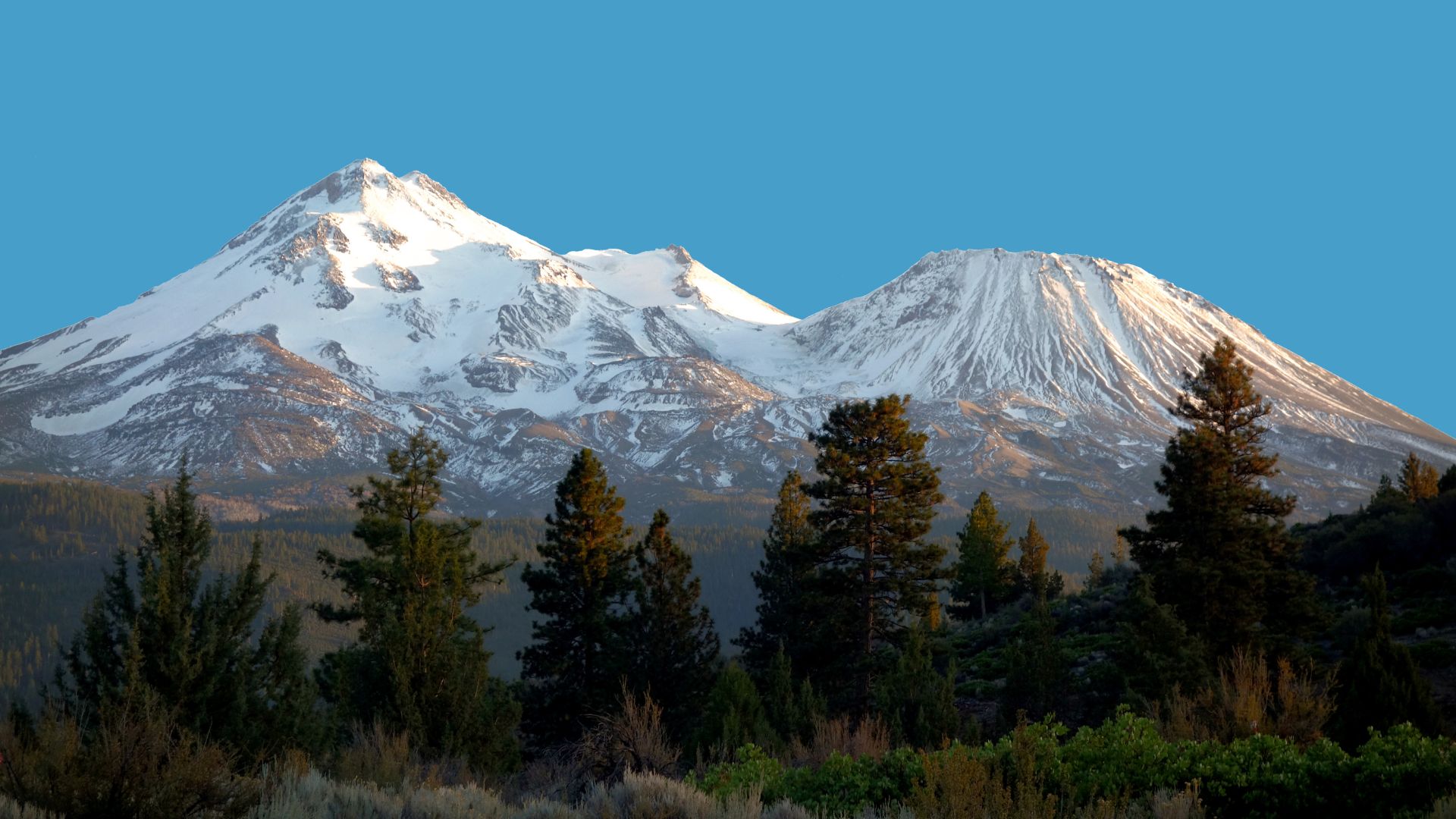
Mount Shasta rises up from Northern California like something out of a dream—14,179 feet of snow-capped wonder. It’s easily one of the most impressive peaks in the state. People come here all year, but honestly, timing your trip can be the difference between a magical adventure and a not-so-great time.
The best time to visit Mount Shasta really depends on what you want to do. If you’re into hiking and camping, hit the summer months from June through September. For snowshoeing or skiing, winter (December through February) is where it’s at. Each season brings its own flavor—sometimes challenging, sometimes just jaw-droppingly beautiful.
After spending a good chunk of my life exploring this mountain, I’ve realized that knowing what the weather’s up to can make or break your trip. I’ll walk you through what to expect: weather, trail conditions, gear, and even some cool spots nearby. Hopefully, you’ll be able to pick the perfect time for your own Mount Shasta adventure.
Understanding Mount Shasta’s Unique Climate and Seasonal Weather
Mount Shasta sits in the Cascade Range, and honestly, the weather here can be wild. The mountain’s elevation and location mean snowpack levels totally shape your experience. One year, you might get easy hiking in June; another year, you’ll need snowshoes.
Weather Patterns Across the Cascade Mountain Range
Mount Shasta lives in a kind of Mediterranean mountain climate. That means you’ll get wet, snowy winters and dry, sunny summers.
Winter brings the most precipitation—January through March are especially soggy and snowy. The mountain can get over 56 inches of moisture in a year, which is a lot.
Summer, on the other hand, is warm and dry. Daytime temps usually hang out between 70°F and 85°F. At night, it can dip to around 50°F, even in July.
Spring and fall? They’re a toss-up. Sometimes you’ll get mild days, but the weather can flip on a dime. I’ve seen summer-like sunshine in January and, weirdly, snowstorms in July.
Key Climate Facts:
- Average annual temperature: 48.8°F
- Wettest months: December, January, February, March
- Driest months: June, July, August, September
- Yearly temperature range: 28°F to 85°F

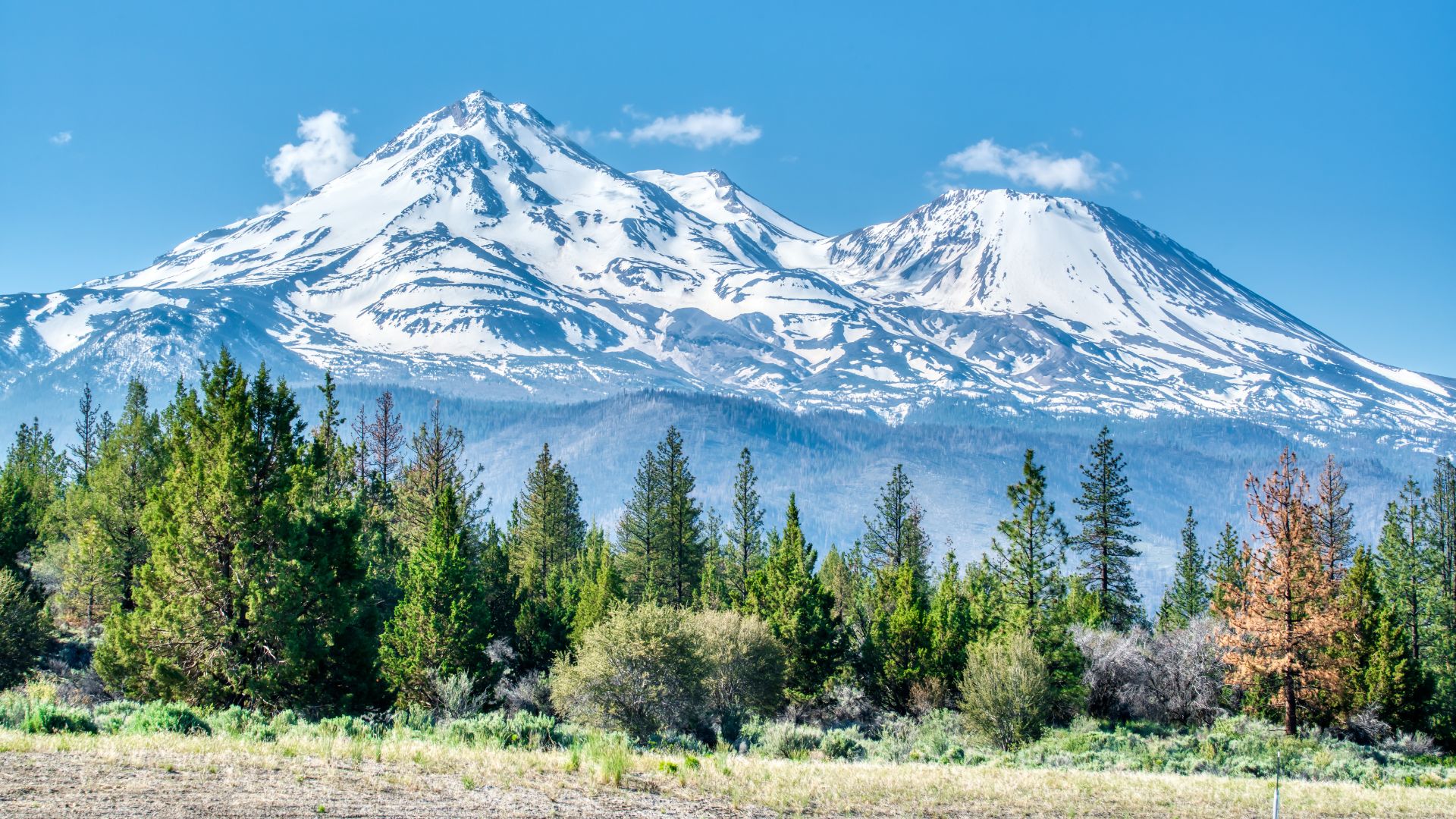
The Importance of Snowpack for Climbing and Hiking
Snowpack is everything on Mount Shasta. It decides which routes you can use and how safe they are.
From November through May, deep snow usually covers the higher trails. Sometimes, it gets 10-15 feet deep up high. That’s paradise for snowshoers and skiers, but it can be a nightmare for hikers.
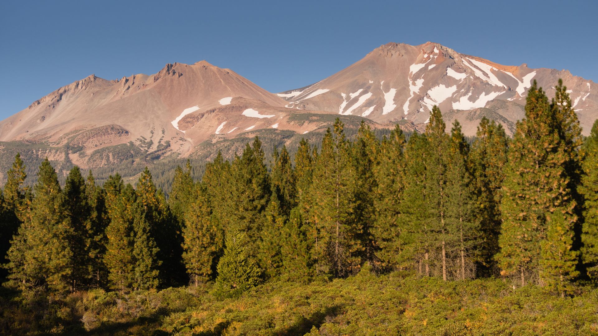
Spring brings melting snow, which can turn trails into rivers or mud pits. A lot of the high routes stay snowed in until late June or even July. The snow changes from hard-packed to soft and slushy as the season goes on.
If you want snow-free hiking, summer is your best bet. Lower trails clear up first, but some spots above 10,000 feet can keep snow all year. I always check the latest snowpack reports before making any big plans.
Optimal Climbing Conditions Based on Season
Summer (June-September) is the sweet spot for most hikers and beginner climbers. Trails are clear, the weather’s pretty steady, and you won’t have to deal with much snow. But it does get crowded.
Winter (December-February) is a whole different beast. You’ll need serious skills and gear for mountaineering in deep snow and freezing temps. Still, the mountain is a world-class spot for winter mountaineering.
Spring (March-May) is unpredictable. Some trails open, others stay buried. The weather can flip from warm to nasty in an afternoon.
Fall (September-November) is lovely and less crowded. Early fall is great, but by late fall, winter starts creeping back.
When Is the Best Time to Visit Mount Shasta?
Mount Shasta feels like two different places depending on when you go. Summer is all about hiking and wildflowers. Winter turns it into a snow-covered playground for snowshoers and skiers.
Key Differences Between Summer and Winter Experiences
Summer (June-September) is when the mountain really opens up for hikers. The weather is usually steady, with temps in the 70s at lower elevations and barely any rain.
Trails are open, lakes are warm enough for a dip, and wildflowers put on a show in the meadows.
Winter (December-March) flips the script. Snow covers everything, and it gets cold—like, really cold. Even the lower elevations can drop below freezing.
Snowshoeing is the go-to activity. Some of my best powder days happened in late January and February.
Spring and Fall are trickier. In April, melting snow turns trails to mud. By November, hiking gets tough and ski areas aren’t quite ready.
Choosing Your Ideal Season Based on Outdoor Activities
Pick your season based on what you want to do:
For Hiking: June through September is the safest bet. July and August are prime for high-elevation trails and camping.
For Snowshoeing: Late December to late February usually has the best snow and most stable weather.
For Lake Activities: Go in summer. June to September is warm enough for swimming, especially at lower lakes.
For Photography: Winter gives you epic snow scenes. Summer means wildflowers and clear views.
Cost Considerations: Winter, especially late January and February, is more affordable and less crowded.
How Current Snowpack and Weather Impact Trip Planning
Snowpack can totally change your plans. Big snow years mean longer winters and later hiking seasons. Light snow years open up trails early but can cut the ski season short.
I always check the current snowpack before heading out. The Mount Shasta Avalanche Center is a lifesaver for updates.
Weather is famously unpredictable up here. I’ve climbed in January in t-shirt weather and gotten snowed on during July hikes.
Winter storms sometimes close roads with little warning. I always double-check road conditions before I go, especially in winter.
Higher up, snow sticks around longer. If you’re aiming for the summit or anything above 10,000 feet, plan for lingering snow no matter the month.
Summer Hiking on Mount Shasta: Trails, Routes, and Conditions
Summer hiking on Mount Shasta is just fantastic. From mid-May through mid-July, you get the best conditions. Most people go for the Avalanche Gulch route, but if you want fewer crowds and more challenge, try Clear Creek or the West Face.
Popular Summer Hiking Trails
There’s something for everyone here.
Lake Siskiyou is a chill, easy walk with awesome mountain views.
Castle Lake sits at 5,400 feet and makes for a moderate two-mile round trip. The lake is crystal clear and perfect for a swim after your hike.
Heart Lake Trail takes more effort, but wow—the alpine scenery is worth every step. The elevation gain is real, but so are the views.
McCloud River Trail is famous for its three waterfalls, including the stunning Lower Falls. The trail follows the river through a basalt canyon, and you can swim in the pools during hot days.
Panther Meadow Loop gives you a taste of Shasta’s high country. It’s a short trail through delicate meadows and seasonal creeks.
Sisson Meadow Loop is a great option for families or anyone wanting a mellow stroll. It’s right in Mount Shasta city and super easy.
Hiking the Avalanche Gulch Route
Avalanche Gulch is the classic route to the 14,179-foot summit. I’d say mid-May through mid-July is your best window.
You’ll need two permits: a free wilderness permit and a $25 summit pass if you’re going above 10,000 feet. You can grab these at the ranger station or at the trailhead.
Climbing is safest when snow still covers the loose rocks. Early summer usually means firm snow, which is a lot easier (and safer) to climb.
By late summer, loose scree makes things trickier, and rockfall gets more dangerous. Most people need 10-12 hours for the round trip.
The weather can turn fast up here. I always bring extra layers and rain gear, even if the forecast looks perfect.
Exploring the Clear Creek Route and West Face
Clear Creek Route is a step up in difficulty. You’ll need mountaineering experience and glacier travel gear.
The route starts from Brewer Creek trailhead and follows the Clear Creek drainage. You’ll deal with crevasses and steep sections—rope skills are a must.
West Face is another tough option for experienced climbers. Expect steep snow, ice, and some rockfall hazards.
Both routes are quieter than Avalanche Gulch but definitely not for beginners. You’ll need to plan ahead, bring the right gear, and know how to use it. Honestly, hiring a guide for your first attempt isn’t a bad idea.
These technical routes usually mean camping out for a night or two. Group sizes are capped at 10 people for all climbing routes.
Winter Adventures: Snowshoeing, Skiing, and Off-Season Mountaineering
Winter turns Mount Shasta into a snowy wonderland, but it’s not for the unprepared. Deep snow opens up epic backcountry skiing and technical mountaineering. Safety and avalanche awareness are critical, especially on busy routes like Avalanche Gulch.
Winter Snowshoeing Routes and Safety
If you’re new to snowshoeing, start at Panther Meadows. It’s gentle, scenic, and not too technical.
The Bunny Flat trailhead gives you access to several snowshoe routes. You can head toward Horse Camp or explore the lower slopes.
Essential Safety Gear:
- Avalanche beacon, probe, and shovel
- GPS device or map and compass
- Emergency shelter and warm layers
- Headlamp (with spare batteries)
Winter snow can pile up over 10 feet deep. I always check avalanche conditions before heading out.
The Mount Shasta Avalanche Center posts daily updates. Above treeline, things can change fast.
Popular snowshoe spots:
- Sand Flat (easy terrain)
- Gray Butte (moderate)
- Panther Meadows to Horse Camp (advanced)
Skiing Opportunities and Backcountry Access
Mount Shasta is kind of a hidden gem for backcountry skiing. The volcanic slopes deliver some of the longest, smoothest runs—when the snow cooperates.
Avalanche Gulch draws experienced skiers in winter. You can get over 7,000 feet of vertical drop from the summit.
The best skiing usually happens between January and April once the snowpack settles. Early season snow can be sketchy—don’t risk it.
Top skiing areas:
- Avalanche Gulch – Only for advanced and expert skiers
- Cascade Gulch – Technical and demanding
- Whitney Glacier – Requires glacier travel skills
Must-have backcountry gear:
- Avalanche safety kit (beacon, probe, shovel)
- Ski mountaineering boots/bindings
- Climbing skins
- Crampons and ice axe
You’ll probably need to camp at Horse Camp or higher. Winter camping experience is a must for these trips.
Climbing Mount Shasta During Winter Months
Winter mountaineering on Mount Shasta really pushes your limits. It’s one of California’s most challenging winter climbs—no question about it.
The Avalanche Gulch route draws the most winter climbers. But avalanche danger? It spikes big time in the colder months.
You’ll need to know:
- How to use an ice axe and crampons
- Self-arrest techniques
- Avalanche rescue basics
- Cold weather camping skills
Don’t forget your gear:
- Mountaineering boots that can handle the cold
- A four-season tent and a sleeping setup that won’t leave you shivering
- A stove that still works when temps drop
- Extra food and plenty of fuel—winter trips can run long
The main winter climbing season runs from December through March. February usually gives you the best shot at stable conditions, though you never really know.
If you’re new to winter mountaineering, hire a guide service. Trust me, the weather can flip from bluebird to brutal in no time.
When camping:
- Horse Camp often sits buried under snow
- Helen Lake turns into a technical camping spot
- Above 10,000 feet, wind protection becomes absolutely critical

Essential Tips for Planning Your Mount Shasta Adventure
Mount Shasta’s high elevation and unpredictable mountain conditions mean you need to plan ahead. Let’s talk permits, where to stay, and how to prep for the mountain’s wild weather.
Permits, Regulations, and Ranger Station Information
You’ll need a Mount Shasta Summit Pass to climb above 10,000 feet. It’s $25 per climber and supports trail maintenance and rescue teams.
Where to snag your permit:
- Mount Shasta Ranger District office in town
- Self-issue stations at trailheads (bring exact cash or a check)
- Online via Recreation.gov if you like to plan ahead
I usually grab my permit early, especially during the busy summer season from June through September. The ranger station always has the latest trail and weather info.
A few rules to know:
- No campfires above 10,000 feet
- Pack out all human waste above tree line
- Dogs can come on leash, but honestly, the summit isn’t a great place for them
The Clear Creek route plays by slightly different rules since it’s often snow-free in late summer. Always check with the rangers about current route conditions.
Camping and Accommodation Options
Mount Shasta offers plenty of camping choices depending on your plans. I’m always surprised how quickly spots fill up in summer, so book early if you can.
Camping spots worth considering:
- Panther Meadows: At 7,500 feet, it’s primitive with no water, but the views are unreal
- McBride Springs: Lower down, with restrooms and picnic tables
- Castle Lake: If you want to camp near an alpine lake, this is the spot
Road trippers can find campgrounds along Highway 89, which makes trailhead access easy. July and August? These spots fill up fast.
Other places to stay:
- Mount Shasta city has hotels and vacation rentals if you like a real bed
- Weed and Dunsmuir offer more budget-friendly options
- Some folks just stay in town and make an early drive to the trailhead
Winter camping is a whole different beast. Only try it if you’ve got legit mountaineering and avalanche experience.
Preparing for Rapid Weather Changes
Mt. Shasta’s weather? Unpredictable doesn’t even begin to cover it. I always pack layers, even when the forecast looks perfect.
Gear I won’t go without:
- Waterproof jacket and pants
- Warm insulating layers—fleece or down
- A hat and gloves that actually keep you warm
- Sunglasses, sunscreen, and a hat for sun protection
Above 10,000 feet, you’ll find snow even in summer. Freezing temps and storms can roll in fast, so don’t get caught off guard.
Keep an eye on the weather:
- Check mountain forecasts before you leave
- Download weather apps for offline use—cell service is spotty
- Watch wind speeds; above 40 mph on the ridges, things get dicey
The weather on Mount Shasta changes on a whim. The foothills might feel like summer, but the summit could be in full-on blizzard mode. Always pack for the worst and stay flexible.
Other Must-See Destinations and Outdoor Activities Near Mount Shasta
The Mount Shasta area isn’t just about climbing. You’ve got lakes perfect for swimming and kayaking, plus easy hikes to waterfalls and scenic viewpoints. I love how this region turns into a road trip wonderland—think hot springs and quirky local stops.
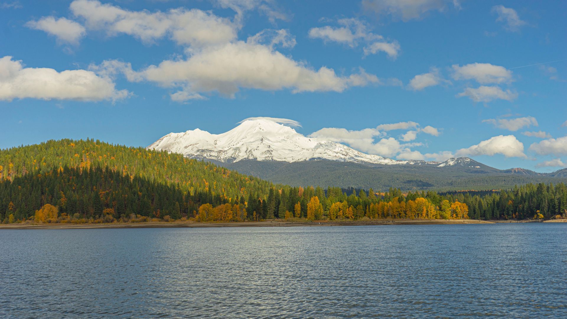
Exploring Lake Siskiyou and Castle Lake
Lake Siskiyou sits just five miles from Mount Shasta city and is my go-to for summer lake days. The water warms up enough for swimming, and the beaches open up for all kinds of fun.
You’ll find a sandy beach with picnic tables and boat rentals. Kayaks, paddleboards, even little motorboats—there’s plenty to try if you want to get on the water. The Lake Siskiyou Trail loops around the lake and gives you mountain views the whole way.
Castle Lake takes a bit more effort—a winding drive up the mountain—but the payoff is crystal-clear alpine water. It sits at 5,400 feet, so don’t expect it to be warm, even in July.
Castle Lake is a favorite for photographers and anyone who likes a quiet spot to think. The Castle Lake Trail keeps going up to Heart Lake if you’re in the mood for a longer hike. In winter, snow can block the road, so check conditions before heading up.
Heart Lake, Black Butte, and Scenic Waterfalls
The Heart Lake Trail starts at Castle Lake and climbs about 2.5 miles to a stunning hidden lake. It’s a tough hike, but the views of Mount Shasta along the way make it totally worth it.
Heart Lake sits tucked beneath granite cliffs, and the whole place feels a bit magical. The elevation gain is no joke, so bring your hiking legs.
Black Butte gives you one of the best views around. The trail is about 2.5 miles each way and climbs 1,800 feet. I always start early in summer because the upper sections are super exposed and heat up fast.
Lower Falls is a classic swimming hole just a short walk from the road. The waterfall drops into a deep, cold pool—perfect for cooling off after a hot hike. Hedge Creek Falls and McCloud Falls are also easy to reach and offer gorgeous scenery.
Road Trip Highlights and Local Experiences
Mount Shasta really stands out as a road trip stop along Highway 5 between Oregon and Southern California. If you want to get a real feel for the place, I’d say give yourself at least two or three days here.
You can unwind at Stewart Mineral Hot Springs, soaking in natural hot pools tucked away in the forest. These springs stay open all year, and honestly, there’s nothing quite like a good soak after a day of hiking or skiing.
Downtown Mount Shasta has this quirky, welcoming vibe—local restaurants, gear shops, and spiritual bookstores line the streets. If you’re traveling with kids (or just curious), swing by the Mount Shasta Fish Hatchery for a quick, educational detour.
Not far from town, McCloud invites you in with its historic railway depot and a handful of antique shops. The McCloud Railway rolls out scenic forest train rides every summer, which always feels like a step back in time.
If you’re up for a longer drive, you can reach Lassen Volcanic National Park in about two hours southeast. Head north for three hours, and you’ll find yourself at Oregon’s breathtaking Crater Lake National Park.