Is there anything better than hitting the open road in summer? The freedom, the fresh air, that sense of possibility—road trips just have a way of making you feel alive. America’s highways and byways unfold some of the country’s most jaw-dropping landscapes, and honestly, driving is still the best way to discover hidden gems most folks never see.
Here are 11 scenic routes across the United States that’ll make your summer road trip unforgettable. Whether you’re craving coastal breezes, mountain air, or a dose of nostalgia, there’s a route here for you.
These drives range from iconic highways to those backroads that locals swear by. I’ll share what makes each one special and toss in practical tips to help you plan a smooth trip.
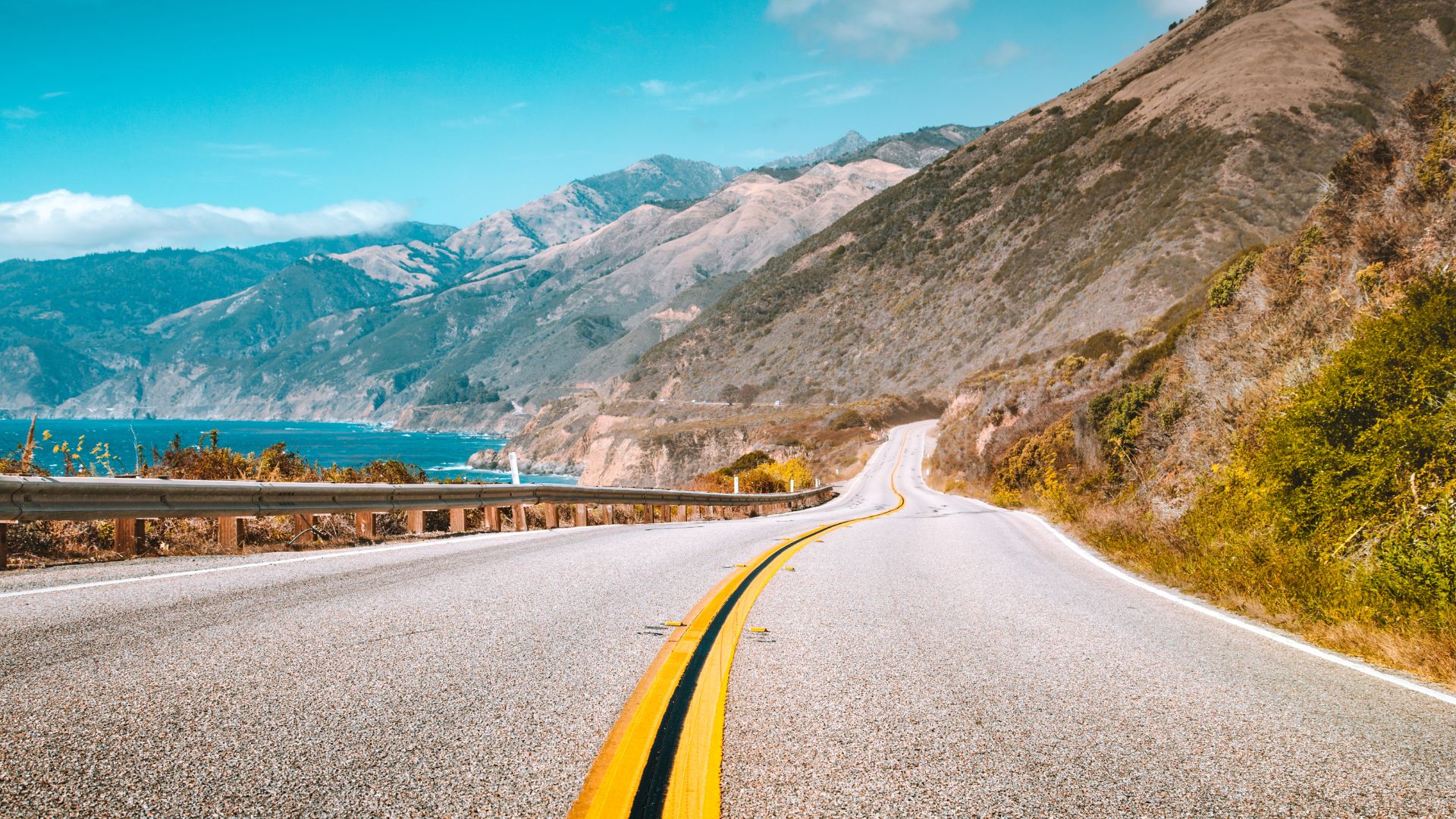
1) Pacific Coast Highway, California
The Pacific Coast Highway is legendary for good reason. Highway 1 hugs California’s wild coastline, winding from San Francisco all the way down to Los Angeles—and honestly, every mile is a treat.
You’ll catch glimpses of rugged cliffs, golden beaches, and coastal towns that feel like movie sets. Big Sur, in particular, is the kind of place that’ll have you pulling over every five minutes just to stare.
The full California stretch runs about 650 miles. Sure, you could rush it in two days, but honestly, give yourself a week if you can.
Stop in Monterey for the aquarium, browse art galleries in Carmel-by-the-Sea, and wander Santa Barbara’s Spanish streets. State parks, lighthouses, and those classic scenic overlooks pop up all along the way.
Summer weather is basically perfect for this drive. I recommend mapping out your rest stops ahead of time—some stretches between towns can feel pretty remote.
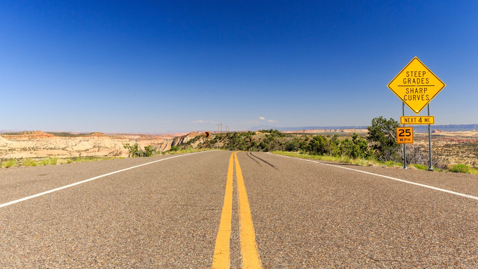
2) Scenic Byway 12, Utah
Utah’s Scenic Byway 12, all 123 miles of it, links Bryce Canyon and Capitol Reef National Park. The Federal Highway Association calls it an All-American Road—and honestly, they nailed it.
You’ll wind through red rock canyons, squeeze between slot canyons, and climb into alpine forests. The elevation jumps from 5,000 to over 9,000 feet, so keep your camera handy for those changing landscapes.
Calf Creek Falls is a must-stop, and trails like the Hickman Bridge and Grand Wash in Capitol Reef are worth the short hikes.
The byway only got fully paved in 1975. Now it’s a smooth ride, with plenty of pullouts for photos or just to soak in the view.
Spring and fall bring cooler temps and fewer crowds, but summer’s great if you’re hoping to cool off in a creek. Start early—there’s a lot to see, and you’ll want time to linger.
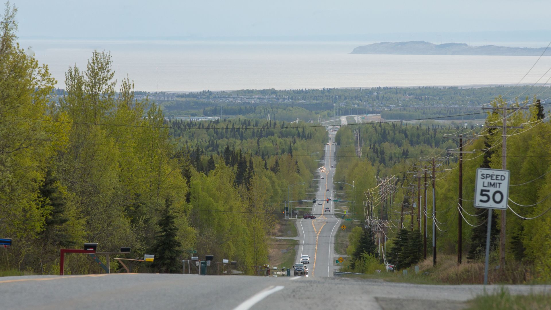
3) Alaska Road Trip from Anchorage to Fairbanks
Driving from Anchorage to Fairbanks is about 360 miles along the George Parks Highway. If you go straight through, it’s around six hours, but who does that?
Denali National Park is the main event here. You’ll spot North America’s tallest peak and, if you’re lucky, see moose or even a bear ambling along the roadside.
Gas stations and small towns—Wasilla, Willow, Talkeetna—break up the drive. Each one has its own character, and it’s worth poking around.
Summer is prime time, from mid-May to early October. The weather’s mild, and the roads are clear. The scenery shifts as you head north, from forests to tundra, and the wildlife is always out and about.
Side trips to Hatcher Pass or the Matanuska Glacier add even more adventure. Alaska has a way of making you feel small—in the best possible way.
4) Newfound Gap Road, Great Smoky Mountains
Newfound Gap Road slices right through the Great Smoky Mountains National Park. It’s a short but sweet 31-mile stretch connecting Gatlinburg, Tennessee, with Cherokee, North Carolina.
You’ll climb up to 5,046 feet at Newfound Gap, the park’s lowest drivable pass. The road’s the only fully paved route that cuts straight through the Smokies.
Every twist and turn brings a new view—hardwood forests at the base, spruce-fir forests near the top. It’s like driving through a living nature documentary.
Stop at the Sugarlands Visitor Center, Oconaluftee Visitor Center, or the Mountain Farm Museum. Mile markers make it easy to find trailheads and scenic spots.
Built back in the 1930s, this road makes it easy to explore the park’s beauty without hiking for miles. Summer means lush forests and cool breezes, especially up high.
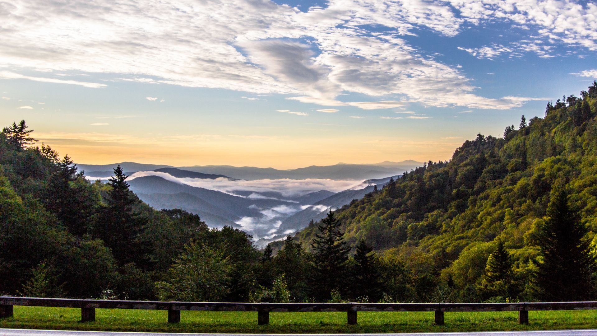
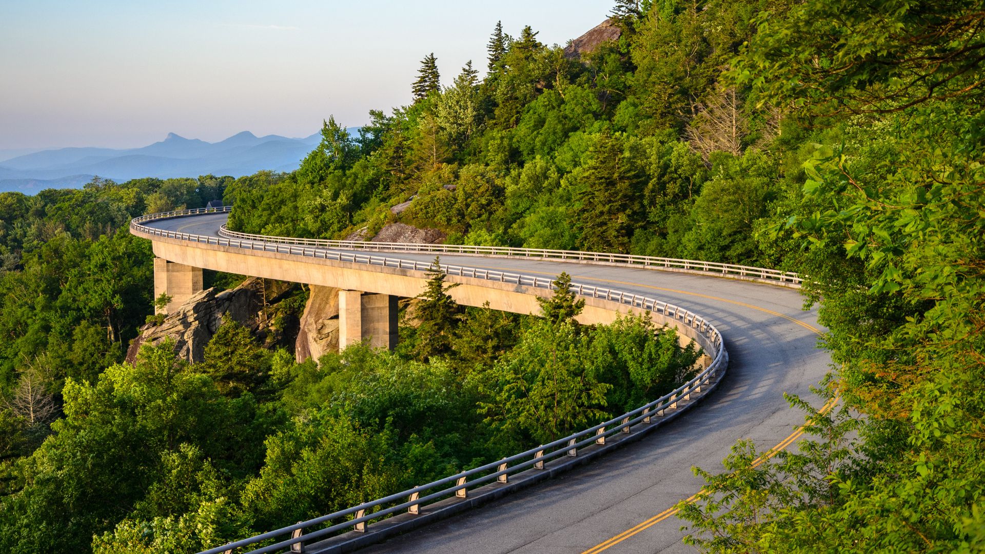
5) Blue Ridge Parkway, Virginia and North Carolina
The Blue Ridge Parkway is 469 miles of pure mountain magic. It links Shenandoah National Park in Virginia to the Great Smoky Mountains in North Carolina.
Every curve delivers a new vista—rolling ridges, peaceful valleys, and the kind of views that make you forget your phone. Waterfalls, hiking trails, and bits of history line the way.
The drive is relaxed, with plenty of overlooks to pull over and snap a photo. Wildlife and wildflowers keep things interesting.
Don’t rush this one. You’ll want a few days to really take it in. Small mountain towns dot the route, offering good food and cozy places to stay.
Summer’s warm, but the higher elevations keep it comfortable. Camping, picnicking, or just stretching your legs at a trailhead—it’s all part of the experience.
Nature lovers and anyone who craves a peaceful escape will fall for this drive.
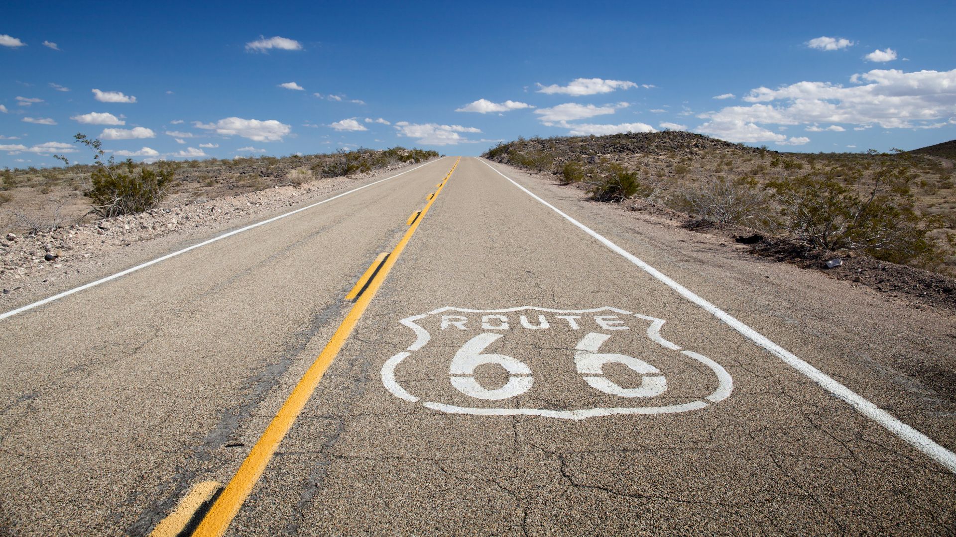
6) Route 66 from Chicago to Santa Monica
Route 66 is the original American road trip—2,400 miles from Chicago to the Santa Monica Pier. You’ll roll through eight states: Illinois, Missouri, Kansas, Oklahoma, Texas, New Mexico, Arizona, and California.
Since 1926, this highway has symbolized freedom and adventure. Vintage diners, neon signs, and oddball roadside attractions are everywhere.
You’ll pass through small towns, wide-open landscapes, and plenty of historic landmarks. The route changed a few times before 1985, so you might want to check which alignment you’re following.
Give yourself at least two weeks if you want to do it justice. Summer means long days and mostly good weather, though you’ll hit everything from plains to desert.
This trip is for anyone who loves Americana or just wants to see the country the old-fashioned way.
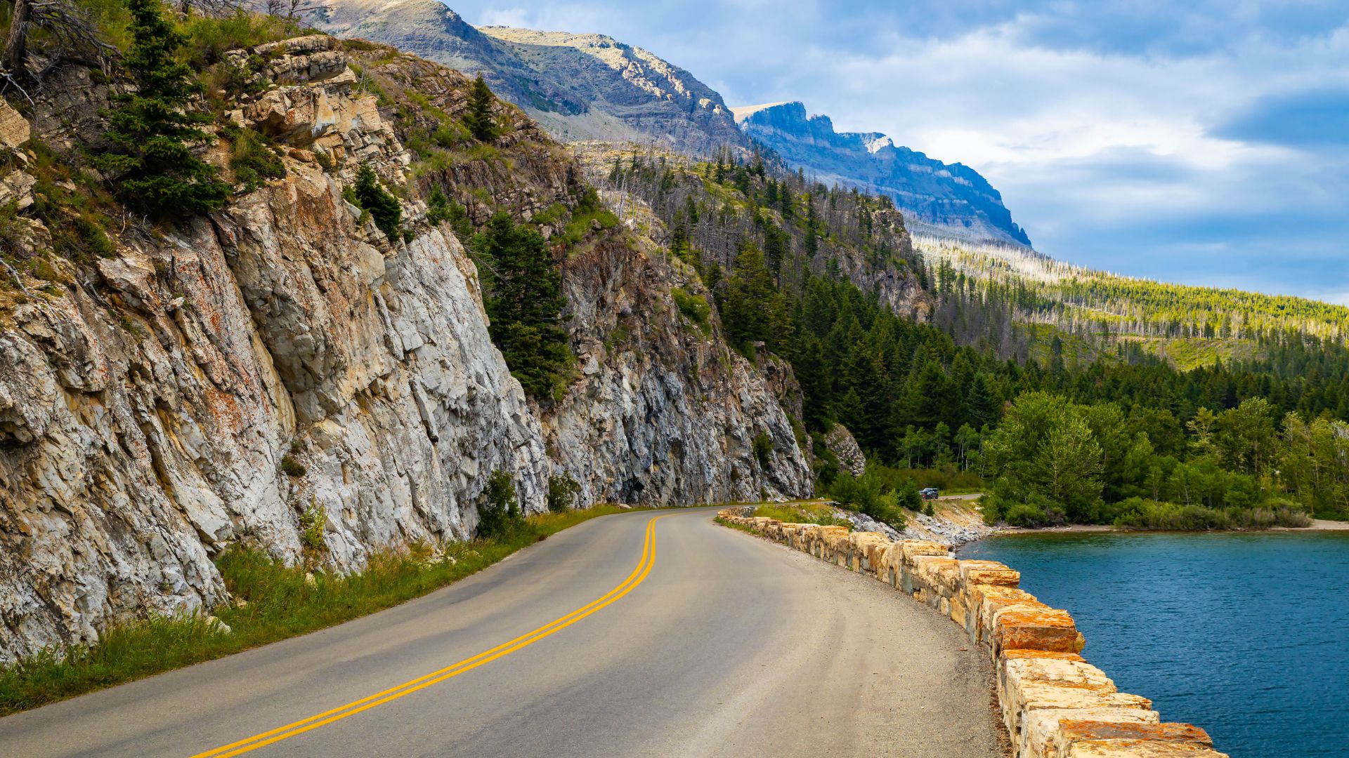
7) Going-to-the-Sun Road, Glacier National Park
Going-to-the-Sun Road is a 50-mile masterpiece cutting through Glacier National Park in Montana. It crests the Continental Divide at Logan Pass—6,646 feet up.
Crews started building it in 1921 and wrapped up in 1933, with the final paving done in 1952. That’s a lot of work for one road, but wow, is it worth it.
You’ll drive through forests, meadows, and up into the mountains. Glaciers, waterfalls, and dramatic peaks fill the horizon. Don’t be surprised if you spot a bear or mountain goat along the way.
The road usually opens in late June or July, after crews clear the snow. It closes again by mid-October, and sometimes earlier if winter comes fast.
Plan on a couple of hours for the drive, but honestly, you’ll want to stop at every overlook. Most folks spend the whole day exploring.
You’ll need a reservation or entry ticket during the busy season. Always check road conditions before you go. Glacier weather can be unpredictable.
8) Overseas Highway, Florida Keys
The Overseas Highway is 113 miles of island-hopping bliss. U.S. Route 1 connects mainland Florida to Key West, skipping across 42 bridges with the ocean on both sides.
It’s not just a drive—it’s an adventure. You’ll pass through the Florida Keys, crossing channels and open water, feeling like you’re floating between worlds.
Stop in small towns, check out state parks, or just pull over to watch the water change color. The views are endless, and you might even spot dolphins or manatees.
This drive works for a quick day trip or a longer stay. There are plenty of places to eat, swim, or snap a sunset photo.
Key West marks the end of the line, and trust me, it’s worth lingering there. Whether you’re into wildlife, water sports, or just chilling with a slice of Key lime pie, you’ll find your spot.

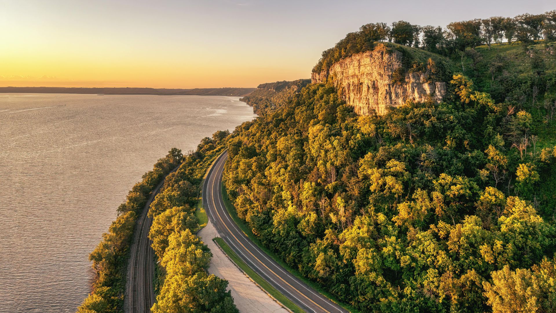
9) Great River Road along the Mississippi River
The Great River Road runs nearly 3,000 miles along the Mississippi River, weaving through 10 states from Minnesota to Louisiana.
You’ll pass through Wisconsin, Iowa, Illinois, Missouri, Kentucky, Tennessee, Arkansas, and Mississippi. Each state adds its own flavor to the journey.
In Minnesota, sandstone bluffs rise above the river. Iowa’s got ancient Indigenous earthworks tucked into forests. Quiet river towns and lively festivals pop up all along the route.
You’ll sample local food, discover historic sites, and stumble onto quirky attractions. The byway makes it easy to dive into each state’s culture and scenery.
Summer brings outdoor events and riverfront fun. There are plenty of places to stretch your legs, grab a bite, or just sit and watch the water roll by.
This route works whether you want a massive road trip or just a quick taste of river life.
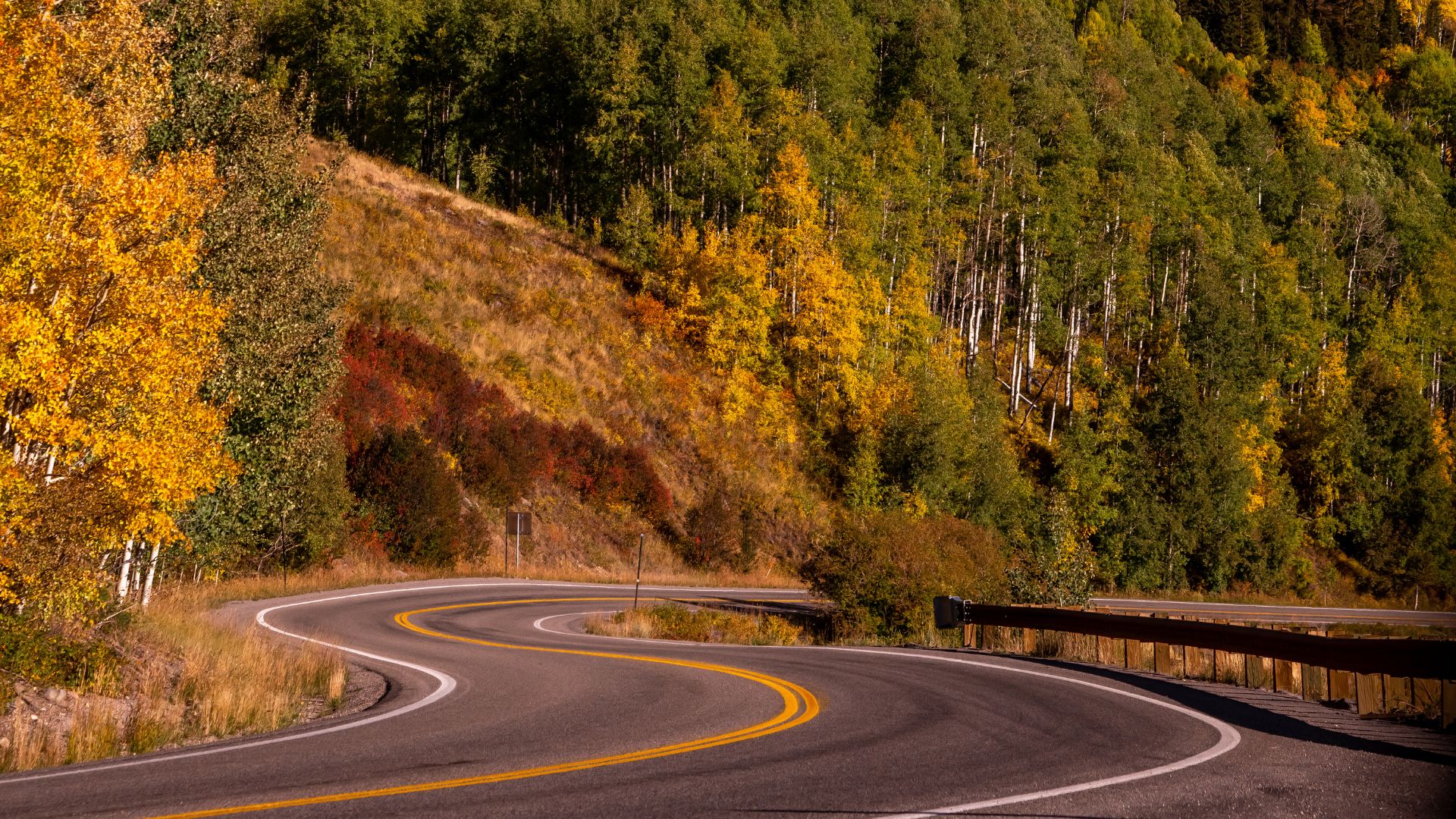
10) The San Juan Skyway, Colorado
The San Juan Skyway is a 236-mile loop through southwestern Colorado’s most dramatic landscapes. You’ll wind past snow-capped peaks, alpine lakes, and red rock canyons.
Historic towns like Durango, Silverton, Telluride, and Ouray dot the route. Each one has its own Old West vibe and stories from Colorado’s mining days.
You’ll climb above 10,000 feet, with 14,000-foot peaks towering overhead. The scenery shifts from desert to wildflower-filled meadows as you go.
Since 1996, the Skyway’s been an official All-American Road—the highest honor for a scenic drive.
Aim for April to October, when the whole loop is open. Summer brings long days, and fall lights up the mountains with color.
You can do the drive in one long day, but honestly, two or three days lets you really explore each stop. This is one of those trips that sticks with you long after you’re home.
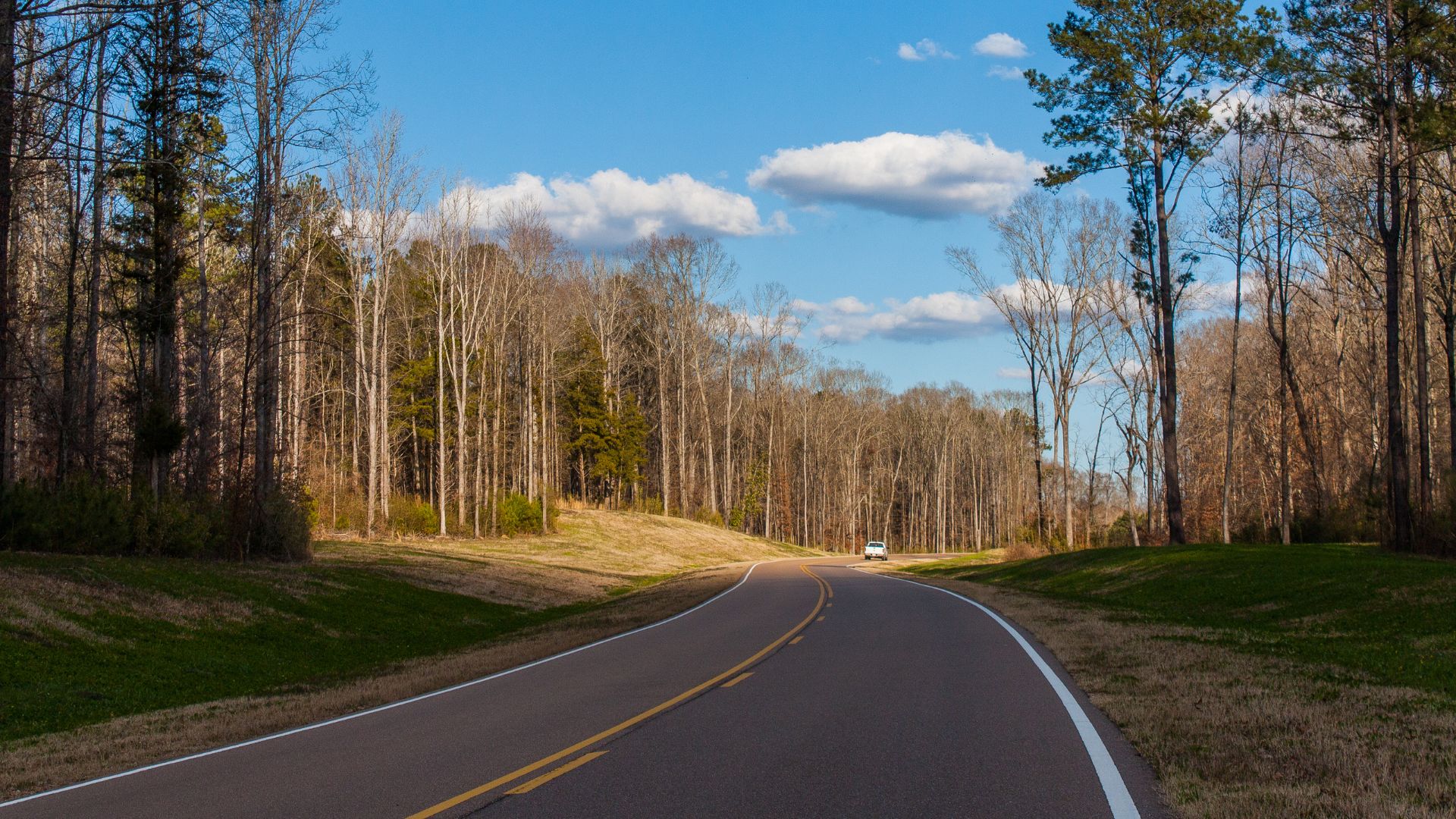
11) Natchez Trace Parkway, Mississippi to Tennessee
Let me tell you, the Natchez Trace Parkway is a drive I’ll never forget. It winds for 444 miles, connecting Natchez, Mississippi, all the way up to Nashville, Tennessee.
You’re basically tracing an ancient path that Native Americans and early settlers used for travel and trade. There’s something kind of magical about that.
On this journey, you’ll roll through Mississippi, Alabama, and Tennessee. The scenery changes constantly—sometimes you’re surrounded by rolling hills, then suddenly you’re driving under a canopy of thick forest, or crossing a sleepy river.
No billboards, no gaudy signs, just the road and the landscape. It’s almost meditative.
The parkway has just two lanes and a relaxed speed limit, which keeps things slow and easy. Big trucks aren’t allowed, so you won’t get stuck behind a convoy or anything.
I recommend pulling over whenever you see a scenic overlook or historic marker. There are Native American mounds, Civil War battlefields, and plenty of natural wonders to explore.
If you love hiking, you’ll find trails and picnic spots all along the route. It’s easy to stop, stretch your legs, and just soak in the peace.
Summer is a fantastic time to drive here. The trees are full and green, and you’ll have long daylight hours to wander and explore.
Essential Tips for Planning a Summer Road Trip
A summer road trip isn’t just about hopping in the car and hitting the gas. If you plan ahead, you’ll dodge crowds, handle weird weather, and actually enjoy those endless hours on the road.
The right prep means your car (and your sanity) survive the journey.
Timing and Seasonal Considerations
I always start early in the morning. You’ll beat the heat and most of the traffic that way.
Since summer is peak travel season, book your hotels or campsites at least 2-3 weeks before you go—especially near national parks or other hotspots.
Give yourself extra time on weekends and holidays. Roads to beaches, mountains, and tourist traps get clogged between 10 AM and 4 PM, especially Fridays and Saturdays.
Before you leave, check the weather along your route. Summer can mean Midwest thunderstorms, scorching heat in the Southwest, or chilly mountain nights. Temperatures can swing 30-40 degrees between desert valleys and mountain passes.
Try to avoid driving through deserts during the hottest hours (2-5 PM). If your trip crosses time zones, factor that into your schedule and rest breaks.
Packing Smart for Varying Climates
Layer up! I always pack both shorts and long pants, plus a light jacket for chilly nights or overzealous air conditioning.
Don’t forget these essentials:
- Sunscreen (SPF 30+)
- Reusable water bottles
- First aid kit
- Portable phone charger
- Paper maps or offline downloads
- Cooler with ice packs for drinks and snacks
Keep a small bag in the front seat with your sunglasses, lip balm, sanitizer, and tissues. Makes life so much easier.
Even if the forecast looks clear, bring rain gear. Summer storms can pop up out of nowhere, especially in the mountains. A small umbrella and a waterproof jacket barely take up space.

Vehicle Preparation and Safety
A week or two before you go, get your car checked out. I always ask my mechanic to look at the oil, brake fluid, coolant, tire pressure, and AC.
Check your tire tread and look for uneven wear. Summer heat can turn a worn tire into a disaster. Make sure your spare is good to go and you’ve got a working jack.
Quick vehicle checklist:
- Test all lights (headlights, brake, turn signals)
- Replace wipers if they’re streaky
- Top off washer fluid
- Check battery terminals for corrosion
- Make sure your registration and insurance are current
Pack a roadside emergency kit—jumper cables, flashlight, basic tools, reflective triangles. Toss in extra oil and coolant if you’ll be far from service stations.
Clean your windshield inside and out before you leave. Sun glare on a dirty windshield is brutal and makes long drives a headache.
Making the Most of Scenic Stops
Honestly, the best part of a road trip isn’t just the view from the car—it’s what you find when you get out and explore.
Finding Hidden Gems Along the Route
Pull off at places that aren’t on any “top 10” list. I’ve found the coolest diners and weirdest little museums just by following my curiosity.
Chat with locals at gas stations or rest stops. They always know about some waterfall or roadside oddity you’d never find on your own.
Apps like Roadtrippers or Atlas Obscura are gold mines for quirky landmarks and natural wonders nearby. State welcome centers hand out free maps that highlight scenic overlooks and hidden gems.
Look for brown road signs—they’ll point you to parks, viewpoints, and cultural sites. Most have parking and restrooms, so you can explore without stress.
If you see an unmarked dirt road or a vintage sign, why not check it out? Some of my favorite discoveries have happened that way.

Capturing Memorable Photos
Nothing beats golden hour for photos. Early morning or just before sunset, the light turns everything magical.
Best times to shoot:
- 6:00 AM – 8:00 AM
- 5:00 PM – 7:00 PM (give or take, depending on the month)
- Overcast days: honestly, any time works
Include people or your car in the shot to give a sense of scale. A person next to a giant tree or your car on an empty road makes the scene feel real.
Wipe your camera lens often—road dust sneaks in everywhere. Try different angles—crouch low, climb a rock, or shoot down a fence line. Leading lines like roads or rivers make your photos more interesting.
Enjoying Local Cuisine and Culture
Skip the chains and eat where the locals do. Every region has its own specialties—seafood on the coast, game meats in the mountains, farm-fresh everything in the heartland.
Hit up farmers markets for snacks you can’t get anywhere else. Homemade jam, fresh bread, and whatever fruit is in season always taste better than gas station fare.
Keep an eye out for food trucks and roadside BBQ stands. These places often serve recipes that have been in the family for generations. Carry some cash—small spots don’t always take cards.
If you have time, check local event calendars for festivals or fairs. Small-town celebrations are a great way to experience local music, art, and crafts. Main streets in old town centers usually have unique shops with handmade goods.
Frequently Asked Questions
Let’s tackle some of the most common questions about summer road trips in the USA. I’ve picked up a few tricks over the years.
Stick to one region for a week—you’ll actually get to enjoy it. The Blue Ridge Parkway, running through Virginia and North Carolina, is a classic. You can drive all 469 miles in five to seven days, stopping for overlooks and hikes.
The Pacific Coast Highway from San Francisco to Los Angeles is another favorite. You’ll pass coastal towns, beaches, and state parks along about 400 miles of stunning coastline.
Utah’s Scenic Byway 12 is perfect for red rock lovers. Pair it with nearby national parks like Bryce Canyon and Capitol Reef for a packed but doable adventure.
For two weeks, pick either a northern or southern cross-country route. Don’t try to see everything or you’ll spend the whole trip in the car.
A northern route takes you from the Pacific Northwest through Montana, Wyoming, South Dakota, and the Great Lakes. You’ll get mountains, plains, forests—the works.
Prefer the South? Connect the Pacific Coast Highway with Arizona and New Mexico’s deserts, then head across Texas and the Southeast. Aim for 200–300 miles a day to leave time for stops and side trips.
You’ll want both digital and paper maps. Google Maps is great for live traffic, but I also use offline GPS apps like Gaia GPS for dead zones.
Old-school road atlases from Rand McNally or National Geographic are super helpful for big-picture planning. State tourism offices usually have free highway maps showing rest areas and scenic stops.
If you’re driving a famous byway, check the Federal Highway Administration’s America’s Byways site for downloadable PDF maps. They’re packed with info on attractions and facilities.
With four weeks, you can see a lot without rushing. Plan your route, but stay flexible for surprises and weather.
Expect higher gas prices in summer, and get your car fully checked—tires, brakes, fluids, AC, the whole nine yards.
Book places to stay in popular areas (national parks, coastal towns) at least two months out. You can wing it more in less crowded spots.
Pack for all kinds of weather, especially if you’re changing elevation or climate zones. A cooler for snacks and drinks saves you money and cuts down on stops.
The Alaska Road Trip from Anchorage to Fairbanks is a wild one—360 miles of pure wilderness, including Denali National Park and views of the continent’s tallest peak.
In the Lower 48, US Route 2 runs from Washington to Maine, skirting northern forests and plains. You’ll pass through Glacier National Park and along the Great Lakes.
Minnesota’s North Shore Scenic Drive hugs Lake Superior, with waterfalls, lighthouses, and thick forests. You can connect it with routes through Wisconsin and Michigan’s Upper Peninsula.
Let’s kick things off with Newfound Gap Road, winding right through Great Smoky Mountains National Park. You’ll catch mountain views that’ll make you stop the car, and if you’re lucky, spot a black bear or two.
Definitely pull over at Clingmans Dome. It’s the highest point in Tennessee, and the panorama from up there? Absolutely worth the short walk, trust me.
If you’re rolling along the Blue Ridge Parkway, you can’t miss Mabry Mill. It’s one of those postcard spots—great for a photo and a quick stretch.
Linville Falls is another favorite of mine, especially if you like a short hike with a big payoff. Mount Mitchell is close by, and since it’s the tallest peak east of the Mississippi, the views are just wild.
Now, let’s talk Pacific Coast Highway. Big Sur’s cliffs basically redefine “dramatic.” I always find myself pulling over just to stare at the ocean.
Don’t skip Hearst Castle—it’s a quirky piece of California history perched up in the hills. And those little towns like Carmel-by-the-Sea and Monterey? They’re charming, full of good coffee shops and sea air.
Point Lobos State Natural Reserve is a must for anyone who loves coastal trails. I’ve spotted sea lions basking in the sun more than once there.
Utah’s Scenic Byway 12 is a whole different vibe. Escalante Petrified Forest State Park has these ancient, colorful logs that make you feel like you’re walking through time.
Drive up Boulder Mountain in the fall and you’ll hit groves of golden aspens. The small town of Torrey makes a perfect base if you want to explore Capitol Reef National Park—it’s got that friendly, welcoming energy that’s hard to fake.