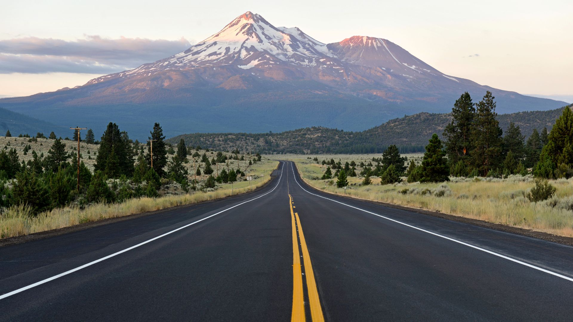
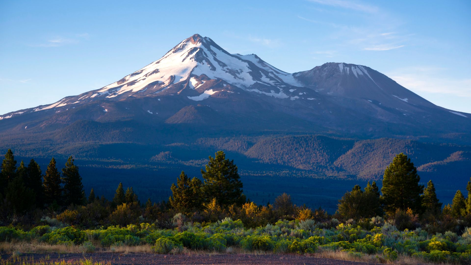
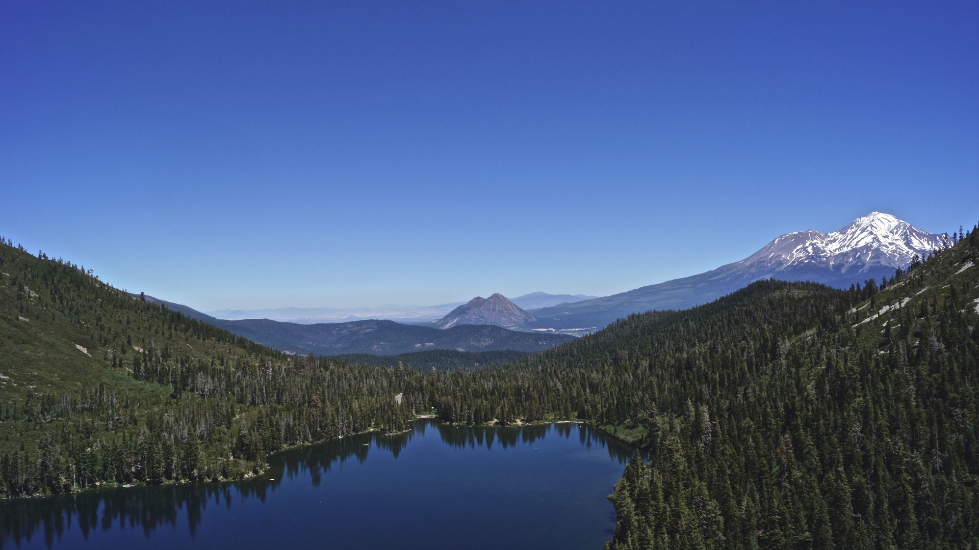
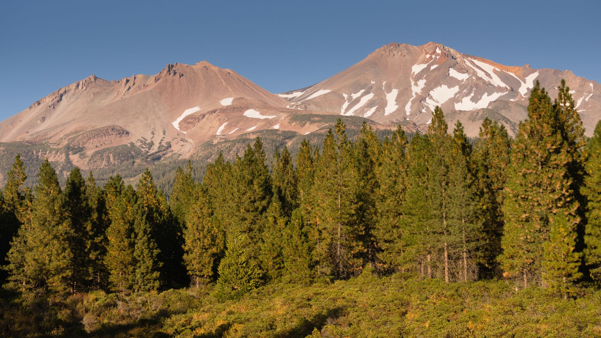
Mount Shasta towers over Northern California, climbing past 14,000 feet and dominating Siskiyou County’s skyline. It’s not just another mountain—it’s a place that feels downright mystical sometimes, and it’s packed with outdoor adventures for every kind of explorer.
You’ll find everything here, from wild summit hikes to those peaceful, soul-soothing moments by crystal-clear alpine lakes.
There are five unforgettable ways to connect with nature around Mount Shasta. You can chase mountain adventures, discover magical water features, visit sacred headwaters, or camp out under some of California’s clearest night skies.
Some folks come here for the spiritual vibes—others just want to get lost in the wilderness for a while. Either way, Mount Shasta delivers something you won’t find anywhere else.
I’ve wandered these trails, dipped my toes in the lakes, and stumbled onto more than a few hidden gems. Every visit reveals a new side of this wild region.
Catching sunrise as it lights up the mountain? It’s magic. And there’s nothing like the quiet by a bubbling spring after a long day on the trail.
Epic Hikes and Mountain Adventures
Mount Shasta’s hiking scene has something for everyone. You can tackle technical summit climbs or wander through family-friendly meadows.
The area breaks down into three main adventure zones: tough summit routes, the accessible Panther Meadow area, and the rugged Castle Crags wilderness that connects to the Pacific Crest Trail.
Summiting Mount Shasta: Routes and Essential Tips
Climbing Mount Shasta’s 14,179-foot summit isn’t for the faint of heart. You’ll gain 7,200 feet of elevation, and the most common route starts at Bunny Flat, heading up through Panther Meadow.
You’ll need:
- Real mountaineering boots and crampons
- An ice axe and helmet
- Plenty of layers
- An emergency shelter (just in case)
Start your climb early—think 2 to 4 AM—to beat the afternoon weather. The Avalanche Gulch route gets technical above 12,000 feet, so brush up on those mountaineering skills.
Permits are a must from May to September. Trust me, preparation and experience make all the difference up here.
Weather flips quickly above treeline. Even in summer, you’ll probably hit snow and ice up high.
Panther Meadow and Bunny Flat Trail Exploration
If you want a more approachable hike, try the Bunny Flat to Panther Meadow trail. It’s a 7-mile round trip with 1,355 feet of elevation gain.
The meadow sits at 7,500 feet and bursts with wildflowers in the summer. Usually, you’ll find the trail snow-free from July through October.
Trail highlights:
- Wildflower meadows in peak season
- Killer views of Mount Shasta and Green Butte
You can camp at both trailheads. In winter, this area transforms into a snowshoeing paradise.
The Panther Meadow Trail itself is just over a mile. It packs a lot in—rocks, cliffs, wildflowers, and creek crossings.
This is also where many bigger adventures on Mount Shasta begin. Surprisingly, it doesn’t get as crowded as you might expect.
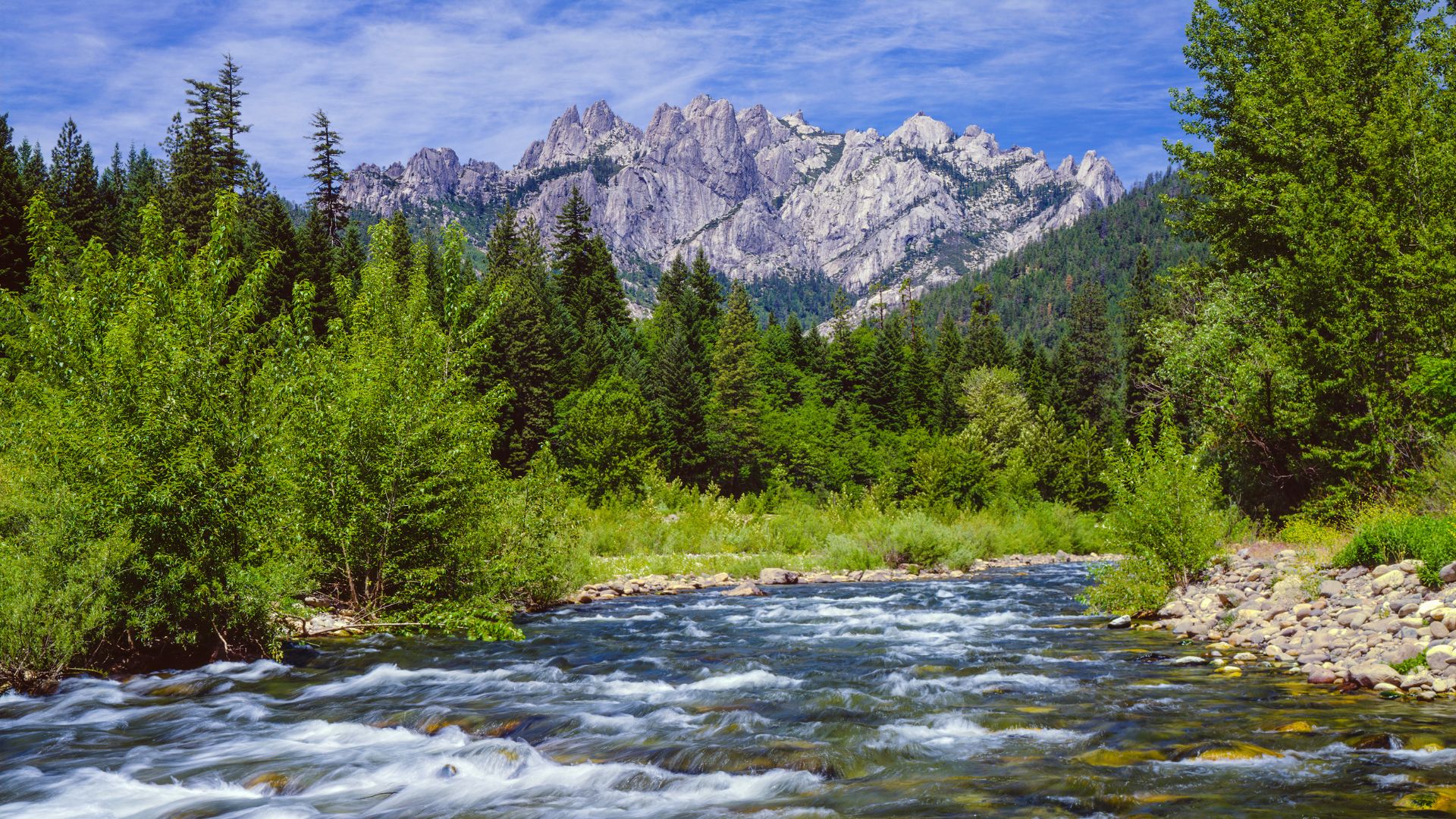
Castle Crags and Pacific Crest Trail Day Hikes
Castle Crags State Park is a granite playground with spires and Pacific Crest Trail access. Bob’s Hat Trail gives you some of the best Mount Shasta views, especially near the top.
Popular day hikes:
- Castle Lake to Heart Lake (3 miles, 814 feet gain)
- Black Butte Trail (6.1 miles, 1,992 feet gain)
- A handful of Castle Crags wilderness routes
The Castle Lake to Heart Lake trail is a local favorite. You’ll get two gorgeous lakes and a moderate workout.
Black Butte stands as Mount Shasta’s biggest satellite peak. The summit offers panoramic views and some hidden canyons to explore.
Castle Crags’ geology makes the landscape feel dramatic year-round. When summer trails close, snowshoers take over.
The Pacific Crest Trail cuts right through here, so you can always extend your adventure north or south.
Magical Alpine Lakes and Water Wonders
If you’re after postcard-worthy alpine lakes or roaring waterfalls, Mount Shasta’s got you covered. Lake Siskiyou is the go-to spot for recreation, while Castle Lake and Heart Lake sit higher up, showing off those mountain views.
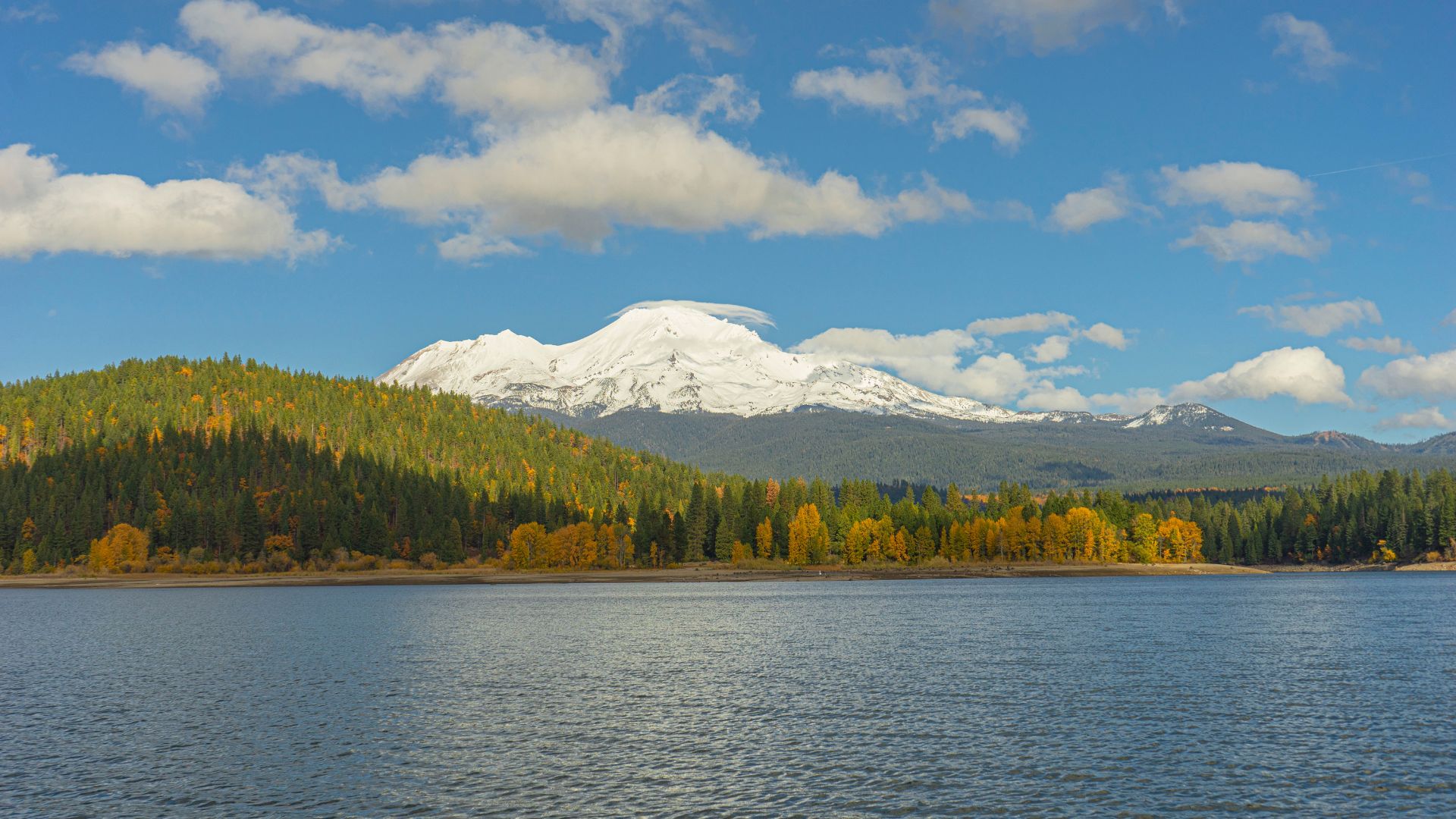
Lake Siskiyou: Recreation and Relaxation
Lake Siskiyou is the area’s main water hangout, formed where Wagon Creek meets the Sacramento River.
You get unbeatable views of Mount Shasta reflected in calm waters, and the evergreen-lined shore just adds to the vibe.
Arrive early if you can. The parking lot fills up fast, especially on weekends.
Things to do:
- Rent a kayak or boat and get out on the water
- Swim in the designated areas
- Fish for trout and bass
- Stroll the Lake Siskiyou Trail Loop
The trail loop is easy and scenic. Fishing is solid all year, but spring and fall are the sweet spots.
You can rent gear in town. Heads up—the lake water stays chilly, even in August, so bring a wetsuit if you plan to swim.
Castle Lake and Heart Lake Views
Castle Lake sits high at 5,280 feet in a glacial basin and might just be the prettiest alpine lake around.
It’s about a 30-minute hike from the parking lot, and the trail is gentle enough for most folks.
Why Castle Lake rocks:
- Super clear alpine water
- Epic mountain backdrop
- Easy access for families
- Awesome for photos
Heart Lake is a bit farther—add another mile to your hike—but the views get even better.
I usually find Heart Lake quieter than Castle Lake. The setting feels more remote, and it’s a great place to just soak it all in.
Both lakes hold brook trout, and the cold water keeps them happy year-round.
Swimming? Technically yes, but it’s freezing. Most people just wade in or post up with a picnic.
Discovering McCloud Falls and McCloud River
McCloud Falls is actually three waterfalls along the McCloud River, each with its own personality.
Middle Falls steals the show. It’s over 100 feet wide and has a perfect swimming hole at the bottom.
Here’s the breakdown:
- Lower Falls: Easy to reach, kid-friendly
- Middle Falls: Best for swimming and photos
- Upper Falls: Longer hike, fewer crowds
You can drive to each parking lot or hike the whole connecting trail. If you’ve got time, hit all three.
The river is a hotspot for fishing—rainbow and brown trout thrive here.
If you go early in the morning, you’ll beat the crowds and catch the falls at their coolest.
Taking a dip at Middle Falls after a hike is the best kind of refresh. The water’s always cold, but that’s half the thrill.
The Sacred Headwaters and Unique Natural Sites
Mount Shasta hides some truly special natural sites. You can drink pure spring water straight from the source or crawl through underground lava tubes shaped by ancient eruptions.
Mount Shasta City Park and Pure Spring Water
Mount Shasta City Park sits right at the foot of Spring Hill and guards a local treasure—the Sacramento River headwaters.
Here, spring water bubbles up from deep underground, cold and clear at 36-40 degrees Fahrenheit year-round.
Locals and visitors alike come with bottles and jugs to fill up. I’ve watched people make it a weekly ritual.
Accessing the spring is simple. Big boulders and paved paths keep things safe and easy.
Park perks:
- Playgrounds for the kids
- Walking bridges and picnic tables
- Restrooms and BBQ grills
- 26 acres of green space
Several footpaths wind through tall trees around the springs. It’s a peaceful place for a stroll.
The headwaters draw in people looking for a spiritual recharge. You’ll spot folks meditating, drumming, or just sitting quietly by the water.

Exploring Lava Tubes and Volcanic Caves
Mount Shasta’s volcanic past carved out a secret world of lava tubes and caves beneath the surface.
These tubes formed when flowing lava cooled on the outside but stayed hot inside, eventually draining out and leaving hollow tunnels.
Some tunnels stretch for miles. The caves keep cool—usually between 40 and 50 degrees—so bring a jacket and sturdy shoes.
Bring along:
- A headlamp or flashlight (plus extra batteries)
- Warm layers
- Non-slip shoes
- Water
Some tubes get tight, so be ready to crouch or crawl. Others open into big chambers where you can stand up and look around.
Inside, the volcanic rock shows off wild colors and textures. Smooth where lava once flowed, rough where it cooled in a hurry.
Backpacking, Camping, and Immersive Wilderness Retreats
Mount Shasta is a dream for campers and backpackers. High-elevation campsites and wild trails in the Trinity National Forest make it easy to disappear into nature for days.
Best Campgrounds and Campsites Near Mount Shasta
Panther Meadows Campground sits way up at 7,500 feet, making it the highest spot you can camp on Mount Shasta. There are 10 free sites, each with a fire ring and table.
Nights get cold, even in the heart of summer. Don’t skimp on warm gear.
Castle Lake Campground is easier to reach and has flush toilets and running water, but sites fill up fast.
For more solitude, try dispersed camping in the Mount Shasta Wilderness. Clear Creek and Panther Creek both have hidden gems.
| Campground | Elevation | Sites | Cost |
|---|---|---|---|
| Panther Meadows | 7,500 ft | 10 | Free |
| Castle Lake | 5,400 ft | 6 | $10/night |
Backpacking Through the Trinity National Forest
Trinity National Forest stretches west with more than 550 miles of trails. I think the best backpacking starts at the Clear Creek Trailhead, already at 6,390 feet.
Dead Falls Lake Trail is perfect for families. It’s 7.76 miles long, climbs 1,165 feet, and bursts with wildflowers in spring and summer.
Canyon Creek Lakes is tougher—14.35 miles and a 2,605-foot climb—but you end up at stunning alpine lakes in the Trinity Alps.
For seasoned backpackers, the Caribou Lakes Trail is a beast: 17.26 miles, nearly 4,000 feet of gain, and scenery that makes every step worth it.
Stargazing and Outdoor Adventures Beyond the Trail
Thanks to its high elevation and remote location, Mount Shasta is a stargazer’s paradise. The landscape here offers way more than just hiking—there’s something to do in every season.
Top Spots for Stargazing Around Mount Shasta
Castle Lake Overlook tops my list for stargazing. It sits on Mount Shasta’s southwest slope and gives you a wide-open view of the night sky.
You’ll get there by following the Castle Lake Trail from the trailhead on Castle Lake Road. The hike winds through alpine forest before opening up at the overlook.
Panther Meadows is another favorite. Up high on the mountain, it’s got almost zero light pollution and a spiritual atmosphere that’s hard to describe.
You can reach Panther Meadows via the Everitt Memorial Highway. Stargazing here just feels different—maybe it’s the setting, maybe it’s the altitude.
Bunny Flat Trailhead sits at 6,950 feet and is super easy to access. The views stretch forever, and it’s a launch point for bigger adventures.
If you’re coming up in summer, you’ll have the best shot at clear skies. Don’t forget those warm layers—the temperature drops fast once the sun goes down.
Year-Round Outdoor Adventure Opportunities
Mount Shasta’s not just about hiking—there’s a whole world of outdoor adventures waiting up here. One of my favorite spots? Pluto’s Cave. You can wander through ancient volcanic lava tubes, and if you time it right, catch a jaw-dropping view of the night sky right from the cave entrance.
You’ll find the cave north of Mount Shasta, close to Weed, California. Once you step inside, the darkness pretty much wipes out any light pollution, so it’s perfect for stargazing.
In the summer, everything opens up. I love pitching a tent and spending the night under the stars. You can hit up Castle Lake during the day, then unwind with some lakeside astronomy after sunset.
When winter rolls in, Mount Shasta shifts gears. Suddenly, it’s all about snowshoeing and cross-country skiing. If you’re up for it, you can trek out to quiet spots and catch some unreal winter stargazing.
Before heading out overnight, I always check the weather. The mountain’s elevation means things can change fast—sunshine one minute, snow flurries the next.
The Everitt Memorial Highway is a solid option for those who want to keep things simple. There are plenty of pullouts where you can park, kick back, and watch the stars without any hassle.