America’s scenic byways have this magic you just can’t find on the big interstates. Honestly, the real heart of the country shows up when you slow down and wander off the main drag. While most people are in a hurry, zipping past the good stuff, I’ve found my favorite memories hiding out on the quiet routes nobody talks about.
These scenic routes wind through everything from coastal cliffs to mountain passes. Each road tells its own story about America’s wild places, quirky towns, and the history lurking just off the map. Whether it’s the Dalton Highway slicing through Alaska or a twisty mountain pass in the Rockies, these byways link up sleepy communities, forgotten landmarks, and secret natural gems that the highways just skip.
I’ve learned that the best travel stories don’t live in guidebooks or on those over-crowded bucket lists. They’re waiting for you on the backroads—where you might stumble on a waterfall with no name, a diner serving pie like your grandma made, or a stretch of silence that feels like a gift.
Overview of America’s Most Iconic Scenic Byways
There are 187 official scenic byways out there, each one showing off a slice of America’s best views and history. The Federal Highway Administration splits them into two types: National Scenic Byways and the even rarer All-American Roads.
What Defines a Scenic Byway
I’ve picked up that a road can’t just be pretty to get the scenic byway label. It has to stand out in at least one of six ways: scenic beauty, natural features, historic significance, cultural importance, archaeological value, or recreational opportunities.
National Scenic Byways really shine in at least one of those categories. They’re the roads that make you pull over, grab your camera, and just stare for a minute.
All-American Roads go even further. They have to be amazing in at least two ways and feel like a destination all on their own.
Right now, there are 150 National Scenic Byways and 37 All-American Roads. State and federal officials put each one through a pretty tough review before it makes the list.
You’ll find these roads everywhere—from Colorado’s high passes to California’s wild coastline. The best ones usually dodge the traffic and let you really get to know the land.
How the Routes Were Chosen
The National Scenic Byways Program kicked off in 1991. Their process is no joke—states put together hefty applications full of details.
If a state wants a road on the list, they have to prove it stands out. That means showing off the road’s unique features, getting local folks on board, and laying out how they’ll handle more visitors.
Every nomination needs a corridor management plan. Local communities have to show how they’ll protect what makes the road special and keep tourism from getting out of hand.
Federal reviewers dig into each application. They check for safety, visitor services, and whether the road really tells a piece of America’s story.
Getting the official nod can take years. Some recent additions include the Great River Road and California’s Historic Route 66 from Needles to Barstow.
The Importance of Back Roads in American Travel
Back roads are the soul of the scenic byway system. They offer the kind of moments you just can’t find on the interstate.
I’ve noticed these roads usually follow the land’s natural shape. They twist through valleys, climb up mountains, and skirt along coastlines, all while showing off the local vibe.
These routes bring life to small towns that highways leave behind. Local shops, diners, and museums count on travelers who wander off the beaten path.
On these roads, you get to slow down. Lower speed limits mean you actually see things—and you’ll want to stop for those weird roadside attractions.
Byway designations can even help towns snag federal funds for road work and keeping local history alive.
Many of these roads started out as Native American trails or wagon routes. Over time, they became today’s most beloved scenic drives.
8 Unforgettable American Scenic Byways
Let’s hit the highlights. These eight routes show off everything from desert highways to snowy passes and tropical bridges. Each one turns a regular drive into something you’ll talk about for years.
Route 66: The Mother Road’s Timeless Allure
Route 66 runs 2,448 miles, connecting Chicago to Santa Monica. I’ve explored long stretches of this legend, and every state adds its own flavor.
The Mother Road cuts through eight states. In Illinois, you’ll spot old-school diners and neon-lit motels right near the start.
Kansas only gets 13.2 miles, but it’s all rolling prairie and tiny towns. I like stopping at the old gas stations and grabbing coffee at a local café.
Texas has the longest piece—178 miles. The panhandle stretch is pure Americana. Don’t miss Cadillac Ranch outside Amarillo, where classic cars rise from the dirt.
Arizona brings 401 miles of wide-open desert. You’ll roll through Flagstaff, with the Grand Canyon just a detour away. Trading posts and ancient sites dot this section.
California’s last miles take you through the Mojave Desert before you finally hit the ocean at Santa Monica Pier. It’s a classic finish—sand, surf, and the end of the road.
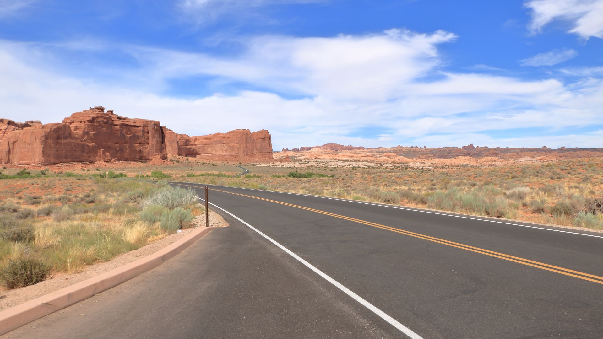
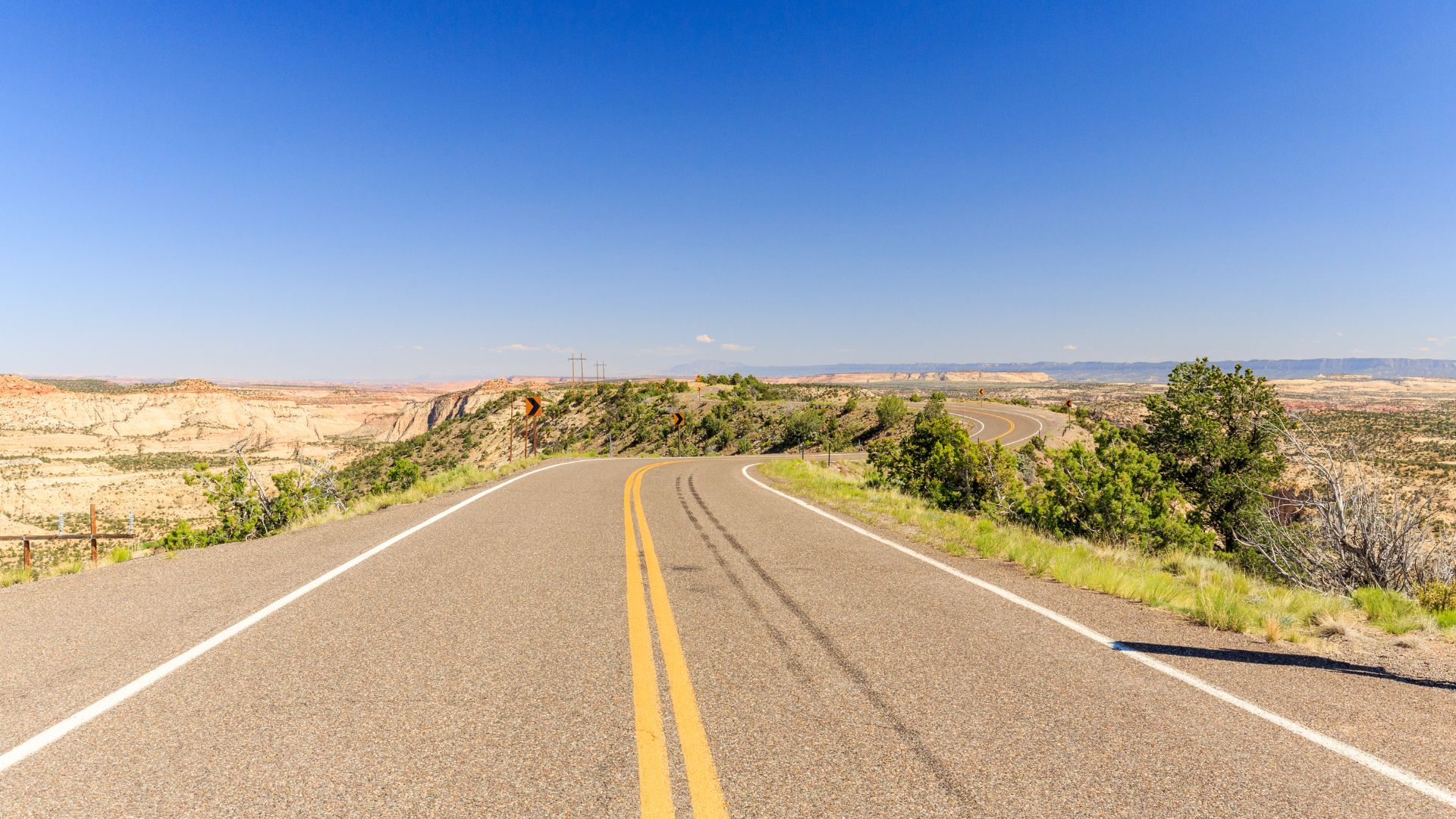
Scenic Byway 12: Utah’s Red-Rock Wonder
Utah’s Scenic Byway 12 packs 124 miles of jaw-dropping red rock landscapes. Honestly, it’s one of the most varied drives I’ve done in the Southwest.
The road links Bryce Canyon and Capitol Reef National Parks. You’ll also pass through Grand Staircase-Escalante National Monument. Every stretch looks like a postcard.
Bryce Canyon is all about those wild hoodoos—thousands of them, glowing at sunrise. Cooler air up here makes summer road trips a breeze.
The byway climbs Boulder Mountain, topping out at 9,200 feet. Suddenly, you’re in pine forests, swapping red rocks for deep green.
Torrey sits at the edge of Capitol Reef. It’s a friendly little town with good food and a laid-back vibe.
Capitol Reef itself protects a massive fold in the earth. You can hike to petroglyphs or snack on fruit from pioneer orchards. The park’s scenic drive is a must.
Overseas Highway: Island-Hopping in the Florida Keys
The Overseas Highway runs 113 miles from Key Largo to Key West. I’ll never forget the feeling of driving over water, hopping from island to island.
Key Largo starts things off. If you love snorkeling, check out John Pennekamp Coral Reef State Park. The fish and coral are unreal.
The Seven Mile Bridge steals the show. It’s an engineering feat that links the middle and lower Keys. I always stop at the old bridge for a photo or two.
Key Highway Facts:
- 42 bridges in total
- Connects 31 islands
- Took over from Henry Flagler’s railroad
- Finished in 1982
Key West sits at the very tip of the continental U.S. The town is full of history—think Hemingway’s house and sunset parties at Mallory Square.
You can drive the whole thing in under three hours, but why rush? Each key has its own personality, so give yourself a day to wander.
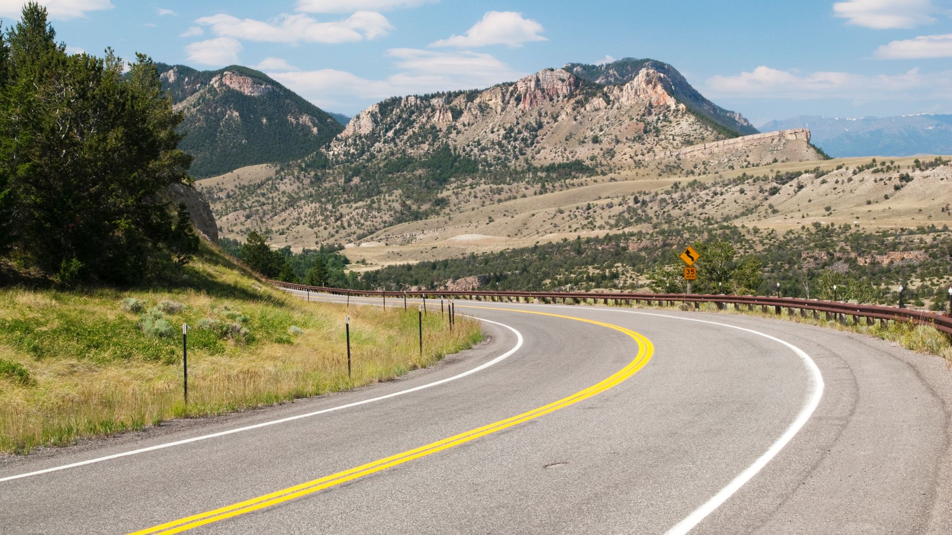
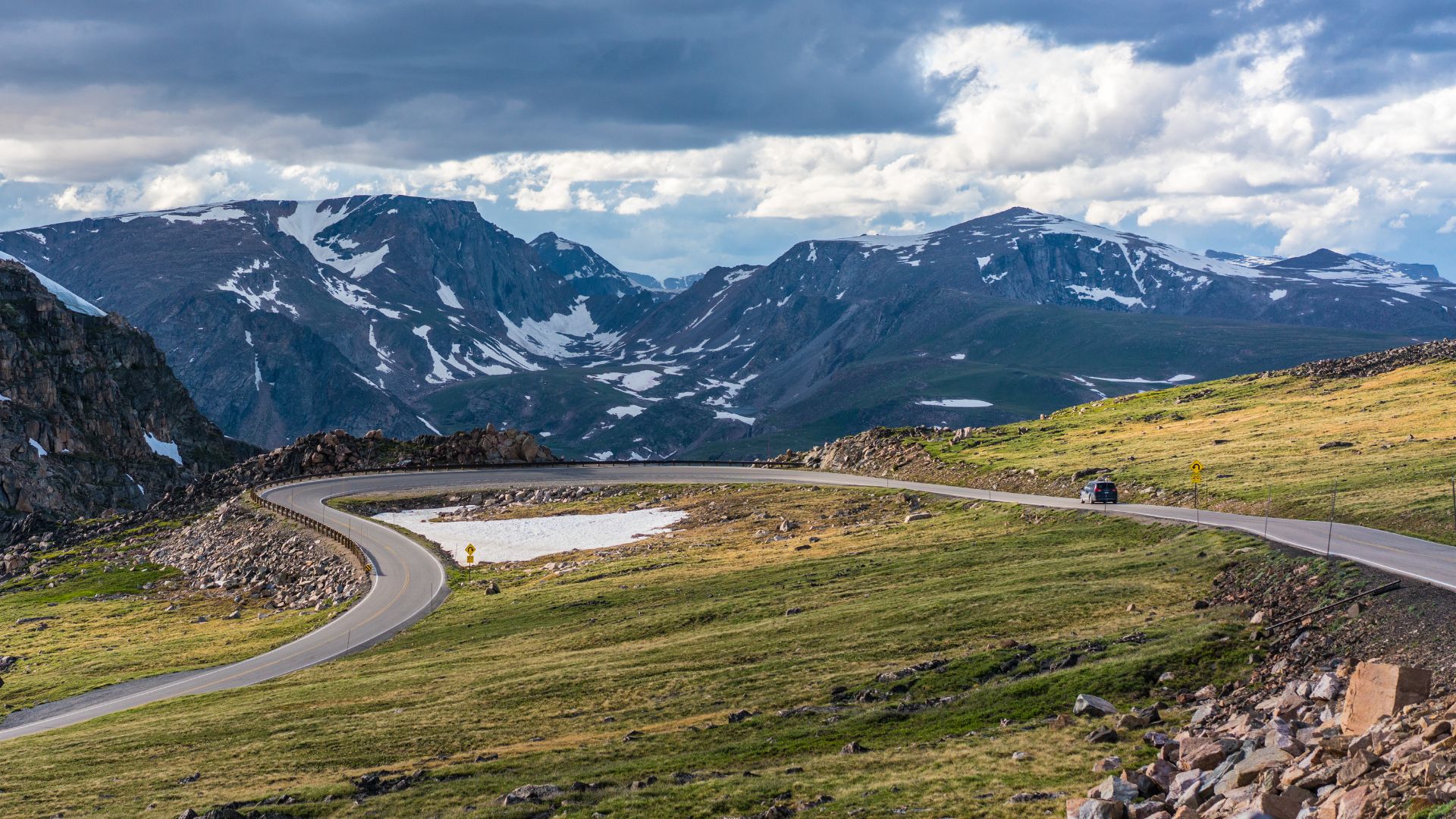
Beartooth Highway: Montana and Wyoming’s Alpine Playground
The Beartooth Highway climbs up to 10,947 feet at Beartooth Pass. For me, this 68-mile stretch is hands-down one of the best mountain drives you’ll find.
You’ll start in Red Lodge, Montana, and end up at Yellowstone’s northeast entrance. The road zigzags between Montana and Wyoming, usually open from late May to October.
At the top, you get sweeping views of the Beartooth Mountains. Alpine lakes and even glaciers dot the landscape. Sometimes there’s snow on the ground, even in July.
The switchbacks up to the pass are wild—sharp turns and steep drops, so take it slow. There are plenty of pull-offs for photos and just soaking it all in.
From up high, you can spot Yellowstone’s wild backcountry. The road drops down through meadows and forests, and if you’re lucky, you might see mountain goats or a bear.
Cooke City is the last stop before Yellowstone. It’s a tiny mining town with a few good places to refuel before heading into the park.
Discovering America’s Hidden Gems: Lesser-Known Byways
Some of the best byways fly under the radar. These next routes bring you through mountain passes, ancient forests, and tunnels blasted right through solid rock. If you want to avoid the crowds, these are the drives to seek out.
Million Dollar Highway: Colorado’s Dramatic San Juan Skyway
The Million Dollar Highway follows U.S. 550 between Silverton and Ouray, making up part of the bigger San Juan Skyway loop. It’s just 25 miles, but wow, does it pack a punch.
I’ll be honest—this is some of the most dramatic mountain scenery I’ve ever seen in Colorado. The road climbs over Red Mountain Pass at 11,018 feet.
Key Features:
- No guardrails on those cliff-hugging stretches
- Steep grades that’ll keep you alert
- Closed in winter for avalanche risk
- Ends in two old mining towns
Silverton keeps its Old West vibe at 9,318 feet. Ouray, tucked in a box canyon, has earned the nickname “Switzerland of America.”
Red Mountain Pass is the trickiest bit. The road sticks to the mountainside with thousand-foot drops, and the weather can turn on a dime.
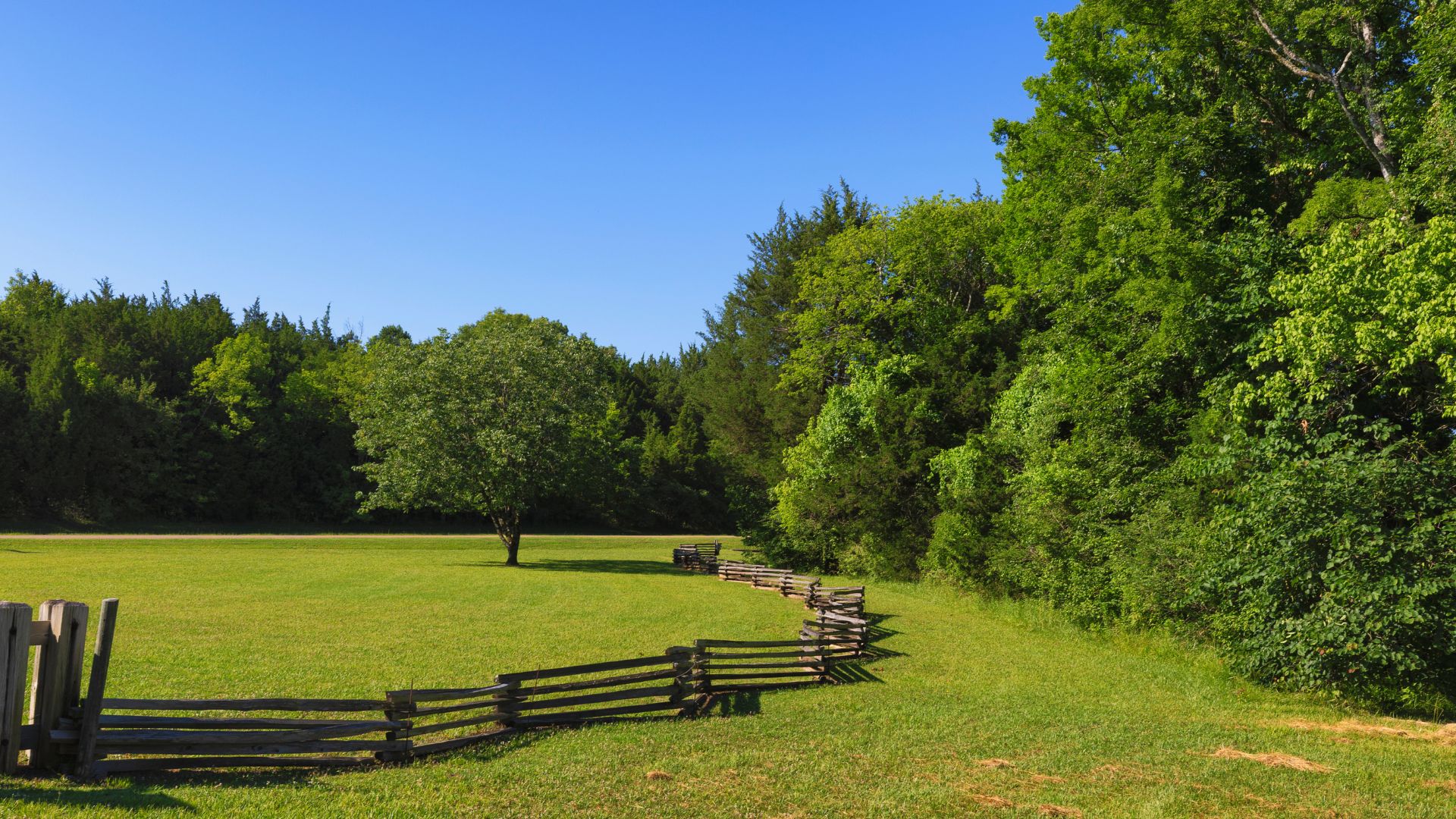
Blue Ridge Parkway: Appalachian Highlands Splendor
The Blue Ridge Parkway stretches 469 miles from Virginia to North Carolina, linking Shenandoah National Park with Great Smoky Mountains National Park.
I think it’s the most approachable mountain drive out there. The grades stay gentle, and the road is wide enough to relax and enjoy the ride.
Notable Sections:
- Skyline Drive at the Virginia end
- The Linn Cove Viaduct at Grandfather Mountain
- Spur to Mount Mitchell, the East’s highest peak
- Craggy Pinnacle for killer views
You’ll find Appalachian culture everywhere—craft centers, old mills, and music festivals. Mabry Mill is a favorite photo stop, and the Folk Art Center near Asheville is worth a visit.
Spring brings wildflowers, while fall bursts into color (mid-October is usually peak). Some higher sections close in winter when ice hits.

Kancamagus Highway: New Hampshire’s Foliage Wonderland
The Kancamagus Highway runs 34.5 miles across White Mountain National Forest in New Hampshire, connecting Lincoln and Conway. You won’t see a single billboard or fast-food joint—just pure forest.
I’ve driven this during peak foliage, and it’s honestly magical. The reds, oranges, and yellows light up the whole landscape. The road climbs over Kancamagus Pass at 2,855 feet.
Trail Access Points:
- Sabbaday Falls (easy hike)
- Rocky Gorge for a quick stop
- Lower Falls if you want to swim
- Champney Falls trailhead
The Swift River runs alongside much of the drive. You’ll cross covered bridges and spot stonework built by the CCC back in the ’30s.
You might see moose, black bears, or deer—especially early or late in the day.
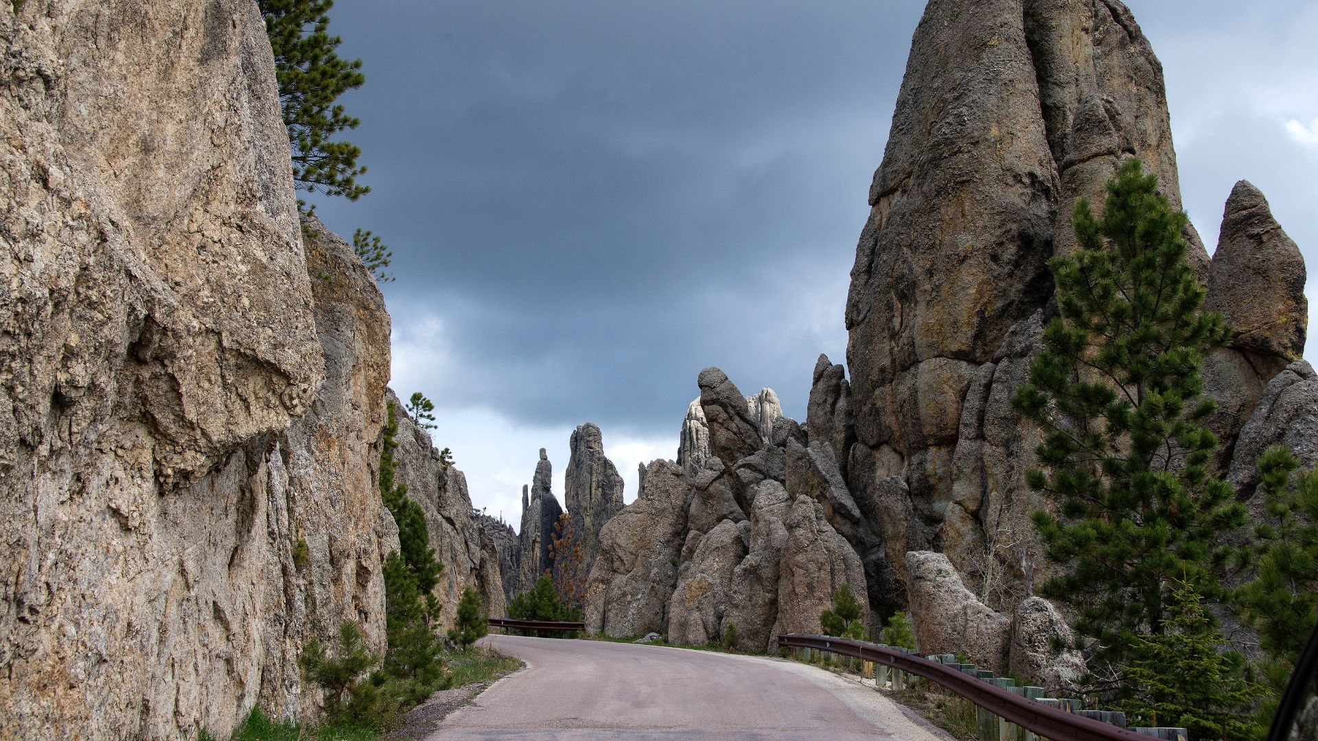
Needles Highway: Granite Spires and Tunnel Adventures
Needles Highway twists for 14 miles through Custer State Park in South Dakota’s Black Hills. This road is a true feat of engineering, with tunnels and hairpin turns carved right into granite.
I still can’t get over how they built this through solid rock spires. There are seven tunnels, and the famous Needle’s Eye Tunnel squeezes down to just 8 feet 4 inches wide.
Tunnel Specifications:
| Tunnel | Width | Height | Length |
|---|---|---|---|
| Needle’s Eye | 8’4″ | 12’0″ | 30 feet |
| Iron Creek | 13’6″ | 16’2″ | 120 feet |
You’ll wind past granite needles that shoot up 200-300 feet. Cathedral Spires is the real showstopper.
Peter Norbeck, the governor back in the day, dreamt up the route in the 1920s. Crews spent six years blasting and chiseling these tunnels—mostly by hand and dynamite. It cost $2 million, but the result is unforgettable.
Regional Diversity Along America’s Scenic Byways
America’s scenic byways? Honestly, they’re a wild showcase of three totally different landscapes that shape our country’s natural beauty. From mountain peaks that scrape the sky to rugged coastlines and ancient desert wonders, these roads prove—again and again—why the back roads always outshine the main highways when it comes to pure scenic value.
Mountain Passes and Alpine Crossings
Trail Ridge Road in Rocky Mountain National Park? It’s hands down one of the most jaw-dropping alpine drives out there. The road climbs above 12,000 feet, and in just 48 miles, you’ll experience three totally different ecosystems.
I’ve taken this drive more times than I can count, and honestly, it never gets old. You start in forests thick with aspen and pine, and then the road twists into subalpine meadows that explode with wildflowers every summer.
Eventually, you break out into true alpine tundra. Only the toughest plants survive up here, clinging to life in the wind and cold. Weather changes in a heartbeat at these heights, so I always pack a jacket—no matter what the forecast claims.
The San Juan Skyway in Colorado? It’s a 236-mile loop that links up historic mining towns with some of the state’s most dramatic peaks. Part of it is the Million Dollar Highway, which hugs the edge of cliffs and will definitely get your heart racing.
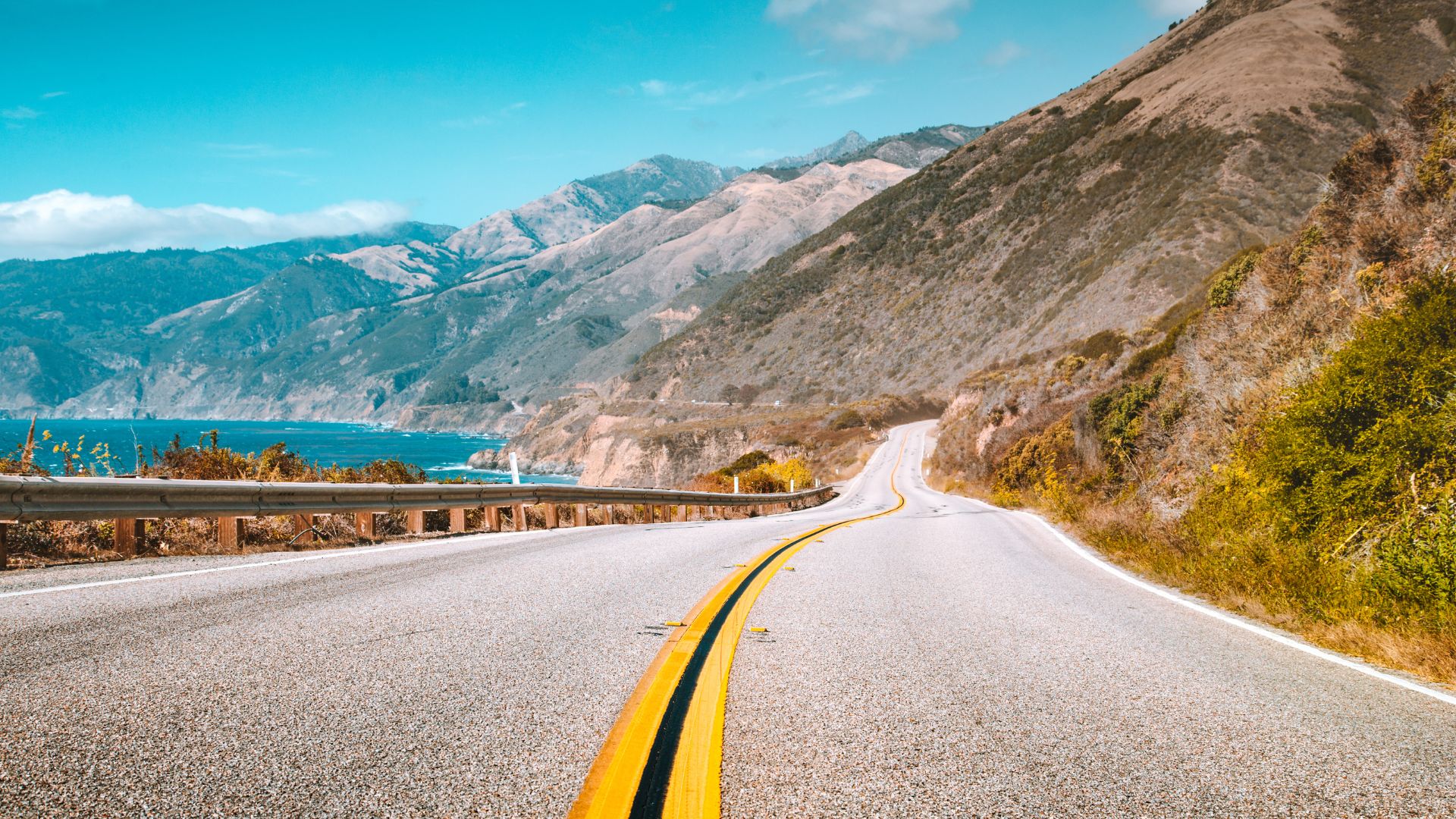
Seaside Escapes and Coastal Drives
Let’s talk about the Pacific Coast Highway. It’s honestly impossible to beat those ocean views along California’s wild coastline. Big Sur is the absolute highlight, where the mountains seem to dive straight into the Pacific.
Fog loves to roll in here, giving the whole place a moody, mysterious vibe. When the sun finally breaks through, waves slam into rocks far below and the colors just pop.
Maine’s Acadia National Park brings something totally different to the table. The Park Loop Road winds past rocky shores and iconic lighthouses, each one with its own story.
I can’t get enough of the contrast between Maine’s cozy coves and California’s sheer cliffs. Then there’s Lake Michigan, where the shoreline drives feel more like the ocean than a lake—massive, blue, and full of surprises.
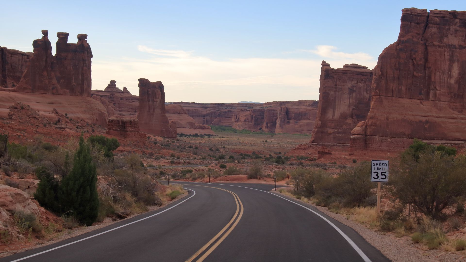
Desert Marvels and Rock Formations
If you want your mind blown, Sedona’s Red Rock Scenic Byway is the place. The road snakes between giant red sandstone towers that light up at sunrise and sunset.
Nature spent millions of years shaping these rocks. Wind and water chipped away at the sandstone, leaving behind formations that look almost otherworldly against the Arizona sky.
Utah’s scenic byways pile on even more surprises. Those weird, skinny rock spires called hoodoos? They’re everywhere in the national parks and monuments, turning the landscape into a natural sculpture garden.
I’ve learned the desert can be just as stunning as any forest or mountain. Light changes everything out here—each season brings new shadows and colors to these ancient rocks.
Historic, Cultural, and Natural Wonders on the Byways
America’s scenic byways do more than show off pretty views. They connect you to national parks, old landmarks, and towns where local traditions and regional food still matter. These drives tell the stories of Indigenous peoples and the wild places that have lured explorers for centuries.
National Parks and Monuments Along the Route
I’ve noticed a lot of byways double as gateways to America’s best natural spots. Take the High Road to Taos in New Mexico—it winds through high desert and leads to ancient Pueblo heritage sites.
Great Basin National Park in Nevada sits way off the beaten path, but it’s absolutely worth the detour. The scenic drive leads to ancient bristlecone pines and the mysterious Lehman Caves. Most days, I barely see another soul on the trails.
Minnesota’s North Shore Scenic Drive hugs Lake Superior all the way to state parks that feel like secret treasures. The forests up here change with the seasons, and each visit feels brand new.
Louisiana’s Creole Nature Trail is a favorite for wildlife watching. I’ve spotted alligators basking on muddy banks, and the marshes fill up with migrating birds every year.
Historic Landmarks and Indigenous Heritage
The Natchez Trace Parkway? It’s one of those drives where history feels alive. This 444-mile route follows ancient Native American paths, and you can still spot traces of the old trail cut into the hills.
Lewis and Clark’s journey west comes to life on modern byways. Some of their old expedition routes now match up with roads we can drive, letting us follow in their footsteps—at least for a while. The Missouri River corridor keeps their story alive with campsites and markers.
Maryland’s byways wind through Civil War battlefields and old colonial towns. The Historic National Road slices across the state, marking the path of America’s first big highway project.
Ohio’s scenic routes connect to Underground Railroad sites and the roots of early industry. These byways are full of stories—westward expansion, Great Lakes shipping, and the dreams that built the Midwest.
Charming Towns and Local Delicacies
Small towns tucked along scenic byways still hold onto real American flavors and traditions. I love how these communities keep recipes and craft techniques alive, passing them from one generation to the next.
New Mexico’s High Road to Taos winds through mountain villages where Hispanic and Pueblo cultures come together in everyday life. I always make time to stop at local restaurants for green chile dishes or warm, pillowy sopaipillas. Along the way, you’ll spot artists’ studios—handmade pottery and vibrant textiles fill the shelves, and it’s hard not to pick up a souvenir or two.
Louisiana’s byway towns? They’re a playground for anyone who loves Creole and Cajun cooking. You can find gumbo that tastes like it’s been simmering for hours, hearty jambalaya, and seafood so fresh you’d swear it just left the bayou. Family-owned restaurants keep these recipes almost sacred.
Minnesota’s North Shore communities really lean into their Scandinavian roots. Bakeries tempt you with lefse and krumkake, and if you wander toward the lake, you’ll catch the scent of fresh-caught Lake Superior fish smoking the old-fashioned way. Honestly, it’s a treat you shouldn’t miss.
Maryland’s historic towns call out to seafood lovers. Crab houses and oyster bars line the Chesapeake Bay, and the locals still use seafood prep techniques that go back centuries. It’s a taste of history with every bite.