Crete draws travelers in with its ancient stories, sunny beaches, and wild mountains. On my last trip, I craved something different—so I set out on the 16-kilometer hike through Samaria Gorge, which people call the island’s wildest and most famous natural wonder.
Hiking Samaria Gorge challenged me, but wow, the payoff was unreal. Towering cliffs, pine forests, and rocky riverbeds—every part of the trail had something to gawk at.
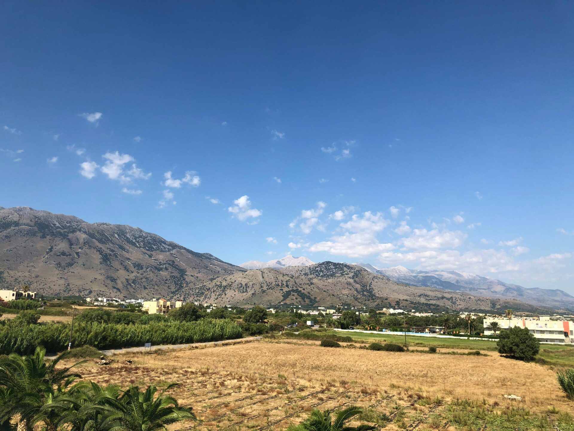
As I started my descent from the White Mountains, the landscape kept shifting. Each step tested my patience and my legs. Still, every time I rounded a bend, I caught another jaw-dropping view. For me, this hike became the highlight of my Crete adventure.
Tourism in Crete thrives thanks to places like Samaria Gorge. I totally get why. If you’re considering this iconic trail, let me share what it’s really like—so you can plan, get excited, and squeeze the most out of every moment.
Essential Planning for Your Samaria Gorge Hike
You’ll need more than just enthusiasm and sturdy shoes for the Samaria Gorge hike. I quickly learned that picking the right time, knowing the rules, and sorting out transportation ahead of time made everything easier and a lot more enjoyable.
Best Time to Visit and Weather Considerations
The Samaria Gorge opens from May to October, give or take, depending on weather and trail conditions. I realized that early summer and early fall are the sweet spots—fewer crowds and less heat.
July and August? The midday sun gets brutal. If you start too late, you’ll feel it. I set out early in the morning, when the air was cool and the light in the gorge looked magical.
Maps and notices about closures get posted at the entrance and online on official Crete travel sites. That saved me from surprises. Always check the weather forecast and ask at a local tourist office before you go, especially if it’s rained recently. Rain can make parts of the trail sketchy or even shut down the whole thing.
Permits, Fees, and Trail Regulations
Samaria Gorge isn’t free, but it’s pretty affordable. When I went, I paid about €5 at the ranger station in Xyloskalo. The staff handed me a ticket, and I had to hang onto it until I exited at Agia Roumeli. They check tickets at the end to make sure everyone gets out safely.
You don’t need a special permit, but there are rules: no camping, no fires, and don’t take stones or plants. Staying on the marked path keeps you safe and helps protect the rare plants and animals here.
Signs with the rules and trail maps are posted at both ends. If I had questions, the tourist offices in Chania and Omalos were super helpful with current info.
How to Get There: Transport and Route Options
Getting to Samaria Gorge took some planning. I caught the early bus from Chania to Omalos, where the trail starts. It cost just a few euros, which was perfect for my budget.
You can take a taxi, but the buses from Chania’s main station are reliable and packed with other hikers. At the end of the hike, you finish in Agia Roumeli—a village you can only reach by foot or boat.
From there, small ferries head to towns like Sougia and Hora Sfakion. I grabbed a bus back to Chania from one of those. Ferry and bus schedules change, especially in spring and fall, so I checked with the tourist office the day before.
For route planning, I used simple maps from Chania’s tourist office and some online resources. If you join a tour group, transport is usually included, but I liked figuring it out myself and meeting other travelers along the way.
Geography and Natural Wonders of Samaria Gorge
Samaria Gorge stretches 16 km through Crete’s wild heart. Around every twist, the scenery changes—soaring cliffs, pine forests, and the sound of rushing water.
Geological Formation and Landscape Features
Hiking Samaria Gorge felt like walking through a natural sculpture park. Water and tectonic forces shaped the gorge over thousands of years.
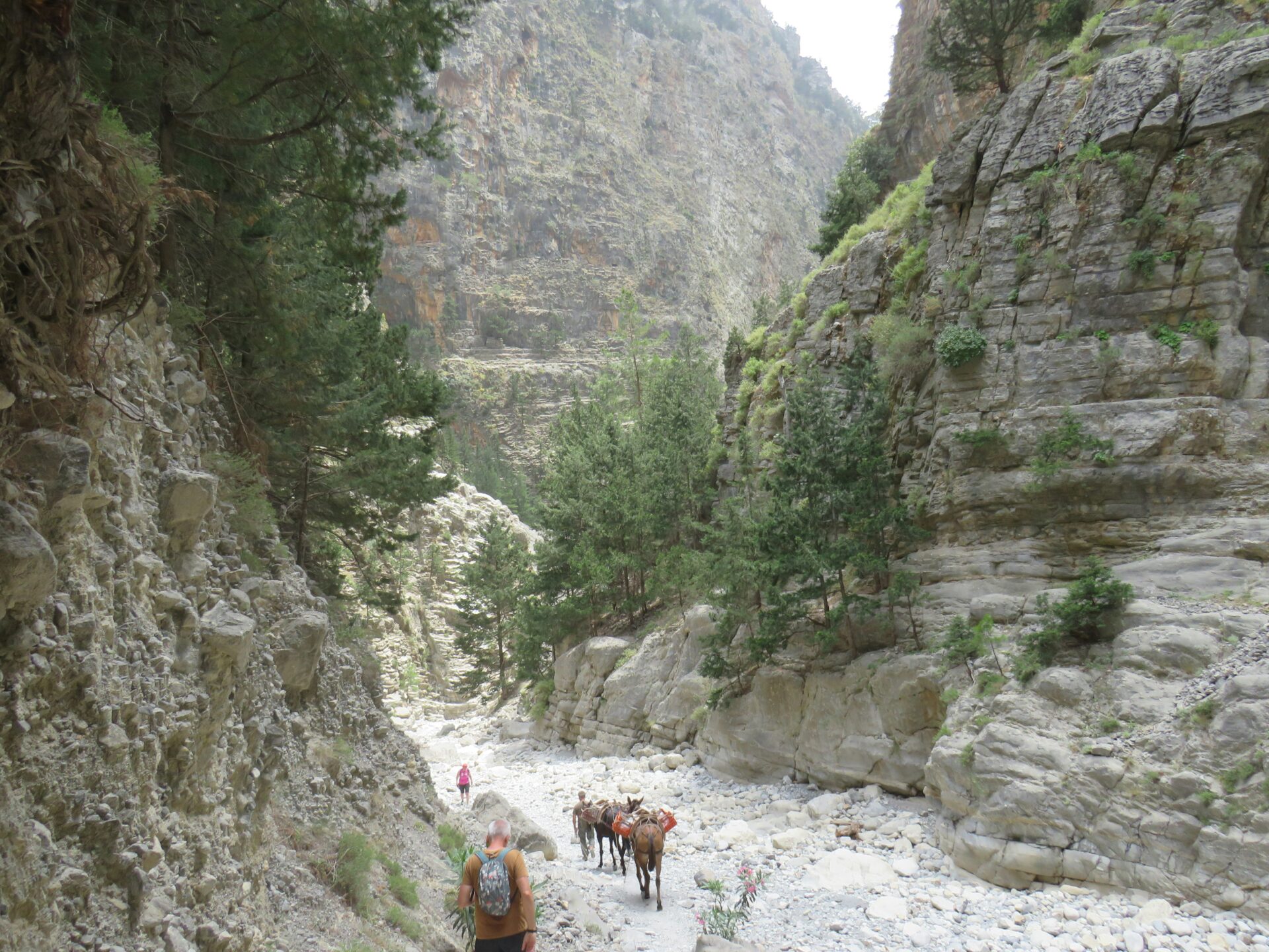
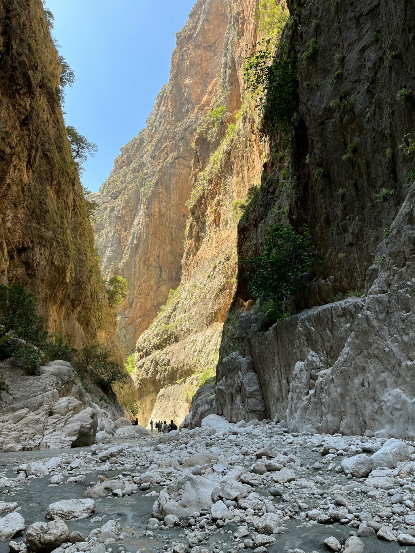
The trail starts at about 1,250 meters up in the White Mountains (Lefka Ori) and drops steeply down to the Libyan Sea. Massive cliffs, some as high as 500 meters, squeeze in at the “Iron Gates,” where the gorge narrows to just three meters wide.
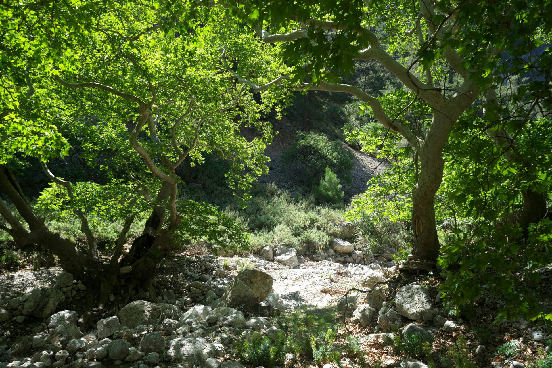
The riverbed is rocky, the limestone walls are streaked with color, and boulders are everywhere. The ground underfoot switches from gravel to smooth rock, keeping you on your toes. As I hiked, I watched the landscape shift from alpine woods to river valley. Each layer told a bit of Crete’s story.
Iconic Flora and Fauna of Crete
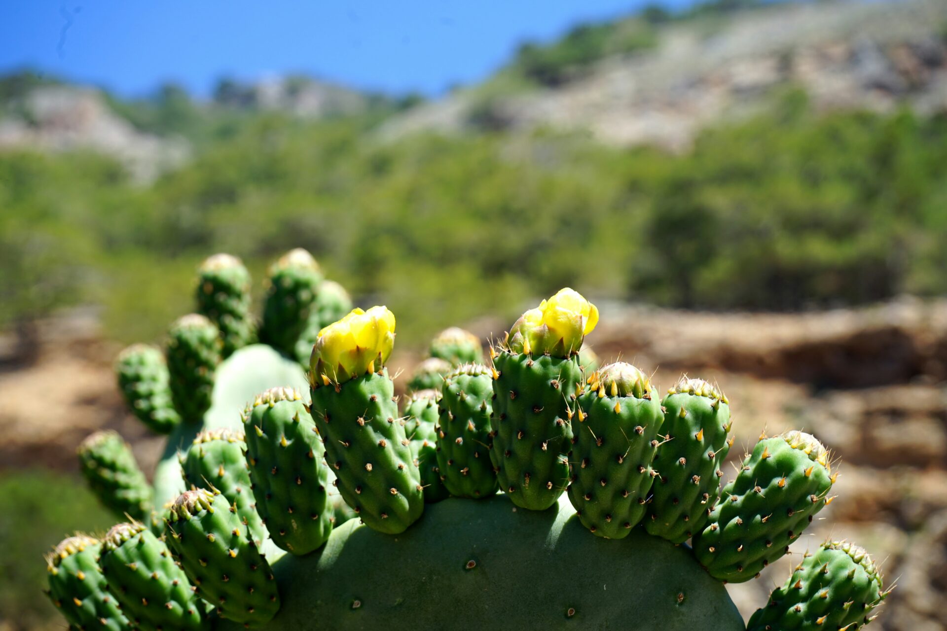
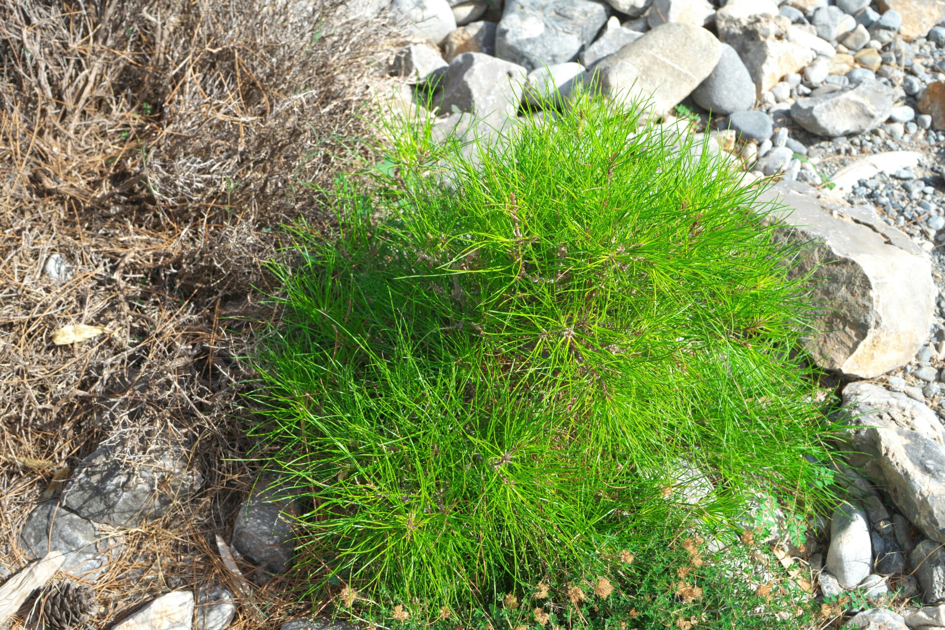
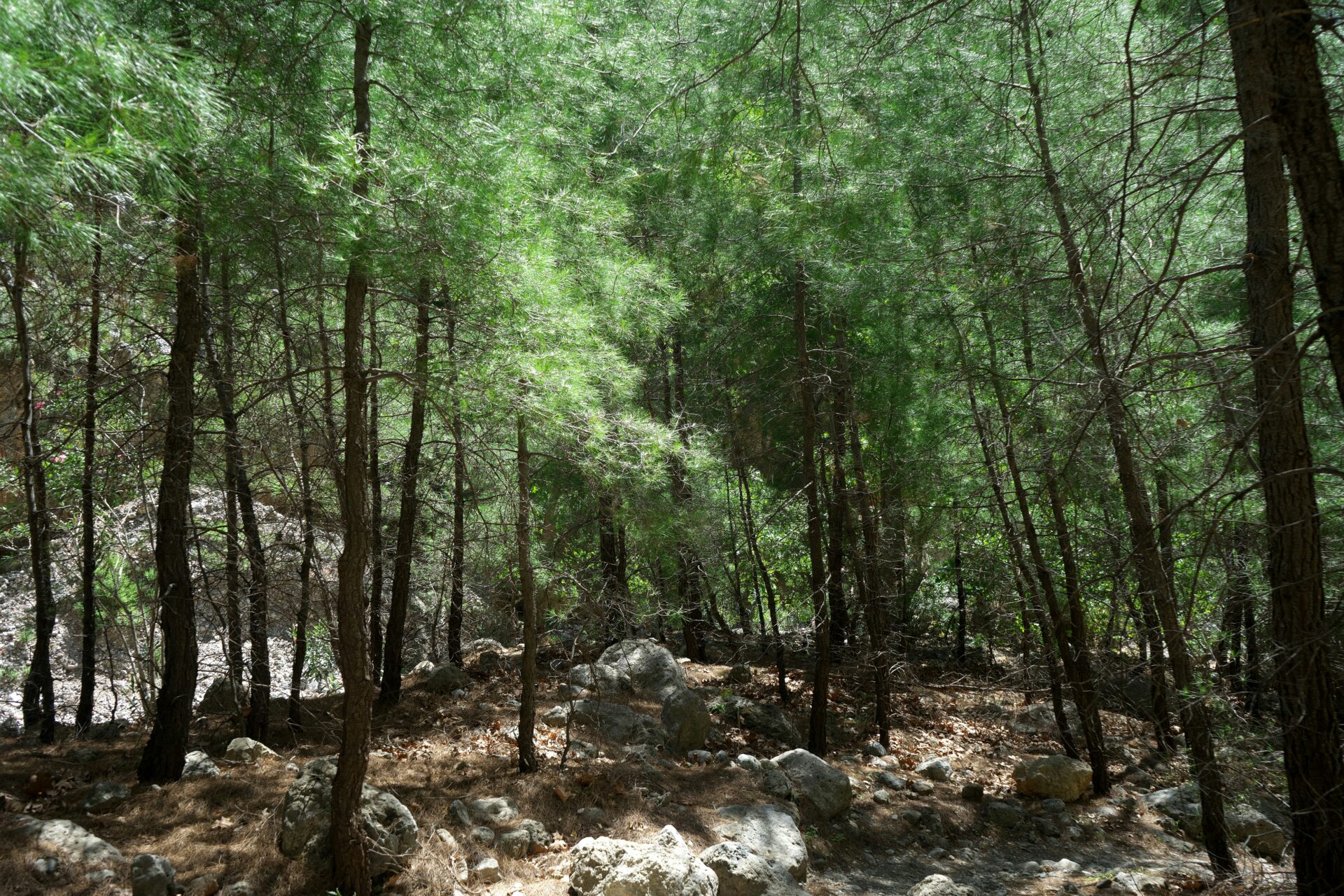
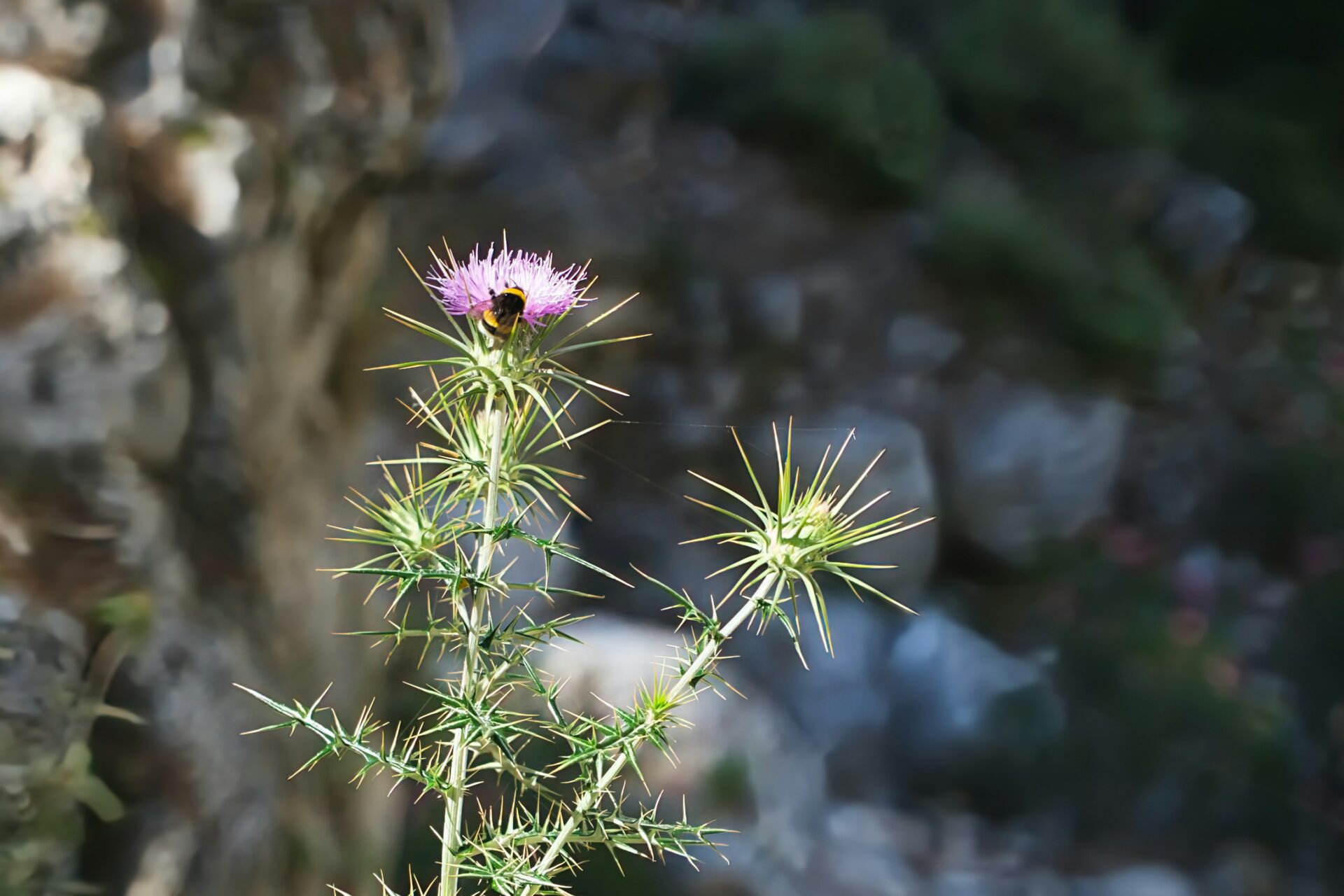
The scent of Cretan pines and wild herbs like thyme and sage hit me right away. The gorge’s slopes are lined with tough trees—Pinus brutia, cypress, plane trees, and old oaks. Wildflowers popped up along the banks, even late into spring.
Animal life here is wild. The Kri-Kri, Crete’s famous wild goat, sometimes appeared on the cliffs, looking down at me like I was the odd one out. I spotted griffon vultures and peregrine falcons soaring overhead. Tiny lizards darted across the rocks. Some species, like the Cretan badger and rare butterflies, only live here.
Ecological and Environmental Importance
Samaria Gorge is a UNESCO Biosphere Reserve and a national park. That’s how important it is. The gorge protects species you won’t find anywhere else.
I noticed signs along the trail reminding visitors to respect the delicate balance here. The seasonal river running through the gorge supports all sorts of habitats. Small wetlands and springs keep things alive even during the hottest months.
Conservation efforts protect old-growth forests from wildfires and overuse. Samaria is a living classroom for sustainable tourism and biodiversity.
Local guides and rangers look after the area’s health. Their presence reassured me that this place will stay wild for a long time.
My 16km Trek: Step-By-Step Adventure
From the steep switchbacks at the start to the dramatic finish by the Libyan Sea, every stretch of the Samaria Gorge hike brought its own mix of challenge, scenery, and history.
I stumbled across ancient ruins, rare wildlife, and flashes of Cretan art, all set against a backdrop that Lonely Planet calls one of Europe’s best walks.
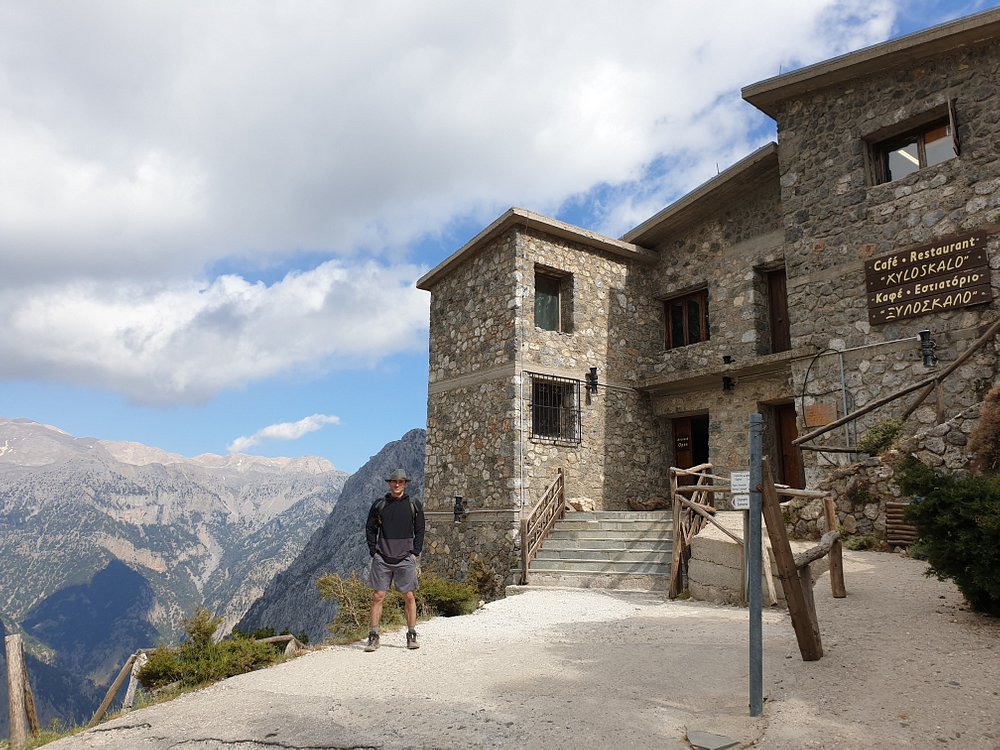
The Start: Xyloskalo and Early Impressions
The hike kicked off at Xyloskalo, perched 1,250 meters up on the edge of the White Mountains. Looking down into the gorge, I felt excited and a bit nervous—zig-zagging stone steps vanished into the forest below.
The trail wound through pine and cypress woods, with sunlight cutting through the shade. Birds chirped and goat bells clanged in the distance, setting a calm, steady pace.
I passed rustic rest stops built from local stone. Signs explained the rules and the cultural heritage of the gorge. Even here, bits of Cretan art showed up, painted on info boards or carved into wooden markers.
Mid-Route Marvels and Cultural Heritage
The gorge deepened, and the riverbed shifted from rocky to sandy. Cliffs rose on both sides, making me feel tiny and completely wrapped in nature. No wonder Lonely Planet calls this a must-do.
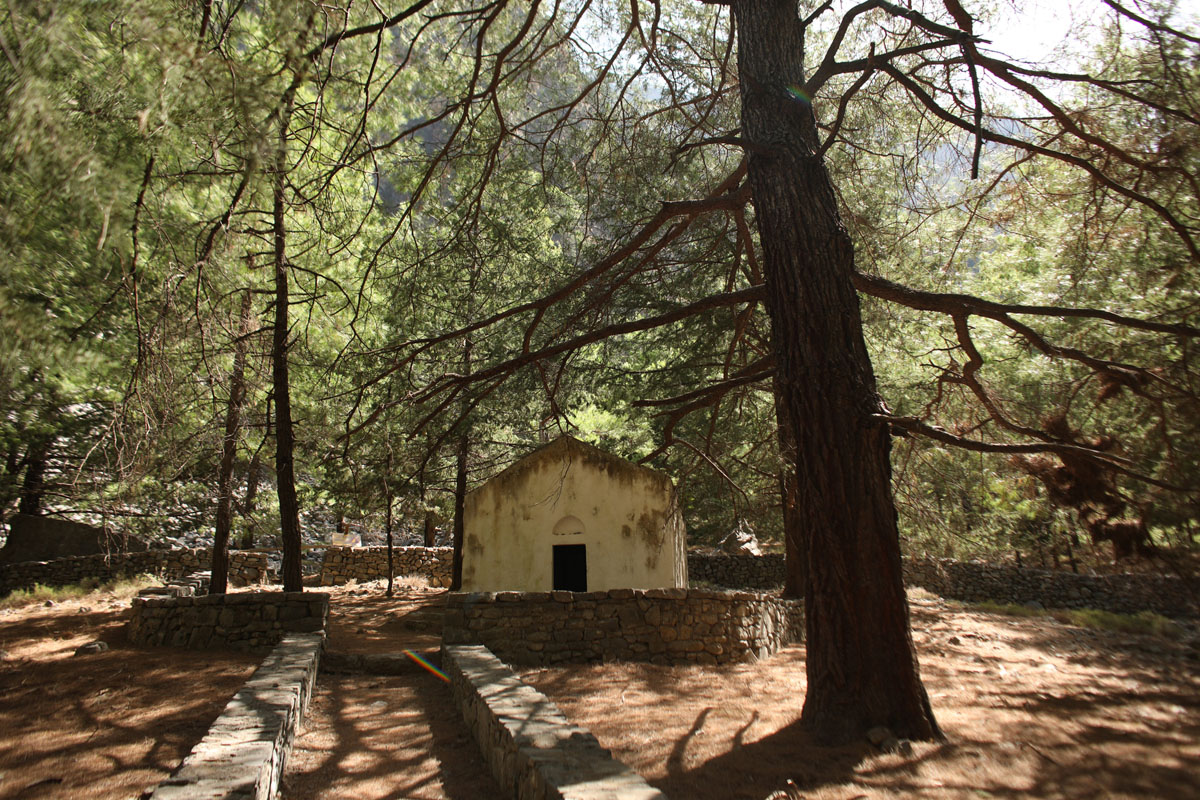
I saw a kri-kri, the wild goat, scramble up an impossible cliff. Small chapels and the ghost village of Samaria reminded me that people once lived here. The ruins showed off old Cretan stonework—a glimpse into the island’s past.
Rest stops along the way offered fresh mountain water and shaded benches. Info panels at these stops highlighted rare plants and animals. One list caught my eye:
- Kri-kri (Cretan goat)
- Cretan dittany
- Griffon vultures
- Wildflowers
The Iron Gates and Reaching Agia Roumeli
The final stretch brought me to the “Iron Gates,” where the gorge narrows to three meters and the cliffs shoot up over 300 meters. Walking through here felt unreal—the walls closed in, echoing the river’s rush.
After that, the path leveled out and the gorge opened toward the sea. I could feel the salty breeze and spot a ribbon of blue on the horizon.
After several hours, I reached Agia Roumeli—a quiet seaside village with sandy beaches. Exhausted but happy, I cooled off in the sea, finishing the adventure surrounded by Crete’s best scenery.
History and Mythology Along the Gorge
Samaria Gorge isn’t just a scenic hike; it’s a place where history and legend feel close. From ancient Cretan myths to the ruins of hidden villages, every step adds a layer to the story.
Ancient Stories and Local Legends
Crete is a land of legends, and Samaria Gorge has plenty. Locals say nymphs and ancient gods once roamed these cliffs and rivers. Some believe the “Iron Gates” guard the land with spirits.
Stories from Minoan times echo through the valley. I imagined King Minos and how ancient people saw the gorge as a sacred dividing line between north and south Crete. Every echo bouncing off the stone walls made the myths seem real.
Locals sometimes share tales of secret tunnels and lost treasures. Hearing a guide tell these stories at a rest stop made the old world come alive.

Relics, Ruins, and Historical Sites
All along the gorge, I found traces of those who came before. Scattered stones mark the ruins of temples and forgotten farmhouses, some dating back hundreds or even thousands of years.
One old Byzantine chapel sits tucked beside the trail, its faded frescoes hinting at a time when Christianity first arrived. I stopped to look at carved stone altars and weathered icons—reminders of Crete’s deep roots.
The gorge also sheltered resistance fighters in World War II. Knowing that made the landscape feel even more dramatic.
A quick table of key sites:
| Site | Era | Notable Feature |
|---|---|---|
| Byzantine Chapel | Middle Ages | Faded wall frescoes |
| Stone Altars | Early Christian | Carved religious icons |
| Rebel Hideouts | 20th Century | WWII safe havens |
Every stone has a story—if you look for it.
Samaria Village and its Place in Cretan Culture
When I reached the remains of Samaria village about halfway through, I felt a real connection to Cretan resilience. Families once lived here, herding goats and farming. Now, the buildings sit empty, echoing with the past. The village was abandoned in the 1960s when the area became a national park.
Samaria village wasn’t just a home—it was a refuge during tough times, including wars for independence and as shelter for early Christian communities. I could almost picture villagers swapping stories under olive trees after a long day.
Today, locals honor the villagers’ memory on Saint Mary’s feast day every August. This celebration keeps tradition alive. For a moment, I felt woven into a story that stretches back centuries.
Practical Tips, Health, and Safety
Staying safe and prepared on the Samaria Gorge trail takes more than just tying your laces and heading out. A little planning goes a long way when it comes to fitness, what to bring, health, and staying on track in the wild landscape of Crete.
Fitness Preparation and Packing Advice
The 16km (10-mile) Samaria Gorge hike isn’t exactly a stroll. You’ll face rocky terrain, steep drops, and rough paths that really test your fitness level.
Before I tried it, I spent a few weeks walking every day and doing some simple leg workouts at home. That honestly saved my knees and energy for the whole route.
The first few kilometers go straight downhill—my legs definitely noticed. Good shoes matter a lot here. I always wear hiking boots or trail shoes with solid grip.
If you pick sandals or flimsy sneakers, you’re asking for blisters or maybe a twisted ankle. In my pack, I toss in a reusable water bottle and some snacks like nuts or energy bars.
A sun hat is non-negotiable. I also like solar-protective clothing and a small towel, since the sun can be brutal and the river crossings are perfect for a quick cool-down.
Packing light just makes life easier, but I never leave out sunglasses or sunscreen. Carrying too much stuff slows you down, but skipping the basics can ruin your day.

Health and First Aid Essentials
Samaria Gorge feels pretty safe, but it pays to prep for small injuries or health hiccups. I always carry a basic first aid kit—band-aids, blister pads, disinfectant wipes, and painkillers.
Getting a blister two hours in with nothing to fix it? That’s the worst. I make hydration my top priority.
I fill my water bottle at streams and rest points, but I also bring purification tablets, just in case. The sun drains you fast, so I wear a sun hat and reapply sunscreen whenever I stop.
Allergies can sneak up, especially in spring. I keep antihistamines handy and, honestly, I’ve needed them more than once.
If you have something like asthma or diabetes, pack extra medication. Cell service drops out in spots, so tell someone your plans and keep emergency contacts on paper.
You might spot a ranger or two and there’s some basic first aid on the trail, but it feels better to rely on yourself.

Navigation, Maps, and Trail Technology
The Samaria Gorge trail has plenty of signs, but honestly, I just didn’t want to risk getting lost. Printed maps are easy to grab at the start—I picked one up—but honestly, I leaned on tech for peace of mind.
Before I left, I downloaded an offline hiking app like Maps.me or AllTrails. That way, I could check my progress even if my phone had no signal.
Crete’s terrain? It’s pretty wild—lots of twisty paths and rocky detours. I used GPS waypoints to make sure I stayed on track, especially in those wide sections where the route gets a bit fuzzy.
The trail skips fancy stuff like lidar navigation or digital markers, but you can find GPS traces from other hikers online and import them into your app. That’s a neat trick if you’re into that sort of thing.
If you’re a gadget fan, a basic GPS watch or device tells you your distance and elevation as you go. I always charge my devices fully and toss a small backup battery in my pack, just in case.
Honestly, tech on this hike is more of a backup than a must-have. Still, those extra navigation tools made me feel more relaxed—and let me focus on the adventure instead of worrying about wrong turns.