California’s High Sierra mountains? They’re wild—truly some of the most jaw-dropping and unique adventure spots in the U.S. After years of getting lost (intentionally and otherwise) among these towering peaks, glassy lakes, and ancient forests, I can honestly say this region delivers experiences you just won’t find anywhere else.
The High Sierra stretches from the legendary granite cliffs of Yosemite all the way to the desert edges near Death Valley. That means you get everything—from scrambling up the tallest peaks in the lower 48 to soaking in natural hot springs under a sky so full of stars it hardly feels real.
Every destination here has its own vibe. Some are all about adrenaline, others about peace and quiet among the giant sequoias. There’s just so much variety.
So, here’s my ultimate bucket list—ten adventures that, in my opinion, show off why the High Sierra is in a league of its own. Think: Yosemite’s iconic domes, secret alpine lakes you have to work for, and moments you’ll be talking about for decades.
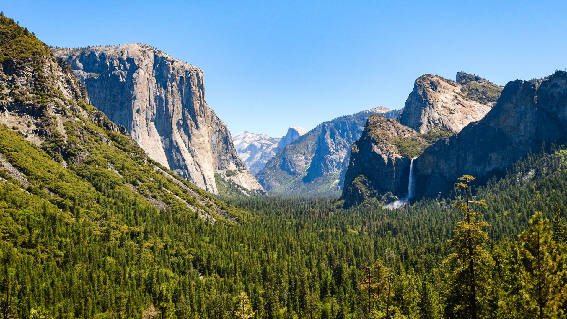
Yosemite National Park: Iconic High Sierra Experiences
Yosemite National Park? It’s the crown jewel—three adventures here basically define the Sierra Nevada: climbing those legendary granite monoliths, chasing waterfalls like Yosemite Falls and Vernal Falls, and soaking up those classic views from Glacier Point or Tunnel View.
Hiking Half Dome and El Capitan
Half Dome is the ultimate test. If you want bragging rights, this is it. The hike’s no joke—16 miles round trip, and you need to win a permit lottery just to try.
I always start before sunrise. Thunderstorms can roll in fast in the afternoons, and you don’t want to be on those famous cables when that happens. The last stretch? You’re hauling yourself up steep granite using metal cables. Gloves are a must. Water, too—lots of it.
Key Requirements:
- Permits: April through October
- Distance: 16 miles round trip
- Elevation gain: 4,800 feet
- Time: 12-16 hours
El Capitan calls to climbers from all over the world. Most folks just gawk from the meadow, but if you’re a climber, this is the big leagues.
Lake Tahoe Adventures: Pristine Waters and Alpine Escapes
Lake Tahoe is basically an alpine playground. Those crystal-clear waters and the Sierra peaks? Unreal.
You can paddle, swim, hike, or ski—there’s always something happening. I’ve lost track of how many times I’ve gone back, and it never gets old.
Kayaking and Paddleboarding on Lake Tahoe
If you love paddling, Tahoe’s the spot. Early mornings are magic—calm water, mirror-like reflections of the mountains.
Sand Harbor on the northeast side is a great place to start, especially if you’re new to kayaking or paddleboarding. The water stays shallow among the giant boulders, so it feels pretty safe.
More experienced? Head along the western shore from Meeks Bay to Rubicon Point. You’ll find hidden beaches and dramatic cliffs you can only reach by water.
Key paddling spots:
- Sand Harbor (easy, relaxing)
- Emerald Bay (gorgeous, but a workout)
- Meeks Bay (perfect for families)
- Cave Rock (for seasoned paddlers)
Summer water temps hit 65-70°F. I usually skip the wetsuit, but mountain weather can flip on you, so I keep one handy just in case.
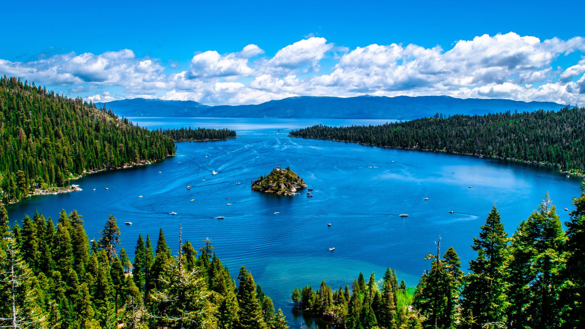
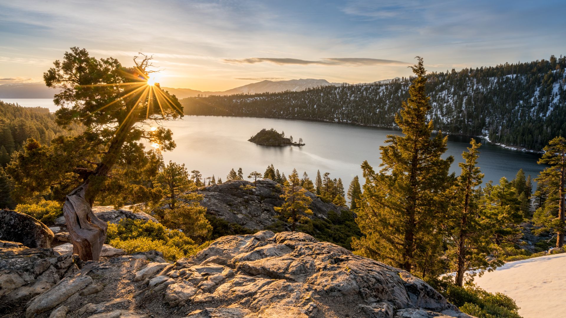
Exploring Emerald Bay and Fannette Island
Emerald Bay is the showstopper. It’s California’s only underwater state park, and the colors—turquoise water against granite cliffs—are unreal.
Fannette Island sits right in the middle. I’ve paddled out there a few times to check out the old stone tea house at the top. It’s tiny but has a cool, almost mystical vibe.
Vikingsholm Castle on the shore is a stunner—Scandinavian architecture in the Sierras, who knew? Pair it with the Eagle Falls trail, and you’ve got a full day of exploring.
Best viewing spots:
- Highway 89 overlook
- Eagle Falls trail viewpoint
- Vikingsholm beach
- Fannette Island itself
Summer gets crowded. Early mornings or late afternoons are my go-to—better light, fewer people, and way better photos.
Epic Skiing and Snowboarding Experiences
Tahoe’s ski scene is legendary. The snow sticks around thanks to the lake effect, and you get a mix of powder and bluebird days that’s hard to beat.
Heavenly Mountain Resort straddles the state line, so you can ski California and Nevada in one run. The views from the top? Insane.
Northstar California is more chill—great for families, plus those groomed runs and terrain parks are a blast.
Alpine Meadows and Squaw Valley (now Palisades Tahoe) are for the hardcore. The snowfall gets ridiculous, and they often stay open into May.
Season highlights:
- December-February: Powder days
- March-April: Spring skiing, sunshine
- May: Corn snow, fewer crowds
The lake keeps temps milder than you’d expect at this elevation, so skiing here is comfy, even on the coldest days.
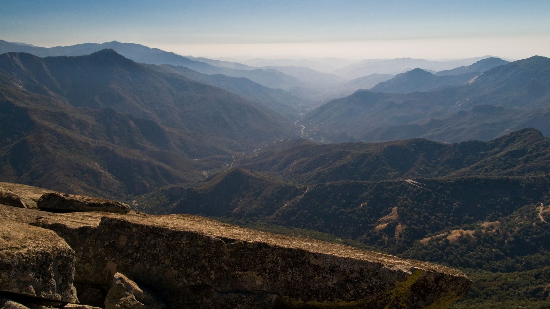
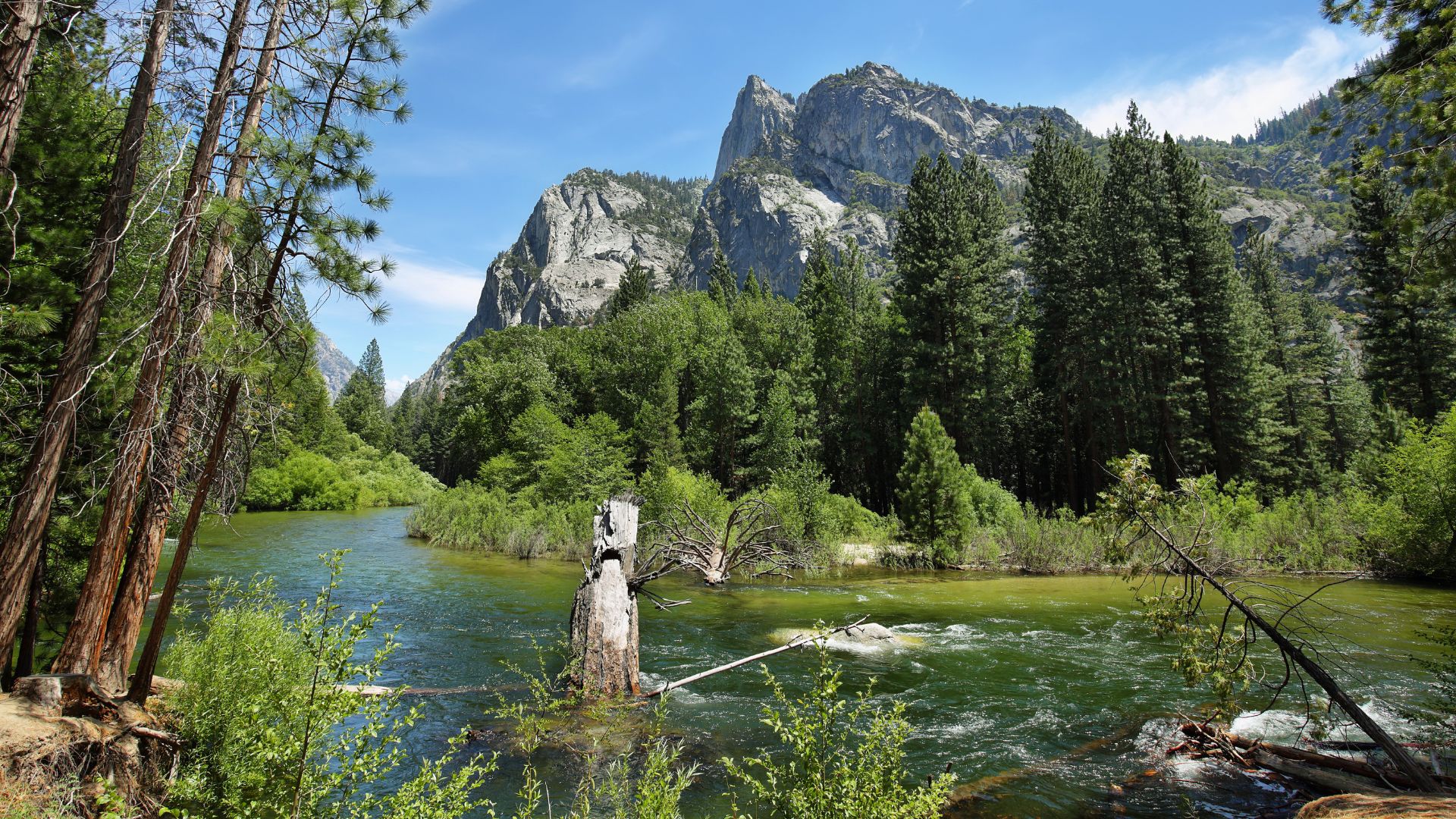
Sequoia and Kings Canyon: Land of Giant Trees and Hidden Valleys
Sequoia and Kings Canyon—these parks are like stepping into another world. Massive trees, deep canyons, and wild, untamed beauty everywhere you look.
I’ve wandered these trails for years, and every visit feels brand new.
Standing Before the General Sherman Tree
The General Sherman Tree? It’s the biggest tree on Earth by volume. Standing next to it, you realize just how tiny you are.
The walk from the parking lot to the tree takes about 10 minutes, winding downhill through Giant Forest. Other sequoias tower overhead, making you feel like you’ve shrunk.
Why it’s special:
- The trunk holds about 52,500 cubic feet of wood
- Estimated age: 2,300–2,700 years
- Even the lowest branch dwarfs most trees
Early mornings or late afternoons are best. The crowds disappear, and the light makes the tree look even more massive.
Exploring Majestic Forests and Granite Formations
Three main forest areas here each have their own personality. Giant Forest is all about the sequoias, Grant Grove has the General Grant Tree and old cabins, and Cedar Grove is pure drama—granite walls, roaring rivers.
Driving down Kings Canyon Scenic Byway, you get hit with one epic view after another.
Key places to check out:
- Moro Rock: Granite dome with a killer 360° view (after 400 steps, but hey, worth it)
- Tokopah Falls: Short hike, big waterfall—1,200 feet of rushing water
- Zumwalt Meadows: Easy loop with river and meadow views
Glaciers and weather shaped these rocks over millions of years. The result? Domes, cliffs, and valleys that feel almost prehistoric.
Backcountry Hiking and Wildlife Encounters
Over 800 miles of trails run through these parks. If you want solitude, head into the backcountry—most folks don’t go far from the main roads.
Day hikes like Tokopah Falls and Zumwalt Meadows are solid choices. Longer backpacking trips can take you to remote lakes or even up toward Mount Whitney.
Wildlife you might spot:
- Black bears (they’re around, so be smart)
- Mule deer grazing in the meadows
- Mountain lions (rare, but they’re out there)
- 200+ bird species—keep an eye out for Steller’s jays
I always carry bear spray and use bear canisters for food. Rangers at the visitor center have the latest safety tips.
The Rae Lakes Loop and High Sierra Camps make for epic multi-day trips. Permits go fast in summer, so plan ahead.
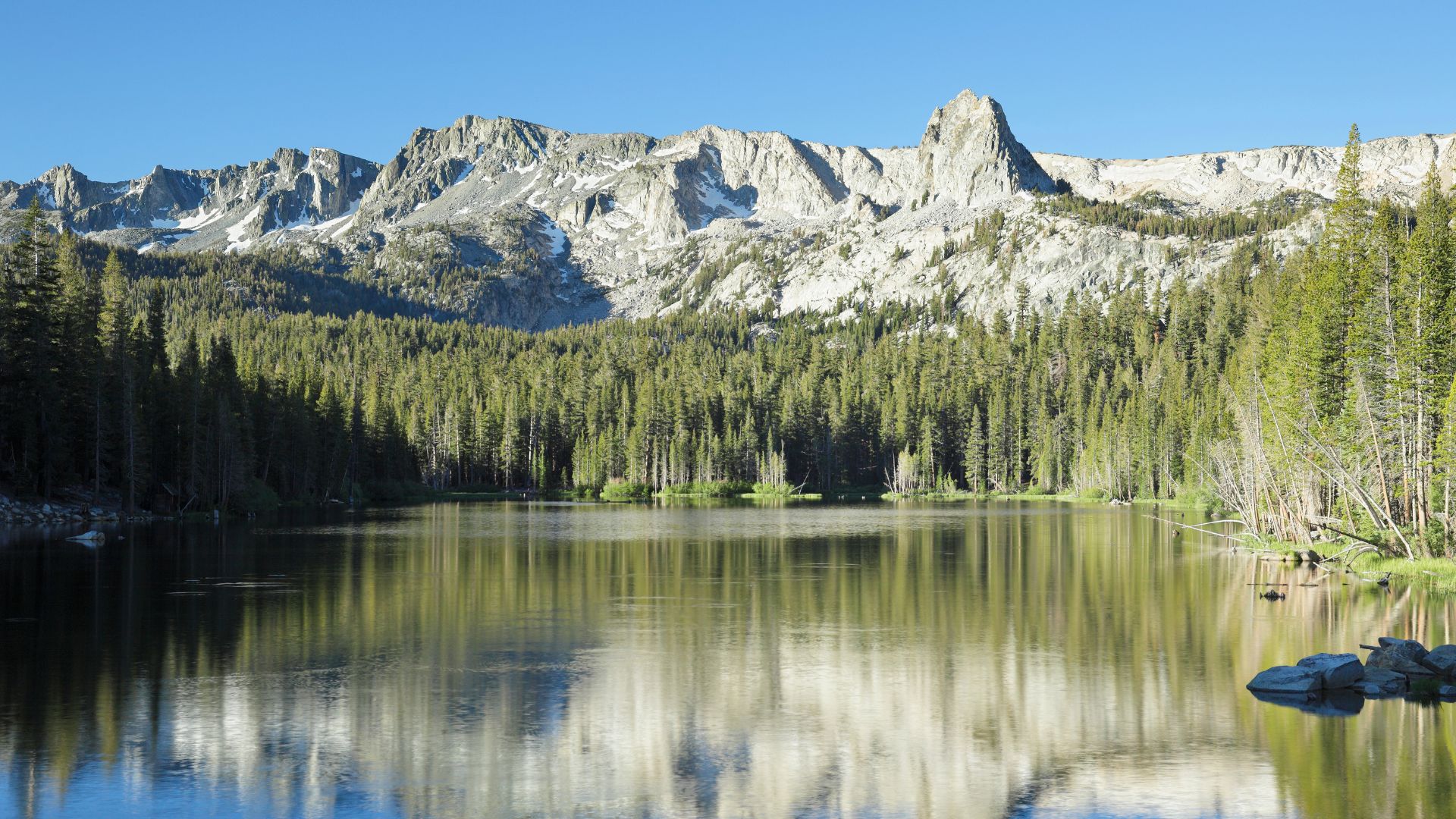
Mammoth Lakes and Mammoth Mountain: Adventure All Year Round
Mammoth Lakes? It’s my go-to for year-round fun. Skiing in July, wildflowers in August, and adventure pretty much whenever you want it.
This mountain town has a vibe that just pulls you in.
Skiing and Snowboarding at Mammoth Mountain
Mammoth Mountain really delivers when it comes to skiing and snowboarding. The season usually runs late—sometimes all the way to July.
There’s something for everyone here. Beginners get mellow runs, while experts can test themselves on steeps and bowls. The summit sits at 11,053 feet—on a clear day, the views are unreal.
Why Mammoth rocks:
- 3,500+ acres of terrain
- 28 lifts, including high-speed gondolas
- 400+ inches of snow most years
- Night skiing on select runs
Staying at The Village makes life easy—ski-in, ski-out, and a lively après scene.
If you’re into cross-country skiing or snowmobiling, the backcountry here is a powder paradise. Just be ready for adventure.
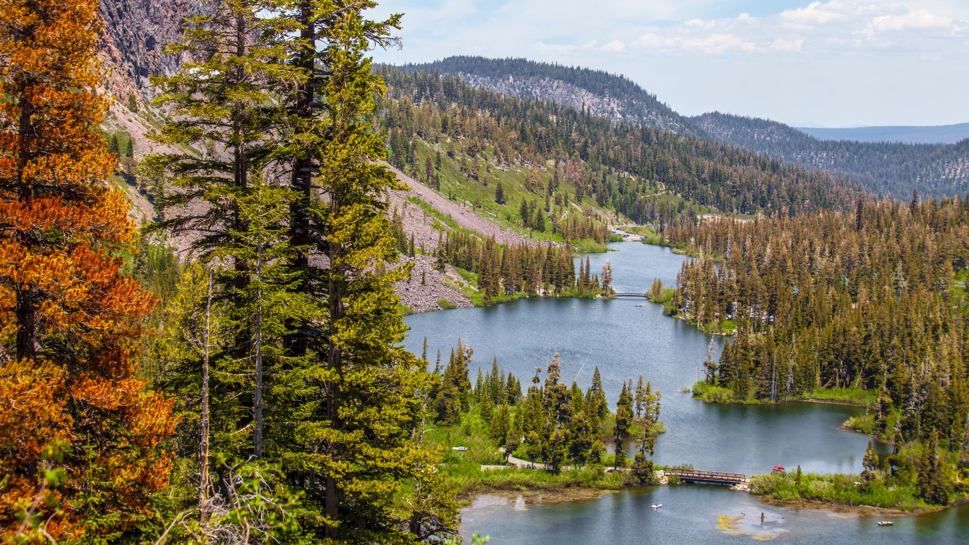
Hot Springs and Alpine Lakes Exploration
Mammoth Lakes is surrounded by some of the prettiest alpine lakes in California. I could spend days just bouncing from one to the next.
Top lakes to explore:
- Lake Mary: Easy to reach, perfect reflections
- Convict Lake: Dramatic granite backdrop, amazing photos
- Crystal Lake: Moderate hike, but so worth it for the solitude
- Lake Mamie: Quiet, great for fishing or a picnic
Hot Creek has natural hot springs right outside of town. There’s something magical about soaking in warm water with snow-capped peaks in the distance. I always double-check conditions before heading out, since access can change with the geothermal activity.
Fishing is big here—rainbow and brook trout are common. And in summer, wildflowers take over, turning the whole area into a colorful wonderland.
Hiking, Mountain Biking, and More
The trail system in Mammoth is huge. Hiking and mountain biking both take center stage once the snow melts.
Can’t-miss hikes:
- Devils Postpile National Monument: Wild volcanic columns, super unique
- Rainbow Falls: 101-foot waterfall, just a moderate trek
- Minaret Falls: Tougher hike, but the alpine views at the end are next-level
Mountain biking? Mammoth Mountain Bike Park is legendary. Lift-accessed downhill trails for thrill-seekers, plus plenty of mellow cross-country options winding through forests and meadows.
Camping’s popular, but if you’re not into roughing it, glamping is totally a thing here. You’ll find everything from basic campgrounds to luxury tents tucked into the woods.
The Adventure Center at Mammoth Mountain is always buzzing. In summer, you can try zip-lining, indoor climbing, or just take the gondola up for those panoramic views.
Wild and Remote High Sierra Gems
Some of my favorite High Sierra adventures happen way off the beaten path. These hidden spots have ghost towns, ancient lakes with bizarre formations, and volcanic landscapes that feel like another planet.
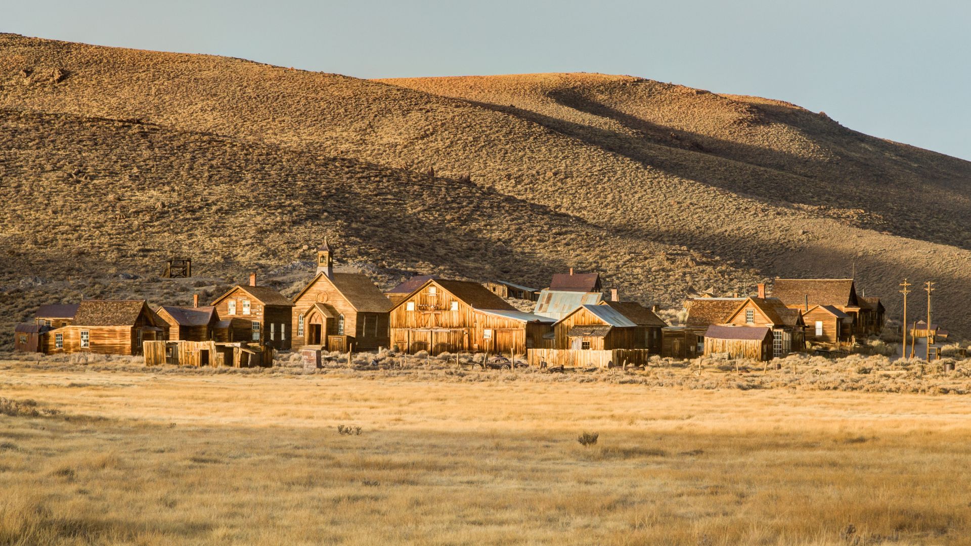
Exploring the Ghost Town of Bodie
Bodie is a time capsule—a real-deal ghost town perched at 8,375 feet east of the Sierra Nevada.
Walking Bodie’s dusty streets, you see about 170 buildings left exactly as they were. Back in the 1870s, this place was booming with 10,000 people chasing gold.
What makes Bodie wild:
- Original buildings still have furniture, dishes, and random personal stuff
- No fake restoration—what you see is the real deal
- State Historic Park status since 1962
The town stays in “arrested decay,” meaning rangers keep things from falling down but don’t restore anything.
Getting there takes a 3-mile drive on a bumpy dirt road. In winter, snow shuts the place down. The remoteness keeps crowds small, which honestly makes it even better.
Marveling at Mono Lake and Its Tufa Towers
Mono Lake’s been around for over a million years. Imagine that—a body of water, ancient and salty, with levels three times higher than the ocean.
The lake’s tufa towers instantly grab your attention. These limestone pillars rise up like something from another planet. They started forming underwater, thanks to calcium-rich springs mixing with the lake’s alkaline water.
Key facts about Mono Lake:
- Spans 65 square miles at 6,380 feet elevation
- Hosts billions of brine shrimp and alkali flies
- Attracts 2 million migratory birds every year
If you want the best views of the tufa towers, head to the South Tufa Area. The boardwalk trail there leads you straight to the shoreline.
Catch the lake at sunrise or sunset—those reflections on the water are unreal.
The visitor center dives deep into the lake’s wild ecosystem. It’s wild to think so many specialized creatures thrive in such harsh, salty conditions.
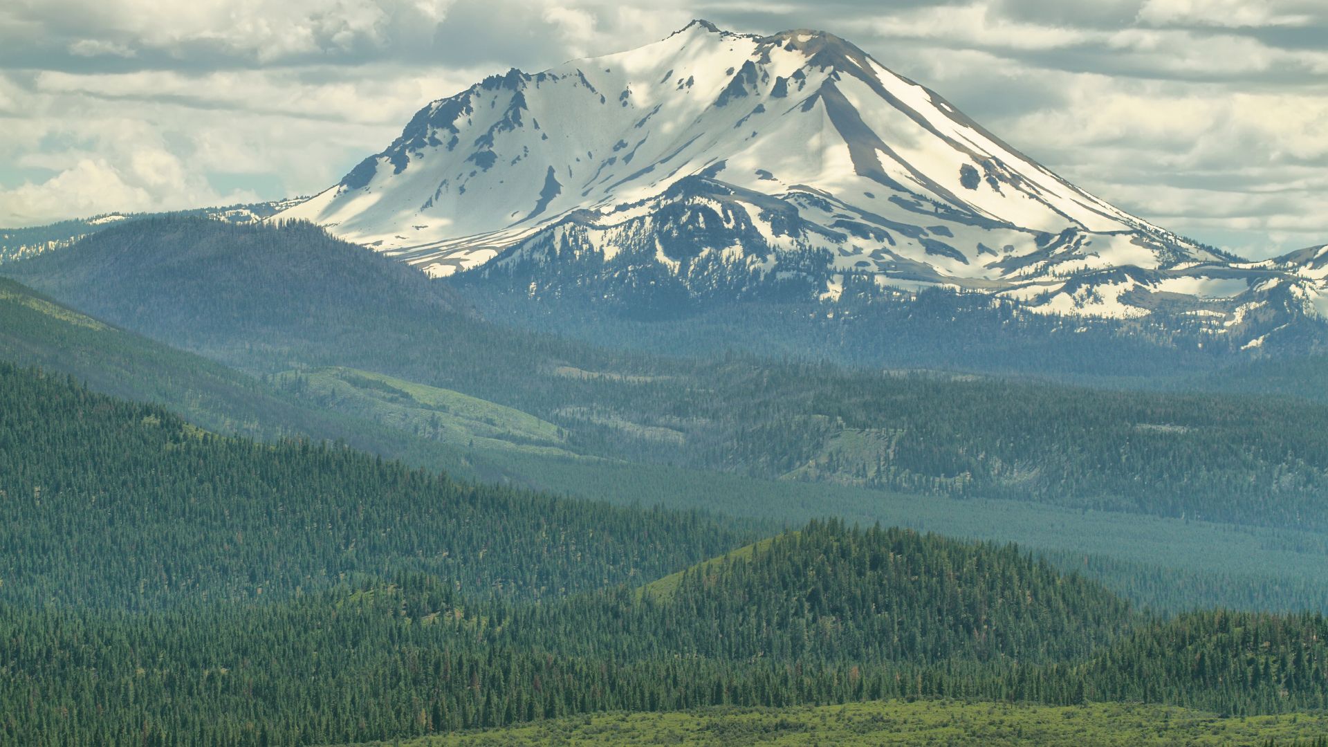
Discovering the Wonders of Lassen Volcanic National Park
Lassen Volcanic National Park sits up in Northern California, showing off active volcanic features you won’t find just anywhere. You get all four types of volcanoes here—pretty rare, right?
Lassen Peak erupted last between 1914 and 1917. I once hiked the 5-mile round trip to its 10,457-foot summit and wow, the views from up there are something else.
Must-see volcanic features:
- Bumpass Hell—biggest hydrothermal area, bubbling mud pots and all
- Cinder Cone—rises 700 feet, surrounded by colorful lava beds
- Sulphur Works—right by the road, with steam vents hissing away
Snow blankets the park from November through June, shutting down a lot of the roads. If you want to hike and explore, summer’s definitely your best bet.
Hot Rock stands as a reminder of the 1915 eruption. This massive boulder traveled four miles during the blast and, believe it or not, still gives off warmth.
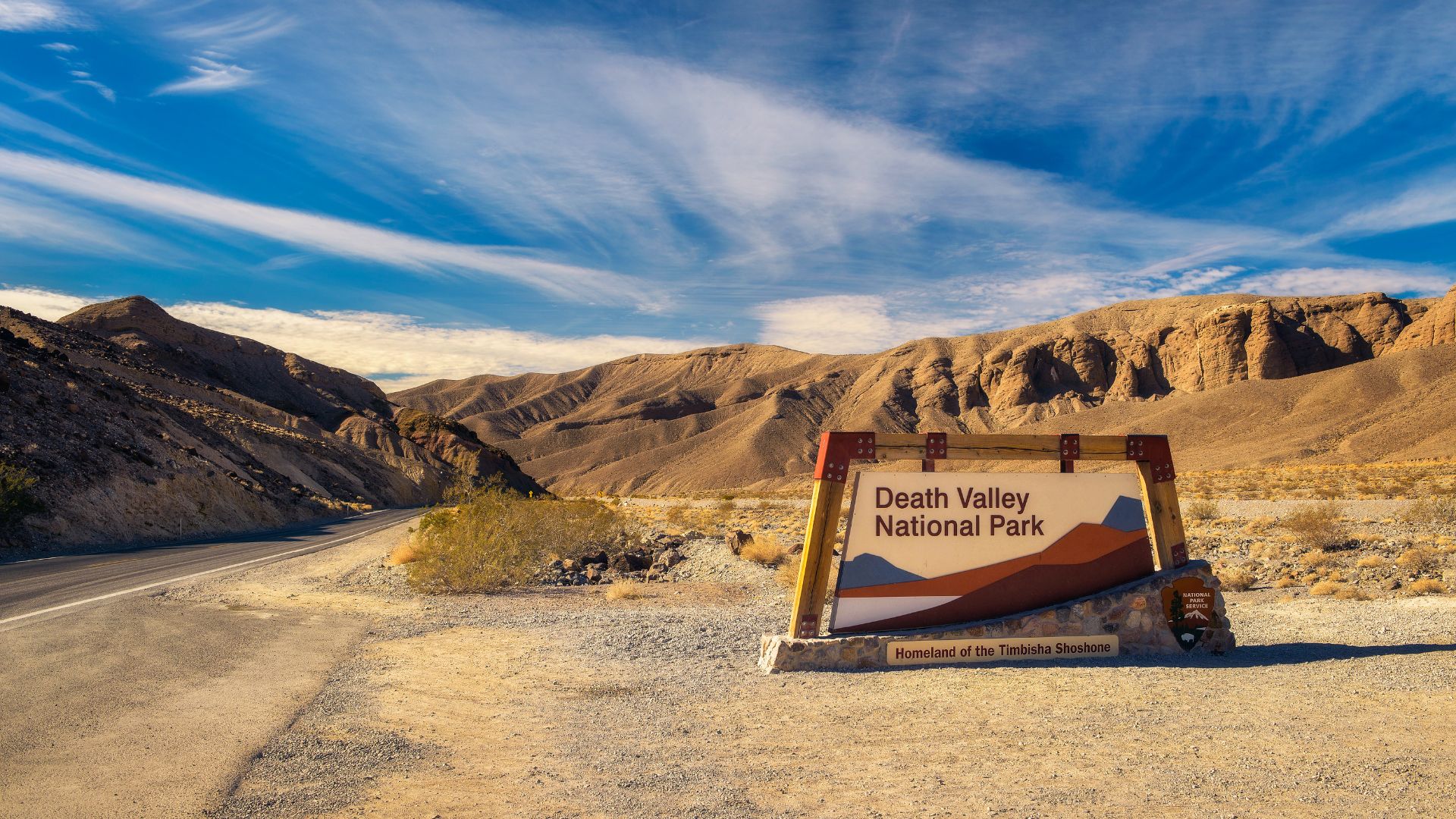
Death Valley and the High Desert: Surreal Sights and Starry Nights
Death Valley National Park hits you with some of California’s most extreme landscapes. You’ve got the lowest point in North America, and honestly, some of the darkest skies you’ll ever see. I’ve wandered this desert and found adventures you simply can’t get anywhere else in California.
Experiencing Badwater Basin and Salt Flats
Badwater Basin sits 282 feet below sea level. It holds the record for the lowest point in North America. The first time I stepped out onto these salt flats, I just stood there, amazed at the endless white stretching out to distant mountains.
The salt forms these wild hexagonal patterns as the water evaporates. It almost doesn’t look real—like you’ve landed on another planet.
Best visiting tips:
- Go early or late—Cooler temps and way better light
- Pack more water than you think—Desert heat sneaks up on you
- Wear sturdy shoes—Those salt crystals? They’re sharp
The salt flats seem to go on forever. The silence out there is almost eerie, honestly—one of the quietest places I’ve ever stood.
Sometimes in winter, rainstorms leave behind temporary lakes. These shallow pools reflect the mountains and sky, making for some unforgettable photos.

Sunrise at Zabriskie Point
Zabriskie Point is famous for a reason. The view from the overlook sweeps across layered badlands, each one telling a story millions of years in the making.
I got there about half an hour before sunrise, hoping to snag a good spot. Turns out, I wasn’t the only one with that idea—crowds gather fast, especially when it’s cool out.
What makes sunrise special:
- Golden light paints the ridges and valleys
- Shadows shift, making everything dramatic
- Colors morph from purple to orange to bright yellow
Ancient lake sediments hardened into rock and, over time, erosion carved those intricate shapes below.
If you’ve got a camera, bring a wide-angle lens. The view sweeps across the valley floor all the way to the distant Panamint Mountains.
It’s a short walk from the parking lot—five minutes, tops. The paved path makes this sunrise spot easy for almost everyone to reach.
Stargazing and Unique Desert Adventures
Death Valley National Park has earned Gold Tier status from the International Dark-Sky Association. You can spot stars and celestial wonders here that most people never get to see.
Top stargazing locations:
- Mesquite Flat Sand Dunes
- Harmony Borax Works
- Badwater Basin
- Ubehebe Crater
If you time your visit around a new moon, the skies turn inky black. I found it takes about half an hour for your eyes to really adjust, but once they do, the stars just pop.
Rangers host special programs in the winter. These sessions walk you through constellations and deep-sky objects that stand out in the desert.
Essential stargazing gear:
- Red flashlight (so you don’t ruin your night vision)
- Binoculars for a closer look
- Warm layers—trust me, it gets chilly fast
- A comfy chair or blanket
One of my favorite memories? Hiking the sand dunes under a full moon. The moonlight spilled over the dunes, making it easy to walk without a flashlight, but you could still spot the brightest stars overhead.
Every spring, Death Valley throws its annual Dark Sky Festival. You’ll find NASA speakers, telescopes set up for public viewing, and hands-on astronomy activities. It’s a little surreal, honestly—science, stargazing, and the desert all coming together.