When it comes to elevation, America really brings its A-game. The country’s mountain ranges—some ancient, some impossibly tall—shape the landscape in ways that are honestly hard to overstate.
From Alaska’s rugged, sky-scraping peaks to the worn-down, tree-cloaked Appalachians, the United States is packed with wild vertical variety.
Across the country, you’ll find over a dozen major mountain ranges. Three big ones really define the map: the Rocky Mountains, Sierra Nevada, and Appalachian Mountains. These giants run from sea level all the way up to more than 20,000 feet. The result? Some of the most dramatic scenery you’ll ever see.
After years of exploring these ranges, I’ve realized each one has its own story. Alaska’s peaks claim the title for highest. Meanwhile, some lesser-known ranges offer surprises for anyone willing to look.
Every range feels different. They challenge hikers, climbers, and dreamers in their own ways—and they’re all worth getting to know.

The Pinnacle of American Peaks: Defining Elevation Game
Let’s be honest, America’s mountains are all over the place in terms of height and character. Alaska’s monsters soar above 20,000 feet, while the Appalachians have mellowed out over millions of years.
Elevation isn’t just a number; it shapes the way people adventure and live.
What Makes a Mountain Range Stand Out in the U.S.
Peak elevation is the first thing people notice. Alaska basically sweeps the podium with the ten tallest peaks, including Denali at a whopping 20,310 feet.
In the lower 48, Mount Whitney in the Sierra Nevada tops out at 14,505 feet. It’s the highest spot you’ll find without heading to Alaska.
Geology gives each range its own vibe. The Rockies? They rose up through tectonic drama. The Cascades are volcanic, still steaming in places. Appalachians? They’ve been softened by eons of wind and rain.
Size matters, too. The Sierra Nevada stretches for over 400 miles in a single sweep. The Rockies break into subranges that sprawl across state lines.
| Key Factors | Examples |
|---|---|
| Peak Height | Denali (20,310 ft), Mount Whitney (14,505 ft) |
| Formation Type | Volcanic (Cascades), Tectonic (Rockies) |
| Geographic Span | Sierra Nevada (400+ miles), Appalachians (2,000+ miles) |
How Elevation Shapes Landscapes and Adventure
Climate zones shift fast as you climb. Down low, you’ll wander through thick forests. Up high, it’s all wind, rock, and tundra.
The Alaska Range really shows off this pattern. Boreal forests blanket the lower flanks, but glaciers and ice rule the peaks above 10,000 feet.
Adventure changes with altitude. Colorado’s Sawatch Range tempts climbers with 14,000-foot summits. The Cascades? Think glacier travel and volcanic ridges.
Weather goes wild up high. Mount Rainier gets slammed with more than 600 inches of snow each year. Denali? Some of the harshest climbing weather anywhere.
Getting there isn’t always easy. Colorado’s fourteeners can be day hikes, but Alaska’s big peaks demand weeks-long expeditions.
The Sierra Nevada’s High Country stretches nearly 200 miles with zero road crossings. If you want solitude, you’ll find it.
America’s Diverse Mountain Geography
Where you go matters. Alaska’s peaks are remote and wild. The West Coast has volcanic chains marching up the Pacific edge.
Eastern mountains tell a different story. The Appalachians snake from Georgia all the way to Maine—ancient, forested, and full of history.
The Southwest throws in desert ranges that shoot up from flat, sun-baked basins. The contrast is unreal.
Weather patterns shift with geography. Pacific storms drench the coastal ranges. The Rockies create rain shadows that shape entire states.
Ecosystems change with every climb. The Sierra Nevada grows giant sequoias at mid-elevation. Alaska’s Saint Elias Mountains hold the world’s largest non-polar icefields.
You’ll find everything from gentle Appalachian strolls to full-on Alaska mountaineering that’ll test even the pros.

Rocky Mountains: America’s Rugged Backbone
The Rockies run 3,000 miles from Canada all the way to New Mexico. They’re the backbone of the West—rugged, wild, and full of surprises.
Colorado alone has 53 peaks over 14,000 feet. But it’s not just about the big numbers. Every subrange has its own flavor.
Key Subranges and Their Distinct Features
Honestly, the Rockies are a maze of over 100 ranges, split into four main groups. The Canadian Rockies wow with sharp limestone peaks and sprawling glaciers like the Columbia Icefield.
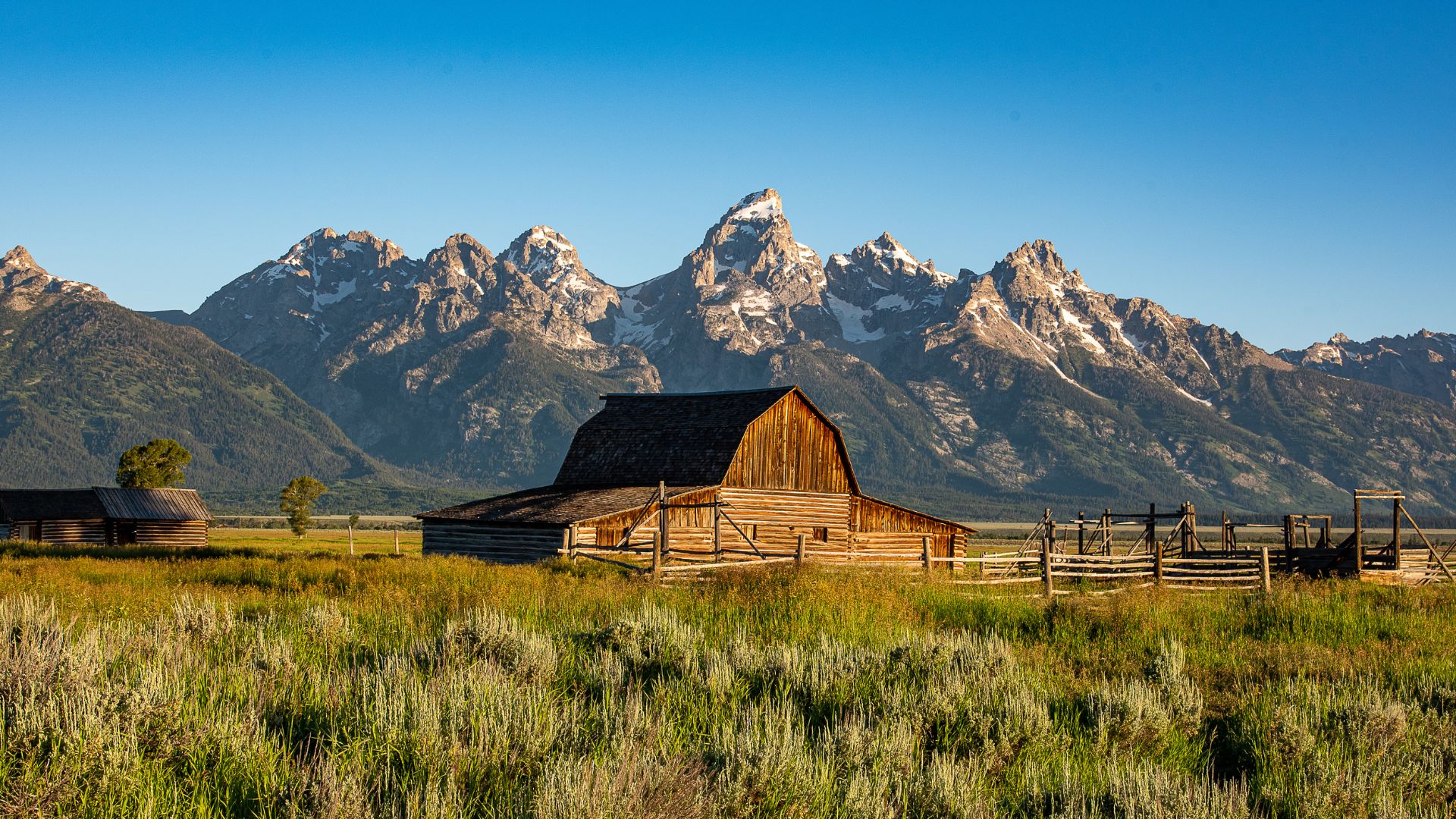
The Middle Rockies cross Wyoming and Utah. The Tetons? They shoot up over 20,000 vertical feet above Jackson Hole—no foothills, just straight up. The Wind River Range hides glaciers like Dinwoody.
Southern Rockies rule Colorado and northern New Mexico. The Front Range hugs Colorado’s east, while the Sawatch Range claims the highest summits. Mount Elbert tops out at 14,433 feet.
The Colorado Plateau covers slices of Utah, Colorado, New Mexico, and Arizona. It’s got mesas, canyons, and a high-elevation feel, even if it’s technically a plateau.
Each subrange grew up in its own way. Thrust faulting built the Canadian Rockies. The Middle and Southern Rockies rose during the Laramide Orogeny, about 65 to 35 million years ago.
Rocky Mountain National Park and Iconic Peaks
Rocky Mountain National Park sits right in Colorado’s Front Range. I’ve wandered its 415 square miles, where more than 60 peaks rise above 12,000 feet.
Longs Peak is the park’s crown jewel at 14,259 feet. The Keyhole Route isn’t for the faint of heart—expect scrambling and exposure. Early starts help you dodge those infamous afternoon storms.
Trail Ridge Road climbs to a dizzying 12,183 feet. You can drive right into the alpine without breaking a sweat. The road usually opens by late May, but snow can linger.
Bear Lake and Emerald Lake are both classic stops. Bear Lake is perfect for families, while Emerald Lake asks for a little more effort. Both deliver big on scenery.
Head north to Grand Teton National Park in Wyoming for a different vibe. The Teton Range just erupts from the valley floor. Grand Teton itself hits 13,775 feet, and there’s nothing subtle about its silhouette.
Hiking, Climbing, and Outdoor Exploration
The Rockies draw hikers and climbers from everywhere. Colorado’s fourteeners are a rite of passage for peak baggers. Mount Elbert is a good starter climb—challenging, but doable.
Technical climbing? There’s plenty. The Diamond on Longs Peak is legendary for a reason. Grand Teton mixes glacier travel with classic rock routes.
Utah’s Uinta Mountains are the only major range in the lower 48 that runs east-west. Kings Peak, at 13,528 feet, takes a backpacking effort to reach.
Trail networks crisscross the whole region. The Continental Divide Trail runs 3,100 miles from Mexico to Canada. The Colorado Trail offers 500 miles of mountain scenery.
Many alpine lakes are hidden gems for fishing and camping. Permits are often necessary in peak season, so check before you go.
Come winter, the Rockies transform. Backcountry skiing is huge, and resorts cater to every level. Avalanche safety is a must for anyone heading off-piste.
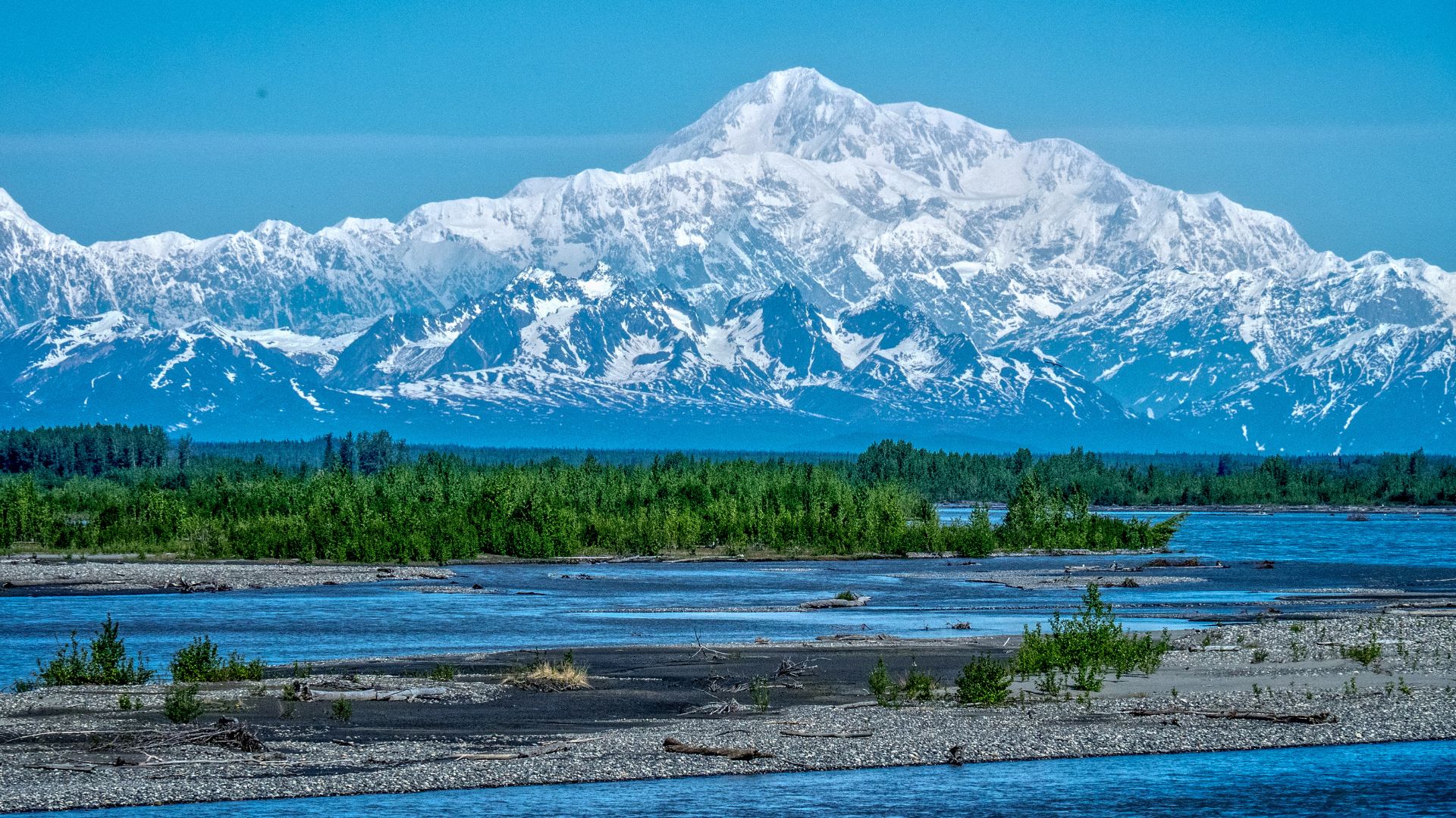
The Alaska Range: Home to North America’s Highest Summits
The Alaska Range sprawls 600 miles across south-central Alaska, and it’s home to the continent’s king: Denali, at 20,310 feet. Here, glaciers meet granite and the climbing conditions are about as tough as it gets.
Denali (Mount McKinley): The Ultimate Test
Denali soars 20,310 feet above sea level, making it North America’s tallest. But what really blows my mind is the base-to-summit rise—over three vertical miles.
That’s actually a mile more vertical than Everest, since Everest starts from a high plateau. Denali rises from just 2,000 feet.
This mountain’s core is granite, forged deep underground. That granite shrugs off erosion and still rises about half a millimeter a year.
| Peak Comparison | Base Elevation | Summit Height | Vertical Rise |
|---|---|---|---|
| Denali | 2,000 ft | 20,310 ft | 18,310 ft |
| Mount Everest | 14,000 ft | 29,028 ft | 15,028 ft |
Denali sits right on top of major fault lines, including the Denali Fault. Tectonic forces keep pushing it higher.
Exploring Glaciers and Volcanic Origins
Glaciers steal the show in the Alaska Range. Some stretch 45 miles and plunge to depths of 3,700 feet. They cover more than three-quarters of Denali’s surface.
The range grew out of millions of years of tectonic drama. The Pacific Plate pushes north, diving under the continent and forcing the land up.
Glaciers carved out the U-shaped valleys and sharp ridges. During the ice ages, they blanketed most of south-central Alaska, leaving behind moraines and scattered boulders.
The Wickersham Wall on Denali’s north side is a beast—14,000 feet of sheer mountain face.
Even now, glaciers grind away at the rock, turning it into silty “glacial flour” that clouds the rivers below.
Climatic Extremes and Challenges
Denali sits at 63 degrees north—a subarctic location that makes it one of the world’s coldest big mountains. It’s way farther north than Everest.
Temperatures have plummeted to -93°F up here, with winds that scream past 150 mph. The mountain’s bulk creates its own weather, so you never really know what’s coming.
Storms from the Gulf of Alaska and Bering Sea slam into the range, flipping blue skies to whiteouts in no time.
Climbers face brutal cold, high altitude, and unpredictable storms. Snow and ice blanket most routes all year.
Storms can roll in with barely any warning, so climbers have to stay sharp and flexible.
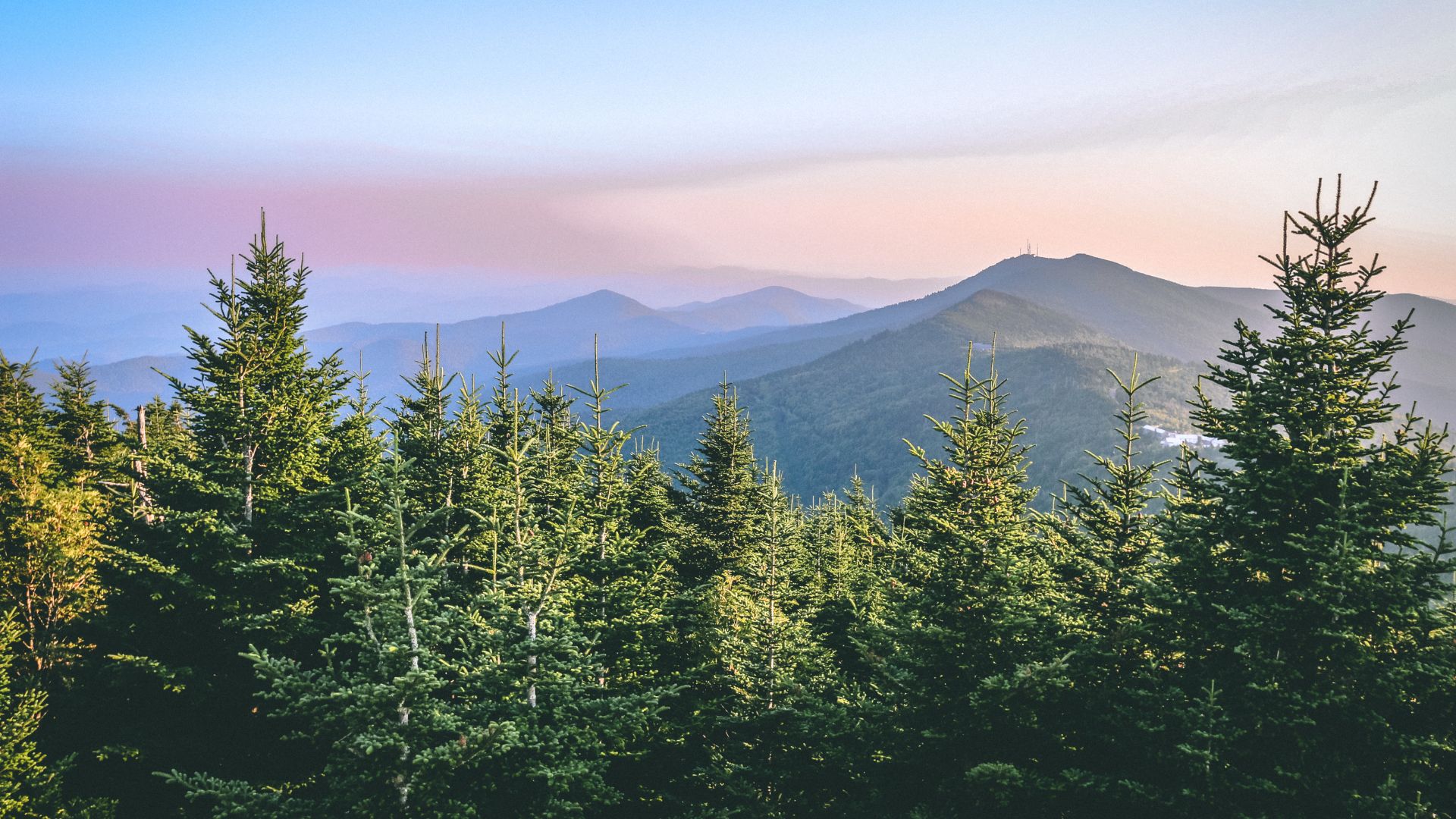
The Appalachian Region: Timeworn Giant of the East
The Appalachian Mountains stretch for 2,050 miles, from Newfoundland down to Alabama. They’re America’s oldest range—full of character and stories.
Mount Mitchell in North Carolina is the tallest at 6,684 feet. The legendary Appalachian Trail stitches together wild corners across the East.
Appalachian Trail: A Legendary Long-Distance Hike
The Appalachian Trail runs 2,175 miles, from Mount Katahdin in Maine to Springer Mountain in Georgia. It cuts through 14 states and pulls in millions of hikers each year.
Trail Stats:
- Total Length: 2,175 miles
- States Crossed: Maine, New Hampshire, Vermont, Massachusetts, Connecticut, New York, New Jersey, Pennsylvania, Maryland, West Virginia, Virginia, Tennessee, North Carolina, Georgia
- Highest Point: Clingmans Dome (6,643 feet)
Most folks just hike sections, not the whole thing. The brave souls who thru-hike usually spend 5-7 months on the trail.
The trail passes through iconic peaks and parks. It crosses Mount Mitchell and winds through Great Smoky Mountains National Park.
Blue Ridge Mountains and Great Smoky Mountains
The Blue Ridge Mountains make up a huge chunk of the Appalachian system. They wind their way from southern Pennsylvania, roll through Virginia, and spill into North Carolina.
Mount Mitchell tops out at 6,684 feet—yep, that’s the highest point east of the Mississippi. The Blue Ridge Parkway snakes along for 469 miles, linking Shenandoah National Park with Great Smoky Mountains National Park. If you love scenic drives, this one’s hard to beat.
Great Smoky Mountains National Park hugs the border between Tennessee and North Carolina. Clingmans Dome, at 6,643 feet, steals the show as the park’s tallest peak.
Notable Blue Ridge Peaks:
- Mount Mitchell: 6,684 feet
- Mount Craig: 6,647 feet
- Clingmans Dome: 6,643 feet
- Mount Washington (Virginia): 5,729 feet
Ever wonder why these mountains look blue from a distance? Trees release natural compounds that create a hazy, bluish tint. It’s one of those small details that sticks with you.

White Mountains and Iconic Peaks
The White Mountains pretty much take over New Hampshire’s skyline. Mount Washington stands at 5,268 feet and everyone around here knows its reputation.
Mount Washington once clocked a wind speed of 231 mph—a world record for surface wind. The weather up there? Absolutely wild. It can flip from sunny to blizzard in what feels like minutes.
The Presidential Range, in my opinion, is the heart of the Whites. Here you’ll find Mount Adams, Mount Jefferson, and Mount Madison—all with their own personalities and challenges.
White Mountain Facts:
- Mount Washington: 5,268 feet
- Mount Adams: 5,799 feet
- Mount Jefferson: 5,712 feet
- Mount Madison: 5,367 feet
The Appalachian Trail slices right through this region. Hikers earn serious bragging rights after tackling this stretch—it’s notorious for being tough.
These peaks offer a taste of true alpine conditions, which is rare for the East Coast. The treeline sits surprisingly low, around 4,500 feet, thanks to the harsh climate.
Pacific Powerhouses: Sierra Nevada and Cascade Range
The western U.S. packs a punch with two of the country’s most jaw-dropping mountain ranges. These giants stretch about 110 miles inland from the Pacific, and each has its own vibe.
The Sierra Nevada rules California with granite peaks and the tallest summit in the lower 48. Meanwhile, the Cascade Range runs from California all the way up through Washington, dotted with volcanoes and icy summits.
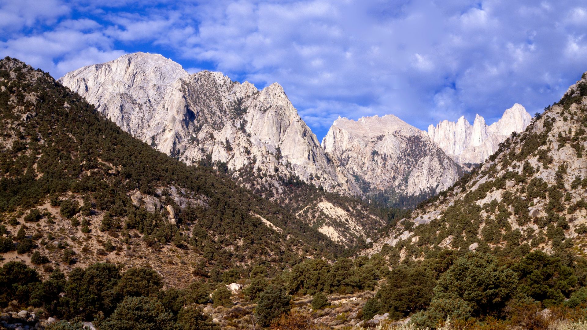
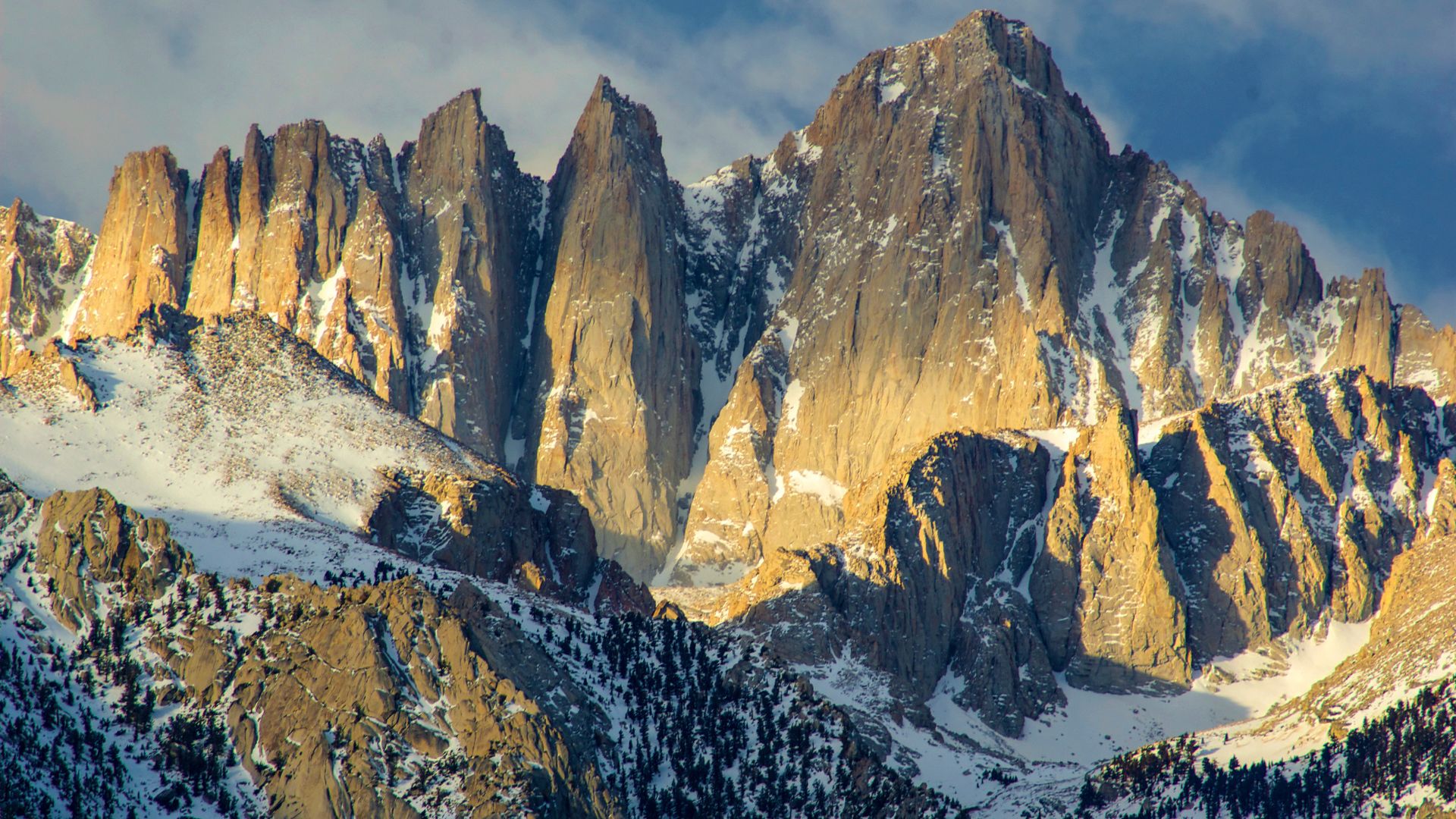
Sierra Nevada: From Mount Whitney to Alpine Wonders
The Sierra Nevada runs for 400 miles along eastern California into Nevada. This range always feels dramatic—towering granite, deep canyons, and elevations that make your lungs work overtime.
Mount Whitney claims the title at 14,505 feet. It’s the highest point in the contiguous U.S., and every summer, climbers line up for a shot at the summit.
Yosemite National Park sits right in the heart of the Sierra. El Capitan and Half Dome, those iconic granite walls, show off the range’s wild geology. Ancient volcanoes and glaciers shaped these landscapes into something unforgettable.
Lake Tahoe nestles into the northern Sierra at 6,225 feet. Its clear blue water mirrors the granite peaks, and honestly, the view never gets old.
The Sierra gets hammered with snow each winter. Thanks to that, skiing here is legendary—places like Mammoth Mountain draw powder hounds from all over. That snow also keeps California’s Central Valley growing crops all summer.
Cascade Range: Volcanoes and Glacial Majesty
The Cascade Range stretches for 700 miles, starting in northern California and running through Oregon, Washington, and into British Columbia. This is volcano country, and the landscape shows it.
The Cascades feature more than a dozen major volcanoes. These peaks rose up as oceanic plates slid beneath North America—a process that’s still happening, by the way. Geothermal vents and hot springs remind you that the earth here is very much alive.
Mount Shasta towers at 14,179 feet in northern California. You can spot its snowy cone from over 100 miles away, and it’s a magnet for climbers and photographers.
Pacific storms dump tons of snow and rain on these mountains. Glaciers cling to the highest peaks, feeding the Columbia and Sacramento rivers.
Lower down, dense forests of Douglas fir and western red cedar stretch for miles. In summer, alpine meadows explode with wildflowers. If you’re lucky, you might spot mountain goats or black bears roaming the hills.
Iconic Summits: Mount Rainier, Mount St. Helens, Mauna Kea
Mount Rainier looms 14,411 feet above Washington. It’s the most glaciated peak in the lower 48, with 26 named glaciers covering 35 square miles.
Mount Rainier National Park wraps around this stratovolcano. On a clear day, you can see Rainier from Seattle—it’s that massive. Climbers test their skills on its icy slopes every year.
Mount St. Helens made headlines with its 1980 eruption. The blast dropped its height from 9,677 to 8,366 feet and left a crater that’s both eerie and fascinating.
The eruption wiped out 230 square miles of forest, but now, new plants and animals keep creeping back. Watching this place recover is like seeing nature hit the reset button.
Mauna Kea rises 13,803 feet above Hawaii’s Big Island. If you measure from the ocean floor, though, it’s over 33,000 feet tall—making it technically the tallest mountain on Earth.
The summit is home to world-class observatories. The air is thin, the sky is clear, and even though you’re in the tropics, snow sometimes dusts the peak.
Hidden Elevations: Unique and Underappreciated Ranges
America hides some real mountain surprises—ranges that run east-west, peaks that shoot up from ancient bedrock, and places where you don’t expect to find real elevation. These spots break the rules and offer adventures you won’t get anywhere else.
Uinta Mountains: East-West Wonder
The Uinta Mountains always catch people off guard. They’re the only major U.S. range that runs east-west instead of north-south.
You’ll find them in northeastern Utah, stretching a bit into Idaho. Kings Peak, the highest point, hits 13,528 feet. The range stretches about 150 miles and hides over 1,000 alpine lakes.
What makes them special:
- More than 400 lakes above 10,000 feet
- Wild, uncrowded trails and campsites
- Rocks that date back 1.7 billion years
Backpacking here feels like discovering a secret. I rarely see crowds, even on multi-day hikes.
The High Uintas Wilderness protects 460,000 acres of rugged terrain. It’s Utah’s biggest wilderness area and home to its tallest summits.
Adirondacks and Majestic Upstate Summits
The Adirondack Mountains in upstate New York offer one of the country’s most unusual mountain scenes. These peaks rise from bedrock that’s over a billion years old.
Mount Marcy claims the top spot at 5,344 feet. The region’s 46 peaks above 4,000 feet have inspired generations to tackle the “46er” challenge.
Key features include:
- 6 million acres of protected parkland
- A unique mix of public and private lands
- Endless outdoor fun, all year long
Adirondack Park blends wilderness with real towns and villages. It’s not just forests and lakes—there’s a whole culture inside these boundaries.
The geology here stands apart from the West. Instead of volcanoes or new tectonic uplift, these mountains rose from ancient rock pushed up over time.
In winter, the Adirondacks transform into a snow lover’s paradise. Ice climbing, cross-country skiing, and snowshoeing here can rival anything New England has to offer.
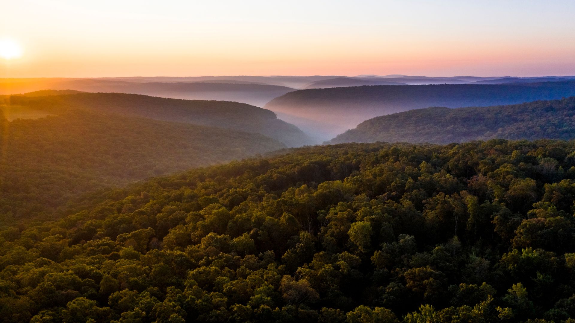
Ozark Plateau and Magazine Mountain
The Ozark Plateau really surprised me—it shapes Arkansas into a place with mountains you might not expect. Magazine Mountain, standing at 2,753 feet, claims the title of the state’s highest point right inside Mount Magazine State Park.
Most folks don’t picture Arkansas with high peaks or dramatic climbs. But the Ozarks? They definitely prove people wrong. The land here is rugged, with deep valleys and a wild sense of vertical drop.
Notable characteristics:
- You’ll spot ancient sandstone and limestone everywhere
- There’s a rare mix of plants you won’t see elsewhere
- The views? They stretch out for miles, sometimes into neighboring states
Magazine Mountain threw me for a loop with its diversity. The higher elevation brings cooler air and a whole new set of plants compared to the steamy lowlands below.
While the Ozark Mountains spill over into Missouri, Arkansas really steals the show with its wildest stretches. The Buffalo National River slices right through limestone bluffs, and the scenery is honestly breathtaking.
Mount Magazine State Park makes it super easy to reach the summit. There are well-marked hiking trails, plenty of camping spots, and a visitor center that dives into the area’s geology and quirky ecology.