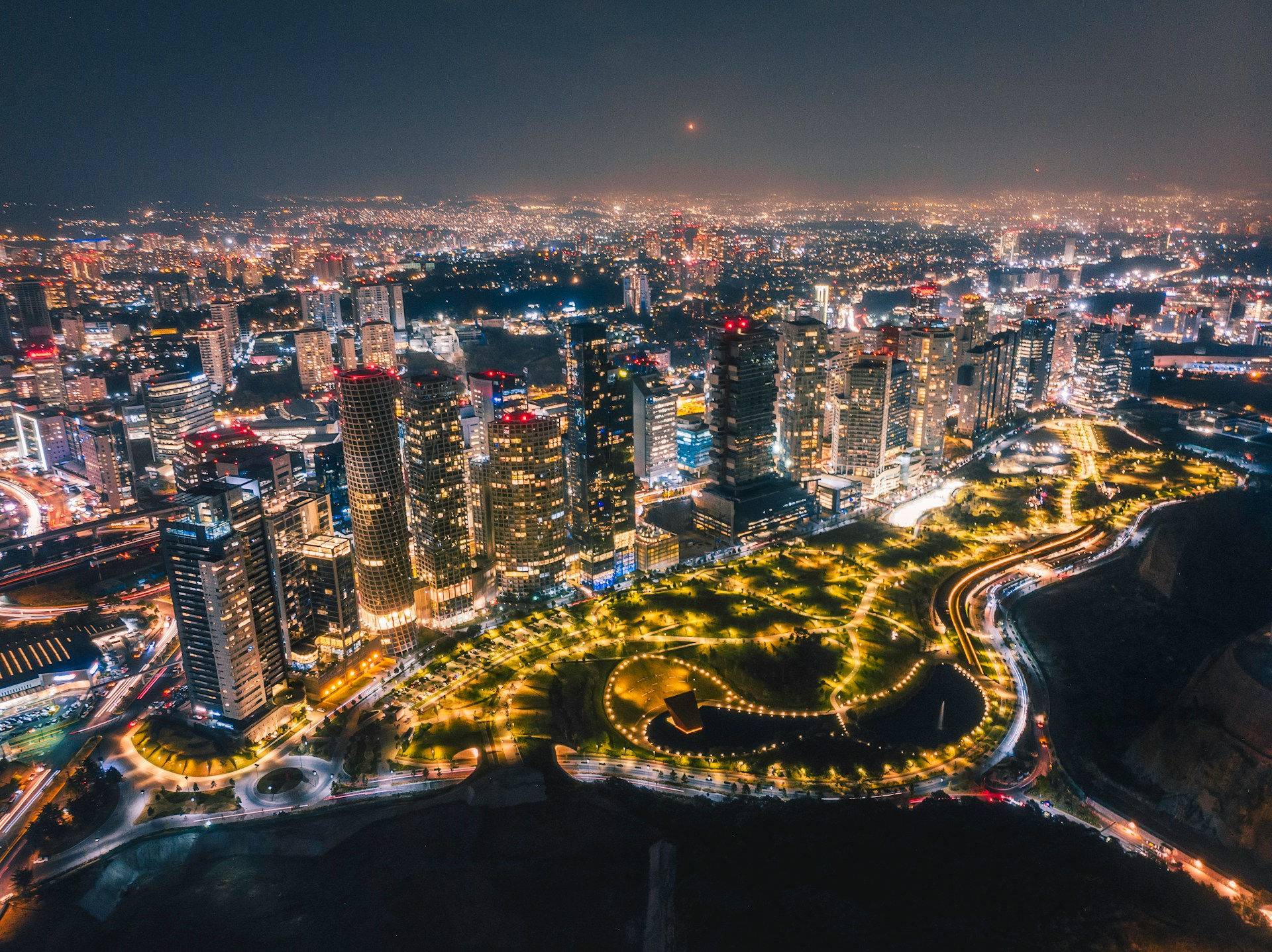
Can you imagine nine million people squeezed into Mexico City’s central district? It’s wild. All those lives fill 570 square miles with noise, color, and a relentless energy you just can’t fake. There’s a special urban energy here—ancient Aztec ruins and modern skyscrapers mingle, and each street corner seems to hold a new story about how people survive and thrive in one of the world’s largest cities.
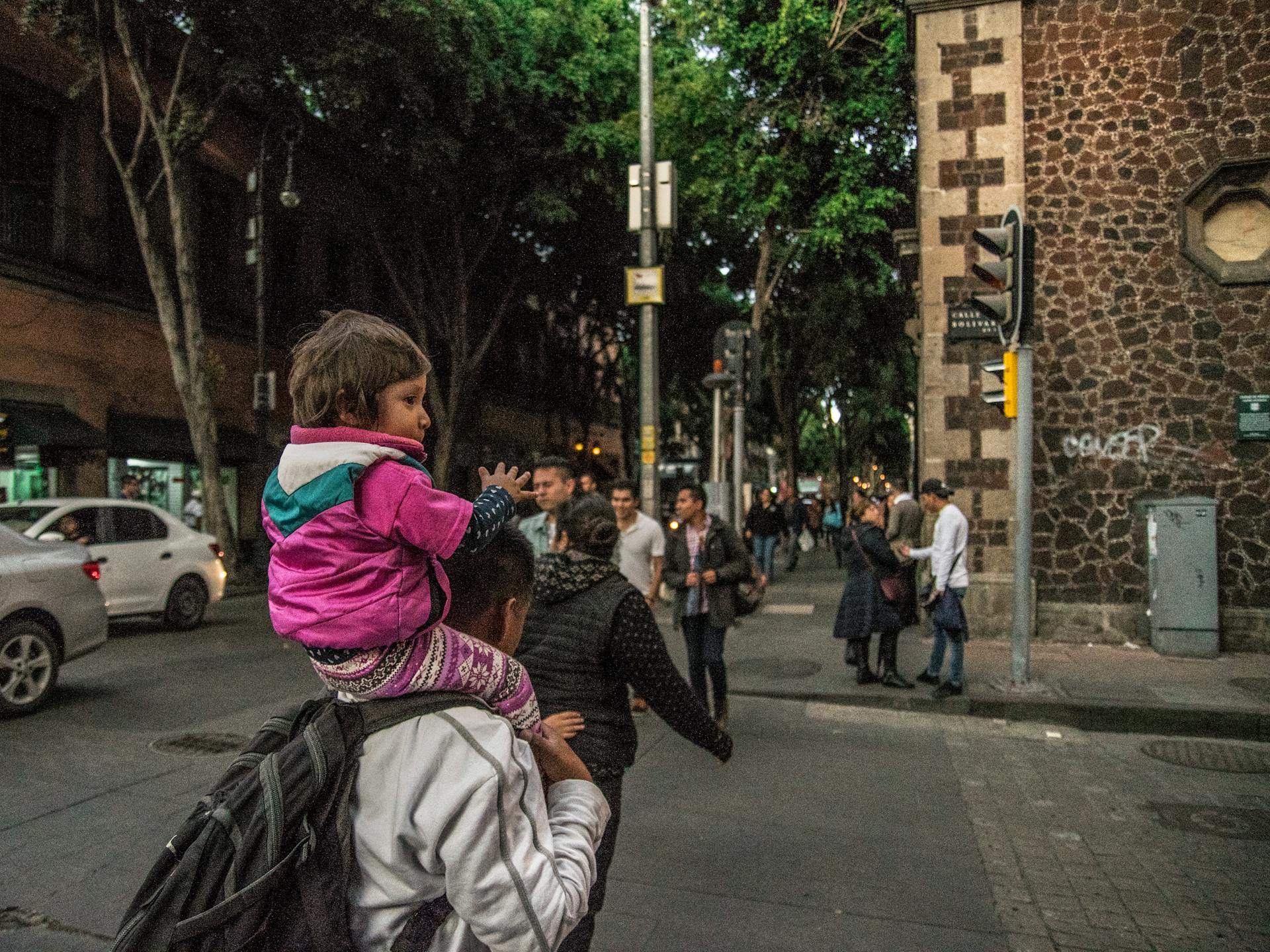
Step into this sprawling metropolis and you’ll feel it right away—the pulse, the movement, the chaos that somehow works. I’ve wandered these streets, sometimes totally overwhelmed, and wondered how the city even functions at all.
Honestly, it shouldn’t work. Traffic snarls for hours. Markets seem to pop up wherever there’s space. The noise never really dies down. But somehow, Mexico City keeps moving forward. It’s like the city’s greatest strength is its ability to find unexpected solutions in the middle of what looks like pure chaos.
What always hooks me is the way locals navigate this madness. There’s creativity everywhere, and a resilience I don’t see in many other places. If you look past the surface, you’ll notice how the city’s layered history, vibrant neighborhoods, and grassroots movements all come together to create something close to urban magic.
Crowds, Complexity, and Urban Rhythm
Mexico City never really stops moving. Every day, 9 million people squeeze through dense neighborhoods, jam-packed streets, and a transit system that seems to be in constant motion.
You can actually feel the rhythm—the ebb and flow of traffic, the mix of street sounds, and the daily hustle of people living on top of each other.
Life With 9 Million: Density and Diversity
It’s kind of mind-blowing how Mexico City fits so many people into neighborhoods that buzz 24/7. Each area feels like its own little world.
Sixteen different delegations make up the city. Condesa and Roma Norte, for example, have this artsy, youthful vibe—cafés, restaurants, and leafy little parks everywhere.
Centro Historico? That’s where you’ll find colonial buildings side by side with modern shops and street vendors. The narrow streets fill up fast, especially during rush hour.
Polanco, on the other hand, caters to the city’s wealthier crowd and business types. Wide boulevards and shiny towers give it a totally different look.
Population density by area:
- Centro: 15,000/km²
- Condesa: 12,000/km²
- Polanco: 8,000/km²
People from all corners of Mexico flock here for work and opportunity. The result? A wild blend of cultures, languages, and traditions all crammed into one mega-city.
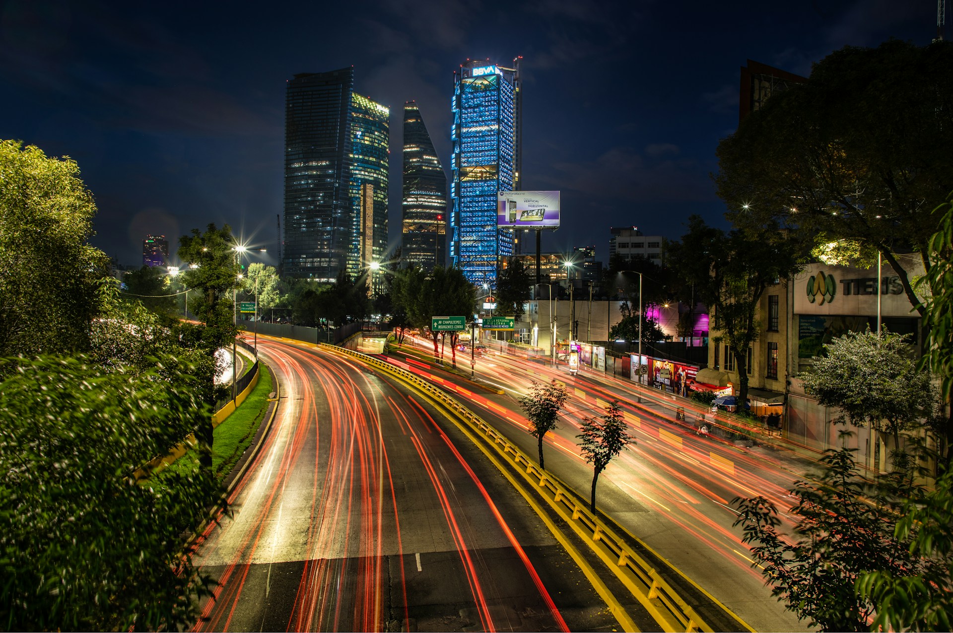
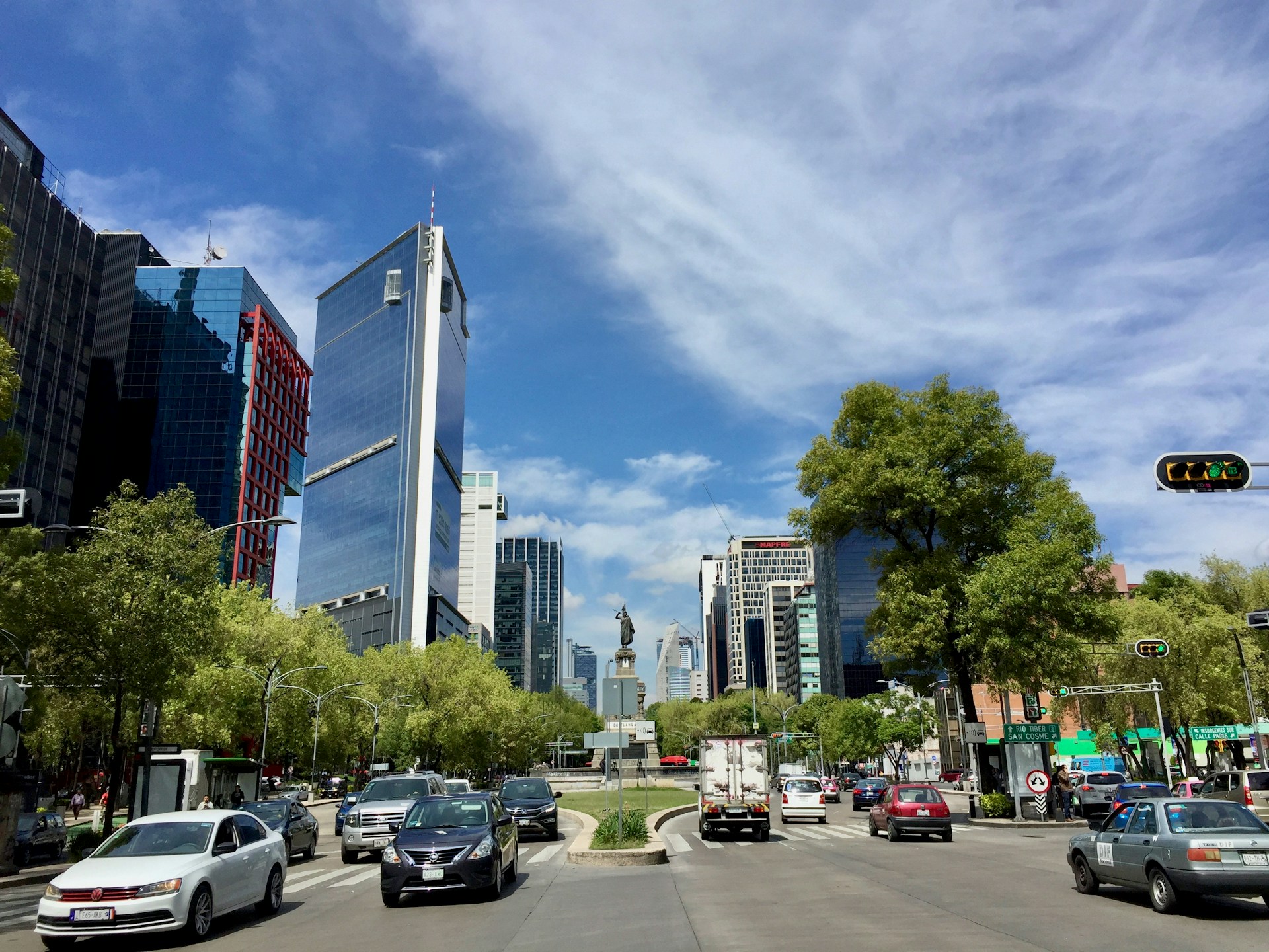
The Constant Motion: Traffic and Transport
Traffic here? It’s legendary. Cars, buses, motorcycles, and people on foot all compete for space, weaving around each other in a daily dance that’s equal parts impressive and exhausting.
Mexico City’s Metro is a beast—one of the biggest in Latin America. It hauls over 4 million people every day across 12 lines. During rush hour, trains show up every two minutes, but good luck finding a seat.
Getting around usually means:
- Metro subway system (195 stations)
- Metrobus rapid transit (7 lines)
- City buses
- Taxis and ride-shares
- Personal cars
Rush hour is no joke—7-10 AM and 6-9 PM, the main roads like Insurgentes and Reforma slow to a crawl. The city tries to ease congestion by limiting which cars can drive on certain days, but honestly, it’s still a daily struggle.
Metrobus lanes help a bit. Those bright red buses zip past regular traffic, but even they get bogged down when the city’s really humming.
City Soundscapes and Everyday Energy
The soundscape here is something else. Every hour brings a new mix—buses roaring, vendors shouting, music blaring, and car horns blaring.
Mornings kick off with the rumble of public transport and the calls of street vendors hawking breakfast. Drivers lean on their horns as they squeeze through tight intersections.
Sounds you’ll hear everywhere:
- Bus engines and brakes
- Vendors’ shouts
- Construction clatter
- Music pouring from shops
- Conversations in Spanish and more
Mexico City never really goes quiet. Even after midnight, traffic hums in the distance, music spills from bars, and sirens occasionally wail. You get used to it—it’s just part of living here.
Markets crank up the volume even more. Vendors hawk fresh fruit, tacos, and handmade crafts. The mix of voices, music, and movement spills into the streets.
Each neighborhood has its own soundtrack. Business districts buzz by day and chill out at night. Residential areas keep a steady hum, no matter the hour.
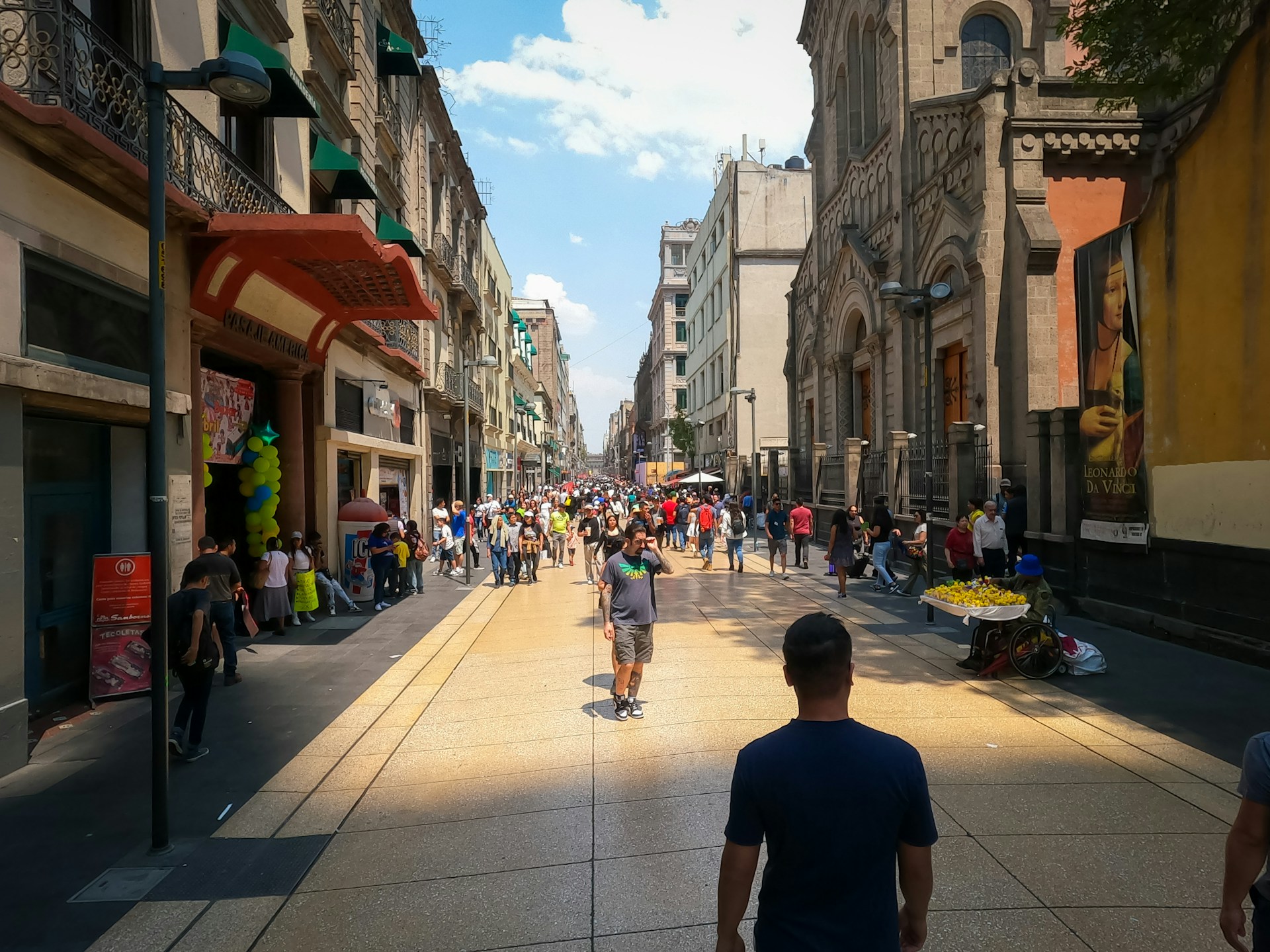
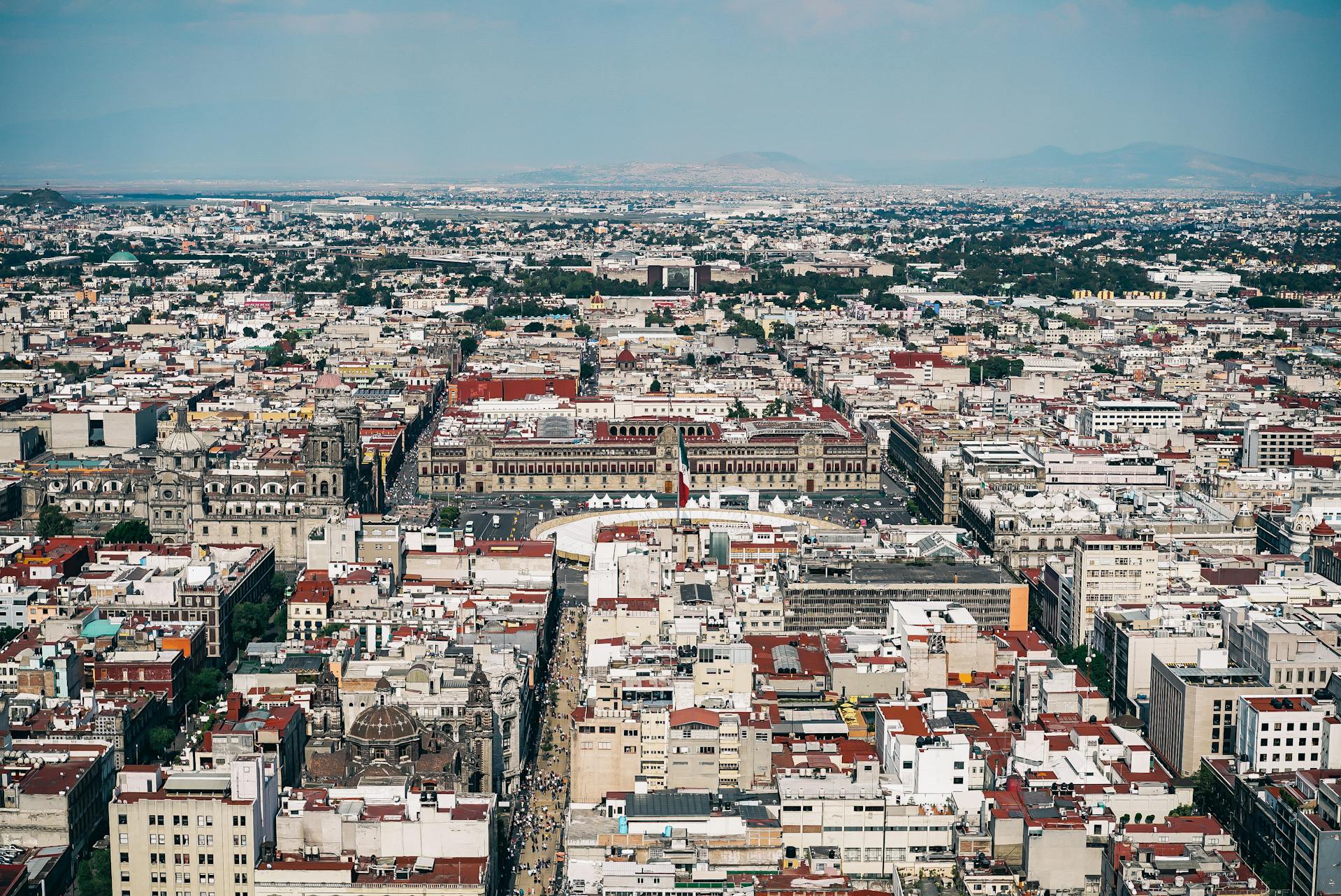
Historic Layers and the Heart of Mexico City
Mexico City sits on a foundation built over centuries. Aztec temples, colonial cathedrals, and glassy modern towers all share the same space. You can see history and the present collide, especially downtown.
Zócalo: A Convergence of Eras
Standing in the Zócalo, you can almost feel the weight of 500 years of Mexican history pressing in from all sides. This massive square covers nearly 60,000 square meters.
Three sides of the plaza show off colonial grandeur. The Metropolitan Cathedral took centuries to build and towers over everyone. The National Palace stretches across the east side with its imposing red stone.
If you look down, the Aztec past peeks through. Archaeologists found temple stones right under the cathedral. The Spanish built directly over Tenochtitlán’s main temple, almost as if they wanted to claim the city’s heart for themselves.
Every day, the Zócalo buzzes with life. I’ve watched flag ceremonies at dawn and huge rallies at sunset. Vendors sell tacos and crafts, and the square shifts from calm to crowded in a matter of hours.
This isn’t just a tourist spot—it’s the country’s political center. Presidents give speeches from the palace balcony. People gather here for protests, celebrations, and everything in between.

Tenochtitlán Underfoot: Ancient Foundations
Beneath these busy streets lies Tenochtitlán, the Aztec capital that once ruled a massive empire.
Back in 1519, Tenochtitlán sprawled across 13 square kilometers. If you squint, you can still spot traces of the old city in the street layout—some modern roads follow ancient canals and causeways.
The Templo Mayor stands just northeast of the Zócalo. Workers stumbled onto it in the 1970s, and archaeologists have since uncovered a huge pyramid with seven different layers.
Water shaped everything here. The city floated on Lake Texcoco, and the Aztecs engineered chinampas—floating gardens—to feed their people.
I love visiting the excavated ruins where original Aztec stones meet colonial brickwork. Spanish builders reused temple stones for churches and palaces, creating a mash-up you won’t see anywhere else.
Symbolic Spaces and Civic Vitality
Downtown Mexico City shows how old spaces can adapt to modern life. Every plaza and street corner has a story—sometimes several.
Public spaces buzz with people all day long. Office workers eat lunch by colonial fountains. Street performers set up where Aztec traders once haggled. Food stalls pop up on corners that have served meals for centuries.
Walk a few steps and you’ll see indigenous artisans selling crafts next to Spanish-era buildings. Modern shops fill the ground floors of ancient structures.
Street life still follows ancient patterns. Markets cluster around the main square, just like in Aztec times. Religious processions wind along old ceremonial routes. It’s all connected, even if most people don’t notice.
Kids play in courtyards where conquistadors once walked. Families picnic in plazas that hosted Aztec festivals. The city center isn’t just a museum—it’s alive because people actually live and work here.
Neighborhood Narratives: From Condesa to Urban Edges
Every neighborhood in Mexico City feels like a new chapter. From leafy boulevards to lively markets, each district shows off a different side of the city.
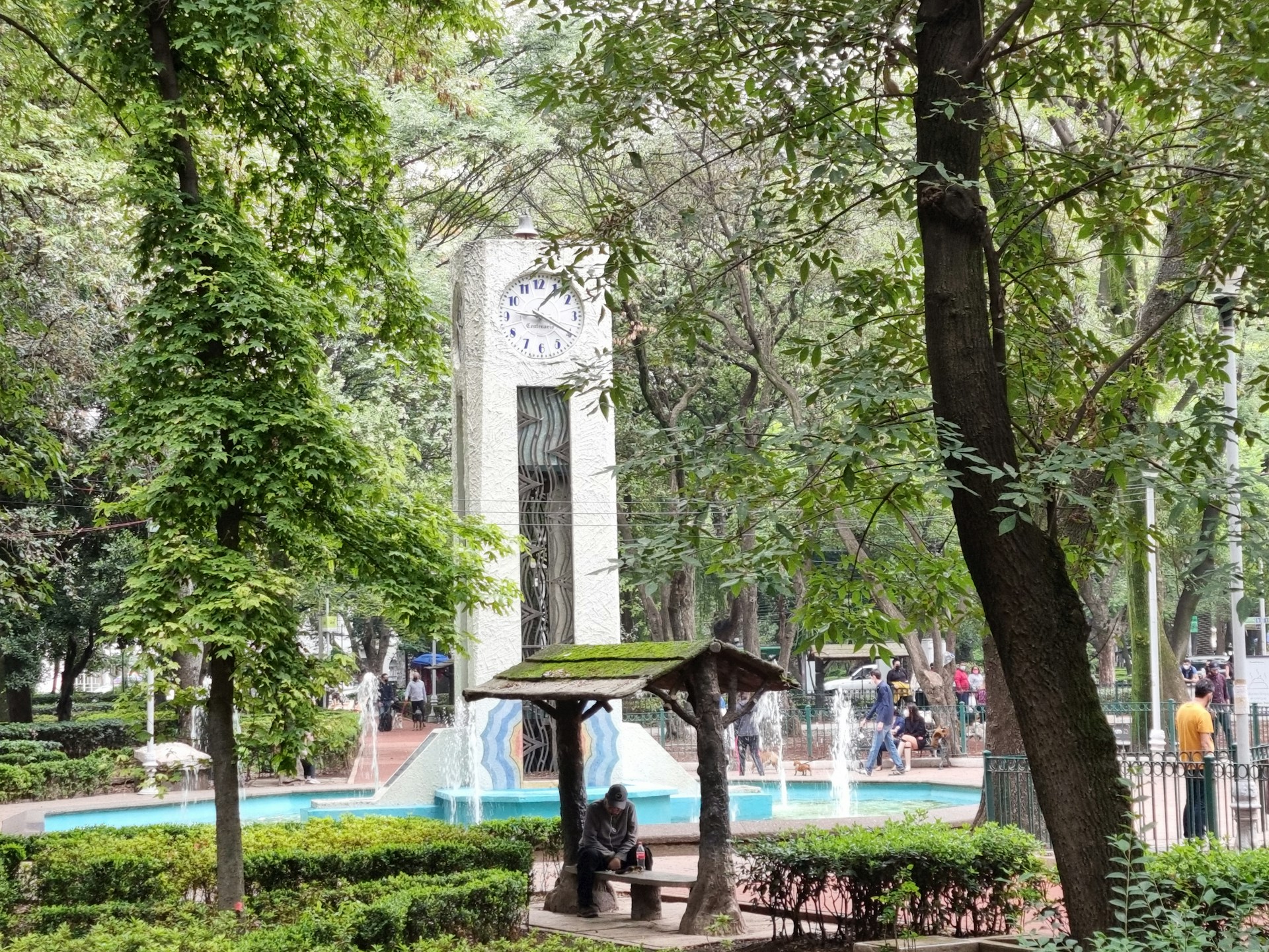
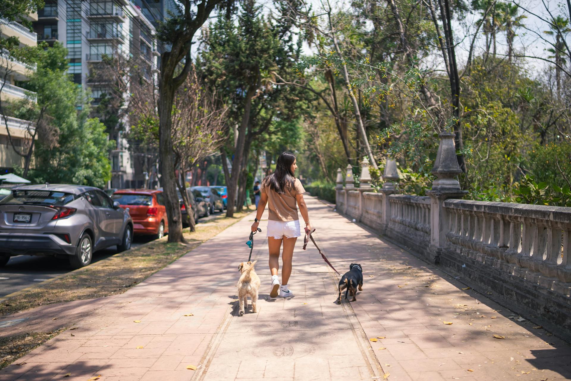
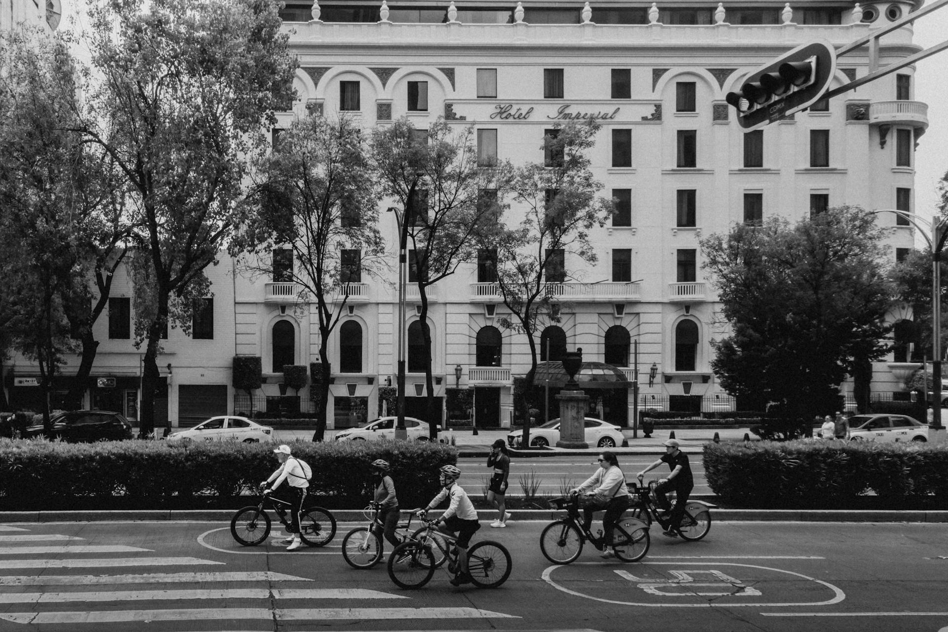
Condesa: Green Design and Modern Living
Walking through Condesa, I notice how the parks and tree-lined streets give the area a relaxed, almost European vibe. Built in the early 1900s for wealthy families, the neighborhood still feels elegant, but now it’s way more accessible.
What makes Condesa stand out:
- Parque México and Parque España anchor the community
- Gorgeous Art Deco buildings from the 1930s and 40s
- Cafés and restaurants on nearly every block
- Wide sidewalks perfect for strolling
Young professionals and creatives flock here. Old apartments get new life as trendy spaces with rooftop gardens and sleek interiors.
On weekdays, you’ll spot families playing in the parks. The area feels safe, and people actually walk everywhere. Local markets mix easily with hip new businesses.
Even as Condesa evolves, the parks remain its heart—a green escape that’s always drawn people in.
Living Traditions in Coyoacán and Roma
Coyoacán holds onto its colonial charm with cobblestone streets and colorful houses. The main square is always lively, with vendors selling crafts and street food that hasn’t changed in decades.
Roma, though, tells a story of constant change. The neighborhood’s shifted so many times over the years. In the 1920s, Syrian Jewish families built businesses and community spaces here.
Roma’s timeline:
- 1920s: Syrian Jewish community arrives
- 1970s-80s: Middle-class families move out
- 1985: Earthquake hits, causing decline
- 2000s: Gentrification and renovation kick in
These days, you’ll see old architecture sharing space with new restaurants and galleries. Some longtime residents have stuck it out, while others left as rents climbed.
Both Coyoacán and Roma show how tradition and change mix in Mexico City. Nothing stays the same for long, but roots run deep.
Cultural Contrasts in Expanding Districts
Head out to the city’s edges and you’ll see a whole different side of life. Millions live in these outer districts, commuting hours to work in the center but building their own communities far from the spotlight.
The differences are obvious. Peripheral neighborhoods often deal with:
- Unreliable water and electricity
- Fewer parks or cultural spaces
- Longer commutes
- More affordable housing
But these areas aren’t just left behind—they’re growing and changing, too. I’ve seen new shopping centers and restaurants pop up as people settle in and shape their own local culture.
All 9 million residents spread out across these neighborhoods, each with its own vibe and challenges. Transportation ties them together. The Metro and bus lines let people move between worlds in a single day.
These expanding districts are where the city’s future is being written. They’re proof that Mexico City never stops reinventing itself.
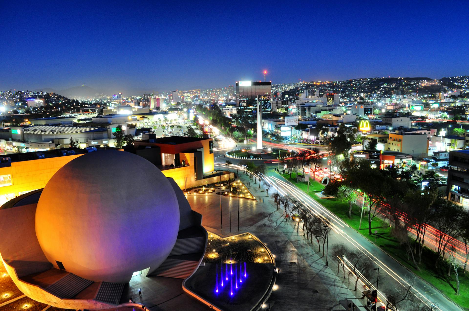
Tourism, Wonder, and the Pulse of Attractions
Mexico City pulls in nearly 12 million tourists a year, and honestly, it’s easy to see why. The city’s top sights blend ancient wonders with modern marvels, giving you a taste of both nature and urban life on a massive scale.
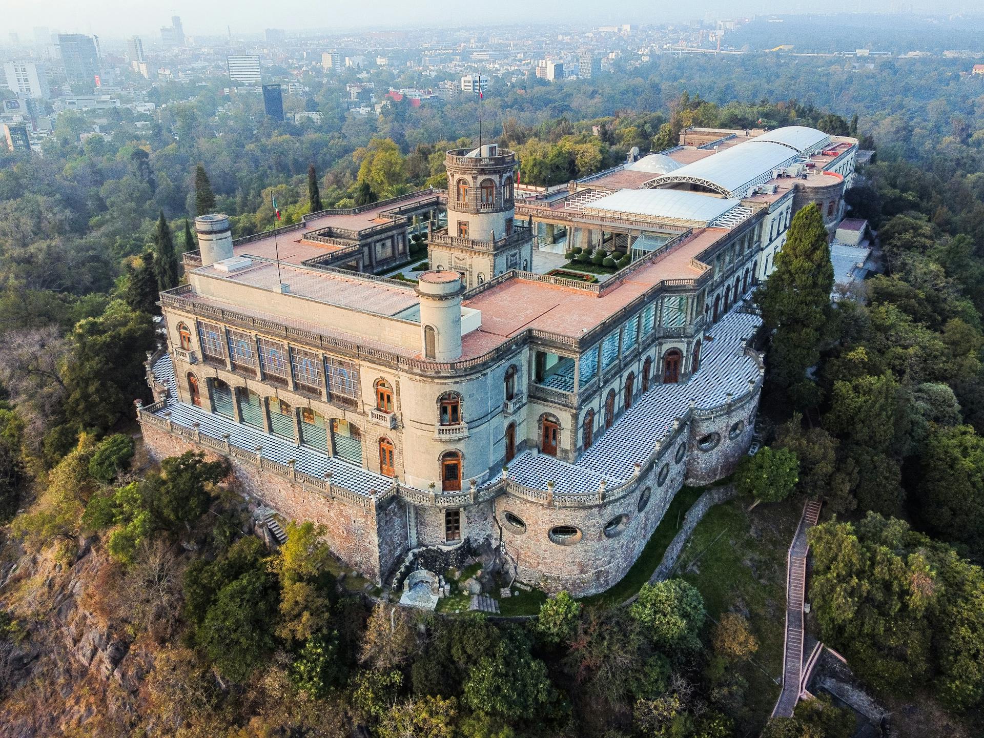
Chapultepec Park: Nature Amid Density
Chapultepec Park always surprises me with its sheer size. It’s bigger than Central Park in New York—1,695 acres of green in the middle of a crowded city.
Why Chapultepec is a must-visit:
- Chapultepec Castle sits high on a rocky hill
- The National Museum of Anthropology is world-class
- Modern Art and Rufino Tamayo museums
- Mexico City Zoo for families and animal lovers
On weekends, families pour in, spreading out picnic blankets and filling the air with laughter. Even though the park serves 21 million people, it somehow feels personal.
Climb up to the castle and you’ll get a view that stretches for miles. From up there, the city seems endless—and the park feels like a much-needed oasis.
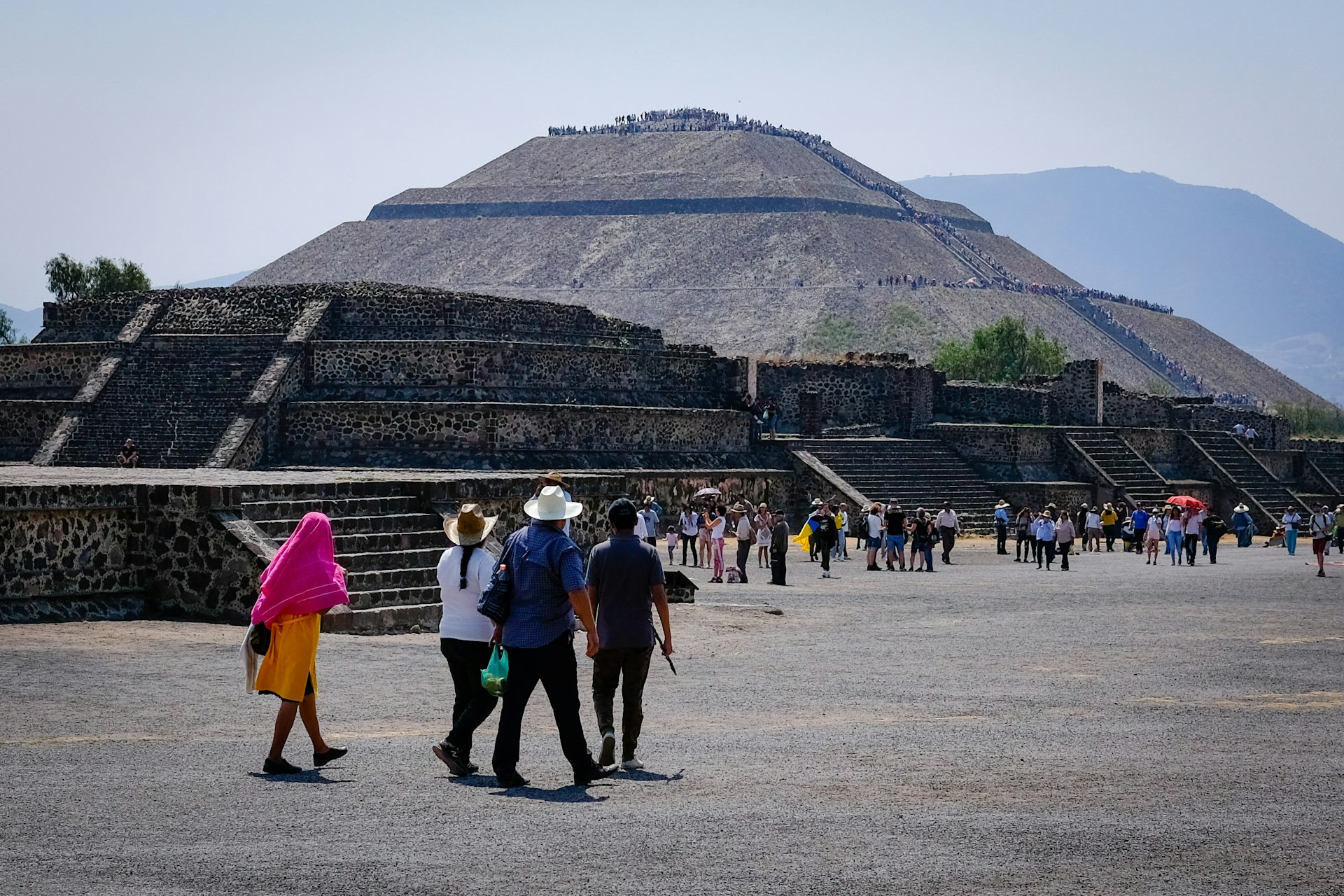
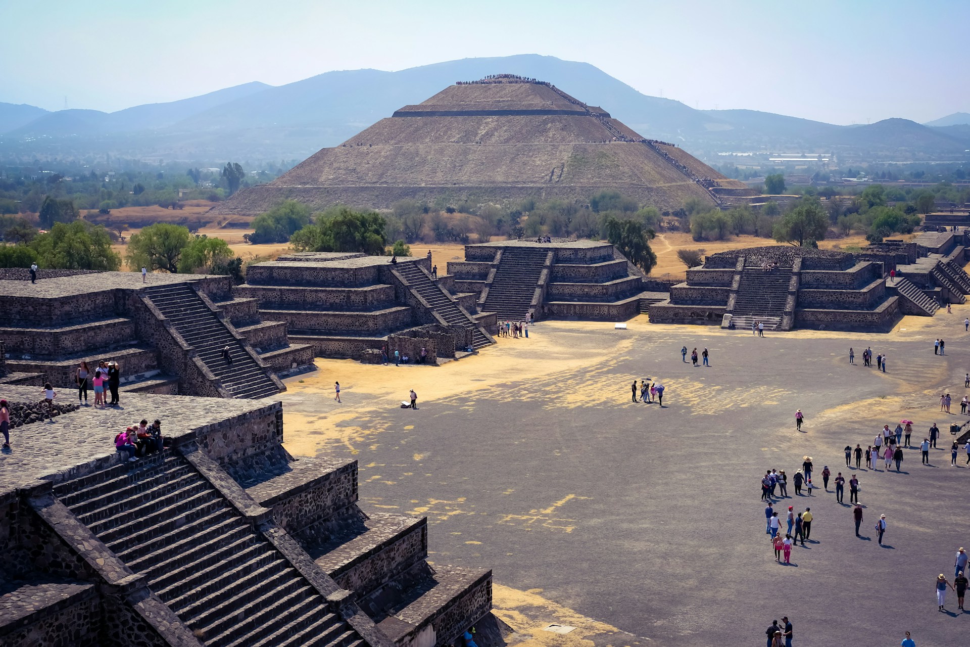
Pyramid of the Sun and Teotihuacán: Human Scale and Engineering
The Pyramid of the Sun at Teotihuacán towers 216 feet above the ground, with a base stretching 738 feet wide. I’ve huffed my way up all 248 steps, and honestly, the sheer scale leaves me in awe of the ancient builders.
Pyramid Statistics:
| Feature | Measurement |
|---|---|
| Height | 216 feet |
| Base width | 738 feet |
| Volume | 41 million cubic feet |
| Steps to summit | 248 |
People hauled over 1.2 million tons of stone and earth to construct this marvel. The way they lined it up with the sun’s path during the equinox? That’s no accident—it feels like standing inside a giant calendar.
Wandering the Avenue of the Dead, I try to picture the city bustling with 100,000 people. The vastness hits me, and I start to see how Mexico City’s population density isn’t just a modern thing—it’s got some serious roots.
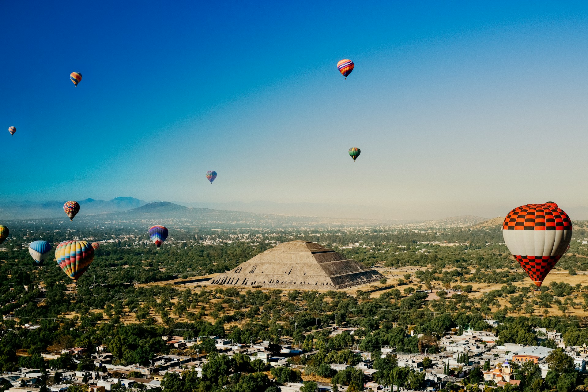
Soaring Above: Hot Air Balloon Experiences
Floating above Teotihuacán in a hot air balloon? That’s a memory that sticks. The view from up there gives you a whole new appreciation for the geometric precision of the pyramids.
If you’re thinking about it, early morning is the best time to go. The light is soft, the air is still, and everything below glows gold.
Flight Details:
- Duration: 45-60 minutes
- Altitude: 1,000-2,000 feet
- Best months: October through March
- Launch time: 6:00-7:00 AM
From 1,500 feet up, the whole city appears perfectly arranged. The Pyramid of the Sun stands out, looking almost too precise to be ancient.
You can actually trace the Avenue of the Dead from above. The way the city’s layout connects everything makes you wonder—how did they pull this off so long ago?
Social Movements, Urban Innovation, and Surveillance
Mexico City’s huge population has set the stage for some wild intersections: grassroots activism, city planning experiments, and digital monitoring all tangled together. Since the 1980s, the city’s political shifts have changed the way people organize, how planners shape neighborhoods, and even how daily life gets managed.
Collective Action and Social Resilience
After the 1985 earthquake, social movements here changed forever. I’ve seen how that disaster pushed regular folks to step up and organize when the government fell short.
People didn’t wait for help—they dove in, rescuing neighbors and rebuilding together. That moment, honestly, lit a fire for decades of activism.
Key Movement Milestones:
- 1968 student protests sparked early organizing
- 1985 earthquake response built neighborhood networks
- 2007 Mexico City Charter for the Right to the City
- 2018 constitutional reforms that echoed social demands
These days, movements focus on building alternatives instead of just demanding government change. They’re creating new systems from the ground up.
Activists from the ’68 protests moved out to the city’s edges. They rallied their neighbors around housing rights and better services.
Small neighborhood groups joined forces over the years. By 2018, their work helped bring in leaders promising real democratic change.
Urban Planning and Modernity in a Megacity
Mexico City’s planning is a tug-of-war between modern dreams and messy reality. Managing a city of over 20 million? That’s no small feat.
The city sits 7,000 feet up, in a basin where a lake once sprawled. That old lakebed means flooding is a constant headache—and engineering here gets creative fast.
Planning Challenges:
- 14 million daily transit trips
- Environmental headaches from the ancient lake
- Informal settlements growing on the city’s edge
- Wrangling 59 neighboring municipalities into one metro area
The Laboratorio para la Ciudad, tucked inside a 1948 neocolonial building, leads some of the city’s most interesting planning experiments.
Planners constantly juggle formal blueprints with the reality of informal systems. Take the pesero minibuses—nobody centrally controls them, but they somehow move millions every day.
It’s wild how you’ll spot world-class architecture right next to makeshift shantytowns. That’s Mexico City: a patchwork of extremes, shaped by planning that doesn’t always reach everyone the same way.
Surveillance and City Management
Digital surveillance plays a huge role in how Mexico City handles its busy, often chaotic urban life. Honestly, the push and pull between those ever-watchful cameras, law enforcement, and our own privacy is hard to ignore.
Walk around the city and you’ll spot video cameras almost everywhere. They’re keeping an eye on public spaces, and that always makes me wonder: Are we safer, or just being watched?
Here’s what the surveillance network actually does:
- Prevents crime in those spots everyone worries about
- Keeps traffic moving—well, most of the time—especially when the roads are jammed
- Coordinates emergency responses when things go sideways
- Monitors parks and plazas where people gather
But the rules? They’re murky at best. Activists and everyday folks argue about where privacy ends and public safety begins.
Cameras don’t just collect data—they shape what we see in the news. Reporters grab footage for their stories, and suddenly, everyone’s talking about what the cameras “caught.” It’s a strange cycle that affects how we feel about safety and control.
City officials, for their part, crave more data. They believe it’ll help them improve services and keep us safe. On the flip side, plenty of residents just want to be left alone, free from government snooping.
Mexico City likes to experiment, trying out the latest surveillance tech before anyone’s really agreed to it. These pilot projects pop up with little warning, which sparks heated debates about who actually gets a say in shaping the city’s future.