The Via Dinarica stretches almost 1,200 miles through seven Balkan countries, but honestly, Croatia’s section feels like a hidden jackpot for long-distance hikers who crave real mountain adventures.
This massive trail snakes through the Dinaric Alps, following old shepherd paths and centuries-old routes. It links up jagged limestone peaks with untouched national parks and mountain villages that seem frozen in time.
I’ve wandered Croatia’s section and, trust me, it’s a world away from the tourist-packed coast. Up here, glacier-carved lakes mirror the peaks, and age-old hiking traditions still guide folks through wild landscapes that feel almost untouched.
Croatia’s mountains opened up a side of the country I’d never expected. The rugged paths of Biokovo Nature Park and the warmth of traditional communities along the way—these experiences dig deep into Croatia’s mountain soul and connect you with the Balkans’ hiking legacy.
Understanding the Via Dinarica Trail
The Via Dinarica is one of Europe’s most ambitious trail networks. It crosses seven Balkan countries and splits into three distinct routes.
This mega trail links Slovenia to Albania, winding through more than 1,200 miles of ever-changing terrain.
Origins and Development
People from Albania, Bosnia and Herzegovina, Croatia, and Montenegro teamed up to stitch together the scattered hiking trails of the Dinaric Alps. That’s how the Via Dinarica Alliance came to life.
Locals and adventure companies pooled their knowledge. They’ve created a cross-border hiking experience that feels organic.
The trail follows paths that shepherds, soldiers, and travelers have used for ages. You’ll find yourself walking in the footsteps of history—sometimes quite literally.
Trail Development Timeline:
- The first idea focused on linking the highest peaks.
- The White Trail became the backbone of the network.
- Blue and Green Trails are still being developed in places.
- The Alliance keeps adding new sections as they go.
Trail Structure: White, Blue, and Green Routes
I love how the Via Dinarica splits into three different trails, each with its own vibe.
The White Trail is the main event. It chases the highest peaks of the Dinaric Alps, starting in Razdrto, Slovenia, and running southeast through Croatia, Bosnia and Herzegovina, Montenegro, and Albania.
This route hits the tallest mountains in each country. For example, in Bosnia and Herzegovina, you can summit Maglić, which stands over 2,200 meters.
The Blue Trail hugs the Adriatic coastline a bit more. It winds through highlands between Herzegovina and Montenegro, serving up both mountain and sea views.
Near Trebinje, you’ll get access to some of Europe’s best coastal hiking. The Mediterranean breeze and wild herbs add a little magic.
The Green Trail is perfect if you prefer cycling or gentler hikes. It meanders through the lower, forested eastern edges of the Dinaric Alps.
There are tons of maintained bike trails here. If you’re into wildlife, this route is a great choice.
Cross-Border Connections and Geographical Scope
The Via Dinarica zigzags through seven countries, stretching diagonally from southeast to northwest. It connects Slovenia, Croatia, Bosnia and Herzegovina, Montenegro, Serbia, Kosovo, and Albania.
Countries and Key Features:
- Slovenia: Where it all starts, with the Nanos plateau.
- Croatia: Home to the country’s tallest Dinaric peaks.
- Bosnia and Herzegovina: The most dramatic section, with peaks soaring above 2,200m.
- Montenegro: Highland crossroads and Blue Trail highlights.
- Albania: The southern finish line.
Each country looks after its own stretch, but they keep in touch to make sure the trail works as a whole. Crossing borders means you’ll need the right paperwork, but the trail signs help you out.
The Dinaric Alps tie these nations together, running from Slovenia’s Julian Alps all the way to Albania’s north.
Rivers like the Neretva, Tara, and Una cut through the landscape. Sometimes, you can even swap your boots for a paddle and go rafting.
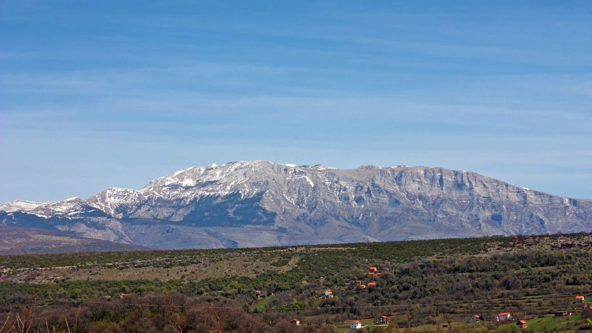
Croatia’s Section: The Heart of the Dinaric Alps
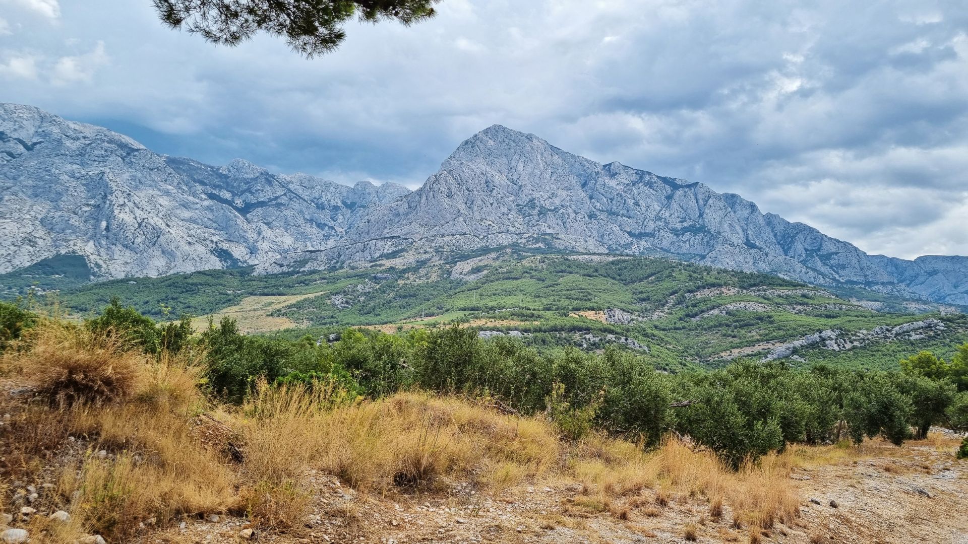
Croatia’s slice of the Via Dinarica is all about dramatic mountain scenery. From the mighty Dinara to the coastal Velebit range, the limestone karst shapes every step.
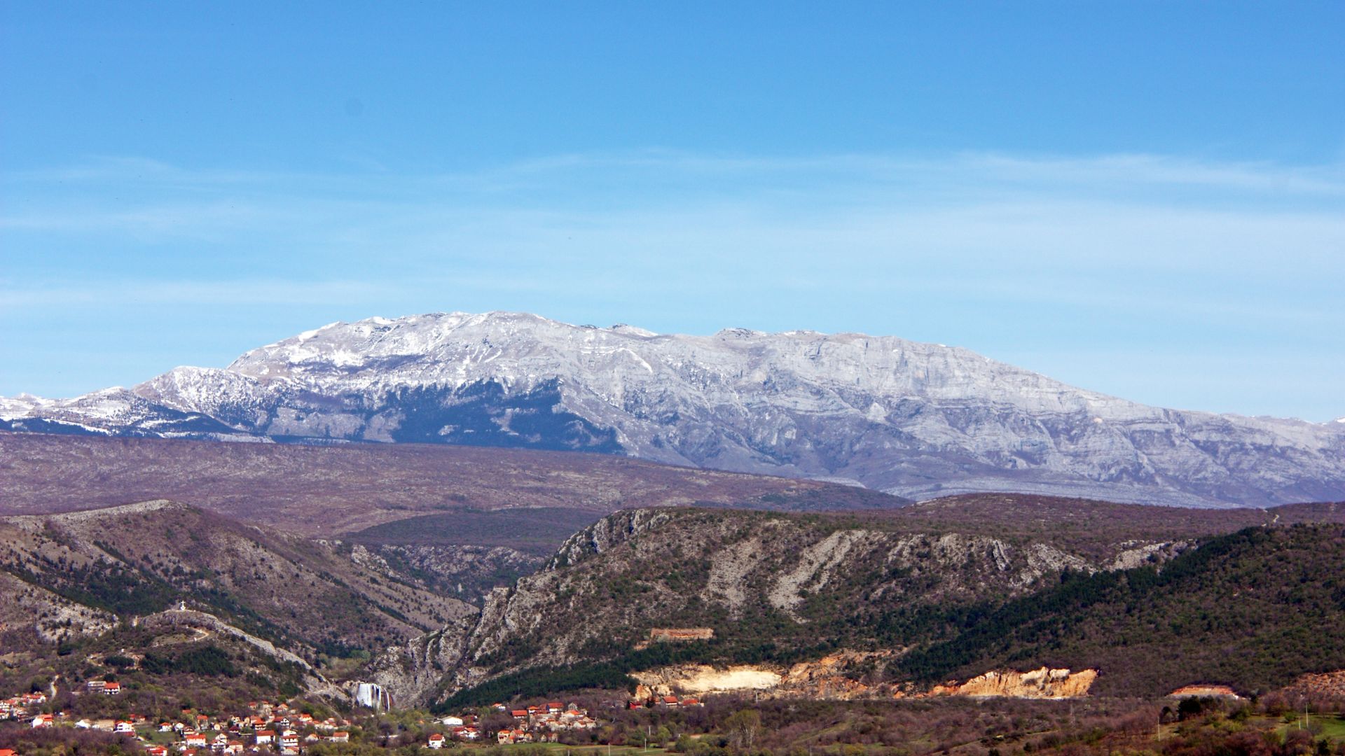
Dinara: Croatia’s Highest Peak
Mount Dinara rises to 1,831 meters, making it Croatia’s highest summit. I’ll admit, reaching the top isn’t easy, but it’s worth every drop of sweat.
Dinara straddles the border with Bosnia and Herzegovina. When you stand on the summit, you get sweeping views of the Adriatic and the endless Dinaric ridges.
Key Features:
- Elevation: 1,831m (6,007 feet)
- Difficulty: Moderate to tough
- Best season: May to October
Getting to the top means you need to be in decent shape. The trail starts in thick woods, then breaks out onto rocky limestone slopes.
The weather up here can turn on a dime. I always check the forecast and pack for surprises.
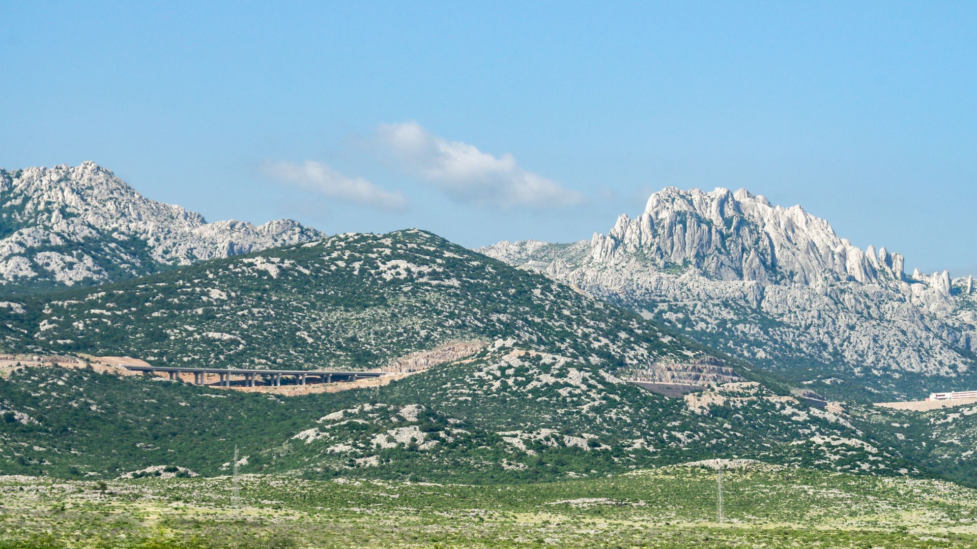
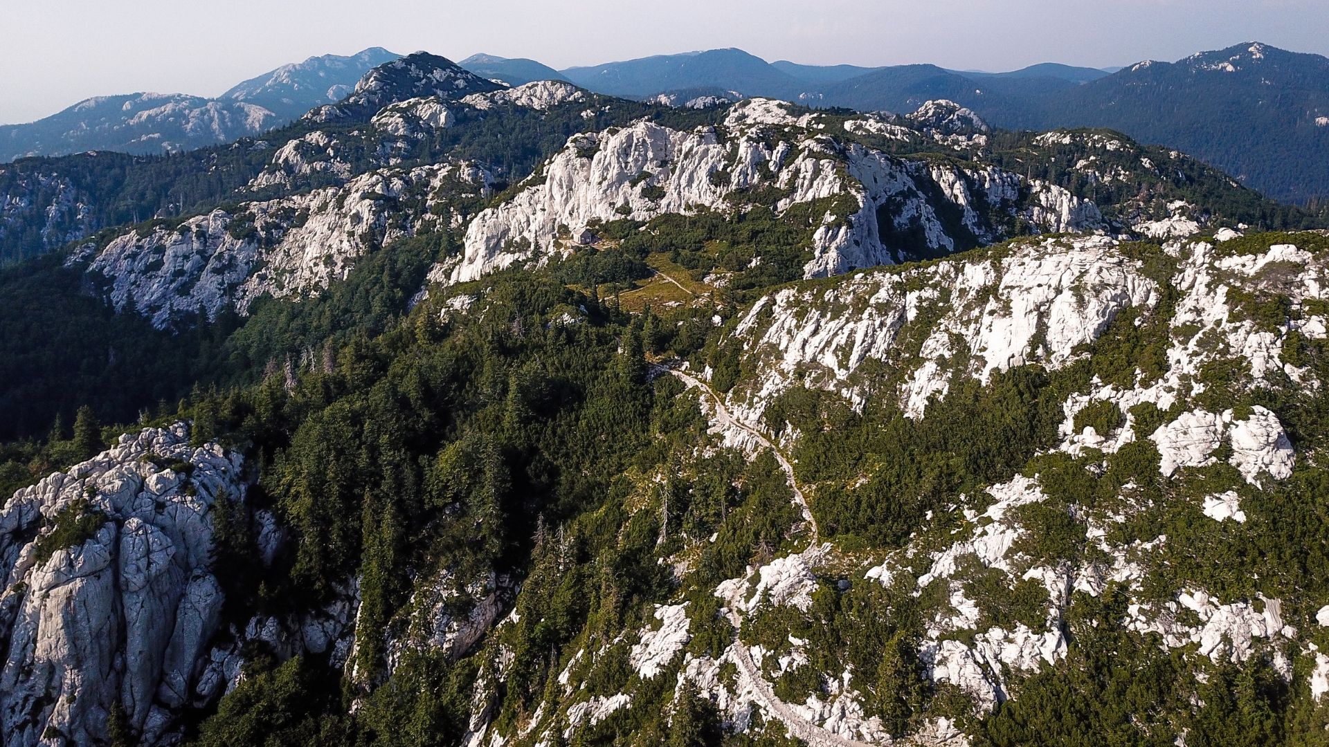
Iconic Mountain Ranges: Velebit and Risnjak
Velebit runs for 145 kilometers along Croatia’s coast. It’s a wild barrier between the inland and the sea, packed with hiking options along the Velebitski planinarski put.
Northern Velebit National Park protects the wildest parts. You’ll see deep gorges, mysterious caves, and rare plants you won’t find anywhere else.
Velebit Highlights:
- Zavižan weather station
- The stunning Premužić Trail
- Cozy mountain huts
Risnjak National Park sits in the Gorski kotar region, close to Slovenia. Its highest point is 1,528 meters.
Risnjak feels more accessible than some other peaks. Well-marked trails wind through beech and fir forests, leading to open views at the top.
You can even connect to Slovenia’s hiking trails from here. It’s perfect for cross-border adventures.
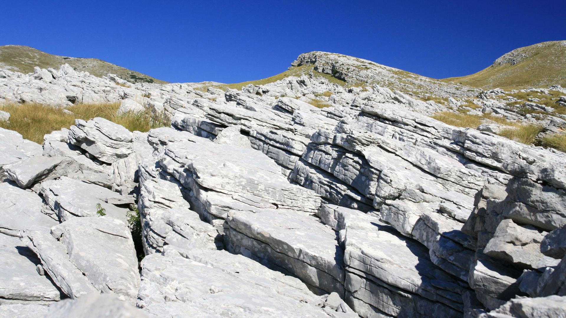
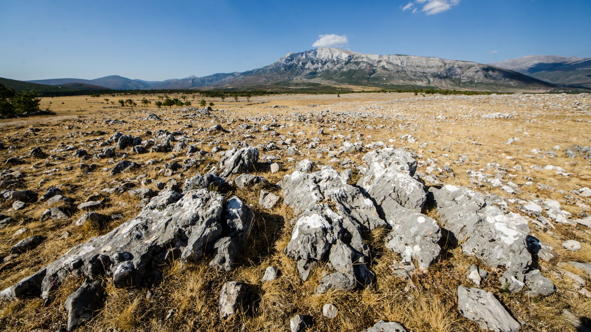
The Karst Landscapes of Croatia
Karst terrain defines hiking in Croatia’s Dinaric Alps. Over millions of years, limestone has worn away to create caves, sinkholes, and underground rivers.
The Istrian Peninsula is a classic example. Dry stone walls and tiny villages dot the landscape, surrounded by rocky outcrops.
Karst Features to Expect:
- Jagged limestone ridges
- Deep cave systems
- Seasonal streams and springs
- Sparse plants on bare rock
Water can be scarce in karst terrain. I never hit the trail without extra water, especially in summer.
The limestone gives great grip underfoot, but it’s rough on gear. Sharp rocks can chew up boots in no time.
Some trails cross big flat karst fields—locals call them “poljes.” After heavy rain, they flood, but by summer, they’re bone dry.
Trail Highlights: Parks, Canyons, and Natural Wonders
The Croatian Via Dinarica passes through some of Europe’s most jaw-dropping protected areas. From deep limestone canyons to a wonderland of lakes, you’ll see a wild diversity of mountain ecosystems.
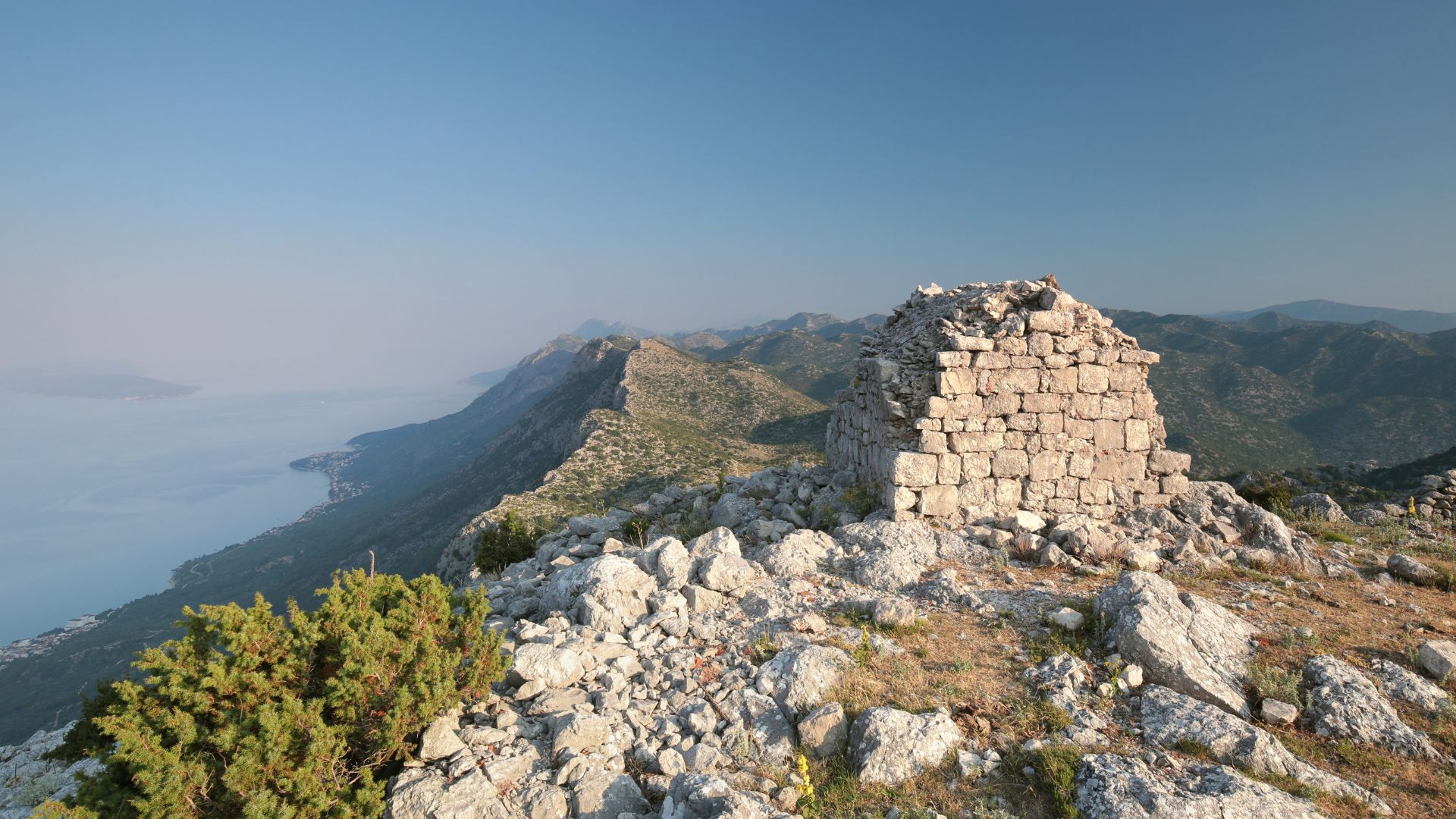
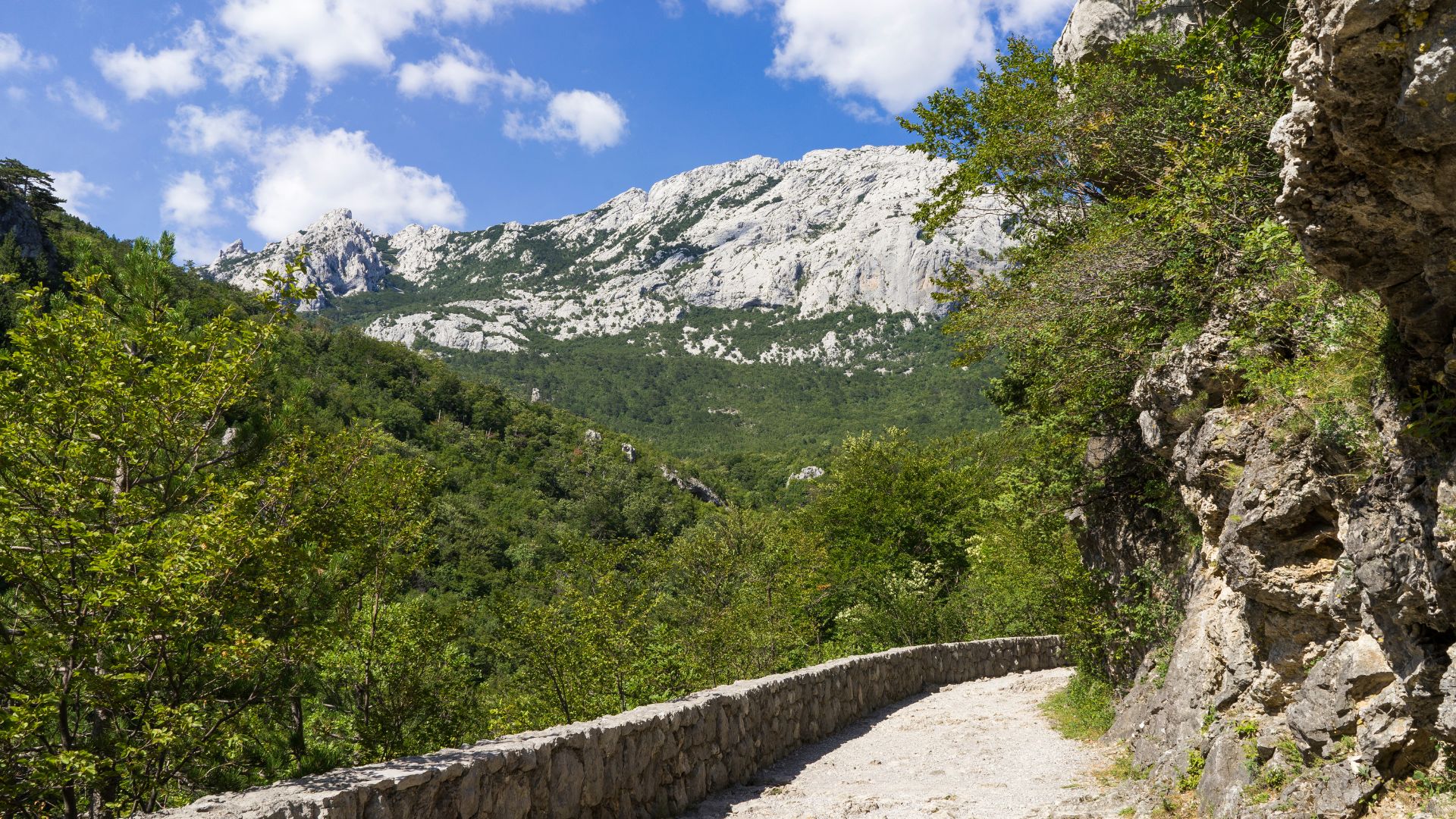
Paklenica National Park and Velika Paklenica
Paklenica National Park blew me away with its drama. The park’s two main canyons cut deep into the southern Velebit slopes.
Velika Paklenica canyon stretches for 14 kilometers and plunges to 400 meters deep. Its limestone walls close in, guiding you upstream. The entrance is easy, but the higher you go, the wilder it gets.
What stands out here:
- Over 150 kilometers of marked hiking trails
- Sheer rock faces that soar 700 meters
- Lush beech and black pine forests
- Mountain huts for overnight stops
Water is usually easy to find. The Velika Paklenica stream runs year-round, so you won’t go thirsty.
Northern Velebit and Risnjak National Parks
Northern Velebit National Park guards the highest, wildest peaks of the Velebit range. The landscape here feels rugged, raw, and a little mysterious.
There’s a botanical garden at Zavižan, perched at 1,594 meters. It’s a showcase for tough mountain plants that thrive in harsh conditions. The weather station nearby logs some of Croatia’s wildest weather.
Risnjak National Park has a different flavor. It’s inland, packed with forests and gentle peaks. Veliki Risnjak tops out at 1,528 meters.
Both parks are great for spotting wildlife. Bears, lynx, and wolves roam these hills, though I haven’t been lucky enough to see one yet.
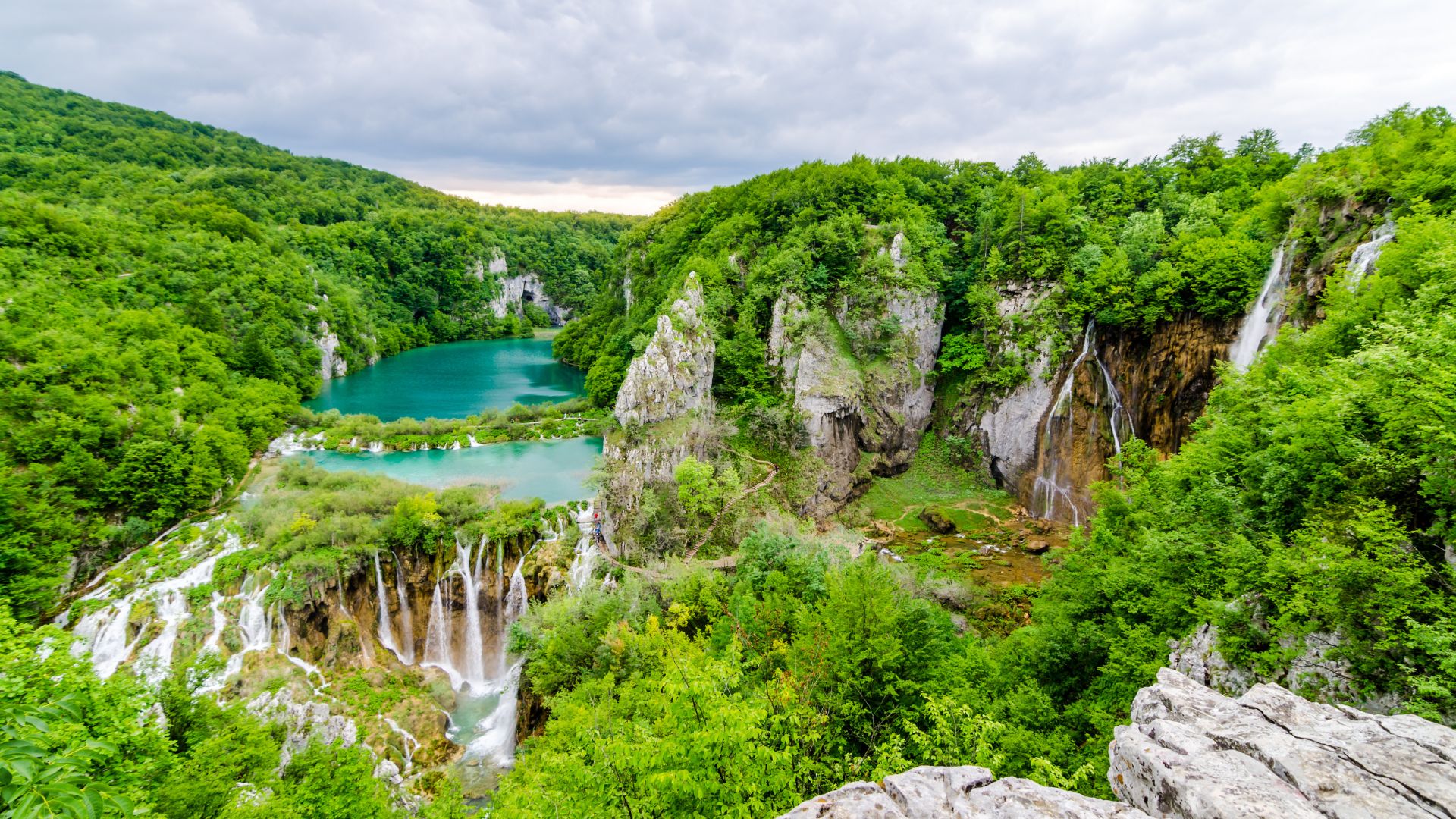
Plitvice Lakes and Krupa Canyon
Plitvice Lakes National Park is Croatia’s superstar—a UNESCO site famous for its 16 terraced lakes and tumbling waterfalls.
The lakes keep forming thanks to travertine deposits, which build up natural dams. That’s what gives the water those unreal turquoise shades.
Krupa Canyon is a quieter, less-crowded alternative. You’ll find crystal-clear pools and waterfalls tumbling over limestone steps. Perfect for a swim on a hot day.
Both spots fill up fast in peak season. If you want the best photos (and a bit of peace), hit the trails early in the morning.
Experiencing Croatia’s Mountain Soul on the Via Dinarica
The Via Dinarica lets you experience Croatia’s mountain spirit up close. Expect wild karst landscapes, sweeping coastal views, and encounters with traditional highland communities that have shaped these peaks for centuries.
Scenery and Panoramic Views
Croatia’s Via Dinarica section delivers some of Europe’s boldest mountain vistas. The Velebit Range, running parallel to the Adriatic, is especially breathtaking.
From the higher summits, you’ll spot the contrast between rugged limestone mountains and the endless blue of Dalmatia below. The views stretch out over islands and seaside towns.
Don’t miss these viewpoints:
- Zavižan peak with its 360-degree panoramas
- The overlooks along the Premužić Trail
- Paklenica’s dramatic canyon views
The trail crosses through both Paklenica and Northern Velebit National Parks. These are Croatia’s wildest, most pristine mountains.
Weather can turn fast up here. A clear morning can turn cloudy by afternoon, especially when sea breezes roll in.
Karst Topography: Sinkholes, Caves, and Limestone Formations
Croatia’s Dinaric Alps are a karst wonderland. The limestone bedrock has shaped the hiking experience in ways you won’t find elsewhere.
You’ll spot plenty of these:
- Deep sinkholes (locals call them dolinas)
- Mysterious underground caves
- Flat stone pavements, known as pločice
- Natural arches and stone bridges
Velebit alone hides more than 2,700 caves. Some trails pass right by cave mouths—bring a headlamp if you want to poke around.
Sinkholes create natural amphitheaters. In rainy seasons, they fill with water and turn into mini-lakes.
Limestone means water vanishes fast. I always stash extra water in my pack, since springs and streams can be hit or miss.
Navigation gets tricky in these valleys. Even GPS can get confused in the deep limestone folds. Sometimes, you just have to trust your instincts and the old trail markers.
Authentic Mountain Culture and Local Traditions
Mountain communities along the Via Dinarica hold onto traditions that stretch back centuries. More than once, I’ve stumbled across shepherds guiding their flocks along ancient paths that crisscross the hiking trail.
Local mountain huts dish up hearty meals like peka—that’s slow-cooked meat and veggies—and homemade cheese. Nothing beats these comforting foods after a long day, and honestly, they just make sense up here in the mountains.
Some traditional practices you’ll spot:
- Seasonal livestock migration
- Building sturdy stone walls
- Gathering wild medicinal herbs
- Predicting weather the old-fashioned way
Old shepherd routes and military paths now make up many trail sections. Hiking here, I feel like I’m walking straight through history, not just pretty scenery.
Village festivals light up the mountains with celebrations for local saints or seasonal changes. If you can, time your trip to catch one—it’s a real window into local life.
People here often talk about their deep bond with the peaks and valleys around them. That connection? It really defines what I think of as Croatia’s mountain soul.
Essential Tips for Long-Distance Hikers
If you’re tackling the Via Dinarica, prep is everything. Croatia’s mountains can be wild, and the weather changes fast.
Planning and Trail Markings in Croatia
The Via Dinarica White Trail cuts about 330 miles through some rugged mountain country. Before you go, grab the GPX tracks from the official Via Dinarica site—trust me, you’ll want them.
Trail markings can be all over the place. On the Velebitski Planinarski Put (VPP), you’ll spot white circles with red borders, which link right into the Via Dinarica system.
Keep an eye out for:
- Water sources (these can dry up in summer)
- Emergency shelters
- Border crossings
- Resupply points
I swear by the Mapy.cz app for offline navigation. It has detailed topo maps and pretty much every trail you’ll need across Croatia’s mountains.
I never hit the trail without paper maps as backup. You can pick up detailed 1:25,000 scale maps from local mountaineering clubs or national park offices.
Safety and Weather Considerations
Croatia’s mountains love to surprise you with sudden weather shifts, especially above 1,500 meters. Even in summer, I always pack rain gear and warm layers.
Lightning is a real threat on exposed ridges. I start hikes early to dodge afternoon storms, and if thunder rolls in, I turn back right away.
Don’t forget these essentials:
- Emergency whistle
- First aid kit
- Headlamp (bring extra batteries)
- Emergency bivvy sack
May to September usually gives the best weather. July and August get scorching down low, but it’s perfect up above the treeline.
Mountain rescue teams here know their stuff, but in remote spots, help might take a while. I always let someone know my route and when I plan to return.
Accommodation and Logistics
Mountain huts (planinarski domovi) dot most Via Dinarica sections in Croatia and make great shelters. I usually don’t need reservations, but during peak season, I call ahead just in case.
Hut prices run 10-25 euros a night. Most serve simple meals and have a few basics for sale. Bring cash—euros or kunas—since cards aren’t really a thing up here.
Wild camping is fine above treeline in most areas. I skip camping in national parks, though, since rules are stricter there. Always stick to leave no trace—locals care deeply about their mountains.
You can resupply in towns like:
- Ogulin
- Gospić
- Senj
I usually carry three or four days’ worth of food between resupplies. Local shops have the basics, but if you want anything fancy, buy it before you head into the hills.
ATMs show up in bigger towns, but once you’re in the villages, cash is king.
Beyond Croatia: Linking to the Balkans
The Via Dinarica stretches from Croatia into six other Balkan countries. Nearly 2,000 kilometers of trails connect you with wild peaks, deep canyons, and tucked-away villages.
Extending the Journey to Bosnia and Herzegovina
Bosnia and Herzegovina offers up some of the most rewarding parts of the Via Dinarica. You can walk straight from Croatia into the heart of the Dinaric Alps.
The trail takes you up Maglic peak at 2,386 meters—Bosnia’s highest. The climb is tough, but the views across three countries? Absolutely worth it.
Sutjeska National Park is packed with ancient forests and war memorials. Camping is legal here, and the wilderness feels untouched.
Near Mostar, the trail winds through limestone peaks and Mediterranean plants. The city itself sits just off the route, and it’s worth a side trip.
Sarajevo is a solid resupply stop. The city, famous for hosting the 1984 Winter Olympics, has plenty of places to stay and stock up.
Bjelasnica mountain offers day hikes right from Sarajevo. Those old Olympic ski slopes? Now they’re hiking trails with killer views.
Highlights in Montenegro, Kosovo, and Albania
Montenegro is all about drama—mountain drama, that is. Durmitor National Park alone has 23 peaks soaring over 2,000 meters.
Between hikes, you can raft the Tara River. This UNESCO site slices through Europe’s deepest canyon, dropping 1,300 meters.
At the three-border point where Montenegro, Albania, and Kosovo meet, you’ll find a mash-up of languages and customs. Crossing borders here feels almost surreal.
Kosovo’s Sharr Mountains are rugged, with 23 peaks over 2,500 meters. Navigation gets tricky, so confidence and self-sufficiency matter.
Albania’s northern ranges? Still some of Europe’s wildest. Permits are needed for certain zones, and I always pack extra food—shops are rare.
The route through Mavrovo National Park in North Macedonia wraps up the southeastern leg. If you’ve made it this far, you’ve earned some serious bragging rights.
Dinaric Alps: From Slovenia to the Adriatic Coast
The Dinaric Alps stretch 645 kilometers, starting in Slovenia’s Julian Alps and winding all the way down to Albania’s wild coastal mountains.
You could hike the full length, but honestly, most folks just pick a country or two and dive in where it feels right.
Slovenia stands out for its well-developed trail system. Mountain huts pop up every 15-20 kilometers, making overnights a breeze if you don’t fancy camping.
The White Trail acts as the backbone for all seven countries along the range. If you’re feeling ambitious, the whole thing takes about 3-4 months.
Blue and Green Trails split off toward the Adriatic. These are shorter—think 2-3 weeks each—so they’re perfect if you can’t take off for a whole season.
You can jump onto the trails from several cities. Ljubljana, Zagreb, Sarajevo, and Podgorica all have airports and good trail access.
Along the way, you’ll walk old shepherd paths and ancient trade routes. There’s something wild about following in the footsteps of travelers from centuries ago.
Weather’s best from June through September. Once October rolls around, snow usually shuts down the higher passes.
If you’re dreaming of epic mountain views and a taste of Balkan adventure, the Dinaric Alps just might be calling your name.