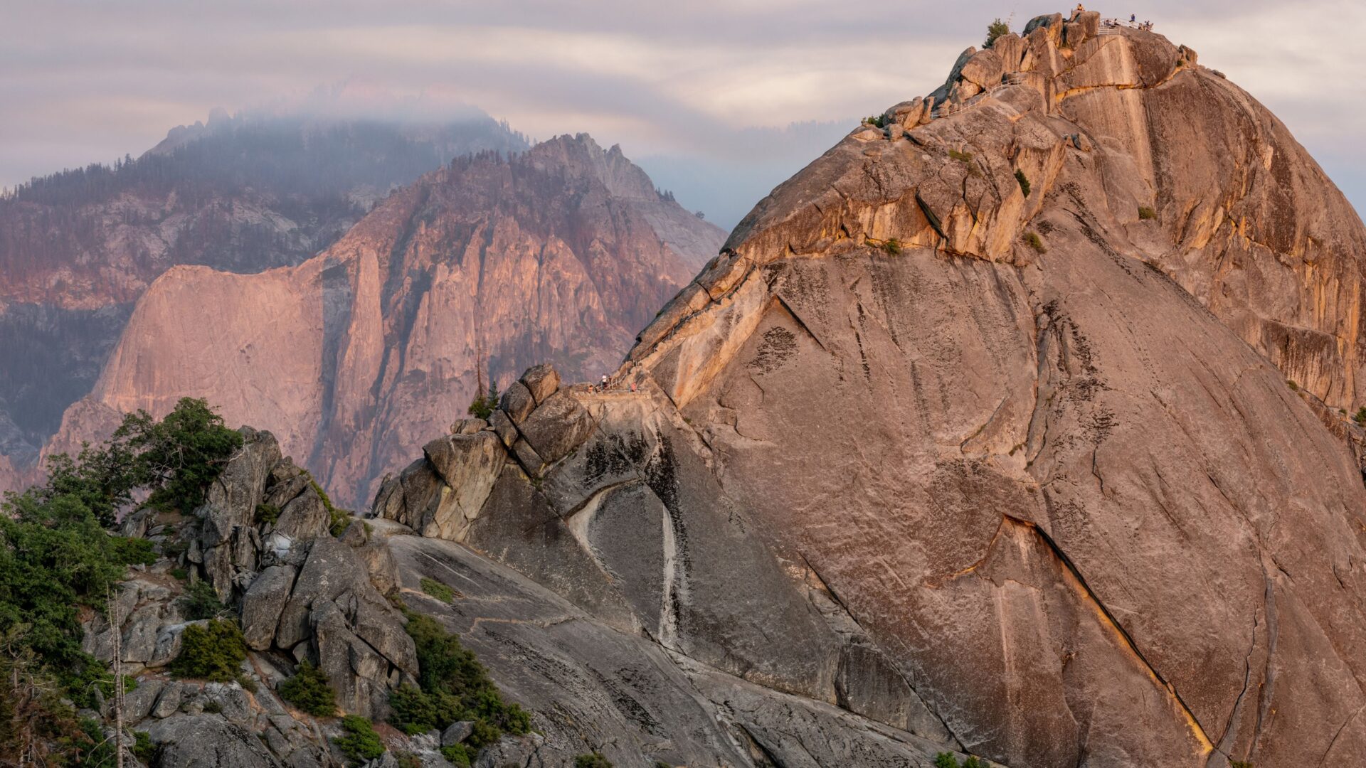
The first time I saw Moro Rock looming above the highway in Sequoia National Park, I just knew I had to climb it. This iconic granite monolith sits at 6,725 feet and offers one of the park’s most accessible—and honestly, thrilling—hikes.
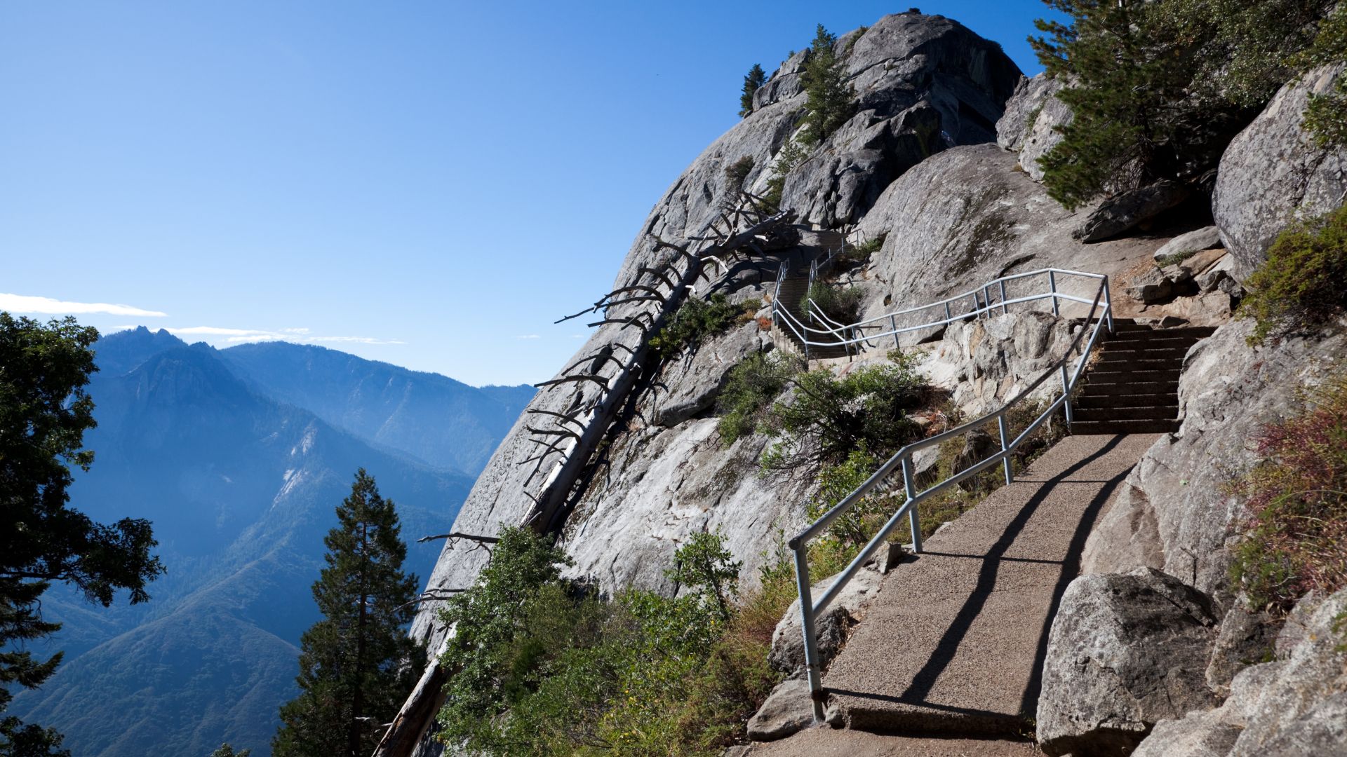
You’ll tackle 350 stone steps carved right into the granite, gaining 300 feet of elevation in just a quarter mile. The hike’s short, but don’t be fooled; the steep grade and exposed sections really get the heart pumping. The reward? Jaw-dropping views of the Great Western Divide and the Sierra Nevada peaks that make every step worth it.
That climb up Moro Rock ended up being one of the highlights of my entire Sequoia trip. The mix of adrenaline, steep stairs, and those panoramic summit views gives you an adventure you won’t soon forget.
Overview of Moro Rock and the Granite Dome Ascent
Moro Rock stands as a massive granite dome, shaped by geological forces over millions of years. This formation tells the story of the Sierra Nevada and gives hikers a front-row seat to the Great Western Divide.
The Unique Geology of Moro Rock
Moro Rock is an exfoliating granite dome perched at 6,725 feet. Magma cooled deep underground eons ago to create this giant.
What makes it truly interesting is how the granite peels away in curved sheets, kind of like an onion. This process, called exfoliation, smooths out the surface I climbed on.
Quartz, feldspar, and mica crystals make up the rock’s unique look. These minerals formed slowly as the Sierra Nevada batholith cooled below the surface.
Over time, erosion swept away the softer rocks around it. Now the granite core stands tall above the forest.
Granite Dome Formation and Geological Significance
Plutonic intrusion created the dome. Molten rock pushed up into older rock layers around 100 million years ago, back in the Cretaceous period.
As the magma cooled, it turned into granite. The weight from above created cracks and joints in the rock.
Uplift and erosion over millions of years finally brought the granite into the open. When the pressure above eased, the rock expanded and cracked along curved lines.
This sheeting process hasn’t stopped. I noticed fresh granite where outer layers had just fallen away. The dome keeps getting smoother and rounder as the centuries pass.
Moro Rock’s Relationship with the Great Western Divide
Moro Rock sits in the perfect spot for checking out the Great Western Divide. This range runs north-south, slicing through the Sierra Nevada and splitting watersheds.
From the summit, I could spot the divide’s peaks stretching out in both directions. Some mountains here soar above 12,000 feet, making a dramatic, rugged skyline.
The rock’s location in the Giant Forest area puts it right where you want to be for views. At 6,725 feet, it rises above the trees but doesn’t quite reach true alpine territory.
This makes Moro Rock a natural lookout. As soon as you climb above the treetops, those massive peaks come into view.
Planning Your Climb: Essential Information
Climbing Moro Rock takes a bit of planning. The trail shuts down in winter, and summer crowds can turn parking into a headache if you’re not prepared.
Best Time of Year to Climb Moro Rock
If you want ideal conditions, aim for late May through early October. Snow and ice close the trail completely in winter.
Summer (June-August) is reliable for weather, but also brings the biggest crowds. I’ve learned that getting there before 9 AM makes all the difference—fewer people and cooler air.
Late spring and early fall—think May and September—are my favorite times. The weather’s great, crowds thin out, and those views? Still spectacular.
Winter? Forget it. The road closes, and the steps turn into a slippery, icy mess.
Access, Parking, and Shuttle Logistics
You’ll need to figure out Sequoia’s seasonal transport system to reach Moro Rock. The trailhead sits a mile from the Giant Forest Museum, right on Moro Rock/Crescent Meadow Road.
In summer, a shuttle runs from the museum to the Moro Rock lot. On weekends, the road closes to private cars, so the shuttle becomes your only way in.
During the week, you can drive yourself, but the lot is tiny. I always try to arrive before 8 AM during busy months to snag a spot.
If you have an accessible parking placard, you can drive the full route any time the road’s open, even when it’s closed to other vehicles.
Trail Conditions and Weather Considerations
The entire trail is a 350-step granite staircase with handrails. You don’t need hiking boots, but I always pick shoes with decent grip.
Weather can shift fast at 6,725 feet. I’ve learned to bring layers, even on warm days—summer storms can roll in out of nowhere.
Steep drop-offs run alongside the whole route. If you bring kids, keep them close and hold those handrails, especially if it’s windy. Wet granite gets slippery fast.
Morning climbs are best for photos and cooler temps. By midday, the sun turns the stone into a frying pan.
Step-by-Step Ascent Experience
Climbing Moro Rock means taking on 350 steep stone steps, all carved right into the granite. A little prep and some caution go a long way here. Each section of the climb brings its own little victories—and challenges—as you make your way to the top.
Navigating the 400 Steps to the Summit
The staircase starts right at the parking lot. The first 100 steps wind gently around the base, and they’re not too bad.
Steps 100 to 250 get steeper and a bit uneven. My legs definitely felt the burn here.
Climbing highlights:
- Steps are cut straight into the granite
- Handrails are there the whole way
- Rest spots pop up every 50-75 steps
- You’ll climb about 300 vertical feet
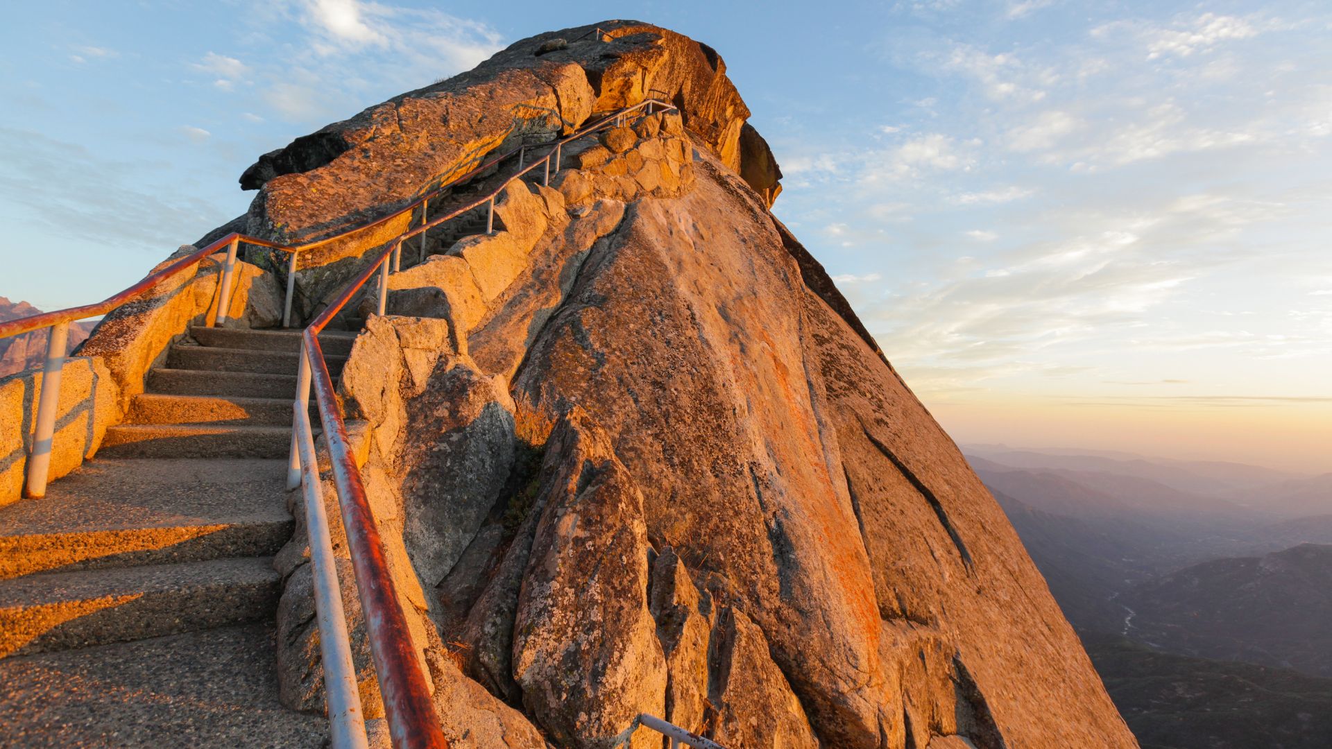
The last 100 steps? That’s where things get real. The granite smooths out and the trail feels more exposed. I took a couple of breathers here.
Weather really changes the climb. Wet granite turns slick, and on hot days, the stone practically radiates heat.
Safety Measures and Trail Difficulty
Handrails run the length of the staircase. I kept a grip, especially when the wind picked up.
A few safety reminders:
- Steep drop-offs line the trail
- Kids need close supervision
- No big barriers between you and the edge
- Weather can flip quickly at this height
The park closes the trail in winter for good reason—ice and snow make it treacherous. I’ve seen people try it in sandals or dress shoes. Not a good idea.
Near the summit, the wind really picks up. I had to steady myself against gusts more than once.
Difficulty: I’d call it moderate to strenuous, thanks to the steep grade and exposure. No special climbing skills needed, just a bit of grit.
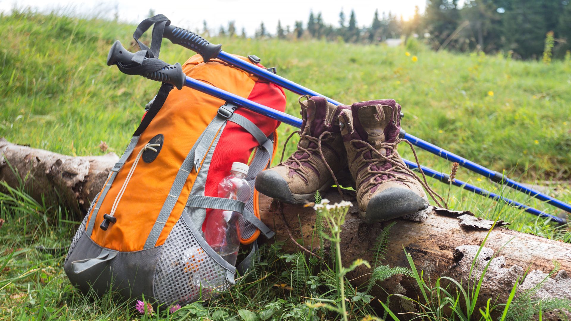
What to Bring and How to Prepare
I like to pack light, but I never skip the essentials. Water is a must, even though the hike’s short.
My go-to packing list:
- 16-20 oz water bottle
- Grippy hiking shoes or boots
- Sun hat and sunscreen
- Phone or camera for those summit pics
- Small snack for an energy boost
Good footwear matters most. I wear boots with sticky soles for the granite.
If you want to prep your legs, try some stairs before your trip. The constant uphill is different from a regular hike.
At this altitude, some folks feel lightheaded. I just slow down and take deep breaths if that happens.
Avoiding Crowds and Maximizing Comfort
Early mornings are the secret. I try to get to the lot by 7 or 8 AM to dodge crowds and the worst of the heat.
Best times:
- Months: April-June or September-October
- Hours: 7-9 AM or 4-6 PM
- Skip: Weekends and holidays if you can
After 10 AM, parking is tough. I’ve waited half an hour or more for a spot on busy days.
In summer, the free shuttle runs from the museum when the road’s closed to cars on weekends.
Cloudy mornings or early starts keep the granite cooler. By afternoon, thunderstorms can roll in fast.
If someone’s moving faster, I step aside at rest areas. It keeps things pleasant for everyone.
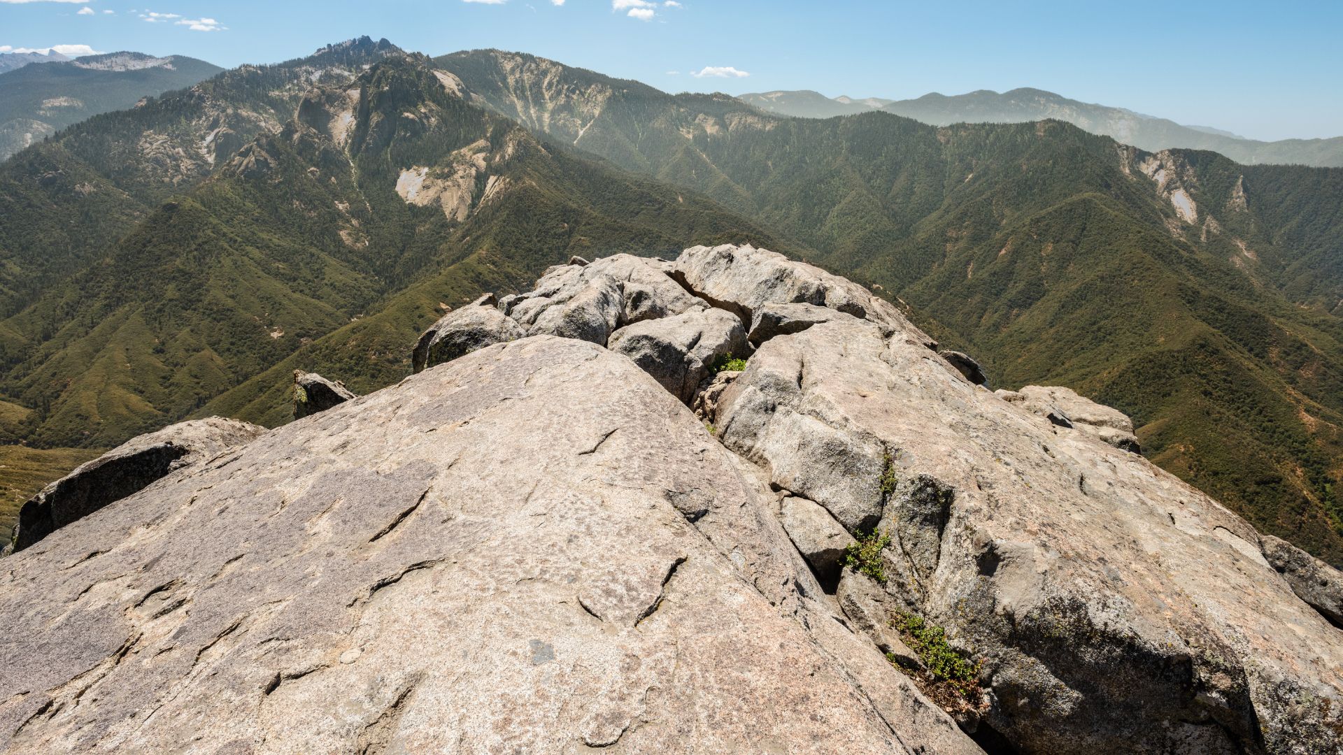
Reaching the Summit: 360-Degree Views of the High Sierra
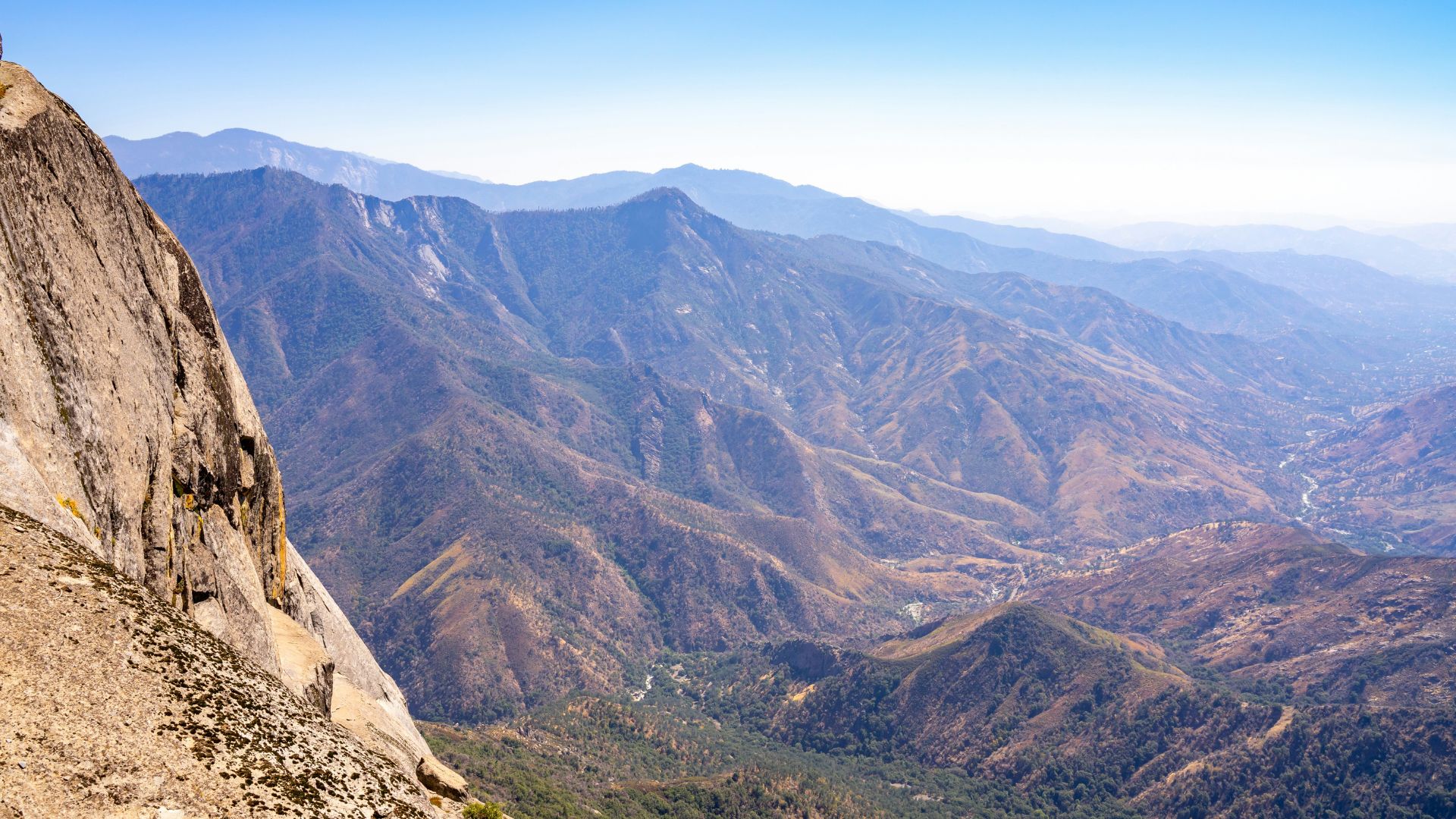
Standing at the top, you get these wild, sweeping views across Sequoia National Park. From the Great Western Divide’s peaks to the flat San Joaquin Valley, the panoramic vistas up here really show off the Sierra Nevada’s rugged beauty.
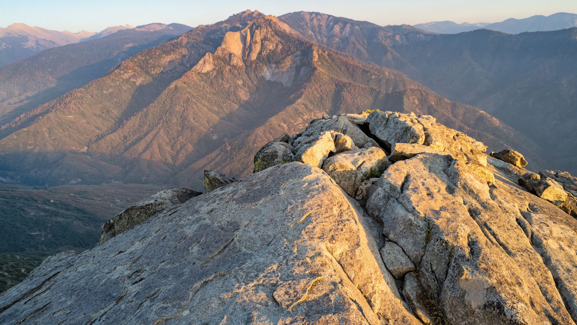
Vistas of the Great Western Divide
The east-facing view steals the show. The Great Western Divide runs down the middle of the park, and from up here, you see its peaks stretching on and on.
I spotted snow-capped summits lining the horizon. The divide splits the park’s eastern and western halves in a way that’s easy to appreciate from above.
Alta Peak and Mount Silliman stand out. They shoot up from the granite landscape below.
Morning light makes these ridges glow. I watched the shadows drift as the sun climbed higher.
The contrast between dark granite and bright snow is just…wow. That view alone makes the climb worth it.
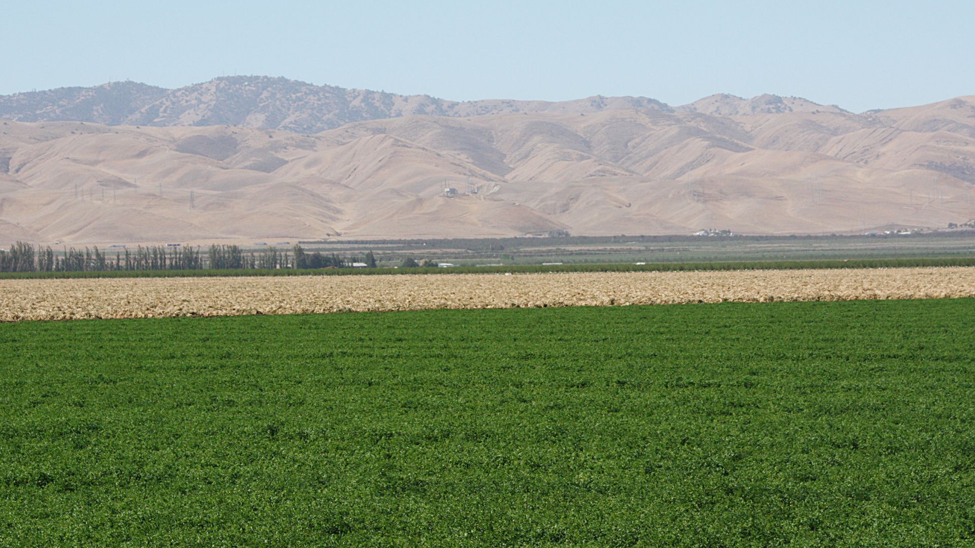
Views of the Sierra Nevada and San Joaquin Valley
Looking west, the San Joaquin Valley sprawls out below. It’s a huge, flat patchwork of farms, stretching all the way to the Coast Range.
From up here, the valley floor is about 7,000 feet down. On a clear day, you can see for more than 100 miles.
To the north, the Giant Forest spreads out under your feet. I traced the path of Generals Highway as it zigzags up the canyon walls.
The sequoia groves look like little green islands from this height. Hard to believe those trees are giants.
If you look south, you’ll spot more granite domes and forested valleys. The Sierra’s western slope rolls away in hills and canyons.
Photography Tips at the Top
The summit’s a dream for photographers, no matter the time of day. I get my favorite shots at sunrise or just before sunset.
Best photo times:
- Sunrise: 6:00-8:00 AM
- Golden hour: About an hour before sunset
- Moonrise: Check the lunar calendar for timing
Wide-angle lenses capture the full panorama. A polarizing filter helps cut haze and brings out the contrast.
The granite makes a solid spot for a tripod, but the wind can get wild—secure your gear.
Layer the mountain ridges in your shots for depth. Granite in the foreground adds texture.
Cold mornings drain camera batteries fast. I learned to bring extras the hard way.
Exploring Surrounding Sights and the Giant Forest
The Giant Forest around Moro Rock is packed with some of the world’s largest trees and easy-to-explore sequoia groves. Nearby, Crescent Meadow and Tunnel Log offer gentle walks among the giants, and the whole area buzzes with wildlife and unique Sierra plants.
The Giant Forest and Its Giant Sequoias
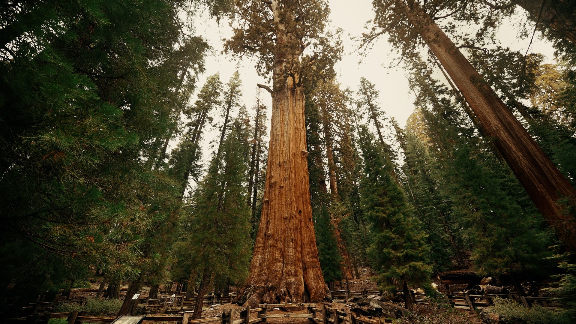
The Giant Forest sits right in the heart of Sequoia National Park. You’ll find more than 8,000 giant sequoias here—honestly, it’s a little overwhelming at first.
When I wandered in, the General Sherman Tree was hard to miss. It’s just 2 miles from Moro Rock and towers at 275 feet, with a base so wide I could barely wrap my head around it—30 feet across!
The Giant Forest Museum always draws me in before I set out for longer hikes to Moro Rock. It’s smack in the middle of the grove, making it a convenient spot to start exploring. Inside, I picked up all sorts of facts about how these ancient trees manage to survive and thrive.
Key Giant Forest Features:
- Over 8,000 mature giant sequoias
- Trees between 1,500 and 3,000 years old
- Easy paved trails that link the main groves
- Shuttle service during the busy season
The forest floor surprised me by how open it feels. Park rangers actually set controlled fires here on purpose. Turns out, giant sequoias need fire to reproduce, and burning sections keeps the sunlight coming in by clearing out smaller trees.
Nearby Trails: Crescent Meadow and Tunnel Log
Crescent Meadow Trail is just 3 miles from Moro Rock. It’s an easy 1.6-mile loop, winding through quiet meadows and—no surprise—more giant sequoias.
John Muir once called Crescent Meadow “the gem of the Sierra,” and I get why. The trail stays flat and paved, which makes it a relaxing walk. If you visit between June and August, wildflowers pop up everywhere.
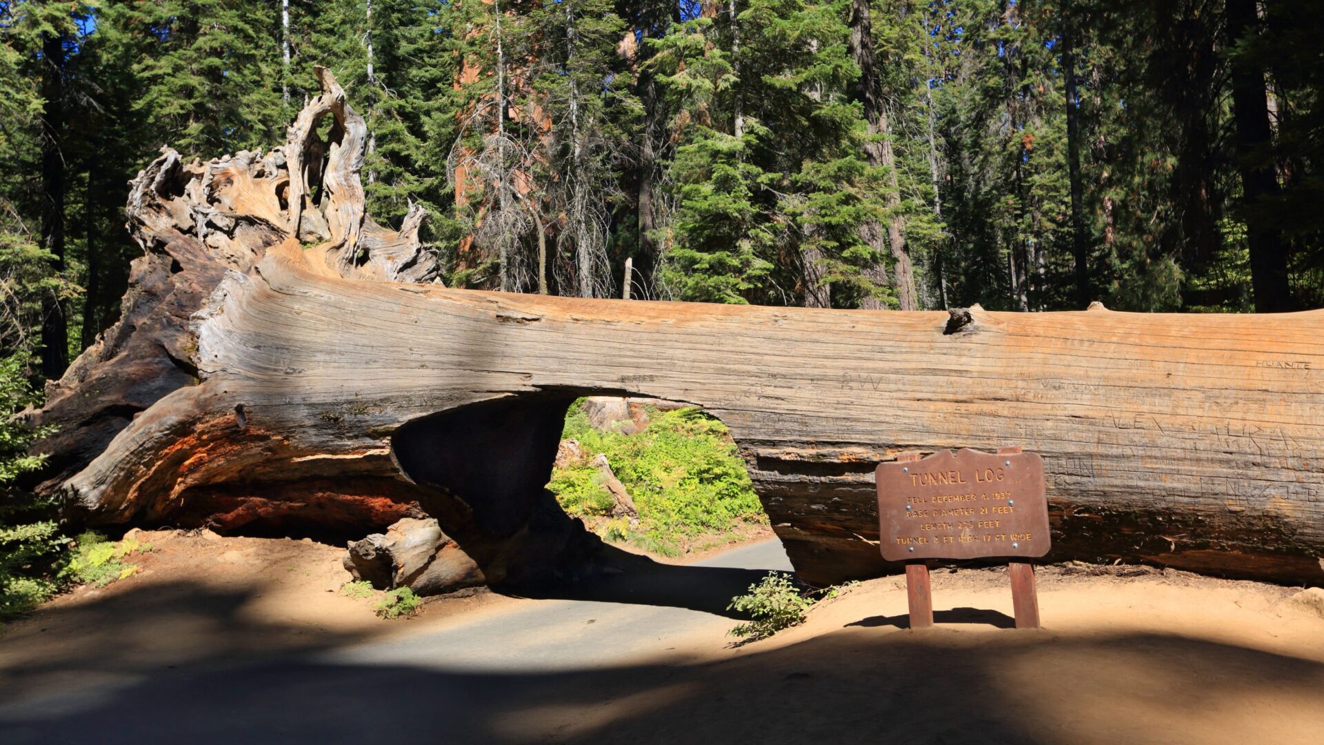
You can’t really miss Tunnel Log if you’re driving to Moro Rock. This massive fallen sequoia was hollowed out back in 1938, so cars could pass right through.
The log itself stretches 275 feet long and 21 feet wide. Sometimes I just walk through it when there’s no traffic. It toppled over during a winter storm in 1937—nature can be wild.
Other Notable Nearby Trails:
- Big Trees Trail (1.3 miles, paved loop)
- Congress Trail (2.1 miles, links several named groves)
- Sunset Rock (1 mile, another granite dome with a great view)
Wildlife and Flora Along the Trail
Black bears wander around the Giant Forest all the time. I’ve bumped into them a few times, especially when they’re busy digging for acorns or snuffling through berries near the big sequoias.
Common Wildlife I’ve Encountered:
- Black bears (they love the meadows)
- Mule deer, usually grazing in open spots
- Steller’s jays shouting from the branches
- Chipmunks and ground squirrels darting around
The forest feels alive with more than just the famous sequoias. White fir and sugar pine trees squeeze into the spaces between the giants, adding their own character to the woods.
Understory Plants:
- Manzanita bushes, all twisty with red bark
- Chinquapin, which has those quirky, spiky seed pods
- Dogwood trees—catch them in spring when the white flowers pop
- Bracken ferns, always hiding out in the shade
If you come in spring, wildflowers light up the clearings. Lupine, paintbrush, and bear grass start blooming in May and keep going into July.
The elevation here hovers between 6,000 and 7,000 feet. This altitude seems just right for the giant sequoias and all their Sierra Nevada neighbors to flourish.