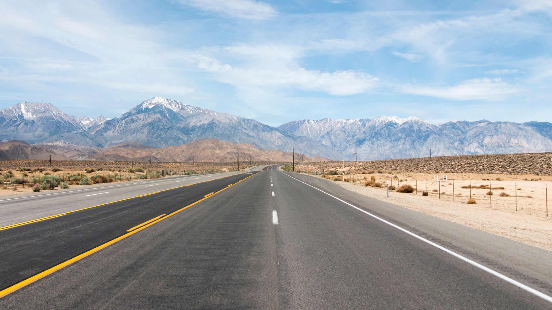
Highway 395 hugs California’s eastern edge, and honestly, it might just be the most jaw-dropping drive in the state. This route winds through the wild “backside” of the Sierra Nevada, far from the crowded western slopes that everyone seems to flock to.
On my drive from Mammoth Lakes to Mono Lake, I watched the scenery shift from towering peaks to crystal-clear alpine lakes and vast desert landscapes. Around each bend, the landscape changed so much, I kept pulling over just to stare.
The eastern Sierra is rugged, sure, but still super accessible for anyone who loves the outdoors. I explored ancient volcanic formations, soaked in natural hot springs, and snapped more photos than I probably should admit.
This road trip covers everything from snowy mountains to strange desert lakes. I stumbled upon hidden gems, figured out some must-know travel tips, and found endless trails and photo ops along the way.

Why Drive the Eastern Sierra Scenic Drive (Highway 395)?
The Eastern Sierra Scenic Drive packs some of California’s most spectacular mountain views into a 200-mile stretch. You’ll see wild geology, crazy landscapes, and—bonus—the roads are in great shape.
Unique Route Highlights
I’ve driven a lot of scenic routes, but Highway 395 just hits different. The variety of natural wonders here is wild.
You’ll cruise past ancient bristlecone pines—some are nearly 5,000 years old. That’s twice as old as the coastal redwoods, which kind of blows my mind.
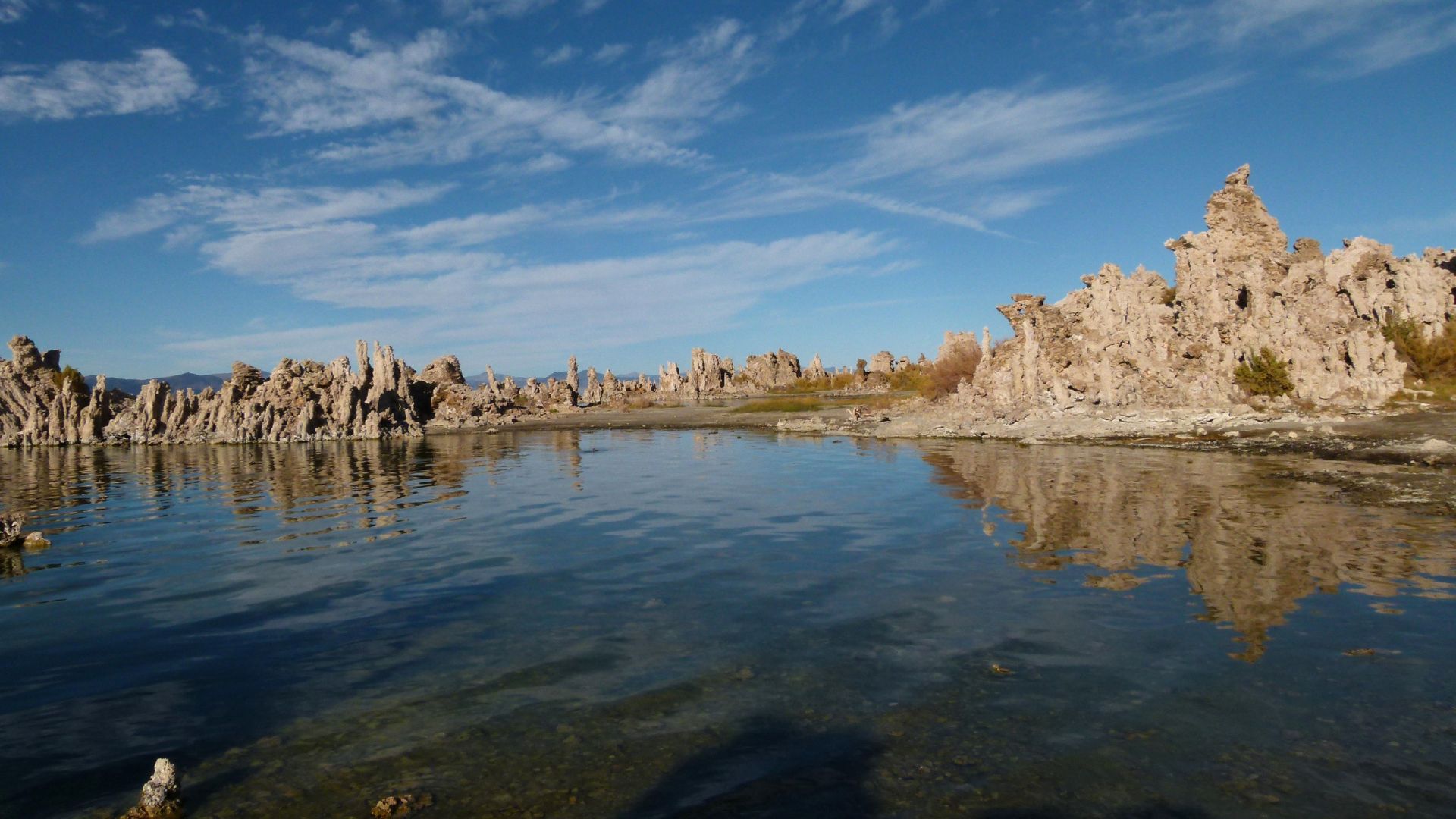
Mono Lake is hands-down one of the weirdest, coolest stops. This ancient, salty lake has these wild limestone spires called tufa towers, and the birdlife is off the charts.
The Alabama Hills? Total movie set vibes. Those round granite boulders with Mount Whitney looming behind them have starred in Westerns since the 1920s.
Natural hot springs pop up all over the Eastern Sierra. You can easily reach places like Travertine Hot Springs or Wild Willy’s Hot Springs right from the highway.
You’ll also drive by Manzanar National Historic Site. It’s a sobering stop—a former World War II internment camp that preserves a tough chapter of American history.
Geological and Scenic Diversity
The Eastern Sierra is basically a geology nerd’s dream. Mount Whitney, at 14,505 feet, towers over the western skyline for miles.
As you head north, the landscape flips from high desert to alpine meadows to volcanic fields. The contrast between the dry Owens Valley and the snowy Sierra peaks is just unreal.
Volcanic activity left its mark everywhere. You can spot:
- Mammoth Mountain’s volcanic dome
- The steaming pools of Hot Creek
- Mono Craters’ volcanic chain
- Obsidian Dome’s sharp black glass
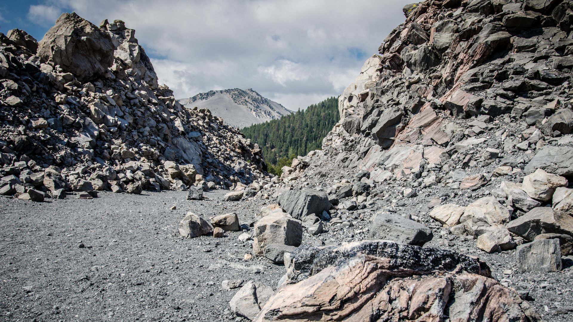
Ancient lakes once covered this whole area. Now, places like Fossil Falls show where glacial runoff carved through volcanic rock thousands of years ago.
Driving Conditions and Accessibility
Highway 395 is a breeze to drive most of the year, but winter does make things interesting. The main highway stays open, though some side roads get snowed in.
You don’t need a big truck or anything fancy—most cars can reach all the good stuff. Trailheads and viewpoints are usually just minutes off the highway.
Summer driving tips:
- Bring extra coolant for those long climbs
- Turn off the A/C on steep grades
- Don’t let your gas tank drop below half
Winter advice:
- Pack tire chains and practice using them
- Check road conditions before you go
- Stash emergency snacks, water, and warm layers
The drive itself might only take 4-6 hours, but honestly, give yourself 2-3 days to really soak it all in. Towns like Bishop, Mammoth Lakes, and Bridgeport have most of the essentials—gas, food, and cozy places to crash.

Must-See Stops Along Highway 395
Three main stops stand out, and each one’s got its own vibe—alpine adventures, wild volcanic landscapes, and a mountain loop that’s pure eye candy.
Mammoth Lakes
Mammoth Lakes makes a killer base for exploring the volcanic side of the Sierra. Sitting at 7,880 feet, the town buzzes with activity year-round.
Devil’s Postpile National Monument was my first stop. These 60-foot basalt columns look almost too perfect, like nature’s own Lego set. The trail to the formation is a quick, easy 0.4 miles.
Rainbow Falls is just another 1.2 miles down the trail. The 101-foot waterfall throws rainbows in the mist if you catch it around midday. The hike there is mostly downhill, which means you’ll feel it on the way back.
Mammoth Mountain looms over everything. I hopped on the gondola to the summit—at 11,053 feet, the views go on forever. It’s $39 for adults, but it’s worth every penny if you ask me.
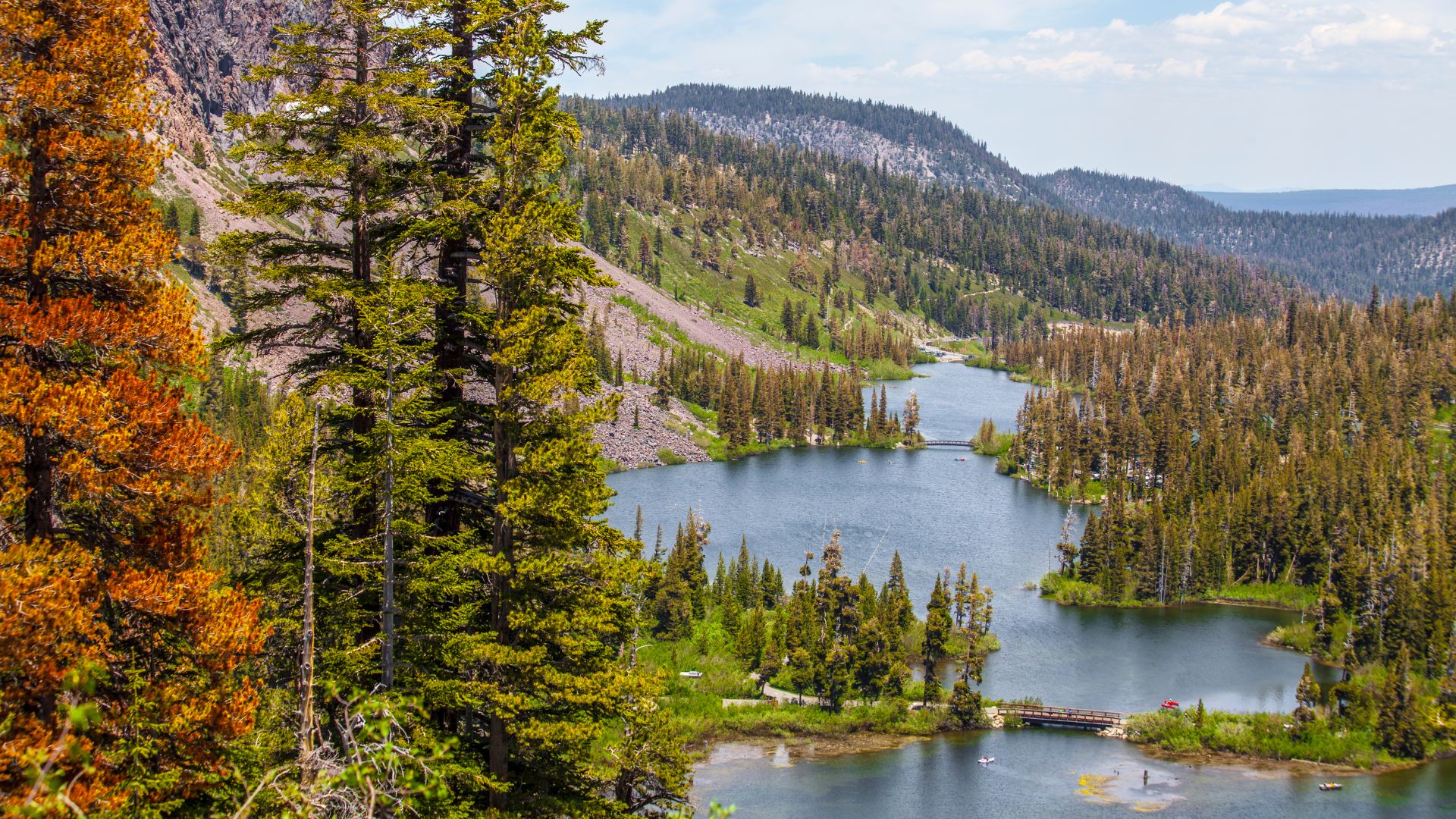
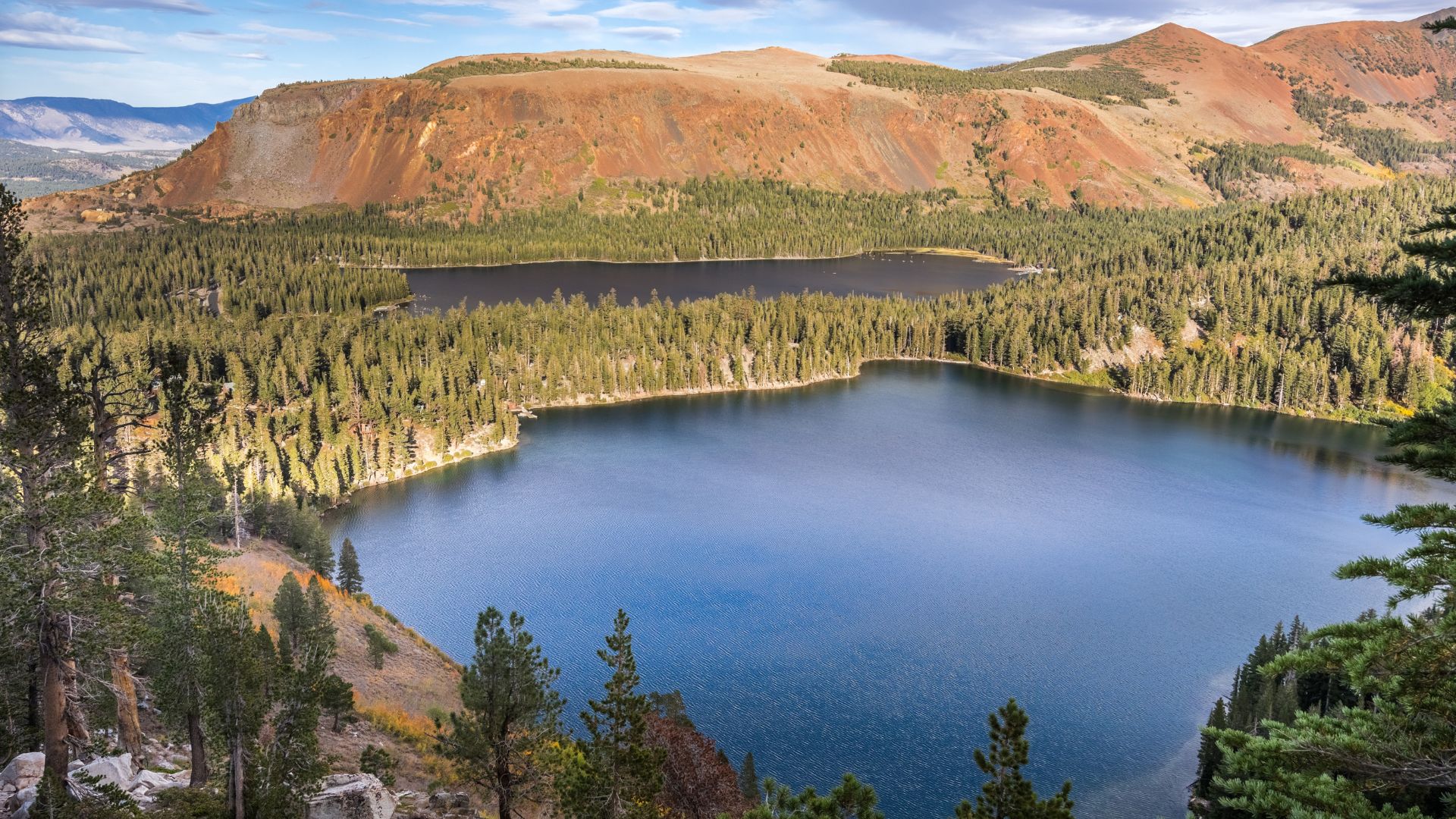
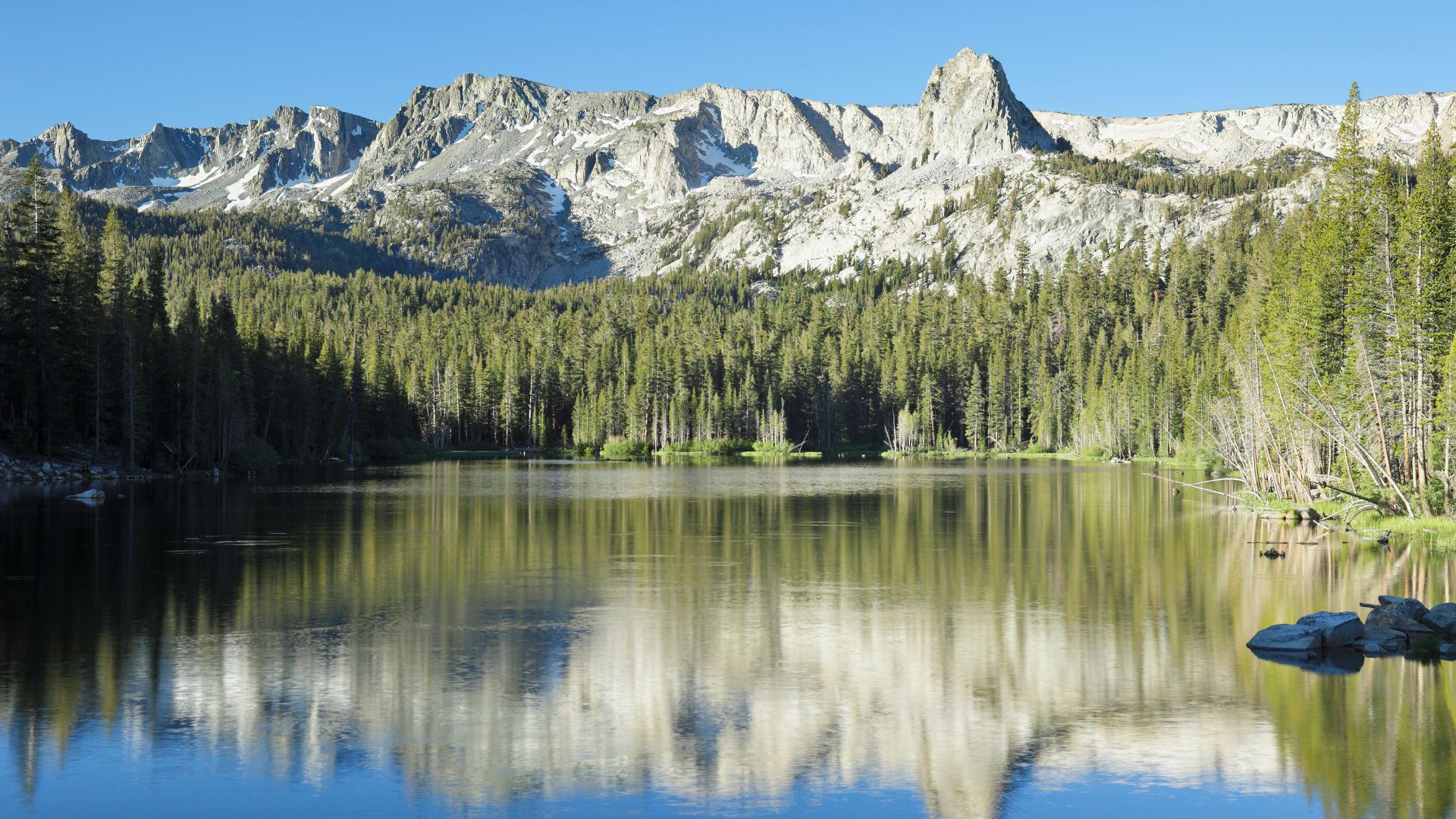
The Lakes Basin is dotted with alpine lakes. I drove out to Lake Mary and Lake Mamie. Both are perfect for fishing, kayaking, or just wandering the shoreline.
Mono Lake
Mono Lake honestly stopped me in my tracks. This ancient salt lake is 760,000 years old and three times saltier than the ocean. Wild, right?
The tufa towers are the main draw. These bizarre limestone formations grew underwater when springs mixed with the salty lake. The 1-mile South Tufa Trail has the best views, and it’s an easy walk.
Panum Crater sits on the south shore. It’s a 600-year-old volcanic crater, and the short hike to the rim only takes about 30 minutes.
I started at the Mono Basin Scenic Area Visitor Center. They do a great job explaining the lake’s weird ecology and the old California Water Wars. The center is open daily from 8 AM to 5 PM.
Navy Beach gives you the easiest water access. Swimming’s not really a thing here (the salt content is nuts), but floating in that dense water feels pretty cool.
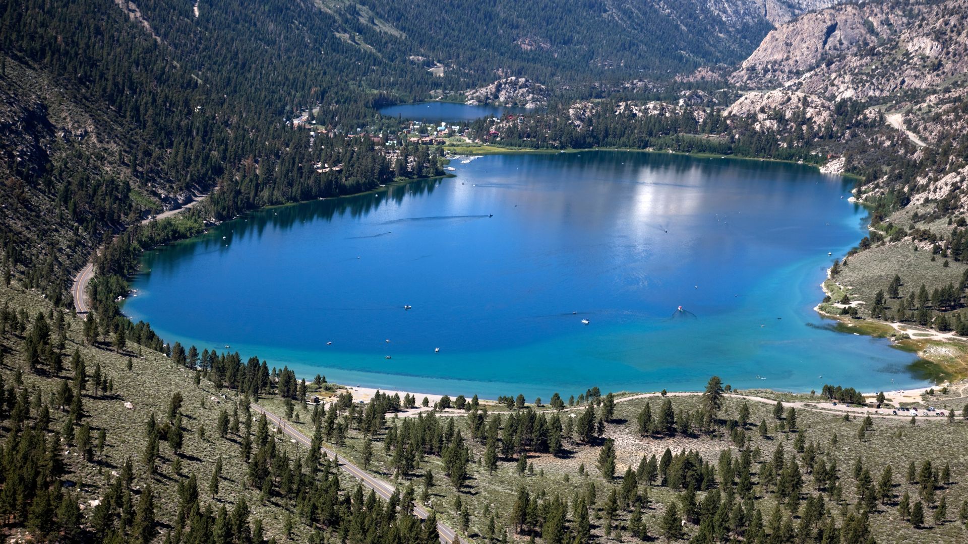
June Lake Loop
The June Lake Loop is Highway 395’s most scenic side trip, hands down. It’s a 16-mile loop that links four alpine lakes tucked beneath granite peaks.
June Lake is the star, with glassy water and perfect mountain reflections. I rented a kayak at the marina and paddled around for a while—total zen.
Gull Lake is higher up at 7,595 feet. It’s smaller, with great trout fishing and way fewer people.
Silver Lake stole my heart. It sits right below Carson Peak’s dramatic north face, and the easy trail around the lake is perfect for a morning stroll.
Grant Lake wraps up the loop at the north end. It’s bigger, with the best camping and boat ramps for those with larger water toys.
You could drive the whole loop in 45 minutes, but I spent a day just hopping from lake to lake and hiking the trails.
Epic Landscapes and Natural Wonders
The Eastern Sierra packs in some of California’s most jaw-dropping natural wonders. Granite peaks, ancient trees, hot springs—it’s like a highlight reel for geology and outdoor lovers.
Eastern Sierra Mountain Views
The eastern face of the Sierra Nevada is just wild. The mountains rise over 10,000 feet straight from the valley floor, and it kind of makes you feel tiny.
Mount Whitney dominates the southern end at 14,505 feet. It’s the highest point in the lower 48. Farther north, the Palisades show off sharp granite spires and deep glacier-carved bowls.
Best places for mountain views:
- Lone Pine: Whitney Portal Road gets you right up close
- Independence: Clear views of multiple 14,000-foot peaks
- Big Pine: The angle for the Palisades is perfect
Morning light hits these peaks around 7 AM. Golden hour is magic for photos—those pink and gold hues on the granite are unreal.
Snow sticks to the highest peaks all year. Even in summer, you’ll see white patches against the dark rock and bright sky.
Hot Springs and Volcanic Features
Geothermal energy bubbles just below the surface here. The Long Valley Caldera, a 20-mile-wide crater, formed after a massive volcanic eruption 760,000 years ago.
Hot Creek runs right through this volcanic zone. Steam rises where hot springs meet cold water, and temps hit 180°F in some spots.
Can’t-miss geothermal stops:
- Mammoth Hot Springs: Soak in natural pools up to 104°F
- Hot Creek Geological Site: Watch steam vents and bubbling pools
- Convict Lake: Shaped by both volcanoes and glaciers
You can still feel the earth moving here—small earthquakes are common, and you’ll see carbon dioxide vents in some areas.
Obsidian Dome near Mammoth Lakes is a must-see. This mound of volcanic glass rises to 8,611 feet, and the sharp black rocks were prized by Native Americans for toolmaking.
Ancient Bristlecone Pine Forest
The White Mountains, just east of the highway, shelter some of the oldest living trees on Earth. The bristlecone pines here survive in harsh conditions at 10,000 to 11,000 feet.
I took the Discovery Trail to see trees over 4,000 years old. The Methuselah Tree, discovered in the 1950s, lived for 4,848 years. There’s an even older, unnamed tree hiding out there.
These pines grow painfully slow. A 10-foot tree might be a thousand years old. The tough environment actually helps them out—less competition means longer lives.
Trail options:
- Discovery Trail: 1-mile loop, easy and scenic
- Methuselah Trail: 4.3-mile loop, moderate but worth it
- Patriarch Grove: 13-mile drive to the largest bristlecone
The visitor center sits at 10,000 feet and opens from May through October. Even in summer, I needed a jacket—mountain winds cut right through you.
Outdoor Adventure Opportunities
The Eastern Sierra is a year-round playground for outdoor lovers. In winter, snow transforms the mountains into a wonderland for skiers and snowboarders. The rest of the year? Hiking, fishing, and exploring are the name of the game.
Hiking and Trail Highlights
Trails along Highway 395 lead to some of California’s best alpine scenery. The Mammoth Lakes Basin Trail system is a great place to start, with easy to moderate hikes circling clear mountain lakes.
Top trail picks:
- Convict Lake Loop – 2.8 miles, easy and flat
- Emerald Lake Trail – 4 miles roundtrip, moderate effort
- Duck Lake Trail – 10 miles roundtrip, a real challenge
The John Muir Wilderness boundary hugs many trailheads, so you can reach pristine backcountry within minutes of the road.
The Mono Lake South Tufa Trail offers a desert hike through wild limestone formations. The 1-mile loop is perfect for photos—especially the boardwalk section.
Fishing Hotspots
Trout fishing is legendary in the Eastern Sierra. Crowley Lake is famous for big rainbows and browns all season long.
Best fishing spots:
- Crowley Lake – Trophy browns almost every year
- Convict Lake – Rainbows and brook trout
- Mammoth Creek – Wild rainbow trout
- Hot Creek – Catch and release only, but the fish are huge
I always double-check current fishing rules. Some spots have special lure and limit regulations, and the California Department of Fish and Wildlife updates these often.
Best months for fishing: late April through October. I usually get the best bites early in the morning or just before sunset.
Photography Locations
If you love photography, Highway 395 is a goldmine. Mono Lake is iconic, especially at sunrise or sunset with the tufa towers mirrored in the water.
Photo hotspots:
- Mono Lake South Tufa Area – Sunrise and sunset are unbeatable
- Convict Lake – Mountain reflections on still water
- Alabama Hills – Wild rock formations with the Sierra behind
- Mammoth Lakes Basin – Classic alpine lake scenes
I always pack a polarizing filter to cut water glare. The high altitude sunlight is intense and can wash out colors if you’re not careful.
Golden hour just before sunset or after sunrise is when the mountains really come alive. The shadows and colors make every shot feel epic.
Winter Sports Access
You’ll find plenty of ski resorts within easy reach of Highway 395. Mammoth Mountain stands out with the largest ski area, and there’s something for every skill level.
Winter Recreation Options:
- Mammoth Mountain Ski Area – Downhill skiing and snowboarding
- Tamarack Cross Country Ski Center – Nordic skiing
- June Mountain – Family-friendly downhill skiing
- Backcountry skiing – Trails for the adventurous, accessed from various trailheads
In my experience, Mammoth Mountain tends to stay open later than most California resorts. Sometimes the lifts are still spinning into May or even June, which is pretty wild.
Cross-country skiing trails wind all through the Mammoth Lakes area. The Lakes Basin has groomed tracks, whether you’re just starting out or you’ve been at it for years.
Practical Tips for Your Scenic Road Trip
Honestly, a little planning goes a long way on Highway 395. The weather can flip on you fast, and high-altitude conditions demand some special gear.
Best Time to Visit
Late spring through early fall gives you the best driving conditions. I’d aim for May to October—most mountain passes stay open, and you won’t have to worry much about snow.
Summer draws the biggest crowds, but you’ll get the warmest days. In July and August, the valleys usually hit 75-85°F.
Spring travel means staying flexible. Sometimes snow keeps Tioga Pass and other high routes closed until late May. I always check Caltrans for current road conditions before heading out.
Fall? Oh, it’s gorgeous. Aspen leaves around Mammoth Lakes turn every shade of gold in September and October, and the crowds thin out.
Winter driving is a whole different animal. You’ll need snow tires or chains, and many side roads just close down for the season.
Packing and Safety Advice
Pack layers to handle dramatic elevation changes. It’s not unusual for temps to swing 30-40 degrees between the valleys and the mountain passes.
Even in summer, I throw a warm jacket in the car. Once the sun dips, those high elevations get chilly fast.
Don’t forget about your car. I make a habit of filling up at every gas station I see—stations can be few and far between.
Extra water and snacks? Absolutely. Cell service drops out for long stretches, and you don’t want to get caught unprepared.
Check your tire pressure and coolant. High altitude can mess with both. I always carry a spare tire and a few basic tools, just in case.
Sunscreen and sunglasses are must-haves. The high desert sun bounces off lakes and snow, and it’s surprisingly intense.
Recommended Itinerary Planning
Give yourself at least 2-3 days to soak in the major highlights. Trust me, trying to cram it all into one day just ruins the magic of a scenic drive.
Kick off your mornings early. Mono Lake, for example, draws a crowd of photographers at sunrise, and honestly, it’s worth joining them at least once.
Book your accommodations ahead of time. Places like Mammoth Lakes and Bishop don’t have a ton of lodging, and they fill up way faster than you’d think.
Between Mammoth Lakes and Mono Lake, I usually budget 4-5 hours for driving, especially with all the tempting stops along the way. If you’re into photography or short hikes, tack on some extra time—you’ll want it.
Don’t forget to download offline maps before you hit the road. Cell service drops out in those winding mountain valleys, and you don’t want to get lost out there.
For meals, plan to stop in towns like Lee Vining or Bishop. Just a heads-up: restaurants in these small communities tend to close earlier than you might expect.