Standing on the volcanic cliffs of El Hierro, I suddenly got why ancient sailors believed this was where the world just stopped. This tiny Canary Island, mostly ignored by travelers who rush to its glitzier neighbors, hides secrets that make it one of Europe’s most remarkable spots.
El Hierro gives you a real taste of sustainable island life, wild landscapes, and untouched marine worlds you just won’t find on the busier Canary Islands.
When I visited this UNESCO Biosphere Reserve, I found an island that lives in harmony with nature. Unlike Tenerife or Gran Canaria, which are packed with tourists, El Hierro quietly welcomes just a handful.
This isolation has kept something rare alive.
You’ll wander through twisted juniper forests that look like nature’s own art gallery. The world-class diving around La Restinga blew me away.
El Hierro is chasing total energy independence and has pulled off marine conservation wins that other places only dream about.
Discovering the End of the World: El Hierro’s Unique Legacy
El Hierro’s reputation as the “end of the world” isn’t just a catchy phrase. For centuries, it marked the Zero Meridian, the edge of the known world.
The island has ties to Christopher Columbus and old legends about dragons lurking beyond its shores. That sense of mystery? It’s still here.
The Westernmost Edge: Isla del Meridiano and the Zero Meridian
For over 300 years, folks called El Hierro Isla del Meridiano (Meridian Island). From 1634 to 1884, this little Canary Island actually served as the official Zero Meridian for navigation.
The meridian line marked Europe’s western edge. Mapmakers all over the continent used El Hierro as their longitude reference.
A few cool facts about El Hierro’s meridian:
- It was the Zero Meridian from 1634 to 1884.
- French, Spanish, and other European navigators relied on it.
- The Greenwich Meridian took over in 1884.
- It sits at about 18°W longitude.
I still can’t get over how such a tiny island played a huge part in global navigation. Ships heading to the Atlantic would use El Hierro as their last safe landmark before venturing into the unknown.
Because El Hierro was the furthest west among inhabited European spots, it just made sense as the “edge” of civilization.

Christopher Columbus and Historic Voyages
Christopher Columbus actually stopped at El Hierro on his way to the New World. The island was his last chance to resupply before heading across the Atlantic in 1492.
Columbus knew how important El Hierro was for navigation. He used it to figure out his westward journey and even recorded compass variations from here.
Columbus and El Hierro:
- Last stop before his 1492 voyage to America
- Used for navigation math
- Noted in his ship’s logs
- Inspired later Spanish expeditions
Columbus’s visits put El Hierro on the maritime map. Spanish fleets often launched their New World journeys from here.
Turns out, Columbus wasn’t the only one. Portuguese explorers and other Europeans also treated El Hierro as their last taste of civilization before the big blue.
Legends, Myths, and the ‘Here Be Dragons’ Mystique
Old maps often scribbled “here be dragons” just west of El Hierro. Medieval mapmakers used this phrase as a warning—beyond this point, who knew what lurked?
Sailors thought sea monsters and dragons owned the waters past El Hierro. The island marked the border between known and unknown worlds.
Some of the wild myths about El Hierro:
- Dragons and sea monsters prowling western waters
- The “edge of the world” where ships might fall off
- A gateway to the underworld, according to some
- The last safe harbor before possible doom
Honestly, these legends came from real fear. The Atlantic west of El Hierro was a mystery for ages.
I found old maps that literally showed the sea pouring off the earth’s edge here. That flat-earth idea hung on for a surprisingly long time.
Even now, El Hierro keeps its mystique. It’s still the least visited Canary Island, and that sense of remoteness is hard to shake.

Embracing Sustainability: Life on a Biosphere Reserve
El Hierro grabbed UNESCO Biosphere Reserve status in 2002 by showing how people and nature can live in balance. The island is chasing total energy self-sufficiency and fiercely protects its unique wild spaces.
UNESCO Designation and Environmental Vision
UNESCO named El Hierro a Biosphere Reserve because it’s a living example of people working with nature, not against it. It’s the smallest and youngest Canary Island, but its green mindset stands out.
You’ll see pine forests and laurel trees. In some places, crazy-shaped junipers called sabinas twist in the wind—they look like something out of a fantasy novel.
What really sets El Hierro apart? Locals truly respect their land. Where other islands sometimes let development run wild, El Hierro keeps things thoughtful and careful.
The island is even aiming to become a Geo-Park, which would make it the first spot on Earth with both UNESCO honors.
Up in the highlands, it almost feels like northern England. Shepherds watch over woolly sheep on grassy pastures that stay green even in summer.
Renewable Energy and Self-Sufficiency
El Hierro wants to be the world’s first island to run entirely on renewables. They built a unique hydro-wind power plant that mixes water and wind to generate electricity.
Back in 2015, there were stretches where the island ran only on wind or water. When the wind picks up, the system pumps water uphill, storing energy for later.
This project proves that even small, remote communities can break free from fossil fuels. Now, El Hierro imports less fuel, saves money, and keeps its Atlantic waters cleaner.

Local Communities and Ecotourism Initiatives
Fishermen here teamed up with officials to create the La Restinga marine reserve. This partnership lets locals protect their sea while still earning a living.
The waters around El Hierro burst with sea life, drawing divers from all over. Tourism here isn’t about crowds; it’s about preserving what makes the island special.
Only about 5,000 people visit each year. Compare that to the millions swarming Tenerife or Gran Canaria.
Low visitor numbers help El Hierro keep its wild, natural character and still bring in some tourism money.
Local businesses stick to sustainable practices that match the island’s environmental goals.
Landscapes of Wonder: El Hierro’s Dramatic Natural Beauty
El Hierro’s landscapes feel raw, shaped by volcanic power and nature’s knack for turning chaos into beauty. You’ll find ancient forests, deep valleys, and coasts carved by fire and water.
Volcanic Origins and the Undersea Eruption
El Hierro sits at the youngest end of the Canary chain. Volcanoes built this island, eruption after eruption, over millions of years.
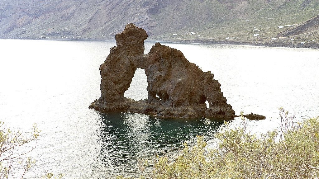
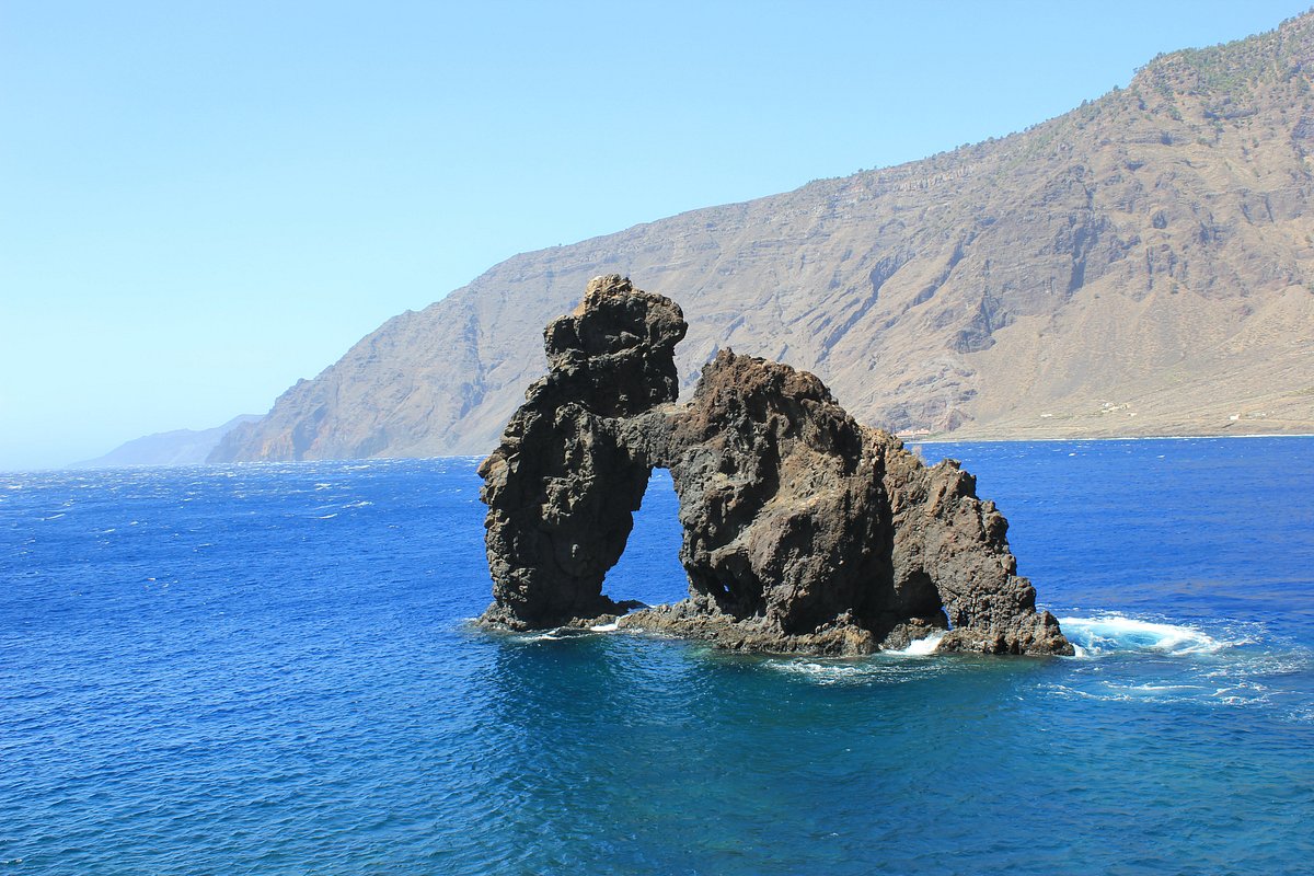
Back in 2011, I witnessed something wild—a new undersea volcanic eruption just off the southern coast. Lava and gas bubbled up from the deep, putting on a show for anyone paying attention.
The eruption site, called Tagoro, lies about 2 kilometers offshore and sits 88 meters down. Local fishermen first spotted strange bubbles and weirdly colored water.
That eruption reminded me just how alive this island is. Black volcanic rock slices through green hills, and the blue Atlantic wraps everything in contrast.
Lush Forests: Junipers, Sabinas, and Pine Groves
El Hierro’s forests caught me off guard with their variety and age. The island shelters some of the last native woodlands in the Canaries.
Sabinas—those twisted junipers—cling to the windward slopes. They’ve been sculpted by the breeze for centuries, making them look like living driftwood.
The juniper groves almost glow in the morning mist. Some trees are over 500 years old, their bark peeling back to reveal smooth, pale wood.
Up high, you’ll find Canary Island pines. These trees are fireproof champs, their thick bark shielding them from volcanic drama and wildfires.
The Garoé area blew me away. This sacred forest once gave water to the island’s first people. Fog gathers on pine needles and drips down, creating a natural water source.
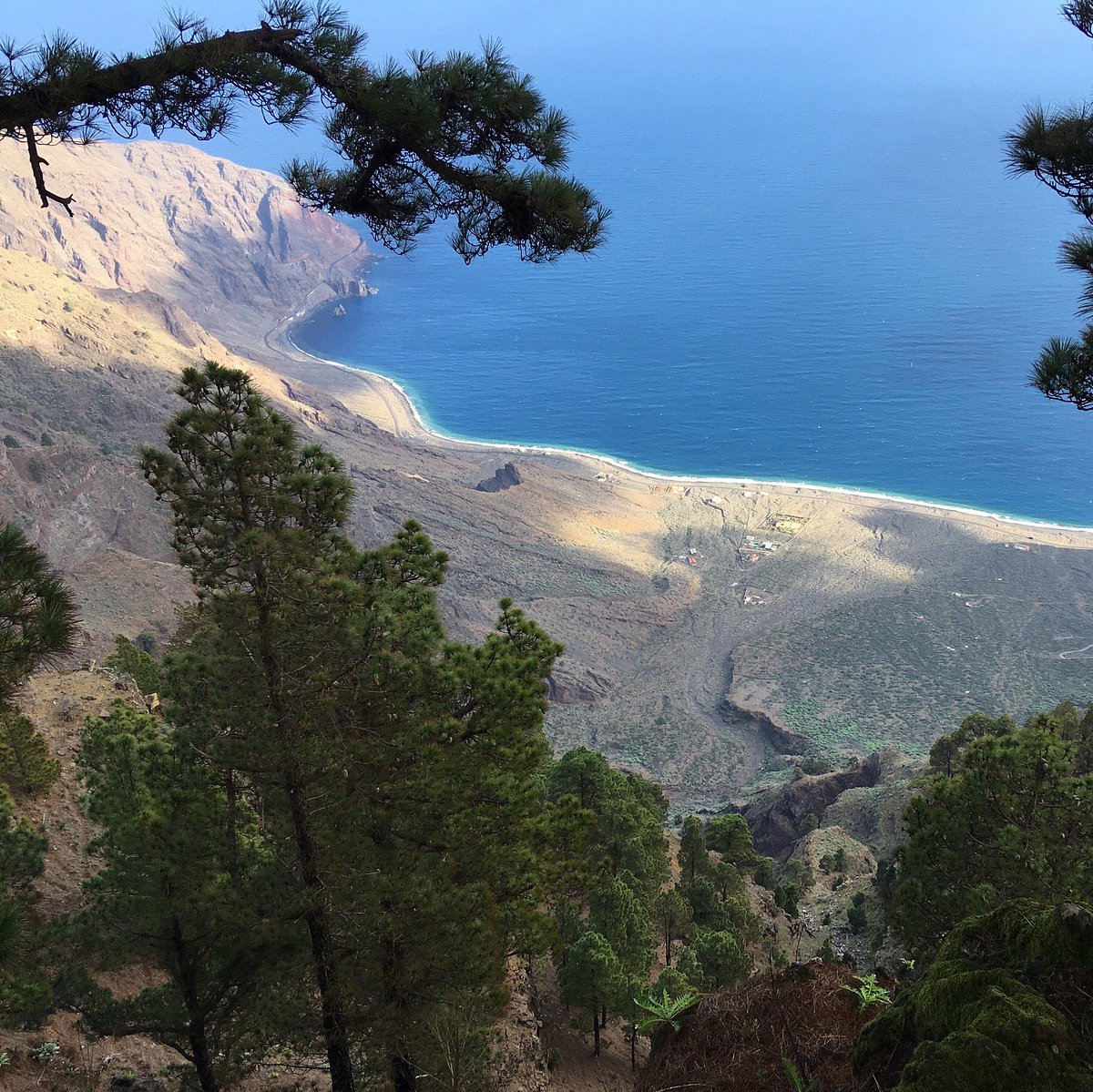
El Golfo’s Valleys and La Frontera’s Panoramas
El Golfo valley dominates the north. Thousands of years ago, a chunk of the island collapsed into the sea, leaving behind a massive crescent-shaped amphitheater.
Rich volcanic soil fills the valley floor. Banana plantations, vineyards, and tropical orchards thrive here.
La Frontera sits right in the middle, offering killer views of the cliffs. The green valley and dark volcanic walls make for some of the most dramatic scenery I’ve ever seen.
From the rim, I peered a thousand meters down to the valley. On clear days, you can spot other Canary Islands on the horizon.
The cliffs tell stories in layers—each stripe marks a different volcanic era, stretching back hundreds of thousands of years.
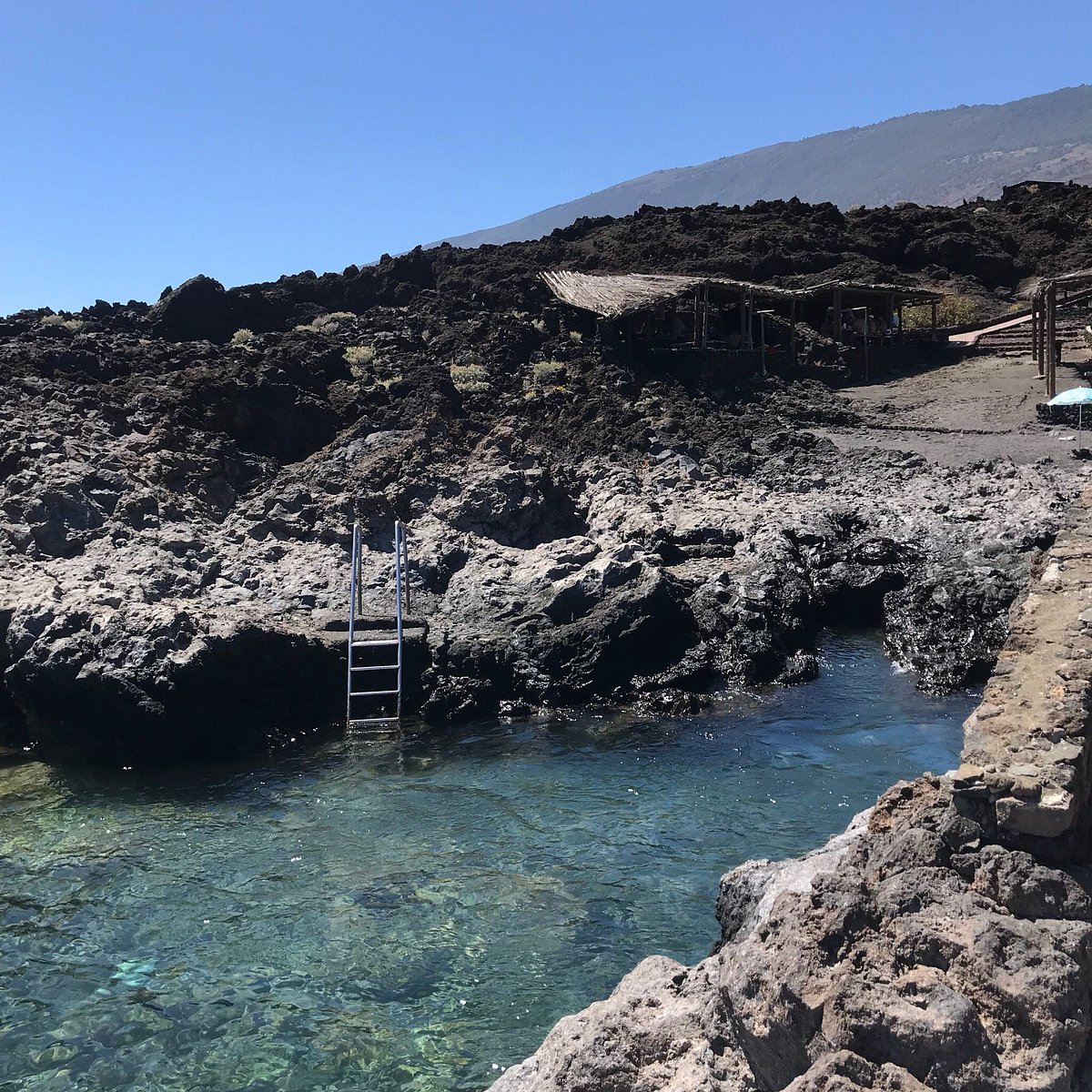
Rock Pools and Rugged Coastlines
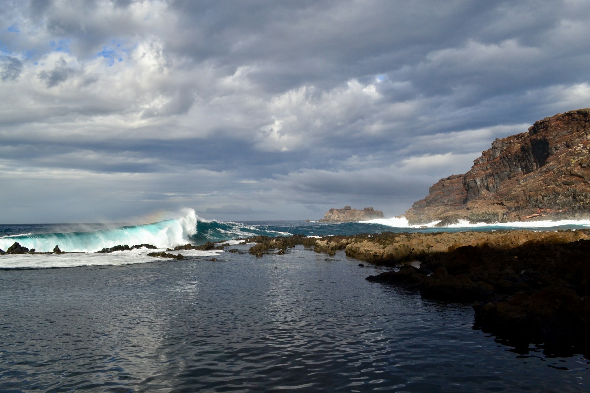
El Hierro’s coastline is wild and pure. Young volcanic rock shapes everything, above and below the waterline.
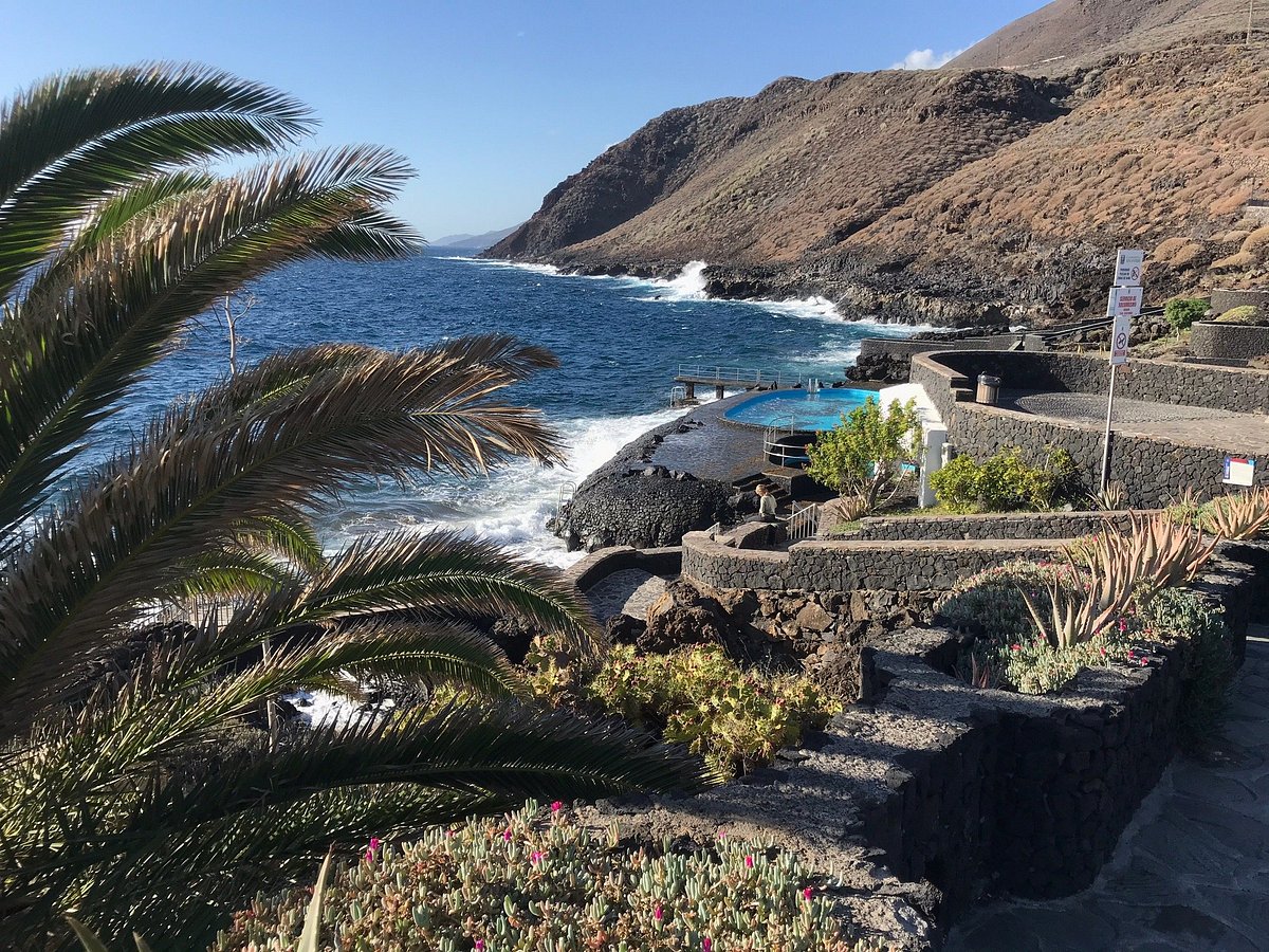
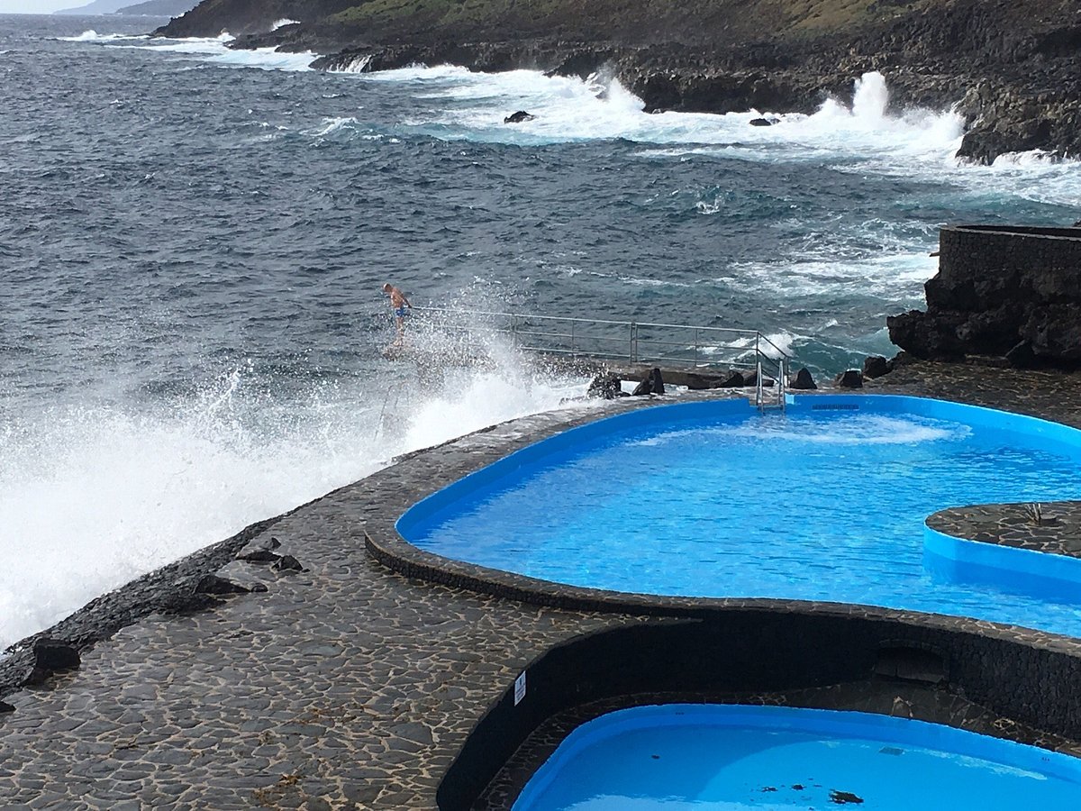
Natural rock pools dot the shore, perfect for a dip. These fill with clear seawater at high tide, and I found them warmer and calmer than the open ocean.
Charco Manso is probably the easiest spot to find these pools. Black rock hugs turquoise water, and little fish dart around your feet.
La Maceta, on the north coast, has pools that almost look carved by hand. Families gather here for swimming and picnics on weekends.
The coast shifts as you move around the island. Jagged cliffs give way to pebble beaches, and every cove has its own mix of sand and stone.
Marine Reserves and Underwater Adventures
El Hierro’s waters are a diver’s dream, especially around the Mar de Las Calmas marine reserve at La Restinga. Sustainable fishing has turned these seas into vibrant underwater worlds, with volcanic forces still shaping the seafloor.
Exploring the Atlantic Ocean from La Restinga
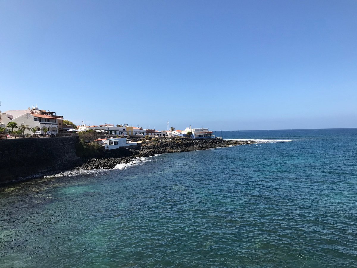
La Restinga, a little fishing village on the south coast, is the gateway to El Hierro’s underwater wonders. The Mar de Las Calmas marine reserve starts right here.
These waters stay calm most of the year, shielded from the Atlantic’s big moods. That means diving conditions are almost always ideal, no matter your skill level.
La Restinga’s marina buzzes with a handful of dive centers. The local guides know every nook and cranny, so you’ll always find the best spots.
Some favorite dive sites:
- Baja Bocarones – shallow reefs perfect for newbies
- El Bajón – deeper waters with bigger fish
- Volcanic vents – where underwater activity creates wild rock formations
The volcanic landscape continues underwater. Black lava contrasts with flashes of marine color.
Water temperatures hover between 18°C in winter and 24°C in summer. On good days, you can see up to 30 meters ahead.
Diving in Biodiverse Waters
The marine reserve is alive with creatures you won’t spot anywhere else in the Canaries.
After the 2011 underwater eruption, new rock formations popped up, offering fresh homes for marine life. Nature wasted no time moving in.
Stingrays glide over sandy bottoms, weaving between volcanic rocks. Schools of barracuda cruise the deep, while parrotfish nibble on algae.
Some species here are unique to El Hierro. They evolved in isolation, and you won’t find them anywhere else in the Atlantic.
You might spot:
- Angel sharks (rare almost everywhere else)
- Moray eels peeking from crevices
- Groupers lurking in deeper waters
- Sea turtles drifting by on migration routes
If you try night diving, you’ll see a whole different crew. Octopus come out to hunt, and lobsters scuttle from their hiding spots.
Sustainable Fishing and Conservation
Local fishermen joined forces with island authorities and actually created the marine reserve themselves. It’s a real example of how conservation and fishing don’t have to be at odds—they can support each other.
They set fishing quotas to keep catches sustainable. Some areas? Totally off-limits to fishing boats, all year.
I discovered that traditional fishing still shapes daily life here. Small boats head out with lines and nets, not those massive industrial trawlers.
Since the reserve went into effect, fish populations have bounced back. Bigger fish now cruise the protected waters, and these healthy numbers spill over into neighboring areas.
Conservation measures include:
- Seasonal fishing restrictions during breeding periods
- Size limits on caught fish
- Banned fishing zones around sensitive habitats
- Regular monitoring of marine populations
Diving tourism brings in money that helps keep these efforts afloat. Dive operators chip in fees, which actually fund the marine protection programs.
After an underwater volcanic eruption, scientists flocked here to study how marine life recovers from dramatic geological changes. That research continues to reveal new surprises.
Journeying to El Hierro: Access and Connections
Getting to El Hierro takes a bit of planning—there aren’t any direct flights, which honestly adds to the adventure. Most people take a ferry from Tenerife, though you can break up the trip with a stopover on La Gomera if you’re feeling curious.
Ferries from Tenerife
I booked my ferry with Naviera Armas. They run the main service to El Hierro, sailing out of Los Cristianos port in Tenerife’s south.
The trip takes about two and a half hours, straight to Puerto de la Estaca. I got to the port 45 minutes early, which is what they recommend if you’re traveling on foot.
Ferry Schedule:
- Tuesday and Friday departures
- Morning departure at 8:00 AM
- Return trips on the same days
The ferry carries both passengers and vehicles. I went as a foot passenger because I wanted to rent a car once I landed on El Hierro.
Tickets start at €35 for a one-way adult fare. I bought mine online a couple of weeks ahead—peak season gets busy.
The crossing can get choppy if the weather turns. I tossed motion sickness tablets in my bag, just in case.
La Gomera: An Enchanting Stopover
Many ferries to El Hierro pause at La Gomera’s San Sebastián port. I grabbed this chance to stretch my trip and poke around another Canary Island.
The stopover lasts around 30 minutes. You can hop off for a quick look, but you have to hustle back when it’s time to board.
I decided to stay two days in La Gomera before heading to El Hierro. It meant booking separate ferry tickets, but I got to wander through Garajonay National Park.
La Gomera Highlights:
- UNESCO World Heritage laurel forests
- Traditional whistling language demonstrations
- Valley of the Great King viewpoint
- Valle Gran Rey coastal towns
Ferries between La Gomera and El Hierro run on the same Naviera Armas schedule. The trip between these two islands took me just an hour and a half.

Travel with KE Adventure
So, I stumbled across KE Adventure Travel and found out they offer guided tours that actually include El Hierro as part of their multi-island packages. Their 15-day Canary Islands walking tour covers all seven main islands—yeah, all of them.
KE Adventure takes care of every ferry booking and the messy logistics. I can’t tell you how much easier that makes things when you’re trying to juggle connections and not miss the boat—literally.
On El Hierro, their groups stay in locally-owned places. That felt like a win to me; supporting small tourism businesses on the island just feels right.
The tour brings you along for guided hikes across El Hierro’s volcanic landscapes and even to sustainable energy installations. Local guides—real characters, honestly—share insights about the island’s quirky ecosystem and vibrant culture.
KE Adventure Benefits:
- They handle all your transportation
- Small groups (never more than 16)
- Local guides who actually know their stuff
- Focus on sustainable tourism
If you’re a die-hard independent traveler, KE Adventure will still give you advice on ferry schedules and island connections, even if you don’t book their full tour. That kind of flexibility makes planning a lot less intimidating.