Perched high above the Atlantic on Lanzarote’s northern cliffs, Mirador del Río sits at 475 meters and offers what I’d easily call some of the most breathtaking views in the entire Canary Islands. I’ve checked out a ridiculous number of viewpoints across the archipelago, but honestly, nothing hits quite like the moment you step inside César Manrique’s creation and look out over the turquoise shimmer of El Río strait toward the untouched island of La Graciosa.
This cliff-top spot fuses Manrique’s bold architecture with Lanzarote’s wild volcanic beauty, so it feels both imaginative and raw at the same time. Built right into the mountain back in 1973, the place is almost invisible from the outside. Grass-covered domes keep the landscape looking wild while hiding the surprisingly sleek interior.
When I planned my visit and wandered the northern coast, I realized just how much this spot reveals about Lanzarote’s dance between human creativity and harsh volcanic terrain. The viewpoint isn’t just a pretty window; it’s a doorway into Manrique’s mind and the island’s stubborn, dramatic personality.
Experiencing the Panoramic Views from Mirador del Río
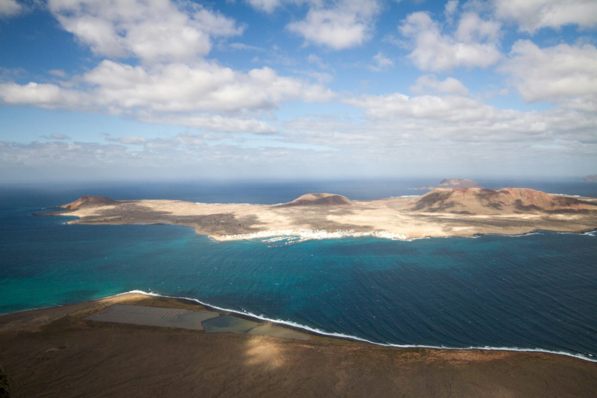
Standing at the edge, 475 meters up, you get these wide-open views across El Río strait to La Graciosa and the whole Chinijo Archipelago. It’s not just the islands, either—the Risco de Famara cliffs and the salt flats below all come into view.
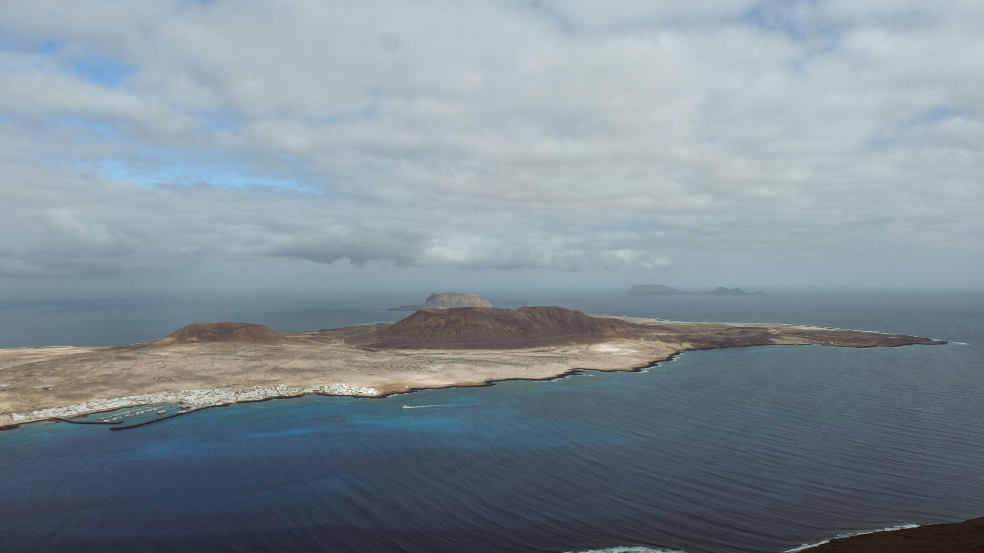
La Graciosa and the Chinijo Archipelago
From the huge windows, La Graciosa looks close enough to swim to on a clear day. It’s wild how the island just sits there, almost teasing you.
The view stretches past La Graciosa, letting you spot Montaña Clara and Alegranza out on the horizon. Even the smaller rocks—Roque del Este and Roque del Oeste—make an appearance.
Alegranza stands out as a haven for seabirds. The islands seem to float right on the blue Atlantic, almost dreamlike.
Weather can be a bit of a wildcard here. Those northerly trade winds sometimes sweep in clouds or mist, and suddenly the islands vanish into the haze.
Risco de Famara Cliffs and Surrounding Landscape
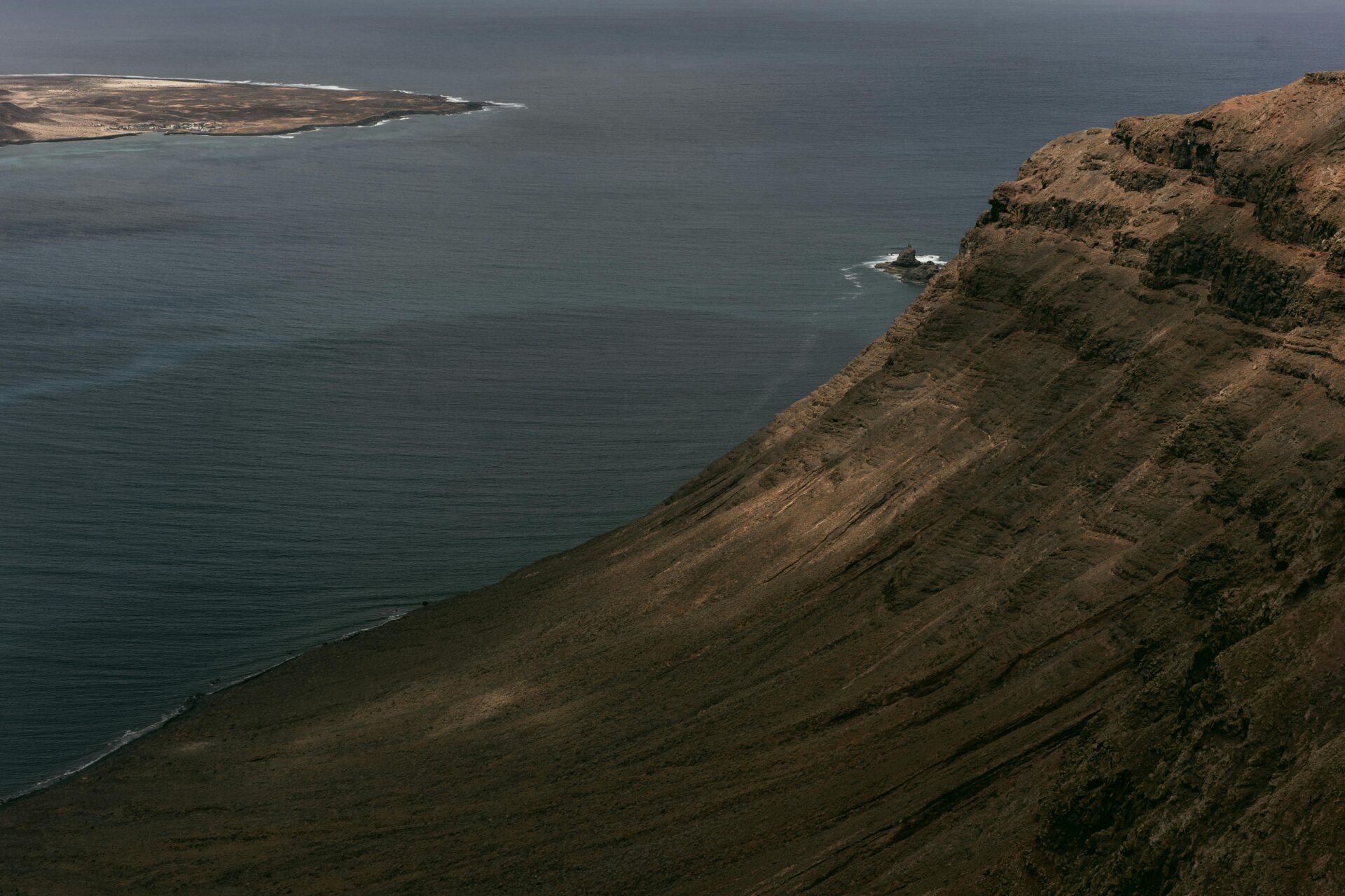
Mirador del Río sits right on top of the Risco de Famara escarpment. These cliffs stretch for 22 kilometers, running from Punta Fariones nearly to Teguise.
The drop to the ocean is seriously steep. Layers of volcanic rock tell the story of Lanzarote’s wild geological past.
You can see the coastline winding away in both directions. The cliffs act as a real dividing line between the island’s interior and the rugged north.
The volcanic terrain down below comes in all sorts of colors and textures. Black lava rock sits next to lighter stone, making the whole scene pop.
Salinas del Río: The Historic Salt Flats
Way down below, the Salinas del Río spread out along the shore. These salt pans are the oldest in the Canaries.
The white salt crystals form neat rectangles that reflect the sunlight, creating a weirdly geometric contrast against the wild cliffs.
They sit right between the cliff base and the sea. Workers still collect salt here, sticking to traditional methods that go way back.
From above, the salt pans look tiny, but they actually cover a good chunk of coastline.
Terraces and Outdoor Spaces
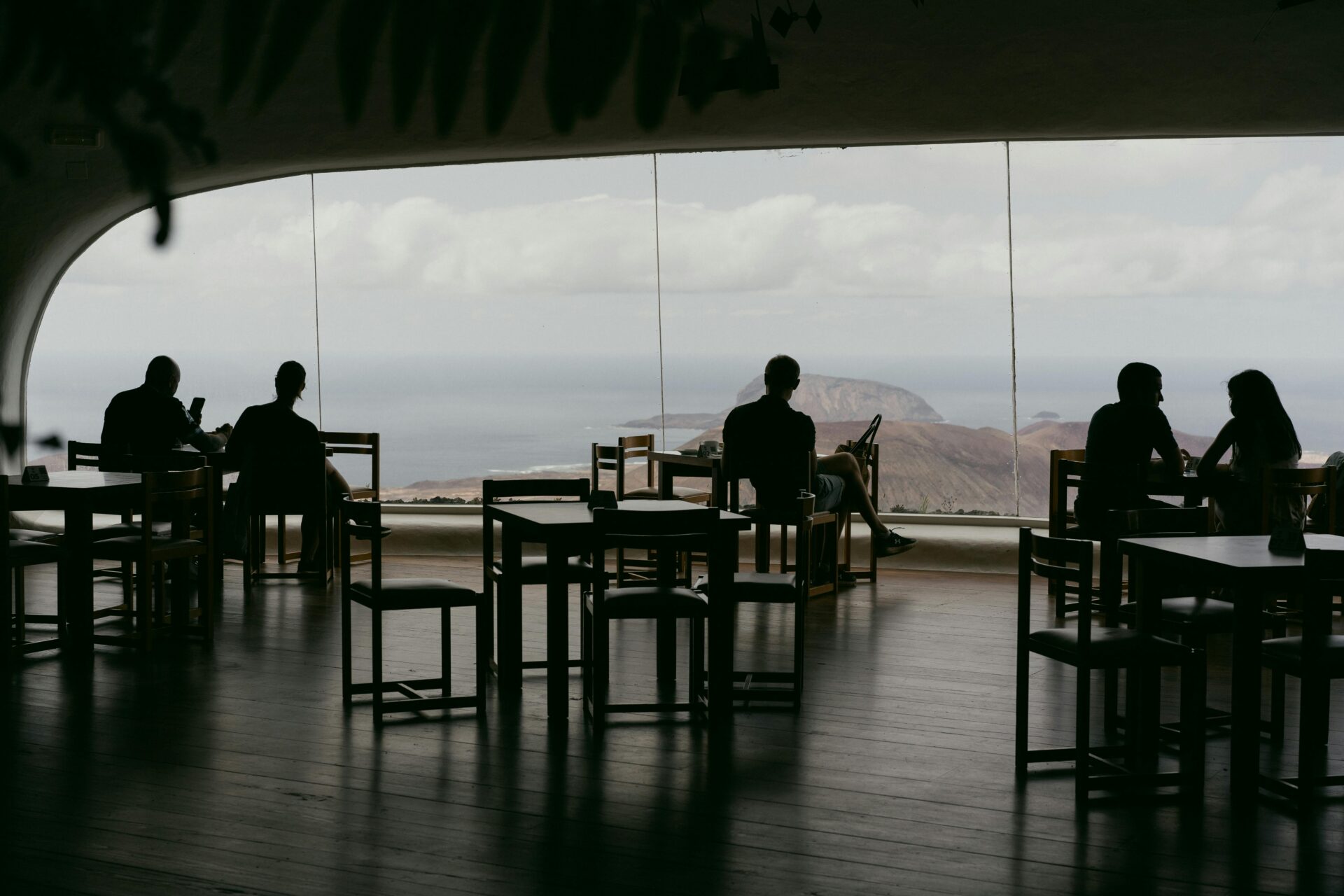
You’ll find both indoor and outdoor spots to soak in the views. Inside, huge glass windows frame the islands and protect you from the wind.
Step outside, and the terraces let you feel the full sweep of the landscape—no glass, no barriers, just wind and ocean.
Manrique made sure the terraces blend right into the cliffs. Local stone helps the platforms disappear into the landscape.
The layout nudges you from one vantage point to the next. Each terrace gives you a fresh angle on La Graciosa and the Atlantic.

César Manrique’s Architectural Vision and Design
Mirador del Río shows off Manrique’s knack for making buildings disappear into the volcanic landscape, all while giving you jaw-dropping views of La Graciosa. He used curved walls, raw materials, and clever hidden spaces, so the whole place feels like both a shelter and a lookout.
Integration with the Natural Environment
Manrique carved Mirador del Río right into the Famara cliffs. The building sits 474 meters up, hugging the rock face.
You can tell he let the landscape lead the way. The walls and windows follow the cliff’s curves instead of fighting them.
He picked materials that make sense here. Whitewashed walls nod to Canarian tradition, while volcanic stone roots the place in Lanzarote’s geology.
A few ways he pulled this off:
- Carved the structure into the cliff itself
- Used curves that echo the natural rock
- Chose native volcanic stone for most surfaces
- Kept the building hidden from above, so the cliffs still steal the show
From certain spots, the viewpoint just vanishes into the rock. That was totally on purpose—Manrique wanted you to stumble upon it, not see it coming from miles away.
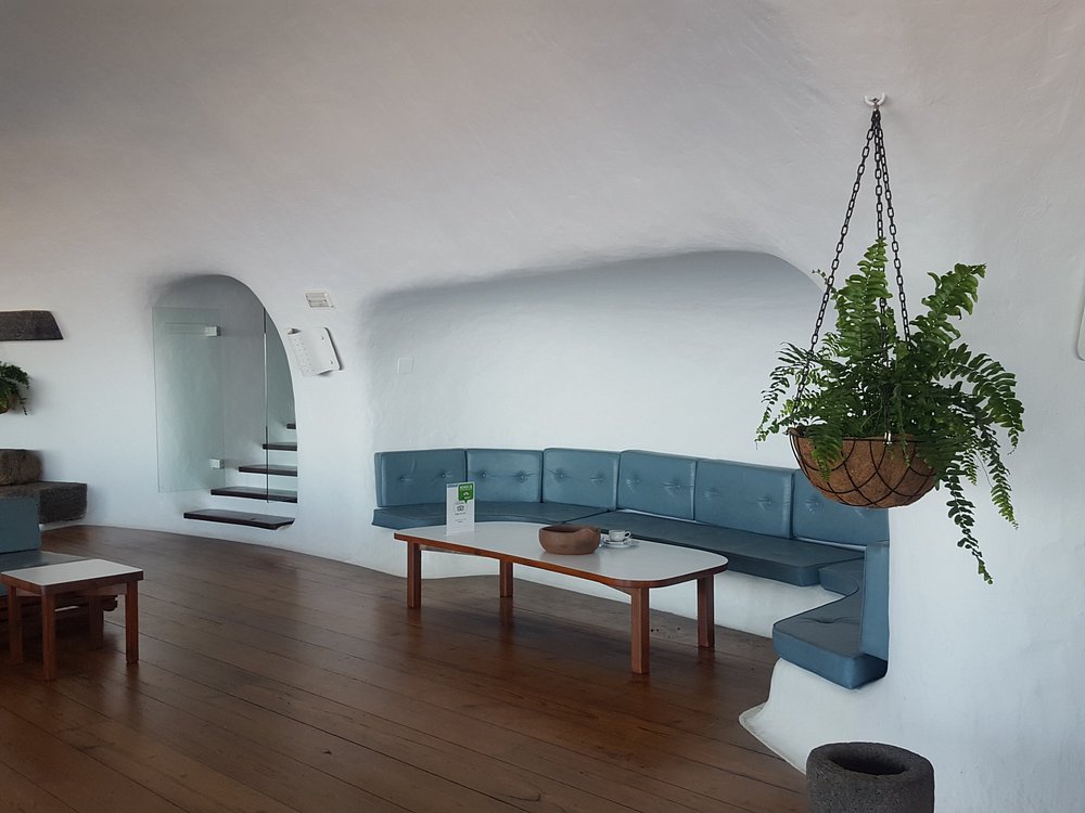
Architectural Features and Interior Spaces
Inside, you’ll find vaulted ceilings and big panoramic windows that frame La Graciosa and the archipelago like living art.
Manrique created different viewing experiences as you move through the building. The main room gives you shelter from the wind but keeps your eyes glued to the scenery.
You can wander between cozy indoor nooks and open-air terraces on the upper level.
What stands out inside:
- Vaulted, curving ceilings
- Floor-to-ceiling windows facing the islands
- Wooden furniture built right into the walls
- Multiple levels for different views
The design keeps the Atlantic winds at bay, but you never lose that connection to the wild outside.
Artistic Elements and Sculptures
Manrique sprinkled artistic touches everywhere. Wrought iron sculptures and hanging plants soften the volcanic vibe.
Here, art and architecture really merge. Nothing feels tacked on—everything belongs.
Eduardo Cáceres and Jesús Soto, two of Manrique’s collaborators, helped shape the overall vision. Their work pops up in both the structure and the details.
Even the furniture feels sculptural. Built-in seats and tables curve like the landscape outside.
Artistic touches you’ll notice:
- Custom wrought iron sculptures
- Hanging gardens tucked into corners
- Furniture that doubles as art
- Decoration that blends right into the structure
These details turn a simple lookout into a full-on sensory adventure. The design celebrates creativity and natural wonder, all at once.
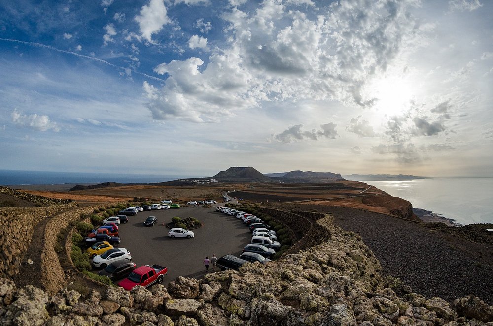
Getting to Mirador del Río and Planning Your Visit
Mirador del Río perches on Lanzarote’s northern cliffs at 474 meters up. All roads lead to the LZ-202, which takes you straight to the entrance and parking.
Route from Puerto del Carmen
Driving from Puerto del Carmen takes about 45 minutes. Head north on the LZ-2 toward Arrecife, then keep going on the LZ-1 in the direction of Teguise.
From Teguise, follow signs for Arrieta and Ye. You’ll pass through tiny villages and volcanic landscapes that shift as you climb north.
The last bit is a winding mountain road with sharp drops. Take it slow, especially if it’s windy. Parking’s available, but it fills up fast when things get busy.
Travel from Teguise, Arrieta, and Costa Teguise
From Teguise, it’s a 25-30 minute drive via the LZ-10 toward Arrieta. The road winds past classic Canarian villages and fields.
Costa Teguise travelers need to head inland and join the LZ-10. You’ll cross rural Lanzarote in about 35 minutes.
If you’re coming from Arrieta, you’ve got the shortest trip—just 15 minutes. Take the coastal road north, then turn inland toward Ye.
All these routes meet up near Ye before the final stretch to Mirador del Río.
Navigating the LZ-202 Road
The LZ-202 is the last leg up to Mirador del Río. It’s a narrow, steep road with a bunch of hairpin bends.
The surface is usually decent, but the drive can spook nervous drivers. The cliffs are exposed, and the wind loves to show off up here.
If the weather looks bad, I’d skip this road. Fog rolls in and can wipe out visibility. There aren’t many spots to pass, so patience is key.
Watch for cyclists and hikers—they use this road too. Give them space and take your time.
Facilities and Visitor Information
Mirador del Río opens at 10:00 AM and closes at 5:00 PM, with last entry at 4:40 PM. I’d aim for 1:00 to 1:30 PM; that’s when the morning clouds usually lift.
Your ticket gets you into the viewpoint, exhibition spaces, and the café. You can buy tickets online or right at the door.
What you’ll find on site:
- Free parking
- Gift shop
- Restaurant with killer views
- Restrooms
- Info displays about the Chinijo Archipelago
The building hides in the cliff, so don’t be surprised if you miss it at first. Look for the fish sculpture near the parking lot—that’s your sign you’ve arrived.
Activities and Attractions Nearby
The area around Mirador del Río is a goldmine for hiking. You’ve also got the fishing village of Punta Mujeres just down the road, which feels worlds away from the tourist trail. El Río strait is your jumping-off point if you want to hop over to La Graciosa by ferry.
Hiking Along Risco de Famara
The Risco de Famara cliffs run for 22 kilometers, from Punta Fariones to Teguise. Trails crisscross these cliffs, rising 478 meters above the sea.
The easiest hike starts near the Mirador’s car park. You can walk west along the cliff edge and catch epic views—no entry ticket needed.
A few good hiking options:
- Cliff-top path to Punta Fariones (2.5 km)
- Trail down to the Salinas del Río salt pans
- Longer hike toward Famara village (8 km)
The ground can be tricky—lots of loose volcanic rock. Good boots and water are a must. Weather can flip fast up here, with mist blowing in on the wind.

Exploring Punta Mujeres and Local Towns
Punta Mujeres is just a 10-minute drive from Mirador del Río. It’s a peaceful fishing village with real Canarian flavor and barely any crowds.
Wander the tiny harbor and watch fishermen haul in their catch. You’ll find a handful of restaurants serving up fresh seafood and local classics.
Other spots worth a detour:
- Haría: A palm-filled town with a laid-back vibe
- Arrieta: Coastal spot with great food
- Orzola: Where you catch the ferry to La Graciosa
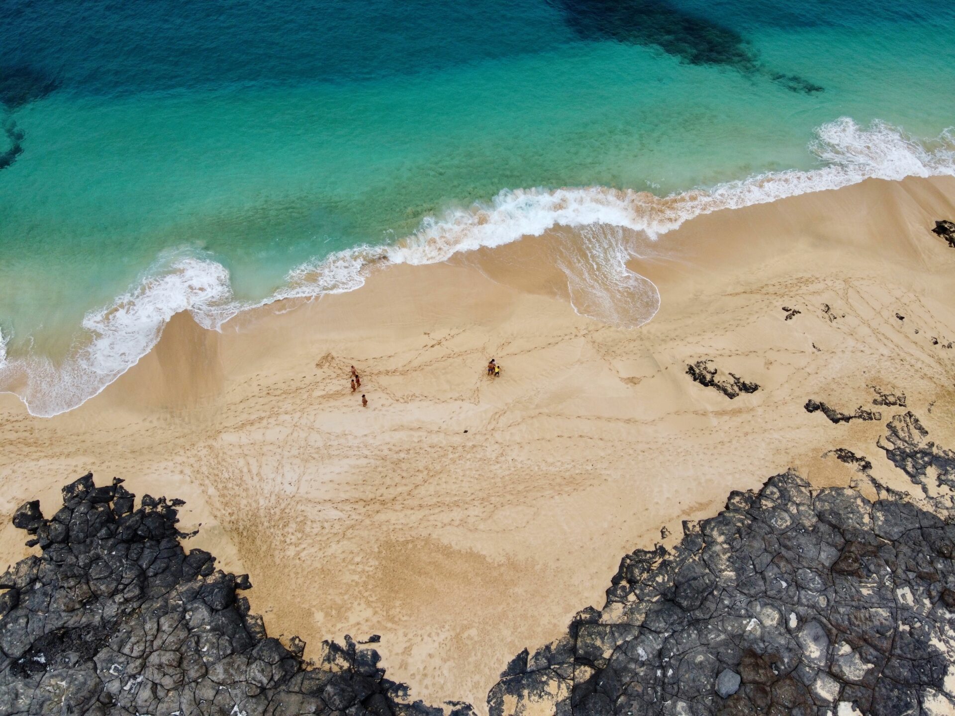
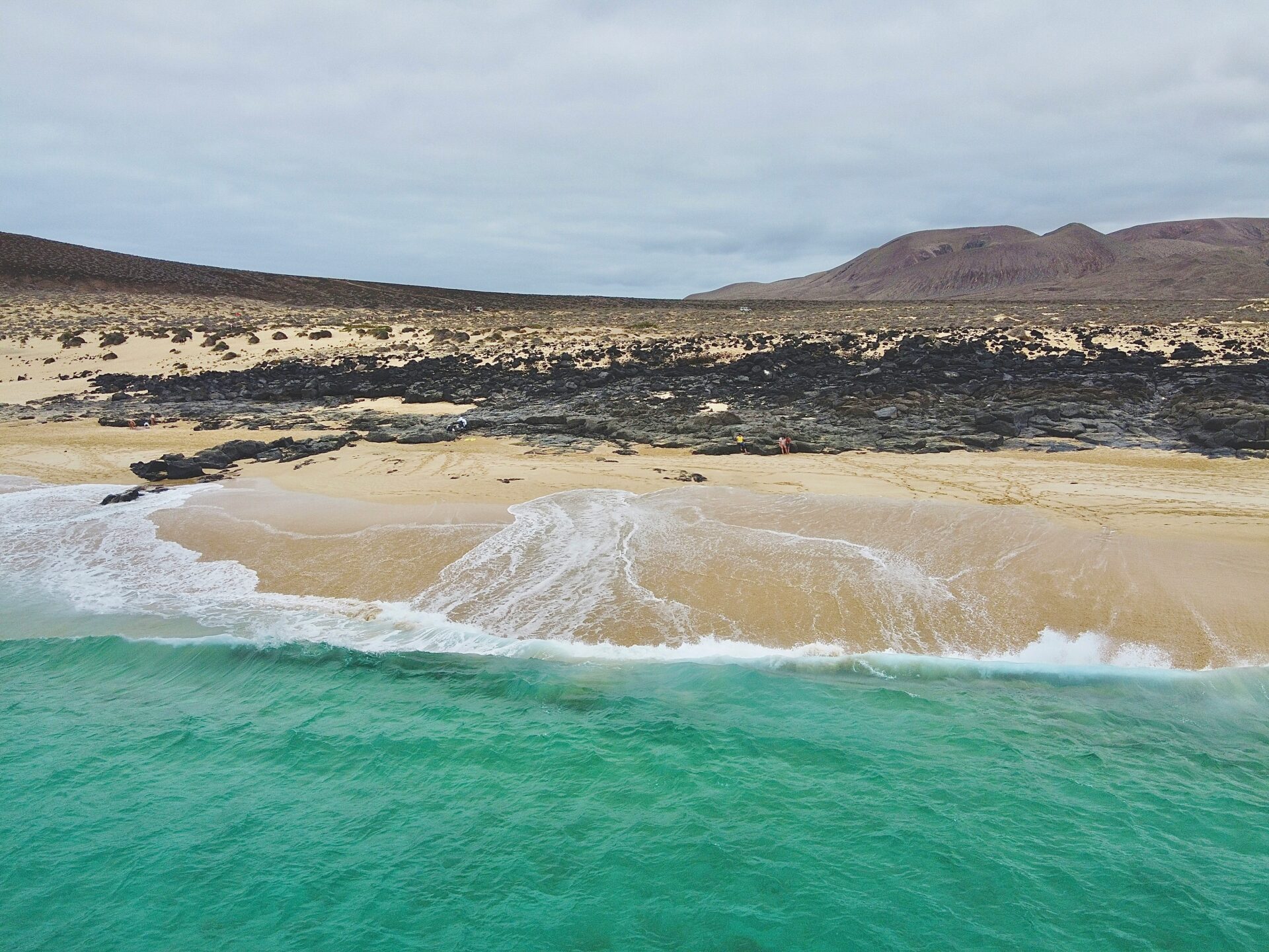
The north’s beaches—La Garita and Caletón Blanco—are perfect for swimming and snorkeling. Their black sand reminds you just how volcanic this island really is.
El Río Strait and Ferry Crossings
El Río strait slices between Lanzarote and La Graciosa. Early settlers thought it looked like a river, which is how it got its name.
Ferries run regularly from Orzola port, just 15 minutes from Mirador del Río. The ride takes about 25 minutes and there are multiple crossings daily.
Ferry details:
- Summer: Every 30 minutes, 8:00 AM to 6:00 PM
- Winter: Every hour, 8:00 AM to 5:00 PM
- Cost: €20 round trip for adults
On La Graciosa, you’ll find untouched beaches and hiking trails. There aren’t any paved roads, so it’s perfect for a walk or bike ride.
The Salinas del Río salt pans lie just below the cliffs near the strait. They’re the oldest salt works in the Canaries and still use age-old methods to collect sea salt.
Exploring Lanzarote’s Northern Coast and Culture
Lanzarote’s northern coast really grabs your attention with its wild cliffs, traditional fishing villages, and a deep sense of Canarian heritage. I always feel like this rugged stretch blends the dramatic Famara cliffs with small communities that still hang on to the island’s seafaring roots.
Famara and Local Villages
The Famara cliffs run for about six kilometers along the northwest. These huge rock faces shoot up almost 500 meters above the Atlantic. Standing there, I can’t help but think they’re among the most jaw-dropping sights in the Canaries.
Right at the foot of these cliffs, you’ll find the village of Famara. Surfers flock here for the steady waves, and the golden beach seems to call everyone at least once. Even though tourism has picked up, the town still feels like a fishing village at heart.
Traditional villages near the northern coast include:
- Mancha Blanca – you’ll spot it for its white houses
- Tinajo – the place to go for local crafts
- Punta Mujeres – a peaceful little fishing port
These spots keep the old Canarian look alive. I always notice those whitewashed homes with shutters painted green or blue. Volcanic stone shows up everywhere in the buildings, adding a bit of rugged charm.
Festivals pop up all year, shining a light on the area’s maritime traditions. Villages set up fish markets, and you’ll see locals selling the day’s catch straight from their small boats.

Historical Background of the Region
For centuries, the northern coast played a crucial role in defending Lanzarote. Military outposts dotted the coastline, keeping watch for pirates and unwelcome visitors.
You can still find traces of old fortifications near Mirador del Río. Locals maintained these defenses well into the 20th century.
Long before the Spanish set foot here, the Guanche people called this wild region home. Archaeologists have uncovered evidence that shows they found shelter—and maybe even held ceremonies—in the caves tucked into the Famara cliffs.
Key historical periods:
- Pre-1400s: Guanche settlements
- 1400s-1600s: Spanish colonization
- 1700s-1800s: Pirate defense era
- 1900s-present: Tourism development
Salt production shaped life along the northern coast. Generations of workers gathered salt from volcanic pools, and this industry kept local families going.
Northern Lanzarote’s isolation kept traditions alive for a surprisingly long time. Fishing boats and small farms dominated daily life here, right up until the tourism boom hit in the 1970s.