The Pacific Coast Highway snakes for 1,650 miles along America’s western edge, cutting through three states. Each beach, cliff, and quirky coastal town has its own vibe, and honestly, that’s what keeps me coming back. From Oregon’s wild sea stacks to California’s golden sands and Washington’s untamed wilderness, I’ve realized no two stretches of this coast ever feel the same. Every mile reveals new landscapes, cultures, and surprises that make the Pacific Coast Highway one of the world’s most fascinating coastal drives.
What makes this road trip unforgettable? It’s not just the jaw-dropping ocean views or bucket-list stops like Big Sur and the Golden Gate Bridge. The coast seems to reinvent itself as you roll north or south. The geology, weather, and local personalities shift, and suddenly you’re in a whole new story. California’s beaches? Wide, sandy, perfect for sunbathing and surfing. Then you hit Oregon, and suddenly you’re clambering over rocks and peering into tide pools alive with strange little creatures.
For me, the real magic comes from picking stops that show off these different coastal personalities. Maybe you’re into the artsy towns along California’s Highway 1, or you want to chase lighthouses across Oregon, or you crave the wild, windswept beaches of Washington’s Olympic Peninsula. Each state brings its own flavor. Along the way, you’ll drive through wine country, ancient redwoods, and seaside towns that have shaped the way America connects with the Pacific.
Pacific Coast Highway: The Heart of the Journey
Highway 1 runs for 655 miles along California’s coast, tying together big cities like Los Angeles and San Francisco and passing through icons like Malibu, Big Sur, and Santa Barbara. This route mixes ocean views, historic landmarks, and those classic California beaches everyone dreams about.
Highlights of Highway 101 and Pacific Coast Highway
If you can, drive north to south. That way, you’ll have the Pacific right outside your window—trust me, the views are better.
Key Route Features:
- Highway 1 (PCH): The main route, hugging the coast with ocean access
- Highway 101: The inland backup if Highway 1 closes due to weather or mudslides
- Total Distance: 655 miles of California coastline
The highway moves through rolling hills near Santa Barbara, then suddenly you’re on dramatic cliffs in Big Sur. It connects the energy of LA with the laid-back charm of San Francisco.
Sometimes, storms or mudslides close parts of Highway 1—especially in winter. Highway 101 becomes the go-to detour.
Before I hit the road, I always check the latest conditions. The California Department of Transportation posts real-time updates, which has saved me more than once.
Historical Landmarks and Engineering Feats
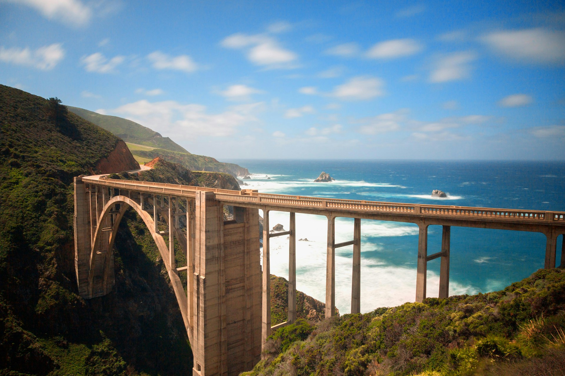
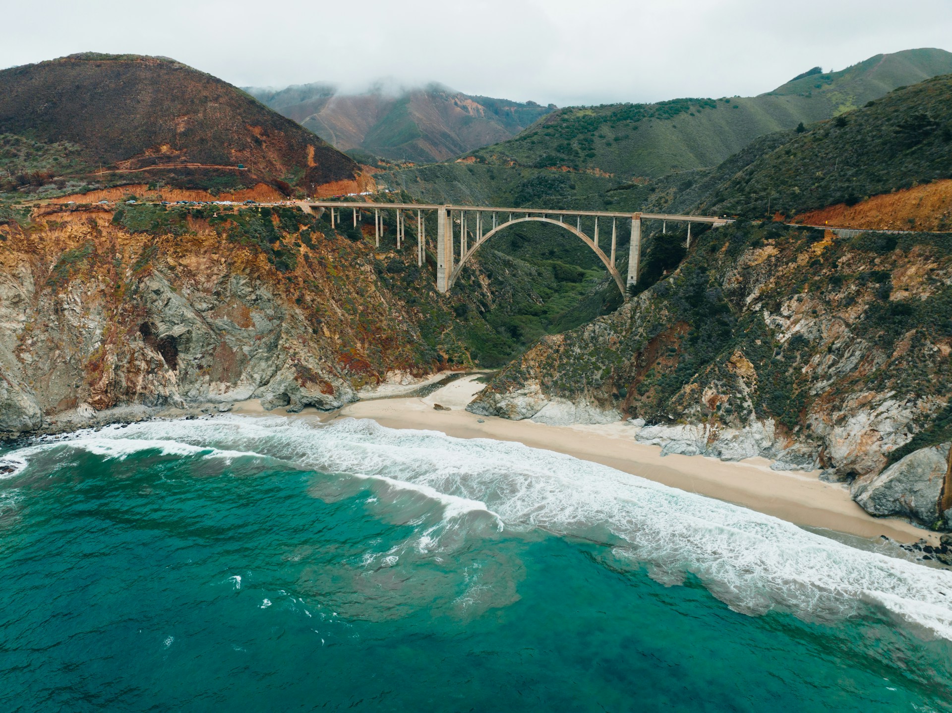
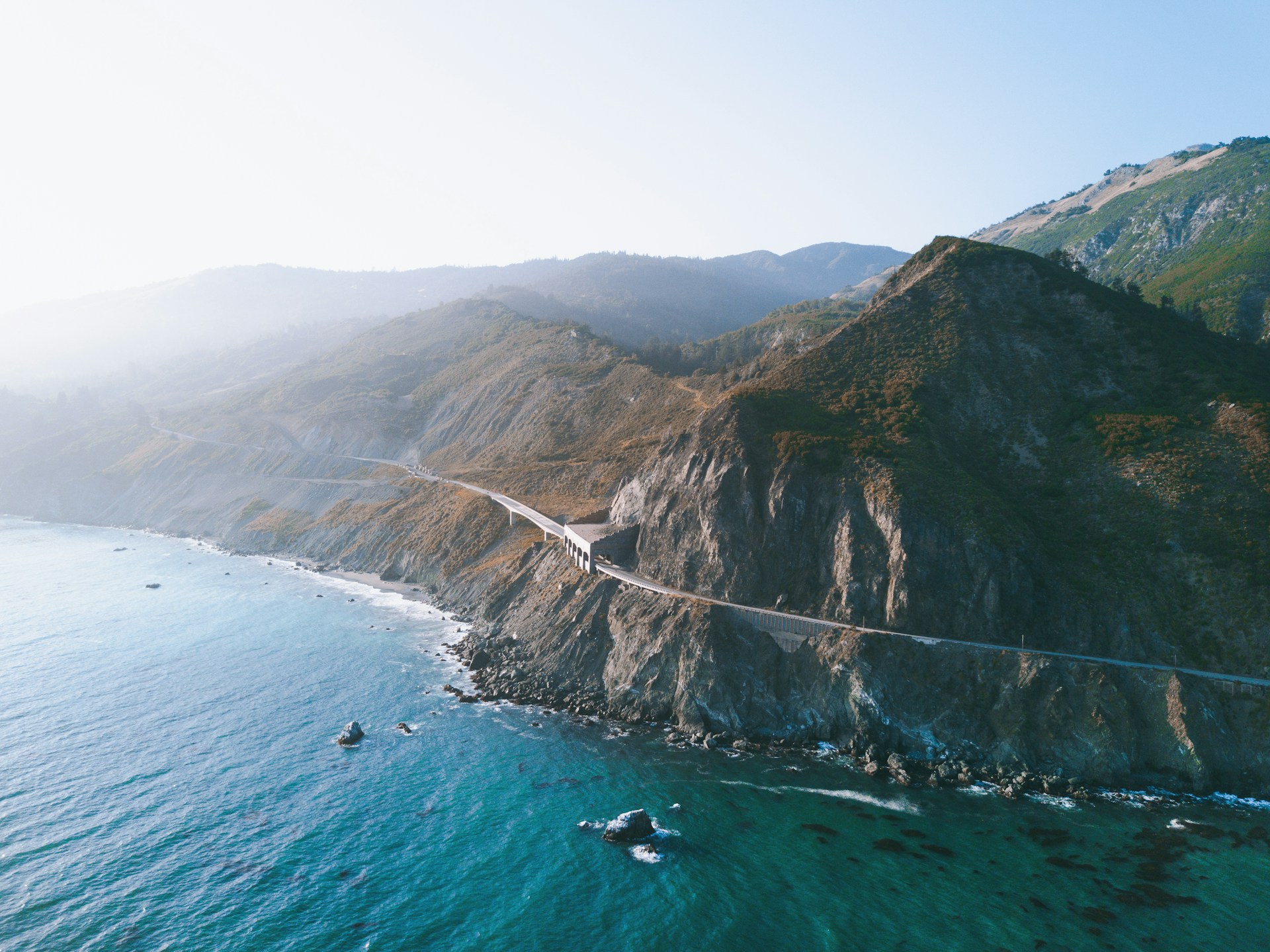
You can’t miss the Bixby Bridge. Built in 1932, this concrete arch stretches 714 feet over Bixby Creek Canyon in Big Sur.
It towers 280 feet above the canyon floor. Everyone seems to stop here for that iconic photo—myself included.
Then there’s McWay Falls, an 80-foot waterfall that tumbles straight onto the beach at Julia Pfeiffer Burns State Park. The land once belonged to heiress Helen Chamblet Hooper back in the early 1900s.
Christopher McWay homesteaded the canyon in 1887, and now both the falls and canyon carry his name.
Building Highway 1 was no small feat. Crews blasted through rock and carved the road into sheer cliffs in the 1930s. It’s wild to imagine how tough that must have been.
Must-See Beach Destinations Along the Route
Malibu stretches for 21 miles along the southern coast. Zuma Beach and Point Dume are favorites—easy to reach, great for swimming or surfing.
Santa Barbara brings you East Beach and West Beach close to downtown. The harbor, with its red-tiled roofs and palm trees, gives the city a Mediterranean feel. El Capitan State Beach sits just a bit north.
Big Sur hides beaches like McWay Beach beneath waterfalls. Most require a short hike from Highway 1, but the rugged coastline rewards you with epic photos.
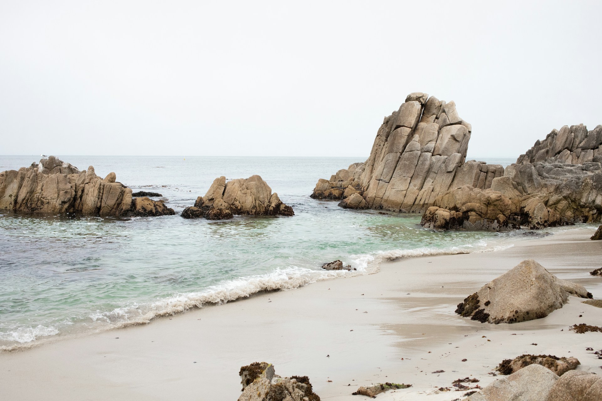
Monterey and Carmel have Carmel Beach—soft white sand, cypress trees, and a relaxed vibe. Monterey Bay offers calmer water for kayaking, and the 17-Mile Drive links both towns through Pebble Beach.
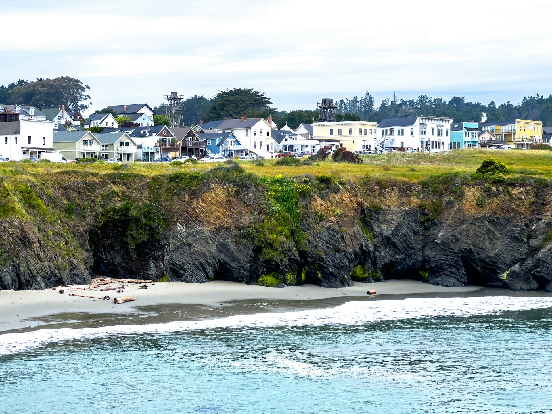
Northern Coast near Mendocino feels wilder and quieter. Fort Bragg and the Lost Coast rarely get crowded, but sunsets here are unreal.
Every beach has its own mood. Some invite you to wade into gentle waves, while others show off powerful surf pounding against rocks.
California’s Diverse Coastal Stories
California’s coast runs over 650 miles, splitting into three regions, each with its own character. From redwood forests to sun-soaked city beaches, there’s a lot to take in.
Northern California: Redwoods and Rugged Beauty
Northern California’s coast feels wild, almost untouched. Mendocino County’s redwoods tower over rocky beaches, where waves crash hard against dark cliffs.
Key Features:
- Ancient redwood groves
- Dramatic headlands
- Rugged tide pools
- Historic logging towns
Mendocino perches on bluffs 90 feet above the sea. Victorian houses line the streets, and trails wind through old-growth forests.
The beaches here have a rough edge. Glass Beach in Fort Bragg, for example, transformed decades of trash into a shoreline full of smooth, colorful glass.
Fog rolls in most mornings, turning the forests into something out of a fairy tale.
Central Coast: Dramatic Cliffs and Artist Towns
Big Sur is California’s drama queen—cliffs drop hundreds of feet to the ocean, and Highway 1 clings to the edge.
I’ve watched sea otters float in Monterey Bay while pelicans dive for lunch. The marine sanctuary here protects over 400 species.
Notable Stops:
- Carmel-by-the-Sea: Storybook cottages and white sand beaches
- Monterey: The famous aquarium and Cannery Row
- San Francisco: Golden Gate Bridge and Alcatraz Island
Artists have flocked to these cliffs for more than a century. Carmel became a haven for writers and painters, all inspired by the cypress trees and crashing waves.
Some beaches here are gentle enough for families, while others hide tide pools packed with sea stars and anemones.
Southern Shores: Iconic Cities and Sunny Beaches
Southern California means endless sun and a laid-back surf scene. Wide sandy beaches stretch from Malibu to San Diego, and the water’s usually warm enough to swim.
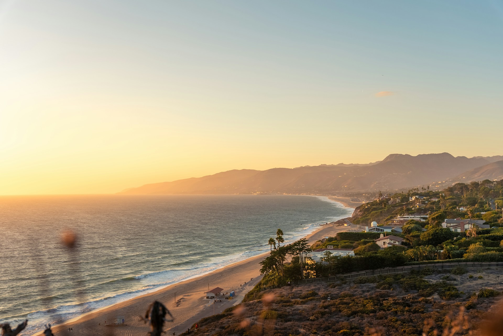
Malibu’s beaches attract both celebrities and surfers. Santa Barbara mixes Spanish-style buildings, perfect weather, and nearby wine country.
Los Angeles brings a different energy:
- Venice Beach: Street performers, murals, and Muscle Beach
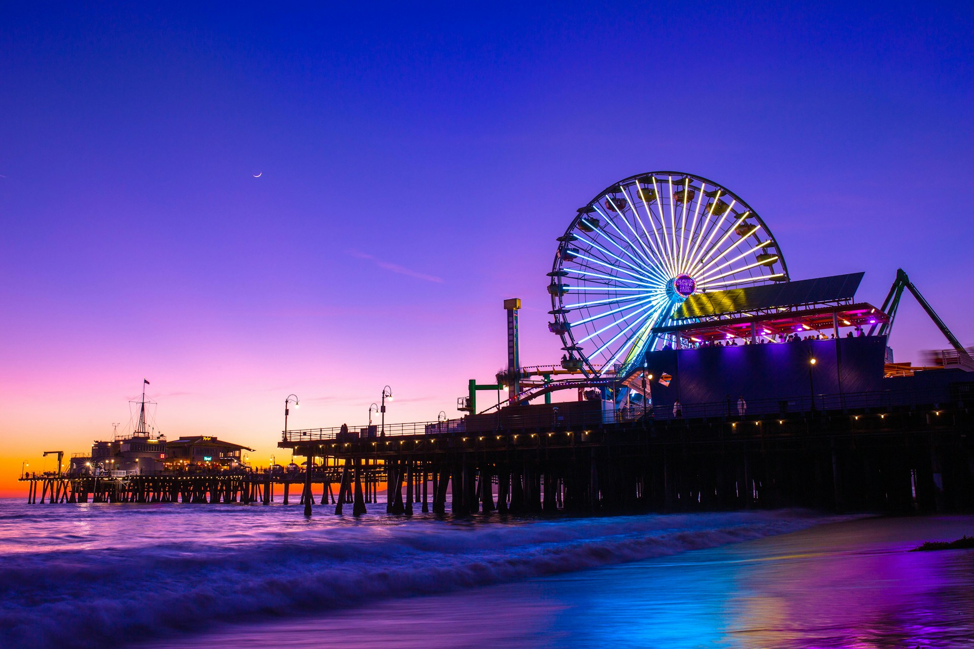
- Santa Monica: The famous pier and amusement park
- Manhattan Beach: Volleyball courts and fancy dining
San Diego offers 70 miles of shoreline. Each area has its own feel, from La Jolla’s cliffs to Mission Beach’s family-friendly sands.
These beaches tell stories of Hollywood, surfing legends, and California dreams. The sunshine and perfect waves helped invent the beach culture we all know.
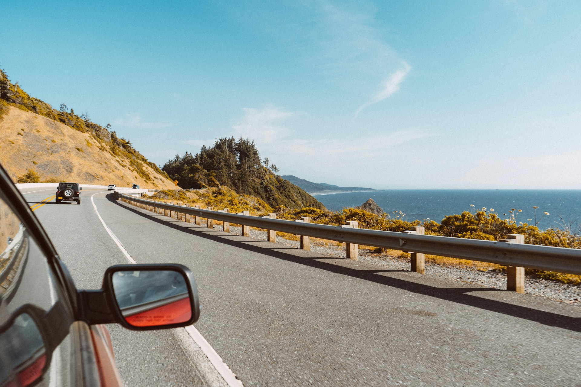
Oregon Coast: Landscapes of Sea Stacks and Dunes
The Oregon Coast runs for 363 miles from Astoria to Brookings. Here, sea stacks rise from the surf, and massive dunes shift with the wind. Dense Sitka spruce forests meet steep cliffs, while old lighthouses keep watch over some of the country’s most dramatic shoreline.
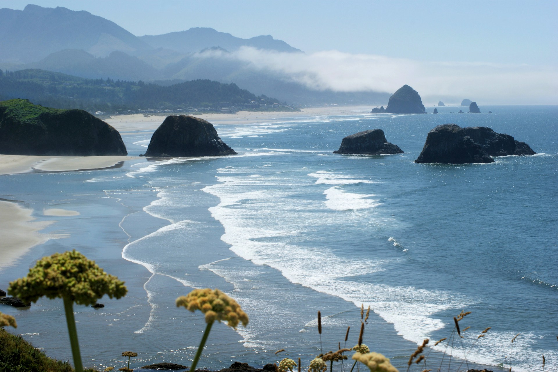
Cannon Beach and Haystack Rock
Cannon Beach might be the most photographed place on the Oregon Coast. The 235-foot Haystack Rock dominates the scene, surrounded by tide pools full of sea anemones and starfish when the tide goes out.
The beach stretches for miles on both sides of Haystack Rock. I love wandering north toward Ecola State Park or south past smaller sea stacks.
Why Cannon Beach stands out:
- Haystack Rock is easy to reach at low tide
- Sea stacks everywhere make for dramatic photos
- The town has art galleries and cozy restaurants
- Ecola State Park offers trails with ocean views
These sea stacks formed as waves wore away softer rock, leaving behind hard basalt columns that now tower above the sand.
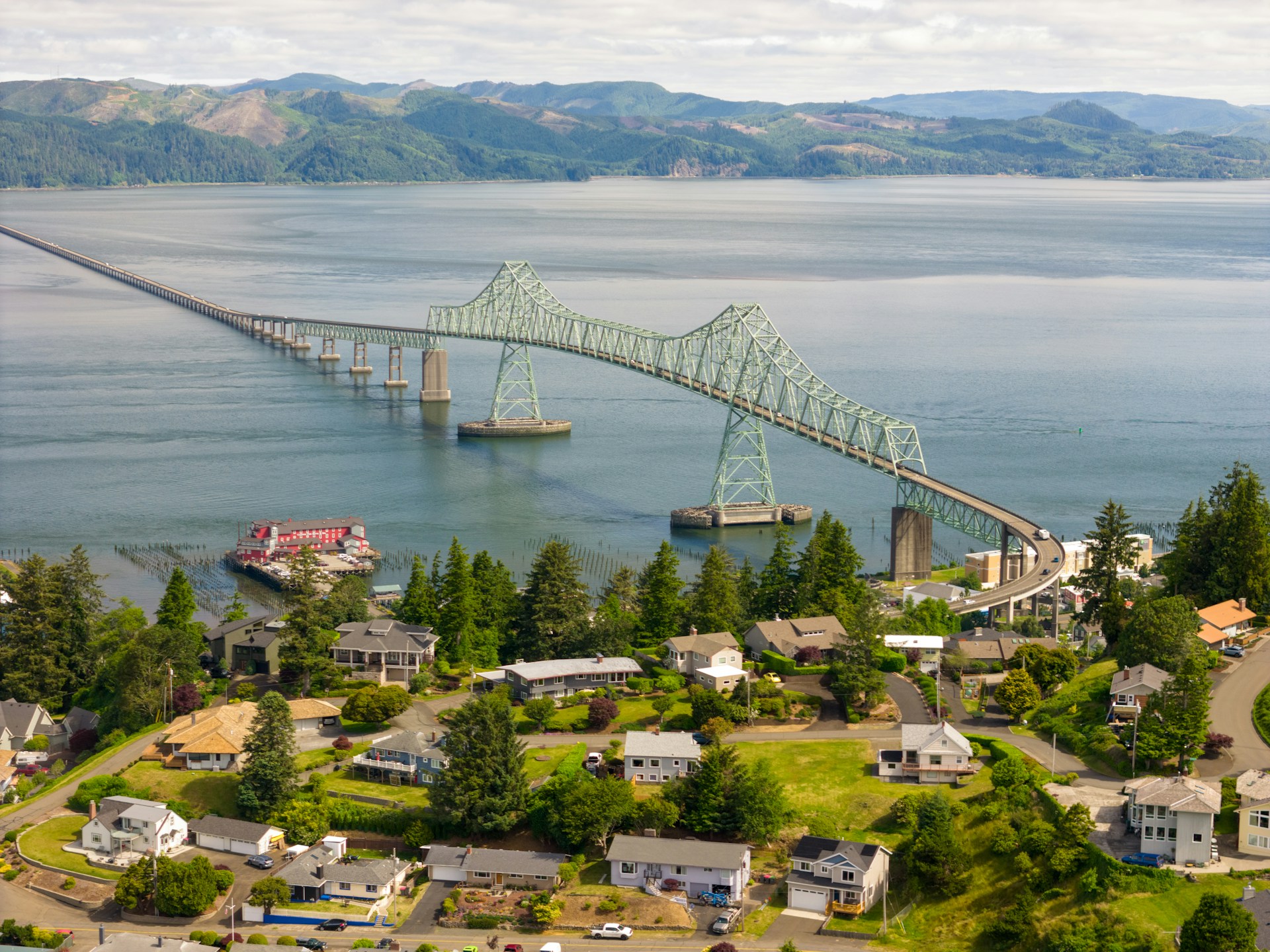
Columbia River and Astoria
Astoria sits where the Columbia River empties into the Pacific Ocean at Oregon’s top corner. I always suggest starting here if you’re driving the Oregon Coast—it’s packed with maritime history and Victorian buildings.
The Columbia River creates a huge estuary at Astoria. Salmon run here, and the mix of fresh and salt water supports all kinds of wildlife.
Fort Stevens State Park sits just outside town:
- Ruins of a Civil War-era fort
- The Peter Iredale shipwreck on the beach
- Miles of bike trails through coastal forests
- Campsites tucked among Sitka spruce trees
Climb the Astoria Column for sweeping views of the river, ocean, and coastal mountains. At 125 feet tall, it’s a great spot to get your bearings.
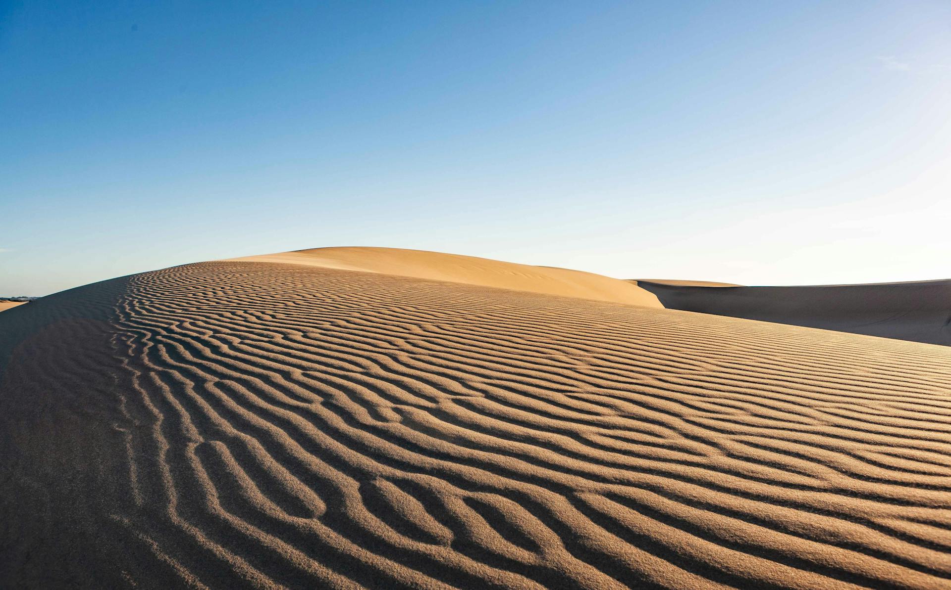
Sand Dunes and Coastal Forests
The Oregon Dunes near Florence create the largest stretch of coastal sand dunes in North America. They roll on for 40 miles and reach up to 500 feet high.
You can hike the dunes or rent an ATV if you’re feeling adventurous. The wind constantly reshapes the sand, so the landscape always feels fresh.
Coastal forests of Sitka spruce and western hemlock press right up to the beaches. The fog and mild climate make these woods lush and green.
The Oregon Coast changes fast:
- Sandy beaches become rocky tide pools within minutes
- Towering dunes turn into forested corridors
- Sea stacks rise from both sand and stone
- Rivers cut through the woods to meet the Pacific
Near Heceta Head Lighthouse, you’ll find forests, cliffs, and sea stacks all in one place. The lighthouse sits 205 feet above the ocean, with views up and down the rugged coastline.
Washington’s Wild Coast and the Pacific Northwest Experience
Washington’s coast brings together wild sea stacks, rainforests, and quirky towns. The Olympic Peninsula offers untouched wilderness, while Seattle packs in urban culture and seafood galore.
Olympic Peninsula and National Park Adventures
Olympic National Park covers nearly a million acres on the Olympic Peninsula. Inside, you’ll find beaches, rainforests, and alpine peaks—all in one park.
The Hoh Rain Forest gets more than 12 feet of rain a year. The Hall of Mosses Trail is a must. It’s just 0.8 miles, but you’ll feel like you’re walking through a fantasy movie set.
Ruby Beach shows off the wild side of Washington’s coast. Huge sea stacks rise from the waves, and driftwood covers the sand. If you go at low tide, you can poke around tide pools filled with starfish.
Forks acts as the main hub for the park’s western side. Sure, it got famous thanks to Twilight, but most folks come for hiking and the outdoors.
Olympic Peninsula Highlights:
- Hiking mossy trails
- Exploring tide pools
- Spotting wildlife
- Soaking in hot springs
- Watching winter storms roll in
Seattle and Pike Place Market
Seattle blends Pacific Northwest style with city life. It sits on Puget Sound, with the Olympic Mountains looming in the distance.
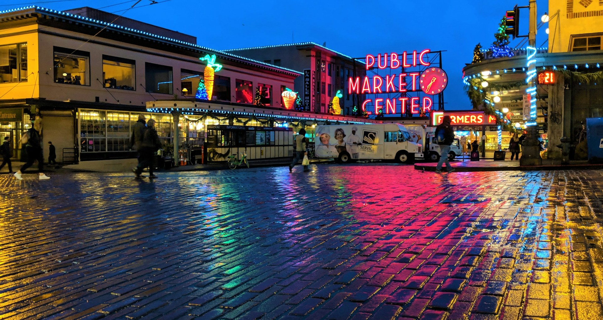
Pike Place Market has been open since 1907 and still buzzes with energy. I always check out the fish-throwing vendors and grab some fresh Dungeness crab.
More than 200 vendors fill the market with local produce, flowers, and crafts. Rachel the Piggybank stands at the entrance, collecting coins for charity.
Coffee culture runs deep here. The original Starbucks opened inside Pike Place in 1971, and it’s still there.
The Space Needle rises 520 feet above the city, giving you a 360-degree view. On a clear day, you can spot Mount Rainier, Mount Baker, and the Olympics all at once.
Idyllic Long Beach and Port Angeles
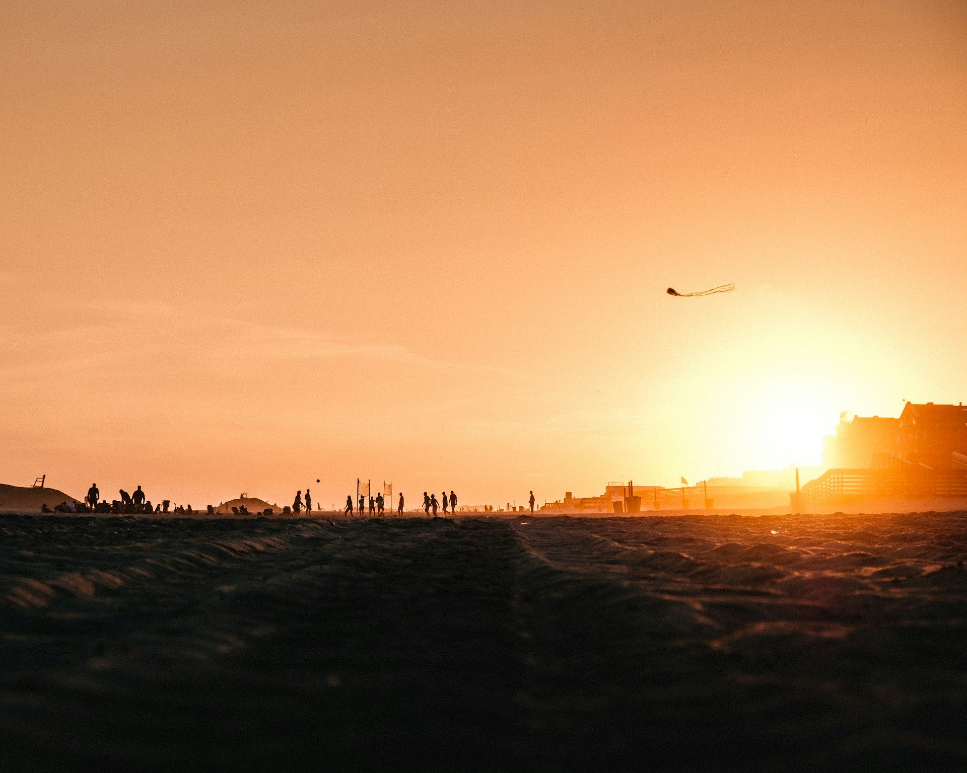
Long Beach runs for 28 miles along the edge of the Pacific. Here’s something you don’t see every day: you can actually drive your car right onto the sand. That’s pretty rare in Washington.
Every August, Long Beach hosts the International Kite Festival. It’s a wild scene—pros show off their kite skills while families just have fun with simpler kites.
Just inland, you’ll find the Willapa National Wildlife Refuge. The place protects old-growth forests and salt marshes. I’ve wandered the boardwalk trails, and they’re perfect for birdwatching—bring binoculars if you’re into that.
Port Angeles sits right on the Strait of Juan de Fuca. It’s the main jumping-off point for the northern side of Olympic National Park, and you can even catch a ferry to Victoria, Canada from here.
Hurricane Ridge is only 17 miles away from Port Angeles. The drive up the mountain is gorgeous, and as long as the weather holds, the road stays open all year. In winter, you’ll see folks cross-country skiing, while summer brings wildflower meadows that look almost unreal.
Quintessential Stops and Hidden Gems
The Pacific Coast Highway is a mix of big-name sights and those blink-and-you’ll-miss-it gems. I’ve stumbled on hidden beaches, quirky towns, and wild stretches where you might spot elk or seals. No two stops are quite the same.
Charming Towns and Cultural Hotspots
Monterey really nails that blend of history and sea life. I always tell people to start at Cannery Row. The old sardine factories now hold cool shops and restaurants. The Monterey Bay Aquarium sits right on the water, and if you love marine creatures, it’s a must-see.
Carmel feels like it belongs in a fairy tale. The cottages look whimsical, with curvy roofs and tiny windows. Carmel Beach has soft white sand and leads right to Pebble Beach’s famous golf course.
Heading north, Astoria in Oregon couldn’t be more different. This port town stands at the meeting point of the Columbia River and the Pacific. If you climb the Astoria Column, you’ll get sweeping views of water and forest all around.
Seaside brings out the classic beach town nostalgia. I love strolling the old boardwalk and watching surfers try their luck. The place still has that retro vibe—think arcade games and shops selling saltwater taffy.
Every town along the way has its own flavor. You’ll find local art galleries, seafood spots, and weathered old buildings that have survived countless storms. There’s always something to discover if you take your time.
Unique Coastal Landscapes and Wildlife Watching
The redwoods rise up like natural cathedrals along the northern stretches of Highway 1. Sometimes, these giants practically lean right over the ocean.
I always find myself pausing at Prairie Creek Redwoods State Park. Wandering beneath trees that have watched centuries pass—it’s humbling, honestly.
Sand dunes near Florence, Oregon, seem to go on forever. The Oregon Dunes National Recreation Area looks almost otherworldly, with golden hills rolling right up to the Pacific Ocean.
You’ll spot people zipping around on ATVs, kicking up sand. Meanwhile, seabirds nest quietly in the protected corners, mostly unbothered by the noise.
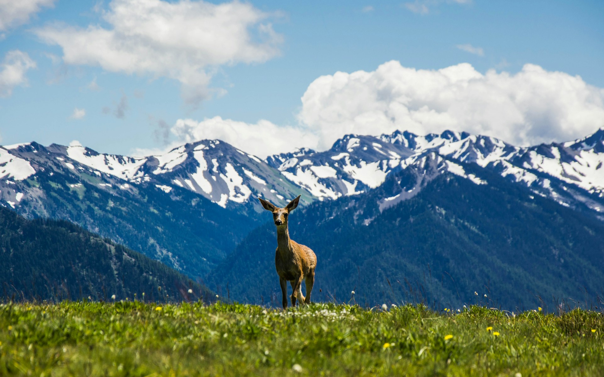
Wildlife watching here? It never gets old. Gray whales cruise by the coast twice a year, and if you’re lucky, you’ll catch a spout or tail flick.
Harbor seals sprawl out on sunny rocks and beaches. Sometimes, sea otters drift lazily in the kelp, looking like they don’t have a care in the world.
Tide pools always draw me in at low tide. There’s something magical about spotting bright sea anemones, starfish, and the occasional crab.
If you’re after the best tide pools, check out Haystack Rock or Point Reyes. Each spot has its own surprises—different critters, wild rock shapes, and the ever-present sound of the waves crashing in.