Exploring the wild side of Exmoor in Somerset has given me some of my best hiking memories. From crossing the ancient Tarr Steps to reaching the windswept summit of Dunkery Beacon, I’ve soaked in breathtaking views and felt the quiet magic of this national park up close.
Each walk has its own flavor. What really sticks with me, though, are those moments when the famous Exmoor ponies or red deer appear, moving through the hills as if they own the place.
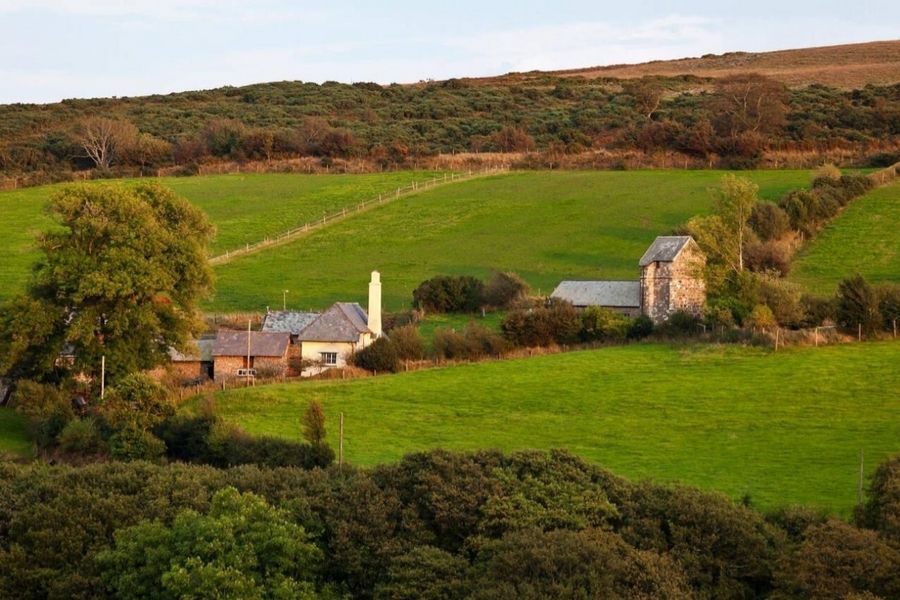
The Somerset part of Exmoor feels rugged and untouched. Every route—whether it’s a gentle riverside stroll or a moorland climb—brings something different.
Along the way, I’ve picked up a few handy tips for wildlife spotting and finding the best scenery. Honestly, each hike feels like its own little adventure.
Discovering Exmoor: The Somerset Side
Exmoor’s Somerset side is all wild moorland, ancient woods, and rolling hills. Sometimes I’d stumble across a herd of ponies or spot wild red deer grazing, with views that stretch on forever.
It’s remote, but there’s something about the landscape that feels steeped in history.
Exmoor National Park Overview
Exmoor National Park covers parts of west Somerset and north Devon, sprawling over 690 square kilometers. When I first set out from the Somerset side, I noticed how quickly things shifted—from gentle farmland to open, untamed moor.
You’ll find the Brendon Hills rolling along and a dramatic stretch of coastline along the Bristol Channel. Dunkery Beacon stands out as the park’s highest point, with views that sweep right across the moor.
Exmoor is famous for its dark skies. If you’re into stargazing, you’ll want to stay out after sunset at least once. There’s a peacefulness here, with scattered stone circles and old tracks that give the place a timeless feel.
Unique Moorland Landscape
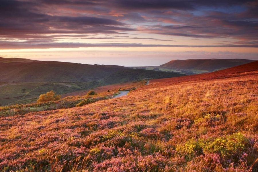
The moorland’s wide-open spaces are covered with heather, gorse, and grasses that change with the seasons. Somerset’s side of Exmoor feels less developed, so there’s a real wildness to the hills.
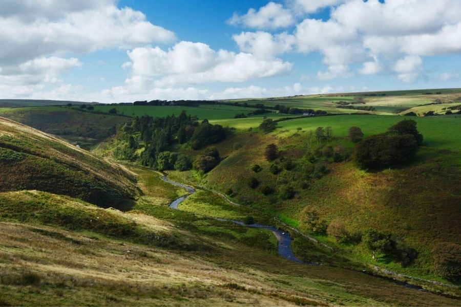
I’ve found myself crunching along peat paths, weaving through patches of bog, and crossing “clapper bridges” like Tarr Steps—those ancient stone slabs that span the River Barle.
The hills dip into deep valleys, woodlands, and quick-moving streams. Weather can turn on a dime here.
Mist sometimes sweeps in, making everything feel mysterious and still. I never head out without a map and a waterproof jacket—losing the trail is way too easy when the clouds drop.
Wildlife and Local Habitats
Wildlife is what keeps drawing me back to Exmoor. Red deer, the biggest wild animals in England, graze quietly at dawn or dusk. Watching a herd move through the bracken? That’s something you don’t forget.
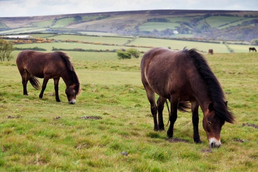
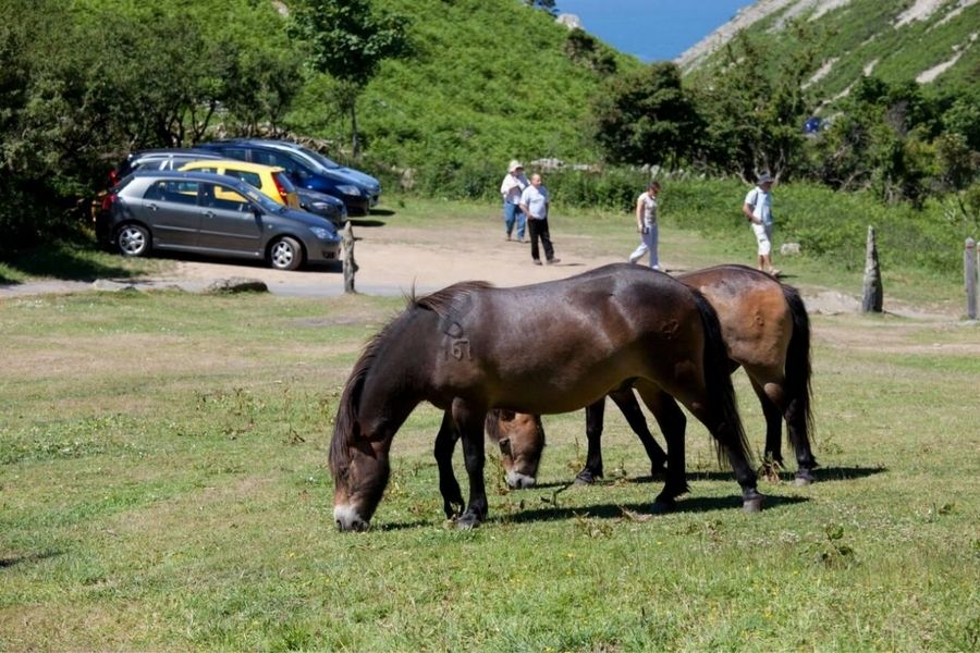
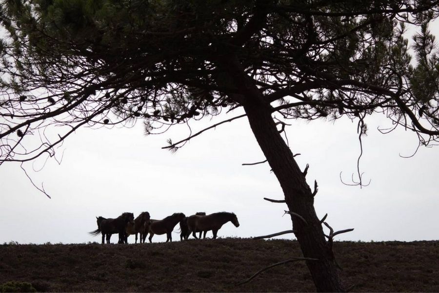
Exmoor ponies roam the hills, totally at home here. They’re a rare breed, tough and sturdy, shaped by thousands of years on this land.
Buzzards circle overhead, songbirds flit through the oak woods, and otters slip along the rivers. Each habitat—from boggy moor to leafy valley—brings its own mix of life.
I always sling binoculars in my pack, hoping for a lucky sighting without disturbing the peace.
Tarr Steps: Ancient Crossing and Scenic Trails
Tarr Steps is a clapper bridge with a story, tucked into the peaceful Exmoor landscape. The River Barle winds through woodland valleys here, and the area offers excellent walking routes right in the heart of Somerset.
History and Significance of Tarr Steps
Tarr Steps stands as one of Britain’s oldest clapper bridges. Builders used huge stone slabs to cross the River Barle, creating the country’s longest span of its kind.
Seventeen massive stones—some over a ton each—make up the bridge. There’s no cement or metal, just careful placement and gravity.
Some folks say it dates back to the Bronze Age, though the first written records are from Tudor times. Walkers still use the bridge today.
Standing there, it’s easy to see why people have valued this crossing for centuries. It just fits into the landscape, like it’s always been part of Exmoor’s story.
River Barle and Surrounding Valleys
Tarr Steps crosses the River Barle in a deep, wooded valley. The river runs clear and fast, with trout darting between the rocks.
I’ve spotted gray wagtails and herons along the banks, just by taking it slow as I walk.
The woodland here is a National Nature Reserve, filled with old oak and ash trees. Ferns and moss cover the ground, making the whole place feel lush and green.
Come autumn, the leaves turn gold and orange—absolutely stunning. This part of Exmoor feels wild but somehow welcoming.
You’ll often see red deer or Exmoor ponies if you’re out early or late in the day. Trails branch out from the bridge, following the river or winding through the woods.
Walking and Circular Routes
If you’re heading to Tarr Steps, start at the main car park—it’s a quick stroll to the bridge. The classic route is a circular walk along one side of the River Barle, crossing a footbridge about a mile downstream, then looping back on the other side.
It’s straightforward, about 2.5 miles, and takes around an hour if you’re not rushing. Families, solo hikers, everyone seems to enjoy it. The signs make it hard to get lost.
On longer days, I like linking up with routes toward Withypool, or heading out to Watersmeet or the Valley of Rocks. Tarr Steps makes a great jumping-off point for exploring more of Exmoor on foot.
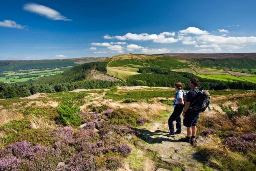
Summiting Dunkery Beacon: Somerset’s Highest Point
Dunkery Beacon rises to 519 meters (1,703 feet), making it the tallest spot in Somerset and Exmoor. My hike up there was a mix of history, open landscapes, and some of the best panoramic views you’ll find in southwest England.
Dunkery Beacon Summit Experience
At the summit of Dunkery Hill, a wide stone cairn marks the highest point. The ground is open moorland—rough grass and heather everywhere.
The climb isn’t steep, thanks to the broad ridges and gentle slope. Up top, the wind can be sharp, and the world seems to stretch out forever.
Standing there, with just birds and wind for company, feels peaceful and a little humbling. I usually take a break by the cairn, watching clouds drift overhead.
Other hikers come and go, but there’s always space to find your own quiet spot.
Routes: Dunkery Hill, Circular Walks & Ascents
There’s more than one way up Dunkery Beacon. The most popular is from the National Trust car park at Dunkery Gate, about a mile from the summit.
Popular routes:
- Direct ascent from Dunkery Gate (about 1.5 miles, easy going)
- Circular walks from Webber’s Post or Horner (longer, 5–8 miles, a bit steeper)
- Short, family-friendly options from laybys just below the summit
Most of the terrain is open and grassy, so it’s accessible for most walkers. I like starting from Webber’s Post for a longer loop—it passes through woods and heath before joining the main path.
Maps and waymarks keep things simple.
Views and Panoramic Vistas
From the summit, you get wide views over Exmoor’s moorland, Somerset’s green fields, and distant hills. On a clear day, you can spot the Bristol Channel, the Quantocks, and sometimes even the mountains of South Wales.
That panoramic sweep is what makes Dunkery Beacon special. Sun and shadow play across the land, and even if it’s cloudy, the sense of space is amazing.
I once visited at sunset—the light over the Vale of Taunton and the moors was unforgettable.
National Trust Spaces and Car Parks
The National Trust looks after Dunkery Beacon and much of the land around it. That means well-marked trails and a welcoming feel for walkers.
Car parks are small but handy. The main National Trust car park at Dunkery Gate fits about eight cars, and it fills up fast on busy days.
Parking is free, but the road’s narrow, so space is tight. Other options include laybys and roadside pull-ins lower down the hill.
Arrive early or late if you want a spot. The National Trust signs are clear, and I appreciate the info boards and simple facilities at the main stops.
Here’s a quick look:
| Car Park Location | Spaces (approx.) | Surface | Facilities |
|---|---|---|---|
| Dunkery Gate (main) | 8 | Gravel | Info board |
| Laybys (lower slopes) | 3-4 each | Grass/Gravel | None |
| Webber’s Post | 15 | Gravel | Toilets, info |
Encounters with Exmoor Ponies and Red Deer
Exmoor’s open hills and wooded valleys host wild Exmoor ponies and herds of red deer. Spotting them during hikes to Tarr Steps or Dunkery Beacon always feels like a treat.
Wildlife Spotting: Exmoor Ponies
You’ll find Exmoor ponies grazing on the open moor, usually in small herds. Their thick brown coats and pale muzzles stand out against the heather and gorse.
These ponies are a rare native breed—smaller than most horses, but sturdy and tough. Sometimes I’d spot managed herds, cared for by local groups to keep the breed going strong.
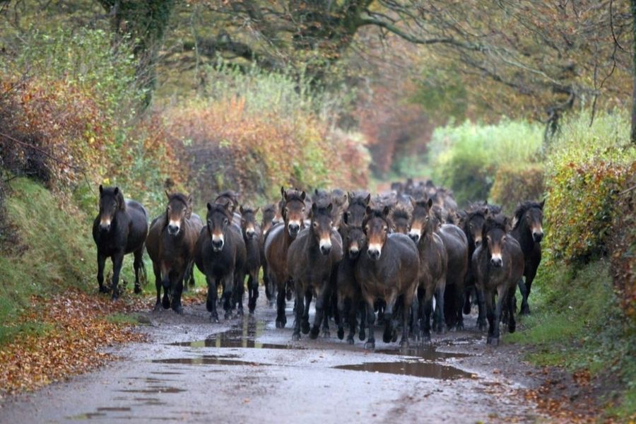
Early morning or dusk is the best time to see them. Ponies are shy, but if you stand quietly, they sometimes wander a bit closer.
If you want a guaranteed sighting, the Exmoor Pony Centre near Dulverton lets visitors learn about and meet the ponies up close.
Observing Red Deer
Red deer are Exmoor’s largest wild animals. On walks near Dunkery Beacon or out on the moors, I sometimes catch them moving between woods and open ground.
Spotting deer takes patience and a quiet approach. Stags are easiest to see in autumn during the rut, but you can find deer all year.
Binoculars help you watch from a distance without disturbing them. I’ve watched groups of hinds and calves grazing, while stags keep to themselves a bit farther away.
Red deer move quietly, so I listen for snapping twigs or the rustle of grass. Sometimes, antlers poke up above the bracken before you see the whole animal.
Tips for Responsible Wildlife Encounters
Respecting wildlife matters. I always keep my distance and use a camera or binoculars instead of getting close.
Feeding ponies or deer? That’s a no-go—human food can harm them. I avoid blocking their paths or making noise.
If I’m with friends, we keep our voices down and move slowly. Dogs should stay on leads, especially near herds.
A quick checklist for responsible encounters:
| Do | Don’t |
|---|---|
| Watch quietly | Feed the wildlife |
| Keep dogs on leads | Chase or follow animals |
| Use binoculars or zoom | Block paths or approaches |
Taking these steps helps make sure wildlife stays wild, and future hikers get the same amazing experiences. Every time I spot ponies or red deer, I feel lucky to witness Exmoor’s wild side in its natural rhythm.
Essential Hiking and Exploration Tips
Hiking in Exmoor isn’t just about putting one foot in front of the other—it’s about staying alert for sudden weather shifts, tricky ground, and the kind of views that make you stop in your tracks. I’ve learned that knowing which trails to take, and where to pause for a photo, can turn a good walk into a great one. Tarr Steps and Dunkery Beacon? Both are worth it, every single time.
Preparing for Exmoor’s Weather and Terrain
Exmoor’s weather likes to keep you guessing. I never leave without a waterproof jacket and an extra layer stuffed in my pack, just in case. Muddy, uneven ground is pretty common, especially after a downpour, so I always pull on my sturdiest waterproof boots.
The ground changes fast—from open, windy hilltops at Dunkery Beacon to the shadowy, tangled valleys near Tarr Steps. Some trails can get slippery or rocky, and bridleways get extra churned up by horses. I take a quick look at the forecast before heading out, but honestly, I expect surprises.
A map and a small first aid kit live at the bottom of my bag. Mobile signal drops out in the deeper valleys, so I download offline maps ahead of time. I throw in a couple of snacks and a full water bottle—shops aren’t exactly around every corner out here.
Bridleways, Footpaths and Trail Networks
Exmoor’s path network is a real maze—footpaths, bridleways, and trails crisscross everywhere. Bridleways let walkers, horses, and sometimes cyclists share the space. I usually pick footpaths for quieter walks, but bridleways give more space (and more mud).
Waymarks are a lifesaver. I spot acorn symbols for national trails and yellow arrows for regular footpaths. Some routes wander through farmland, so I make sure to close every gate and keep half an eye out for sheep or cows.
Popular trails, like those to Tarr Steps or Dunkery Beacon’s summit, fill up on weekends. If I’m after peace and quiet, I wander off onto less-marked paths or start early. An OS Explorer map helps me spot new routes and plan a quick detour if I need one.
Photography and Scenic Spots
Exmoor’s moorland, valleys, and coastline beg for a camera. I get my favorite shots just after sunrise or as the sun drops, when the light turns everything golden. Dunkery Beacon is a classic spot—wide views, big skies, and on a clear day, you can see the Bristol Channel.
Wildlife is everywhere if you’re patient. I keep my camera handy for Exmoor ponies and, if I’m lucky, catch a glimpse of red deer slipping through the trees. Tarr Steps, with its ancient stone bridge and rushing river, is a must-shoot, but those rocks can get slick, so I tread carefully.
For quick hikes or trail runs, I just use my phone or a small action camera. It’s lighter, and I don’t worry about bashing expensive gear. I keep my distance from animals, especially in spring when there are young ones about—no photo is worth stressing them out.
Exploring Surrounding Highlights and Nearby Villages
Exmoor isn’t just wild hills and moorland. There’s a patchwork of historic villages, deep valleys, and all sorts of walking paths. Every new place I’ve visited here has its own personality—different views, wildlife, or a bit of local history that sticks with you.
Withypool and the Two Moors Way
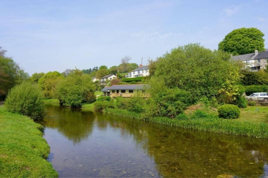
Withypool sits quietly by the River Barle, tucked away from the main roads. I loved crossing its old stone bridge before wandering off through green meadows and up wooded slopes. The village has a cozy tea room and a tiny shop—perfect for grabbing supplies before heading out.
The Two Moors Way cuts right through Withypool. This long-distance trail connects Exmoor and Dartmoor, stretching about 117 miles. The stretch around Withypool is peaceful, with sheep grazing and big, open moorland views.
Waymarks make this path easy to follow, even if you’re new to hiking. Withypool works well as a place to rest or as a launch point for a longer journey—south toward Dartmoor or north to the coast.
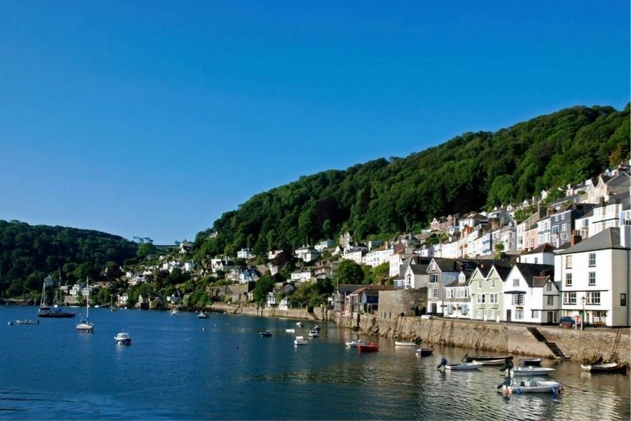
Minehead, Dunster, and Dunster Castle
Minehead sits on the Somerset coast and acts as the gateway to the South West Coast Path. It’s easy to stock up here before heading into more remote corners of Exmoor. The seafront is nice for a gentle walk, and the harbor runs boat trips along the Bristol Channel.
Not far inland, you’ll find Dunster, a village packed with medieval charm and crowned by its castle. Dunster Castle is open to visitors, and I spent a good chunk of time wandering its gardens and poking around rooms full of old treasures. The hilltop gives you sweeping views toward the sea.
Dunster itself is small but lively, with old inns, tea rooms, and quirky shops. The yarn market on the main street is a reminder of how wool once shaped the village’s fortunes.
Horner Wood and Holnicote Estate
Horner Wood, tucked inside the big Holnicote Estate managed by the National Trust, feels ancient. Mossy paths wind under old oaks, and I often spot red deer or hear birds echoing through the trees. Even when Exmoor gets busy, this woodland stays calm.
Holnicote Estate sprawls over 12,000 acres—farmland, villages, and even bits of coastal heath. Waymarked walks start from the village of Horner, and several circular routes loop over to Bossington, a lovely spot nearby.
You won’t find steep climbs here, but the shady tracks and bursts of wildflowers offer a welcome break from the windswept hills. Sometimes, a slower wander is exactly what you need.
Connections to Dartmoor, Devon, and the South West Coast Path
Exmoor feels closely tied to other legendary landscapes nearby. If you’ve got a car or a bit of extra time, Devon and Dartmoor are both within easy reach for a day trip. I remember following the Two Moors Way, which basically links Dartmoor and Exmoor—one moment you’re wandering on open moorland, the next you’re in a completely different world.
When I wanted a change of scenery, I kicked things off at Minehead, which marks the official start of the South West Coast Path. This trail stretches for over 600 miles, hugging the coast all the way through Devon and Cornwall. Honestly, the North Devon section blew me away with its wild sea cliffs and hidden coves. On a clear day, you might even catch a glimpse of the Brecon Beacons far off in the distance.
Switching between moorland and coastal paths is surprisingly simple. The signs are clear, so you can hop from one landscape to the next with barely any hassle—perfect for anyone craving variety in their hikes.