Death Valley National Park isn’t like anywhere else I’ve explored—America’s hottest, driest, and lowest national park is a true land of extremes. Salt flats stretch for miles, and the canyons look like something from another planet. My journey here felt both challenging and fascinating. The clash between barren valleys and snow-capped peaks? I never expected it.
I wandered across Badwater Basin, 282 feet below sea level, feeling the sun’s intensity and the desert’s hush. Even in the harshest spots, I found wildflowers after a rare rain and spotted tiny wildlife hiding near secret oases. These moments made me realize Death Valley isn’t just about heat or records—it’s full of surprises if you’re willing to look closer.
Visiting Death Valley National Park pushed me to prepare well and stay curious. The wild geography, the need to stay hydrated, and the thrill of venturing into one of America’s most extreme places—every part felt like an adventure.
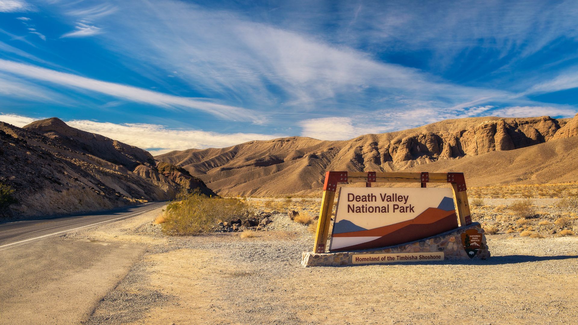
Death Valley National Park: The Most Extreme Landscape
People know Death Valley National Park for its tough geography, relentless climate, and record-breaking heat. As I made my way through the park, I could see how these extremes shaped everything around me.
Geography and Location
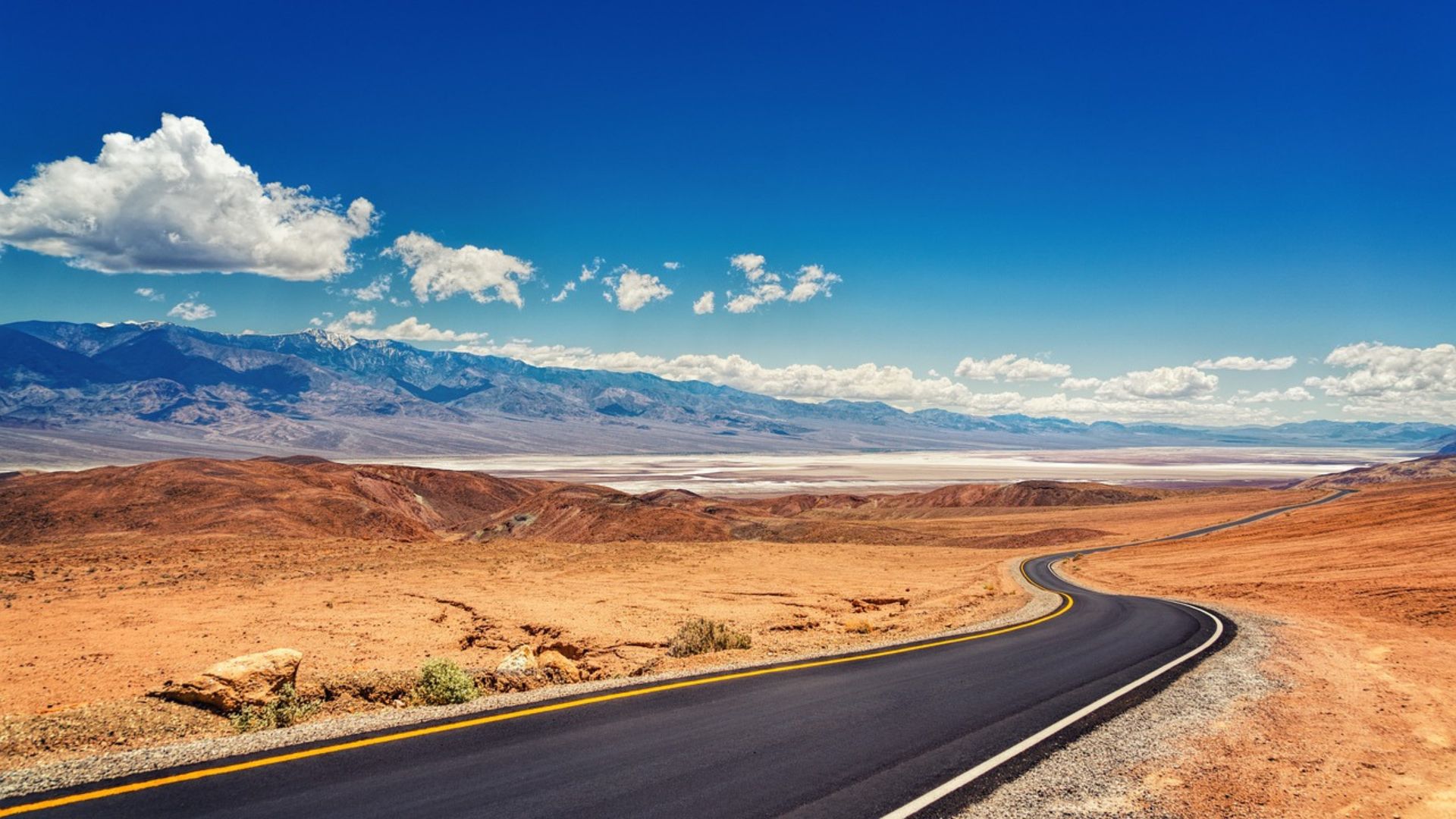
Death Valley National Park sits in eastern California and spills into Nevada. It covers about 3 million acres, making it the biggest national park in the lower 48 states.
The valley runs between the Panamint Range on one side and the Amargosa Range on the other. Sometimes, you can spot the Sierra Nevada far off in the distance.
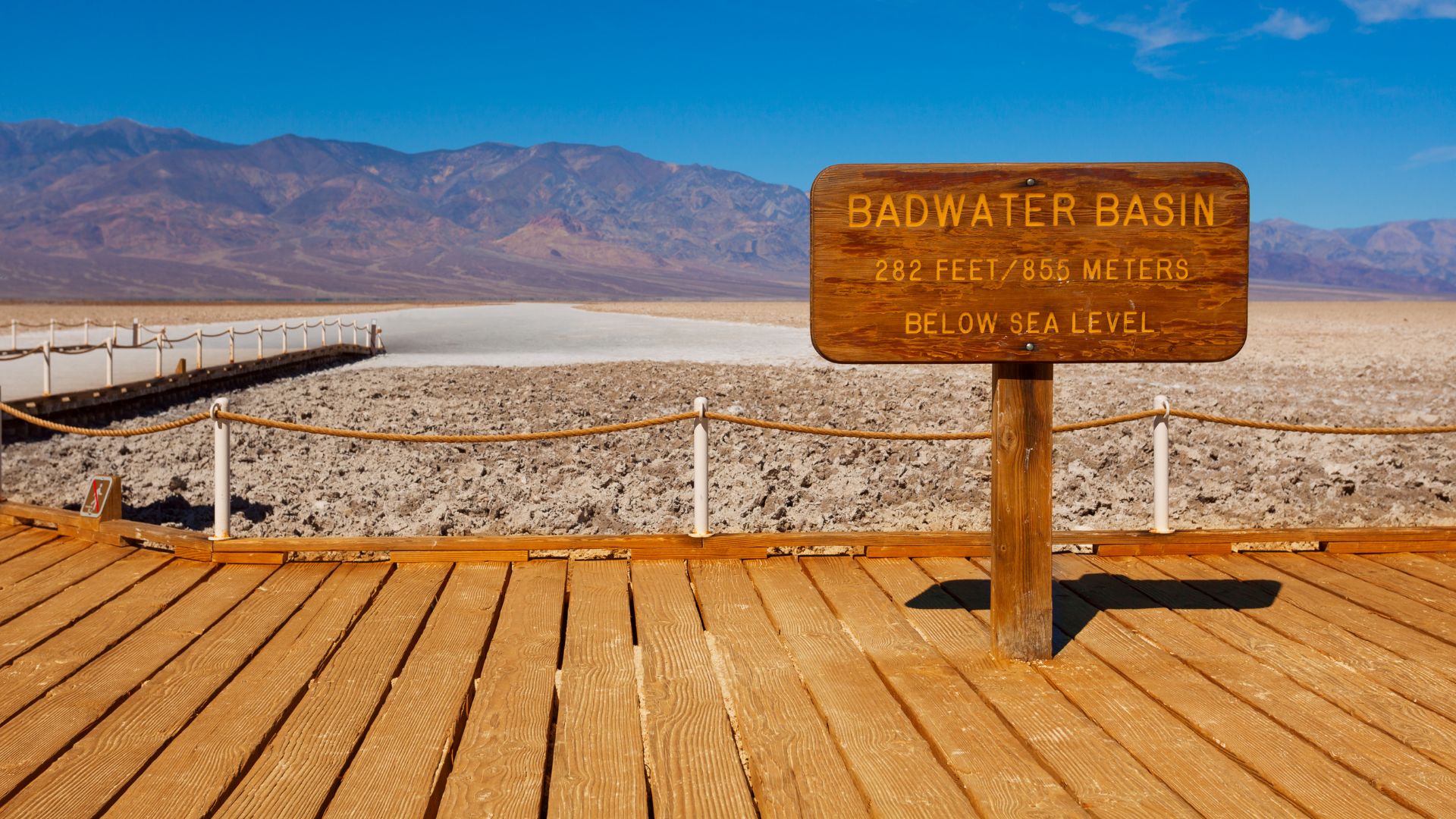
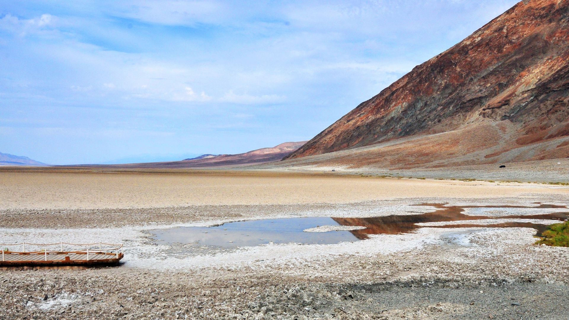
Badwater Basin stands out as a truly unique spot. At 282 feet below sea level, it’s the lowest point in North America. The valley floor is a patchwork of salt flats, sand dunes, and canyons that twist through the rock. The sharp peaks and rainbow-colored hills feel almost unreal, rising above the endless flatness.
Unique Climate and Highest Temperatures
Death Valley’s climate is something else. Summers drag on, hot and dry, with barely any humidity and just a sprinkle of rain. Less than 2 inches falls in a year, making it the driest national park in the country.
Daytime highs in summer often blast past 120°F (49°C), especially in July and August. Nights cool off some, but compared to most places, they’re still pretty warm. The Panamint Range sometimes gets snow in winter, but down in the valley, it stays dry and hot. That contrast between mountain chill and valley heat? You can really feel it, especially at sunrise or late afternoon.
Record-Breaking Heat and Extreme Drought
Death Valley holds the record for the highest air temperature ever recorded on Earth. On July 10, 1913, Furnace Creek hit 134°F (56.7°C). That number is wild—and it’s why people call this the hottest place on Earth.
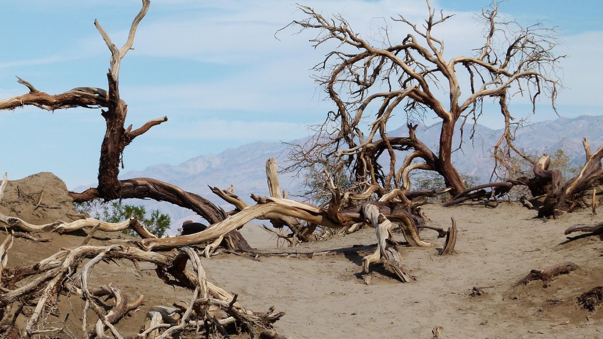
Drought is just a way of life here. Streams and rivers rarely stick around after a rainstorm. Most plants and animals have figured out how to get by with almost no water. As I walked the salt flats and dry washes, I spotted tough little plants and the occasional sign of life clinging to the baked ground. The lack of water and relentless sun shape everything, giving Death Valley a character you won’t forget.
Iconic Landforms and Geological Wonders
As I drove and hiked through Death Valley National Park, I stumbled upon landforms shaped by heat, dryness, and a wild geologic past. Salt flats, sand dunes, rocks in wild colors, and a volcanic crater all grabbed my attention.
Badwater Basin: Salt Flats and the Lowest Point
Badwater Basin blew my mind with its endless, white salt flats. This spot—282 feet below sea level—is the lowest in North America. Water once filled the valley, then vanished, leaving thick salt behind.
Walking across the flats, I saw hexagonal patterns covering the ground. These salt crusts form as the desert gets wet, then dries out again and again. The place feels alien—flat, bright, and bordered by the Black Mountains looming in the distance. I noticed alluvial fans, where rocks and gravel spill down from the mountains onto the valley floor.
Here’s a quick table of facts about Badwater Basin:
| Feature | Detail |
|---|---|
| Elevation | 282 ft below sea level |
| Main Landform | Salt flats |
| Nearby Mountains | Black Mountains |
| Notable Feature | Hexagonal salt polygons |
Mesquite Flat Sand Dunes and Eureka Dunes
Mesquite Flat Sand Dunes are super easy to reach and stretch out as far as you can see. Soft hills of sand ripple with patterns made by wind and wandering feet. These dunes cluster near Stovepipe Wells and rise about 100 feet tall. They’re perfect for sunrise photos, when the light and shadows play across the sand.
Eureka Dunes, tucked away in Eureka Valley, are some of California’s tallest dunes at around 680 feet. When I visited, I heard a low, humming sound as the sand slid—“booming sand,” they call it. Both dune fields sit in dry, open country dotted with stubborn desert plants.
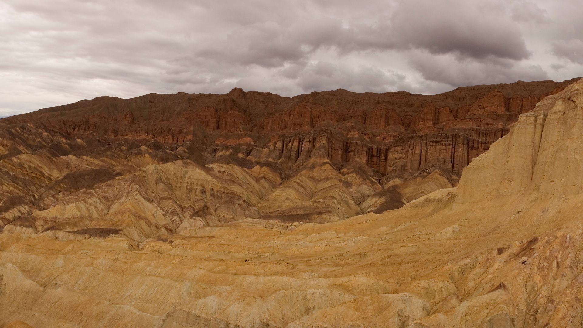
Zabriskie Point and Geological Formations
Zabriskie Point gave me one of the most iconic Death Valley views. From the overlook, waves of yellow, brown, and gold hills stretched out, worn down by millions of years of erosion. These hills are layers of sedimentary rock from an ancient lake.
At sunrise, the colors and shadows shift, making the landscape glow. Golden Canyon and the Badlands Trails nearby let you get closer to these wild rock layers. The minerals here paint the hills in all sorts of shades, with the Black Mountains standing bold in the background.

Ubehebe Crater and Volcanic Features
Ubehebe Crater stands out—a half-mile wide, 600 feet deep, and dramatic. Less than 2,000 years ago, hot magma hit groundwater here, causing a massive explosion that blew out the crater and scattered ash everywhere.
Walking the rim, I spotted layers of dark ash and pale rocks. Smaller craters dot the area, proof that this part of Death Valley once bubbled with volcanic activity. The crater walls show off signs of erosion, and the whole area feels stark, quiet, and a little eerie.
Must-See Sights and Things to Do in Death Valley
Some places in Death Valley just stick with you. I climbed high for sweeping views, wandered through canyons, and watched strange rocks “move” across the desert floor.
Top Lookout Points: Dante’s View, Artists Palette, and Telescope Peak
Dante’s View towers above the valley, offering one of the best views I’ve ever had. From up here, I looked down on the salt flats and up at the Panamint Mountains. The air felt cooler, so I lingered for photos and to soak it all in.
Artists Palette is a drive-through area famous for its colorful hills. Pink, green, and gold rocks pop thanks to minerals in the soil. I pulled over a few times to get out and see the colors up close. Early morning and late afternoon light make everything glow.
Telescope Peak rises to 11,043 feet, the highest point in Death Valley. Hiking up is tough, but the views from the top are wild—you can see both the lowest and highest spots in the park. Up there, the wilderness feels endless.
Exploring Golden Canyon and Hiking Trails
Golden Canyon draws hikers for good reason. I walked the main trail, winding between colorful rock walls and ending at the Red Cathedral. The trail is easy to follow, and there are shady spots to pause.
Star Wars filmed scenes here, so there’s a bit of movie magic in the air. The Salt Creek Interpretive Trail is another favorite, flat and family-friendly. It passes a salty stream where rare pupfish dart about. Most hikes are best early or late, when the heat lets up a bit.
The Racetrack Playa: Mysterious Moving Rocks
Racetrack Playa is famous for its “sailing stones.” I bumped down a rough dirt road for hours to see these rocks, which leave long tracks across the dry lakebed as they slowly move. For years, nobody could explain how they moved, but now we know thin ice sheets and wind do the trick.
The playa feels remote and wild. There’s no shade, no water, and no services, so I packed plenty of supplies. Standing out there under the huge sky, I felt tiny. It’s easily one of the most otherworldly places I’ve ever set foot in.
Ghost Towns, History, and Mining Heritage
Death Valley hides old mining ruins and ghost towns all over. I found traces of the gold rush and borax mining scattered across the desert—stories of grit, hope, and dreams that faded fast.
The Gold Rush Legacy and Borax Mining
Death Valley once buzzed with mining booms. Miners flocked here for gold, silver, copper, and especially borax. Borax, used in everything from soap to glass, became the big draw.
The gold rush in the late 1800s brought thousands of dreamers. Tiny camps exploded into towns overnight. When the minerals ran out, folks left, and the towns went quiet.
Borax changed everything. Big companies set up plants, and the famous “20-mule teams” hauled borax out of Death Valley. Their story is woven into the park’s history. I spotted old equipment and faded signs, reminders of those tough days.
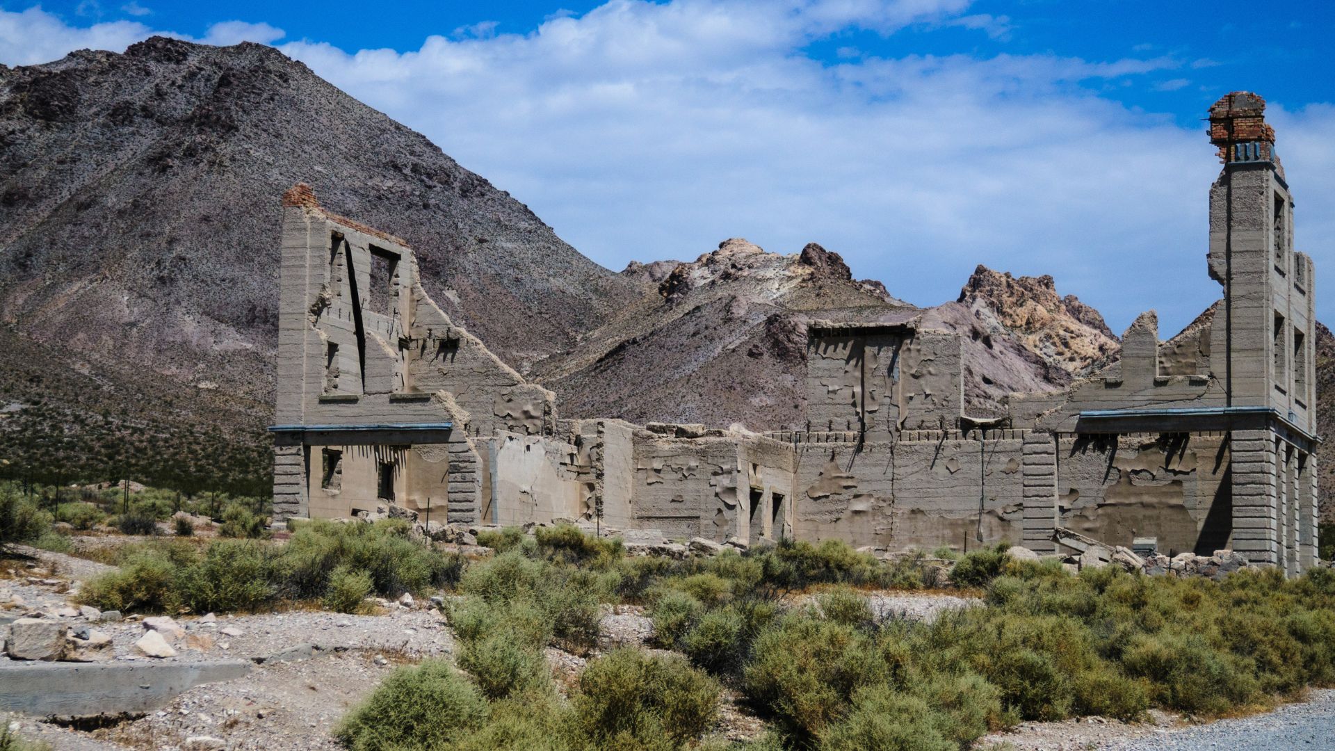
Visiting Rhyolite and Historic Ghost Towns
Rhyolite caught my attention right away. From 1905 to 1911, it was a bustling city with schools, churches, and even a bank. At its peak, nearly 10,000 people called it home, but after the mining bust, everyone vanished.
Today, Rhyolite is pure ghost town. Crumbling stone walls, a train depot, and a bottle house built from glass bottles are all that remain. It’s free to visit, and you can wander among the ruins. Old foundations and rusted tools give you a real sense of how quickly fortunes changed.
Other ghost towns like Panamint City and Ballarat dot the Death Valley area. Some are tough to reach, requiring long drives or even hikes. Each spot is a reminder of the boom-and-bust cycle that shaped this region.
Harmony Borax Works and Keane Wonder Mine
Harmony Borax Works stands as one of the oldest, most famous sites in the park. Built in the 1880s, it processed tons of borax and launched the 20-mule team wagons. Signs explain how workers used huge vats and wooden carts to get the job done.
Keane Wonder Mine is another site that grabbed my interest. Gold was discovered there in 1903, turning it into a major operation. The mine had cable tramways to move ore down the mountain, and you can still see pieces of these structures.
Both places are preserved inside Death Valley National Park. Walking among the old buildings and machinery, I could almost imagine the miners’ tough lives. Harmony Borax Works and Keane Wonder Mine are open to visitors, though some areas are off-limits to protect what’s left.
Visitor Tips: Planning Your Death Valley Experience
If you want to enjoy Death Valley’s wild beauty, you really need to prepare well. Timing, road info, park fees, and picking the right campgrounds all make a huge difference. These are the things that helped me get the most out of my trip.
Best Time to Visit and Surviving the Extreme Heat
Death Valley has a reputation for smashing temperature records. Honestly, the only time I felt comfortable exploring was between November and March. Daytime highs then usually stick between 65°F and 80°F.
Summers, though? They’re brutal. Temperatures easily soar past 110°F, sometimes hitting 120°F. I wouldn’t try outdoor activities during the middle of the day at that time of year.
If I had no choice but to visit in summer, I’d wake up before sunrise or wait until sunset for any hikes or sightseeing. I always tossed a gallon of water per person into the car, wore the lightest clothes I could find, and didn’t forget a hat and sunscreen.
I checked the weather forecast religiously and skipped canyon hikes if a heatwave was coming. That kind of heat isn’t just uncomfortable—it can actually be dangerous. I can’t say it enough: plan your big adventures for the cooler months and don’t take risks in extreme heat.
Camping, Stargazing, and Accommodations
Camping under Death Valley’s sky is an experience I’ll never forget. I found popular campgrounds at Furnace Creek, Stovepipe Wells, and Texas Springs. Furnace Creek Campground stays open all year, but you’ll need reservations from October to April.
The smaller campgrounds? They’re first-come, first-served. So, if you want a spot, arriving early is your best bet.
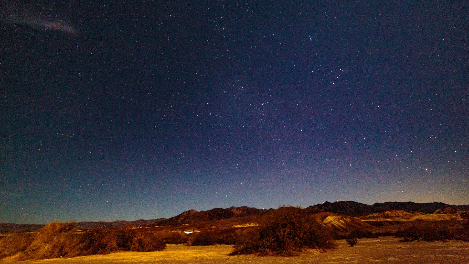
At night, the sky just explodes with stars. Death Valley’s far from city lights, and it’s actually an International Dark Sky Park. I saw the Milky Way without even trying, and meteor showers felt like a private show. If you have a telescope or even binoculars, bring them.
Sometimes, I just want a real bed. In that case, The Inn at Death Valley and The Ranch at Death Valley are solid choices. Rooms fill up fast in winter and spring, so I booked ahead. Stovepipe Wells Village also has cabins and motels if you’re looking for something different.
Essential Routes: California State Route 190 and Backcountry Roads
Most folks, myself included, drive in on California State Route 190. It’s a smooth road that cuts right through the park and connects you to all the big spots—Badwater Basin, Zabriskie Point, Furnace Creek, and Stovepipe Wells.
The drive itself is gorgeous, and you don’t need a special vehicle for the main route. But if you’re feeling adventurous, Death Valley has miles and miles of backcountry roads. You’ll need a high-clearance or four-wheel-drive vehicle for those.
Titus Canyon and Racetrack Playa are two routes that take you deep into the wild parts of the park. Before I went off-road, I always checked the latest conditions at the Furnace Creek Visitor Center and packed extra water and a spare tire, just in case.
Cities like Las Vegas (about two hours away) and Ridgecrest make great jumping-off points for a day trip. I always filled up on gas before heading in, since stations are rare and, honestly, way pricier inside the park.
Park Entrance Fees and Visitor Facilities
To get into Death Valley, I paid a park entrance fee of $30 per vehicle, which covers you for a week. Motorcycles and bicycles get in for less. You can pay at self-serve kiosks at the entrances, online, or just stop by the Furnace Creek Visitor Center.
The Furnace Creek Visitor Center is where I grabbed maps, info, and checked out the exhibits. They’ve got clean bathrooms, drinking water, and a small bookstore too.
You’ll find other visitor centers and general stores at Stovepipe Wells and Panamint Springs. They don’t have everything, but you can pick up snacks, souvenirs, and a few basics.
Facilities get pretty sparse once you’re out in the remote areas. I always planned ahead for snacks, water, and bathroom breaks. Knowing where the services are made me feel a lot more confident exploring such a huge, wild place.
Diverse Wildlife, Nature, and Conservation
Death Valley National Park surprised me with its wildlife. So many plants and animals have managed to thrive in one of the driest, hottest places on the planet.
Park staff and conservationists work hard to protect these unique species, but it’s an ongoing challenge. Nature and people both put pressure on this fragile ecosystem.
Wildlife Adapted to the Harsh Environment
I couldn’t believe the amount of life I spotted out there. Even when the thermometer hit 120°F, I saw coyotes trotting by, lizards darting across the sand, and little rodents braving the open.
Wildlife in Death Valley includes:
- Desert bighorn sheep
- Kangaroo rats
- Sidewinder rattlesnakes
- Desert tortoises
- Birds—especially wherever there’s water
Plants like creosote bush and mesquite barely need water to survive. Insects and reptiles often burrow deep into the sand to escape the heat. Many animals come out only at night, taking advantage of cooler temperatures.
Some creatures live nowhere else but here, perfectly adapted to the harshness. It’s wild to see how tough and creative nature can be in a place like Death Valley.
Conservation Challenges and Preservation Efforts
Protecting Death Valley’s wild landscapes isn’t easy. Climate change, drought, and the steady flow of curious visitors all threaten this strange, beautiful place.
I’ve seen how rising temperatures and long dry spells can push rare plants and animals right to the edge. It’s honestly a bit worrying.
The National Park Service steps in with clear rules to limit damage from cars, hikers, and campers. Rangers and volunteers roll up their sleeves to restore habitats, pull out invasive species, and keep a close eye on wildlife that might be struggling.
Efforts include:
- Educating visitors about fragile ecosystems
- Protecting endangered species
- Restoring damaged land
Scientists don’t just sit back—they’re out there tracking every shift in plant and animal numbers. Conservation in Death Valley means obsessing over the tiniest details, because even a small change can ripple across this tough, yet surprisingly delicate, ecosystem.