The first time I drove Tioga Pass Road through Yosemite’s high country, I stumbled onto what’s probably the park’s most scenic—yet strangely underappreciated—route.
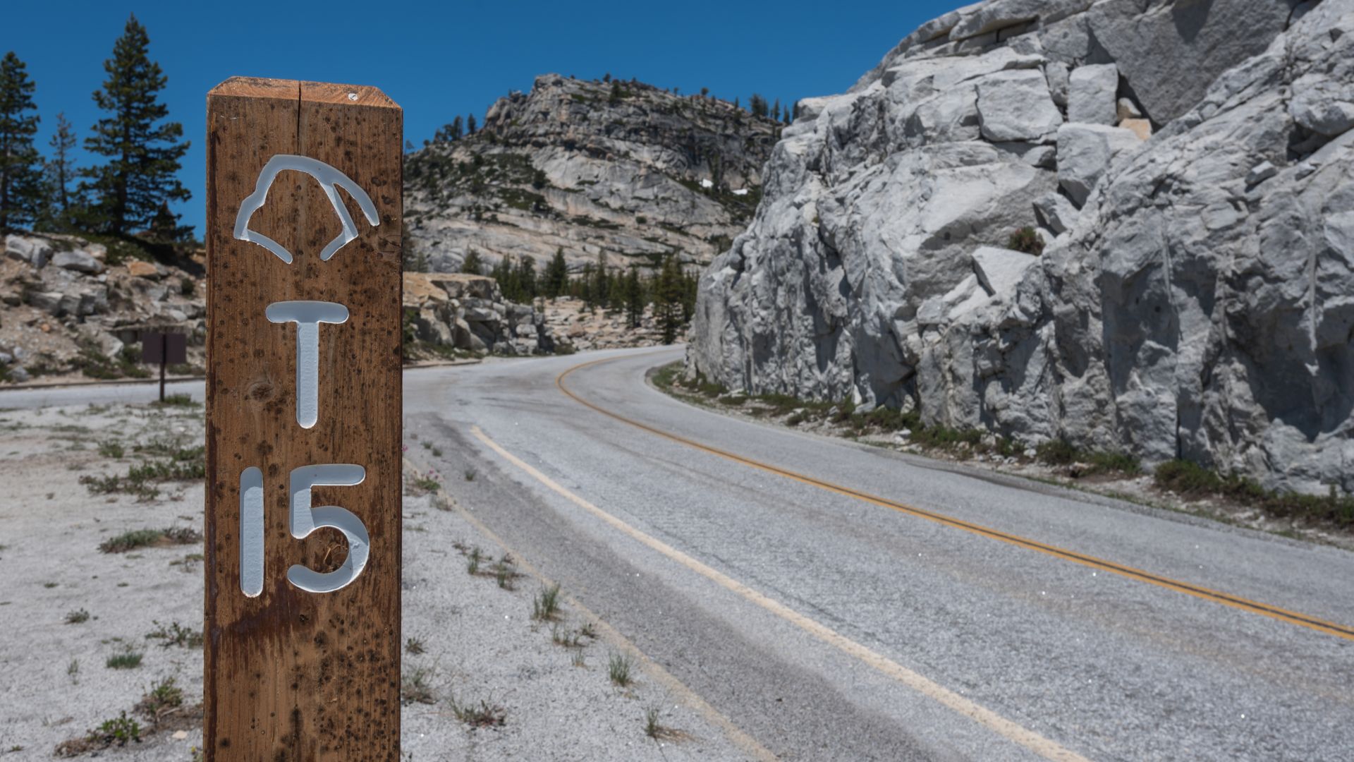
Tioga Pass Road (Highway 120) winds through California’s highest mountain pass at 9,943 feet. It’s the gateway to pristine alpine lakes, meadows that seem to stretch forever, and granite domes most folks never even hear about. This road links the western and eastern Sierra Nevada, but it only opens up from late May through November, depending on snow.
As I cruised along this 46-mile stretch, I started to get why so many seasoned travelers skip the Valley crowds and head for Tioga’s peaceful scenery instead.
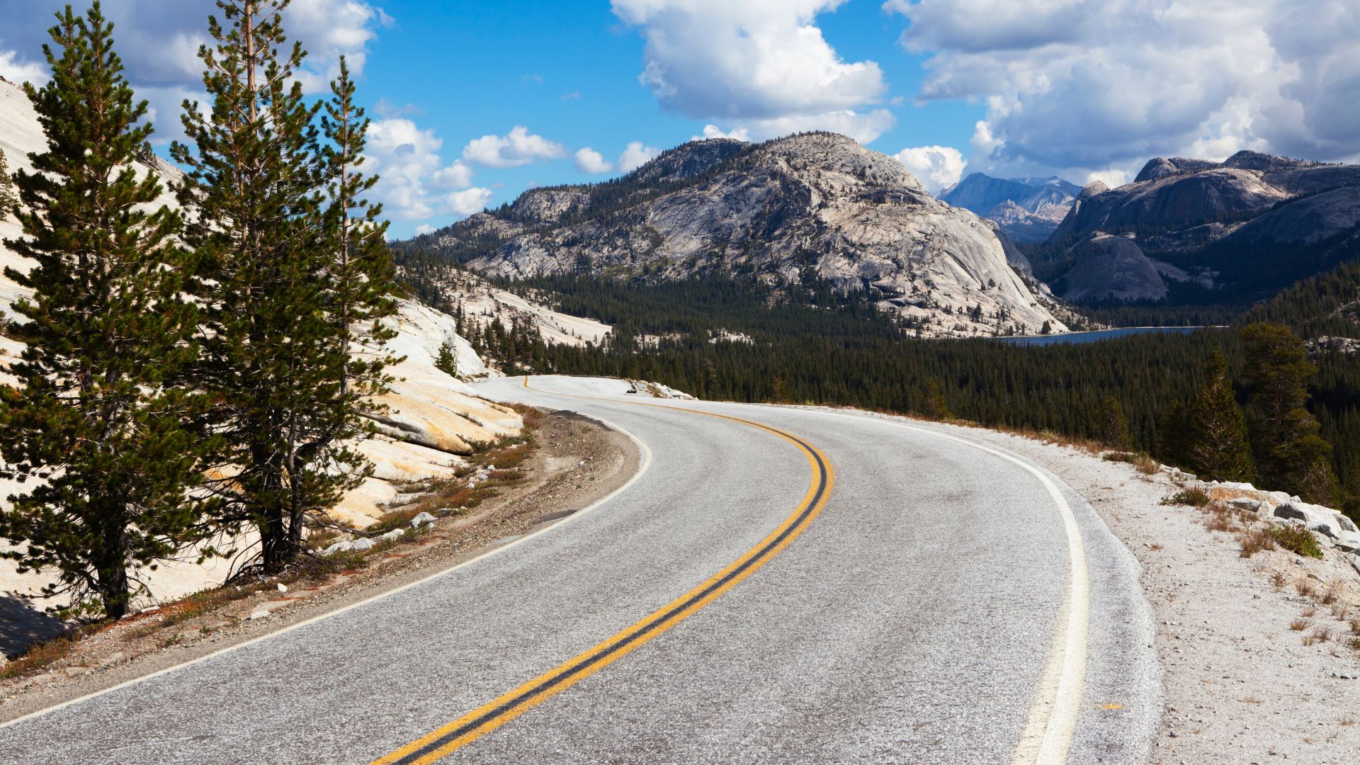
You’ll pass through thick forests, then suddenly burst into high meadows, with stops like Tuolumne Meadows, Tenaya Lake, and Olmsted Point. Every few miles, the views change—granite peaks, glassy lakes, and meadows bursting with wildflowers, all shifting with the season.
Planning this drive isn’t just about picking a date and going for it. I quickly realized that timing, a little prep, and knowing the best stops can turn a decent trip into a downright epic one.
The elevation is no joke, and those mountain curves command respect. But if you’re up for the adventure, you’ll find some of California’s most jaw-dropping scenery and trailheads leading deep into Yosemite’s wildest corners.
Planning Your Tioga Pass Road Adventure
If you want your Tioga Pass trip to go smoothly, you’ll need to plan ahead. The road’s open season is limited, and park entry rules can trip you up if you’re not prepared.
You’ll want to keep an eye on weather, get your reservations locked in, and pick the best route for your plans.
When to Drive: Seasonal Access and Road Conditions
Tioga Road usually opens between late May and early June, but it all hinges on how much snow piled up over winter.
Most years, you can drive it through October or maybe November, but snow sometimes closes Highway 120 out of the blue—even in summer.
Best months to visit:
- June-July: Wildflowers everywhere, waterfalls at their best
- August-September: Warm days, steady conditions
- October: Fall colors, fewer people, but weather gets tricky
Before every trip, I check the National Park Service site. Rockfalls, wildfires, or a freak storm can close the road fast.
You’ll climb between 8,000 and 10,000 feet as you go. Weather can flip from sunny to stormy in minutes, even in July.
Entrance Requirements and Reservation Tips
For summer 2025, you’ll need a peak-hour reservation just to get into Yosemite. The system’s there to keep the crowds manageable during the busiest hours.
You’ll need both a park pass and a timed entry reservation. Get those as early as you can—spots disappear fast.
Entry options:
- Annual Yosemite pass
- America the Beautiful annual pass
- 7-day park pass
Reservations usually cover entry from 5 AM to 4 PM during peak season. After 4 PM, only your park pass is required.
I always try to arrive early or late in the day. Not only do you skip the crowds, but the light at Olmsted Point and Tenaya Lake is just unbeatable early in the morning.
Navigating Highway 120 and Access Points
Highway 120 runs the whole park, from the west gate to the east. On the west, you’ll come in through Crane Flat and connect to Yosemite Valley. On the east, you’ll drop down to Lee Vining and Mammoth Lakes.
Western approach: Enter at Big Oak Flat, then head east on Tioga Road.
Eastern approach: Come in from US Highway 395 near Lee Vining.
When I’m staying in Yosemite Valley, I prefer the western route. The shift from forest to alpine landscape feels gradual and dramatic.
If you’re coming from Mammoth Lakes or anywhere in the Eastern Sierra, the eastern approach is more direct—and honestly, the mountain views are wild.
Cell service drops out for most of Tioga Road. I always download maps to my phone before leaving and bring a GPS as backup.
Must-See Scenic Stops Along Tioga Road
Tioga Road’s scenic stops show off Yosemite’s high country at its best—granite peaks, clear alpine lakes, wide-open meadows, and some pretty unreal viewpoints.
You’ll find everything from easy roadside stops to hikes that’ll have you sweating (but smiling).
Olmsted Point: Panoramic Vistas and Granite Wonders
Olmsted Point always blows me away. At 8,400 feet, you get a totally different angle on Half Dome, plus views of Clouds Rest and a sea of granite rolling out toward Tenaya Lake.
There’s a short paved path from the parking lot, so just about anyone can check out the view. Don’t forget your camera—seriously.
What you’ll see:
- Half Dome’s back side
- Clouds Rest summit
- Tenaya Lake shimmering in the distance
- Polished granite everywhere
Interpretive signs along the trail break down the geology. I always end up lingering, reading about glaciers and how they sculpted all these domes.
You barely have to walk, but the payoff is huge. Those granite slabs are perfect for snapping photos or just sitting and soaking it all in.
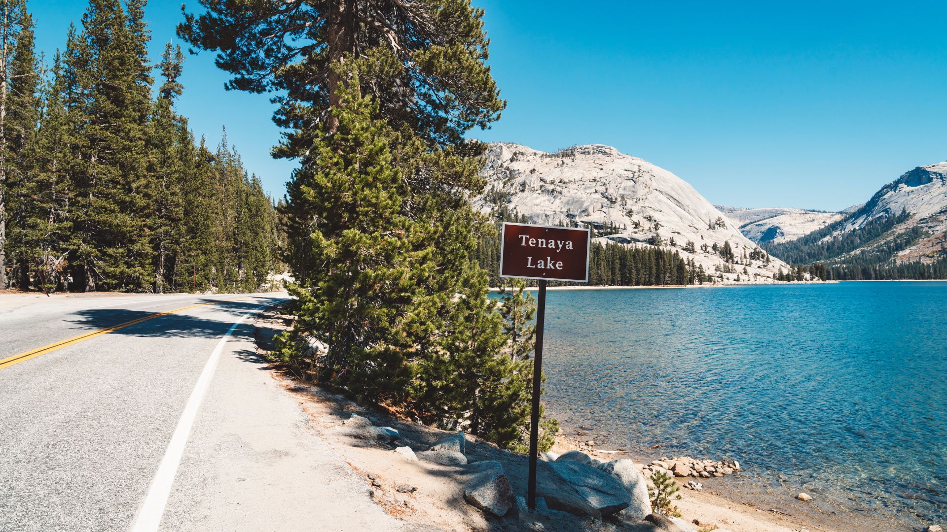
Tenaya Lake: Serenity, Swimming, and Scenic Beauty
Tenaya Lake sits at 8,150 feet, stretching about a mile long and half a mile wide. Its crystal water mirrors the granite peaks, and honestly, it’s one of the prettiest spots I’ve found in Yosemite.
The little sandy beaches along the shore are ideal for a picnic or just lying back and watching clouds drift by.
On a hot day, you’ll see folks braving the chilly water for a swim. Even in summer, it’s cold, but sometimes you just have to jump in.
Key features:
- Clear alpine water
- Sandy spots to relax
- Swimming (if you’re brave)
- Granite cliffs all around
Several trails start here, including hikes to Clouds Rest and May Lake. There’s an easy shoreline path if you just want a mellow stroll with lake views.
I always end up spending more time here than planned. The way the light shifts on the granite makes the whole scene change hour by hour.
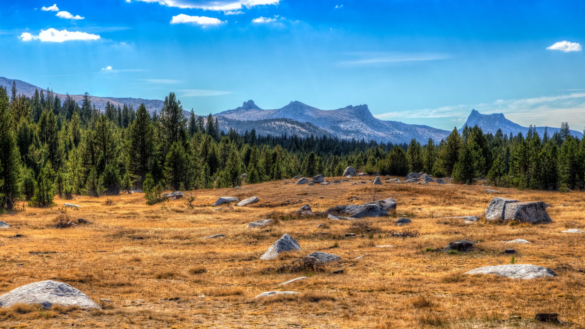
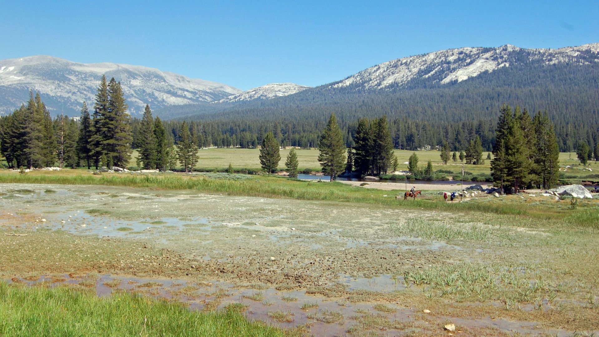
Tuolumne Meadows: Yosemite’s Alpine Heart
Tuolumne Meadows is the heart of Yosemite’s high country, no question. At 8,600 feet, it’s a huge green expanse ringed by granite domes and peaks.
Miles of meadow unfold, with the contrast between lush grass and gray rock always catching my eye.
What makes it special:
- Biggest high-elevation meadow in the Sierra
- Trailhead for the John Muir and Pacific Crest Trails
- Tons of wildlife
- Visitor center with cool exhibits
The Tuolumne River snakes through the meadows, adding to the scenery. Sometimes I’ll just wander the riverbanks, watching for deer or catching the play of light on the water.
Even if you’re not hiking deep into the wilderness, you’ll find plenty of spots for photos or just a quiet moment.
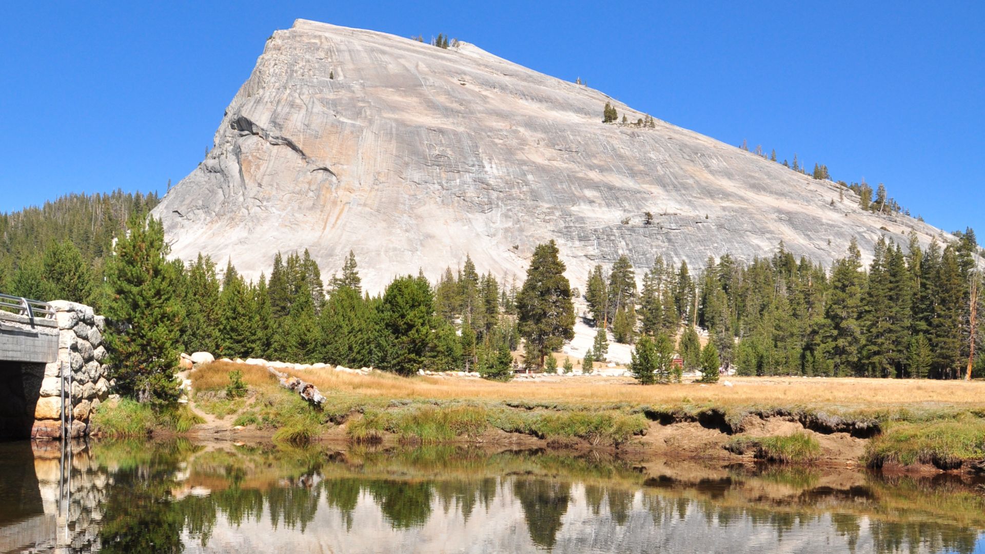
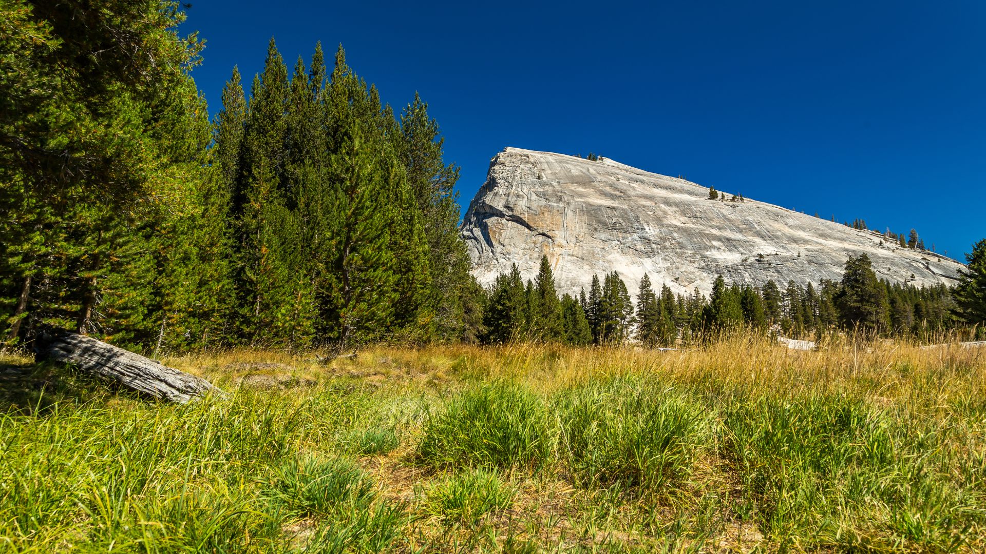
Lembert Dome: Hiking and Iconic High-Country Views
Lembert Dome towers at 9,450 feet and, for me, offers one of the best hikes along Tioga Road. Its granite face dominates the area near Tuolumne Meadows.
The trail to the top is 2.8 miles round-trip and moderately tough. The last section is a scramble over granite—challenging, but worth every step.
Trail highlights:
- Lodgepole pines
- Smooth granite slabs
- Big summit views
- Tuolumne Meadows and the Cathedral Range stretched out below
From the top, you get a full panorama of the high country. Granite domes seem to go on forever.
Rock climbers love Lembert Dome for its variety of routes. Even if you’re not climbing, it’s fun to watch people scale those slick faces.
Its smooth, sloping granite gives it a look you won’t forget—definitely one of Yosemite’s high-country icons.
Outdoor Activities: Hiking, Swimming, and More
The Tioga Pass Road is a playground for outdoor lovers. You’ve got mellow meadow walks, tough climbs up domes, and lakes perfect for a cold dip.
Tenaya Lake is my go-to for alpine swimming, while the Tuolumne River area is great for fishing and picnics.
Best Hikes Along the Route
Lembert Dome is my top pick for a moderate hike. It’s 3 miles round-trip, climbs 900 feet, and the views over Tuolumne Meadows are unbeatable.
Pothole Dome is easier—just 1.5 miles round-trip. Sunrise here is magical, and you’ll have the place mostly to yourself.
For families, the Soda Springs trail is a flat 1.5-mile stroll through open meadows. The bubbling springs always get a reaction from kids.
| Hike | Distance | Difficulty | Best Feature |
|---|---|---|---|
| Lembert Dome | 3 miles RT | Moderate | Panoramic views |
| Pothole Dome | 1.5 miles RT | Easy | Sunrise views |
| Soda Springs | 1.5 miles RT | Easy | Natural springs |
Cathedral Lakes starts from Tuolumne Meadows and heads into the Yosemite Wilderness. It’s a 6-mile round trip to stunning lakes ringed by granite.
Swimming and Relaxing at Lakes
Tenaya Lake is the main swimming spot along Tioga Pass, sitting at 8,150 feet. Even in July, you’ll get a chill, but the granite slabs are perfect for sunbathing.
I always head for the north shore—the sandy beach there makes getting in and out a lot easier.
May Lake takes a short 2.4-mile hike to reach, but the water’s a bit warmer and you’ll find fewer people. It sits in a granite bowl that’s just right for a swim.
The Tuolumne River has several swimming holes through the meadows. Look for bends in the river where the pools are deeper and the water warms up a bit.
Always check water conditions first. Snowmelt can make the water icy and fast, even in the middle of summer.
Fishing and Picnicking Hotspots
The Tuolumne River is a solid spot for brook trout fishing. I usually have the best luck in the deeper pools near the road.
You’ll need a California fishing license if you’re 16 or older. Parts of the river run through wilderness areas, so check the rules before you cast.
Tenaya Lake allows shore fishing or wading. You might catch rainbow or brook trout, but they can be a bit tricky.
For picnics, I like the meadows near Soda Springs. Flat grass, mountain views—what more do you need?
Tuolumne Meadows has several picnic areas with bear boxes for your food. Always stash your food—bears are definitely around.
The Parsons Lodge area is a unique lunch spot with a bit of history. Built in 1915, it gives you a glimpse into old Sierra Club days.
Historic Landmarks and Geological Highlights
Tioga Road is packed with historic sites and wild geology. Bubbling mineral springs, a century-old lodge, and massive granite domes all tell the story of how people and nature shaped this high country.
Soda Springs and Parsons Memorial Lodge
Every time I’m on Tioga Road, I make a point to stop at Soda Springs. It’s an easy 1.5-mile walk from the road, and you’ll find natural mineral springs bubbling up right out of the ground.
The springs fizz with carbon dioxide, making a sound you won’t hear anywhere else. Native Americans knew about these springs long before anyone else came along.
Parsons Memorial Lodge is just up the trail, built in 1915 by the Sierra Club. This stone lodge honors Edward Taylor Parsons, one of the club’s early leaders.
The lodge stands as a symbol of the first conservation efforts in Yosemite and served as a base for Sierra Club explorers.
Today, the lodge and the easy trail make this a great stop for families. Even young kids can handle the walk, and there’s plenty of room to run around.
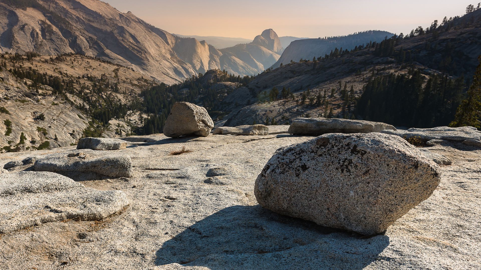
Glacial Landscapes and Granite Formations
When you drive along Tioga Road, those granite domes really grab your attention. Glaciers shaped these massive rocks over thousands of years, leaving behind some pretty wild evidence.
Lembert Dome towers 800 feet above Tuolumne Meadows. Its smooth, rounded shape? That’s thanks to glaciers polishing the granite during the last ice age.
Tenaya Lake sits right in a natural granite basin, carved out by glacial erosion long ago. On a clear day, the lake’s water mirrors those surrounding granite walls—almost unreal.
You can spot glacial striations on so many rock faces out here. These scratches actually reveal the direction the glaciers once moved, slowly carving the whole scene.
Millions of years ago, the granite domes started forming deep underground. Over time, erosion revealed these giants, and now they dominate the landscape.
If you’re looking for a less challenging climb, Pothole Dome is a friendlier option than Lembert Dome. Both spots reward you with sweeping views of the glaciated valleys below.
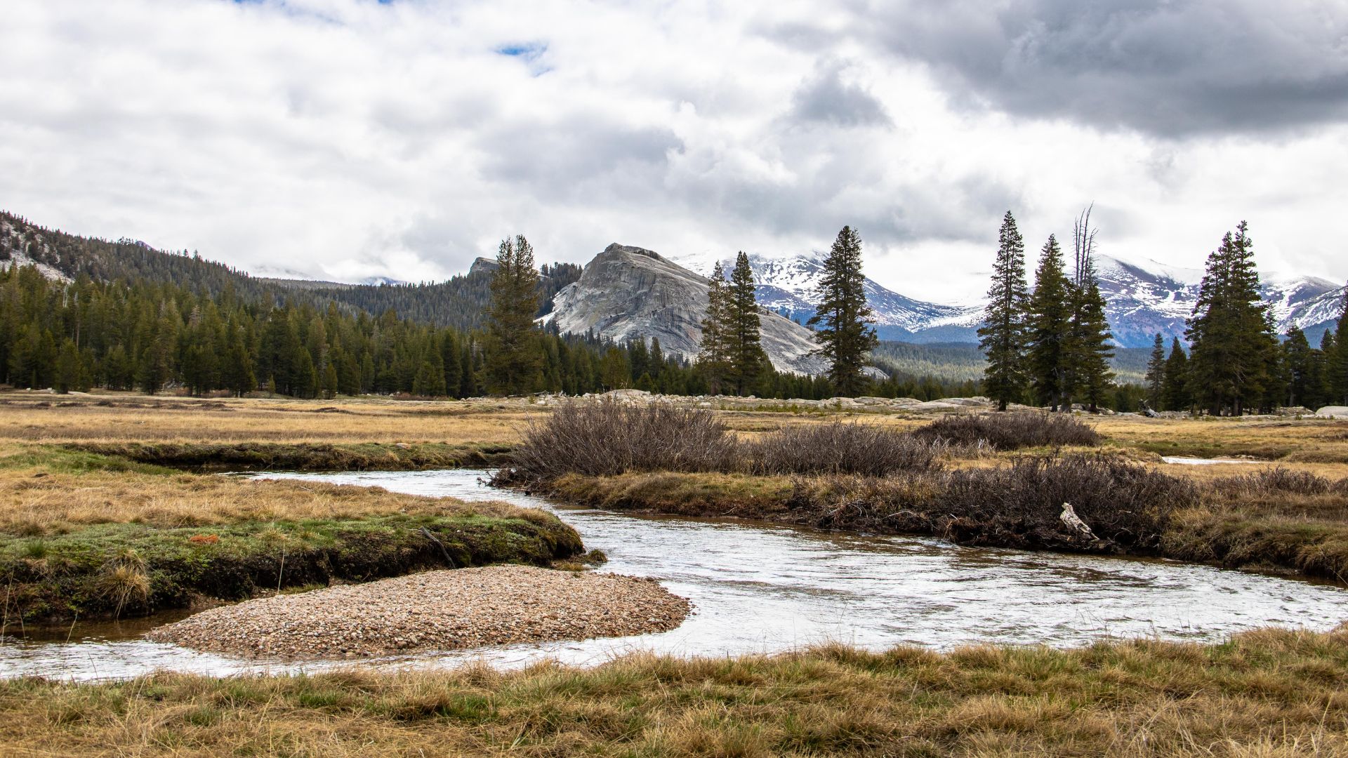
Tuolumne River’s Journey Through the High Country
The Tuolumne River begins its journey in the high meadows near Tioga Road. I’ve wandered along its banks through different parts of Yosemite Wilderness, and every section feels a little different.
In Tuolumne Meadows, the river starts as a network of small streams. These gentle waters weave through the grass, creating a lush meadow that draws all kinds of wildlife.
As it heads west, the river picks up speed and carves deeper channels into the granite. Eventually, it forms those dramatic waterfalls you see in Yosemite Valley.
Spring snowmelt turns the river into a rushing force. By late summer, the flow settles down, meandering through the meadows at a calmer pace.
Wildflowers, grasses, and trees all depend on the river along its winding route. It’s the lifeblood of the entire ecosystem up here during the growing season.
Final Stretches: Reaching Tioga Pass and Beyond
The last stretch of Tioga Road climbs to California’s highest highway pass, topping out at 9,945 feet. Just beyond, the eastern Sierra suddenly appears, with wide-open views of Mono Lake and the small gateway town of Lee Vining.
Crossing Tioga Pass: High-Altitude Thrills
Reaching Tioga Pass always feels like a milestone. At 9,945 feet, it’s the highest highway pass in California.
The road gets steeper as you approach the top. My ears always pop from the altitude change, and the air feels noticeably thinner.
Key Features at Tioga Pass:
- Elevation: 9,945 feet
- Yosemite National Park eastern entrance
- Seasonal closure: typically November through May
- Parking area with restrooms
At the pass, there’s a small parking area and an entrance station. The views here are something else—look west and you’ll see Yosemite’s granite peaks stretching across the horizon. Look east, and the eastern Sierra tumbles away below you.
The temperature drops fast up here, even in summer. I always pack a jacket, just in case. Honestly, snow can surprise you at Tioga Pass any time of year.
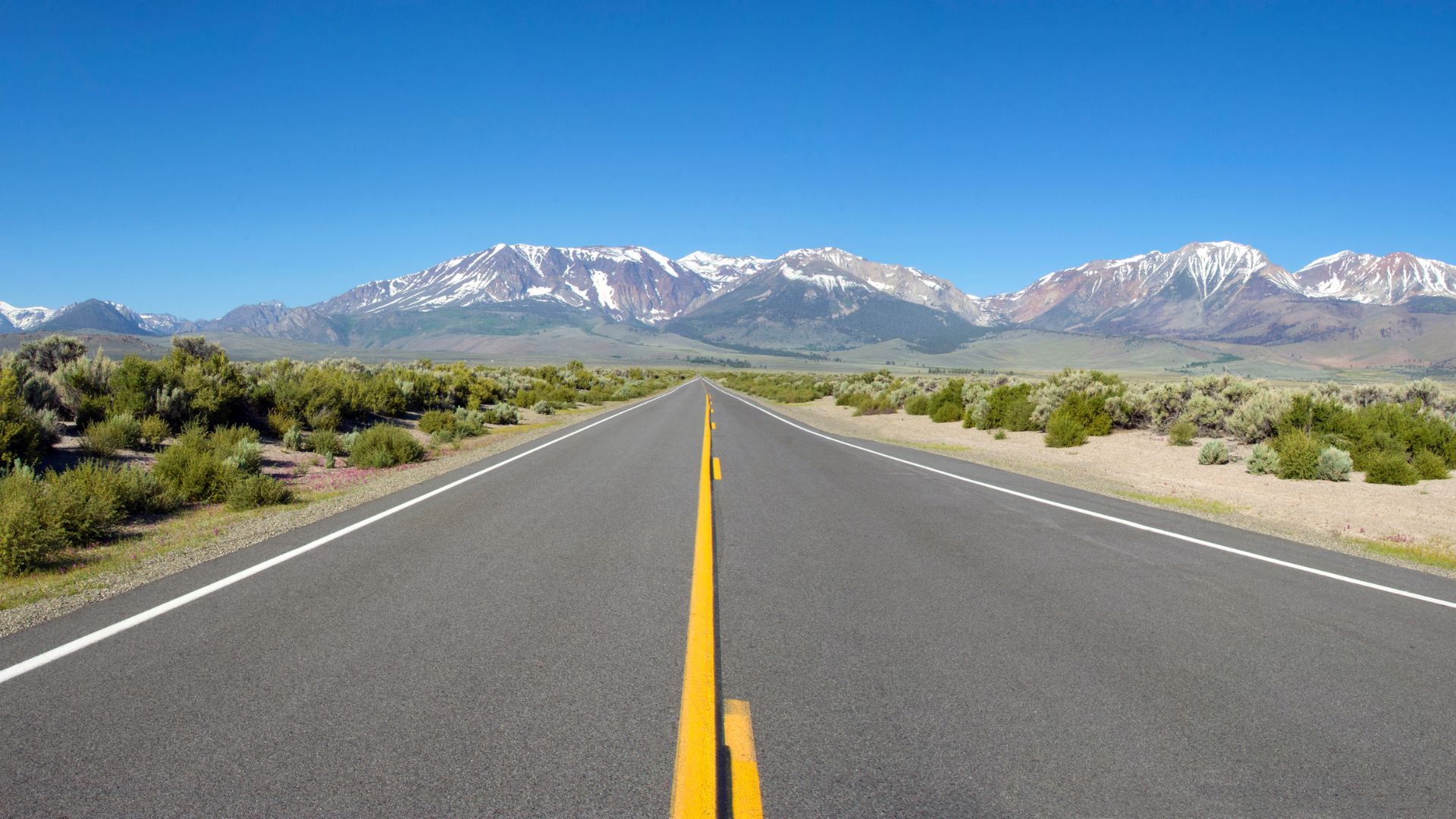
Lee Vining, Mono Lake, and the Eastern Sierra Gateway
After winding down from Tioga Pass, I pull into Lee Vining about 12 miles later. It’s a tiny town, but it really feels like the front door to Mono Lake and the eastern Sierra.
Lee Vining sits up at 6,781 feet. Here, you’ll find a couple of gas stations, some classic diners, and a handful of motels. Honestly, it’s a solid spot to fill up, grab a bite, or just stretch your legs.
What I Find in Lee Vining:
- Gas stations and convenience stores
- Restaurants and cafes
- Motels and lodging
- Visitor information center
Mono Lake waits just north of town—a place that’s been around for over a million years. The lake’s crazy-high salt content creates these weird, otherworldly tufa towers that stick out of the water.
It’s wild how quickly the scenery shifts. One minute, you’re surrounded by Yosemite’s granite giants; the next, you’re staring at the vast high desert of the eastern Sierra.
From this side, the Sierra Nevada feels totally different. The mountains just shoot up from the desert, bold and sudden, making you wonder how nature pulls off these dramatic changes.