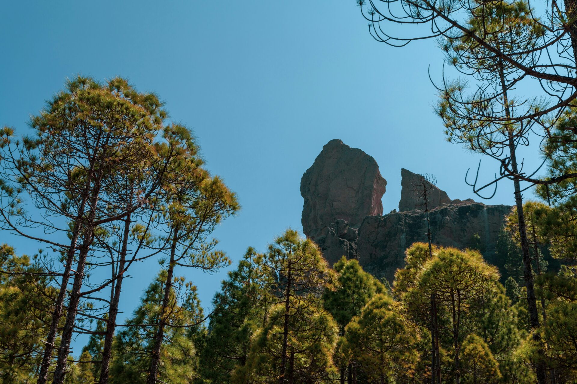
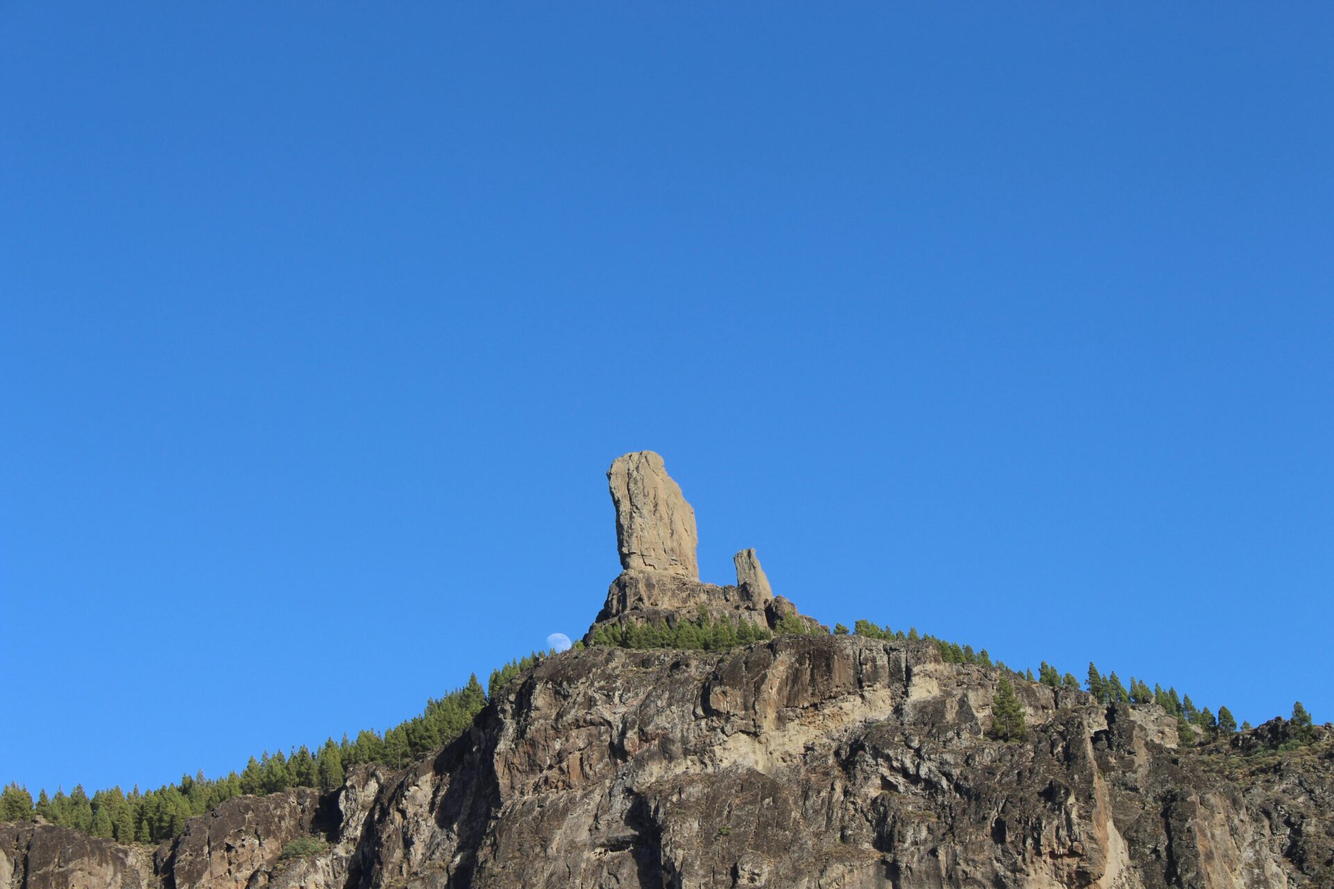
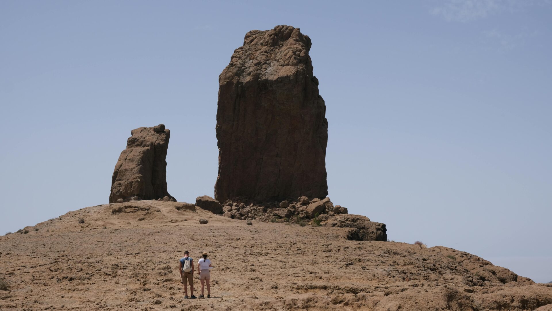
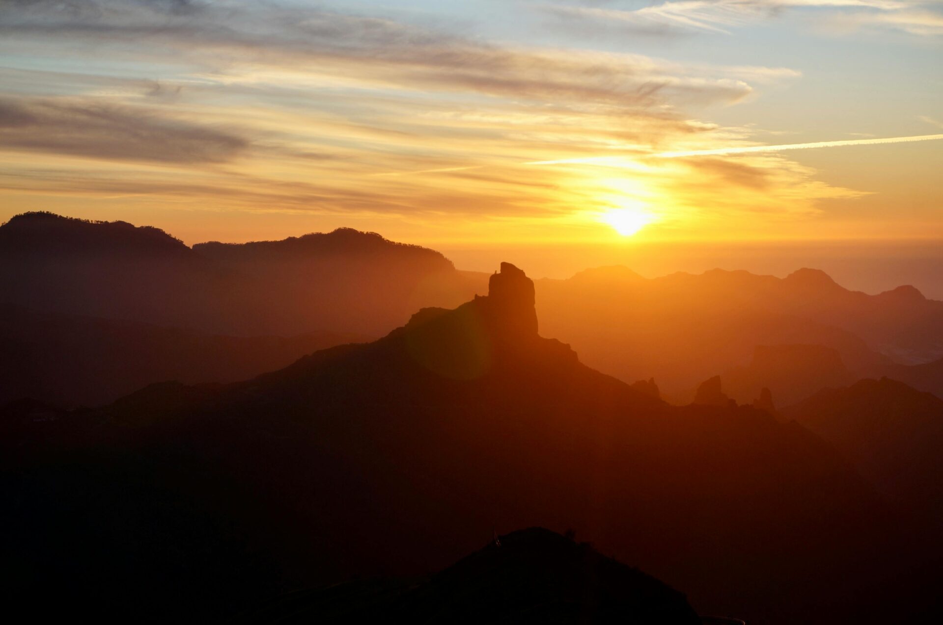
Roque Nublo rises to 1,813 meters above sea level, right in the heart of Gran Canaria. This 80-meter volcanic rock has sparked the curiosity and awe of travelers for centuries.
Locals call it “Cloud Rock” because mist and clouds often swirl around its summit. The rock itself formed about 15 million years ago as an ancient volcanic plug—pretty wild to think about.
The hike to Roque Nublo is actually pretty doable for most people. You can complete the shortest route in around 90 minutes, round trip. And let me tell you, the panoramic views are something else—easily among the best in the Canary Islands.
As I made my way up to this dramatic landmark, I started to understand why it means so much to the island’s original inhabitants, the Guanches. They saw it as a sacred gathering place, and honestly, it does feel special up there.
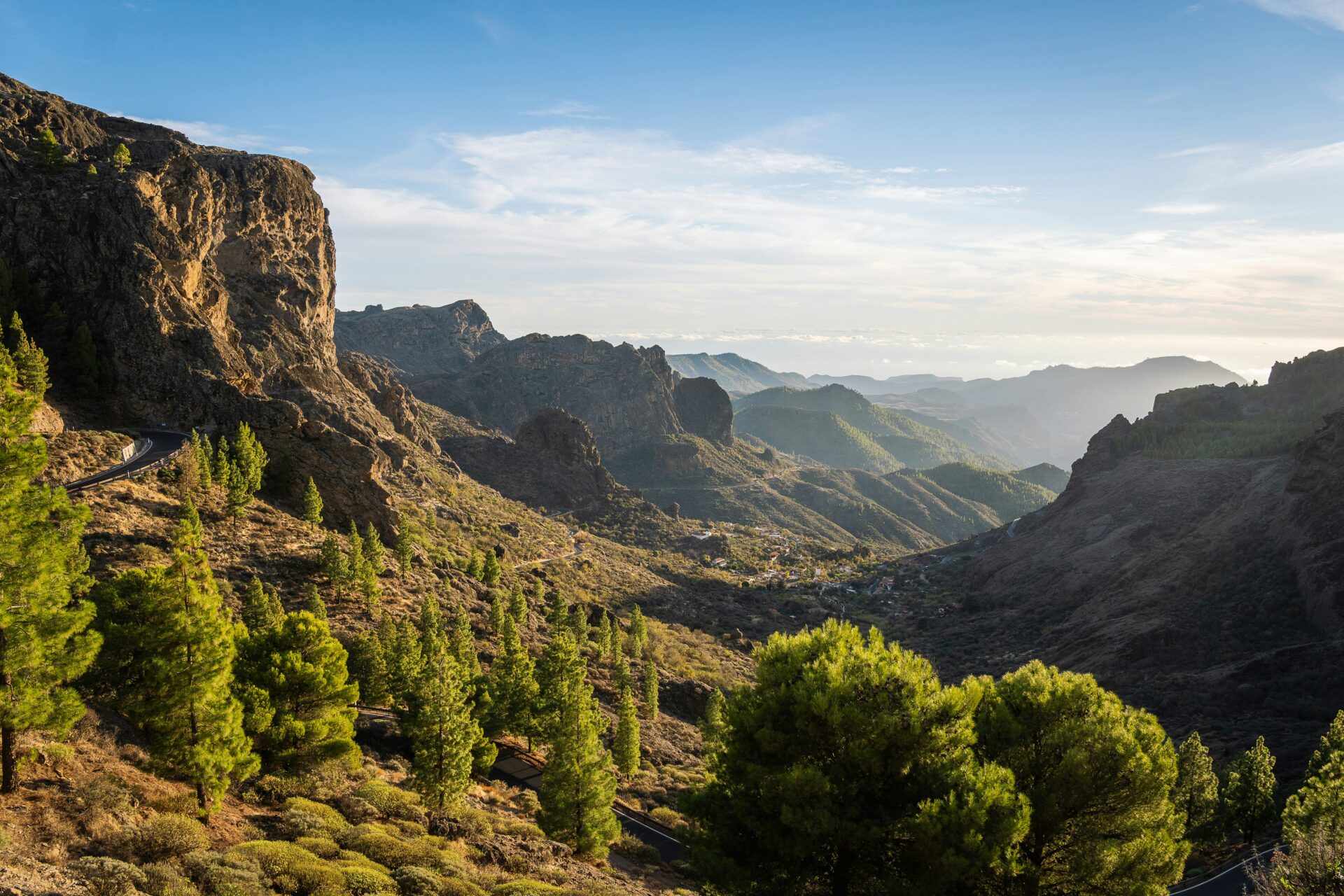
The trail winds through pine forests and rugged volcanic terrain, eventually opening up onto a rocky plateau. That’s where Roque Nublo really takes over the skyline.
When the weather’s clear, you can see all the way across Gran Canaria. Sometimes you’ll even spot Tenerife off in the distance, which feels like a little bonus.
You can stick to the quick 3-kilometer route from the main parking area, or take on a longer circuit if you’re feeling ambitious. Either way, the hike is manageable but the payoff is huge.
I’ll break down what you need to know—how to get there, what to pack, and what you’ll actually experience on the trail. Roque Nublo really is one of Gran Canaria’s must-see spots, and I’m excited to share my tips.
Essential Facts About Roque Nublo and Its Significance
Roque Nublo isn’t just a cool rock—it’s one of Gran Canaria’s most important symbols. Ancient volcanic forces shaped it, and it’s deeply woven into the island’s culture.
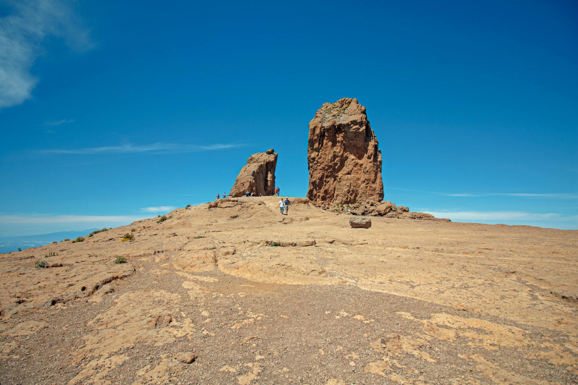
This volcanic plug stands 80 meters tall, perched at 1,813 meters above sea level, right in the Tejeda caldera.
Geological Origins and Volcanic History
Fifteen million years ago, lava hardened inside a volcano’s vent and created Roque Nublo. Over time, wind and rain wore away the surrounding rock, leaving this dramatic spire behind.
The rock sits in the center of the Tejeda caldera, a huge volcanic depression about 10 by 12 miles across. That’s the result of a massive eruption way back when.
Roque Nublo is one of the highest points on the island. Its name—”Cloud Rock”—makes perfect sense, since its peak often disappears into swirling mist.
The Canary Islands themselves rose up from the Atlantic thanks to volcanic activity over millions of years. Roque Nublo is a striking reminder of those powerful forces.
Spiritual and Cultural Significance for the Guanches
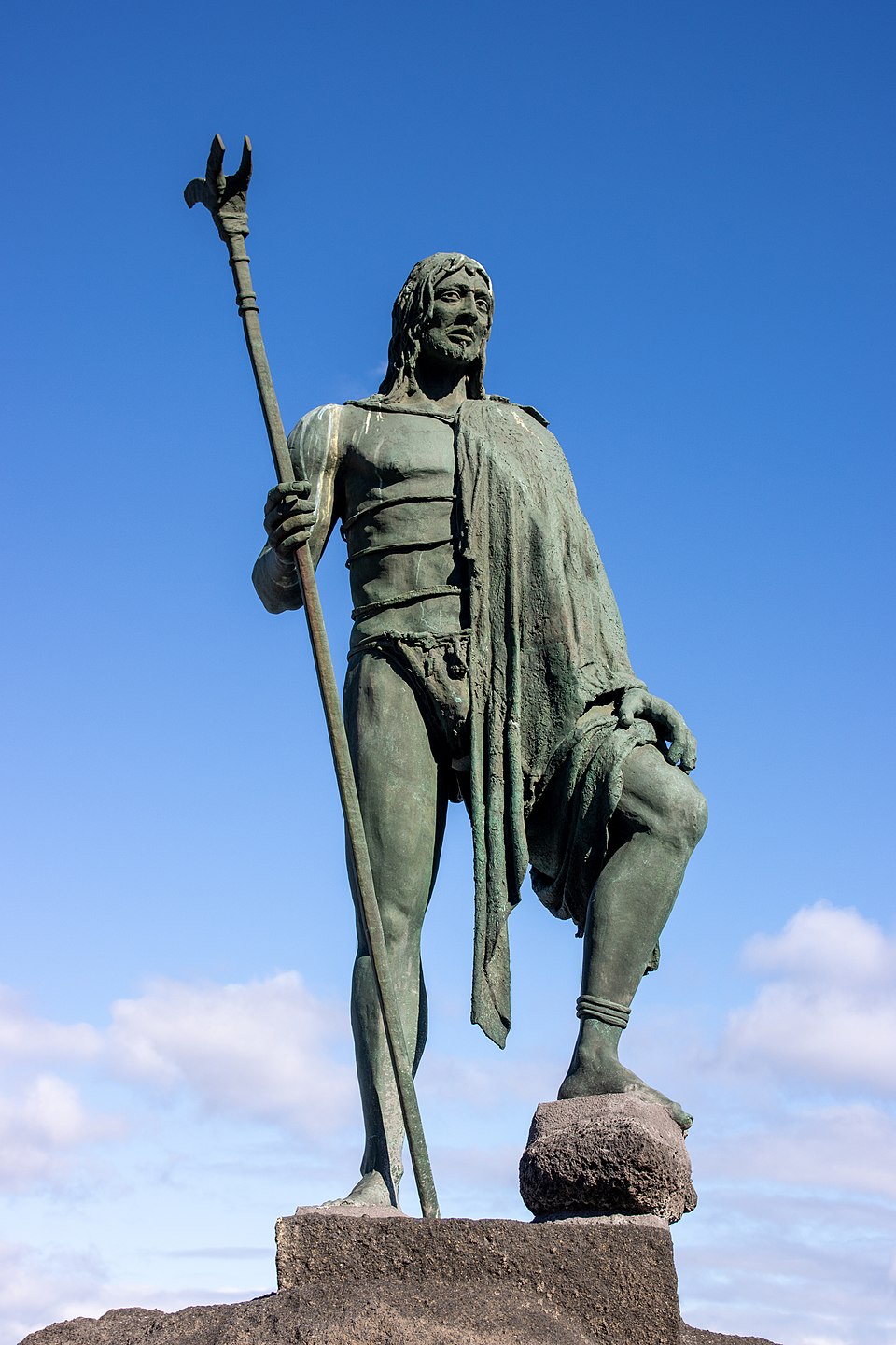
The Guanches, Gran Canaria’s first people, arrived from Africa somewhere between the first and second centuries BC. They treated Roque Nublo as a sacred site, a place for rituals and ceremonies.
Archaeologists found evidence that the Guanches gathered here to honor their sky god, Acorán. Not far away, Roque Bentayga has an ancient calendar site that lines up with Roque Nublo during certain lunar events.
This area served as a natural temple. You’ll find cave dwellings and carved fertility symbols nearby, a sign of just how important this region was to the island’s earliest inhabitants.
Spanish settlers came in the 15th century and changed everything, but the spiritual connection to Roque Nublo still runs deep in Gran Canaria’s culture.
Roque Nublo’s Role as a Natural Monument
Roque Nublo is now part of the UNESCO World Heritage site called Risco Caído and the Sacred Mountains of Gran Canaria. This protects both the land’s natural beauty and its cultural history.
Every year, thousands of hikers show up to see Roque Nublo’s wild shape and the sweeping views from the plateau. Artists, poets, and musicians have all drawn inspiration from it.
As a protected monument, Roque Nublo helps keep Gran Canaria’s volcanic landscape intact for future generations. It’s a dramatic symbol of the island, popping up on everything from postcards to local art.
Preparing for the Roque Nublo Hiking Experience
Getting ready for Roque Nublo is half the fun. A little planning goes a long way to making this hike unforgettable.
You’ll want to think about timing, gear, and how tough the trail is. Trust me, being prepared makes all the difference.
Best Time of Year and Ideal Conditions
I’d say the best months for hiking Roque Nublo are April through October. The weather’s usually steady, and the views are at their best.
Summer draws the biggest crowds, so I like to start early. One morning, I rolled up to the Degollada de la Goleta parking area around 7 AM and pretty much had the place to myself.
If you can, go in April-May or September-October. The weather’s still great, but you’ll dodge the crowds. Sunset hikes during these months feel extra magical.
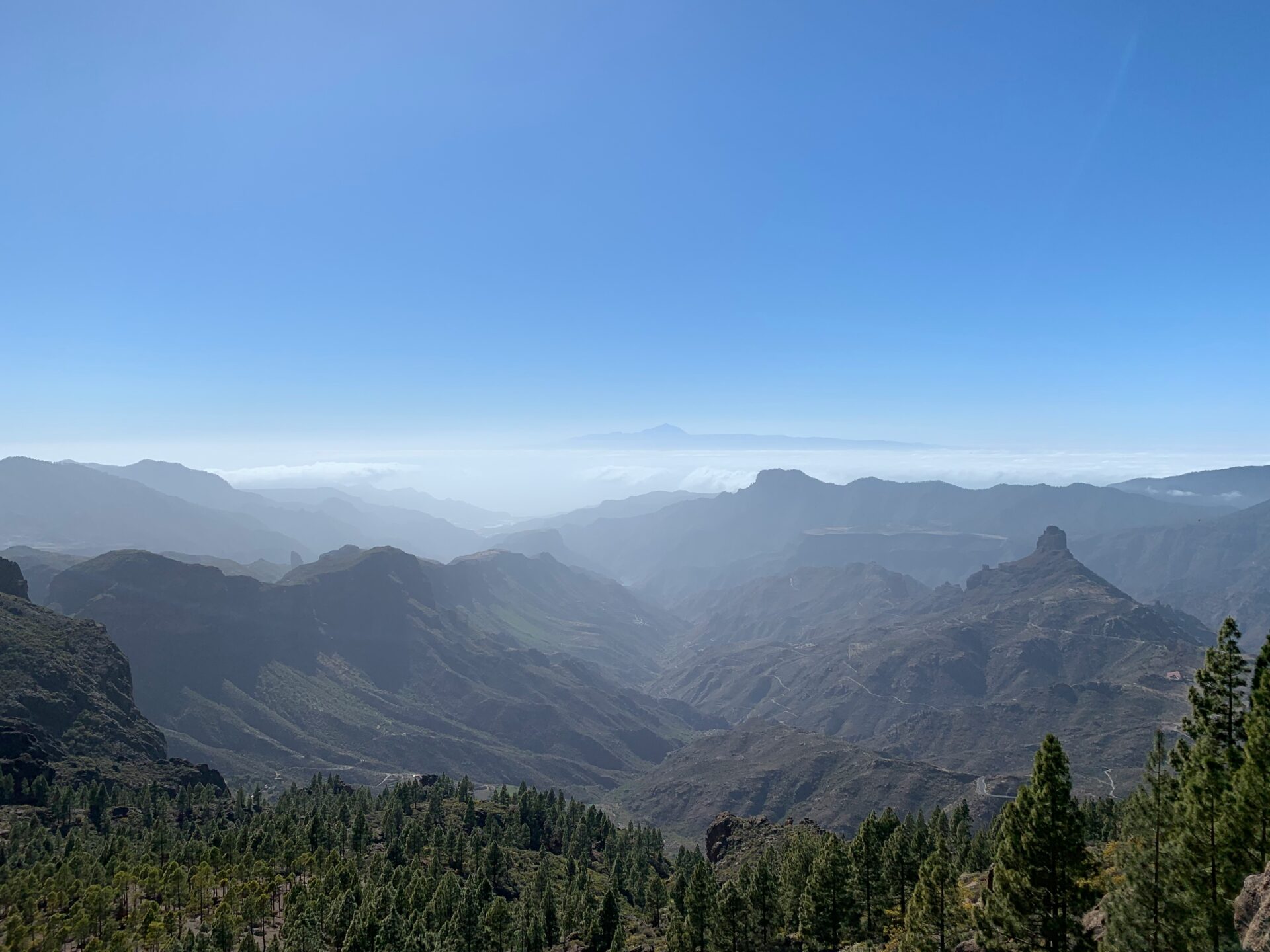
Weather can make or break this hike. On a clear day, you’ll see the whole volcanic landscape and even Mount Teide on Tenerife. If clouds roll in, the views vanish and your photos won’t do it justice.
Winter hiking is possible, but expect chilly temps and clouds. I always check the forecast before heading up there.
Essential Gear and Safety Tips
Don’t skimp on hiking boots—the trail’s rocky and loose in spots, so ankle support is key.
Here’s what I always bring:
- Water: At least a liter per person
- Sun protection: Hat, shades, sunscreen
- Layers: It gets chilly as you climb
- Camera: You’ll want the photos
- Flashlight or headlamp: Especially if you’re catching sunset
There aren’t any water sources or facilities on the trail. Sometimes a food truck parks at the trailhead, but I never count on it.
If you’re hiking at sunset, pack extra warm clothes. Temperatures drop fast after dark, and a headlamp makes the rocky descent way safer.
I keep emergency supplies simple—a tiny first aid kit and a fully charged phone for GPS.
Fitness Level and Trail Difficulty
Almost anyone can tackle the Roque Nublo hike with a little preparation. The out-and-back route covers 3.1 kilometers and climbs about 155 meters.
I’d call this trail easy to moderate. The path is well maintained, winding through pine trees and old lava flows until you reach the plateau.
Some parts are rocky, so you’ll need to watch your step. I’ve slipped on loose stones before, so don’t rush.
If you walk regularly, you shouldn’t have any trouble. The incline is steady but gentle, and there are plenty of scenic spots to catch your breath.
I always budget 2-3 hours total, since you’ll want time for photos and soaking in the summit.
The last bit up to Roque Nublo means scrambling over some volcanic rocks. Balance helps, but you don’t need climbing skills.
Getting to the Roque Nublo Trailhead
Honestly, the trickiest part of hiking Roque Nublo isn’t the trail—it’s figuring out how to get to the start. After 2025, access rules changed, so planning ahead is crucial.
Driving Routes to Degollada de la Goleta
The GC-600 is your main road to Roque Nublo, no matter where you’re starting from. It’s a winding mountain drive, but the scenery is worth it.
From Las Palmas de Gran Canaria, I drive south through the island’s center. The trip takes about 45 minutes on twisty roads. I follow signs for Tejeda, then continue on the GC-600 toward Ayacata.
From Maspalomas and the southern coast, I head north via San Bartolomé de Tirajana. This drive also takes around 45 minutes, connecting to the same GC-600.
From Cruz de Tejeda, it’s a quick 15-minute drive along the GC-600, and you’ll pass through beautiful pine forests on your way.
The roads are well marked, but cell service drops out sometimes. I always download offline maps just in case.
Parking Tips and Trailhead Facilities
Here’s something that surprised me: the old Aparcamiento de la Degollada de la Goleta parking lot is now closed to regular visitors.
Now, the closest parking is at Cruz de Los Llanos, about 5 kilometers from the actual trailhead. From there, you’ve got two options:
- Walk an hour along a marked 3.7 km trail
- Hop on bus line 18 for a quick 10-minute ride
Only people with mobility issues can use the Degollada de la Goleta lot, and even then, it’s just for 2 hours. If you try to park illegally, expect a fine.
Cruz de Los Llanos has basic facilities, including restrooms. At the trailhead, you’ll sometimes find temporary toilets and a small food stall with drinks and local snacks.
Public Transport and Guided Tour Options
Bus line 18 runs several routes that make reaching Roque Nublo doable without a car. The main one goes from Maspalomas to Tejeda, stopping at Cruz de Los Llanos and the trailhead.
From Cruz de Los Llanos, the bus costs €1.40 and accepts cards. I always double-check the schedule—missing the bus means a long walk.
No direct bus runs from Las Palmas to Roque Nublo. If you try to piece together connections with Guaguas Global, you’ll spend over three hours each way. Not ideal for a day trip.
If you’re staying in Las Palmas and don’t have a car, I’d suggest booking a guided tour. They handle transport and guide you along the trail, so you don’t have to worry about buses or timing.
Step-By-Step Guide to the Roque Nublo Hiking Trail
The Roque Nublo hiking trail is easy to follow, with clear markers and some of the coolest volcanic scenery on the island.
Let me walk you through the main route, highlight the unique rock formations you’ll pass (like El Fraile), and share my favorite photo spots.
Route Overview and Navigation
The classic Roque Nublo trail starts at the Aparcamiento de la Degollada de La Goleta off the GC-600. Most people begin here, and it’s the simplest option if you’re driving.
Wooden signposts and stone cairns mark the way. I never felt lost—the path stays obvious all the way to the summit plateau.
Trail Stats:
- Distance: 2.3 miles round trip
- Elevation gain: 328 feet
- Time: About 90 minutes total
- Difficulty: Easy to moderate
You start on a wide dirt track that narrows as you climb. The ground gets rockier, so those hiking boots really earn their keep.
There’s just one main trail, so navigation is a breeze. The route winds upward through volcanic outcrops, with Roque Nublo looming ahead.
Landmarks and Natural Highlights Along the Trail
The first landmark I spotted was Roque de la Rana (Frog Rock). Look for it early on—it really does look like a giant frog if you catch it from the right angle.
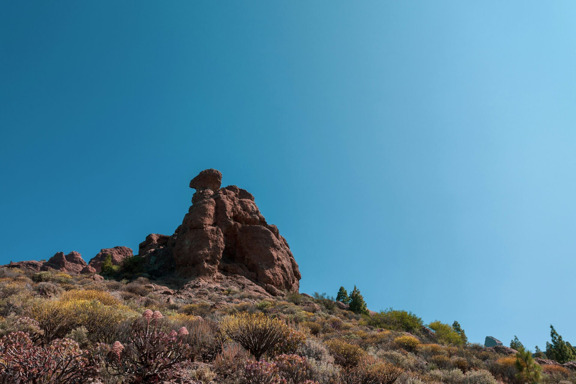
Higher up, El Fraile (The Friar) comes into view. It’s a rock that looks like a monk in prayer, and it stands as Roque Nublo’s smaller companion.
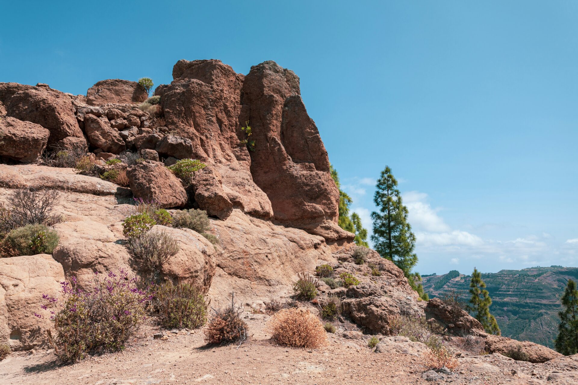
The trail cuts through the Caldera de Tejeda, an old volcanic crater filled with red rocks and hardy plants that thrive at altitude.
Ventana del Nublo is a natural rock window—perfect for framing photos of the landscape beyond.
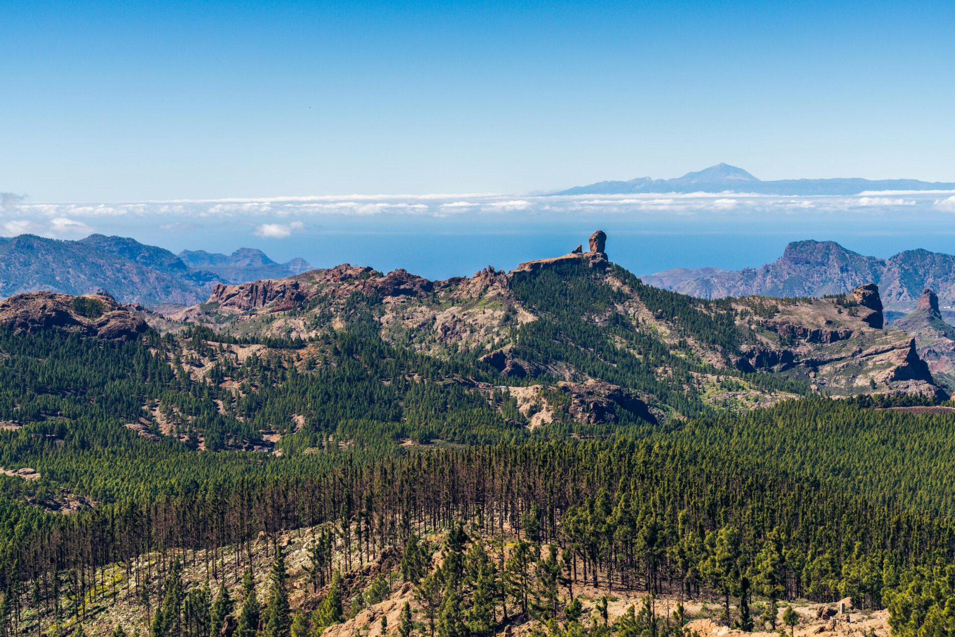
The final stretch brings you out onto the Roque Nublo plateau, a wide, flat expanse right at the foot of the towering volcanic plug. Standing under that ancient lava column, you really feel the island’s wild history.
Key Viewpoints and Photography Spots
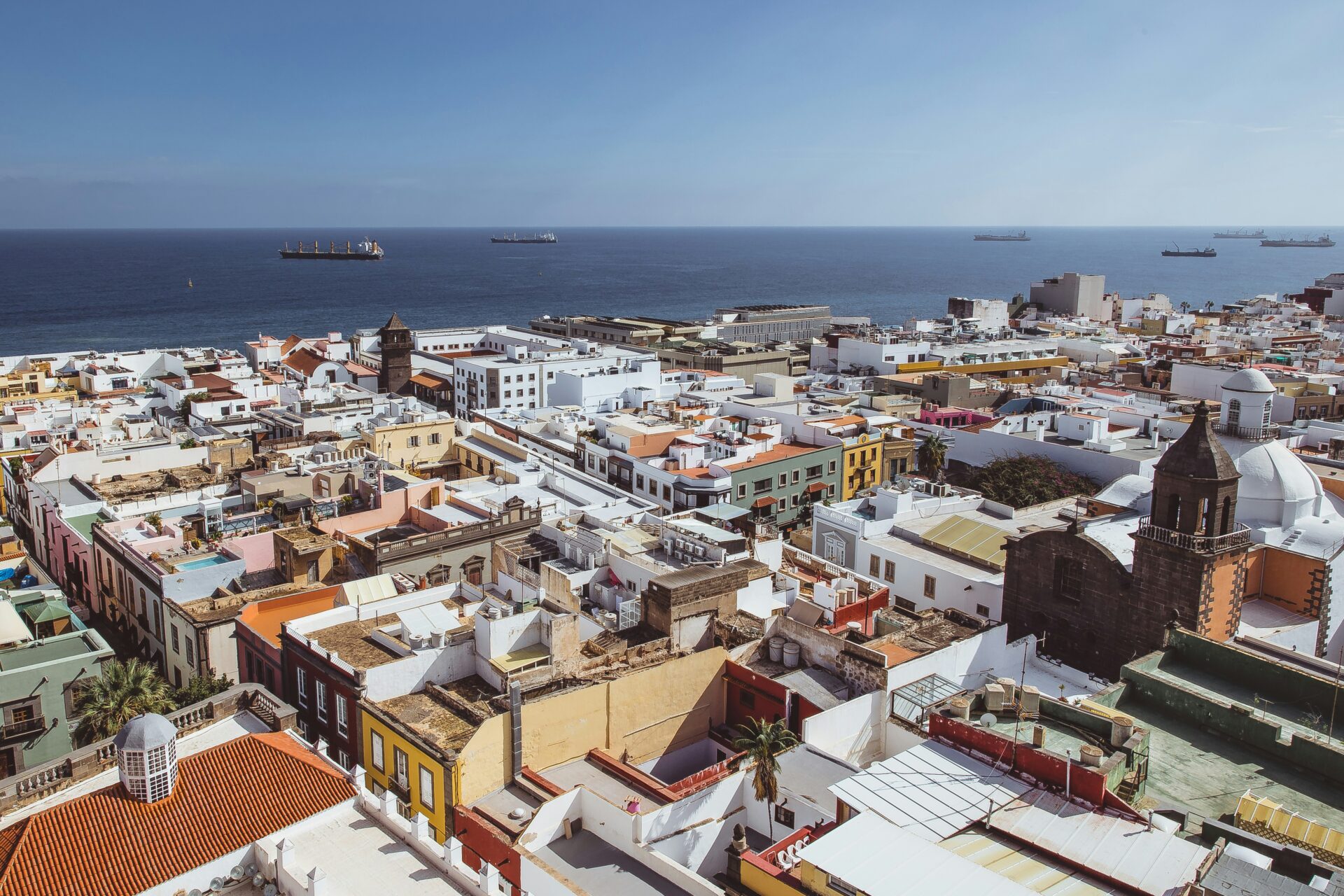
The Mirador Presa de los Hornos kicks off the hike with some stellar views over the Tejeda Basin. From up there, the whitewashed houses of Tejeda village seem almost sprinkled across the valley.
About halfway up, a clearing opens up with sweeping views of the central mountains. If the weather plays along, you’ll spot Pico de las Nieves—Gran Canaria’s highest point—standing tall in the distance.
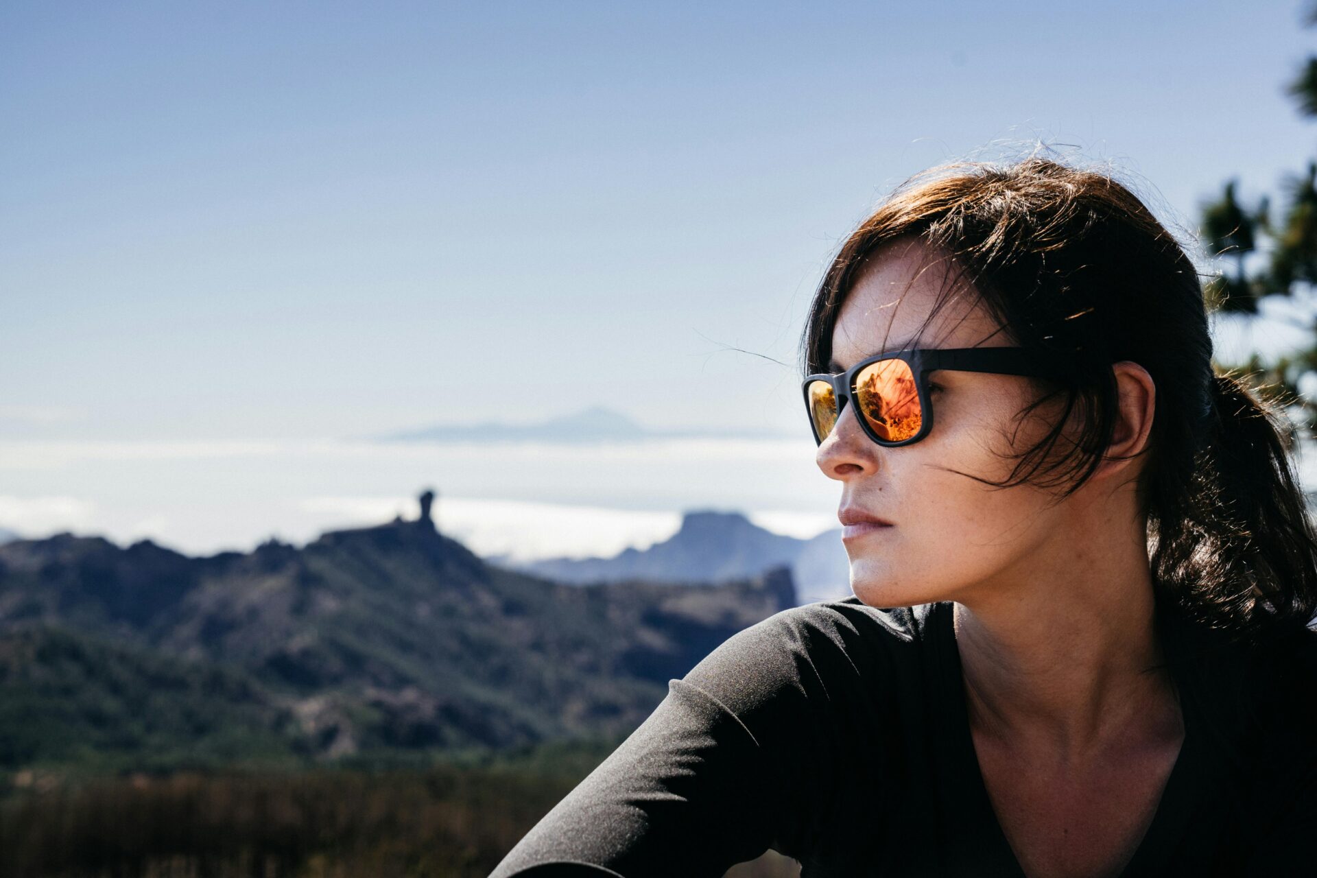
When I reached the plateau, I wandered around the base of Roque Nublo, camera in hand, chasing the changing light and angles. This spot really draws photographers, and it’s easy to see why.
Best photo spots:
- Sunrise: East side of the plateau
- Sunset: West side facing the ocean
- Wide shots: Northern edge for full rock formation
- Portraits: Use El Fraile as background
At the summit, I spun around and took in the 360-degree views stretching across Gran Canaria. The coastline, volcanic peaks, and—if you’re lucky—clouds drifting through the valleys all come into view.
Optional Extended Routes and Variations
For those craving a challenge, the Cruz de Tejeda circuit offers an 11.8-mile loop that starts in Cruz de Tejeda village. This loop includes the classic Roque Nublo trail but throws in a longer mountain traverse for good measure.
If you’re an experienced hiker and want a full-day adventure, this route’s for you. The path dips down through Tejeda, climbs through pine forests, and links up several impressive viewpoints.
Another way to mix things up? Start your hike from Tejeda village itself. It adds about three miles each way, but you’ll wander through almond orchards and maybe even pop into a local bakery.
Advanced route options:
- La Culata Tejeda area: Descend through traditional villages
- Roque Bentayga connection: Link up two iconic rock formations
- Pine forest loop: Spend more time in the Canarian pine forests
These longer trails take more time and you’ll need to navigate carefully. For first-timers, I’d stick to the main trail and focus on reaching Roque Nublo.

Unforgettable Views and What You’ll See From the Summit
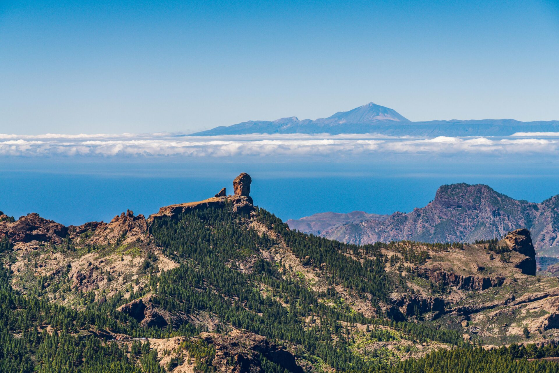
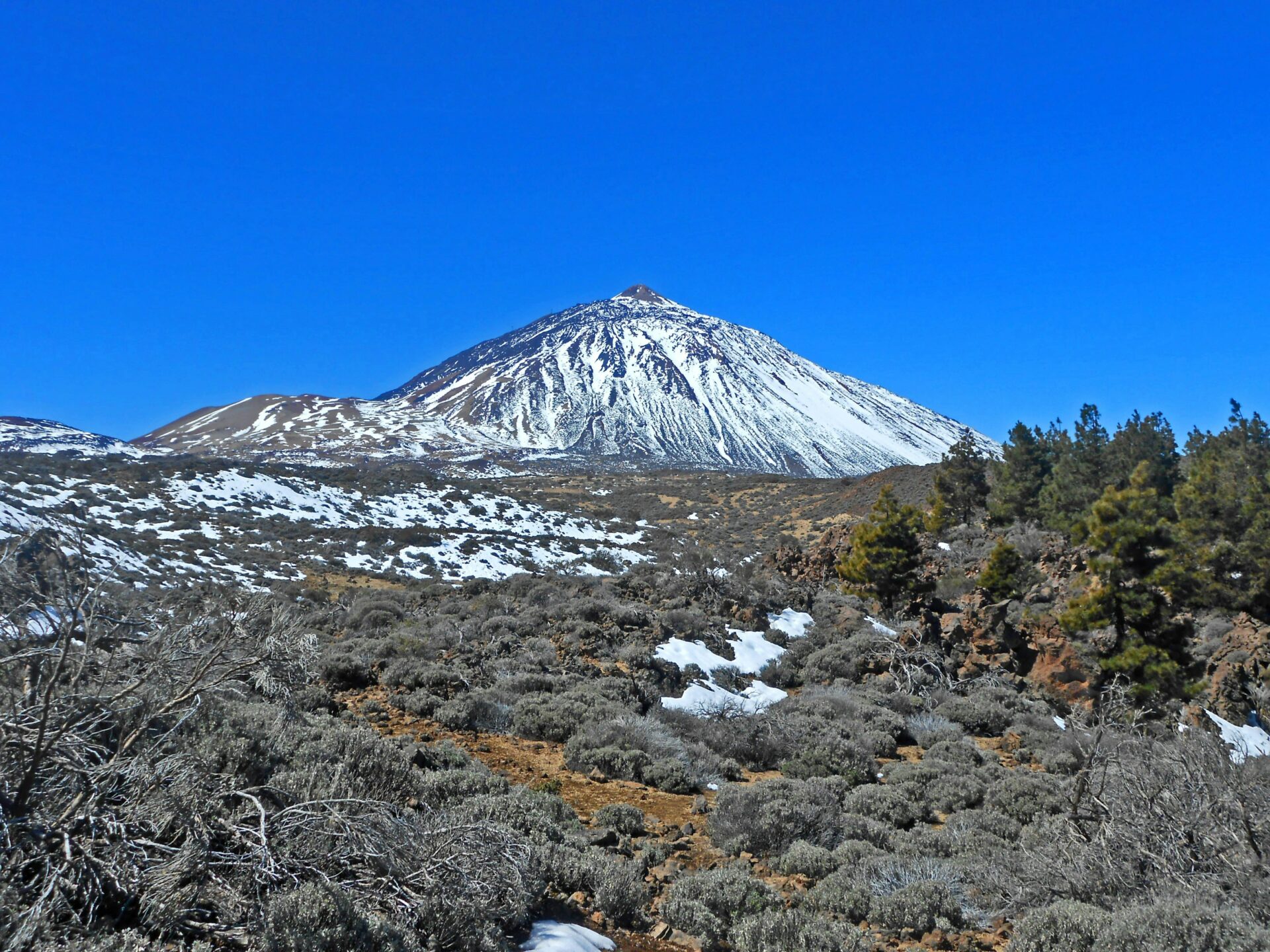
Standing at 1,813 meters on Roque Nublo’s plateau, you get a wild mix of landscapes. From nearby volcanic peaks to far-off islands, the scenery just keeps coming. Sometimes, if the air’s clear, Mount Teide on Tenerife appears on the horizon, and the ancient rock formations all around remind you how volcanic forces shaped this place.
Panoramas Over Gran Canaria
From the plateau, I gazed down at the Caldera de Tejeda—it really does look like a massive volcanic bowl. The view shifts as you walk across the rocky, almost lunar surface.
To the south, the Maspalomas sand dunes show up as gold patches near the coast. The contrast between the rugged interior and those sandy stretches is pretty striking.
Key viewpoints from the plateau:
- La Culata village tucked in the valley
- Chira dam sparkling in the sun
- Fataga valley winding through the landscape
- Pine forests hugging the lower slopes
With so little vegetation up here, nothing blocks your view. Spring brings a few wildflowers, brightening up the rocks.
Spotting Tenerife and Mount Teide
On the clearest days, Mount Teide over on Tenerife rises above the ocean like a distant giant. At 3,715 meters, it’s Spain’s highest peak—and you can’t mistake it, especially with snow on top.
I caught the best glimpse of Teide during a sunset hike. The volcano’s silhouette looked especially dramatic as the afternoon light faded.
Weather can really mess with visibility up here. Sometimes clouds and winds roll in and block everything. Mornings usually offer a better shot at seeing Tenerife—humidity tends to build up and form clouds as the day goes on.
Even though Teide is 60 miles away, its snowy peak stands out against the blue Atlantic. It’s a surreal sight, honestly.
Other Notable Rock Formations and Peaks
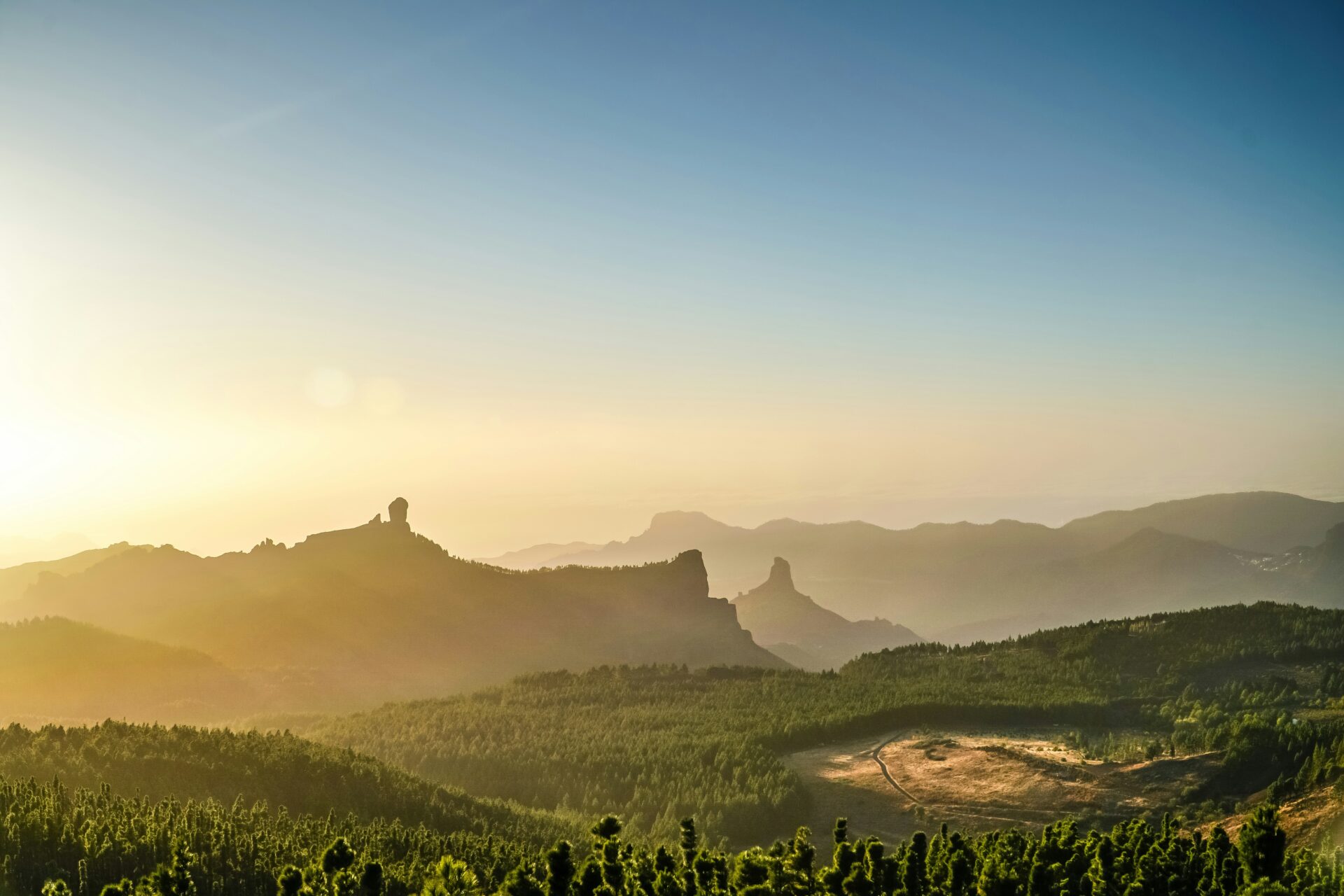
Roque de la Rana sits right next to Roque Nublo. Locals say it looks like a frog from certain spots—once you see it, you can’t unsee it.
To the northeast, Roque Bentayga rises up at 1,414 meters. The ancient Guanche people once considered it sacred. If you look through the smaller hole in the rocks left of Roque Nublo, you can frame Bentayga perfectly.
El Fraile—the monk—stands at 1,713 meters and really does resemble a robed figure from the trail. It’s easier to spot once you’re on the plateau.
Pico de las Nieves is the island’s highest peak at 1,949 meters. It’s not as dramatic as Roque Nublo, but it anchors the mountainous spine of Gran Canaria.
One of my favorite photo spots is the triangle-shaped window in the rocks. It frames the caldera backdrop and just begs for a picture.
Nearby Attractions and Where to Stay for Hikers
The Roque Nublo area is packed with great places to stay, especially in mountain villages like Tejeda. You’ll also find other hiking trails and scenic drives winding through Parque Rural del Nublo.
Best Bases: Tejeda, Cruz de Tejeda, and Maspalomas
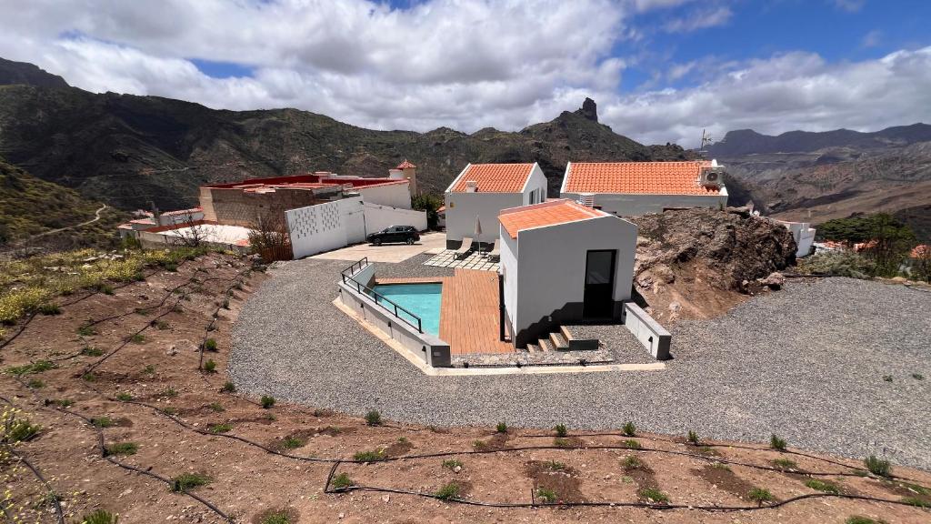
Tejeda is a favorite among hikers. This little mountain village sits just minutes from the trailhead, surrounded by peaks.
The white buildings look gorgeous against the volcanic backdrop. I loved wandering the quiet streets after a long hike.
Cruz de Tejeda sits higher up and makes another great base. It’s super convenient for accessing multiple trails and panoramic viewpoints.
This spot puts you right in the middle of Gran Canaria‘s hiking country. Roque Nublo is just a quick 15-minute drive away.
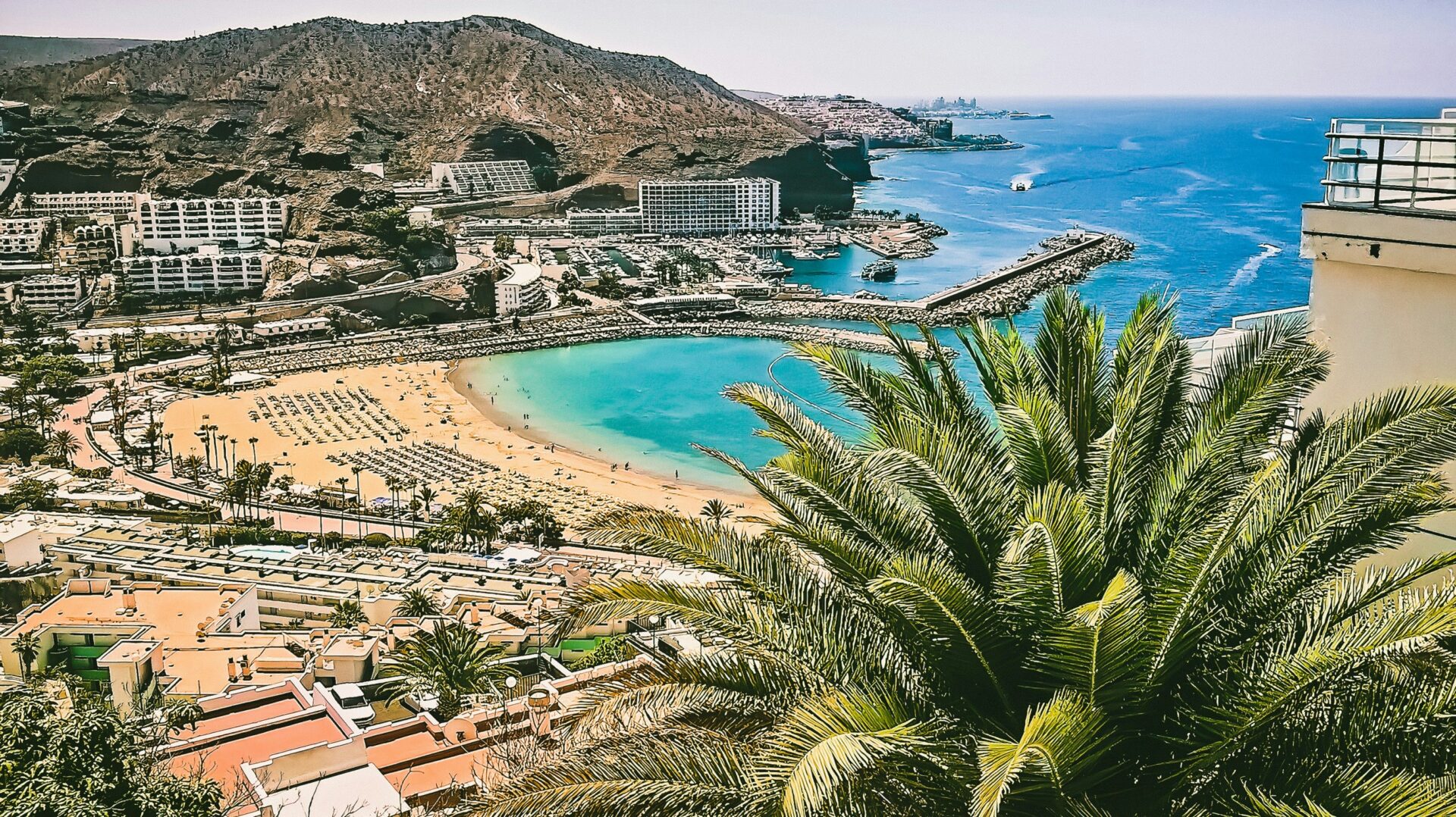
Maspalomas is a solid pick if you’re after some beach time when you’re not hiking. The drive up to Roque Nublo takes about 45 minutes along winding mountain roads.
Staying in Maspalomas lets you blend mountain adventures with a bit of coastal relaxation. Lots of travelers use it as their base for road trips around the island.
Recommended Hotels and Rural Guesthouses
Parador de Cruz de Tejeda delivers a bit of luxury with sweeping mountain views. The rooms are comfy, and the food’s great too.
You can walk straight out onto hiking trails from here. It usually books up fast, so I’d recommend grabbing a room early if you can.
Calma Suites Tejeda offers modern apartments right in the village. Each one has a kitchen and a balcony overlooking the valley.
Hotel Rural Fonda de la Tea feels like classic Canarian hospitality. This family-run guesthouse has charming local architecture and serves up home-cooked meals.
Vivienda Vacacional La Portada gives you a real village experience. It’s a vacation rental with modern comforts but keeps that traditional vibe.
If you’re planning a trip with friends or family, this place works especially well for longer hiking getaways.
Other Hikes and Road Trip Ideas
Pico de las Nieves really stands out as a second hike. You’ll reach the highest point on Gran Canaria and get those sweeping 360-degree views—it’s honestly breathtaking up there.
You can link the trail to Roque Nublo if you’re feeling adventurous. I tried both in one day and, wow, it was tough but so worth it.
Parque Rural del Nublo has a bunch of shorter trails scattered throughout. Some wind up to viewpoints, others dip down to ancient caves or weird volcanic rock shapes.
If you’d rather drive, Fataga and Puerto Rico de Gran Canaria are perfect. The roads twist and turn, showing off just how varied the island’s scenery can get.
Try mapping out a circular route that swings by mountain villages and dips down to the coast. It’s a great way to squeeze in both hiking and sightseeing without rushing.
Don’t skip the Mirador Degollada de las Yeguas. It’s only about ten minutes from the main trailhead and honestly, the photo ops there are next level.