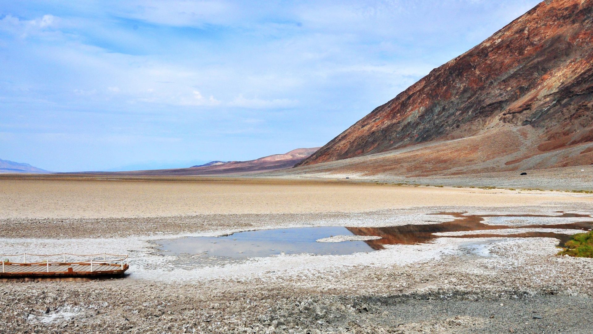
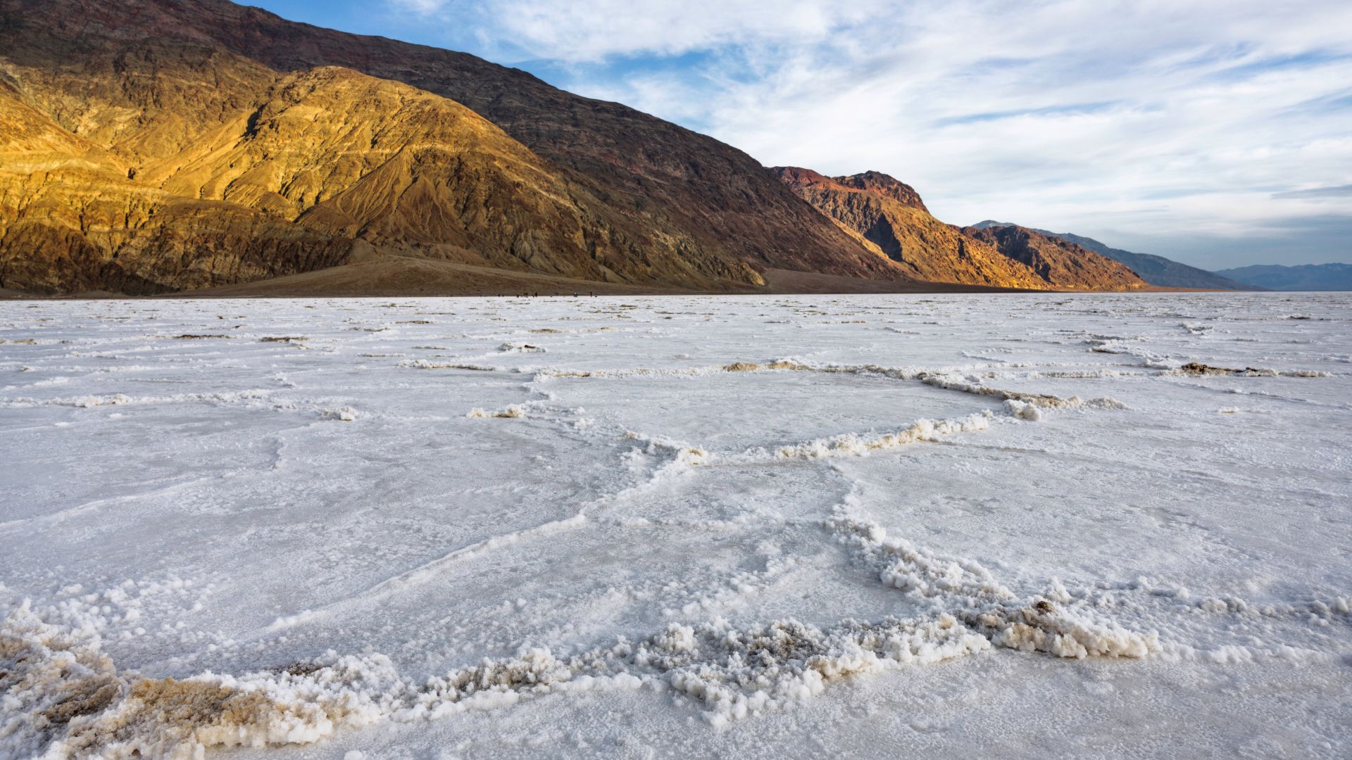
So, there I was, hiking across Badwater Basin in Death Valley—282 feet below sea level and officially the lowest spot in North America. Standing on those blinding white salt flats, with geometric patterns stretching everywhere, felt totally unreal. It’s like I’d landed on another planet—just this flat, silent world that goes on forever.
Salt crunched under my boots with each step, and the dry air shimmered in the heat. Far off, mountains lined the horizon, making the flats seem even bigger than they already are.
You get this weird mix of science, history, and raw natural beauty here. I haven’t found anything quite like it anywhere else.

Discovering Badwater Basin: The Surreal Salt Flats
As I wandered into Badwater Basin, those endless white salt flats spread out in every direction. It was eerily quiet, and the sky felt huge overhead.
The whole place felt unlike anywhere I’ve ever visited.
Geological Wonders of the Salt Flats
Badwater Basin’s salt flats exist because of extreme heat and evaporation. When rain does fall in Death Valley, it pools up in shallow basins—nowhere to go, really.
When the water vanishes, thick crusts of salt and minerals remain behind.
I kept seeing these hexagon patterns all over the ground. They looked like nature’s own tiles.
The flats cover close to 200 square miles, which is pretty wild.
The crust felt rough, almost sharp, under my shoes. The air carried a faint salty tang.
It surprised me to realize this isn’t soil at all—just layers of pure salt left by ancient lakes.
Why Badwater Basin Is the Lowest Point in North America
At Badwater Basin, I stood 282 feet (86 meters) below sea level. No other spot on the continent dips lower.
Over millions of years, shifting earth plates pulled the land apart and made Death Valley sink. Death Valley is a graben, basically a low area between mountains that have drifted away from each other.
Because water can’t escape, minerals collect here and form thick layers. The dry, heavy air means water only leaves by evaporating, so salt keeps piling up.
That’s what keeps Badwater Basin so far below sea level.
Famous Landmarks Around Badwater Basin
Badwater Basin isn’t just about salt flats. Not far away, I stumbled onto the Devil’s Golf Course—a field of jagged salt spires.
The ground is so uneven here, early explorers joked that “only the devil could play golf” on it.
Cliffs tower nearby, and you can spot signs way up high marking sea level above your head.
The parking lot sits right at the edge, so you can walk straight out onto the salt.
Key landmarks include:
| Landmark | Description |
|---|---|
| Badwater Basin Flats | The main salt crust, open for walking and exploring |
| Devil’s Golf Course | Sharp salt pinnacles that cover the ground |
| Sea Level Sign | Marker high on the cliff showing how far below sea level |
Each spot reveals a different, sometimes bizarre, side of Death Valley.
Walking on Salt: My First-Hand Experience
Exploring Badwater Basin’s salt flats under the glaring sun, I found myself surrounded by pure white crusts and endless space.
The ground felt different here, almost alien, and you really need to come prepared for the desert’s extremes.
How It Feels Underfoot
The first step onto the salt flats, and the ground crunched softly. In some places, the salt formed sharp, hard edges, while other patches looked almost wet and smooth.
With each step, the ground gave a little. Some areas had thick, bumpy patterns, and others were surprisingly flat—sometimes even a bit slippery.
Wearing sturdy shoes saved my feet from the rough crystals.
The surface reflected so much light, it actually felt hotter than the air. Salt dust clung to my shoes, leaving white marks everywhere.
I pressed my hand down and little salt bits stuck to my skin.
Unique Visuals and Photography
The basin’s bright white stretches for miles, and the dark mountains in the distance make the contrast even sharper.
Early mornings, the salt sparkled, and long shadows brought out the textures.
I couldn’t resist snapping photos of the geometric salt polygons. These crystals make wild patterns—great for wide shots or close-ups.
People in the distance looked like tiny specks, which really shows off just how massive the flats are.
I got my favorite photos around sunrise or sunset, when the light softened and colors deepened.
Sunglasses helped a ton with the glare while I lined up my shots.

Essential Tips for Safe Walking
The sun here doesn’t mess around, even early in the day. I slathered on sunscreen and reapplied often.
A hat and sunglasses were non-negotiable to keep my skin and eyes safe from all the reflected light.
I made sure to carry plenty of water—there’s zero shade for long stretches.
Solid, closed-toe shoes kept my feet safe from sharp salt crystals.
I stuck to marked areas to avoid damaging the flats and for my own safety. Hikes stayed short during the hottest hours, and I always checked the weather before heading out.
Here’s a quick checklist I used:
| Item | Why I Needed It |
|---|---|
| Sunscreen | Prevent sunburn |
| Sunglasses & Hat | Shield eyes and face |
| Water bottle | Stay hydrated |
| Hiking shoes | Protect feet/salt crust |
Planning Your Trip to Death Valley National Park
Planning ahead made all the difference for my trip to Death Valley National Park. Getting to Badwater Basin and knowing what to expect with parking and facilities really helped me relax and enjoy the adventure.
Getting to Badwater Basin
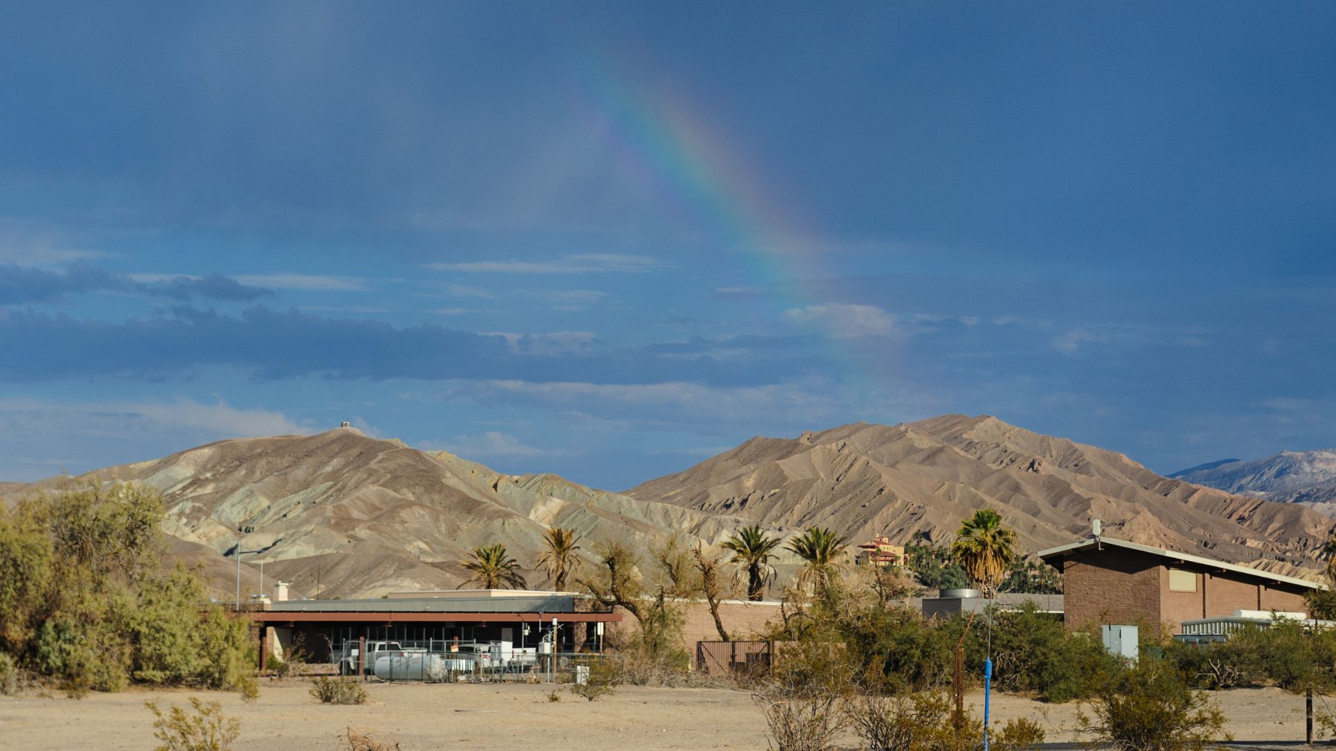
Badwater Basin sits right in the middle of Death Valley National Park, California. I drove in along Highway 190 and turned off onto Badwater Road.
It’s pretty straightforward once you’re on the main road.
Here’s the basic route I followed:
| Starting Point | Direction | Key Details |
|---|---|---|
| Furnace Creek Area | South on Badwater Rd | About 17 miles to the parking lot |
| Las Vegas, NV | West on Hwy 160, CA | About 2 hours to the park entrance |
I didn’t see any public buses or shuttles to Badwater Basin—having my own car was a must.
The road felt wide open and empty, with hardly any places to stop for gas or snacks. I filled up the tank before entering the park.
Parking and Facilities
There’s a dedicated parking lot right at the entrance to the salt flats. I arrived early and found a spot easily.
The lot is paved, but it fills up fast on weekends or during spring.
Facilities are pretty basic:
- Restrooms sit near the parking lot.
- There aren’t any water fill-up stations, so I brought plenty of my own.
- No food services—just a few informational signs at the entrance.
I used the restrooms before heading out. Later, I noticed some picnic tables, but no shade anywhere.
Packing extra water and snacks was a lifesaver.
Exploring More Death Valley Wonders
After wandering the salt flats, I realized Death Valley hides a bunch of other amazing places. Each one feels different and adds something new to the trip.
Nearby Trails and Viewpoints
Zabriskie Point became one of my favorite stops. The viewpoint gives sweeping views of colorful, eroded hills.
I loved going early, when the sunrise made everything glow.
Golden Canyon is a must for hikers. The trail starts off easy, winding between red and gold rock walls.
If you want more of a challenge, you can keep going to the Red Cathedral.
Furnace Creek works well as a base—it has a visitor center, restrooms, and water. Plus, it’s close to most of the main sights.
The Natural Bridge Trail is a short walk and leads to a huge stone arch. I thought it was worth the quick detour just for the view.

Otherworldly Landscapes to See
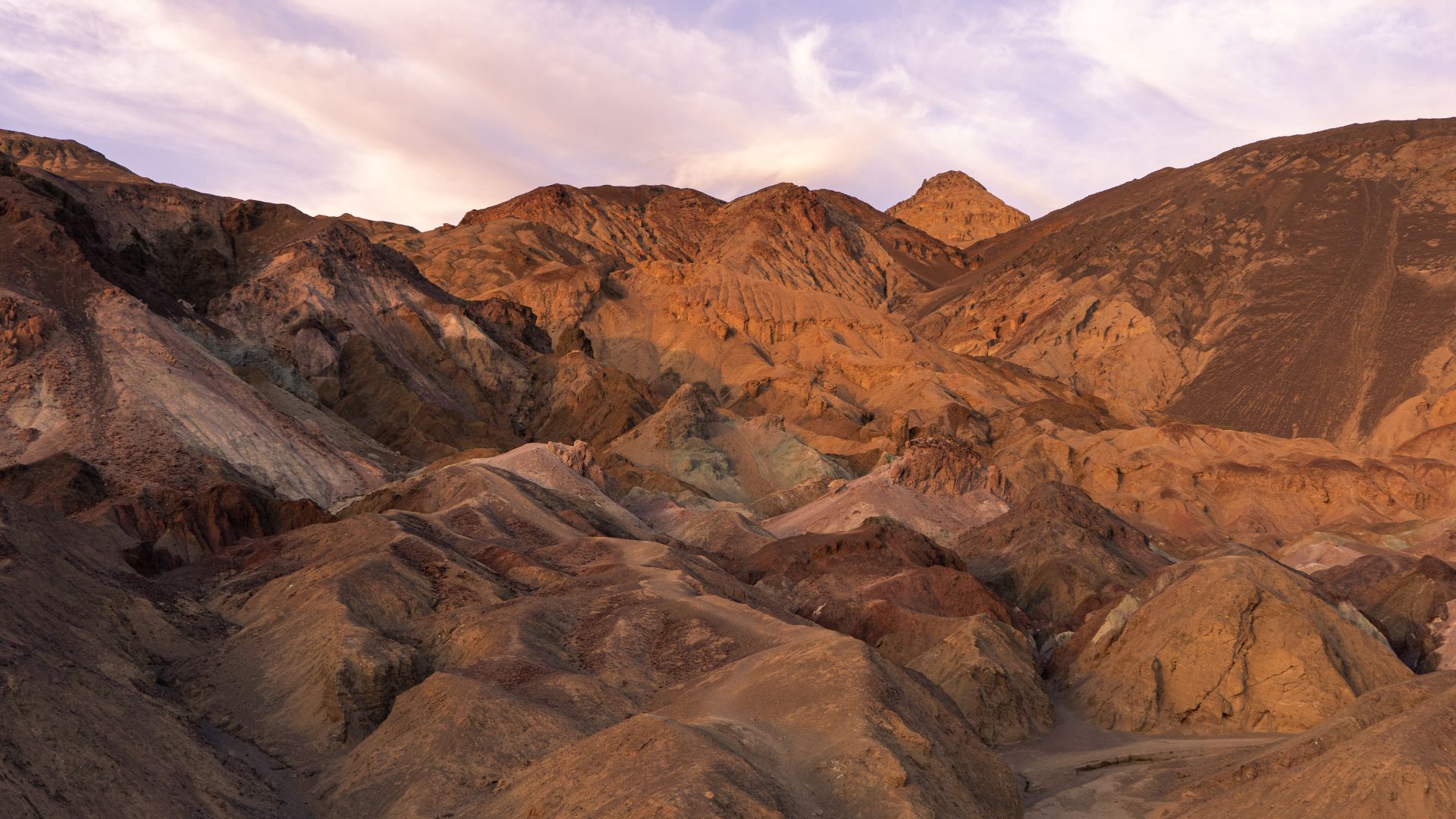
Artist’s Palette really pops with its pink, green, and purple rocks—minerals in the soil create the colors. I went late in the day, and the colors looked their best.
The Mesquite Flat Sand Dunes near Stovepipe Wells look straight out of a movie. Walking on the dunes, I enjoyed the silence and the patterns the wind left in the sand.
Furnace Creek’s palm trees and springs brought a totally different vibe—cool shade and a break from the sun.
Each of these spots left me with new memories, whether it was wide landscapes or small details in the rocks and sand.
Practical Advice for an Unforgettable Visit
A little planning goes a long way in Death Valley. The heat, blinding sun, and how remote everything is can catch you off guard if you’re not careful.
Best Times to Visit
I found the sweet spot for visiting Badwater Basin is November through March. Cooler months mean daytime temps are much more manageable—usually in the high 60s to low 80s (°F).
Sunrise or sunset visits are smart, too. The salt flats get quiet, and the light turns the whole place beautiful.
Summer temperatures can get brutal—over 110°F—so I avoided long walks then.
I skipped mid-day adventures even in the shoulder season, since the sun felt relentless.
Always check the weather before you go—heat spikes or sudden winds can really change things fast.

Protecting Yourself from the Elements
There’s basically no shade on the salt flats. I wore a wide-brimmed hat, lightweight long sleeves, and sunglasses to shield myself from the sun.
High-SPF sunscreen is essential, and I reapplied every couple of hours.
I brought at least two liters of water for my walk, since the dry air pulls moisture from you fast. Good shoes kept my feet safe from sharp salt.
I kept my phone charged and let someone know where I was heading. Cell service can be spotty, so I didn’t rely on my phone for directions.
Where to Stay and Accommodation Options
Death Valley is massive, so I made sure to lock in my accommodation ahead of time. There are a handful of main choices, each with its own vibe:
- The Inn at Death Valley: This place feels fancy, with air conditioning and a pool—definitely a treat after a long, hot day.
- The Ranch at Death Valley: It’s more laid-back and family-friendly, right in the heart of the park.
- Furnace Creek Campground: If camping sounds good, this spot has the basics covered. I grabbed my reservation early, especially since winter gets busy.
- Nearby Towns: Beatty and Pahrump offer motels and hotels, though they’re a decent drive from Badwater Basin.
Honestly, staying inside the park made everything easier. I could catch those unreal sunrises and sunsets without rushing around.
If you’re planning a trip during the cooler months, I’d say don’t wait too long to book—places fill up fast.